|
July 4, 2021: A Visit to the San Antonio Botanical Garden |
|
April 2-5, 2021: A Trip to San Antonio |
|
Return to the Index for 2021 |
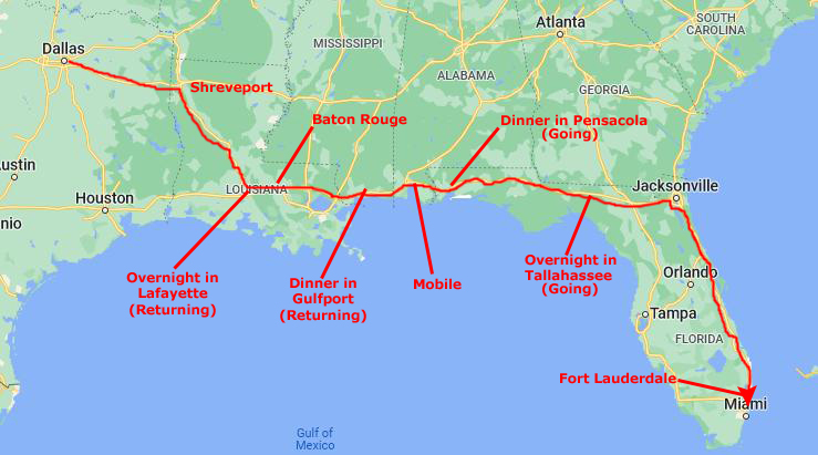
Due to the death of Fred's Mom in late February, we skipped our traditional March trip to Florida, as Fred had way too much to do in working through all the particulars of a passing. I won't go into all he had to do, but by the middle of May everything was well underway, if not yet finalized. So, having not been anywhere in a while, we decided to head down to Fort Lauderdale.
We left Dallas on the 14th of May and stayed until early June. As these trips to Florida have become so commonplace, we tend to take fewer and fewer pictures, and so there is less and less need to divide up the trip day by day. Rather, I'll continue doing what I've done for the last few years- just divide the photo album page by topic, pretty much regardless of when the picture was taken.
Getting to Fort Lauderdale
|
Mississippi and Alabama are an hour each, so we are heading east from Mobile about six-thirty or seven. This puts us north of Pensacola right about dinnertime about eight. After dinner, we used to stay near Pensacola so we don't have to do a lot of driving at night, but doing that made a heck of a drive for the next day, putting us into Fort Lauderdale so late that after our getting settled and celebratory drink at the dock, we didn't get to dinner until nine-thirty or so. So recently we have begun driving from Pensacola to Tallahassee to stay the night. Particularly with my new car, driving at night is much more pleasant.
We usually get away from the hotel in Tallahassee about nine or so for the 150-mile drive to Jacksonville, which we usually reach about eleven-thirty. Then we take I-295 around Jacksonville to the south, going through Orange Park. This 14-mile stretch is kind of neat, mostly because of the long bridge that crosses the St. Johns River as it opens out into a large lake southwest of the city. (It narrows as it approaches and flows around downtown Jacksonville to eventually empty into the Atlantic.)
I-295 connects up with I-95 south of the city and we simply take that south for another 300 miles down to Fort Lauderdale. This is another boring part of the drive, but it gets us to the condo around 5PM, depending on traffic in Fort Lauderdale on I-95 (which can be horrendous).
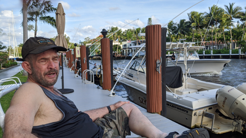
We unloaded everything at the condo, got Bob and Cole situated (and fed) and the laptops all set up. Getting here by 5PM means I have time to do a bit on the recumbent bike before we have our drink at the dock:
|
|
Then we are at the Floridian Restaurant for dinner before nine. I wish we had transporter technology, but the drive is not a hard one- although sections of it can be boring.
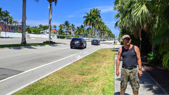
Bob and Cole are young enough that they are still good travelers. Bob, for example, will come out of his carrier every hour or so and walk around the car and sit up front for a while. But then he goes right back in and curls up. Cole stays out of his own carrier more; he usually curls up behind my seat where I usually make a flat space on top of my computer and duffel for him. I like it when they come up front, and it is especially nice when they will stay in one lap or the other for a while. As the driver, I'm OK with that; I just try to ignore them and concentrate on the road.
We have been here to Florida so many times that we have pretty much photographed everything worthwhile anywhere nearby. The pictures we take now are just candid shots around the condo, at the dock or perhaps at an Art Fair or other event that occurs while we are here. So I've begun the practice of just grouping the pictures for these Florida trips by topic.
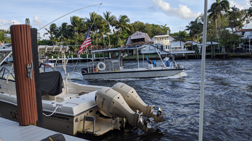
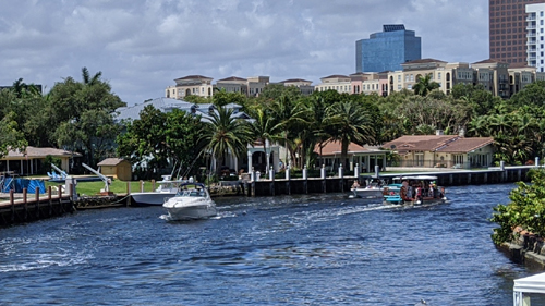
Boat Traffic on the New River (Installment 52)
|
|
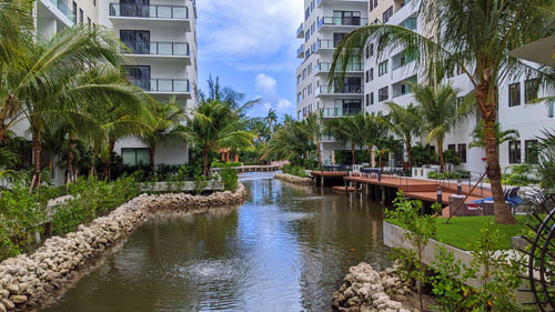
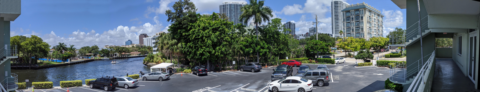
At Riverview Gardens
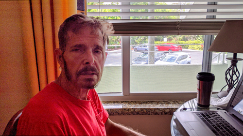
"I-just-this-minute-got-up" look. |
|
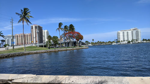
Riverview Gardens has nice views up the river and towards downtown- but only if you are on our side of the building.
|
|
But you can easily see that no only have the plants and trees grown up, but the downtown skyline has as well- and many of the new skyscrapers are right on the New River, which is out of the picture to the left.
In addition to all these new buildings, the entire Riverwalk was constructed soon after we started coming to the condo here. Broward County has been one of the fastest-growing areas in the state of Florida, which is, I think, currently the fastest-growing state in the nation.
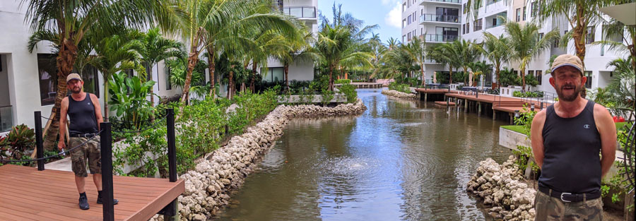
After taking that single picture looking towards downtown, I thought that I would try a panoramic view, so I took four separate pictures covering the view towards the river, through downtown, and to the north (along the walkway to my front door), and then stitched them together into a panoramic view. I have put that view into the scrollable window below. (If, when the page loads, the picture doesn't fill the window, please just click on it to make it do so. Then you can scroll back and forth.)
 |
The last picture I have for this section wasn't taken at the condo, but I have no logical place to put it. One night during our stay, Jay Silbert was feeling under the weather, and so we went to the Olive Garden with our good friend, Ron Drew. Just for the heck of it, I took his picture at the restaurant, and you can see it here.
A Walk Through Beverly Heights
|
If you head east and cross the Himmershee Canal, then we are in another residential area known as Colee Hammock. It is also bounded by Broward Boulevard on the north and the New River on the south, but the Himmershee Canal is its western boundary and the Las Olas Isles area (those long fingers of land with million-dollar homes) bounds it on the east.
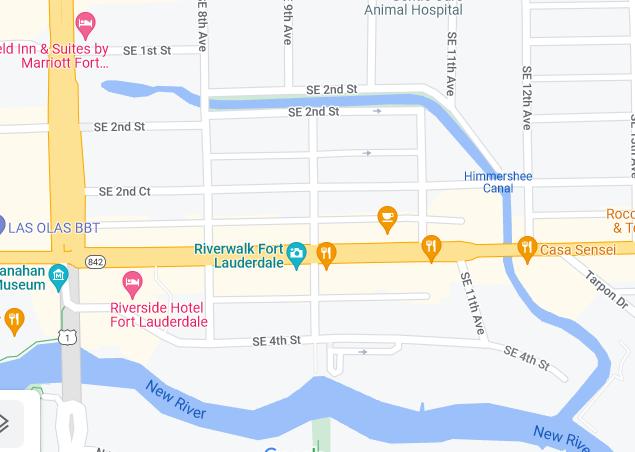
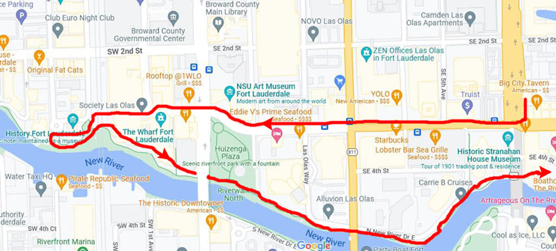
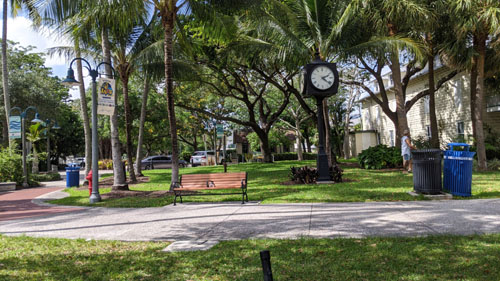
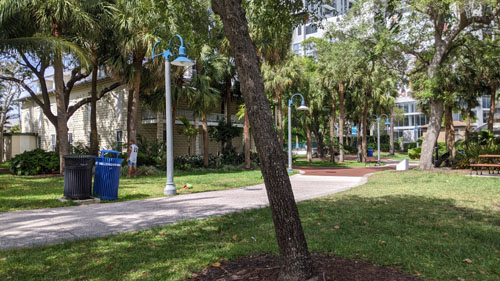
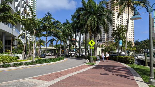
Today, Fred and I are going to take a walk through Beverly Heights where in the last few years numerous highrise condos and apartments have been built, a new hotel or two has gone in, and the Himmershee Canal has been developed into a major water feature and walking/recreation space.
We often walk to the beach and along the Riverwalk, but this is something we haven't done before, and we just want to see what this new and improved neighborhood is like. On the map at left, I've bounded Beverly Heights with a red outline, and I will mark some of the stops we make- if not the exact walking route we followed, which is actually fairly immaterial.
From the condo, we walked over to SE 9th Ave, and we walked north across Las Olas to SE 2nd Ct. Then we went west again over to SE 8th Ave. Right there on the northwest corner is a new, 40-story apartment building-the Amaray Apartments-, which I've described before in these pages.
|
Now, you might think that SE 4th St would be four blocks south of Broward, but actually, there are more than that. When new streets are added between the numbered ones, as they have been over the years, they are "courts" (no matter their direction). Las Olas is actually SE 3rd Street, but there are numerous cases where a street or avenue doesn't carry its number name. Sometimes, the street sign above an intersection might read something like "Powerline Road/NW 7th Avenue" just to be on the safe side. But, then again, some don't (like Las Olas, Broward Boulevard, Andrews Avenue, or Federal Highway/US 1).
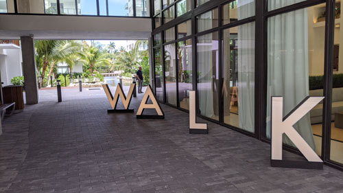
Anyway, we turned west on SE 2nd Street, and found ourselves in the middle of a new, low-rise (buildings range from 7 to 12 stories), multiple-building apartment complex called the "10X Las Olas Walk", spanning both sides of the street. That, apparently, is why there are two skybridges- to allow renters of units in the building south of 2nd Street to cross to the north buildings (where most of the amenities are) without having to go outside- which probably would entail having to have an outside key with you.
|
One interesting thing about downtown living in Fort Lauderdale is where the condominiums are versus where the apartments are. Generally, all the buildings south of the New River are apartments, although there is one new condominium there. North of the river, if the building is right on the river, it is almost always a condominium. The two major exceptions are Society Las Olas (a building that features cooperative living designed for young people on a tight budget) and the Icon Las Olas, which is a mixture of condominiums and apartments. Once you get away from the river, and are north of Las Olas, almost all the buildings will be apartments.
I guess that the reason for this is that the people who can afford river views can afford to buy their units; apartment dwellers probably care more about convenience and amenities than they do the views. The Amaray is the tallest apartment building in Beverly Heights, and from any unit above the 12th floor or so, there are pretty spectacular views, and from units above the 20th floor, you can see the ocean.
|
I made a movie looking around this area, and you can use the movie player below to watch it.
|
|
Here are two still pictures taken in this central courtyard/space at 10X Las Olas Walk:
|
|
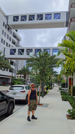
I took another couple of pictures with Fred in them here at the courtyard, and then I noticed that the two pictures overlapped so that I could put them together into a panorama:
|
We came back out of 10X Las Olas Walk and then started walking south again along SE 6th Avenue. SE 6th Avenue is also Federal Highway/US 1, but at this point it is coming up out of the Kinney Tunnel. There is a street that runs from Las Olas Boulevard north at grade, and when Federal Highway/US1 gets up to grade, the two streets merge- almost like an onramp for a freeway. Over on the other side of the highway there is a street that motorists can use when coming south on US 1 to keep from going through the tunnel and exit instead into downtown or onto Las Olas Boulevard.
|
|
|
In the view below, I am looking back up SE 6th Ave at the north building of 10X Las Olas Walk.
|
When we get down to Las Olas, we are going to turn west, cross over the Kinney Tunnel, and we will no longer be in Beverly Heights, but in downtown Fort Lauderdale proper.
Old Fort Lauderdale and the Riverwalk
|
We continued down the north side of Las Olas Boulevard all the way to Andrews Avenue. The Fort Lauderdale Art Museum is on the corner there. Then we cross Andrews Avenue and are on a street that used to run through the Riverfront Center complex. The street is still there, but the actual Center has been torn down.
Replacing it are the Wharf Fort Lauderdale (a young, hip, open air area with food trucks and bars) and Society Las Olas, a young, hip, apartment building. In Society Las Olas, individuals can rent a bedroom with ensuite in what is essentially a two-, three-, or four-bedroom apartment- depending on how many roommates one has or wants. It's really the same as getting a roommate or two to share the expense of an apartment you couldn't afford on your own, but instead of finding your own roommate(s) (which you can still do), the building can find them for you. You tell the building a lot about your schedule, your likes and dislikes, and so on, and the building can assign you to an apartment with what they think will be compatible roommates.
This is a new concept in downtown Fort Lauderdale living, and is intended to address the problem of affordable, in-city housing for service workers on low salaries or young folks just starting out. It's not something I can relate to at my age, but seems quite reasonable for kids who've either just come from home or perhaps from a college dormitory. The building offers way more amenities and anyone starting out could hope to find in an affordable building full of one-bedroom apartments.
|
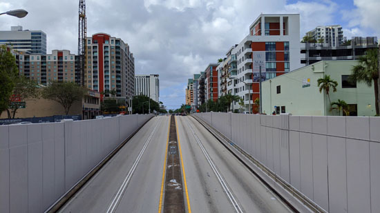
So why, in all my trips here, have I never been able to get just this view before? Because up until now, there has been a high wall blocking the view. The wall had served a dual purpose. First, it was a safety measure to prevent anyone from falling down into the traffic lanes. Second, it also prevented (well, didn't prevent actually, but certainly deterred) pedestrians from tossing stuff down onto the cars.
But the wall was recently taken down as part of a "deck park" project that is going to extend Laura Ward Park across Las Olas and a hundred feet or so north, the sloping road that is going down into the tunnel being partially covered over in the process. It is a multi-year project, and the area of Las Olas near the Cheesecake Factory is pretty much a mess. Las Olas becomes a divided boulevard here, but the southern two lanes have been closed so that the northern two lanes have to carry both directions of traffic. This has meant that parking along the north side of Las Olas has been eliminated, putting a stress on parking facilities in the area.
The deck park is not supposed to be completed until late 2022, but I'll bet that the pandemic sets that schedule back considerably.
|
|
The walk down this part of Las Olas is always interesting; almost every building is brand spanking new- or at least looks that way. Eventually, we came to the intersection of Las Olas and Andrews Avenue.
|
 |
We walked across Andrews Avenue and down the street past The Wharf and thence to Society Las Olas. You can actually walk right through the ground floor of this building to get to the Riverwalk where it crosses the Florida East Coast Railway. As we walked through the building, we saw a number of people selling stuff. I was not at all sure if it was a flea market, an art fair, or vendors selling things apartment dwellers might need. Maybe you can tell from the two pictures I took:
|
|
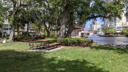
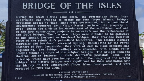
Coming out the other side of the building we crossed the railroad tracks and were in History Fort Lauderdale- officially known as the Fort Lauderdale History Center, and formerly known in these pages as Old Fort Lauderdale.
|
The 1907 King-Cromartie House has been furnished as a historic house museum of 1915, and is open by guided tour. The 1899 Replica School House is also open by tour, and was originally constructed in the 1970s as an American Bicentennial project.
The Fort Lauderdale Historical Society also maintains a public research library and archives of the history of Greater Fort Lauderdale.
The History Center is one of two places in downtown Fort Lauderdale devoted to the history of the city. The other is the historic Stranahan House that is located near the Cheesecake Factory next to the Icon Las Olas.
It was a very nice day, and there weren't many people about, and so I took this opportunity to create a 360° panorama. I could have used my phone, which does panoramas automatically, and that would have been a better choice had there been much movement- people or boats going by. But we had the place to ourselves, so I took eight pictures and used my software to stitch them together. Before I show you the final result, let's take a look at the eight pictures so I can tell you what you are seeing.
At left, in the Tarpon River neighborhood, is the Esplanade-on-the-New-River condominium. To its right is part of the Symphony Condominium, on the other side of the river in Sailboat Bend. To the right of that is the Broward Performming Arts Center and then the Riverwalk coming from the west into the History Center Complex. |
Here we see a small part of the Performing Arts Center, the western part of the History Center complex (and the Riverwalk walkway coming in from the west and crossing through the complex). In the background at right is the Fort Lauderdale Science Museum and IMAX Theatre. |
This is the middle of the History Center complex showing a couple of the buildings and a clock that used to be in the center of town in the 1920s. |
The Riverwalk is leaving the History Center complex heading east. You can also see the Society Las Olas apartment complex and tower at the right. |
Now we are looking straight downriver. Although a big tree blocks the view of many of the new condo buildings on the north side of the river, you can still see the new ones on the south side. |
Here we see the new condos on the river's south side, and then the old Shirttail Charlie's complex- which consists of a small boat dry storage building (which I am not sure is still used) and the Shirttail Charlie's dockside restaurant (which is now called Pirate Republic). |
Here we see Pirate Republic and an old boatyard (now a storage place for Water Taxi craft). The large boatyards that used to be here, repairing and outfitting moderately-large yachts, have both moved as the land has become too valuable. The old buildings remain- for the moment. |
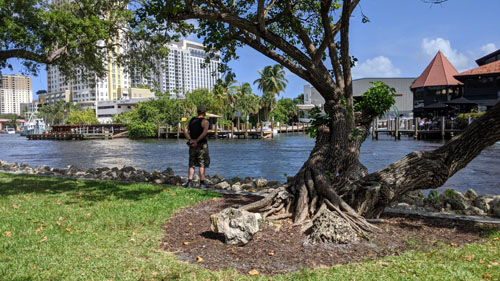
The last view brings us back around to the first, and looks across the river at the Tarpon River area. The way development is going, I would expect Pirate Republic to be flanked by highrises before too long. |
Now for the pièce de résistance- stitching all eight pictures together. Thanks to Microsoft's Image Composite Editor, this is easy and automatic. When overlapping images are not perfectly aligned, however, there is usually some cleanup I have to do manually, but it's not difficult. The full panorama is in the scrollable window below, and as you scroll from left to right you can compare to the pictures above. I hope you enjoy the panorama; I need validation.
 |
It was a really nice day, and we just sat down on one of the benches here on the grounds of the History Center and watched the boats go by for a while.
|
It is always a really nice walk along here, and a lot of other people usually find it so also. Back around by the Icon Las Olas, the walk goes over a cantilevered section over the river to end up at Laura Ward Park. You can actually go a little further, and that puts you only a block from the condo.
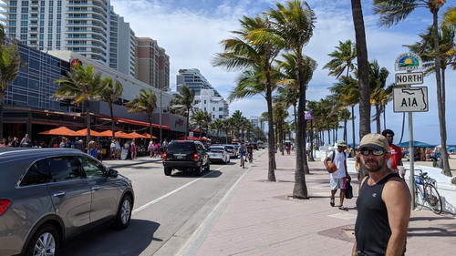
A Walk to the Beach
 |
I won't bother drawing a line to show you the route; we simply go up to Las Olas from the condo and head east. Las Olas dead-ends into the beach.
|
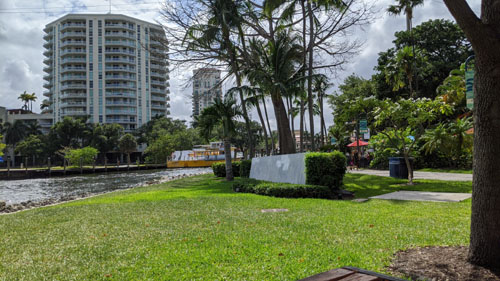
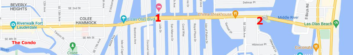
Colee Hammock extends from the small canal at the east end of our section of SE 4th Street for about a quarter mile to the area known as Las Olas Isles, a series of man-made fingers of land that extend north and south from Las Olas Boulevard. On these isles can be found some of the areas nicest homes and a boatload of, well, boats- as they are docked all along both sides of each isle.
At left is a picture I took of Fred after the gentle curve between the canal boundary of Colee Hammock and the second or third finger island to the south (#1 on the map). Now the road is arrow straight all the way to the Las Olas Bridge. The isles to the south of Las Olas are more exclusive than those on the north, and the boats docked there belong to the homeowners on the isles, and some of them run up to 100 feet long.
The north isles are still very nice, but there are apartments and smaller homes there, and the docks are often rented to people who don't actually live on the isle. Some of these people actually live on their boats. Most of the craft here are 50-footers or less.
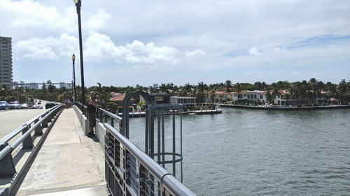
Anyway, as you can see on the map, there is a little park on the south side of Las Olas just before it goes up and over the bridge (#2 on the map). We stopped here to get a couple of pictures of the bridge and of the Intracoastal:
|
|
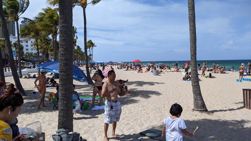
While we were taking photos here, the drawbridge went up, so we had to hang out here for a while until it came down. Then we walked across (there are sidewalks) and down onto the barrier island, then another two blocks to the beach. That's where these photos were taken:
|
|
State Road A1A (SR A1A) is a major north–south Florida State Road that runs 338 miles along the Atlantic Ocean, from Key West to just south of the Georgia State Line. It is the main road through most oceanfront towns, and part of it is a National Scenic Byway. SR A1A is famous worldwide as a center of beach culture in the United States. Originally designated State Road 1, it was renamed to eliminate confusion with the parallel US Highway 1 (which stays on the mainland). It is not the fastest route north-south (thats I-95), or the one with the most services (that's US 1), but it is by far the most scenic.
|
|
Just for the heck of it, I made a short movie as we walked north. Some people had masks on, but since we've had our vaccinations, we tend not to wear ours when we are out in the open, although we still wear them inside commercial establishments or anywhere else we are requested to.
We stayed there for a while, enjoying the afternoon, and then came back the same way. Then, about five o'clock, we began to head back to the condo along Las Olas.
It is almost always true that when you are crossing the Las Olas Bridge you are treated to beautiful views in either direction. Since we were crossing on the north side of the bridge, the panoramic view I took looks north up the Intracoastal:
 |
There has been an incredible amount of construction on the barrier island in recent years, including the multi-story parking garage (to the right of the new highrise) just north of the east end of the Las Olas Bridge. This parking lot, with its interesting facade that is lit up in colors at night, took the place of an open parking lot that, to tell the truth, had always been pretty much of an eyesore. The two marinas this side of the garage have always been there, but there facilities have been modernized and expanded.
Here are two more pictures I took on our walk back to the condo:
|
|
The Trip Home
|
Lucky and Zack were happy to see us (and their brothers), and Zack jumped up onto my bag I'd brought in as if to say "You aren't going away again, are you?"
You can use the links below to continue to another photo album page.
|
July 4, 2021: A Visit to the San Antonio Botanical Garden |
|
April 2-5, 2021: A Trip to San Antonio |
|
Return to the Index for 2021 |