|
November 13, 2019: A Visit to the Sagrada Familia |
|
November 11, 2019: A Visit to Park Guell |
|
Return to the Index for 2019 |
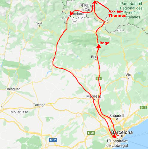
Today, we are going to join Greg on a tour that he found early in the summer and booked for our second day in Barcelona. We'll be taking a motorcoach northwest from Barcelona, eventually ending up in the tiny principality of Andorra. We'll make some stops along the way, adding another country (one of three on this cruise vacation) to our individual lists of countries we've visited.
The Drive to Bagŕ
Early this morning, we checked out of the HCC Hotel, as they did not have rooms for us for the night of the 12th. When we were out for dinner last night, we found another hotel down the street, and made a reservation there. We just left our bags in the HCC Hotel and headed down towards the tour office for our trip to Andorra.
|
The sun came up as we were passing to the west of Montserrat, a place we visited years ago on another cruise. We'd heard of the red hills above the monastery, and hoped to get a good photo but, as luck would have it, neither my pictures nor Fred's turned out:
 |
Our tour had been advertised as "...visiting three distinctly different countries with three different atmospheres." We would begin in Spain, cross into France, and finally drive into Andorra before returning to Spain.
|
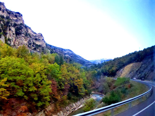
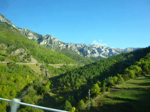
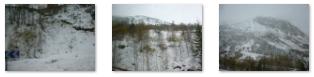
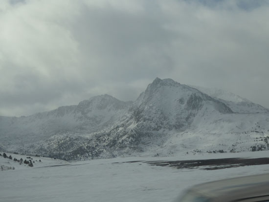
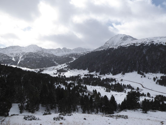
There were lots of neat views, particularly when we entered the mountains. Taking pictures out the tinted windows of the fast-moving bus wasn't easy, and a great many of our pictures didn't turn out. But here are five that did:
|
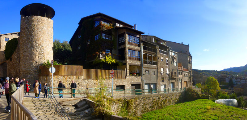
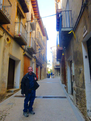
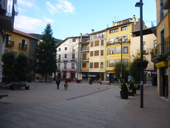
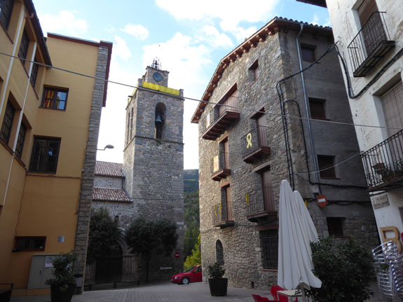
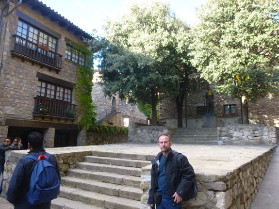
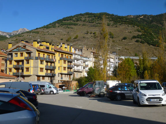
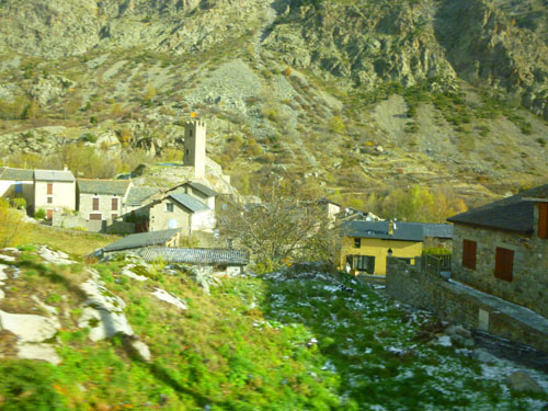
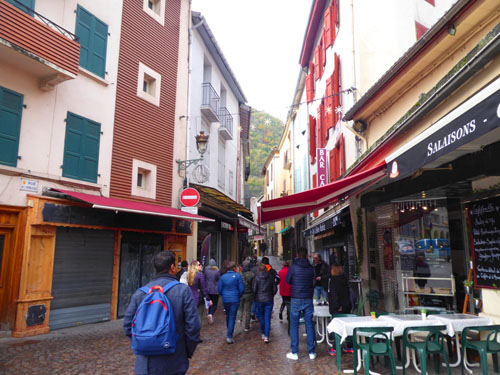
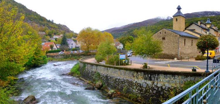
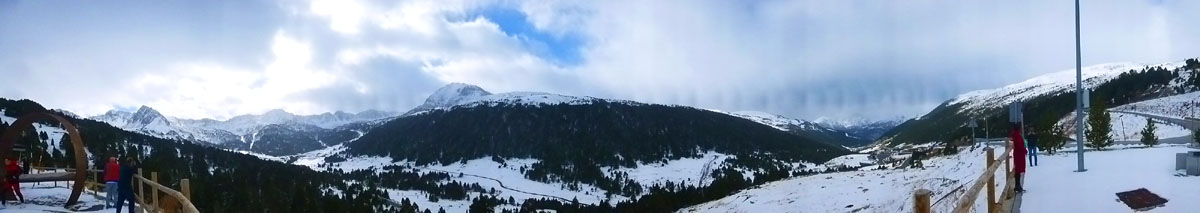
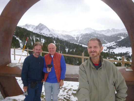
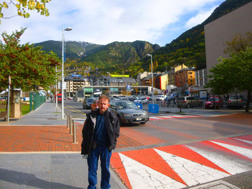
We came into a parking area at Baga just about 9AM, piled out of the bus, and walked with our guide right into the center of the small town.
Walking Around the Town of Bagŕ
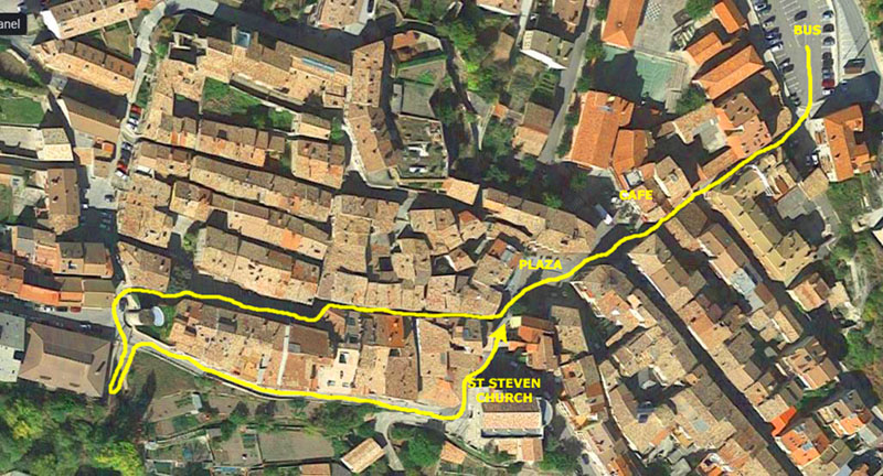
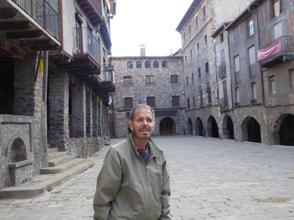
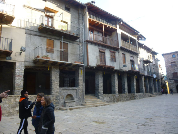
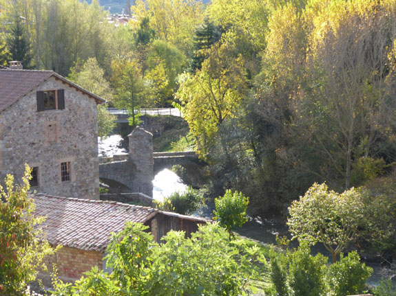
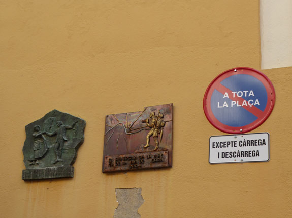
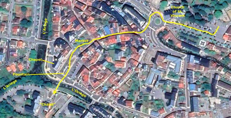
The first stop on our day tour to Andorra was actually a small Spanish town named Bagŕ, located at the head of the valley of the Llobregat river, at the feet of the high mountains of the Cadí range. The town itself is at 2400 feet above sea level. Bagŕ is 7 miles north of Berga, and 3 miles to the south of the Cadi Tunnel- a tunnel which pierces the Cadí range, connecting with the region of la Cerdanya.
|
The town was redesigned in the 13th century by Galceran IV de Pinós, and is a rare example of medieval city planning. The town grew rapidly and by the beginning of the 14th century a new neighborhood had to be built outside the town's walls to accommodate its growing population. Bagŕ was also granted a weekly market (which continues to this day) consolidating its role as a regional capital.
As a curiosity, some medieval documents refer to a “Hugo of Bagŕ” being the founder of the Knights Templar, though this is uncertain.
The tour bus parked in what seemed to be the town's only parking lot, and we piled out to follow our guide down into the village. To help orient you and the pictures we took, I've taken an aerial view of the old part of the town from Google to include here.
|
From the tour brochure:
| "As this sleepy villages comes to life, you can get a fresh pastry or sandwich in the local bakery, and a coffee in one of the many typical cafes, before rejoining your guide who will give you a short walking tour of the village before leaving you some free time to explore alone." |
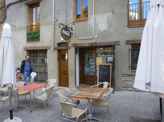
As it turned out, we didn't do much exploring on our own, but followed our guide as he led us through the town (along the route marked on the aerial view). We did, however, get a pastry from the local bakery (a modern pastry shop, from all appearances), and we did stop for a coffee in a local cafe- one of two that we found on the town's main square (the other being more of a tavern, from the accounts of the people to stopped in there). All three spots are used to visitors, as this particular tour runs six days a week, and the Explore Catalunya organization brings a busful of tourists to the town each day.
|
|
After our guide gave us some of the historical information I've used above, we did have an opportunity to relax, have a coffee, and warm up a bit before we headed out on our 1-hour walk through town.
|
|
|
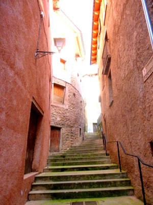
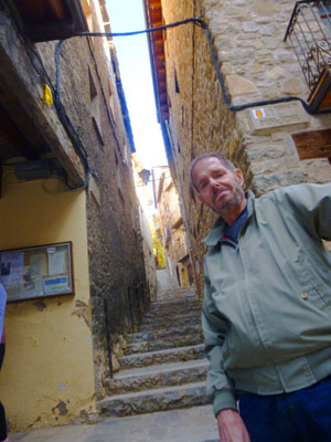
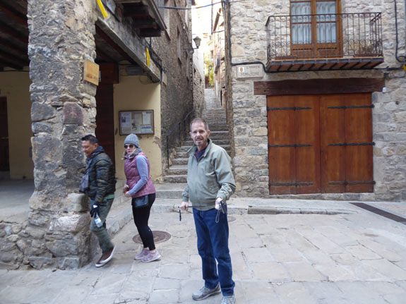
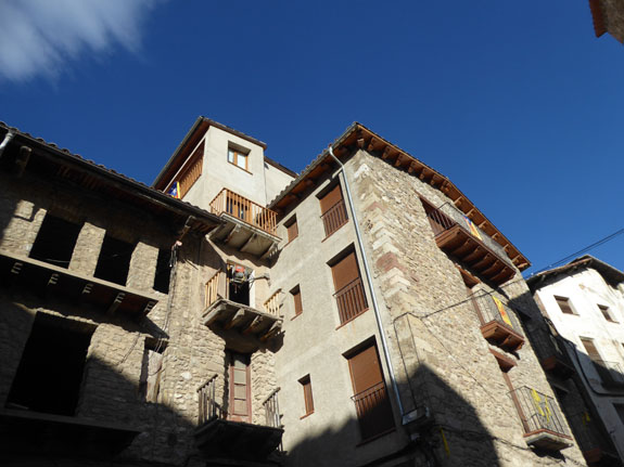
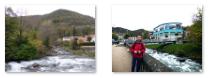
Although it wasn't built on the top of a hill, still and all Baga itself was not nearly flat. As we have seen in many places in Europe before, many of the narrow streets in Baga were as much stairways as they are streets. Not every one of the narrow streets had stairs; those that happened to run east and west, around the side of the hill, were pretty normal, but those that ran perpendicular (up and down the hillside) were steep enough to often require stairs.
When we first arrived in town, early in the morning, it was very cloudy, but by the last half of our walking tour, the sun had come out and the skies had cleared a great deal. The town looked a lot better in the sunlight.
|
|
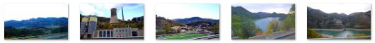
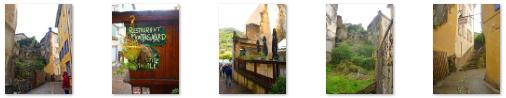
Even after eliminating duplications, and pictures that really didn't add much to your appreciation of Baga (like a couple of pictures that Fred took of some unique decorations he found on a couple of drains embedded in the large cobblestones, decorations that you can see here and here), I was left with quite a few that you might want to see. When this has been the case elsewhere in this photo album, I have chosen a slideshow as the best way to allow you to see them quickly and easily, and I've done so again here.
The slideshow itself is at right. If you aren't already familiar with how these slideshows work, it's easy. To go from one picture to the next, just click on one of the little arrows in the lower corners of each picture; you can go backward and forward. You can see which picture you are on, and how many there are in the show, by referring to the index numbers in the upper left. The slideshow "wraps" so going forward from the last picture will bring you around to the first one again.
I've interleaved Fred's pictures and my own, so that they are in the general order of the path our walking tour took. Come on along with us as we wander through Baga!
Returning to the square, we spent a bit more time in the cafe and then trooped back to the parking area and the bus, ready to head off to the second country in our "three country in one day" tour- France.
Driving to Ax-les-Thermes
Let me organize the pictures from our second tour stop (in France, this time) by separating the pictures we took between Baga and Ax-les-Thermes from those we took as we walked around the French town.
"From Bagŕ, you will headed deeper into the countryside as we drove towards the French border." With that bit of knowledge from the tour brochure, we indeed did leave Baga and head further north.
|
|
The road kept winding up and around into the mountains, and eventually it became clear that there was no way the highway could go over them. About that time, our guide came on the PA and said that we would shortly reach the entrance to the Cadi Tunnel.
|
(Mouseover Image Above for Video Controls) |
It comprises two lanes, separated by a 2-foot-wide safety zone in the middle. The southern entrance, at an altitude of 3,855 ft, is located in the settlement of l'Hospitalet, part of the municipality of Guardiola de Berguedŕ. The northern entrance is in Cerdanya, in the municipality of Urús, and is at an elevation exactly 200 feet higher. I made a short movie out the front window of the coach as we drove through the tunnel, and you can use the player at right to watch it.
The Serra de Moixeró is often confused with the nearby Serra del Cadí range, hence the tunnel's naming after the latter. Both ranges are within the Cadí-Moixeró Natural Park, which also includes nearby Pedraforca.
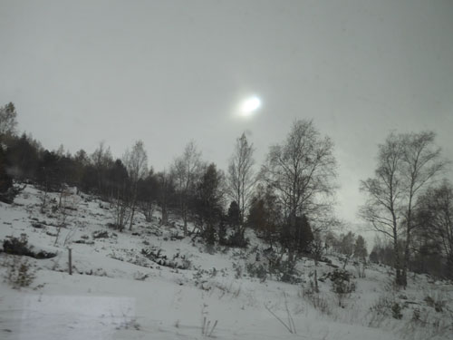
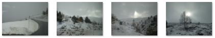
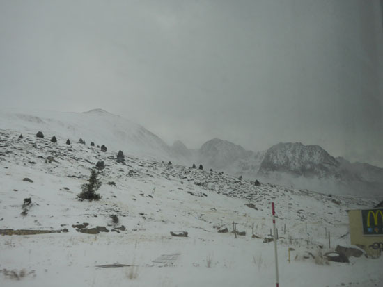
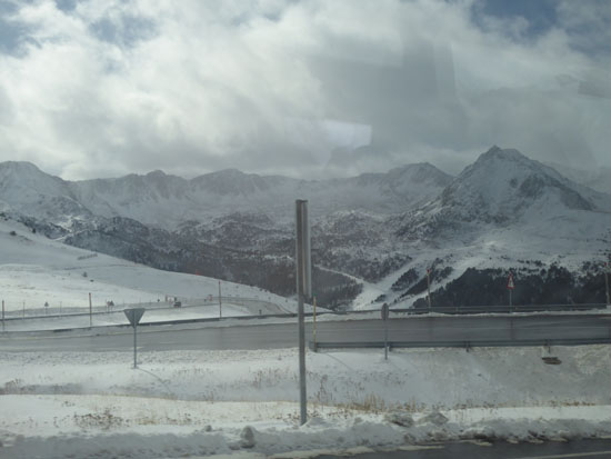
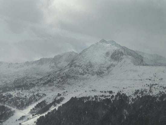
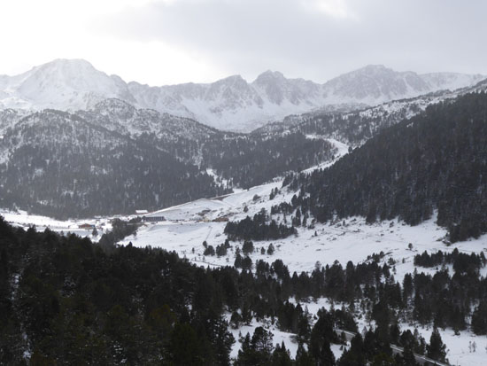
I am sure the driver knew ahead of time, but we discovered when we came out of the tunnel, which certainly, according to our guide, cut off many miles from the trip north, that we had to pay for that convenience. Coming out of the tunnel, we were still in the mountains, but we began descending into we were in an area of broad fertile valleys, but we eventually began climbing out from those valleys and into the higher mountains of the Serra del Cadi range that eventually became snow-covered. Sprinkled throughout the area were numerous small towns, each with its iconic church steeple:
|
These mountains (the highest peak of which is the 8,700-foot Vulturó) stretch from east to west between Alt Urgell and Berguedŕ, and provide the watershed for the Llobregat River. Oddly, the northern slopes are made up of Jurassic materials while the peaks are Eocene limestone. The southern face is an almost continuous series of sheer cliffs. The present structure formed during the Tertiary as a consequence of the orogenesis of the Pyrenees and is characterized by its Alpine folding. The jagged peaks eventually became more rounded as we ascended, and that's when the snow cover appeared.
|
|
During our ride north, I had a chance to listen to our guide and also to take a look at what the tour brochure said about our next stop:
| "Your next stop is the charming and beautiful ancient spa town of Ax-Les-Thermes. Your guide will recommend some of the best natural fountains to visit, and those best suitable for soaking your feet in. You'll then have free time to enjoy the healing waters, browse the local artisan shops where you can buy local cheeses and cured meats, as well as looking out for a souvenir to remember your visit. After an hour of wandering around this typical French village, its time to choose from one of the many local restaurants for a traditional French lunch." |
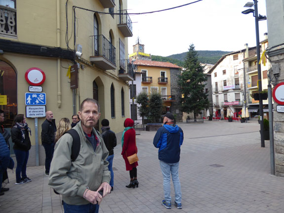
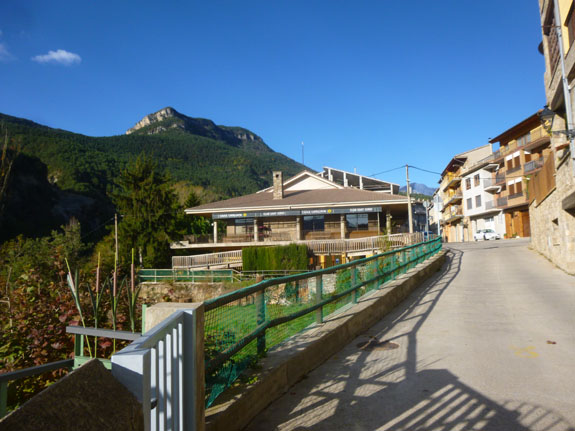
Ax-les-Thermes
As we closed in on Ax-les-Thermes, the weather deteriorated. It became cloudy and colder, and by the time we pulled into the parking area at Ax-les-Thermes, there was even some mist in the air occasionally. But we put on our jackets and headed towards the center of town.
|
From the parking area, we are going to first stop in at the town's parish church and after that walk through the old town to the original town square, which we found to be a market (at least through lunchtime). We walked southwest towards the confluence of the two rivers, just a couple of hundred feet from the town square.
The 2,300-foot-high town, whose name means "water of the hot springs", is well known for its sulphurous hot springs, first utilized by the Romans. The springs were developed in the medieval period on the orders of Saint Louis to treat soldiers returning from the Crusades afflicted with leprosy. From the 19th century, a spa tourism industry developed.
So come on along as we spend a couple of hours here in Ax-les-Thermes and get a bit of lunch.
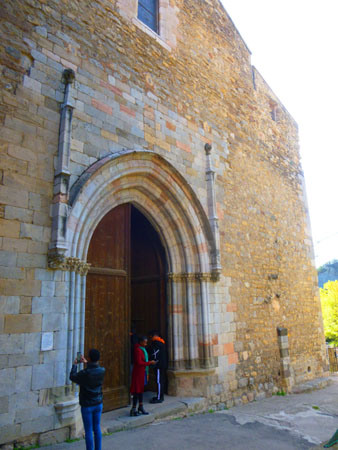
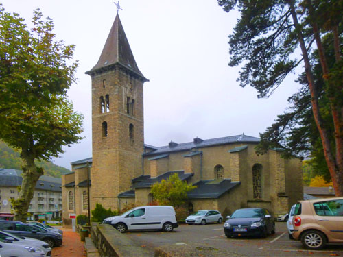
L'Eglise de St Vincent
|
In 780, a rich Catalan lord owning land in Ax had the chapel altered. The texts from that period mention "the church of Ax". In 978, monks from Ripoll Abbey, claiming unrest in the region due to bands of looters, came to Ax to take the remains of Saint Udaut to shelter them in their church. The church was then dedicated to Saint Vincent, a Spanish deacon martyred in Valence in 304. An act of donation dating from 987 mentions the church as being among the goods given to the Abbey of Lagrasse by Arnaud de Carcassonne in the event that he would not have had children (although the donation never became effective).
The church was rebuilt in the 12th century but then a fire destroyed the town in 1240 but left the church intact. Roger-Bernard II de Foix, count of Foix ordered that the town be rebuilt further downstream, between the three rivers, the Aričge and its two tributaries, the Oričge and the Lauze. The church had been on the west side of the town at that time, but after the rebuilding it was outside the city limits (and thus the ramparts). It remained there until the ramparts themselves were torn down to allow the town to expand, that event taking place in the late 1300s.
|
|
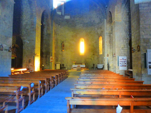
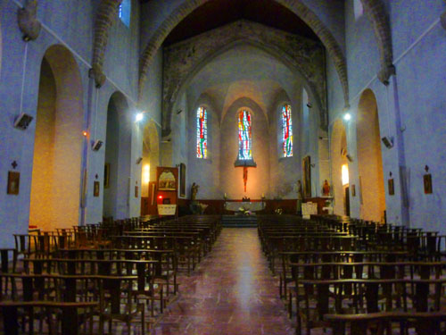
The church was enlarged in the 15th century, then restored in the 16th, and transformed when it was rebuilt in the 17th century. The nobles of Ax were buried in the side chapels of the nave before 1789. The archpriests of Ax and Sabarthčs had the privilege of being able to be buried in the choir. Until 1650, the consuls who managed the current affairs of the city met in the church or in the Saint-Jean-d'Auze chapel adjoining the church.
|
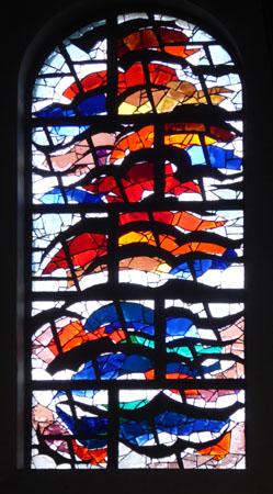
The modern stained glass windows were produced by Dom Ephrem Socard (1985) from the Abbey of En-Calcat with the participation of Jean-Claude Izard, under the direction of Father Odilar, a Benedictine monk. At left you can see one of the windows at the front of the nave, and one of the pictures below shows the rose window at the back of the nave.
|
In 1886, the bishop of Vic authorized the return to Ax-les-Thermes of a fragment of the relics of Saint Udaut. The reliquary is in the Saint-Vincent chapel, first chapel on the left, near the choir. Next to it is a shrine with relics of Saint Vincent.
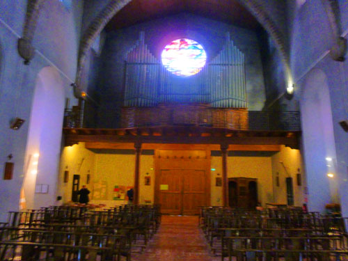
The church had an organ as early as 1595, but it disappeared during the French Revolution. The church then had a treat until 1856, and after that a harmonium. In 1897, donations from parishioners enabled the church to acquire an organ made by Oscar Annessens from a family of Belgian organ builders, established in Menen. The organ was installed on September 4, 1897 and inaugurated on Saint Vincent's Day, January 22, 1898. The 24-stop organ was restored in 1952 and 1968. It was rebuilt in 1978 by Maison Pesce to install mechanical traction for the notes and an electro-pneumatic system for the registers.
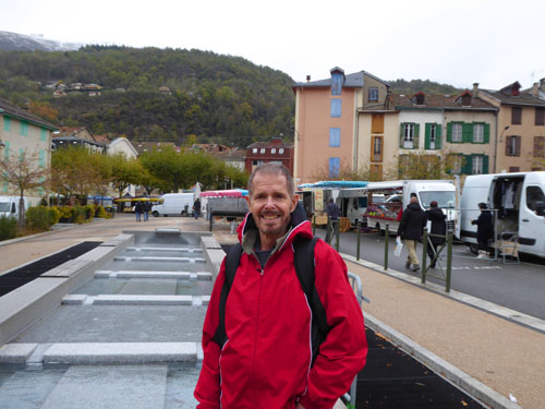
Ax-les-Thermes Town Square and Market
|
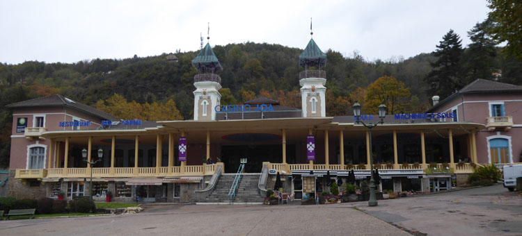
Here are some pictures Fred took of the roundabout in front of the casino:
|
So our guide led us around the west side of the roundabout, crossing the street, and the going in front of some of the buildings and storefronts and restaurants until we came to the street that would lead down to the central square.
|
|
I thought this was interesting, and it made me wonder if there was some civic or historical organization that oversaw this kind of thing; maybe the ruined walls and other structures cannot be torn down, but then we didn't see any signage to describe what these things were the ruins of. But, then again, perhaps no one really knows. But still and all it was kind of neat, as new, modern stores were built in some cases right next to or into these old buildings. In some cases, like that one restaurant we passed, the business had actually incorporated itself into a ruined structure.
So even this prosaic walk down an old-town street revealed many interesting things, and I can only imagine that this is true throughout the Old World. In the States, the only places I can think of that might have something similar would be Boston in the north or perhaps Charleston, Savannah, or St. Augustine.
|
(Mouseover Image Above for Video Controls) |
|
The square was bordered by shops and little hotels, some very French and some more modern- like the Hotel de Ville. Most visitors to the town, we found out, come for its wintertime activity, and many of the shops were related to skiing.
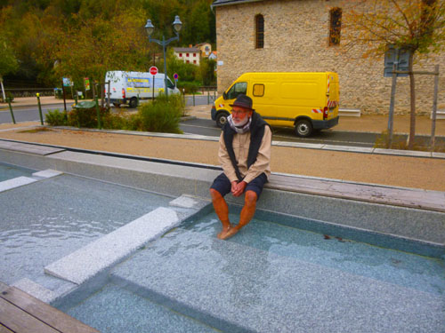
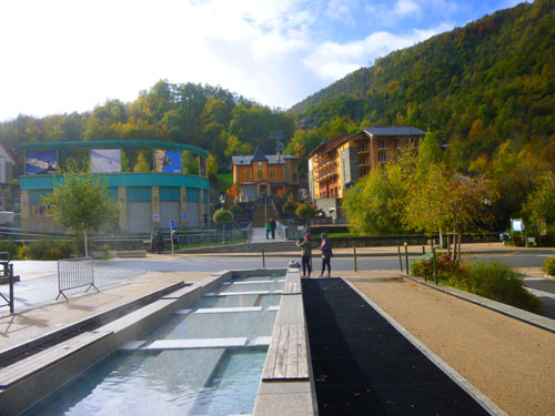
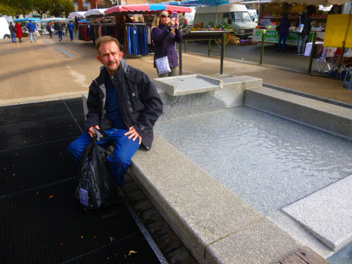
The Water Basins of Ax
|
|
Adjacent to this pool, we did find some interesting signage relating to the thermal pools that are, apparently, found throughout the town (although this was the only one we walked by).
|
|
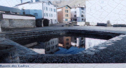
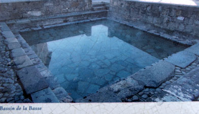
These pools, created in 2014, are fed by natural thermal water discharge. "You will definitely enjoy relaxing here after a long hike while benefiting from the invigorating footbaths. You can also discover these soothing benefits at some of the other pools around Ax-les-Thermes, notably those nearby at Ladres and La Basse."
|
|
At the Oričge River
|
(Mouseover Image Above for Video Controls) |
As you can see, the Oričge seems to be a much larger stream than the Ariege- at least by volume of water, but for some reason the river takes the name of the smaller stream- the Ariege- past the confluence. Why this should be so I have no idea, but at least that's the way it's labeled on Google Maps. But the labeling is confirmed in the Wikipedia article on Ax-les-Thermes, when it says that "...the Aričge flows through the commune from south to north at the start of its journey to join the Garonne. The Oričge flows from the east to join the Aričge in the village." If you refer to the aerial view of the town above, you can see that it is the stream in my movie that "flows from the east", and so that stream is the Oričge.
Right in front of the tram terminal there is a footbridge across the Oričge that enables people to get to the tram station and to the apartments and other buildings on the south side of the river. I would presume that there are other bridges upstream and downstream as well, of course.
|
|
It was getting about time to meet back at the tour bus, so we headed back across the stream and back through the town square to Saint Vincent's church. We were a bit early, so we got back on the bus to warm up, and in another fifteen minutes we were all aboard and heading back south out of Ax-les-Thermes on our way to Andorra.
The Trip to Andorra la Vella
After our "memorable French experience", the tour bus headed off for Andorra, initially following the same road south that we'd taken to come to Ax-les-Thermes. The route took us through the Pyrenees Alps.
|
|
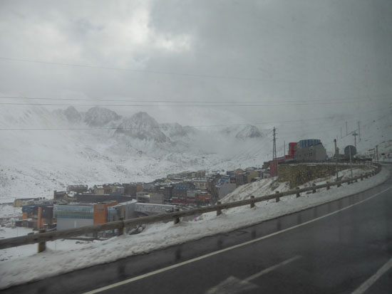
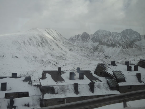
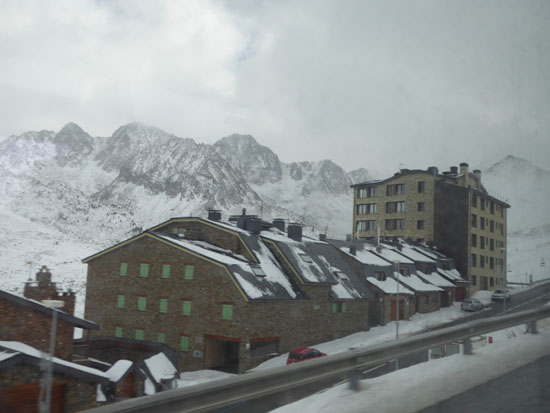
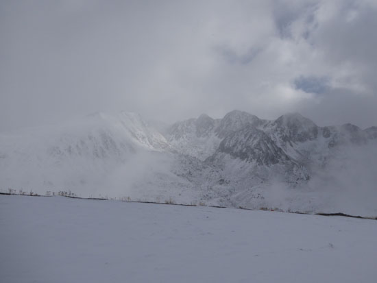
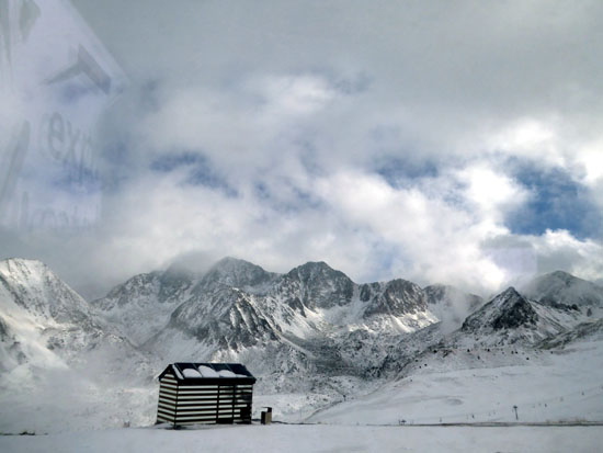
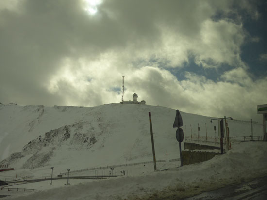
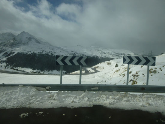
Eventually, we turned west on the highway leading to the Andorran border, and at that border we stopped at the border crossing to have our passports checked. (Andorra is not a member of the European Union, but has reciprocal customs agreements with France and Spain. As none of us were from either country, our guide had to take our passports inside to have them checked.) Then we were off through the snow-covered mountains to El Pas de la Casa.
|
At right is the best picture of the town that we got (no glare from the bus windows), but here are a few others:
|
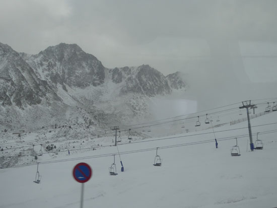
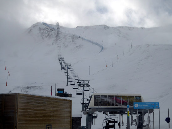
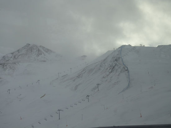
From the town of El Pas de la Casa, we eschewed the new tunnel and instead the tour bus climbed steadily to the top of the actual pass- probably because the whole point of the tour is to see things and the pass, according to the tour information, "offers some stunning photo opportunities". We took a number of neat pictures from the bus as it climbed, and even better ones when it stopped near the crest of the pass. Here is that "stunning" view:
|
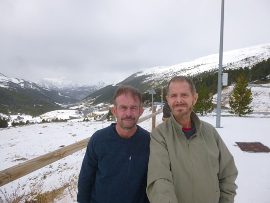
But that's just one of the many spectacular views that we got here in the snow-covered Pyrenees. I guess I had expected lower, more rounded mountains, but instead found something more like the Alps (although not nearly as high, of course).
|
|
|
(Mouseover Image Above for Video Controls) |
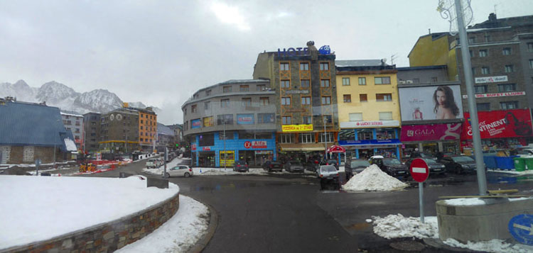
In the City of Andorra la Vella
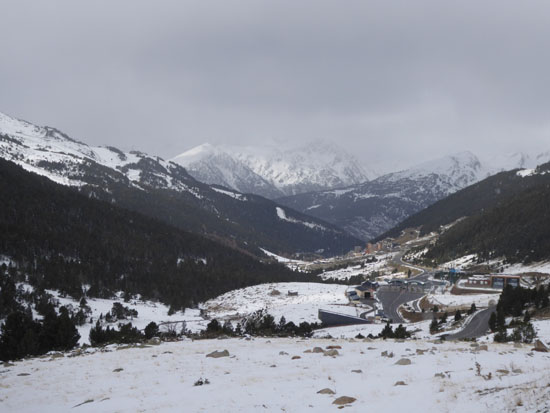
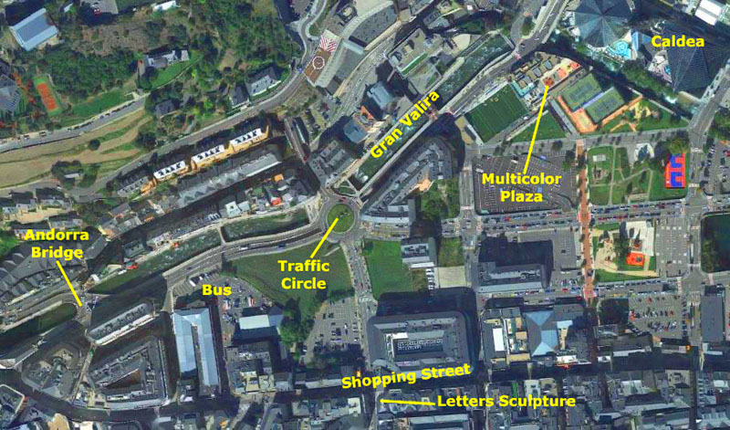
Andorra la Vella is the capital of the Principality of Andorra. It is located high in the east Pyrenees, between France and Spain. It is also the name of the parish that surrounds the capital. As of 2015, the city had a population of 23,000, and another 17,000 people live in the surrounding urban area. Coming down out of the mountains, the snow disappeared, the mountains greened up, and civilization reappeared. Here is a sequence of eight photos we took as we came into Andorra la Vella:
|
(We were actually supposed to stop off at a typical mountain valley outside Andorra and do a short hike, but the snow made that inadvisable- according to our guide, anyway.) We continued down into the city of Andorra la Vella- our last stop of the day. Our tour bus pulled into the parking lot behind the huge LeClerc store in the center of town, and that's where we parked for 90 minutes or so while we all got a chance to walk around. I assume that the tour company coordinates with that particular store, as the store also provided a "comfort stop" for us to use.
|
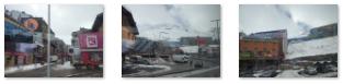
First, we walked south alongside the LeClerc store (something like a Walmart Supercenter, but more upscale) to a pedestrian shopping street that ran pretty much east west, and which was lined with all kinds of stores (again, most of them fairly upscale, but with a McDonalds to keep it real). Here are some views of the street as we headed east:
|
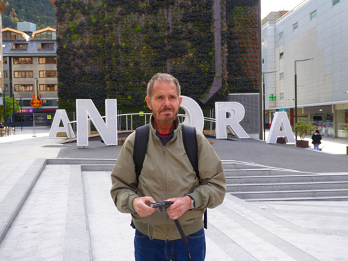
We were walking up the street doing some window shopping and we eventually came to an open area that turned out to be the intersection of two or three of these pedestrian streets. There are a lot of them in Andorra. Here, we found a kind of sculpture, consisting of seven large letters spelling out the name "ANDORRA". The letters seemed to be haphazardly sited- some close to us and some further back- but generally in the order they should be.
|
|
(Mouseover Image Above for Video Controls) |
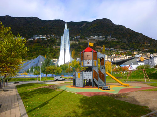
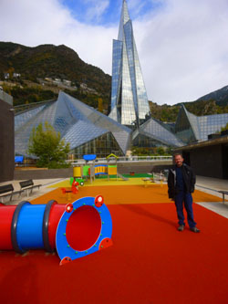
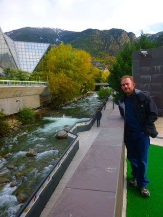
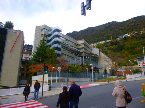
Here at this intersection, Greg saw some stores he wanted to visit, so he left us to walk around town on our own. We had seen what appeared to be some sort of pyramidal glass building on our way into town- a church, I thought- and we headed northeast in that general direction, leaving the shopping district, apparently, and walking past a couple of playgrounds and parks.
|
|
You can see what direction we are headed if you refer to the aerial view. On that view, you can see that just southwest of the glass structure there seem to be some multicolored squares; these turned out to be a kind of playground. There were some little shops that on a summer day might sell snacks or ice cream, and there were some facilities, and of course places for kids to play (with some odd constructions for them to climb on). And the playground was backdropped at one end by the glass pyramid:
|
|
|
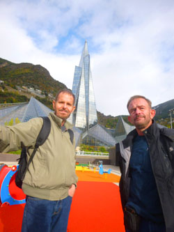
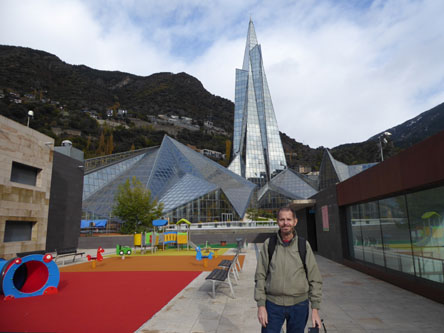
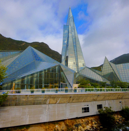
We walked to the end of the play area closest to the glass tower, and found that it was a whole complex of angular glass buildings. In one of the lower structures we saw an indoor swimming pool, and of course this eliminated my supposition that this was a church. Our other theory, that this was an office building, seemed also to have been disproven. But what was it?
|
I still think that the glass pyramid has some other purpose; it's way too tall for something associated with the spa. I am going to assume it is at least partially an office structure, but I don't know for sure. Here are some other views of this remarkable complex:
|
Andorra la Vella means "Andorra the Town", to distinguish it from the Principality of Andorra as a whole. Although in Catalan the word vella (like French vieille) is derived from the Latin word vetula which means "old", the Vella here (like French ville and Catalan vila) is derived from the Latin word villa and means "town".
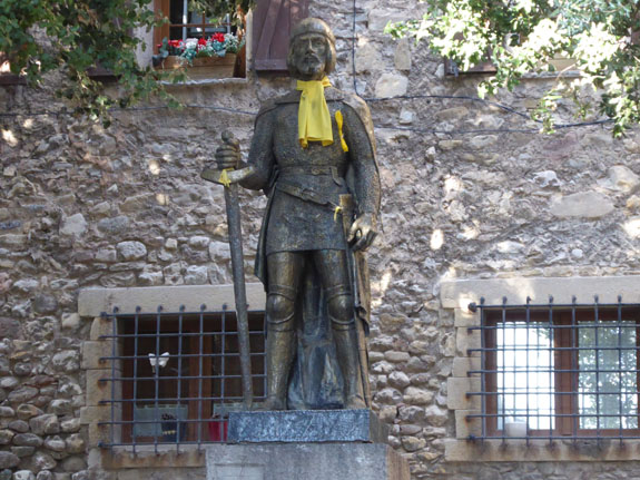
Just before we came up to the multicolored play area we passed a public sculpture that I wanted to mention here. It was right underneath a tree, but I don't recall seeing a plaque with its name or attribution. So I can only assume is entitled "Girl with Rooster" as I can't imagine what it is commemorating. It is probably just a piece of community artwork; there was lots more around town.
|
|
(Mouseover Image Above for Video Controls) |
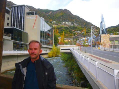
The Gran Valira is a tributary to the Segre, which in turn is a tributary to the Ebro. It flows into the Segre in La Seu d'Urgell. Its main tributaries are the Valira d'Orient, the Valira del Nord and the Madriu. The Valira river system is 22 miles long.
The map service of the Andorran government calls it the Gran Valira. In certain sources, especially those with a Spanish influence such as maps published in Spain, it is sometimes referred to as the Valira because in the territory of Spain there is only one Valira river. In Andorra, however, there are several different Valiras and hence there is a need to distinguish between them.
Down at the street, we began walking south towards a bridge that we could see a few blocks downriver; this was also the direction we needed to go to get back to the tour bus. Here are a couple of nice views of the city and the mountains that border it:
|
|
I thought that the city of Andorra de Vella was very picturesque, but then any city with mountains, I think, falls into that category. The city isn't a large place; 25,000 people as I mentioned above.
|
The settlement of Andorra la Vella has been the principal city of Andorra since 1278 when the French and the Episcopal co-princes agreed to joint suzerainty. Andorra la Vella's old town— the Barri Antic— includes streets and buildings dating from this time. Its most notable building is the Casa de la Vall— constructed in the early sixteenth century— which has been the state's parliamentary house since 1702. Andorra la Vella was, during this period, the capital of a largely isolated and feudal state, which retained its independence due to this principle of co-sovereignty.
Well into the twentieth century, the area around Andorra la Vella remained largely forgotten; indeed the state was not part of the Treaty of Versailles, simply because it was not noticed. After political turmoil in the 1930s and an attempted coup by Boris Skossyreff, an informal democracy developed.
In 1993, the country's first constitution formalized this parliamentary democracy with executive, legislative, and judicial branches located in Andorra la Vella.
During this period, Andorra also developed as a tax haven, resulting in the construction of modern banking offices in Andorra La Vella. The city also developed its skiing facilities, to the extent that Andorra la Vella was Andorra's applicant city for the XXI Olympic Winter Games, the 2010 Winter Olympics. However, Andorra la Vella was not selected by the IOC as a candidate city, following the evaluation report of an IOC commission. It also hosted both the 1991 and 2005 Games of the Small States of Europe.
|
|
(Mouseover Image Above for Video Controls) |
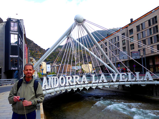
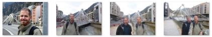
The last stop we made on our walk through town was the interesting bridge that we'd seen from all the way up at the spa complex. It turned out to be the city's "signature bridge"- the "Pont de Paris".
|
|
On the way back to the tour bus (which was parked in a lot just beyond the end of the building at the right in the picture of the bridge at left), we took a few more interesting pictures that are worth including here:
|
We were supposed to be back at the tour bus at four-thirty, but a couple of folks were a few minutes late, so we headed out of Andorra la Vella a little late. We returned to Barcelona via a different, more westerly route. The scenery was very nice, but again it was clouding up. We made a rest stop after about an hour. We arrived back in Barcelona a little after 7:30, getting dropped off right at the centrally-located Plaza Catalunya.
We went back to the HCC hotel to collect our luggage when we took to our hotel for the second night- the Hotel Praktik Rambla. It was only a couple of blocks towards Plaza Catalunya from the HCC. We went out for a late supper and an after-dinner walk before returning to the hotel and bed.
You can use the links below to continue to another photo album page.
|
November 13, 2019: A Visit to the Sagrada Familia |
|
November 11, 2019: A Visit to Park Guell |
|
Return to the Index for 2019 |