|
July 3-4: A Side Trip to Iguassu Falls |
|
June 28-30: Arrival in Rio and Sugarloaf Excursion |
|
Return to the Brazil Trip Index |
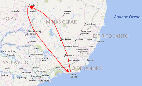
The next day, I got up very early to head over to the airport for the first of the two side trips that Steve had planned for me. Today's trip would be to Brasilia, the new capital that was built entirely from scratch out in the middle of the country.
Getting to Brasilia
|
From 1763 until 1960, Rio de Janeiro was Brazil's capital. At that time, resources tended to be centered in Brazil's southeast region near Rio. Brasília's geographically central location fostered a more regionally neutral federal capital. An article of the country's first republican constitution dating back to 1891 stated the capital should be moved from Rio de Janeiro to a place close to the country's center.
The first plan to do so was conceived in 1827 by José Bonifácio, an advisor to Emperor Pedro I. He presented that plan to the General Assembly of Brazil; it called for a new city called Brasília, with the idea of moving the capital westward from the heavily populated southeastern corridor. The bill was not enacted because Pedro I dissolved the Assembly.
The idea of building the new capital got a boost from an unlikely source. According to legend, Italian saint Don Bosco in 1883 had a dream in which he described a futuristic city that roughly fitted Brasília's location. Needless to say, this had quite an impact in the heavily-Catholic country, and many began to feel that there was some divine inspiration for the move. In fact, in Brasília today there are many references to Bosco throughout the city and one church parish in the city bears his name.
|
I need to explain a bit about this day trip to Brasilia. As I said, Steve, my travel agent, had booked a tour that would take an entire day and include lunch. He found the tour in one of his travel guides, and it was described, he told me before I started out for South America, as a group tour of all the highlights of Brasilia. It would be a bus tour, and the little photograph that he showed me had a kind of mini-bus, so I assumed that there would be eight to ten folks on the tour.
My instructions had been to go into the terminal and look for a tour guide holding a sign with the name of the tour company (which I do not recall) on it. I found the middle-aged gentleman with no problem, but when I came over to him, he was standing by himself; there were no other folks around. He spoke quite good English, and he told me that today I was the only person who had booked the tour. Then he asked me if it would be OK if he just used an automobile to take me around, instead of the small bus. He explained that it would be easier to park and everything. I was fine with that, particularly since I would be getting an individualized tour for the price of a group tour.
Our Trip into Brasilia
|
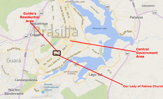
Anyway, with everything arranged, we set off from the airport to the area where the tour guide lived. Since I am creating this web page in 2017, and have access to aerial views of Brasilia, I wanted to add some of them to supplement the pictures and the descriptions that I wrote after my return from South America. I have discovered that, at least as far as the aerial views are concerned, Brasilia has changed so much in 35 years that it is almost impossible to match my pictures to those views- unless I took a picture of a landmark that has stood the test of time. For example, the side street that I photographed at left as we were driving into the city would be impossible to locate now- if indeed it has not been torn down and replaced.
I am sure that many of the newer buildings that I photographed are still there, but the layout and architecture of Brasilia is so formal and frankly repetitive that it is hard to identify a particular structure unless it is one of those landmarks- like a major church or government building. So, where I can, I will add an aerial view or two, but for many of the pictures, just the picture and the description I wrote of it will have to suffice.
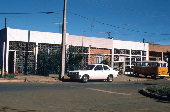
 This is a side street in an industrial area that we drove through on our way from the airport. My tour guide was heading towards the neighborhood where he lived, so we weren't following one of the main roads into the city. |
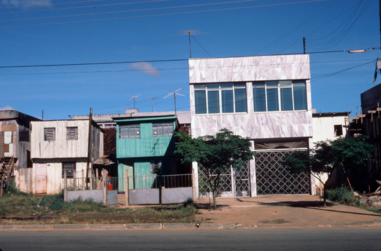 It looks as if this area was a commercial area of some sort, even though these may well be residences. There wasn't much foot traffic- people shopping and such. |
The relatively new airport is some distance from the capital itself, and we had to drive a kind of circuitous route to get into Brasilia itself. My driver, who spoke surprisingly good English, told me that the new city is still under development, and that new highways to the airport are on the drawing boards.
|
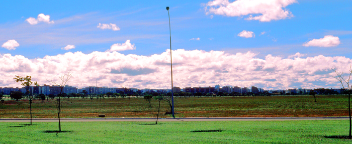
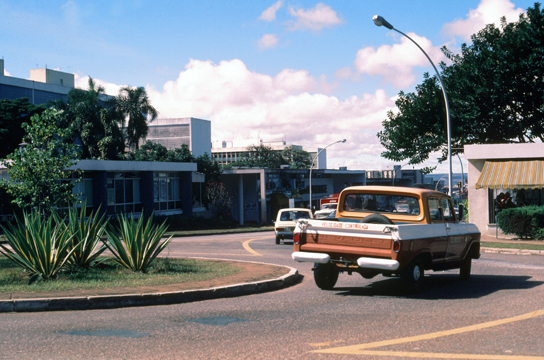
It looked as if we were heading towards an area away from the official capital structures, which my driver had said would be the case, as we went to his house/office to trade the little minibus for his taxi. This area of Brazil is much drier and warmer than the coastal areas. The weather seemed uniformly good, much like our own Midwest during the later Summer and early Fall.
Our destination, as I mentioned earlier, was the area where my guide actually lived; I believe this was on the southwest side of the new city, some distance from the main government buildings.
|
So in our own country some worthless land in Maryland was bought by the government, and the capital, Washington, built. Just as we had Pierre L'Enfant lay out the entire city from the beginning, Brasilia was done the same way. Land was selected for the capital, and then a contest was held to determine who would be the main urban planner; this competition, in which 5000 people competed, resulted in the selection of Lúcio Costa in 1957. Oscar Niemeyer, a close friend, was the chief architect of most public buildings and Roberto Burle Marx was the landscape designer.
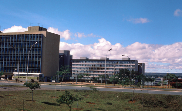
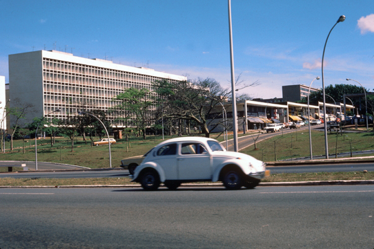
At the time I took this tour, many of the offices and government buildings had been constructed, but you could tell that there were going to be many more. There were broad avenues with few buildings along them as yet, and everywhere you looked there was some type of construction going on. These are two of the office blocks that house some of the government agencies of Brazil, and you can see that there is a great deal of open space. Of course, lots of open space was part of the plan, but there were too many streets and boulevards for just the buildings that existed. In fact, in one of the public buildings there was a model of what Brasilia is supposed to look like in the year 2000.
 This is a typical government building; I'm not sure what this particular agency was, but the building is representative. Since Brasilia is totally new, there are no old structures like our Capitol, or the Smithsonian, or even the White House. |
 Here are more of the small offices and other buildings that we passed on the way to the southwest residential areas. |
The Southwest Residential Area
 |
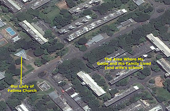 |
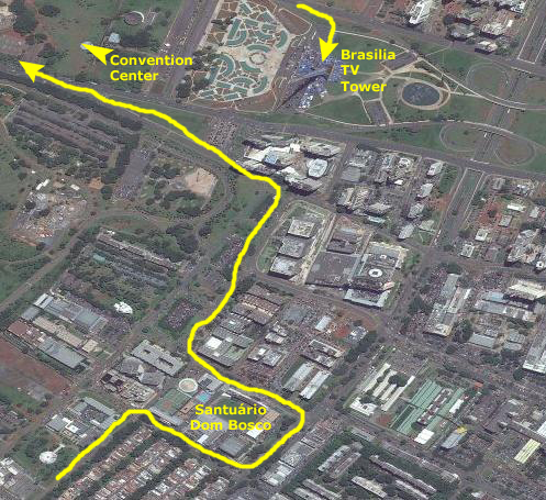
The area where my guide lived was south of the main center where most of the government buildings were, and west of the westernmost of the two parallel avenues. On the map above, left, you can see generally where this area is, and to the right of that map is an aerial view of the small map area outlined in black. It is in this area that the next group of pictures was taken.
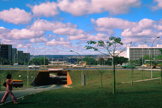 As we cross an avenue into the residential area, you can see how spread out everything is, and how new and modern all the roadways and buildings are. |
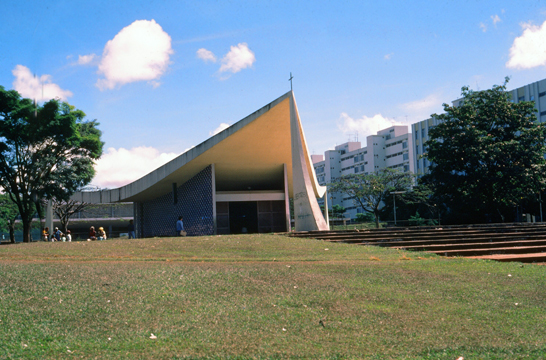 This is Our Lady of Fatima Church, designed by Oscar Niemeyer. It is a study in triangles, and I wish I had gotten to go inside. |
When we got to the area where my guide lived, I had a chance to walk around the area. It was typical of the new residential areas that are being built; most of what residents need- shopping, schools, and such- are located within walking distance. Here are some of the pictures that I took while we were here:
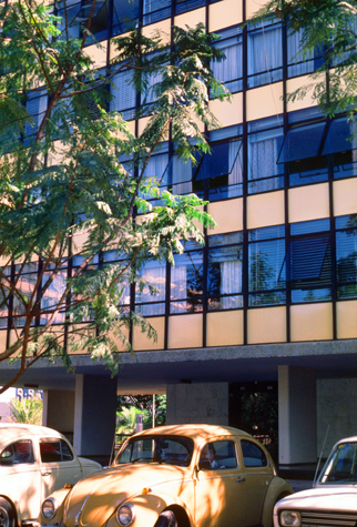 |
(Picture at left) I am not positive that this was the actual building that my guide lived in; he didn't actually go inside one of them but simply retrieved his taxi from one of the parking areas. But this building seemed to be typical of those in this residential area.
(Picture at right)
|
 |
 |
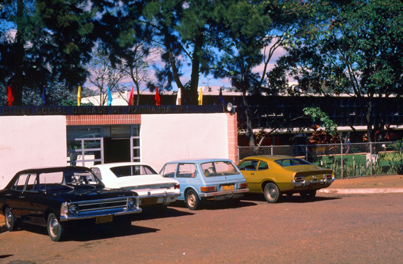 |
I did note in my narrative that the car my guide actually drove me around in was the black one at the left of the line of cars in this picture. It wasn't air-conditioned, but that wasn't needed here in the highlands.
 |
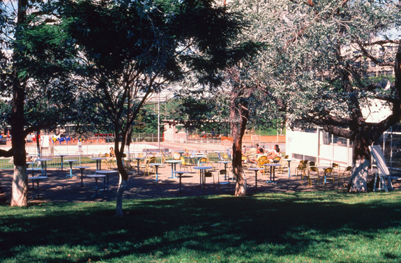 |
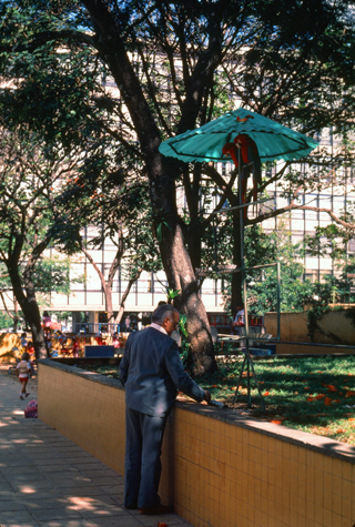
Between the school buildings there were outside eating areas and what looked like a playground. I assume that all the tables were used for students having their lunches.
Once my guide had gotten his car and talked with his wife, we headed off to see some of the sights of the Federal City.
A Panoramic View of Brasilia
|
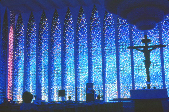 |
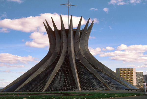
The church was built in 1963 according to a design by Carlos Alberto Naves; the floor area amounts to approximately 10,000 square feet, while 80 Gothic columns in the form of concrete pillars with a height of 50 feet support the roof of the structure. The windows are actually constructed of glass blocks, in 12 different shades of blue to purple, which symbolize the clear starry sky. Another special feature is the 10-foot crystal chandelier suspended from steel ropes, made up of 7,400 individual pieces of Murano glass. The 25-foot-high crucifix was designed by Gotfredo Thaler, and the bronze doors with scenes from the life of Don Bosco were created by the artist Siron Franco.
|
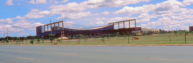
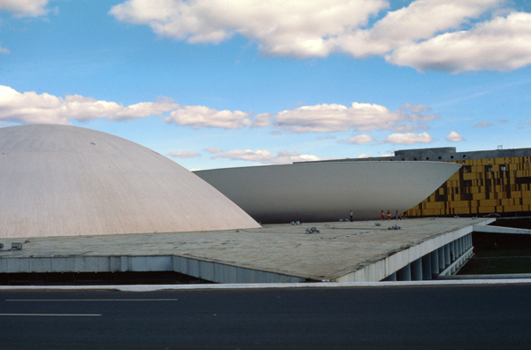
The construction of the Brasilia Cultural Center started in 1973; it was one of the few important buildings in Brasilia which were not designed by Oscar Niemeyer. It was repurposed a couple of years before my visit, when it was turned into a convention center to handle the increased number of gatherings being held in Brasilia. In the two years between its opening and my being driven by it, it was handling a large convention almost every other week.
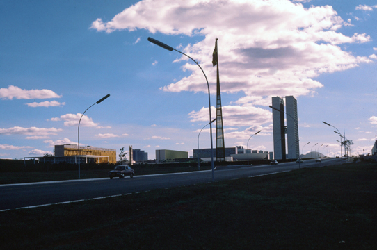
The Brasília TV Tower was completed in 1967 (the observation platform opened in 1965) at a height of 218 meters. The tower rose another six meters after additions by the TV channel Bandeirantes for the current height of 224 meters. The tower is the fourth tallest structure in Brazil and is also one of the most noticeable from Juscelino Kubitschek Bridge. It is located on Brasilia's Monumental Axis.
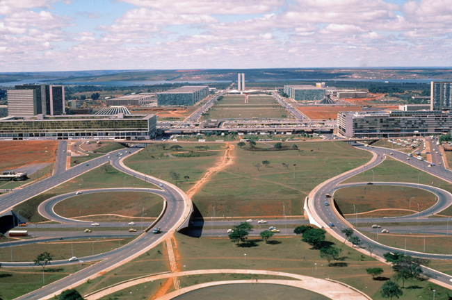
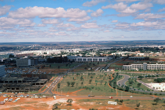
My guide got me through the process of going up to the observation deck halfway up the tower, and from there I could see Brasília spread out before me- including the "Monumental Axis" (similar to our National Mall in Washington) that runs east-west. You can see an aerial view of the Monumental Axis in the scrollable window above.
|
I think that the best picture that I took from the observation deck was the view at left. This view (taken in 1980) looks east across the Monumental Axis, and it matches up pretty well with the aerial view (current circa 2016). You can match up the roadways in the nearground, although the buildings in the midground have apparently been expanded since my visit there.
But beyond that, you can see the two rows of ministry buildings on the north (left) and south (right) side of the greenspace and, at the end of the mall, you can see Brasilia's iconic National Assembly buildings- the low-rise legislative building and the twin office towers attached to them. These, too, we will see up close a bit later in the day. In the distance is Lake Paranoa, which wraps around the eastern side of Brasilia.
But for now, you can compare my view to the aerial view and easily see that many new structures have been erected on either side (and in the middle of) the mall. One of the most prominent is the National Museum- the round structure just this side of the Brasilia Cathedral (the building that looks very much like a huge crown roast of pork).
On either side of the mall, out of the aerial view to the top and the bottom, are a mix of commercial and government buildings. Many of the foreign embassies are north of the mall, while most of the commercial buildings are to the south. From the observation deck, I took a number of pictures:
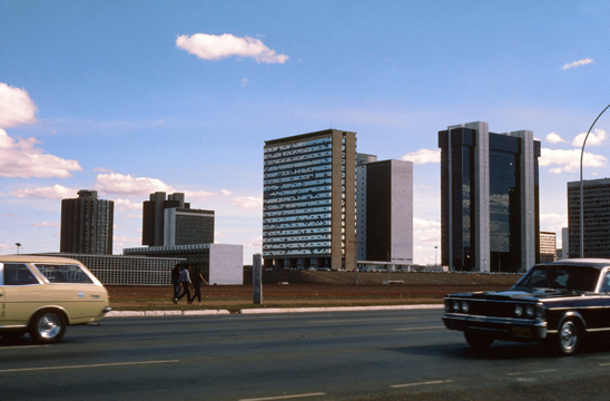
 This picture looks basically north, and you can see much new construction. This area is a mix of governmental buildings, embassies and, in the distance, residential areas. You can see how spread out everything is. |
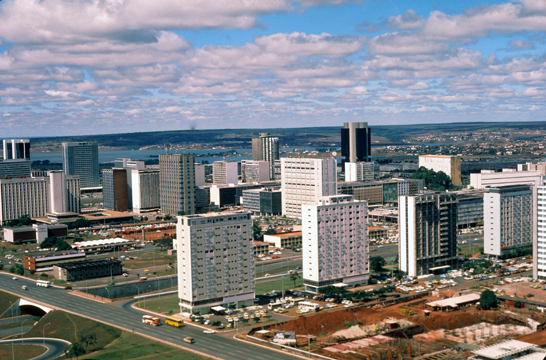 Looking south, this is the very new, mainly commercial area of the city. Here are the offices of the major Brazilian organizations that do business with the government, plus the the typical businesses that serve the residents of the city. All of this is less than 20 years old. |
Like Washington, Brasilia is very symmetrical, having, like Washington, been built de novo. The buildings along the National Mall aren't identical though, but most of them are here. The weather was beautiful today (as it is for months at a time, my guide told me). Note again how flat this part of Brazil is.
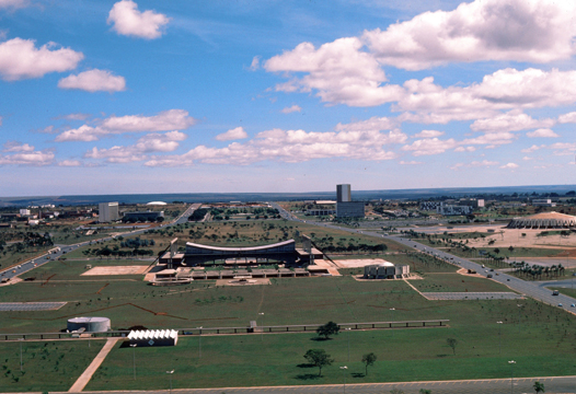 The tower on which I am standing is right in the center of the two-mile-long Monumental Axis, and this shot looks west. Everything is on a grand scale here, and again you can see the symmetry and flatness of everything. Brasilia is just getting going as a city, so there is still a lot of open space. That's the Convention Center again. |
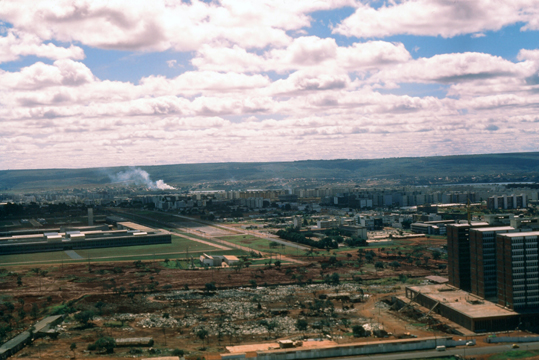 The industrial areas are off to the side and out of the way. Of course, being an administrative city, Brasilia doesn't have much industry to speak of. The lion's share of the productive capacity of the city is directed to manufacturing the materials used to build the various buildings. |
As I came down from the observation tower, I mused that the big problem with Brasilia is that pretty much everything needed to build an entire city had to be transported to this site; none of it was here. If bricks were needed, either they had to be trucked in or flown in, or they had to be manufactured right here, in new factories built for the purpose. When Brasilia was begun, there were not even any good roads to this part of Brazil; all that had to be built from the ground up. And all of this has been done in just 20 years or so.
Lunch and Lake Paranoa
|
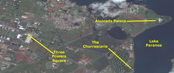
My guide drove me down the south side of the Monumental Axis and past Three Powers Square, and then continued through the open countryside another few miles to the restaurant that was situated on the shores of Lake Paranoa. I have marked the location of the restaurant (from memory) on the aerial view of this area at right.
I have also marked a location that my guide took me to after lunch, seeing as we were already out here by the lake- Alvorada Palace, the residence of the President of Brazil.
My guide dropped me off at the restaurant. I thought it odd that he didn't come in, but he said that his wife always makes him a small lunch on days that he is conducting tours, and so I ate my delicious meal along. Churrascaria's concentrate on meat, although there was a table set up with salads and vegetable dishes. Waiters roam around the large dining room with platters of various barbecued meats, and you can pretty much take as much of anything in particular as you want. I tried to sample a little of everything, although I found myself partial to the barbecued pork (maybe because of my affinity for southern pork barbecue back home).
|
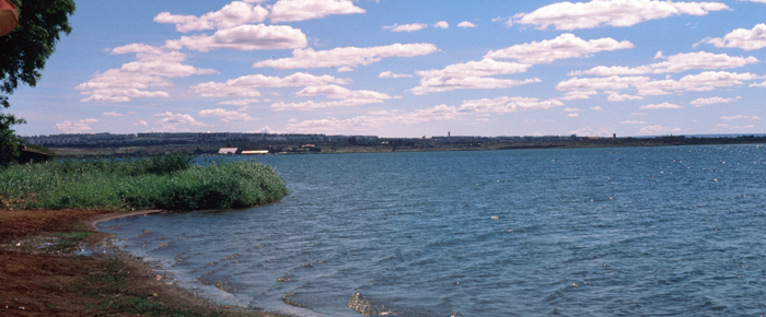
I had no way of knowing, until my guide told me, that Lake Paranoá is actually an artificial lake. During construction of the city, the Paranoá River was dammed to form the lake, which has a circumference of 50 miles. On its shores are embassies and consulates, sports clubs, restaurants, the residential areas of Lago Sul and Lago Norte, the University of Brasília, and the Palácio da Alvorada, the official residence of the President of Brazil.
The lake is named for the Paranoá River; that name is derived from the Tupi "parană" ("sea") and "kűá" ("bay" or "cove"), giving "sea cove".
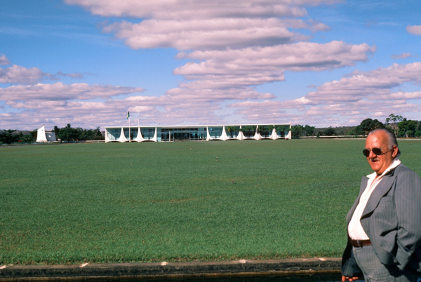
We got back in the car and my guide Carlos drove me about a mile up the lake shore and out to the parking area in front of the Alvorada Palace, where we got out to see the palace from a distance. There are tours of the house, but none that were timed conveniently for us today, so I contented myself with looking at it from the outside.
|
The 75,000-square-foot building has three floors: basement, landing and second floor. Located in adjacent buildings within palace grounds are the chapel and the heliport. The basement level houses the movie theater, game room, kitchen, laundry, medical center, and the building's administration.
The ground floor houses the state rooms used by the presidency for official receptions. It is made up of the Entrance Hall, Waiting Room, State Room, Library, Mezzanine, Noble Room, Music Room and Banquet Room. One wall of the Entrance Hall is inscribed with a quote from President Kubitschek: "From this central plateau, this vast loneliness that will soon become the center of national decisions, I look once more at the future of my country and foresee this dawn with an unshakeable faith in its great destiny."
All of the ground-floor rooms are decorated with artworks by Brazilian artists and antiques from both Brazil and Portugal. The second floor is the residential part of the palace, with the presidential apartment consisting of four suites, two guest apartments and other private rooms. There are some 150 employees in the building, including secretaries, assistants, waiters, cooks, doctors and security personnel. The palace complex is protected by the Presidential Guard Battalion.
From the palace, my guide and I headed off back towards Three Powers Square.
Three Powers Square
|
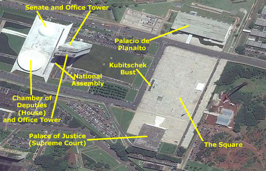
Praça dos Tręs Poderes (Three Powers Plaza) derives its name from the presence of the three governmental powers around the plaza: the Executive, represented by the Palácio do Planalto (presidential office); the Legislative represented by the Congresso Nacional (National Congress); and the Judiciary, represented by the Supremo Tribunal Federal (Supreme Federal Court).
The plaza was designed by Lúcio Costa and Oscar Niemeyer as a place where the three powers would meet harmoniously, it has now become a tourist attraction of Brasília.
The plaza is home to the largest flag in the world that is regularly (in this case, continuously) flown. The Brazilian flag hoisted here weighs about 1300 pounds and has never been taken down (not counting monthly replacements) since the capital was inaugurated on 21 April 1960. The flag is changed monthly in the presence of the Presidential Guard Battalion, Independence Dragoons, other troops and sometimes the President of Brazil.
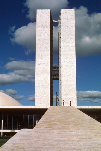
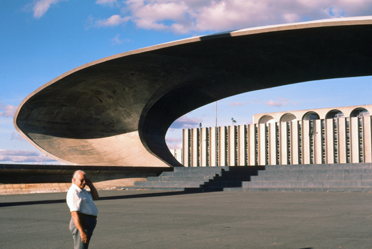
Carlos parked his vehicle near the square, and the two of us got out and walked around. I can't remember all of what Carlos told me, although some of it found its way into the picture narratives that I wrote when I got my slides back a few months later. Of course, I can fill in the gaps with information from today's Internet. Our first visit was to the National Assembly building, which consists of what corresponds to our Capitol (with the Chamber of Deputies and the Senate) and two office buildings- one for the Deputies and one for the Senate.
|
|
Attached to the building containing the two chambers, and in the middle of the building's width, are two vertical office towers- one for the Senate and one for the Chamber of Deputies. Both houses of the Congress also occupy other surrounding office buildings, some of them interconnected by a tunnel.
The National Congress building is located in the middle of the Monumental Axis- the main street of Brasília. In front of it there is a large lawn where demonstrations take place. At the back of it, is the Praça dos Tręs Poderes (Three Powers Plaza), where lies the Palácio do Planalto and the Supreme Federal Court. I thought that having the ramp was a neat idea, although I did think that a railing would have been a nice addition. I did go inside the Congress Building, and I visited each of the chambers.
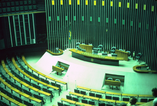 The legislature was not in session, so my tour guide was able to get me in to see both chambers. This is the Chamber of Deputies. This house is the larger of the two, but everything is smaller and less ornate- exactly what I expected. |
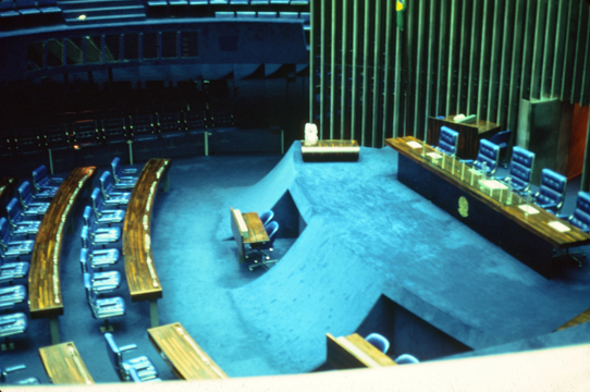 Here is the Senate chamber, and you can see the contrast with the other chamber. The Senate chamber makes more use of carpeting and decoration, and the chairs and desks are more ornate. This is true in our own Capitol as well. |
From the National Congress Building, we exited from the east side to arrive on the Praça dos Tręs Poderes (Three Powers Plaza), where I was able to get a look at the other two main building that comprise the square.
is a plaza in Brasília, the capital of Brazil. The name is derived from the presence of the three governmental powers around the plaza: the Executive, represented by the Palácio do Planalto (presidential office); the Legislative represented by the Congresso Nacional (National Congress); and the Judiciary, represented by the Supremo Tribunal Federal (Supreme Federal Court).
|
Along the north side of the plaza is a monument to Juscelino Kubitscheck, President of Brazil and founder of the new capital at Brasilia. He is arguably the most famous of all Brazilian Presidents. Kubitschek, who died in 1976, served as the 21st President of Brazil from 1956 to 1961. His term was marked by economic prosperity and political stability, being most known for the construction of the new capital. A leader who favored long-term planning and who set high goals for Brazil's future, Kubitschek is viewed inside the country as the father of modern Brazil. He stands among the politicians whose legacy is held most favorably, and was highly respected by the people.
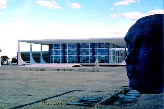
The eleven judges of the court are called Ministers (Ministro), although having no similarity with the government body of ministers. They are appointed by the President and approved by the Senate. There is a mandatory retirement age of 75. In the picture of the Supreme Court building, you can just see the sculpture called "The Justice" in front of the building.
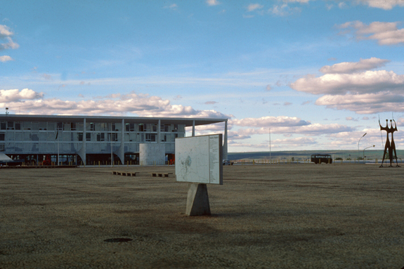
When I was here, there was little on the square save for a few sculptures, but I have seen more recent pictures that show that more has been added on the square, and large trees now dot the area.
|
This building is one of the official palaces of the Presidency, along with the Palácio da Alvorada, the official residence. Besides the President, a few high advisers also have offices in the Planalto, including the Vice President and the Chief of Staff; the other ministries are laid along the Ministries Esplanade. As the seat of government, the term Planalto is often used as a metonym for the executive branch of the federal government.
In the picture at left, you can also see another of the major sculptures here on the plaza; it is called "the Warriors", and was created by the artist Bruno Giorgi.
The presidential palace was a major feature of Lucio Costa's plan for the newly established federal capital, and Oscar Niemeyer was chosen as the architect of the Palácio do Planalto. The palace was officially inaugurated on April 21, 1960, by President Juscelino Kubitschek. It was one of the first buildings inaugurated in the new capital city, along with the National Congress and the Supreme Federal Court. The inauguration ceremony was attended by several heads of state and attracted thousands of spectators, as it symbolized the transfer of the capital city from Rio de Janeiro to the center of the country.
The palace owes its name to the Brazilian Highlands (the term "planalto" meaning highland), speciffically the Brazilian Central Plateau, where Brasília is located.
The Esplanade of Ministries
 This picture was taken as we approached the Three Powers Square from the east. It is not late in the day yet; my camera was fooled from the fact that I was looking into the western sun. You can see the National Assembly and some of the Ministry buildings beyond it. |
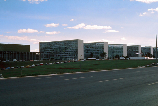 Many of the major government agencies or departments has its own building in the capital, and most of the buildings are pretty much the same, save for external ornamentation. Here is one row of Ministry buildings. |
|
|
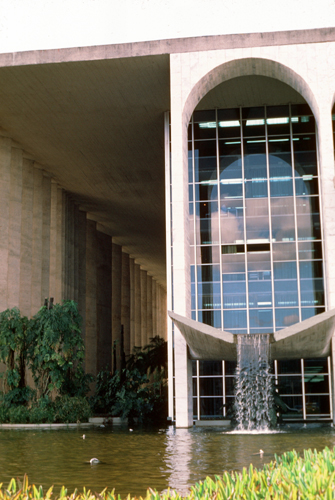
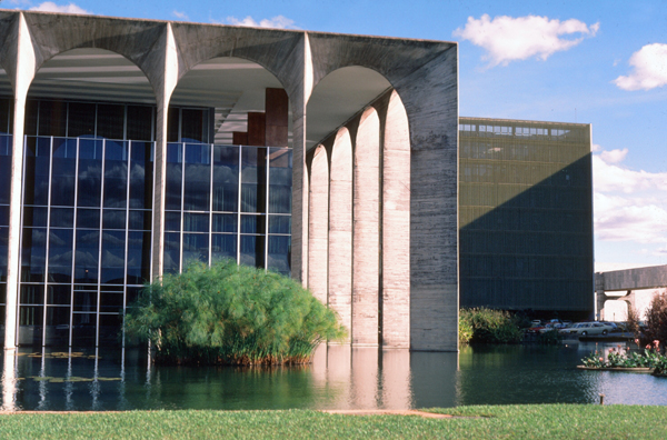
The building was designed by architect Oscar Niemeyer and inaugurated on April 21, 1970. It is located to the east of the National Congress building along the Ministries Esplanade, near the Praça dos Tręs Poderes (Three Powers Plaza).
The word "Itamaraty" originates from the Nheengatu language. According to linguists, the word means "river of small stones", by joining ita (stone), Bantam (small) and ty (river).
The name was also used for the former headquarters of the Ministry of Foreign Affairs (1899-1970) when it was located in Rio de Janeiro.
 South of the mall there are apartments, governmental offices, and commercial buildings. |
 Another city scene, this picture marred by an underexposure. |
I was continually impressed with how new the city was, and that meant that in most places there was little in the way of grass and trees. Though the city was dedicated in 1960, many of these buildings were not completed until the last few years, so trees have not had time to grow. I imagine that at the turn of the century, Brasilia will look a lot different than it does now.
|
|
Even though the US is not a religious society, that particular church in Washington is often used when a religious setting is required for some function. Here in Brasilia, that is more true than at home, since Brazil is very much a Catholic country.
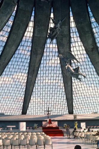
My guide urged me to go inside the Cathedral, and I am very glad that I did. The picture at right was taken inside that church, and I must admit that the architecture is spectacular. Though not a church-going person, I might be inclined to go to this one, just to admire the openness and light that comes through the glass ceiling.
I wondered to myself whether this church was actually used by a particular congregation of common folk; I thought it might be reserved for grander occasions. But on giving it more thought, I did not think that the Catholic Church would allow the building to sit idle, even though it is a very grand structure.
 This is the Defense Ministry, and you can see my guide, standing in front of one of the many monuments erected at the time of the dedication of the city. |
 It is getting later in the day, almost time for me to leave. This was taken outside of the main government area, and shows some of the offices, support structures and residential areas. |
My Return to Rio
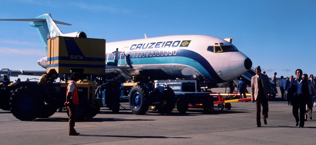
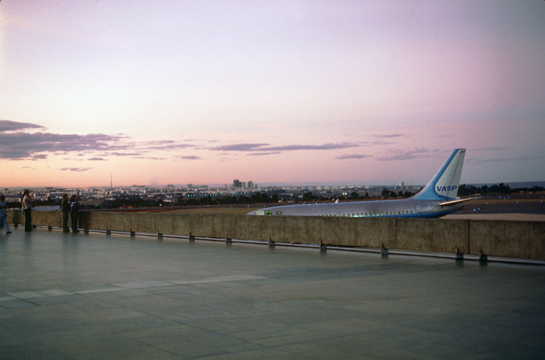 At the airport, I thanked Carlos for his excellent guidance (and gave him a generous tip). I flew back to Rio on a Viasa plane. |
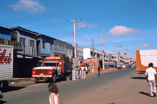
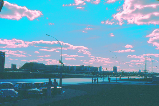
 My taxi in from the airport went down this coastal street, lined with folks selling everything imaginable- food items most of all. |
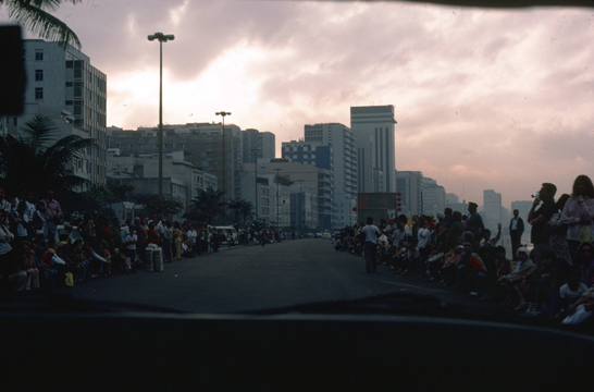
I spent the next day in Rio. I went to the beach and did some preparation for my class three days hence. That evening, I went walking in Rio (which is crowded but apparently safe).
You can use the links below to continue to another photo album page.
|
July 3-4: A Side Trip to Iguassu Falls |
|
June 28-30: Arrival in Rio and Sugarloaf Excursion |
|
Return to the Brazil Trip Index |