|
August 7-8, 1976: A Weekend in Washington, DC |
|
April 17, 1976: My First Trip to Yosemite National Park |
|
Return to Index for 1976 |
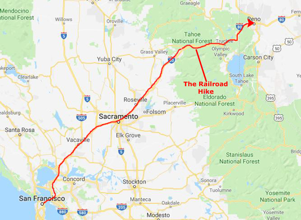
Here is yet another album page that wouldn't exist were I not spending so much time on our software project in San Francisco. I am very fortunate to have gotten involved in the EEO-REPORTER development, as San Francisco is such a great place to be. Not only am I enjoying staying right in the city, but every chance I get I like to go explore some nearby part of California. This weekend, Greg is again away, so I am taking a Monday vacation day to make a big circle trip from San Francisco to Reno/Lake Tahoe and then back through Yosemite National Park (the high country, not the Valley this time).
Reno, Nevada
|
The first landmark is the Carquinez Strait bridge that takes you into Vallejo, and from there the route heads north gradually going inland and leaving the North Bay behind. Sacramento, the state capital, is about a hundred miles from the city and puts you a little less than halfway to Reno.
Since this was a leisurely trip, and since I didn't plan on doing anything in Reno save for staying overnight and checking out some of the casinos, I took the time to plot out the locations of a few Baskin-Robbins stores in Sacramento that would be reasonably convenient to the freeway, and I think I ended up visiting three of them. (There are many more, so I hope there will be a return trip to the city in the future).
NOTE:
I should say a word or two about the constant reference to Baskin-Robbins throughout these narratives; I am on a quest to visit as many of them as I can in my travels. Up through 1975, I had, just by chance, visited about sixty different Baskin-Robbins stores= on my own or with Tony Hirsch, my frequent Cullinane travel companion. Once we discovered that we'd been to so many, I (and we) started to make a conscious effort to find and visit new ones.
An obliging store owner gave me one of her "city lists" that they used to post on the store wall so patrons would know where else they could find stores. That same list was titled "Over 1300 Stores Worldwide", so Tony and I knew that there'd be no shortage of new stores to allow us to indulge this erstwhile "hobby", and we began to make something of an effort to go to new stores, and so when in the same city for three or four nights, we might visit a different one each evening. And using the city list, we knew ahead of time when there was a store nearby, and we just looked up the address(es) in the phone book. (Some large cities had so many stores that I'd get a city map and mark their locations. Even if we didn't visit all the stores in one trip, I'd have the map to use the next time we were in the same place.)
I thought it would be an fun hobby, since I had little to do after work in a strange city otherwise, and as time went by the list of stores I had been to grew and grew. So that explains why, as I passed through Sacramento, I stopped at two or three stores. I did the same thing in Reno and Lake Tahoe, as there were stores in both locations. After adding in the stores on this trip, my store total was approaching 200, which I thought was pretty good. I was later to decide that I was going to have to up my game, but that's another story. You can learn more about the quest, and where it eventually ended up, on my personal web page, which address is www.rondougherty.com.
Leaving Sacramento, the interstate began to climb into the foothills of the Sierra Nevada Mountains, and the landscape began to change dramatically from the dry, flat area between Vallejo and Sacramento:
 |
 |
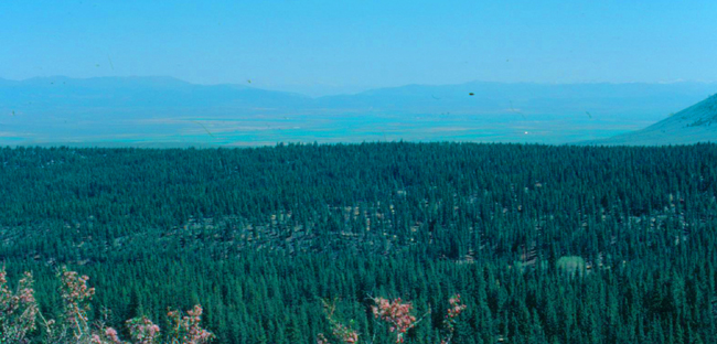
The Sierra Nevada is a mountain range that lies between the Central Valley of California and the Great Basin. The vast majority of the range lies in the state of California, although the Carson Range spur lies primarily in Nevada. The Sierra Nevada is part of the American Cordillera, a chain of mountain ranges that consists of an almost continuous sequence of such ranges that form the western "backbone" of North America, Central America, South America and Antarctica. The Sierra runs 400 miles north-to-south, and is approximately 70 miles across east-to-west. Notable Sierra features include Lake Tahoe, the largest alpine lake in North America; Mount Whitney at 14,505 ft, the highest point in the contiguous United States; and Yosemite Valley, sculpted by glaciers from one-hundred-million-year-old granite. The Sierra is home to three national parks, twenty wilderness areas, and two national monuments.
|
|
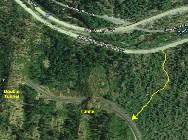
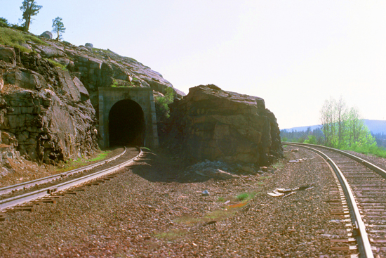
The Transcontinental Railroad connecting California with the eastern states was completed in 1869. The 1,659-foot long Summit Tunnel in combination with four other tunnels, miles of snow sheds, and a pair of Chinese Walls proved an engineering and construction challenge for the Central Pacific Railroad. Today, nearly 150 years after its completion, the transcontinental railroad still attracts a lot of interest, and the hour I spent walking up to and along the tracks was part of that. Although some sections of the original route have been improved with new tunnels and realigned tracks, the basic route is till the same as it was back in 1866. Trains still climb the steep mountainsides, fight their way through winter snow, and roll down the long, winding grades.
|
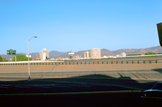
Past Truckee, I came to the long descent into Reno. Reno, "The Biggest Little City in the World", is known for its casino industry. It sits in a high desert river valley at the foot of the Sierra Nevada and its downtown area occupies a valley informally known as the Truckee Meadows. The city is named after Union Major General Jesse L. Reno, who was killed in action during the American Civil War at the Battle of South Mountain on Fox's Gap. With a couple hundred thousand people, Reno is the only other population center in Nevada, other than the Las Vegas area.
I found a Holiday Inn near downtown, and stayed there overnight. The downtown area is like a miniature Las Vegas, and I enjoyed walking along through the area, and going in to a few of the casinos. Like Las Vegas, there were also a number of quick marriage chapels. To counterbalance that, Reno has long been known also for the ease of getting a divorce here. Ernie Pyle once wrote in one of his columns, "All the people you saw on the streets in Reno were obviously there to get divorces." In Ayn Rand's novel The Fountainhead, published in 1943, the New York-based female protagonist tells a friend, "I am going to Reno," which is taken as a different way of saying "I am going to divorce my husband." A number of high-profile celebrity divorces were arranged here, but the industry has fallen off as other states have begun to liberalize their own laws.
Lake Tahoe
|
 |
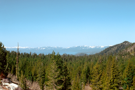
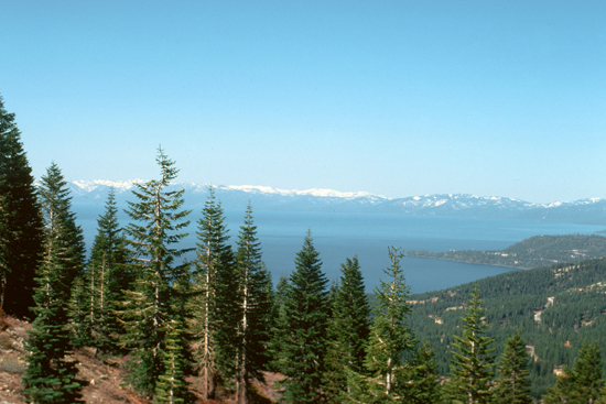
As I left the valley heading up into the hills, numerous vistas opened up.
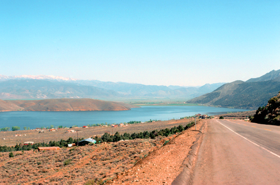
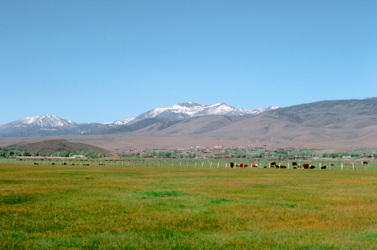
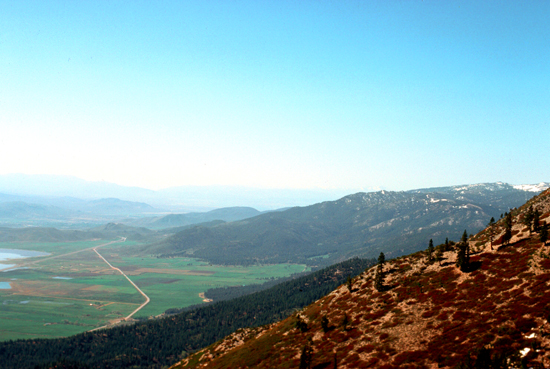
 This is a view of the valley in which Reno is located. |
 Heading up into the mountains, the valley falls below and this perspective of the Reno area offers. |
Let's take a look at more of the scenery along the road up to Lake Tahoe:
 Just before going into the high country, this last view of the Nevada valley below Tahoe. |
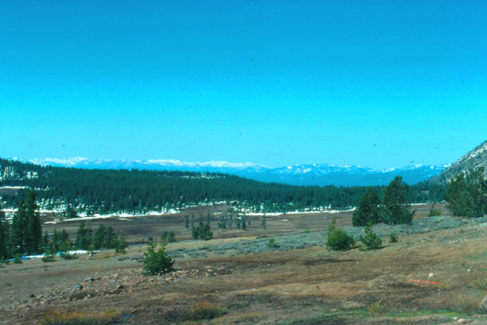 Here is a view of the high country north of Lake Tahoe. |
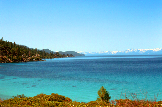
Even in June there was still snow on the ground, although the air temperature was probably about fifty. Eventually, I came over the crest of the mountains I was crossing to get my first view of Lake Tahoe in the distance, and these views hint at the rare beauty of the whole area.
|
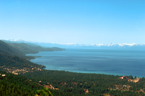
The lake was formed about two million years ago as part of the Lake Tahoe Basin, with the modern extent being shaped during the ice ages. It is known for the clarity of its water and the panorama of surrounding mountains on all sides, and you will easily see why in the pictures that I took. The area surrounding the lake is also referred to as Lake Tahoe, or simply Tahoe. More than 75% of the lake's watershed is national forest land, comprising the Lake Tahoe Basin Management Unit of the United States Forest Service.
Lake Tahoe is becoming a major tourist attraction in both Nevada and California. It is home to winter sports, summer outdoor recreation, and scenery enjoyed throughout the year. Snow and ski resorts are a significant part of the area's economy and reputation. The Nevada side also offers large casinos, with highways providing year-round access to the entire area.
Lake Tahoe is about 22 miles long (oriented north-south) and about 12 miles wide, with about 75 miles of shoreline (two thirds of which is in California, as the state line runs down the middle of the lake but makes a jog to the southeast before reaching the southern shore). If you can visualize the outline of the eastern boundary of California, you know there is an angle in the middle; that angle is actually in Lake Tahoe. The lake is so large that surface is actually convex, due to the curvature of the earth. If you were floating on a raft in the middle of the lake, you would not be able to see the actual shoreline (although you would, of course, be able to see the Sierras). The east and west shores would actually be nearly 100 feet lower than your elevation, and the north and south shores would be lower by an astonishing 300 feet! (I know this is also true of many large lakes on the planet, but I thought the factoid an interesting one.)
|
Lake Tahoe is fed by 63 tributaries. These drain an area about the same size as the lake and produce half its water, with the balance entering as rain or snow falling directly on it.
Now for the dangerous part. The Truckee River is the lake's only outlet; it flows northeast through Reno and eventually into Pyramid Lake. Pyramid Lake has no outlet at all, except for evaporation. The Truckee River accounts for one third of the water that leaves the lake, the rest evaporating from the lake's vast surface. The flow of the Truckee River and the height of the lake are controlled by the Lake Tahoe Dam at the outlet. There has always been a concern that should Lake Tahoe receive an influx of water somehow, the spillway would have to be opened, and the Truckee River would overflow.
(Writing this narrative in 2019, I can report that this fear came true around New Year's Day, 1997. A once-in-a-lifetime "Pineapple Express" (an atmospheric "river" of very warm air originating in the South Pacific, swept through the Sierras melting incredible amounts of snow in just days and threatening to raise Lake Tahoe's level to overwhelm the dam. All spillways had to be opened, the Truckee River flooded; downtown Reno and much of the surrounding area was inundated to a depth of several feet.)
During the first half of the 20th century, development around the lake consisted of a few vacation homes. But the post-World War II population and building boom, followed by construction of gambling casinos in the Nevada part of the basin during the mid-1950s, and completion of the interstate highway links for the 1960 Winter Olympics held at Squaw Valley, resulted in a dramatic increase in development within the basin. Since 1960, the permanent residential population has increased from about 10,000 to greater than 50,000, and the summer population from about 10,000 to about 90,000.
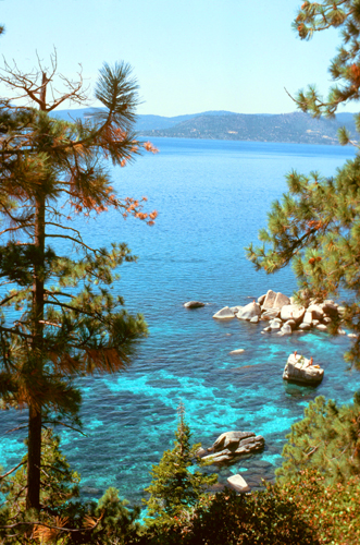
When I arrived at the north shore of the lake, I started driving down the Nevada side, stopping occasionally to take pictures. Here are a couple of good ones:
 |
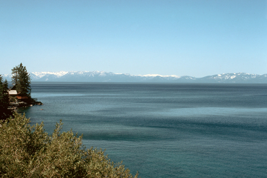 |
It has only been in the last twenty years or so that this area has achieved prominence, much to the detraction of the Lake, I think, and now the area is beginning to have to deal with the problems of misuse, the large numbers of people being a drain on the local services. It is said that the lake is being irretrievably spoiled.
|
|
Even though the air was only fifty here, it was probably close to ninety in Oakland. The fact that it was so cool was one of the reasons why I didn't think I was getting a sunburn when I lay out for a while.
As I drove south along the lakeshore, I was actually driving through national forest and other land-use-restricted acerage, and so there was not a great deal of development. There were lakeside homes and a few small stores to be sure, but nothing major. I was just enjoying the day and the drive and the scenery.
|
I continued south to Stateline and South Lake Tahoe and the concentration of new casinos and hotels and development. I stopped for a late lunch and went into a few of the casinos. Unlike in Las Vegas or Reno, buildable land here is at a premium, and so I did not see the kind of mega-casino developments that are beginning to take over Las Vegas. I am sure that another reason is that not nearly so many people come to Lake Tahoe to gamble as go to Las Vegas or Reno. So the casinos were small, but very nicely-done- especially the newer ones. Inside, they were indistinguishable from those I've been in elsewhere, albeit a good deal smaller.
I needed to continue south to the east entrance to Yosemite near Mono Lake, so I needed to get back over once again to US Highway 395. So after spending a bit of time in South Lake Tahoe, I took a highway east from Stateline that twisted and turned through the mountains once again to come down into Nevada's high altitude central valley and pick up that highway. Soon, I had crossed back into California.
|
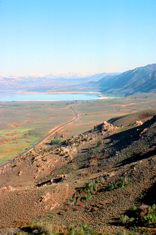
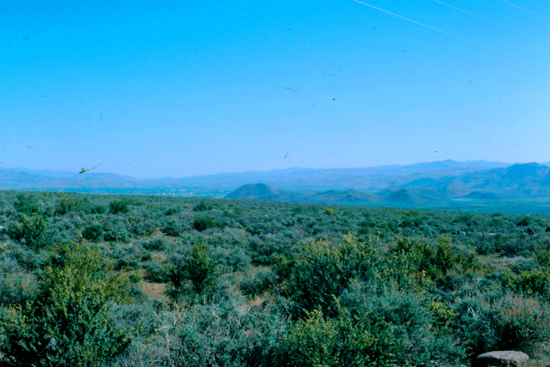
This desert lake has an unusually productive ecosystem based on brine shrimp that thrive in its waters, and provides critical habitat for two million annual migratory birds that feed on the shrimp and alkali flies. I discovered at dinner that the hottest topic of conversation around Mono Lake and in the town of Lee Vining, is yet another "Los Angeles water theft"- certainly not the first in that city's history. Just in the last ten years, a new aqueduct has been completed to bring water to Los Angeles from this area, and it has had the effect of lowering the lake's level. Just last year, the area was alerted to the problem by a Stanford University graduate student, and now the population is up in arms.
Mono Lake's formation is believed to have been a result of the "Long Valley eruption". Sediments located below the ash layer hint that Mono Lake could be a remnant of a larger and older lake that once covered a large part of Nevada and Utah, which would put it among the oldest lakes in North America. At its height during the most recent ice age, the lake would have been about 900 feet deep, and old shore lines can still be seen between the lake and Yosemite.
Currently, Mono Lake is in a geologically active (not while I am here, I hope) area at the north end of the Mono�Inyo Craters volcanic chain and is close to Long Valley Caldera. Volcanic activity continues in the Mono Lake vicinity: the most recent eruption occurred 350 years ago, resulting in the formation of Paoha Island. Panum Crater (on the south shore of the lake) is an excellent example of a combined rhyolite dome and cinder cone.
The land around here is very barren, and quite a contrast to the Sierras (and Yosemite, which is only ten miles west), but the reason is simple (and one that residents of Washington State, Oregon, California, and Nevada know well. What moisture there is in the weather patterns that come in off the Pacific (more from Santa Barbara northward than in LA and San Diego) is released on the western slopes of the Sierra Nevada and the Cascades, making them lush and green. When the air begins to descend on the east side of the mountain ranges, it is dry and warm, and so on the eastern side of the mountains is dry grassland or desert.
|
|
Lee Vining (formerly, Poverty Flat) is a "census-designated place", not really even a town. It lies at an elevation of 6800 feet on the southwest shore of Mono Lake. I didn't see a population sign, but my guess would be that there are only a couple hundred people here. Fortunately, there were two motels and a couple of cafes, so I was all set.
The town was named after Leroy Vining, who founded the town in 1852 as a mining camp. In 1926, the town was laid out by Chris Mattly and named "Lakeview", but when a post office was sought in 1928, it was learned that there was already another Lakeview, California. What name the town had (other than "Poverty Flat" for its unfavorable agricultural conditions) for the next 25 years, I have no idea, but the town's current name was chosen in 1953.
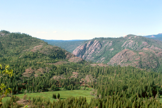
This being June, I still had some light, so I drove into the Park for a ways, climbing high enough that I could get a couple of good pictures before heading back down to Lee Vining for the evening.
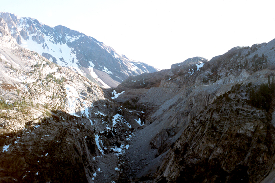 The High Country of Yosemite |
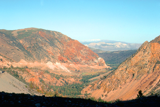 The View Back East from Yosemite |
When I got back to Lee Vining, it seemed as if both motels were quite full; I was glad I'd gotten my room earlier. The little cafe that I went to was certainly busy as well.
Yosemite: The High Country
|
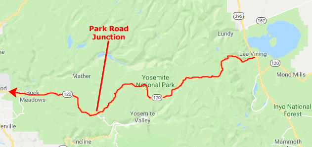
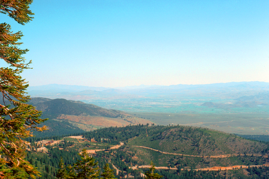
This time, I will continue on that highway, passing through the Park Entrance Station, and then continuing on it as it traverses the Sierra Nevada Mountains. My route will take me north of Yosemite Valley, which I visited just a couple of months ago. I don't plan to repeat that visit today, though. The highway will take me to the junction with the Yosemite Park road that takes you down into the valley; the same intersection I went through to get to the valley on my visit a couple of months ago.
Once I reach it, I will just repeat my return route over to the Bay Area.
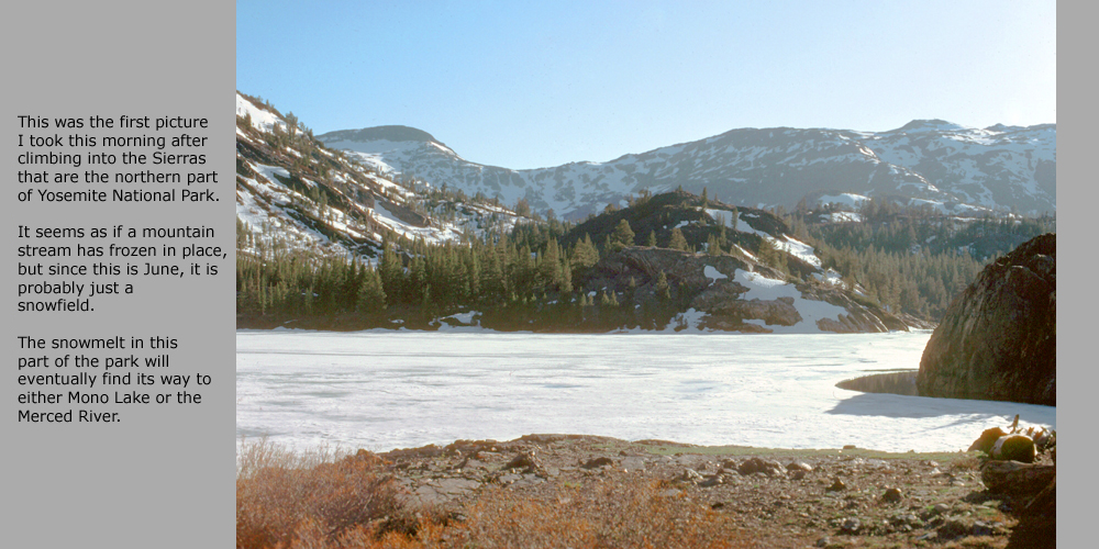
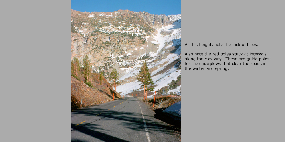
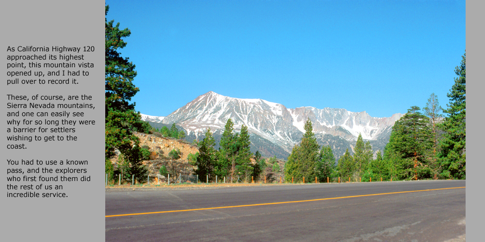
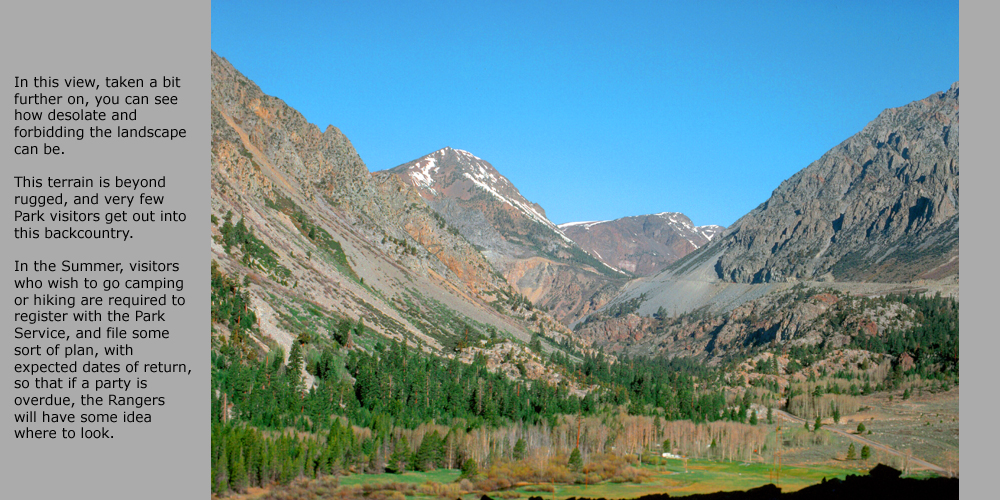
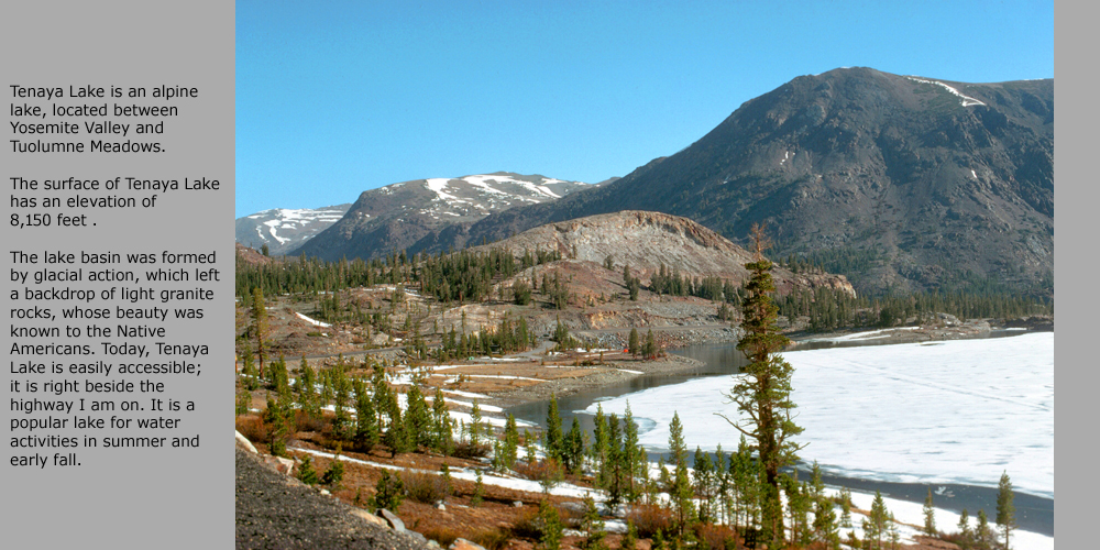
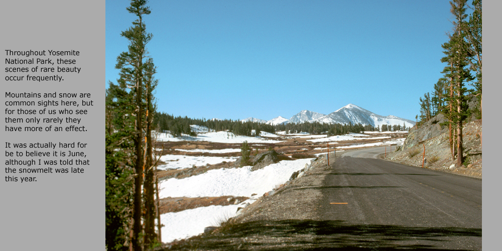
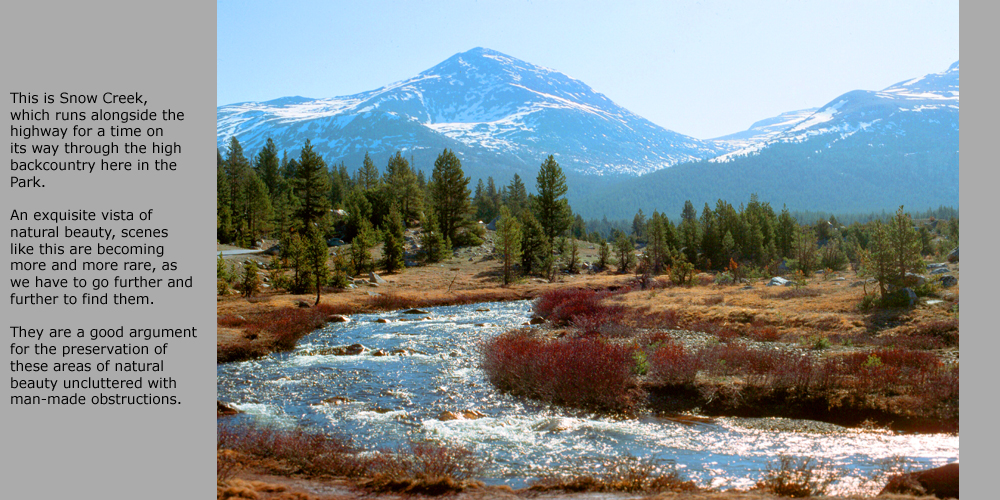
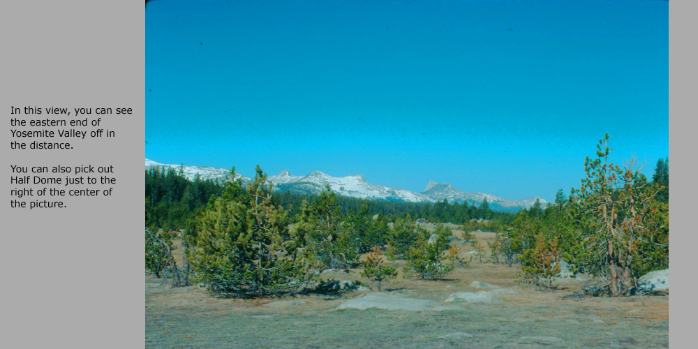
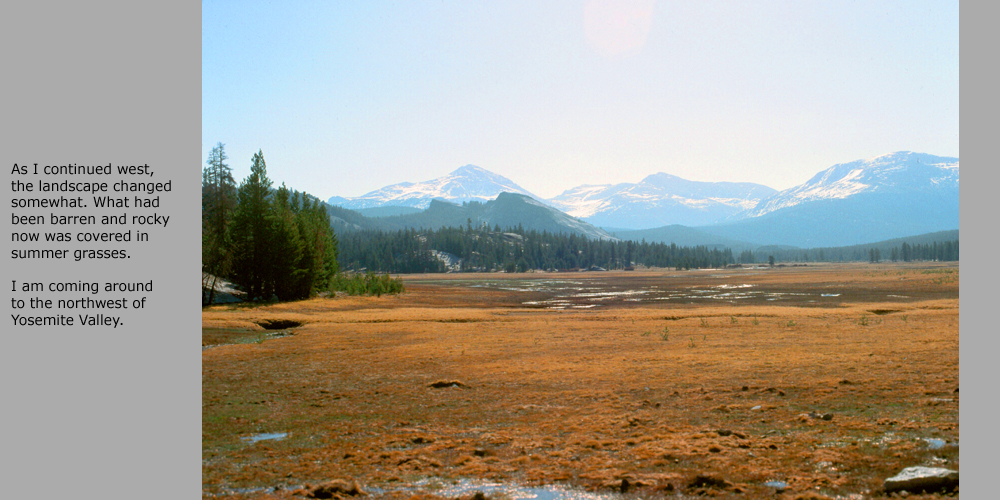
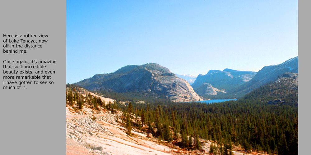
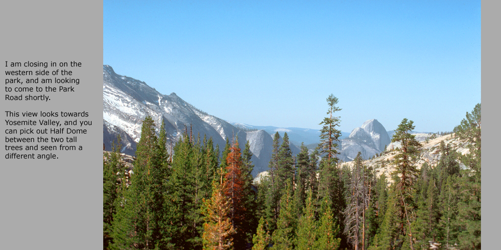
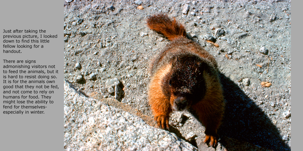
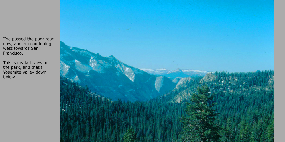
As it turned out, there were no marked stopping points or turnouts on the highway, the kind with signs telling you what, exactly, you are looking at (except for Tenaya Lake). So the photos I have are not of specific features I can name, and so all I want to do is record a bit of what my impression was of each view (many of them quite spectacular). There is a slideshow of these pictures below. You can go from slide to slide by clicking on the little arrows in the lower corners of each slide. Enjoy driving the highway with me!
I got back to San Francisco in the late afternoon, after a really great trip, and when Greg returned the next day we went back to work at Wells Fargo on our EEO-REPORTER project.
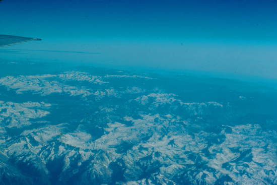
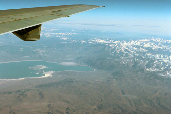
At the end of that week, I flew back to Chicago and, as luck would have it, the flight path of the United jet climbing out of the Bay Area took us right over the Yosemite valley, and so I had an opportunity to see from the air what I had just driven through on the ground.
 Here is Yosemite Valley, right in the center right of the shot; it's that deep valley without much snow. |
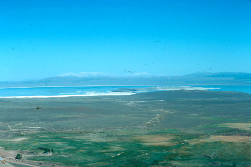
 In this view you can see Mono Lake and the Eastern end of the Park. |
It was a great few weeks in San Francisco, but past time to return home.
You can use the links below to continue to another photo album page.
|
August 7-8, 1976: A Weekend in Washington, DC |
|
April 17, 1976: My First Trip to Yosemite National Park |
|
Return to Index for 1976 |