

|
|
1968 Family Pictures |
|
As I work backward through the various pictures that I got from my Dad, I will be less and less sure about when they were taken, unless my Dad happened to write a date on the pictures. I will continue to do what I can to pin them down, within the year, but my guesses won't be perfect. It also true that as we move backward I may not know or remember some of the people or locations in the photos, but again I will do my best to identify them.
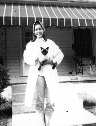
March: Judy and Feline
|
Now, as for the feline, I am assuming that it is Judy's cat, but I don't think it is the Siamese named "Chin-Chan" that we used to have. This is 1968, and I am sure that there is no cat living on Somerset Drive. I am at Davidson and Judy lives in Burlington, and my Mom and Dad would not have a cat on their own.
So perhaps Judy, when she sees this page, can enlighten me on the cat and its history.
May: In Valdese, NC
My Mom and Dad made a visit to Valdese, North Carolina, sometime in May (as per my Dad's label on one of his pictures.
|
|
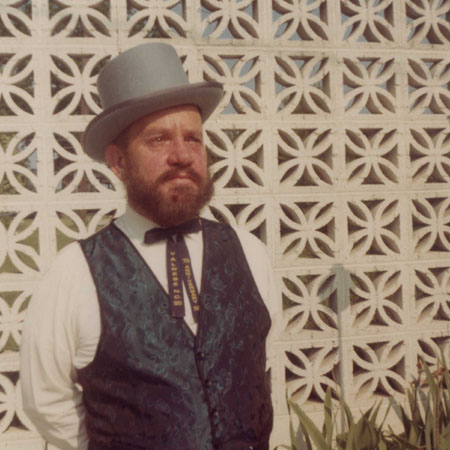
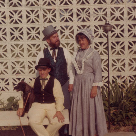
Years ago, my Dad worked on a hospital construction project in Valdese, coordinating with the hospital administrator, a Mr. Bill Owens. They became good friends, and on a couple of occasions the four of us visited Bill, his wife Sue, and their son David there in Valdese, occasionally going to the Christmas buffet at the local Elk's Club.
This was another commonality Dad shared with Mr. Owens. On this particular visit, Valdese was celebrating its Waldensian heritage, and there was a function at which the Owens family was dressed in traditional Waldensian garb, which accounts for the way the family looks in the pictures at left.
The Elk's Club in Valdese was almost a resort, and on this visit my Mom had a chance to grab a bit of sun one afternoon on the poolside patio there at the club.
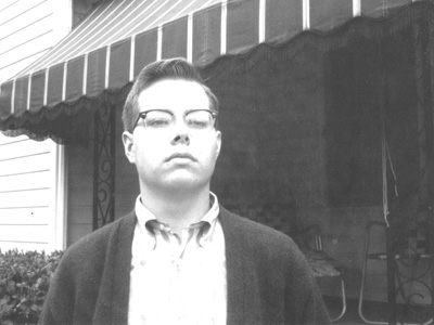
June: My Graduation from Davidson College
My four years at Davidson have come to an end this month, and on Graduation Day my parents have come up to the campus for the graduation ceremony- which was held outside in front of Chambers Hall. Here are two pictures that my Dad took prior to the beginning of the ceremony:
|
|
After the ceremony and reception were concluded, my parents invited to of my friends to come down to Charlotte to have dinner with us. My roommate Peter Guerrant and his parents were heading right back to California, so Steve Lee, Ed Shuping, and I came to my house (where this picture was taken), and went out to supper with my parents. After that, Steve returned to Shelby and we dropped off Ed in Rockwell, NC, just up the road from Charlotte.
June: Leaving for California
After college, my plan was to begin my mandatory Army service- a four-year stint due to the fact that I had an ROTC scholarship for my Junior and Senior years at Davidson. I was not going to Graduate School (at least not right away), so the Army had me reporting to Fort Harrison for the U.S. Army Finance School beginning in August. I decided that I would accept Peter's invitation to come out to Altadena, California, to visit with him and his family before going into the Service.
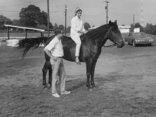
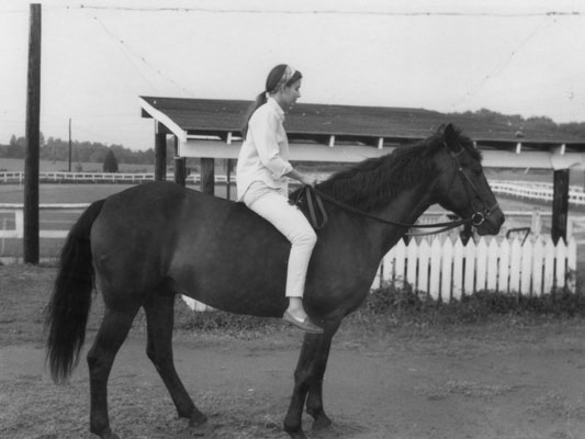
So my first task was to purchase an automobile- a green Oldsmobile 88- to drive to California and then use when I went to Fort Harrison. Then, in mid-June, I made a trip up to Burlington to visit my sister before beginning my cross-country trip. On my visit to Judy, we spent some time at the Saddle Club where Judy kept her horse:
|
|
I spent the day with her, returned to Charlotte, and a couple of days later was on my way West.
| NOTE: I am writing this particular bit of narrative in early 2026, and I can't resist commenting a bit on my trip West, particularly since in the subsequent years I was able to revisit many of the places that I saw for the first time in 1968. My route took me down I-85 to Atlanta and then west on I-20 to Dallas. I would in later years retrace this particular part of the route numerous times as I returned home to visit my Mother fairly often from my home in Dallas. I took the turnpike from Dallas to Fort Worth (now it is I-30) and then continued west through Snyder, TX, intending to visit Carlsbad caverns on the way. I recall vividly one of the heaviest thunderstorms ever during the night I stayed in Snyder. I did not know on this trip how important it might be to me later to have recorded the trip photographically. I did not have a camera, and did not think to buy one ahead of the trip. I wish I had. I passed through Phoenix, where I had to have the car's AC repaired, and then took I-10 on into the Los Angeles area and to Peter's house in Altadena. I had a very nice visit to Peter's house, and I recall having my first avocado (oddly enough). When my visit was over (Peter himself was going to begin his own Army service), I headed back east towards Indianapolis and Fort Harrison. I visited Las Vegas for the first time, and then went through Denver, Kansas City, and St. Louis (all cities that I would subsequently visit on business and for pleasure numerous times) and on into Indianapolis. As I was TDY for the Finance School, I got an apartment in Lawrence, IN, just south of Fort Harrison, and began my six weeks of training prior to my first actual posting, which would be at Fort Lee, Virginia. |
July: Dad's Trip to Atlanta
As I work backward to add these pictures that I didn't take and might not have even been present for, this is the first section of pictures in which I wasn't involved at all. I have left for California and then Fort Harrison, and in July of this year (some of the pictures in this group were so annotated by my Dad) he, and I presume my Mom as well, made a trip that included, at least, a stop in Atlanta.
|
 |
I assume that my parents just drove down I-85 to the Atlanta area, and then circled partway around the city to get to Ralph and Jane's house. I had only been there once; they live in a modest but nice brick house in a small development on a tree-lined street. They live on Huntley Drive, and the other street in the small development is Brinkley Circle. If you are of a certain age, you'll understand for whom the two streets were named. If you're too young, just Google "The Huntley-Brinkley Report".
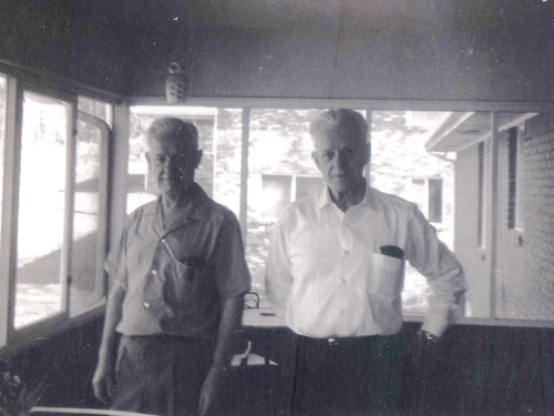
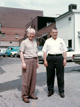
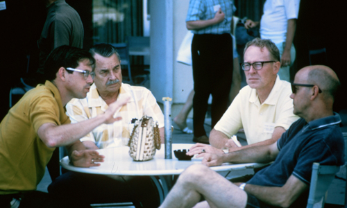
On this visit to Ralph's house, Dad's other brother, my Uncle Bud, was also visiting from his home in Detroit. Here are the other three pictures my Dad left of himself and his brothers from this visit:
|
|
|
Here is one more picture from my Dad's visit to Ralph's house, and I want to include it here:
|
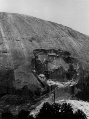
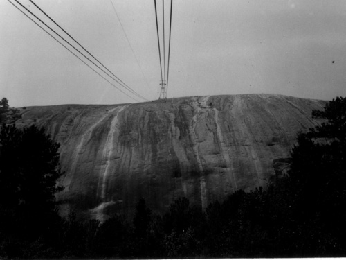
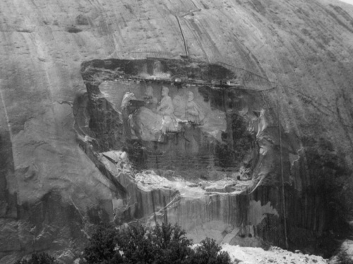
In the same album, next to the pictures above of my Dad, Uncle Ralph, and Uncle Bud, there was a group of pictures that I recognized as being taken at Stone Mountain, outside Atlanta. One of these was labeled with "Jul 68", and so I assume these were taken on this same trip.
|
Stone Mountain, once owned by the Venable Brothers, was purchased by the state of Georgia in 1958 "as a memorial to the Confederacy." Stone Mountain Park officially opened on April 14, 1965- 100 years to the day after Lincoln's assassination, although recreational use of the park had been ongoing for several years prior. The park today is owned by the state of Georgia.
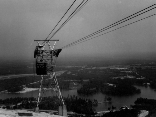
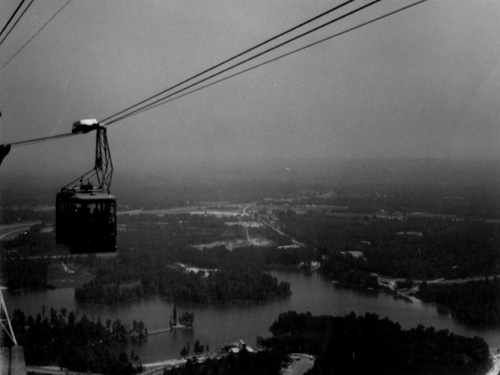
The mountain, which ranges in composition from quartz monzonite to granite and granodiorite, is more than 5 miles in circumference at its base. The summit of the mountain can be reached by a walk-up trail on the west side of the mountain or by the Skyride aerial tram.
Human habitation of Stone Mountain and its surroundings date back into prehistory. When the mountain was first encountered by European explorers, its summit was encircled by a rock wall, similar to that still to be found on Georgia's Fort Mountain. The wall is believed to have been built by early Native American inhabitants of the area, although its purpose remains unclear. By the beginning of the 20th century, the wall had disappeared. The mountain was the eastern end of the Campbellton Trail, a Native American path that ran through what is now the Atlanta area.
Europeans first learned of the mountain in 1567, when Spanish explorers were told of a mountain farther inland which was "very high, shining when the sun set like a fire." By this time, the Stone Mountain area was inhabited by the Creek peoples. In the early 19th century, the area was known as Rock Mountain. After the founding of DeKalb County and the county seat of Decatur in 1822, Stone Mountain was a natural recreation area, with an easy path to the top. An observation tower has been on the summit since 1838, and granite quarrying operations (which destroyed some geological features, began about the same time, continuing for about a century, until the site was purchased by the State of Georgia in 1958.
|
|
Here are two more pictures my Dad took of the Skyride Aerial tram:
|
|
The largest bas-relief sculpture in the world, the Confederate Memorial Carving on the north face of the monolith depicts three Confederate leaders of the Civil War: President Jefferson Davis and Generals Robert E. Lee and Thomas J. "Stonewall" Jackson (on their favorite horses, Blackjack, Traveller, and Little Sorrel, respectively). The sculpture was cut 42 feet deep into the mountain, measures 90 feet in height and 190 feet in width, and lies 400 feet above the ground.
|
C. Helen Plane, a charter member of the United Daughters of the Confederacy, set up the Stone Mountain Memorial Association in 1914, convincing Samuel Venable, an active Klan member and owner of the mountain, to deed one side of the mountain for the project. She chose the sculptor Gutzon Borglum (lead sculptor of Mount Rushmore) for the project. Borglum's original plan had some 700 to 1000 figures and a huge room with facing columns cut into the rock.
Financial conflicts between Borglum and the Association led to his firing in 1925, the destruction of the partially-completed face of Robert E. Lee, Borglum's escape to North Carolina to escape arrest, and much discord in the Association.
Sculptor Augustus Lukeman took up the work in 1925, but work stopped in 1928- remaining stopped until after World War II.
In response to the 1954 Brown v. Board of Education Supreme Court ruling and the birth of the civil rights movement, in 1958, at the urging of segregationist Governor Marvin Griffin, the Georgia legislature approved a measure to purchase Stone Mountain at a price of $1,125,000. In 1963, Walker Hancock was selected to complete the carving, and work began in 1964. The carving was dedicated in a ceremony in 1970 but not completed (by Roy Faulkner) until 1972. Since my Dad's picture of the carving in progress can be dated to 1968, it is obviously the work in progress, not completed until four years after his visit.
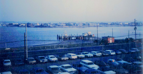
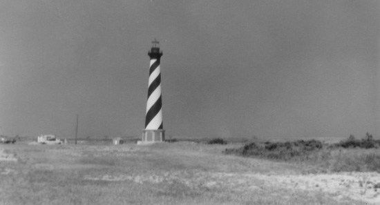
July: Dad's Trip to the North Carolina Coast
I don't know if the four pictures from Nag's Head, North Carolina, were taken on a separate trip from Charlotte to Nag's Head, or as part of the trip that included the visit to Atlanta, but it really doesn't matter. I suspect that the Nag's Head visit was incorporated into a visit with my sister in Burlingon.
and my sister are in relation to my parents' home in Charlotte. |
I'm also not sure of just why my folks made this trip, but I suppose that's not important.
|
|
Nags Head is located in Dare County, and is a busy vacation spot because of its beaches and sand dunes of Jockey's Ridge.
Early maps of the area show Nags Head as a promontory of land characterized by high sand dunes visible from miles at sea. The origin of the town's name is obscure but it is likely to have been named after any one of the places called Nag's Head on the English coast. A folkloric explanation claims that mules or horses (nags) would have lights hung on their heads by nefarious wreckers in order to trick ships into running aground and then loot the ships of their valuables. The town's emblem depicts one such equine accomplice from the tale.
Around 1830, Nags Head became known as a resort area. This direction was accelerated in 1855 when Dr. W. G. Pool bought 50 acres of oceanfront land which he separated into plots and sold to friends, increasing the number of homes in the area. Jockey's Ridge is the last vestige of the sand dunes seen by the first explorers, as the area is now highly developed. The town incorporated in 1961.
|
|
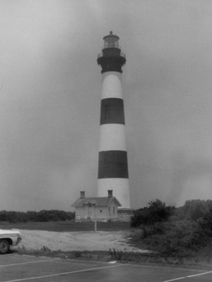
The current Bodie Island Lighthouse (pronounced “bah-dee") is the third that has stood in this vicinity of Bodie Island on the Outer Banks in North Carolina and was built in 1872. It stands 170 feet tall and is located on the Roanoke Sound side of a portion of a peninsula that is the first part of the Cape Hatteras National Seashore. The lighthouse is just south of Nags Head, a few miles before Oregon Inlet. (In 1968, the public could not climb the tower, but a 2009-2013 renovation made walking up the 219 steps possible.) The structure is one of only a dozen remaining tall, brick tower lighthouses in the United States- and one of the few with an original first-order Fresnel lens to cast its light.
The preceding Bodie Island lighthouses actually stood south of Oregon Inlet on Pea Island in an area that is now under water due to the southward migration of the inlet. The first was built in 1847 and then abandoned in 1859 due to a poor foundation. The second, built in 1859, was destroyed in 1861 by retreating Confederate troops who feared it would be used as a Union observation post during the Civil War. The third and current lighthouse, with its original first order Fresnel lens, was completed in 1872. This lighthouse was built further North and further inland on a 15-acre site. In 1932, the Bodie Island Lighthouse became automated (and the light was upgraded to an electric lamp by using oil-fueled electrical generators), and by 1953 it had been transferred into the care of the National Park Service. It remained staffed until 1940, when the lighthouse was fully automated. In 1953, the generators were disconnected and power was supplied from the commercial electric grid.
|
The history of the lighthouse after my parents' visit in 1968 saw a major restoration effort. After years of raising funds and postponement, work to restore the cast iron and other parts in need of work began on the lighthouse in August 2009. As of March 2010, the outside scaffolding was 100% complete while interior scaffolding was 50% completed. The restoration was stopped in spring 2011 after significant new structural integrity issues were found in many of the main support beams under the balcony. The additional repairs needed were too costly to finish in the original restoration project. In August 2011, Hurricane Irene blew out some of the newly restored lantern room glass and tore away a protective shroud covering the lantern room. Flooding caused buckling of the floors in the Bodie Island Light Station Double Keepers Quarters. Additional funding was obtained to continue the restoration, which was restarted in 2012 and completed in March 2013. There was a re-lighting ceremony on April 18, 2013, and the lighthouse was opened for the general public to climb the following day for a fee.
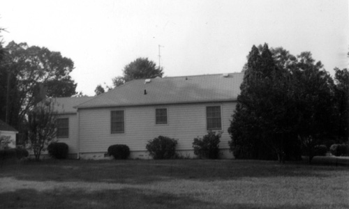
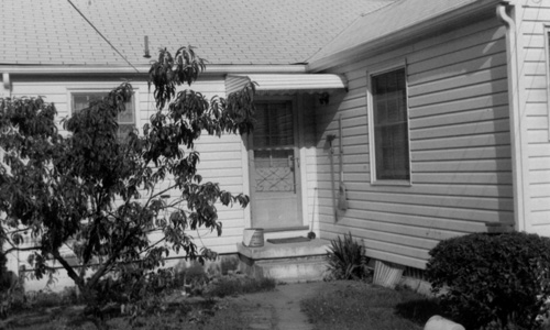
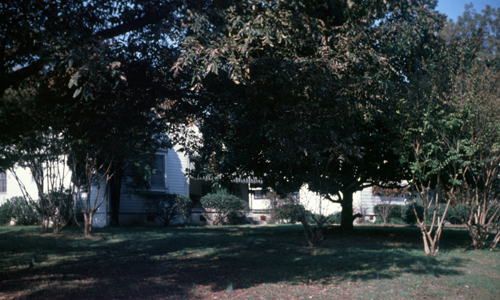
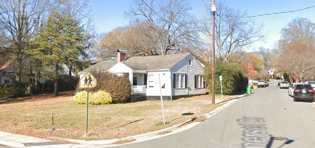
July: Some Pictures from Somerset Drive
I have left for California and Fort Harrison, and so am not present in, nor was present for, these pictures taken at and around the Somerset Drive house in July, according to dates on the pictures. First, there were a couple of pictures of the house:
|
|
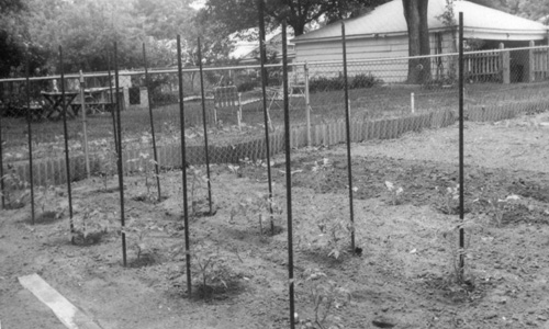
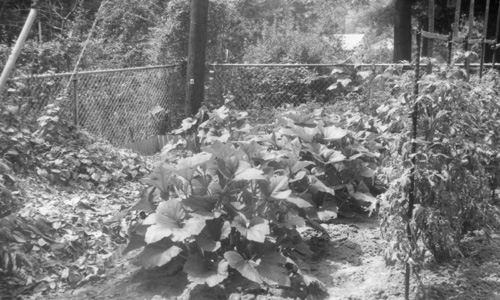
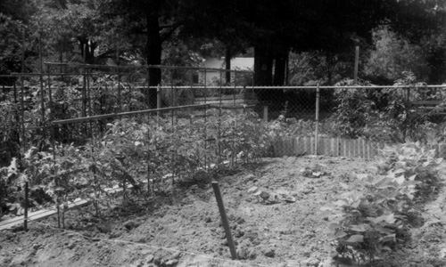
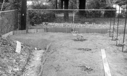
A fixture of our property for at least ten years was the garden that we had that took up the northern half of the back yard. We grew onions, peppers, beans, tomatoes, eggplant, melon, radishes, and numerous other vegetables over the years. Here are four pictures of the garden from this summer:
|
|
|
|
|
|
What I can say is that the picture was taken with my Dad's Polaroid camera (as were all of the square-format, color pictures from the years between about 1963 and 1970).
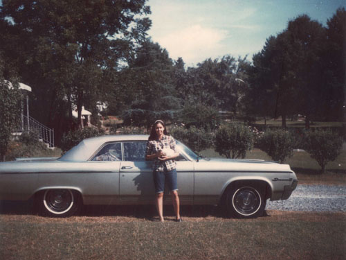
September: More Pictures from Somerset Drive
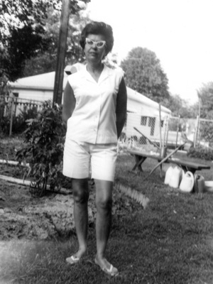
Here is a group of pictures from Dad's albums. Two of them were annotated "9-68", and the remainder I am assuming were taken at about the same time. First are two pictures of my sister and the car she bought (an Oldsmobile Dynamic 88) when she took her job at Carolina Biological Supply up in Burlington:
|
|
The other pictures were of the Somerset Drive house itself:
|
|
|
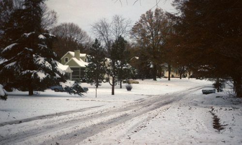
November: Snow!
It doesn't snow often in Charlotte. I recall numerous times in my early years that it seemed as if the conditions were right for snow, but we usually never got much. And it didn't take much in Charlotte to close the schools, since the city wasn't prepared for regular seasonal snowfalls like we had in Muskegon.
But on November 11-12, 1968, Charlotte received an official two inches of snow- actually a bit more in the part of town where we lived. In fact, the snow event this year still stands as the earliest measurable snowfall on record for the city. On the 11th, Charlotte received 1.7 inches of snow, and during the early hours of the next morning an additional inch of snow fell, resulting in a total accumulation of 2.5 inches.
My Dad took a couple of pictures of the event:
|
|
The snowstorm was described as "freakish" in nearby Rowan County, where it was accompanied by a thunderstorm and dumped as much as 5 inches of snow, causing power outages due to the heavy accumulation on trees and power lines. This snow even was hardly Charlotte's heaviest, the city having received over 17 inches in a single storm in 1902. And next year, in February 1969, the city would receive over a foot of snow.
1968 Uncategorized Pictures
There were some additional pictures that I have assumed were taken this year, more because of their position in the albums than anything else. None of them were dated, so my assumption they were taken this year might be incorrect. In any event, I've put them in this section.
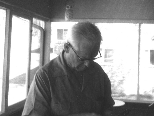
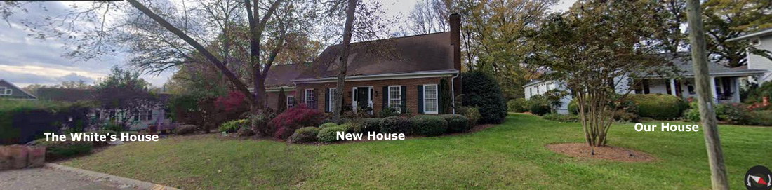
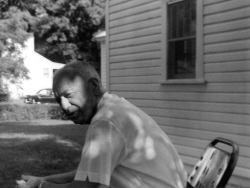
Our Neighbor, Mr. White
|
Actually, all the houses nearby have either been extensively renovated (and enlarged) or else torn down and replaced. Two exceptions are our house and Mr. White's.
|
|
In any event, I don't remember much about Mr. White or his wife, and I recall only being in their house once or twice.
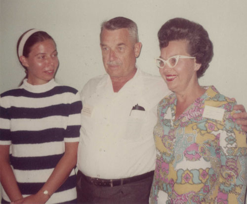
A J.N. Pease Function
|
|
 |
I Visit at Christmas
|
|
 |
I'm not sure why there weren't any other Christmas pictures from this year, but I am sure that I stopped at Judy's on the way down to Charlotte.
Those are the old pictures that I have for 1968.
You can use the links below to continue to another photo album page.
|
|
1968 Family Pictures |
|