|
May 4, 2018: A Visit to Chania on the Isle of Crete (Greece) |
|
May 1, 2018: A Transit of the Suez Canal |
|
Return to the Index for 2018 |
The Holy City:
Jerusalem, Israel
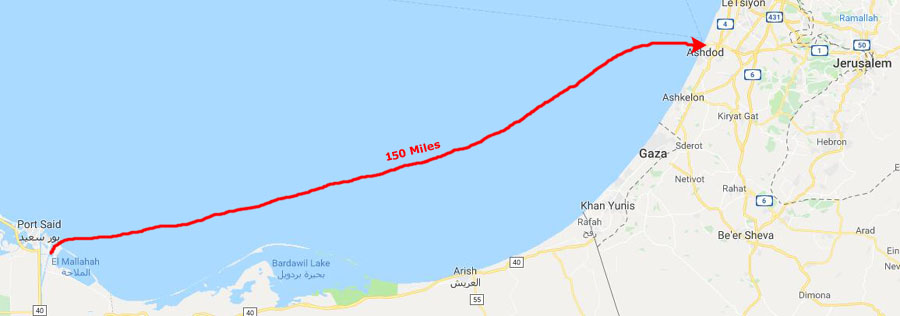
We transited the Suez Canal yesterday, and as night fell we were slowly making our way up the eastern cost of the Mediterranean and along the coast of Israel to dock this morning at Ashdod- an Israeli city that serves as the port for Jerusalem.
Docking in Ashdod
Once we exited the Suez Canal yesterday, we were less than 200 miles from Ashdod, Israel, the port where we would dock this morning.
|
I happened to look at one of the interactive maps that are on TV screens around the ship, and I noticed where we were- passing off the coast of the Gaza Strip. Looking at the names of these places that have figured in the news for so many years was a bit sobering.
We were in a part of the world that has been for so long a center of instability, and it made me just a trifle apprehensive about getting off the ship today and heading to Jerusalem.
But talking to Mary and Nikos, our dinner table companions who were also tour guides, it seemed as if they were quite comfortable with getting off the ship and leading their own Jerusalem tour, so we relied on their knowledge and put our concerns to rest.
|
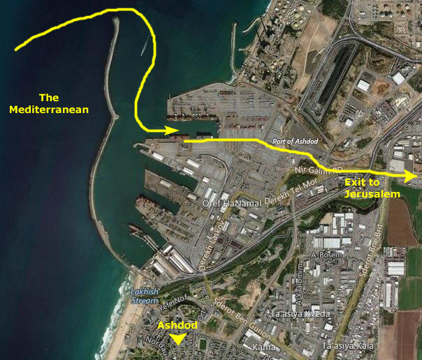
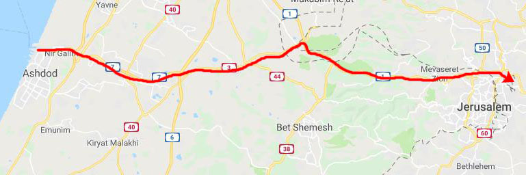
Modern Ashdod was established in 1956 on the sand hills near the site of the ancient towns; the planned city was incorporated in 1968. Ashdod today has a population of 225,000 spread over an area of 18 square miles. At right you can see our route into the port and where we docked.
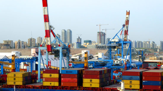
Ashdod is one of the most important industrial centers in Israel. All industrial activities in the city are located in northern areas such as the port area, the northern industrial zone, and around the Lachish River. The port of Ashdod is the largest port in Israel, handling about 60% of Israel's port cargo. It was extensively upgraded in recent years and will be able to provide berths for Panamax ships. Various shipping companies offices are also located in the port area which also is home to a power station and coal terminal. In recent years, Ashdod has also become a cruise port, and jumping off point for tours to Tel Aviv and Jerusalem.
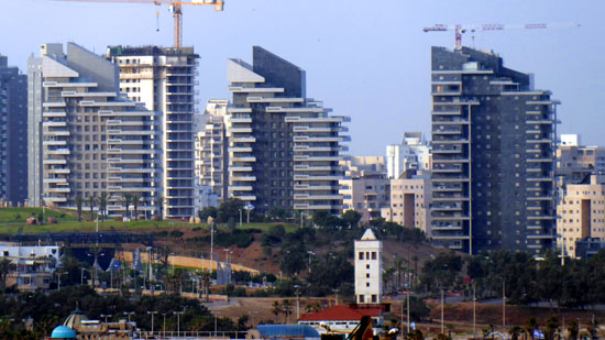
I was pretty impressed with the daylight came up and I could see clearly to the south; I had not expected so many tall buildings in this relatively small city (by American standards). Most of the taller structures, as it turned out, were residential.
|
|
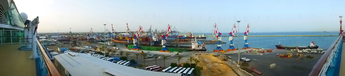
I find ports interesting, and here we were docking the ship right in the middle of this one. This was the most active of the ports we stopped at, although the port area in Dubai was actually larger. But I found it interesting as did Fred, and we took quite a few pictures. Here are the best of them, if you want to have a look:
|
More people left the ship on shore excursions here than at any other stop save Petra and Dubai. Here is a panoramic view looking south; you can see all the tour buses lined up:
|
The Drive to Jerusalem
Today was an early departure on our shore excursion to Jerusalem. We were in the theatre at 8:30 getting our group assignments and fifteen minutes later we were leaving the ship to board our bus into Jerusalem. As you might expect, port security was tight, and our bus was boarded at the exit checkpoint so the security personnel could take a look at us.
|
|
On other album pages, I've used aerial views to show walking and driving routes, but for our Jerusalem excursion I have not done so. The reason is that, for some reason, the quality of the aerial views of the Jerusalem area is much, much lower than for other places I've been- or even the other stops on this cruise. My suspicion is that this is intentional, so that evildoers will have a harder time planning their activities. In any event, the aerial views available here don't add much of anything to the experience (for me or for you). All I will be doing today is using maps to show the stops we made and the relative location of the things we saw.
The Mt. Scopus Overlook
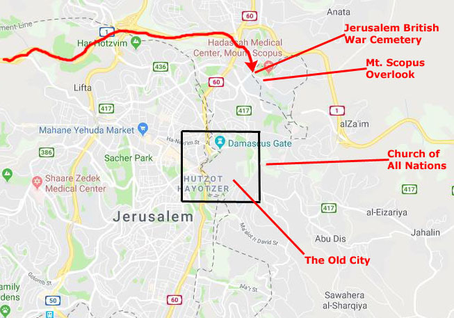
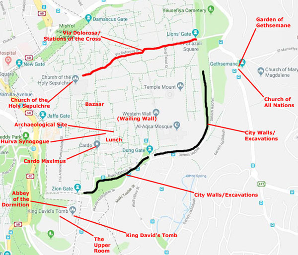
On the way into the city, our tour guide talked with us about what we would be doing today, and I'd like to lay out at least the first few things that we will be seeing today. Below, left is a map of most of the city of Jerusalem. I just want to use it to lay out what we'll be doing and seeing today.
|
After the overlook we will get back in our tour bus and drive down the hill and over towards the Old City- stopping first to visit the Church of All Nations and the Garden of Gethsemane. Here we will also get good views of the old city walls (and the excavation and restoration work that is going on. (This will also be our "pit stop" for the morning.) Finally, our bus will take us close to the Old City's Zion Gate and let us off for our guided walking tour through the Old City; it will pick us up again at the so we could get our bearings and look out over the city of Jerusalem.
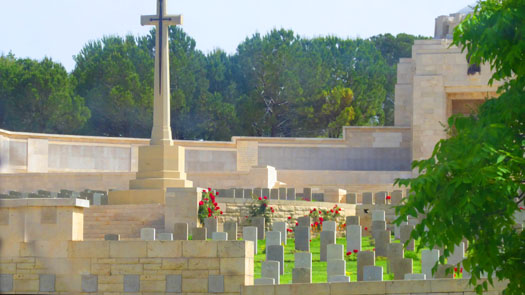
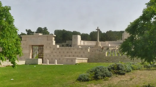
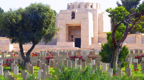
Before we stop at the overlook, though, we did pass the war cemetery, which contains some 2,500 graves; it includes a small Jewish section (kind of surprising, since the cemetery is located in Israel, although wehn it was established, this area wasn't Israel yet). We didn't actually visit the cemetery; the only pictures we have of it were taken as the bus passed by, although a couple of them did turn our well:
|
|
The cemetery also contains the Jerusalem Memorial to 3,300 Commonwealth service personnel who died on operations in the same war in Egypt and Palestine and have no known grave. Its architect was John James Burnet and the sculptor Gilbert Bayes. It was unveiled on 7 May 1927 by Lord Allenby, who had been British commander-in-chief in the Middle East.
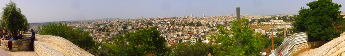
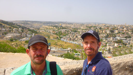
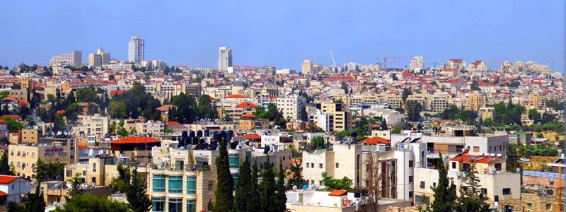
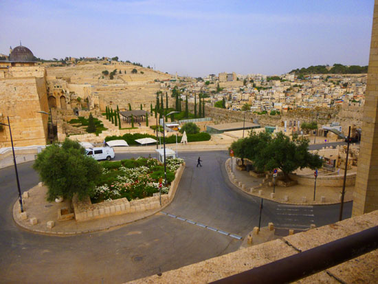
Our bus pulled off the street into the parking area at the overlook- an area that was incredibly crowded; this much be a very popular place for views of Jerusalem. We could see those views right away, but our guide led us over to an area where we could all gather together and have a listen.
|
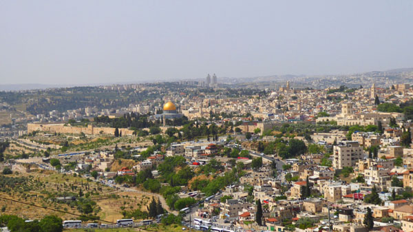
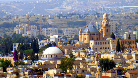
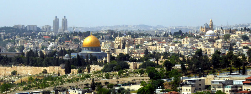
This ridge of mountains east of ancient as well as modern Jerusalem offers the best views of the city, which it dominates. Since the main part of the ridge bears the name Mount of Olives, the name "Mt. Scopus" ("lookout") was reserved for this peak to the northeast of the ancient city. The view at left is typical of what you see from here. It is easy to pick out the Mount of Olives and the city walls at left, the gold-domed Dome of the Rock, the Old City to its right, the Abbey of the Dormition (just beyond the white dome of the Hurva Synogogue) and the tower adjacent to the Church of the Holy Sepulchre at the right.
Not also seen in that particular view, but visible down below the overlook, you can also see the gold onion domes of the Church of Mary Magdalene.
One thing all the names for this mountain/hill agree on (Hebrew, Arabic, Greek and Latin) is the notion that the site is a "lookout". For example, "Scopus" is a Latinization of the Greek word for "watcher", "skopos", the same as in "telescope". Adding to the multi-layered meaning of the name, it is also said that in times in which Jews were not allowed to enter Jerusalem by the city's Roman or Christian authorities, they used to come and look at their former capital from this vantage point.
|
We are actually standing in the Tabachnik Garden, which is an Israeli National Park; in addition to the Overlook Memorial Plaza, the park also preserves some Jewish burial caves from the Second Temple period and two small cemeteries. There are actually two lookouts here- , the Bentwich Cemetery and one of the cemeteries of the American Colony. Inside the park there are two lookouts, one facing eastward towards the Dead Sea and the Judean Desert, the other westward towards the Temple Mount.
|
|
I confess that I missed much of what our guide was talking to us about as I was wandering around admiring the views and taking pictures. (I also confess that with the availability of the Internet, I can always find the same information online when I am working on the photo album; the information here about Mt. Scopus is just one example.)
|
In AD 70, at the conclusion of the same war that led to the destruction of the Jewish Temple, Mount Scopus was used as a base to carry out the final siege of the city by the same 12th Legion, plus the 15th and 5th Legions, while the 10th Legion was positioned on the continuation of the same ridge, known as the Mount of Olives.
The Crusaders used it as a base in 1099.
|
|
I like panoramic views, but it was time to head off to see some of the sights of Jerusalem and the Old City up close, so we all piled back onto the bus to head off to do just that.
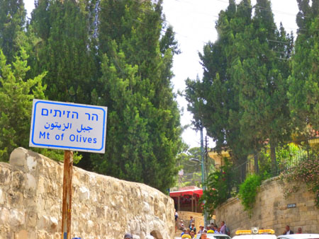
The Mount of Olives
The exact route we took down to the Mount of Olives from Mt. Scopus is not at all important; and in any event, I can't recall it (as I might have been able to if I had been driving). We were on local streets, and passed only a couple of landmark sites that one or the other of us photographed.
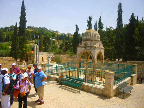
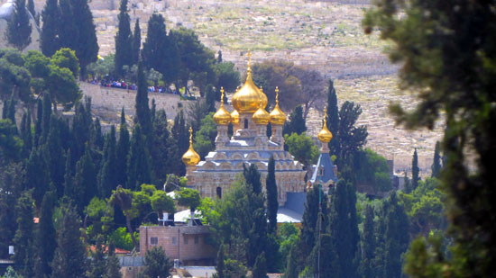 Church of Mary Magdalene |
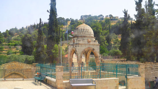 Tomb of the Virgin Mary |
Taking pictures out the bus window was hit or miss, and most of them didn't turn out well, but here are a few that did- some humorous, some not:
|
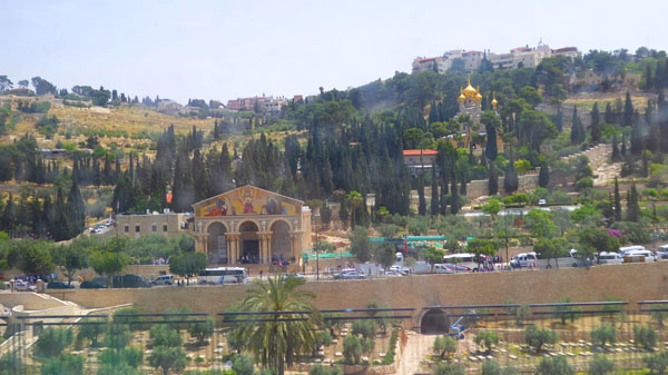
Our bus came to a stop on Jericho Road, just across from the Church of All Nations, right on the slope of the Mount of Olives. Our guide led us from the bus to some facilities we could use and then we walked to some of the sites here in this particular area- including the Mount of Olives itself. So come along with us and have a look.
The Mount of Olives
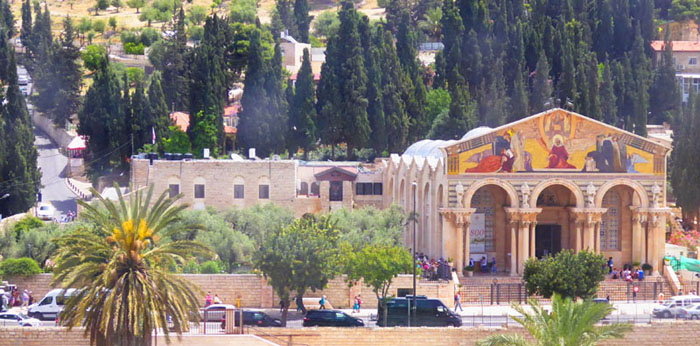
The Church of All Nations and Church of Mary Magdalene |
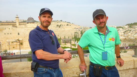
Much of the top of the hill is occupied by At-Tur, a former village and now a neighbourhood of East Jerusalem with a majority-Muslim population. The overlook we were at is on the slope of Mt. Scopus, adjacent to and above this area.
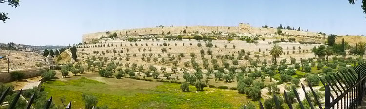
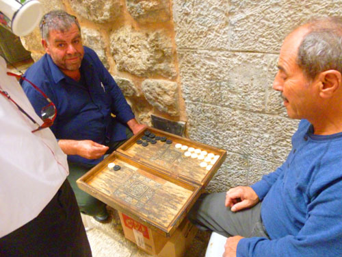
It is a bit hard to describe the scene here, for we think of the Mount of Olives as being some tranquil grove (of olive trees, presumably) that the ancient inhabitants of this area would wander through. The modern reality is quite a bit different, for almost all of the olive trees are gone, and large swaths of the area seem to be covered in rocks (many of which are undoubtedly grave markers). Once off the bus, our tour guide led us down the stairs to King's Valley and the facilities that our group could use.
While folks were doing that, Fred asked our guide about an ancient Greek coin that he was wearing, and he obligingly took it off so Fred and a couple of other folks could see it closely. It had Alexander the Great on one side of it, and was supposedly some 2500 years old. Fred, interested in such things, took a couple of pictures of the obverse and the reverse of the coin. Our guide also took some time to explain a bit about the area in front of us, where the land slopes down from the walls of the Old City to a depression known as King's Valley.
|
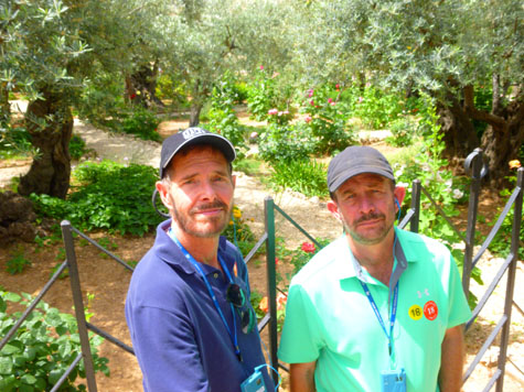
Before we did, I took one more picture of Fred on the King's Valley Promenade as he was talking to the guide. Fred got views of the graveyards slope and also the onion domes of the Church of Mary Magdalene sticking up above the trees. And I looked across the valley at the walls of the Old City:
|
The Church of All Nations
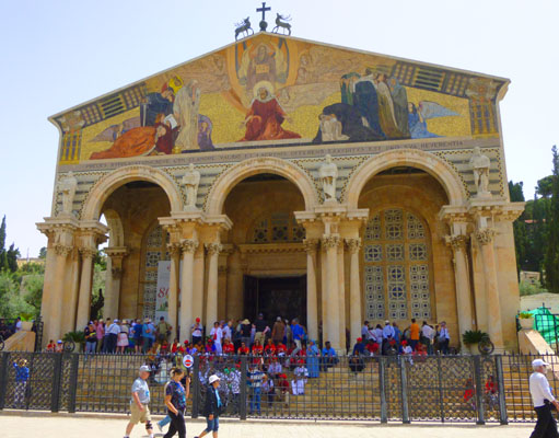
The Church of All Nations, speaking from the casual photographer's viewpoint, is hard to photograph. It abuts a busy street, and even from across the street about all you can get into the picture is the front facade of the church.
|
The earliest church on this site was The Byzantine Basilica. It was constructed in the time of Theodosius (circa 380 AD) and it had, at the center of the apse, the "Rock of the Agony" which is still conserved. It was smaller than the present basilica, had a beautiful mosaic floor, and was destroyed by an earthquake in 746 AD. The second church was The Crusader Basilica. That church was erected in the 12th century, and the remains of this basilica are still visible to the south of the present church; it was abandoned around 1345 AD.
|
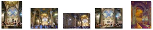
The interior uses a stone from the quarries at Lifta, and is divided by six columns into three aisles, but with an even ceiling lacking a clerestory. This design gives the impression of one large open hall. Alabaster panels dyed violet were used for the windows to evoke a mood of depression analogous to Christ's agony, and the ceiling is painted a deep blue to simulate a night sky. Here are some interior views:
|
Outside, a different stone was used- this time a rose-colored stone from Bethlehem.
|
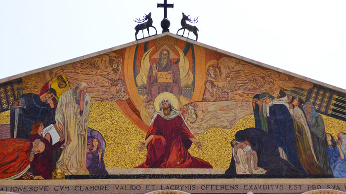
The columns and statues are set below a modern mosaic depicting Jesus Christ as mediator between God and man. The designer of the facade mosaic was Professor Giulio Bargellini.
The bubble-domed roof, thick columns, and facade mosaic, give the church a Neoclassical look. The church was designed by Italian architect Antonio Barluzzi and is currently held in trust by the Franciscan Custody of the Holy Land.
When we were done inside the church, we gathered back with our tour guide (no mean feat since the outside of the church was incredibly crowded) and, after he counted noses, we went back around the side of the church to the Garden of Gethsemane.
The Garden of Gethsemane
|
As it turns out, there are four locations that at least some scholars and locals claim to be the place where Jesus prayed on the night he was betrayed. Garnering the most support is this garden next to the church, as it contains what many call the "Rock of the Agony". But the three other contenders- a location near the Tomb of the Virgin Mary a quarter mile north, the "Greek Orthodox" location a quarter mile east, and the orchard next to the Russian Orthodox Church of Maria Magdalene a half mile away.
According to the Eastern Orthodox Church tradition, Gethsemane is the garden where the Virgin Mary was buried and was assumed into heaven after her dormition on Mount Zion. The Garden of Gethsemane became a focal site for early Christian pilgrims. It was visited in 333 by the anonymous "Pilgrim of Bordeaux", whose Itinerarium Burdigalense is the earliest description left by a Christian traveler in the Holy Land. In his Onomasticon, Eusebius of Caesarea notes the site of Gethsemane located "at the foot of the Mount of Olives", and he adds that "the faithful were accustomed to go there to pray".
|
However, William McClure Thomson, author of The Land and the Book (1880), wrote:
| "When I first came to Jerusalem, and for many years afterward, this plot of ground was open to all whenever they chose to come and meditate beneath its very old olive trees. The Latins, however, have within the last few years succeeded in gaining sole possession, and have built a high wall around it. The Greeks have invented another site a little to the north of it. My own impression is that both are wrong. The position is too near the city, and so close to what must have always been the great thoroughfare eastward, that our Lord would scarcely have selected it for retirement on that dangerous and dismal night. I am inclined to place the garden in the secluded vale several hundred yards to the north-east of the present Gethsemane." |
|
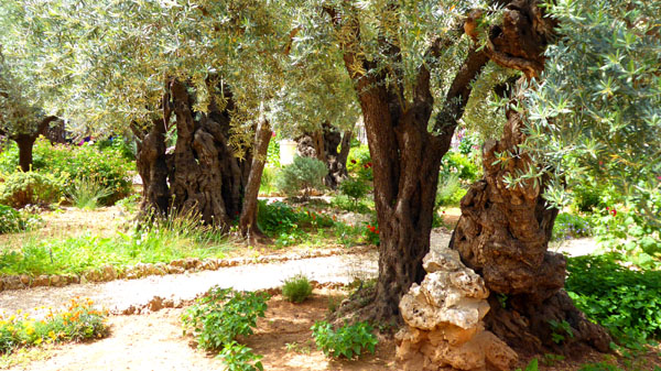
This could indicate an attempt to keep the lineage of an older species intact. Then again the three trees tested could have been sprouts reviving from the older roots. "The results of tests on trees in the Garden of Gethsemane have not settled the question of whether the gnarled trees are the very same which sheltered Jesus because olive trees can grow back from roots after being cut down", researchers said.
However, another member of the Italian Research team wrote that "all the tree trunks are hollow inside so that the central, older wood is missing...In the end, only three from a total of eight olive trees could be successfully dated. The dated ancient olive trees do, however, not allow any hypothesis to be made with regard to the age of the remaining five giant olive trees."
It is possible that the roots of the oldest trees are possibly much older than what we see above ground today, although no researchers are willing to assert that any of the trees are two thousand years old.
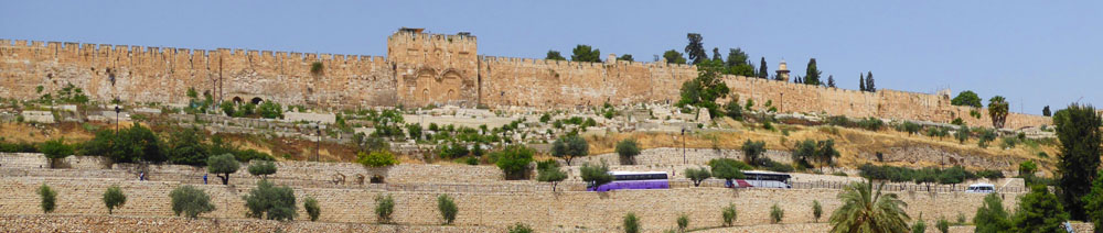
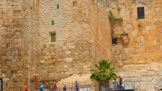
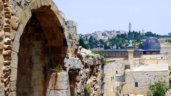
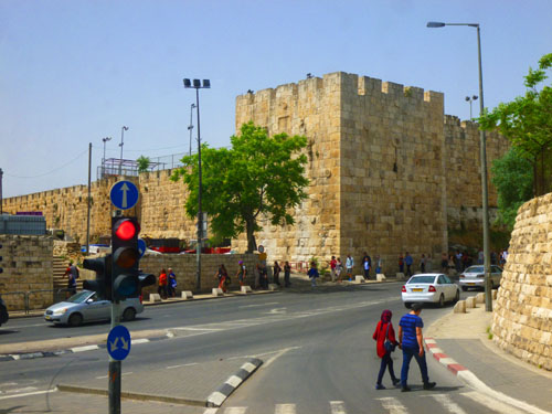
The Walls of Jerusalem
|
If you think of the old city as a rectangle, long sides on the north and south, the Garden of Gethsemane from which we have come is near the northeast corner of that rectangle, and the first stops on our walking tour will be south of the rectangle. So the tour bus had to go by the east side of those walls (shown above) and then around the southeast corner of those walls and over towards the Zion Gate. On the way, we passed both the Damascus Gate and the Tomb of the Virgin Mary:
 Jerusalem's Damascus Gate |
 The Tomb of the Virgin Mary |
The Walls of Jerusalem surround the Old City; when Jerusalem was part of the Ottoman Empire, Sultan Suleiman I ordered the ruined city walls to be rebuilt. The work took some four years, between 1537 and 1541. The walls are about 2.5 miles long, with an average height of 40 feet; they are an average of 8 feet thick. The walls contain 34 watchtowers, and seven main gates open for traffic, with two minor gates reopened by archaeologists. In 1981, the Jerusalem walls and the Old City becae a UNESCO World Heritage Site.
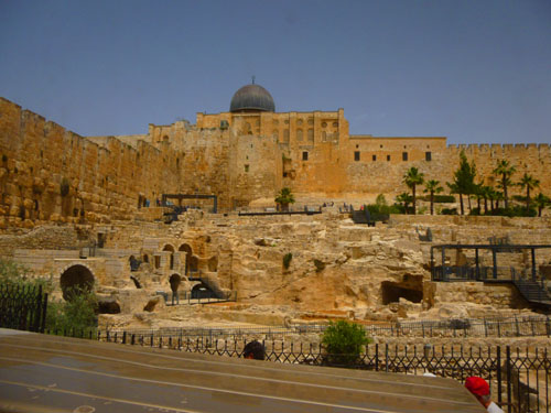
|
According to Jewish tradition, King David conquered Jebus, renamed it City of David and started expanding it- but it was still outside today's Old City area. The first recorded structure that is part of today's Old City was the First Temple built by Solomon, David's Son, on the hilltop rising right above the city he had inherited. This was the Temple Mount, and the city's walls were extended to protect it.
During this period the city walls were extended to include the northwest hill as well- the area where today's Jewish and Armenian Quarters are located. But the entire city was destroyed in 586 BC during the siege led by Nebuchadnezzar of Babylon.
|
|
A pagan Roman city was built here by the Emperor Hadrian; at first, it had no walls. These were erected two centuries later, probably by Diocletian, around 300, and were renewed and expanded between 443-460. In 1033, most of these walls were destroyed by an earthquake. They had to be rebuilt by the Fatimids, who left out the southernmost parts that had been previously included: Mount Zion with its churches, and the southeastern hill (the City of David) with the Jewish neighborhoods which stood south of the Temple Mount. The Crusades saw the walls damaged and repaired frequently, but they were finally torn down by 1219, and for the next three centuries, Jerusalem remained without protective walls- save for the Temple Mount and the Citadel.
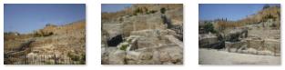
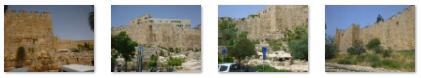
|
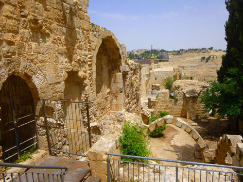
We have seen other cities with walls, but none with so many iterations built at so many different times over such a long period. It would have been interesting to go slowly through the excavations and read the numerous signs posted about. But we had to content ourselves with pictures. Here are some more of them:
|
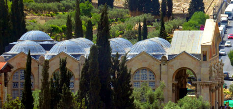
Our tour bus brought us to the Zion Gate, where we would actually enter the Old City. We first came past the Church of Saint Peter in Gallicantu- a Roman Catholic church located on the eastern slope of Mount Zion, just outside the Old (walled) City. The bus brought us up to drop us off right at the gate, where we had our last good look at the Mount of Olives. Then our walking tour of the Old City began.
King David's Tomb
Before we head to our first stop here in the Old City of Jerusalem, let me give you the lay of the land, and some idea of where, spatially, the stops that we made were located.
|
Inside the Zion Gate, we'll begin by turning south to make two stops- at King David's Tomb and at the Upper Room- before we head north again to pass the Church of the Dormition. (I might point out here that whether the actual "tomb" that we saw had King David in it, or whether the upper room that we went through had, at one time, a banquet table set for 13, are both open to some debate. And there is a lot of that, our guide indicated.)
We would then head towards the restaurant where we would have lunch, passing a couple of archaeological sites on the way. After lunch, we'd head northwest in the direction of the Church of the Holy Sepulchre (stopping first in a gaily-decorated square where we'd have our first (and only, as it turned out) "shopping opportunity".
Then, we will spend time in the Church and immersing ourselves in its legends before taking a walk through the souk-like streets to see part of the Via Dolorosa. Finally, we would head south again to our final stop (and the one I was most looking forward to) at the Wailing Wall (the Western Wall). I wanted to see this site in particular as it has often been in the news (both for good reasons and for bad) and I wanted to compare the reality to what I've seen already.
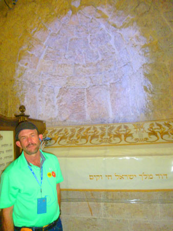
Our bus is supposed to pick us up at the Dung Gate about four hours from now, so I suppose we should get started. Our guide led us through the old city streets to a courtyard surrounded by low buildings on all sides. At one end of the courtyard, I could see a two-story building and tower. Our guide told us that King David's Tomb was on the lower level, while above it was the upper room- the site of the Last Supper. Above both rooms was a tower and balcony.
|
The building housing the tomb is located is on Mount Zion here in the Old City of Jerusalem, near the early 20th century Abbey of the Dormition. The tomb is thought to be situated in a ground floor corner of the remains of the former Hagia Zion, considered a Byzantine church or late Roman era Synagogue. The building is now administered by the Diaspora Yeshiva, a Jewish seminary group.
Formerly a mosque, it was converted into a synagogue following the establishment of the State of Israel in 1948; from then onwards, the Israeli Ministry of Religious Affairs began the process of turning the site into Israel's primary religious site. Jewish prayer was established at the site, and Jewish religious symbols were added. From 1948 until the Six-Day War in 1967, it was considered the holiest Jewish site in Israel.
The tomb compound includes the location traditionally identified as the Cenacle of Jesus (the Upper Room, or Room of the Last Supper), the original meeting place of the Christian faith. Recent years have seen rising tensions between Jewish activists and Christian worshippers at the site.
Jerusalem, for such a holy place to so many, has more than its share of conflict- most of it due to the tension between Arab and Jew, not necessarily between Muslim and Christian. Our guide seemed to think that most of the problems he see are political in nature, created or exacerbated by persons trying to maintain power and control.
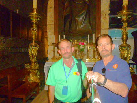
|
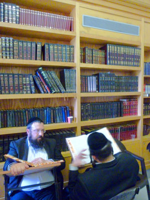
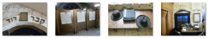
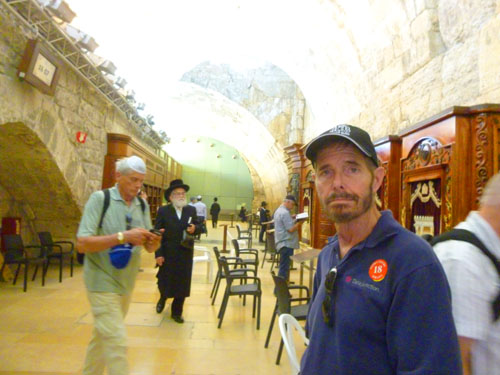
The actual room where the "tomb" is was very small, and there were hundreds of people rotating through it. The only good picture of the tomb itself that we got was the one above with Fred and the tomb. The "library" room was larger, so I could get off to the side to take a few pictures. Here are the best of those:
|
While in the small room standing beside what is said to be tomb of such a legendary figure, I couldn't help but reflect on what our guide had said outside- that for all the controversy over who should control the site, the bigger question is what, in fact, the factions are contending for control of. Take the tomb itself; the contents of the sarcophagus have never been subjected to any scientific analysis, to determine their age, former appearance, or even whether there is actually still a corpse there.
|
(Mouseover Image Above for Video Controls) |
(I made one movie in the sarcophagus room; you can use the player at right to watch it.)
Even the accounts that say King David was buried on Mount Zion may not be referring to modern-day Mount Zion (which is where we are at the moment). Historians from the time, including the famous Josephus, described Mount Zion as a hill across the valley to the west- not the one we call Mount Zion today. Josephus described David's Tomb as being on the larger hill to the west.
Some scholars contend is that "David's Tomb" was actually once a late Roman synagogue, and indeed there was one on this site. But this view has been thoroughly challenged because this building is absent typical synagogal architectural characteristics.
Although the sources for the tradition of David's Tomb on Mount Zion are not clear, it appears that it only began to take root during the subsequent, early Muslim period. Apparently, the Christians inherited this belief from the Muslims, and only at a relatively late juncture in the city�s history were the Jews finally convinced as well. (Muslims originally venerated David's tomb in Bethlehem, but by the 10th century were beginning to venerate it on Mount Zion. The reasons why are not at all clear.) So who knows for sure?
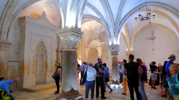
The Upper Room: The Room of the Last Supper
The Cenacle (from the Latin "dining room"), also known as the "Upper Room", is a room in the David's Tomb Compound traditionally held to be the site of the Last Supper. In Christian tradition, the "Upper Room" was not only the site of the Last Supper but also the room in which the Holy Spirit alighted upon the eleven apostles after Easter. It is sometimes thought to be the place where the apostles stayed in Jerusalem and, according to the Catholic Encyclopedia, it was "the first Christian church".
|
Although Jesus and his disciples never ate in this actual room; scholars and history are quite in agreement on that. This room was built more than a millennium after that biblical event.
Some believe that this entire building was constructed by Crusaders just before Saladin�s conquest of Jerusalem in 1187, while others attribute it to Holy Roman Emperor Frederick II, after he arrived in the city in 1229. Still others hold that it was not built in this form until the Franciscans acquired the site in the 1330s. Scarce documentation and disturbed structural features offer little strong support for any of these dates.
So it is quite impossible that this is actually the physical room in which the Last Supper occurred. Why, then, is it a holy site? That's hard to say, and, not being a believer myself, I can't tell you what prompts believers to come here or whether they actually do think it is the physical room. So did I get any weird feelings being here? No. The room is undoubtedly old, but as for the spirits of its possible former occupants there was little evidence- at least for me.
|
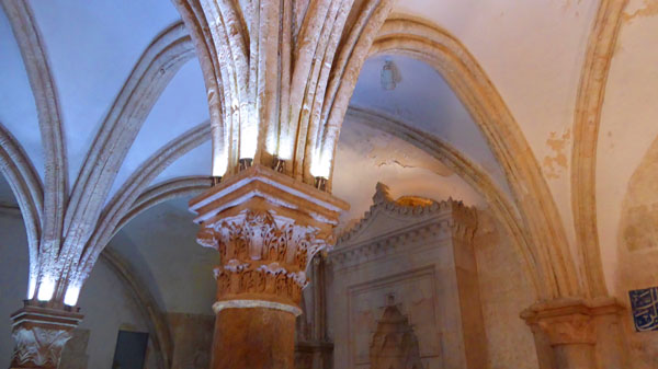
An analysis of the column and pillar capitals offers clues, but not a solution, to the mystery of the current building�s origin. The Corinthianesque capital between the second and third bays of the Cenacle is stylistically indicative of multiple geographical regions and chronological periods.
This capital�s spiky leaves, which tightly adhere to the volume of the column before erupting into scrolls, are in congruence with common outputs of the 12th century sculpture workshop at the Temple site in Jerusalem in the last years before Saladin�s conquest in 1187. The workshop also frequently utilized drilling as an ornamental device.
The Jerusalem workshop included artists from diverse regions in the West, who brought stylistic traits with them from their native countries. The workshop produced sculpture for many Crusader projects and other structures, such as the al-Aqsa mosque. This comparison allows for the support of the 12th century date of the Cenacle. There are also, however, similar capitals which originated in workshops in southern Italy, a draw for scholars who wish to associate the building with Holy Roman Emperor Frederick II and the Sixth Crusade in 1229. Examples can be seen in the Romanesque cathedral in Bitonto, a small city near Bari, in southern Italy, and on column supports of the pulpit in the Pisa Baptistery, carved by Apulian-born sculptor Nicola Pisano around 1260.
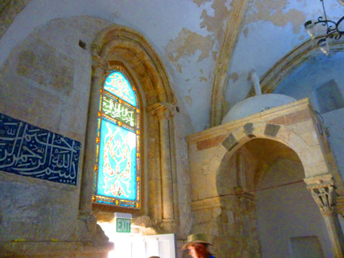
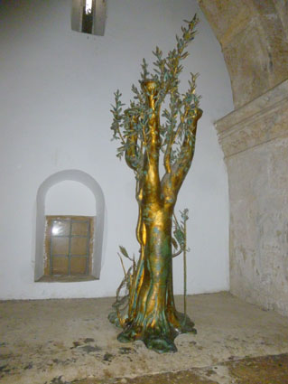 The Olive Tree |
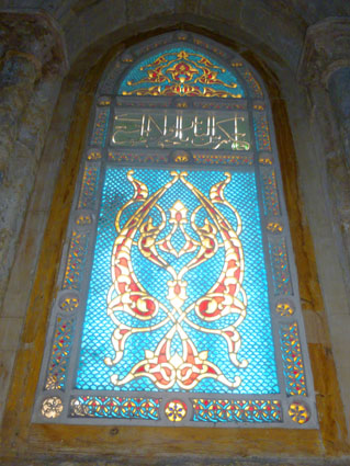 Stained-Glass Window with Arabic |
The capitals of the freestanding columns are not identical. The capital between the first and second bays seems either severely weathered or shallowly carved, and its volume is a marked contrast from the others. It rises from the shaft in a straight cylinder, rather than in an inverted pyramid, and then flares only just before it intersects with the abacus.
The third capital, which now flanks the Cenacle�s western wall, is also unique among the three. It is not decorated with a floral motif, rather, scrolling crockets spring from the base of the volume. Scholars have proposed a comparison to buildings constructed by Frederick II.
So this columnar analysis doesn't yield enough significant evidence to link them to the 14th century and a potential Franciscan construction, nor does it definitively date them to the 12th or 13th century. The construction history of this entire building thus remains a frustrating, but intriguing, mystery- to those whose life's work it is to know such things.
|
So I have looked around on the Internet and finally found a picture someone did take close up. Obviously, they had time, as they got the lighting just about perfect too.
So what's the carving? The column has pelicans sculpted on it. There is a mother Pelican who is apparently bleeding and two baby pelicans feeding on the flesh and blood. This is a symbolic representation of the ultimate sacrifice- namely, that of Jesus dying on the cross for the sins of humanity, and so saving the human race.
I know you can't see that in my picture, but if you will find the top of the column in the lower right corner of the image at right, I'll show you a better, enlarged view.
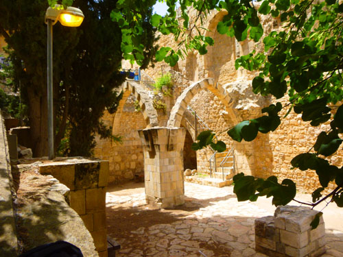
We left the Upper Room and went back down to the other side of the courtyard. There was another stairway to a building opposite, but we weren't headed there; we were off to walk the streets of the Old City towards the spot where we would have lunch.
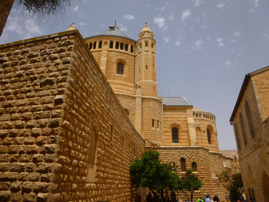
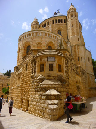
The Abbey of the Dormition
From the Upper Room, we will be walking generally north towards the Zion Gate again. The city walls at this point have undergone much restructuring, as some of the places we've stopped have been, at different times, inside or outside the walls of the Old City. When the bus first let us off here at the city walls, we at first walked past the Zion Gate to go first to see the Tomb of David and the Upper Room. It was a little confusing at the outset, but we were just following our tour guide, and he wasn't very clear that we would be outside the walls for a while. Now we are walking back towards the Zion Gate to get into the Old City proper, but on the way we passed the Abbey of the Dormition.
|
We had actually walked past the Abbey of the Dormition earlier, when we came through a narrow opening between the church and the abbey, but now we were returning by the building along the street from the Cenacle. The site on which the present church stands has a long history. A Byzantine basilica, Hagia Sion, was built here early in the 5th century by John II, Bishop of Jerusalem; as part of the consecration of the church, relics attributed to Saint Stephen were transferred to it in 415. The church was destroyed in the 614 siege of Jerusalem by Sasanian king Khosrau II; its foundations were not rediscovered until 1899 until Germans from the Diocese of Cologne came to investigate the site.
A monastic order known as the Abbey of Our Lady of Mount Zion was established at this site in the 12th century, with a church built on the ruins of the earlier Byzantine church. The 12th-century church was destroyed in the 13th century, and the monks moved to Sicily. The order was eventually absorbed into the Jesuits in 1617, and this site became lost to church history for five centuries.
|
According to local tradition, it was on this spot, near the site of the Last Supper, that the Blessed Virgin Mary died, or at least ended her worldly existence. In Orthodoxy and Catholicism, as in the language of scripture, death is often called a "sleeping" or "falling asleep", and this gave the original monastery its name, the church itself is called Basilica of the Assumption ("Dormition"). In the Catholic dogma of the Assumption of Mary, Christ's mother was taken body and soul to heaven.
Heinrich Renard, the Diocesan official to investigated the site, prepared the designs and plans for the Abbey, and a local Jerusalem architect was entrusted with the construction. The foundation stone (which I should have photographed) was laid on 7 October 1900. Construction was completed in only ten years; the basilica was dedicated on 10 April 1910 by the Latin Patriarch of Jerusalem.
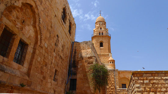
|
The design of the Church called for a bell tower, and you can see it in the picture at left. Interestingly, the bell tower is not directly accessible from the church itself, as it would normally be. It turns out that, out of regard for the nearby Jewish and Muslim sacred place of David's Tomb, which occupies part of the ground floor of the Cenacle where it has traditionally been said that the Last Supper took place, the bell tower is set far enough away that its shadow does not touch the tomb, and that made it just too far to be attached to the church itself. (It is reached via a covered, outside walkway.)
This was a beautiful old building (though not much more than a century old); it had numerous interesting details. Again, this area of Jerusalem, just outside the Zion Gate, as undergone a great deal more recent renovation than has most of the area inside the Old City walls. But even there, as we will see, one finds the very ancient right next to the relatively new. Here are some additional views of this handsome, but small by cathedral standards, church:
|
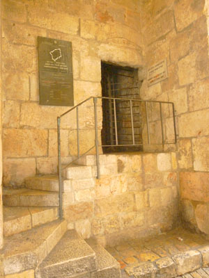
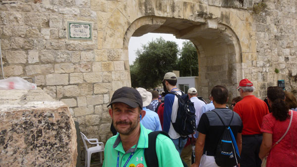
Just beyond the church, we returned to the Zion Gate- a not-so-imposing entrance through the Old City walls. Notice the numerous bullet holes in that last picture; these were the result of the Israeli assault in May 1948 during the independence war to help to break off the siege of the Jewish quarter. This is why this gate is also named the "wounded" gate. (Were the aerial views of Jerusalem better than they are, then this "You are Here" sign would have been helpful in marking our route.) We went through the "Gate" although as you can see, it was not much more than a long hallway. There was a well-done star-shaped design in the walkway at the entrance to the Gate.
|
|
On the way through the gate, we passed the set of steps you can see at left; I had to walk over to read the plaque on the wall to see what they were or where they led. They turned out to be the exit from those tours that include a walk on the ramparts of the city walls. (Our guide said that individual walking of the walls isn't allowed for security reasons- only guided tours.)
There was a plaque at the L-turn in the corridor; I missed our guide's explanation, but found out later that it is like an historical marker with information about the gate (in Hebrew). This gate was restored about ten years ago. But the bullet holes weren't repaired.
We were now, officially, in the Old City of Jerusalem.
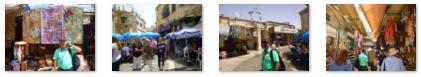
Walking Through the Old City- and Lunch
When we came out into the Old City from the Zion Gate, I could get a nice view of the inside of the city walls as they extended to the east away from me. Our group turned and began following Jerusalem's "Cardo".
|
(Mouseover Image Above for Video Controls) |
During the visit of Hadrian to Judea in the 130s AD, Jerusalem's ruins were surveyed and Hadrian decided to build a Roman colony in its place, naming it Colonia Aelia Capitolina. Like many Roman colonies, the new city was laid out with a grid plan of narrower streets and wider avenues.
Our guide told us much of this, as we passed little shops and got a nice view of the Sidna Omar mosque next to Hurva Synagogue:
|
We could see the Roman plan of the city even today, as we walked along Jewish Quarter Street (as that sign indicates). This street, while not so wide as it might have been originally, was still a fairly wide route through the city. It might not appear to be a main street, but we passed side streets, we could see that they were much narrower, and these streets had few, if any, shops. I presume they led to residences (and the Old City still has a great many actual residents). One interesting side street was this one that was mostly steps and which looked to be pretty recently restored.
|
This main north-south thoroughfare, the Cardo Maximus, was originally a paved avenue approximately 70 feet wide (roughly the width of a six lane highway) which ran southward from the site of the Damascus gate, terminating at an unknown point.
The southern addition to the Cardo, constructed under Justinian in the 6th century, extended the road further south to connect the Church of the Holy Sepulchre with the newly built Zion Gate. Along its length, the roadway was divided into three parts: two colonnaded covered walks flanking a 40-foot wide road.
The shaded porticoes provided separation of pedestrian traffic from wheeled carts, shelter from the elements, space for small-scale commerce, as well as opportunities for residents and visitors to gather and interact. The central open pavement provided commercial access as well as ritual space. The Cardo�s most striking visual feature was its colonnade, clearly depicted on maps from the time.
|
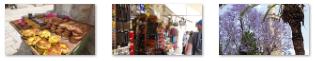
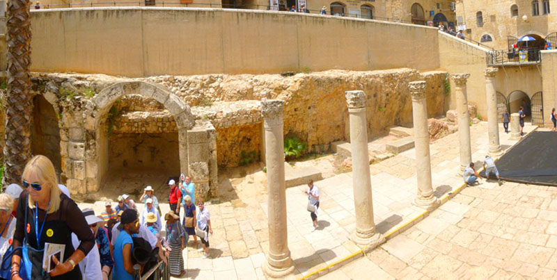
The line of the Cardo Maximus is still visible on the Jewish Quarter Street, though the original pavement lies several meters below the modern street level. And of course, today there are numerous buildings- some old and some new- all around this area where the ancient Cardo Maximus has been excavated:
|
In the 7th century, when Jerusalem fell under Muslim rule, the Cardo became an Arab-style marketplace. Remains of the Byzantine Cardo were found in the Jewish Quarter excavations beginning in 1969.
|
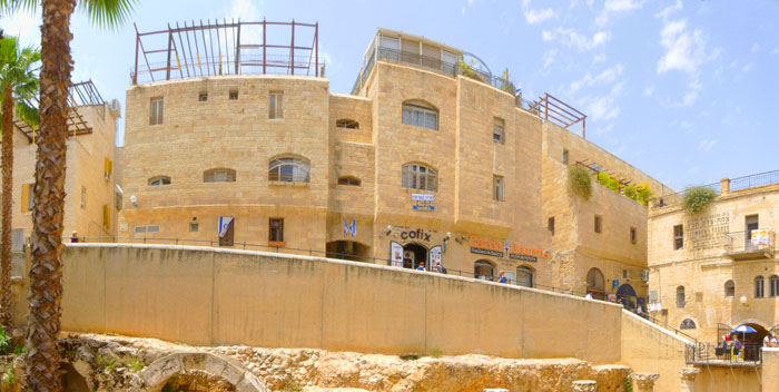
Time was of the essence and mounting pressure to repopulate the Jewish Quarter led to the construction of a superstructure which allowed the residential buildings to be built while the archaeologists continued to work below. The project was 575 feet long in total and was divided into eight sections to allow for construction teams to move quickly from one section to another.
By 1980, 37 housing units and 35 shops were built, incorporating archaeological finds such as a Hasmonean wall from the second century BC and rows of Byzantine columns. The combination of old and new is also visible on the Street of the Jews, where the shops have been set into old vaults and the gallery is covered by an arched roof containing small apertures to allow for natural lighting. We will be walking along that street in a few minutes, and you'll see some of those shops.
|
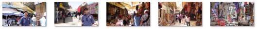
Here are some other scenes and sites you might find interesting (and/or amusing):
|
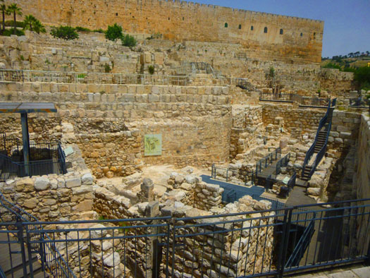
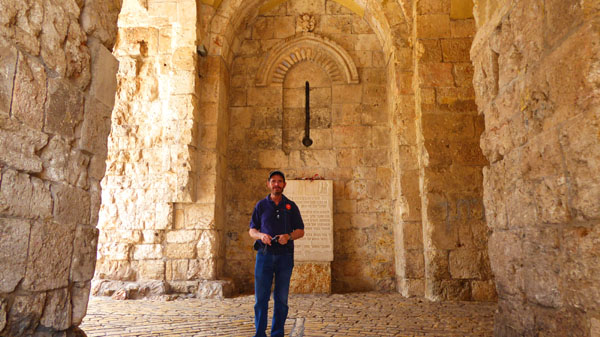
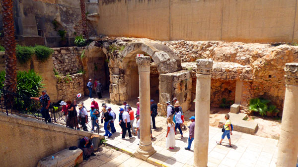
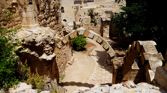
When we were done with lunch, and while everyone else on our tour group was finishing up, Fred and I went outside the restaurant where there seemed to be some sort of archaeological excavation going on. Just off the street on which the restaurant was located we found some stairs leading down, and we followed them. There were lots of people going up and down, so these stairs couldn't have just been an access to the area that was being excavated. Right at the top of these stairs, we could see the work going on below us; here are a couple of pictures we took from there:
|
|
While Fred was at the top, I jogged down the stairway to the site; the stairway had turned to descend alongside some buildings, and I found an access to the excavation partway down. I ducked inside to take a picture and then returned to the top to take another:
 The Area Being Reconstructed |
 Looking at the Excavation from Above |
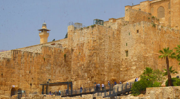
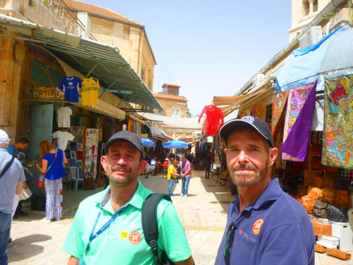
Back at the top of the stairs, our group was re-forming and we were off to our "shopping opportunity" (a shop that the tour guide said would offer reasonable prices and honest deals, but which was probably just the shop that gave him a "finder's fee" for bringing a busload of people in). Walking generally towards the Church of the Holy Sepulchre, we again found some interesting things to see- like this excavated wall from the First Temple period (1000-500 BC). Fred got an interesting views of the city walls and the Mount of Olive graveyard. Look at one picture of that graveyard here, and be sure to look at the closeup view of that graveyard as well; it is among the pictures below that we took on the way to our shopping opportunity:
|
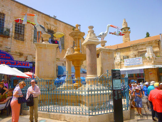
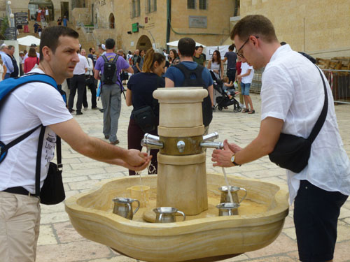
The place where we stopped to do our shopping was an area called the "Muristan" (from the Persian for "hospital")- a complex of streets and shops in the Christian Quarter of Jerusalem's Old City. The fountain in the center of the square was named because this had been the location of the first hospital of the Knights Hospitaller.
|
After 400 years of Arab rule, the hospital was destroyed, along with a large number of other Jerusalem buildings. It was reconstructed 25 years later. Over the next centuries, as control of Jerusalem changed hands, the hospital remained and even expanded. During the Crusades, the Pope put control of the hospital into the hands of the Knights of St. John or Hospitallers. After the Siege of Jerusalem in October 1187, all Christians were driven out of Jerusalem by Sultan Saladin, and the site and hospital building deserted. Those early magnificent structures eventually fell into ruin.
In 1868, the Sultan Mehmed VI presented part of this area to Crown Prince Frederick William of Prussia, and it became the center of a German Christian colony in Jerusalem. The other part was assigned to the Greek Orthodox Church; it is now occupied by the Greek bazaar, and at the center of this bazaar area the ornamental Muristan Fountain was constructed and the Mosque of Omar was built nearby.
So that, in a condensed nutshell, is how this fountain, and this area of the Old City came to be. Much of the area looks like someplace in Rome, with narrow streets lined with cafes. Other parts look more like a traditional souk, with narrow, covered streets lined with small shops.
|
|
We all continued our walk through the narrow streets until we came through a doorway to the Church of the Holy Sepulchre.
Church of the Holy Sepulchre
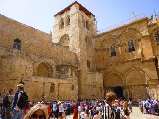
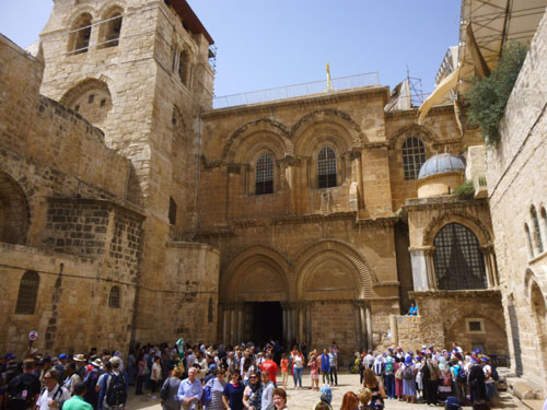
The Church of the Holy Sepulchre, here in the Christian Quarter of the Old City of Jerusalem, contains, according to traditions dating back to at least the fourth century, the two holiest sites in Christianity: the site where Jesus of Nazareth was crucified, at a place known as "Calvary" or "Golgotha", and Jesus's empty tomb, where he is said to have been buried and resurrected. The tomb is enclosed by the 19th-century shrine, called the Aedicule (Edicule). The Status Quo, a 150-year-old understanding between religious communities, applies to the site.
|
The church was damaged by fire and earthquake numerous times. It was intentionally damaged by the Sassanids and the Fatimids, although other Arabs tried to protect the church from being turned into a mosque. One wrote a decree prohibiting Muslims from praying here. Finally, in 1009, a Fatimid caliph's ordered the complete destruction of the church as part of a more general campaign against Christian places of worship in Palestine and Egypt- an action that helped initiate the Crusades.
Years later, that caliph's son allowed the rebuilding and redecoration of the Church, completed in 1048. Other concessions were made on both sides. Contemporary sources credit Emperor Constantine IX with spending vast sums in an effort to restore the Church of the Holy Sepulchre after this agreement was made. Even so, only the rotunda and its surrounding buildings were rebuilt; the great basilica remained in ruins. Control of Jerusalem and the Church continued to change hands several times between the Fatimids and the Seljuk Turks until the arrival of the Crusaders in 1099. During the Crusader period, fortunately, the Church was relatively undamaged.
In the centuries since the end of the Crusades about 1300, the Church has been maintained and gradually repaired and improved. The Aedicule was rebuilt around 1550, and other improvements made through the end of the eighteenth century. In 1808, a fire caused the dome to collapse and smash much of the Aedicule's exterior; the Rotunda and Aedicule were rebuilt by 1810. Repair of the red marble cladding of the Aediule is currently ongoing. The current dome dates from 1870, although it was restored between 1994�1997. Two years ago, in 2016, more restoration of the Aedicule was done. During excavations, the original limestone burial bed was revealed intact. This suggested that the tomb location has not changed through time and confirmed the existence of the original limestone cave walls within the Aedicule. The tomb was resealed shortly thereafter.
Let me break up our visit to the Church of the Holy Sepulchre into sections.
The Parvis (Courtyard) and Facade
|
One oddity is a wooden latter that seems to be left by accident beneath one of the windows on the facade. This "Immovable Ladder", according to various accounts, once belonged to a mason who was doing restoration work in the Holy Sepulchre. Also called "The status quo ladder", it is made of cedar wood, possibly from Lebanon. It was first mentioned in 1757 and has remained in that location since the 18th century, aside from being temporarily moved on two occasions. The ladder is referred to as "immovable" due to an understanding that no cleric of the six ecumenical Christian orders may move, rearrange, or alter any property without the consent of the other five orders. Upon the Pontifical orders of Pope Paul VI in 1964, the ladder was to remain in place until such a time as the Catholic Church and the Orthodox Church reach a state of ecumenism.
After our guide had completed his talk outside, we moved towards the entrance, where I got another nice view looking up at the bell tower. Historically, two large, arched doors allowed access to the church. However, only the left-hand entrance is currently accessible, as the right door has long since been bricked up. Before we follow our guide inside, here are some additional pictures we took of the facade of the church:
|
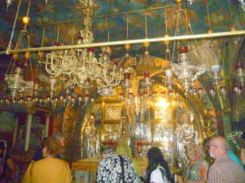
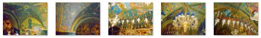
The Chapel of Calvary
|
The whole chapel was ornately-decorated, and here are some closeup views of some of that decoration:
|
|
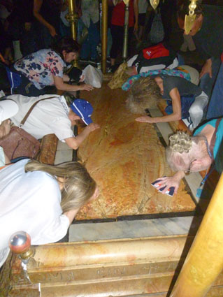
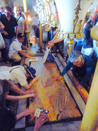
The Stone of Anointing
The Stone of Anointing |
The anointing stone is separated from the small rotunda behind it by a wall. It was tough to get good pictures of this small rotunda, as line of site was usually blocked. Here are some decent views of this rotunda if you would like to have a look at them:
|
The wall was a temporary addition to support the arch above it, which had been weakened after the damage in the 1808 fire; it blocks the view of the rotunda, separates the entrance from the Catholicon, sits on top of the now-empty and desecrated graves of four 12th-century crusader kings, and is no longer structurally necessary. There is a difference of opinion as to whether it is to be seen as the 13th Station of the Cross, which others identify as the lowering of Jesus from the cross.
The lamps that hang over the Anointing Stone are adorned with cross-bearing chain links, and have been contributed by Armenians, Copts, Greeks and Latins.
Immediately to the left of the entrance is a bench that has traditionally been used by the church's Muslim doorkeepers, along with some Christian clergy, and to the right was the stairway we took up to the Calvary Chapel. Our guide said there was another chapel, the chapel of Adam, further down the same wall to the right, so perhaps we will see that later.
|
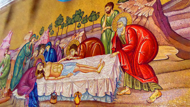
The mural was impressive- very Byzantine, I thought. Above the various scenes, and at the wall's corners were smaller mosaics of angels in mourning.
On the way into the main rotunda, we passed another work of art- this one apparently a depiction of Mary and the young Jesus.
Next, our guide set us off on our own, giving us a time limit for touring through the church. Some people wanted to stand in the long line for entry to the Tomb of Christ, but we wanted to go around and see as much as we could. We went next to the Rotunda.
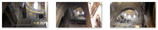
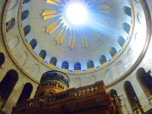
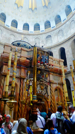
The Rotunda and Aedicule
|
|
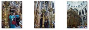
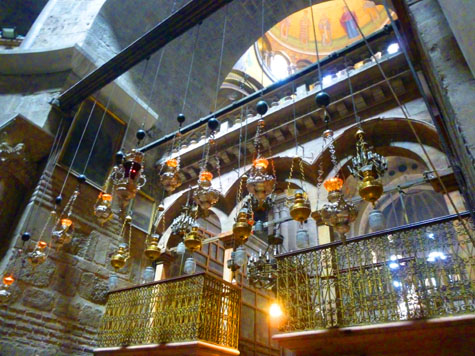
And a few pictures taken around the inside of the Rotunda:
|
I have to say I was disappointed in many of the pictures that Fred and I took here in the Church of the Holy Sepulchre. It is usually difficult to take good pictures in large spaces with dim light, and it is even harder when so much of what was around us was monochromatic. Add to that the crowds and the difficulty we had in even getting to stand in one lace for fifteen or twenty seconds without being jostled. You can compare the pictures we took here with those we have taken in other large churches in Europe, though.
|
The Aedicule has two rooms, the first holding the Angel's Stone, which is believed to be a fragment of the large stone that sealed the tomb; the second is the tomb itself. Possibly due to the fact that pilgrims laid their hands on the tomb or to prevent eager pilgrims from removing bits of the original rock as souvenirs, a marble plaque was placed in the fourteenth century on the tomb to prevent further damage to it.
|
Under the status quo, the Eastern Orthodox, Roman Catholic, and Armenian Apostolic Churches all have rights to the interior of the tomb, and all three communities celebrate the Divine Liturgy or Holy Mass there daily. It is also used for other ceremonies on special occasions. To its rear, in a chapel constructed of iron latticework upon a stone base semicircular in plan, lies the altar used by the Coptic Orthodox.
From May 2016 to March of last year, the Aedicule underwent restoration and repairs after the Israel Antiquities Authority declared the structure unsafe. Much of the $3 million project was funded by the World Monuments Fund.
We made a circle around to the west of the Aedicule, admiring the huge columns supporting the dome of the rotunda. Here are a couple more views of the decoration here in the Rotunda:
 A Chapel West of the Aedicule |
 Decoration in the Rotunda |
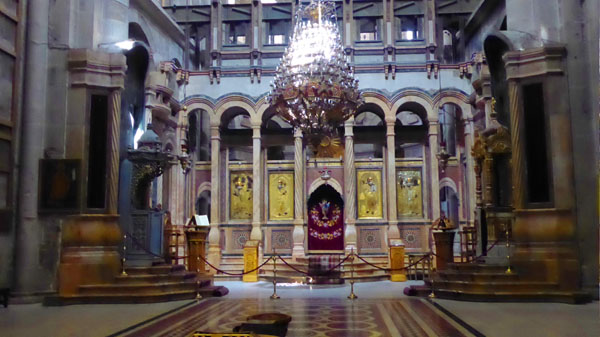
The Catholicon
|
The inside of the dome was beautifully decorated; here are some views of it:
|
Entry to the Catholicon was blocked off, so we couldn't get inside to look around and get better pictures of the dome or anything else. The doorway was crowded, and I tried to make a movie of the interior, but kept getting jostled, so Fred's one good picture at left will have to suffice.
The Chapel of St. Helena/Other Chapels
|
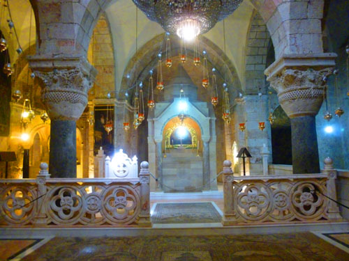
Partway around this aisle, between the first couple of these small chapels, we found some stairs descending to the Chapel of St. Helena.
|
Here are a number of additional views of the inside of the Chapel of Saint Helena:
|
Off to the side there was a wrought iron door that was open, although entrance to the room beyond was blocked off. This turned out to be the Chapel of Saint Vartan, and inside we could see archaeological remains that a sign said were from from Hadrian's temple and Constantine's basilica.
We also found yet another set of stairs down to another chapel even deeper (22 stairs deeper) underneath the church- the Chapel of the Invention of the Holy Cross. This is believed by some (obviously the folks who donated to build the chapel) to be the place where the True Cross was found. There was another archaeological display (maybe the "true cross", but I doubt it).
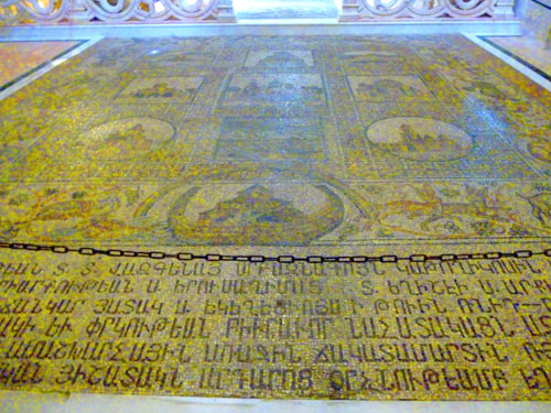
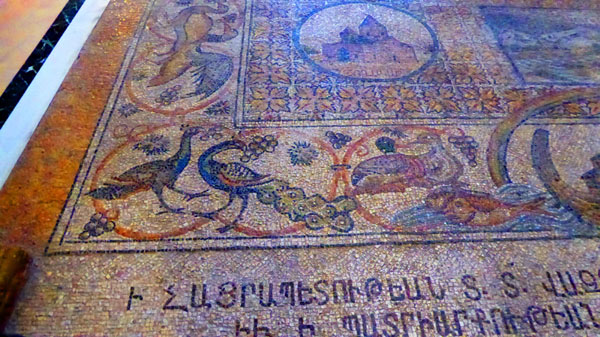
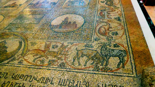
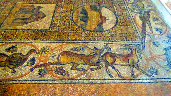
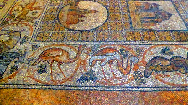
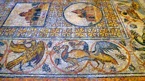
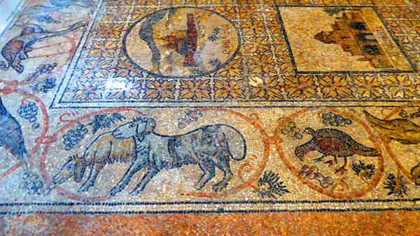
Back up in the Chapel of Saint Helena, we stopped to admire the mosaic floor again, and since the folks that had been standing on it earlier had left, we could get some pictures. The middle of the floor was a series of small pictures of buildings and events, but around the edges of the huge mosaic were a large number of animals of various kinds, and Fred found them very interesting.
|
From the Chapel of Saint Helena, we went back up the stairs to the church and then back out to the front of the church to rejoin our tour group. While everyone was being gathered up, we took more pictures and chatted with our tour guide before heading off towards the Western Wall by way of the Via Dolorosa.
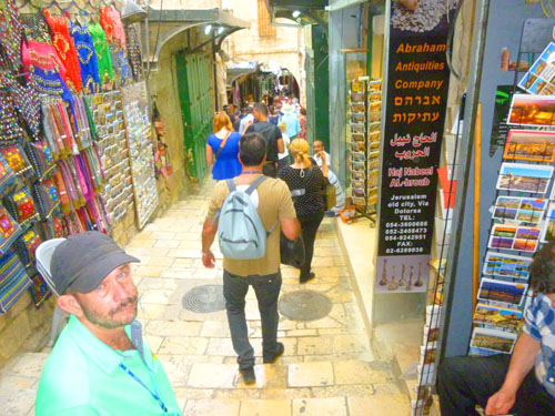
The Via Dolorosa
Our walk to the Western Wall was at least in part along the Via Dolorosa; we also made our way through streets that were more like those in a souk. The Via Dolorosa is a street within the Old City of Jerusalem, believed to be the path that Jesus walked on the way to his crucifixion. The winding route from the Antonia Fortress west to the Church of the Holy Sepulchre� a distance of about a third of a mile- a celebrated place of Christian pilgrimage. The current route has been established since the 18th century, replacing various earlier versions.
|
|
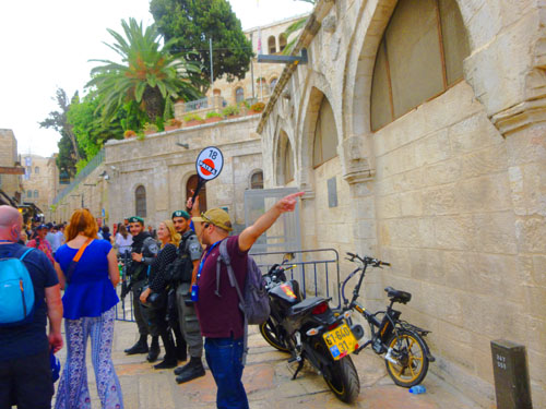
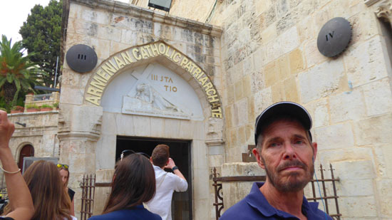
The New Testament makes no mention of a meeting between Jesus and his mother, during the walk to his crucifixion, but popular tradition introduces one. The fourth station, the location of a 19th-century Armenian Catholic oratory, commemorates the events of this tradition; a lunette, over the entrance to the chapel, references these events by means of a bas-relief carved by the Polish artist Zieliensky. The oratory, named Our Lady of the Spasm, was built in 1881, but its crypt preserves some archaeological remains from former Byzantine buildings on the site, including a mosaic floor.
We did not see all the stations, of course, because we had to head more south to go to our last major stop at the Western Wall. But in the Church of the Holy Sepulchre we passed a few of these markers, and then I noticed three or four more of them along our walk.
|
|
(Mouseover Image Above for Video Controls) |
There were a few specific things we saw that I should mention. One was that we passed a street sign (on the side of a building, of course) for the "At-Takiyyah Ascent", and that's exactly what it was- a street of stairs. I think I've also mentioned earlier that here in the Old City there are many examples of very old grottoes and buildings having been readapted to a modern use, and we passed an excellent example.
|
Before we arrive at the Western Wall, here are some final pictures from our walk through this part of the Old City:
|
Finally, we came to today's first security checkpoint, where we had to put our backpacks through X-ray and walk through a scanner. This was the entry to the plaza by the Western Wall.
The Western Wall ("Wailing Wall")
The Western Wall, often called the "Wailing Wall", is an ancient limestone wall- actually a relatively small segment of a far longer ancient retaining wall, known also in its entirety as the "Western Wall". The wall was originally erected as part of the expansion of the Second Jewish Temple begun by Herod the Great, which resulted in the encasement of the natural, steep hill known to Jews and Christians as the Temple Mount, in a large rectangular structure topped by a huge flat platform, thus creating more space for the Temple itself and its auxiliary buildings. For Muslims, it is the site where the Islamic Prophet Muhammad tied his steed, al-Buraq, on his night journey to Jerusalem before ascending to paradise.
|
Here are a few more of our first pictures at the Wailing Wall:
|
The Western Wall is considered holy due to its connection to the Temple Mount- the holiest site in the Jewish faith. But since entry is restricted, the Wailing Wall is the closest and therefore the holiest place where Jews can pray regularly. This would not have been so had not the esplanade created by Herod been irregular in shape, making the Wailing Wall slightly closer to the Temple than any of the other walls that enclose the Temple Mount esplanade.
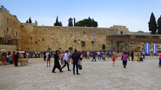
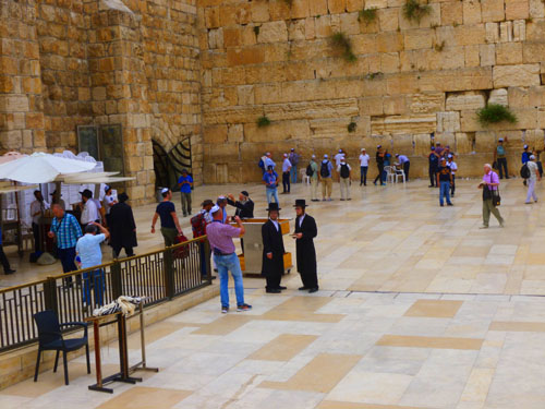
|
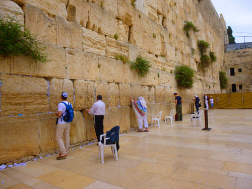
First, the entry to the Wall is via the ramp at left, and partway down, by the white awnings, there is a box of disposable white yarmulkes for men whose heads are not already covered to put on to fulfill the Orthodox requirement that this be done in houses of worship.
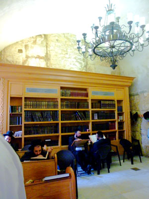
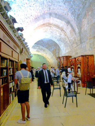
In the far corner, there is an entry into what we discovered later to be a kind of library; there, we found Jews reciting the Torah, reading and studying, and talking with each other. Right in the middle is the Wailing Wall, of course, which actually extends far to the right, although we did not see anyone further than the point underneath the walkway from the Old City to the Temple Mount.
Although you may not be able to see it in the picture, there are no women at the Wailing Wall. But that's just because of the picture's point of view. Women are segregated from men at the Wailing Wall; the women's area is at the right, and you can see that there is a barrier that extends from the middle of the Wailing Wall Plaza to the wall itself.
Entry to the Wailing Wall
 |
 |
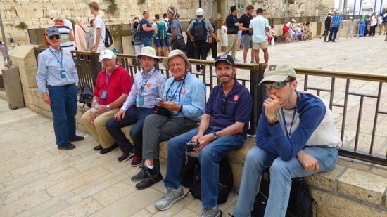
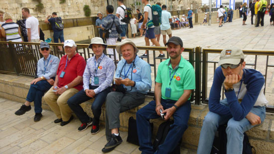
Fred and I also switched off taking pictures of our group. In each of them, from left to right, are Richard, John Lambert (John Toohey stayed on the ship as he thought the walking would have been too much), Zoran, Greg, either myself or Fred, and Steven:
 |
 |
Wilson's Arch
|
In 2005, a major effort began to renovate the space. Israeli workers spent three years renovating and restoring the area, strengthening the arch in preparation for access for visitors and use for prayer.
|
(Mouseover Image Above for Video Controls) |
New construction also included a women's section and gallery, which was dedicated in 2006, allowing for separate seating during worship services and special events conducted within the Wilson's Arch prayer area, including Bar Mitzvah ceremonies, and advertisements reminding women that this new area exists.
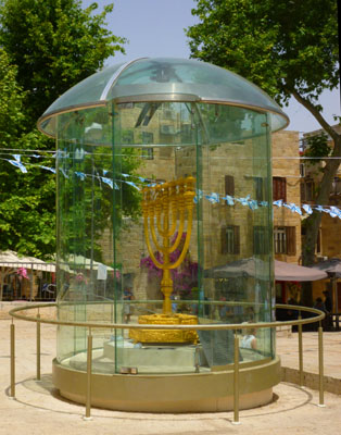
In 2010, an oil-burning "eternal light," was installed within the prayer hall within Wilson's Arch, the first eternal light installed in the area of the Western Wall. According to the Western Wall Heritage Foundation, requests have been made for many years that "an olive oil lamp be placed in the prayer hall of the Western Wall Plaza, as is the custom in Jewish synagogues, to represent the menorah of the Temple in Jerusalem as well as the continuously burning fire on the altar of burnt offerings in front of the Temple, especially in the closest place to where they used to stand." I did not see the lamp, but understand now that it was further back in the space than I had time to go.
|
The Western Stone, located at the north end of the space, s a monolithic stone block forming part of the lower level of the Western Wall. Weighing 628 tons, it was one of the largest building blocks in the world and thought to be one of the heaviest objects ever lifted by human beings without powered machines. Sadly, it is only partially intact; some of it was destroyed in 70 CE during the Roman siege of Jerusalem.
Here are three more views of the prayer room underneath Wilson's Arch:
|
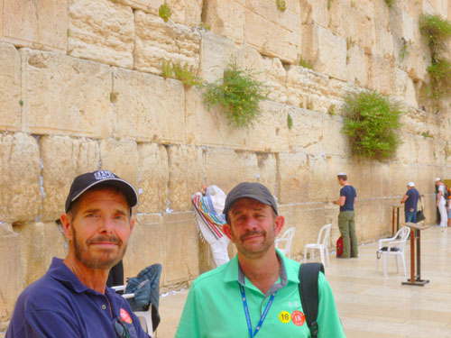
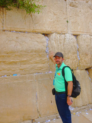
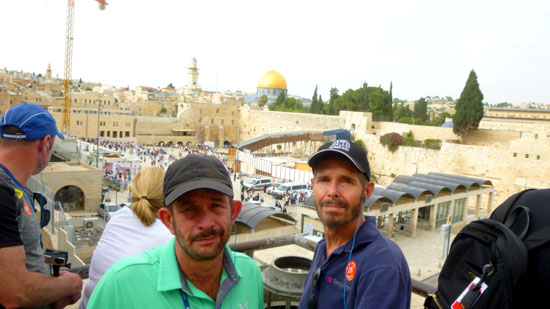
Fred and I at the Wailing Wall
|
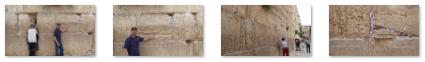
There is a much publicised practice of placing slips of paper containing written prayers into the crevices of the Wall. The earliest account of this practice comes from the 18th century, and more than a million of them are placed here each year. You can see them in just about all our close pictures of the wall:
|
Listening to our guide made me think that prayer at the wall has become, to many, a weird article of faith. Some Jewish scholars state that when you pray here, you have done so at the exact location where prayer is most efficacious. More than one high-level Rabbi has written that since the gate of heaven is near the Western Wall, prayers here will "ascend" with greater frequency. On a more humorous note, a well-known efficacious remedy for finding one's soulmate is to pray for 40 consecutive days at the Western Wall.
|
|
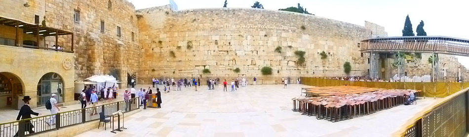
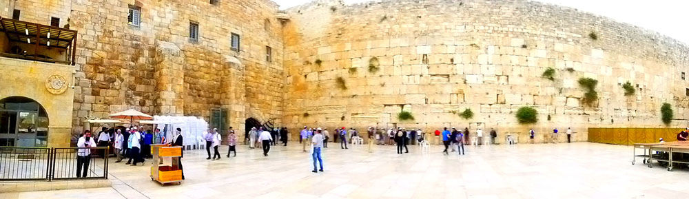
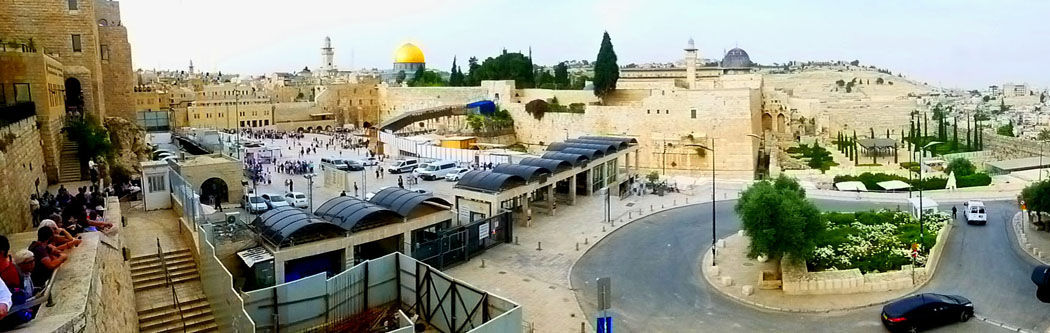
To end our visit to the Western Wall, I want to include two panoramic pictures. The first was taken near the wall:
|
And, finally, from back out in the center of the Western Wall Plaza, a 360-degree panoramic view (so large that I had to put it in a scrollable window):
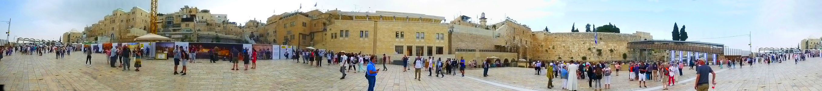 |
Leaving the Old City of Jerusalem
|
But we did head over to the stairs in our group, and we were partway up the stairs when everything seemed to slow down. I thought I would take the opportunity to snap a picture. I don't know where Greg, Steven, and John were at that moment, but I did get a nice picture of Richard, myself, Zoran, and Fred.
The line of people exiting moved ahead a bit, while for some reason the people coming down the other side (to the entrance to the plaza) seemed to have completely stopped. We reached the top of the stairs and then we, too, stopped completely. Our guide was with us, and he got on his phone to find out what the delay in exiting was. Meanwhile, we went to the edge of the stairs so we could take some pictures.
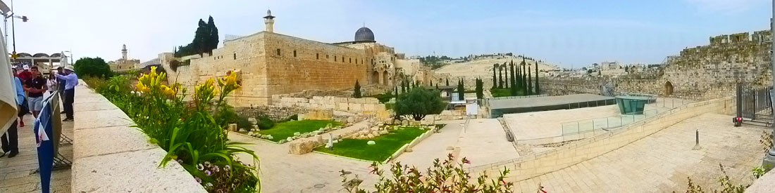
From the overlook, we could look out over the Davidson Center and the Jerusalem Archaeological Park. The center and the archaeological park are a major tourist attraction, although we wouldn't have time to stop there today. But in the center there are archaeological finds and displays from the First& Second Temple periods: the ancient city wall, the Temple�s staircase, a preserved ancient street, ritual immersion baths, and stores.
|
After we had taken a few pictures, one of us noticed a large suitcase- bright red, as I recall- that was apparently being dragged remotely across the street where you see the man in my picture. I think there was a pulley or something on one of the trees in the cluster at the right. (Actually, I think that the man crossing the street was carrying a cable that had been attached to the luggage, and he actually attached it to the pulley system.) About then, our guide told us that the security people had found the luggage abandoned on the plaza, and were going through their procedures to deal with that. The procedures, apparently, assume that there is an explosive device in the object that is found.
Somehow, when the luggage reached the trees (please don't ask me how this works) it was able to be hoisted up and then actually opened remotely (don't ask me how that works, either). As we watched, the suitcase popped open and its contents spilled out onto the sidewalk. No explosive device, apparently- just clothes was all we saw.
The finding of the suitcase was the cause of our delay. People heading to the Dung Gate need to go down along that street and to the right where the gate is. That route was closed while this was going on, and so we were held on the stairs. Entrance to the plaza at the bottom of the stairs was closed, too, to keep more people from potentially being endangered. My suspicion is that if the luggage had actually exploded, then everyone exiting the plaza would have been examined, and there's no telling how long that might have taken. But fortunately, it was much ado about nothing, but better to be safe than sorry.
One good thing about the delay was that we had plenty of time to take pictures from this vantage point, and I want to include a number of them here. First, here are a couple with Fred and I:
|
|
And here, look back the way we have come, is a panoramic view:
|
The rest of the pictures that I want to include were taken at a couple of different points. Some were taken from our lookout perch while we were waiting for the exit to be reopened, and the rest were taken just before we exited the Dung Gate.
|
|
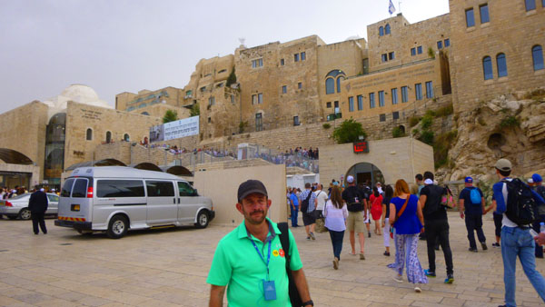
The Dung Gate was built in the 16th century, and is situated near the southeast corner of the Old City, southwest of the Temple Mount. The Dung Gate is a main passage for vehicles coming out of the Old City and for buses headed to the Western Wall. The actual 16th-century gate was much smaller; it was enlarged in 1952 and renovated in 1967. It is probably named after the residue that was taken from the Jewish Temple into the Valley of Hinnom, where it was burned. Just after I took the picture of Fred at the Dung Gate, I made one final panorama of the Temple Mount, the Archaeological Park, and the Davidson Center:
|
Returning to the Ship and Departing Israel
We had done a lot today, and when we all got back on the tour bus we were happy to settle into a comfortable seat for a while and enjoy the ride back to Ashdod- a ride that followed the same route we had taken to get here this morning.
|
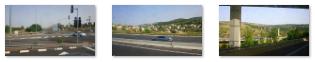
On our way back to Ashdod, most of our pictures were taken in Jerusalem and its suburbs, for it was getting dusky as we neared the port city. In this last section, I just want to include a few of the more interesting pictures that we took on the way back.
|
|
Our "all-aboard" time was 7:30, and I think we were coming through the port security gate about an hour before that. There was just time for Fred and I to board ship and hit the gym before our dinner in the Windjammer Cafe, and our time on deck to watch the ship set sail. It was dark by then, and so no pictures of the process. By nine PM, the Mariner of the Seas was headed back out into the Mediterranean and northwest for our arrival, day after tomorrow, on the Isle of Crete.
You can use the links below to continue to another photo album page.
|
May 4, 2018: A Visit to Chania on the Isle of Crete (Greece) |
|
May 1, 2018: A Transit of the Suez Canal |
|
Return to the Index for 2018 |