


 |
April 15, 2018: Cochin, India |
 |
April 9 - May 6, 2018: Aboard the Mariner of the Seas |
 |
Return to the Index for 2018 |
We will leave the ship today for an all-day shore excursion here in Phuket, Thailand. It will involve a city tour, lunch, and a boat tour of the islands along this part of the coast of Thailand.
Getting Ashore
|
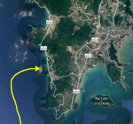
It wasn't until we'd gotten up this morning and gone up on deck that I discovered that the ship would not be docking or anchoring off the main part of the city of Phuket. Apparently, there are limited facilities there for ships to actually dock and so we, like post other cruise ships, will be anchoring off Patong Beach and tendering in to shore from there. As we were coming in to that anchorage, we passed numerous little bays, bights, and small beaches; this side of the peninsula is like a resort community for the city of Phuket. Most everything here is focused on either the tourist industry or on recreational activities for Thais.
|
Today, Fred and I are on our own for this excursion; the other guys are going to visit the giant Buddha and take a city tour. We met in the theatre and followed our group down to the tender deck to board a boat into the beach. I'll say more about the Mariner of the Seas tendering procedure on the page about the ship itself, so I don't have to repeat the process at each port. But here are a few pictures that we took on the way in to Patong Beach:
|
Just away from the side of the ship, I was able to take a panoramic picture, looking north, of the inlet here at Patong Beach:
|
Our trip in to the beach on the tender took only about ten minutes and quite soon we were tying up at the floating pier, actually right next to another tender from the MSC ship that was also anchored in the bay. We walked the few hundred feet along the pier to alight on the beach, and then we followed the guides holding numbered signs to find our tour guide.
|
You can see many of these boats and other beach scenes in some of the pictures we took as we were walking a bit north along the beach to gather at the spot where our guide was waiting:
|
Just before our guide started telling us about the tour we would take today, I took an interesting panoramic picture of all of Patong Bay, looking out to where the two cruise ships were anchored:
|
Then we stopped to find our more about today's excursion. First, we will be driving north along the coast, off the island on which Phuket is actually located, and onto the mainland to our first stop at a Buddhist Temple that is actually situated in a cave. We will continue on to a small resort area on the east side of the peninsula where we will have lunch and then board our small Thai boat for a tour of the beautiful islands on that side of the peninsula (including a stop at "James Bond Rock"). Late in the day, as we return to Patong, there will be the obligatory "shopping opportunity" at a cashew nut factory.
Wat Suwan Kuha: The Monkey Temple
Our day trip began with our guide leading us through the Patong Beach community to a parking area where our bus waited. Then we headed off on an hour-plus trip to Wat Suwan Kuha. Our ride up north was interesting for two reasons. One was that our guide kept up a running commentary about this part of Thailand- its geography and his history.
|
|
|
|
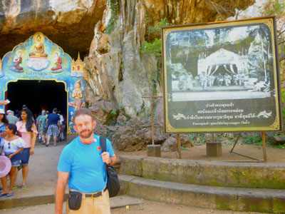 |
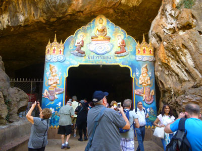 |
The decorated gate opens at the foot of a cliff 1nto a large cavern with high ceilings, about forty meters long and twenty meters wide. This natural temple shelters an impressive fifteen meters long golden reclining Buddha and several other large standing Buddha images. The whole place is also decorated with numerous religious items. Our guide said that a monk is often meditating in front the Buddha, surrounded by some lazy cats who seems to find the place spiritual enough to have a nap, but sadly we didn't see either the monk or the cats.
|
And there were indeed numerous other figures in the cave- including a row of four different Buddha figures:
|
There were some stairs next to the reclining Buddha that went up to another small grotto with some smaller Buddhas inside. And at the far end of the cave we could see a flight of stairs leading up to an open area and one of the other entrances to the cave that opened to a forest outside. Before we head up there, though, here are some more pictures of us and the items in the temple portion of the cave:
|
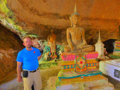
|
At the end of the cave room we found that the stairs led up to an actual cave, with formations and everything. We also found, sitting on a rock near the other cave entrance, the monk we'd been missing. Still no cats, though.
|
|
Of course we wanted to go have a look at the cave, so we climbed the stairs towards the large entrance through which we could see the forest. The actual cave was off to our left, with more stairs that led down into it and then even more up to the back of it.
|
|
When we'd finished exploring the cave we returned to the entrance to rejoin our tour group, and then we all headed back to our assigned bus. (There were, I think, five buses on this particular tour- maybe 150 people altogether.) As we pulled out of the temple parking area back to the highway, we passed some of the buildings of the actual Buddhist monastery that is located here:
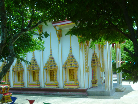 Monastery Building/Temple |
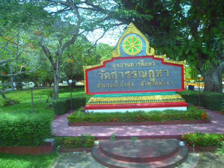 At the Temple Grounds Entrance |
Lunch at Phang-Nga Beach Resort Hotel
Back on the bus, our tour guide told us that our next stop, perhaps 30 minutes away, would be for lunch. The lunch would be provided at a hotel at a place called Phang-Nga Beach.
|
|
The towns of Phang-Nga and Phang-Nga Beach are on the eastern side of that small peninsula, up above the top of Phang Nga Bay- the body of water between the Phuket Peninsula and the Malay Peninsula. The place where we will have lunch is on an inlet that snakes north from the Bay.
|
I actually went to take a look at this hotel on TripAdvisor while I was creating this page. A surprising number of people from all over the world have visited Phang-Nga (possibly because it seems to be the starting point for a great many of the boat tours that head down to the islands in the Bay). But few of them had very nice things to say about this particular resort; the average review seemed to be something just south of "average". Now, whether they mean average for Thailand or average for all the places the reviewers have stayed, I have no idea. But I would put the hotel on par with a Super 8 or a Red Roof Inn or something like that.
But as I said, I don't think people come here to relax by the pool (yes, there was a small one) and sip tropical drinks before heading out to the night life in Phang-Nga Beach (if there is any); I think they probably come here so they have a place to stay after spending the entire day boating around the islands, as it would be a long drive to get back to Phuket or, even worse, Bangkok. We would be leaving from our own boat trip about five-thirty in the afternoon, but I would think that land tourists would want to stay longer than that.
Anyway, we were just here for lunch, and I will be happy to admit that it was a nice one- a buffet with all kinds of dishes, most of them with an Oriental influence. It was warm, but not oppressive, and the views were certainly nice while we ate. Here are some of the pictures we took during lunch:
|
|
After we'd all finished lunch and had a chance to freshen up, our guide had us gather in the lobby so we could walk next door to the boat dock where our tour boats were waiting.
Boat Tour of Phang Nga Bay
The major activity on this shore excursion was our boat tour around Phang Nga Bay, and the stops we would make at the three main "attractions" here in these beautiful islands in the Bay. First, let's take a look at the Bay in general.
|
Ao Phang Nga National Park here in Phang Nga Province in southern Thailand was created by royal decree in 1981. It includes coastal sections of the two administrative districts that include Phuket and Phang Nga. Most of the park consists of an area of the Andaman Sea (Phang Nga Bay is a part of this sea) studded with numerous limestone tower karst islands. The best known of these islands is Khao Phing Kan, popularly called "James Bond Island" because it was used as a location for the James Bond movie The Man with the Golden Gun.
The dramatic appearance of the islands with their sheer sides has made the area a popular tourist attraction. The park also protects the largest area of native mangrove forest remaining in Thailand. Sadly, James Bond wasn't good for the area. Prior to the 1974 movie, this part of Thailand, though incredibly scenic, was lightly visited- mostly by native Thais in small craft. But when the movie appeared, tourism exploded- and the increase was 99% foreign.
We aren't talking the kinds of tourist numbers that visit, say, Bangkok, but the numbers were sufficient that the increase in boat traffic, and the increase in attractions designed to entertain the tourist trade, took their toll on the fragile islands. We are going to be a part of that effect today, but at least the area is now regulated as a National Park, and tourism is controlled. For example, only a limited number of tours can actually stop at James Bond Island and let people wander around (and ours would not be one of them).
The effects of mass tourism were in large measure what prompted the King to declare the area protected, but even those protections have only been moderately successful. In an interesting move, the Fodor's Travel organization (they publish the famous guidebooks and conduct their own tours as well) placed the park on their "No List" for 2018 (canceling their own scheduled tours there), and actually suggested that tourists skip the park in order to allow it to "...recuperate from being loved to death". We, ourselves, will be on what is called a "low-impact" tour; all we will do is motor around the islands. The only place we will actually go onto an island is to visit Koh Panyee Village. The island of Koh Panyee has been developed for the better part of a century; it is the only town in the islands and has handled the local Thai tourist trade for many years. It has expanded since then to be a stopping point for today's tours, but it was specifically developed for the purpose, and can handle the numbers of people that stop here each year (which means restaurants, souvenir shops, a few small hotels, and so on).
We took a lot of pictures this afternoon, so I've organized them in the sections below.
Along the Inlet from Phang Nga Resort to the Bay
|
|
I am pretty sure that our entire busload was able to fit on one boat; I'd wondered why there were a few empty seats on the bus, so perhaps the boat capacity dictated how many were in our group. Anyway, the boat was full. As I said, I tried to get a seat up front so I could take pictures, and it turned out that our guide and the boat captain were just ahead of me on the other side of the craft.
|
|
Even here at the resort we were surrounded by the same karst cliffs that a couple of miles south form the islands at the north end of Phang Nga Bay. One could easily imagine that ten foot rise in the sea level would make this entire area a group of islands as well, and perhaps one day that will happen.
|
(Mouseover Image Above for Video Controls) |
Fred took a couple of other good pictures as we were motoring south from "civilization" and down to the Bay:
|
Riding down to the Bay, we passed a couple of miles of these karst formations. They were unlike much we have seen before, being so small and concentrated and so numerous. I don't pretend to understand how these pinnacles formed, but it has something to do with differences in the rocks in the area. Karst is a topography formed from the dissolution of soluble rocks such as limestone, dolomite, and gypsum. It is characterized by underground drainage systems with sinkholes and caves (like the cave temple we just visited and the sea cave we will visit later). Karst formations can also occur in more weathering-resistant rocks, such as quartzite, given the right conditions.
|
Whatever the mechanism that created these formations, even here along the inlet they were pretty interesting:
|
The study of karst is considered of prime importance in petroleum geology since as much as 50% of the world's hydrocarbon reserves are hosted in porous karst systems and, as we know, Indonesia and the southern end of the Malay Peninsula have proven oil reserves.
In addition to offering us views of the karst formations, our boat driver was able to get us fairly close to some of the cliffs so we could see the coloring and also formations hanging off the cliffs that looked like stalagtites, or the calcium formations that form on undersea shipwrecks. You'll see lots more of these later.
|
|
Koh Panyee Village
|
Being on stilts provided easy access for the fishermen, and the small settlement prospered. The community slowly became wealthier, but it wasn't until tourism came to the area and to Thailand. The law was eventually changed, allowing the descendants of the original fishermen to buy actual land on the island. They did so, and the first structures of relevance (i.e., not on stilts) were built; those first two structures were a mosque for the island and a freshwater well.
You can see in these pictures how Koh Panyee is situated on the island- right in the shelter of the tall karst monolith that is the northern point of the island:
|
On our tour, we actually motored past Koh Panyee on our way down to James Bond Island, and then we stopped here on the way back for a "shopping opportunity" and pit stop. But, as I said above, I want to go ahead and put all our pictures from here in this single section. It was tough to get the whole town into a single picture, but we were just far enough away on the way down that Fred was able to do a pretty good job:
|
The village has a Muslim school which is attended by both girls and boys in the mornings. Due to the informal nature of this education, many of the boys attend schools further in Phang Nga or in Phuket. Emigration from the village is actually encouraged as the size of the settlement is restricted by both the small amount of available land as well as dangerous water conditions in the rainy season.
|
Interestingly, the village includes a floating soccer field. The original floating field was actually built by the island's children; they used old scraps of wood and discarded fishing rafts. The boys (Thailand has no Title IX, apparently) formed a team to compete in the Southern Thai School Championships. The island team made it to the semi-finals, and that spurred two things: first, many people on the island took up the sport, and, second, a brand new field was built (this one on more permanent stilts). The wooden one still remains as it is popular among tourists. The local team has an impressive record, having won the South Thailand Youth Soccer Championship eleven times since 2004. (And the original floating field is so iconic that it was the pit stop for Leg 4 of season 19 of the American reality competition show The Amazing Race.
We slowed down as was passed Koh Panyee the first time, but even though we were moving, we were able to get some good pictures of the settlement, which is now a fair-sized town.
|
Passing by Koh Panyee on our way south, we got an excellent view of the long string of little islands that extend all the way south ahead of us out into Phang Nga Bay. I know there are islands like these off the coast of China, but I have only seen them in film. Until and unless we get a chance to visit them, these will have to do:
|
Later in the afternoon, after we'd toured James Bond Island and some of the other islands south of Koh Panyee, we returned to Koh Panyee Island to go ashore. The ostensible reason for stopping was so folks could use the facilities, but I think that a "shopping opportunity" was also on the agenda.
|
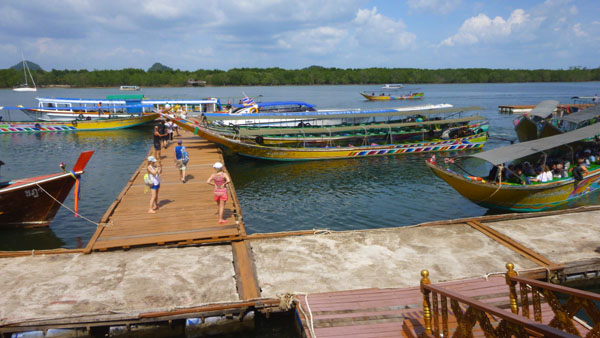
Getting off the boat and walking in from the end of the dock, we passed a number of traditioanl Thai boats, all of which seemed to be decorated with flowers on their prows. I have no idea whether this is something that is always done or whether, more likely, it is done only on the boats that locals are intending to give tourists rides on (I suspect the latter), but the decorations were pretty neat.
|
(Mouseover Image Above for Video Controls) |
Along the dock there were quite a few of the traditional Thai boats, with the backdrop of Koh Panyee Island. The dock area was pretty neat, and both Fred and I took pictures of the dock, the boats parked there, and the incredible town all built on stilts. Here are some of those pictures:
|
In the late-20th century, the community found it difficult to subsist solely on the fishing industry and the village leader proposed to invite tourists to the village to benefit the residents. Good move. Today, Koh Panyee is one of the main attractions on tours of Phang Nga Bay from Phuket, often serving as a lunch stop. With the increasing number of tourists, a number of seafood restaurants are present on the island, as well as various stalls selling souvenirs. In addition, their legendary football team's old field serves as a major attraction.
|
|
So what did we actually see in the town? Nothing, as it turned out. Our guide led us through the congested shops towards what I thought should be the town itself, but it got so congested and it was so warm that I, for one, was getting a little claustrophobic, so Fred and I decided to just hang out back by the dock for thirty minutes until the rest of the group returned and we filed back onto the boat for our return to Phang Nga Beach.
James Bond Island
|
|
Our tour boat continued south for a ways, and soon we came to an island comprised of three peaks- two of them connected by a beach and the third a freestanding pillar nearby. Khao Phing Kan is the name of the island with two peaks, and two peaks are typical limestone tower karsts. About a hundred feet from the shore of Phao Phing Kan is the 66-foot-tall islet called Ko Ta Pu. But no one uses these names anymore- at least not since 1974.
|
(Mouseover Image Above for Video Controls) |
Khao Phing Kan means "hills leaning against each other" in Thai, reflecting the connected nature of the islands. Ko Ta Pu can be literally translated as "nail" or "spike" island, reflecting its shape. After appearing in the 1974 James Bond movie The Man with the Golden Gun, however, Khao Phing Kan and sometimes Ko Ta Pu became widely referred to as James Bond Island, especially in tourist guides, and their original names are rarely used by locals.
Surely, the spike island is unusual. Not only is it tall and thin, but the sea has eroded the island at its base, and now it flares outward as it rises, making it look as if it is likely to fall over at any moment.
Having watched that clip, you are probably now familiar with the geography of both the island and the spike. Bond made a nice fly-through of the center of the island, and then he beached his seaplane on the side of the island where the spike island is. When we arrived at James Bond Island, we came at it from the other side- the side without the spike.
|
From this side of the island, we could actually look through the space between the two peaks and see Ko Ta Pu Island on the other side. But we would get around there presently. While we are on this side of the main island, here are some more views of the busy tourist activity on this side:
|
From the first side of the island, we could see the two tall monoliths and the beach between them. Well, we couldn't really see the beach very well, as there were so many boats and tourists around.
|
|
|
(Mouseover Image Above for Video Controls) |
Looking the other way from the island, there were lots of tourist boats scattered around, and also some traditional Thai longboats (although I am not at all sure if these longboats weren't actually built to appear traditional. And, as always, there were a multitude of little islands acting as a constant backdrop:
|
Now our own tour boat started moving around to the other side of James Bond Island. I made two movies as we went around, and you can use the players below to watch them. In the second one, the "spike" island comes into view.
|
(Mouseover Image Above for Video Controls) |
(Mouseover Image Above for Video Controls) |
Khao Phing Kan consists of two islands connected by a low beach. The western island is about 800 feet by 400 feet and has a relatively flat top. The eastern island is a fairly circular karst monolith about 400 feet in diameter. Both islands have a few caves and some small sandy beaches. There's a little government office on the larger island where every visitor has to pay a tax. The beaches and caves are regularly flooded with the tides, although the connecting beach usually stays above water. Waters around the island are only six feet deep and are pale-green in colour. The bottom is covered with silt, brought to the Phang Nga Bay by several rivers from the north.
|
In addition to appearing in the earlier movie clip as part of Red China, Ko Ta Pu also appeared in another Bond film, Tomorrow Never Dies in which it is in Vietnam, and in an Italian film, where it is in the Philippines. That island certainly gets around!
We didn't get as close to the island from this side as I would have liked, and we certainly didn't land on the beach, but Fred and I did get some good pictures of the island formations:
|
James Bond Island was pretty interesting when we were there, but investigating how it has been used in popular culture added a new dimension. And knowing that before it appeared in a movie the island was pretty much deserted brought to mind the Eagles' famous song "The Last Resort" in which the last line is "Call someplace Paradise, kiss it goodbye".
Thalu Mountain Sea Cave
|
|
There is an outfitter here that rents these kayaks, but the outfitter is not on the island itself; the sides of the peaks are much too steep for that. Our guide told us that all the kayaks we saw are brought here from a base on the mainland a couple of miles away, towed in a huge flotilla. Then, the various tour companies bring their clients here on larger passenger boats so they can transfer to one of the small kayaks and spend their time paddling around.
Now, if all they were going to do was to paddle around and look at the bases of these peaks. These are interesting, for there are excellent examples here of the limestone formations that look like stalagtites that you would see in a cave, save that these are actually hanging off the sides of the cliffs that form the sides of most of the islands here.
|
|
But the big attraction on Ko Thalu Ok is the actual sea cave (more of a natural tunnel or bridge) that has been worn right through the mountain, allowing kayakers to go from one side of the mountain to the other.
|
It might be overkill, as Fred's picture was so good, to show you any more, but in case you are interested, here's a selection:
|
This sea tunnel was the last stop on our boat tour (although you might recall that the actual last stop was at Koh Panyee, and the pictures from there are in a section above). The rest of our boat ride was to head north back up the estuary to Phang Nga Beach. On the way, we of course passed island after island, so lots more pictures aren't going to add any more to this narrative (even though the pair in that last picture were pretty because our boat went to the west of them, allowing the sun to illuminate them a lot better).
|
|
(Mouseover Image Above for Video Controls) |
We got back to the resort in Phang Nga Beach, made another pit stop, and then reboarded our bus for the ride back to Patong Beach.
Our Return to the Mariner of the Seas
The ride back to Patong Beach and the cruise ship tenders was uneventful, and we passed the same sights that we'd seen on the way up, with just a couple of exceptions.
|

The one new thing we did on the way back was to fulfill the dictum that almost every shore excursion encompasses a "shopping opportunity" (as do many land tours, like our Seoul city tour; remember the Ginseng store?).
|
|
As we came back into town, we passed one of the three or four mosques that we saw during the day. As we neared the beach, I realized that I had not seen a gas station anywhere in Phuket (although I think I did see one or two out in the countryside). As if she was reading my mind, our tour guide mentioned the same thing, saying that we had passed quite a few of them without noticing. When she explained what we were looking at, I began to see them everywhere, and just before we got to our drop-off point I took a picture of one of these gas stations. Did you spot it? For a number of reasons, stations like those we are familiar with are quite rare. There aren't that many autos; most people ride around on scooters. And the autos that there are don't go very far and are quite small, so they don't need all that much gasoline. So what happens is that gas is decanted into one- or two-liter bottles and those bottles are available all around town. So a rack of bottles is a gas station, and it only takes up a couple of square feet. So if you didn't spot the "gas station", click here and I'll highlight it for you.
|
(Mouseover Image Above for Video Controls) |
|
Arriving back on board brought our visit to Phuket, Thailand, to a close. I hope you will want to come along with us on our next shore excursion in India, or take a look at some of the pictures and movies we took aboard ship.
You can use the links below to continue to another photo album page.
 |
April 15, 2018: Cochin, India |
 |
April 9 - May 6, 2018: Aboard the Mariner of the Seas |
 |
Return to the Index for 2018 |