


 |
April 6, 2018: Seoul City Tour and Gyeongbokgung Palace |
 |
April 3, 2018: Traveling to Seoul |
 |
Return to the Index for Our Visit to Seoul |
Today we slept in just a bit to recover from our long day yesterday. Our major outing for the day will be a tour we have arranged to the DMZ. We'll be picked up at the hotel at 10:30 this morning, and so we had time to go out for a morning walk in the neighborhood near the hotel. On that walk, we discovered the Mahabodhi Temple.
The Mahabodhi Temple/Morning Walk
About 8 in the morning we went out for a walk to scope out the neighborhood around the Ibis hotel. We hung a left out the front door and walked down the narrow street on which the hotel is located. After a few blocks, we came to a larger street running, if my internal compass hasn't failed me, north-south- Donhwamun.
|
|
Near the corner of Donhwamun Street and Samil-daero (the street the Ibis was on) there was a little grocery, and I made a mental note to stop here later and pick up some snacks to take back to the hotel. Continuing south, we noticed that off to our left seemed to be a large park, and between us an it we noticed an intricately-decorated classic Japanese temple structure, so we walked over to have a look.
|
|
In 1912, Zen Master Yong Sung met Mr. Kim Gu, age 32. Seven years later Kim Gu was imprisoned for his active participation in the Independence Movement. He escaped from prison and later became an ordained Buddhist monk at Magoksa, where he practiced for three years before he became a layman.
Kim Gu stayed at Daegaksa whenever he was in Seoul. Having been greatly influenced by the Zen Master Yong Sung, Kim Gu decided to dedicate his life to the independence of Korea. When Kim Gu was exiled to Shanghai for his activities, Zen Master Yong Sung provided the funds to support his activities.
On March 1, 1919, the 33 representatives of the Independence Movement, including Zen Master Yong Sung, declared Korea's independence at Tapgol Park. He was imprisoned for two years as a result.
|
Zen Master Yong Sung passed away on February 24, 1940, at Mahabodhi-sa. His relics (Sari) are preserved in Haein-sa. Mahabodhi-sa is a Mecca of Buddhist teaching and March 1 Independence Movement.
There was some confusion in our minds as we wandered around the outside of these brightly-decorated structures. Another sign near the entrance identified this as the Daegaksa Temple, but I think it and Mahabodhi Temple are one and the same. The second sign said that Yong Sung established the temple with the goal of propagating the teachings of Supreme Enlightenment (Daegak).
A new main prayer hall, Daegakseongjeon Hall, and a monk's dormitory were built in 1930, and the complex changed its name to "Seonjong Chongnim of Korean Buddhism" in 1939 and to the "Capital Mission Center (Gyeongseong Pogyodang)" and "Supreme Enlightenment Seon Center (Daegak Seonwon)" in 1944. The temple was the venue of the ceremony celebrating the homecoming of the members of the Korean Provisional Government, including President Kim Gu, held on December 12, 1945.
|

(Click on Thumbnails to View) |
From the temple, we just continued wandering the side streets in the light misty rain, eventually winding up at the next major intersection on Donhwamun south of our hotel. At that intersection, there was a subway station, so, not for the first time in these few days in Seoul, we went down to see what it was like. There there was, of course, the obligatory subway map, and as you can see the system is pretty extensive. Seoul had no subway when I was here, but then in 50 years you can build quite a bit. Not for the first time, we noted the sometimes weird advertising posters, including this one featuring a naked Bart Simpson. We wandered back to the hotel via a different route, taking our first walk through the rabbit warren of little shops, restaurants, and residences that we could see from our hotel window.
|

(Click on Thumbnails to View) |
We were back at the hotel by 9:30, with plenty of time to get ready for our pickup for the DMZ tour.
Our Tour to the Demilitarized Zone (DMZ)
There were two problems with today's tour to the DMZ- one caused by Mother Nature and the other a result of my mistake. Mother Nature conspired to make today cold and rainy. This meant that it was unpleasant walking around on the tour, and we had to have umbrellas close at hand. It also meant that the pictures were not very good, as it was totally overcast and at times quite dark. The other problem really wasn't the fault of the tour; it was my mistake in confusing "DMZ" with "JSA". I did not realize until our tour got underway from Seoul and our guide started her explanations that I'd made a mistake.
The "DMZ" (DeMilitarized Zone) is that area, about two miles wide, that straddles the border between North Korea and South Korea. While the North and South own their parts of it, by treaty they may not bring troops or equipment into it (save for what is allowed in the treaty itself). The "JSA" (Joint Security Area), on the other hand, refers to a specific compound within the DMZ at its western end where representatives of the North, the South, and the United Nations, hold their meetings and negotiations. It was the JSA that I actually wanted to visit again, having been their a couple of times during my 13 months incountry in 1969-1070, and that was the location I wanted Fred to see, too. I can show you what I wanted Fred to see by including here a couple of the pictures I took (or had taken) on one of my visits to the JSA back in 1970:
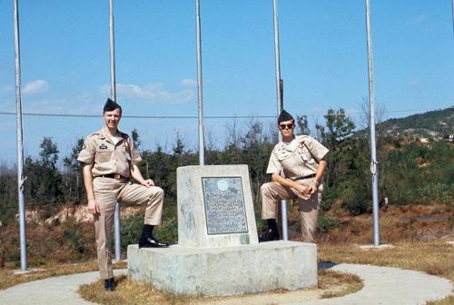 SP4 Chapman and I in the JSA |
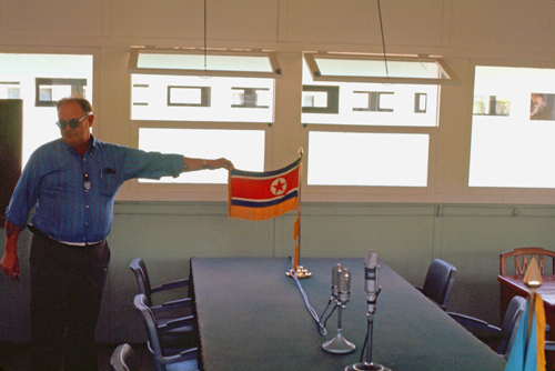 Conference Room and North Korean Flag |
My mistake was that when I was booking tours online, I neglected to ensure that the tour actually went to the JSA; very few tours do, because I understand that now there are advance booking and information disclosure requirements for tourists who wish to visit. The tour I booked didn't specify a visit to the JSA, so what we got was just a tour of some sites south of the DMZ itself.
The Trip to Imjingak Park
|
The "DMZ" is that area, about two miles wide, that straddles the border between North Korea and South Korea. By treaty, it is "demilitarized", which is to say that neither side is allowed to bring military equipment or soldiers into the area- except for a certain number of guards and a certain number of small arms for either side.
North and South Korean civilians are not allowed in the DMZ, save for the residents of two small villages inhabited by the direct descendants of people who owned the land before the Korean War. Tourists, certainly, are not allowed to roam around unescorted; even official visitors are tightly monitored. The Military Demarcation Line (MDL) runs through the middle of the DMZ; it represents the actual border between North and South, and was the "front" when the Armistice was signed. On our tour we'd be able to look out across the DMZ, but we would never actually enter it.
One of the things I thought I might be able to do on this trip was to visit Camp Howze, where I was stationed 50 years ago. Some investigation over the last six months, however, including contact with a couple of my fellow soldiers, revealed that the base was closed in the early 1980s and, in the years since, has been replaced with industrial development. Apparently, even the entrance marker for Camp Howze has been removed. So there was nothing to see. On our ride up, though, I knew we would pass fairly close to the camp's former site atop a low hill, and I think I may have spotted it, but sadly I can't be sure.
So, our van headed west and then north out of Seoul on the way to Paju-ri. It was raining and overcast, and so most of the pictures we took from the van (whose windows kept fogging up) did not turn out well. For example, this view of one of Seoul's downtown avenues would have been beautiful with a blue sky and a clear window. Even so, a few of the pictures we took on the way were good enough to include here.
|
|
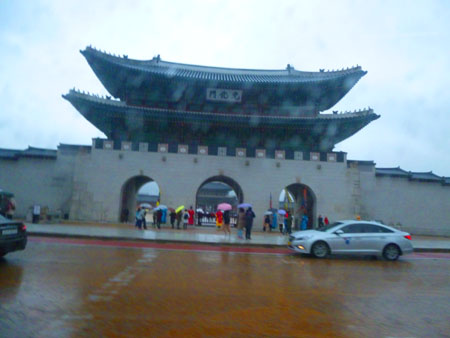 Gwanghwamun Gate of Gyeongbokgung Palace |
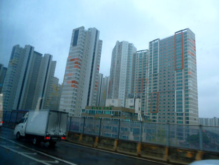 Housing Blocks in New Seoul |
It took about an hour to get about 40 miles northwest, but eventually our van pulled into Imjingak Park- our first stop on our DMZ Tour.
|
Our first stop will be at the Imjingak Peace Park. Here, we will get our entry documents for the other stops we will make. We'll also have a chance to go in the Visitor Center and look at the exhibits, as well as wander around and look at some of the monuments and memorials that are there.
As it turns out, the other stops can only be reached via official transportation; private tour buses and cars (like ours) aren't allowed to roam around the area. So the other reason for stopping here is for our tour group to aggregate with other tours and board the official buses.
The next stop will be the Dora Observatory, essentially an overlook from which you can look out across the actual DMZ and see North Korea a couple of miles away.
Third will be our visit to the tourist complex surrounding the "Third Infiltration Tunnel", one of the many surreptitious tunnels dug by the North to provide access for agents and provacateurs to get into the South.
Lastly, our tour bus will stop at the Dorasan Station, the northernmost railway station within South Korea on the rail line that actually links Seoul and Pyongyang in North Korea. It is thought that one day it might be possible to take a train from Pusan on South Korea's southeastern tip all the way to Edinburgh in Scotland. At the moment, passage through North Korea is not possible, and the two railway lines that cross Asia (one in Russia and one in China) are too tightly-controlled to make such a trip feasible for the average person.
Imjingak Park
|
We found a couple of buildings that we could go into and look around. One was the park building for "DMZ Now", which turned out to be a museum about the JSA and the DMZ. We found inside that this was also a check-in point for people who were actually going to visit the JSA, and the departure point for the special buses that take visitors there. I understand that there is a corresponding building at the JSA itself. Apparently, there is great effort made to ensure that no one who is not authorized (an official or the member of an authorized tour) can get to the JSA itself; violent events there over the years have made everyone cautious.
Inside the park's Visitor Center, we were able to get out of the cold for a bit before we went out to walk around and see some of the monuments and other sights here in the park. I did notice that there was a map on the wall that indicated the locations of some of the historic or cultural sights in this area between Seoul and the DMZ. I was struck by a couple of the pictures because they looked so familiar to me. After looking through my slides from my time in Korea, I did find pictures of both those locations:
|
|
|
|
|
Imjingak is where the "Bridge of Freedom" lies. The Freedom bridge does actually cross the Imjin river, and was a former railroad bridge. It is famous in that it was the route usually followed by repatriated POWs/soldiers returning from the North. When we'd warmed up a bit, we went out to walk around the area and look at the various monuments and exhibits.
|
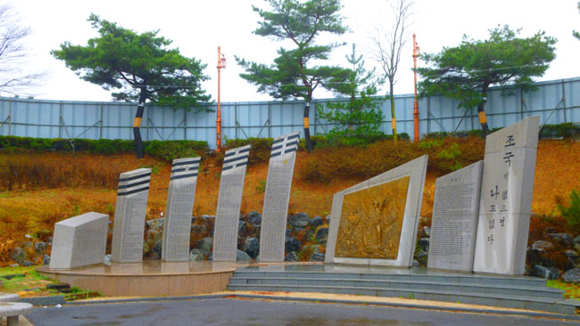
Out in front of the Visitor Center is a huge parking area; I suppose that in spring, summer, fall this park is very crowded (as the weather will be much better). But you can see how cold it is; we did not pack for this weather, since our upcoming cruise will traverse very warm areas. In the distance, across the parking area, Fred was able to get a view of the largest outdoor sculpture here- one symbolizing the suffering of the Korean people before, during, and after the conflict:
|
|
Most of the monuments were up a small hill behind the Visitor Center, so that's where we went next.
|
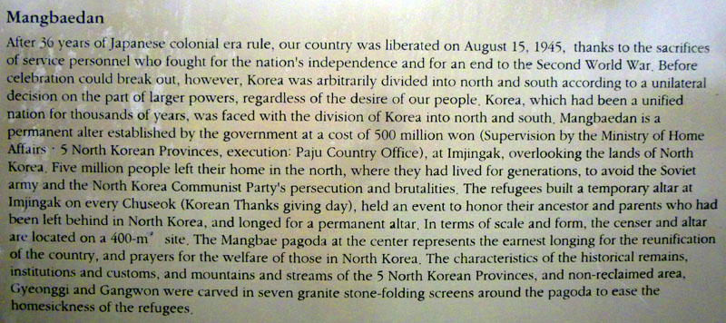 |
Back up behind the Visitor Center there was a large observation building. Our guide had told us that we would be stopping at a different observation point- the Dora Observatory- and so if we spent much time in the building here we would be duplicating what we would see later on. It was also very misty just now, so we thought that the views would not be that good anyway, so we continued around the area outside.
|
|
There was also music quietly playing, and at first I thought it was someone's phone or something, but then I realized it was coming from behind the monument. Then I noticed a sign on the other side of the monument but when I went over to read it, it turned out not to be about the monument, but about the song that was playing. I took a picture of the plaque, and the English portion is at right.
Before we continue on to the next thing we saw here at Imjingak Park, I think it might be helpful to show you an aerial view of the park area. Perhaps I might have done this earlier, but better late than never.
|
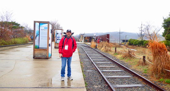
The explanatory towers behind me told the story of the intentional destruction, by UN forces, of the rail line leading to North Korea. This was done to ensure that the line was not used by the North to bring troops and equipment south in a possible invasion. There was an engine here at the time of the destruction, and it was the last train out from what is now the DMZ down to Seoul, and it carried persons who were fleeing the conflict's front line.
In the aerial view, you can see that the only part of that original rail line left past this point are the pylons in the Imjin River that had supported the rail bridge. South of those pylons, and indeed south of Imjingak Park, you can see the new rail line that leads to Dorasan Station and, many hope, one day to Pyongyang and beyond.
|
|
That sentiment was written January 1, 2000, by Chang-Yuel Lim, Governor of Kyonggi Province.
We finished up outside just as it was time to head back down to the Visitor Center to board our bus for the 1PM departure to the other sites on our tour.
Dora Observatory
|
From here, we were able to look directly across the DMZ and into the reclusive North Korean state through the provided binoculars on the 300-square-foot observation platform.
Today was cloudy, overcast, and misty, so the views were not that great. But we were looking at the North Korean propaganda village situated in the DMZ, a remnant of the old prosperity of the North. Had the day been clear, the signs said, we would have been able to see as far as the North Korean city of Kaesong. (Pyongyang is 125 miles away, and so not visible from here- no matter what kind of binoculars you have.)
In this picture of the observatory building (complete with fake cut-out soldier out front) you can just barely see the patio at the extreme left.
Inside the observatory itself, we found some small exhibits, an auditorium space where presentations and lectures are presumably held, and also a model of the area covered by the views from the observatory platform.
|

(Click on Thumbnails to View) |
After our short stop at the observatory, we were back on the bus for another couple of miles north and east to the Third Infiltration Tunnel.
The Third Infiltration Tunnel
|
The total length of the incomplete tunnel is about a mile, with an interior height averaging about six feet and width about six and a half feet. It runs through bedrock about 250 feet below ground.
It was, apparently, designed for a surprise attack on Seoul from North Korea, and could, according to visitor information in the tunnel, have accommodated 30,000 men per hour along with light weaponry.
Upon discovery of the third tunnel, the United Nations Command accused North Korea of threatening the 1953 Korean Armistice Agreement signed at the end of the Korean War. Its description as a "tunnel of aggression" was given by South Korea, who considered it an act of aggression on the part of North Korea.
Outside the Visitor Center stands a statue entitled "This One Earth". It is one of a number of pro-unification artworks and sculptures found on both sides of the DMZ. The split earth indicates the sadness of a country torn in two. Here men, women and children on either side of the divide attempt to push the earth back together, in a symbol of peace and forgiveness.
Inside the Visitor Center, there was an exhibit area at the front, and a museum between that and the actual entrance to the tunnels. You could carry your cameras and take pictures in the museum and exhibit areas, but photography in the tunnel (in fact, carrying anything at all except water into it) was not allowed, so you had to use one of the available lockers to store what you'd brought with you.
|
 (Click on Thumbnails to View) |
One interesting exhibit was a diagram of the Third Tunnel, and I thought you might like to see it:
 |
Initially, North Korea denied building the tunnel. North Korea then declared it part of a coal mine, the tunnel having been blackened by construction explosions. Signs in the tunnel claim that there is no geological likelihood of coal being in the area. The walls of the tunnel where we went were observably granite, not the sedimentary stone where coal would be found.
|
Even though the tunnel is now a tourist site, it is still well-guarded, and there were five or six soldier/guards along the way down to the tunnel and in the tunnel itself.
There are actually two ways down to the tunnel. One is via the long steep incline that starts in the, while the other is via a rubber-tired little train. There is only one set of rails, and the train leaves from a different building some distance away across the parking area. The train has a driver who switches between the ends of the train depending on whether it is going up or down. The train can carry about fifteen people at a time, but for some reason it was not operating today. Fortunately, no one in our group looked as if they would absolutely have to have it.
As I said, I couldn't take my camera, so a very general description will have to do. The tunnel itself had a planked wood floor, and even someone my height (five foot nine) usually had to stoop just a bit- especially when passing someone going the other direction. The walls were rough, with lights strung along up on the ceiling. The South Koreans have blocked the actual Military Demarcation Line in the tunnel with three concrete barricades. We could go only as far as the first barricade, where we could see the second through a window. The third is right at the demarcation line, but we couldn't see that one at all.
|
When everyone in our party had returned from the tunnel, our guide called the bus to come pick us up, and we were off to Dorasan Station.
Dorasan Station
|
On December 11, 2007, freight trains began traveling north past Dorasan Station into North Korea, taking materials to the Kaesong Industrial Region, and returning with finished goods. It was scheduled to make one 10-mile trip every weekday.
On December 1, 2008, however, the North Korean government closed the border crossing after accusing South Korea of a confrontational policy. This coincided with the South Korean legislative election, 2008, and a change to a more conservative government. After that it was opened and closed again repeatedly, with the most recent reopening having been on 16 September 2013.
The station is currently served by four daily trains from Seoul, which are used mostly by tourists, but the importance of Dorasan Station is not as a transportation hub (only a hundred or so passengers a day use the station)- its importance is symbolic. Following the June 15, 2000, South-North Joint Declaration made by the two Koreas, both agreed to connect the Gyeongui Railroad Line. Under military control, the barbed wire and mines were removed, and Dorasan Station was opened. The South and North actually connected the railroad line in 2003 at the Military Demarcation Line in the DMZ. The roof of the building shows a figure of clasped hands as an expression of sincee wishes that it would play a decisive role in linking South and North Korea. Let's go in and have a look around.
|
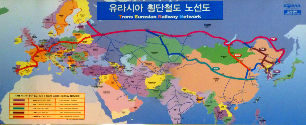
But even more than that, many South Koreans see the Dorasan station not as the last station from the South but the first station towards the North. Looking towards the future, South Koreans (and perhaps some in the North as well) think that when the "Trans Korean Railway" extends to and connects with both the Trans Siberian Railway and the Trans Chinese Railway, then South Korea (and, if reunification has occurred) the North will emerge as the distribution hub of Northeast Asia, with Dorasan Station as the gateway towards Eurasia. In this grand plan, Koreans envision being able to travel by train from Pusan in the south all the way to either Portugal or Edinburgh.
Outside, on a huge billboard, there was a map of what the future stations will be like in the area around Dorasan. I found it interesting and took the best picture I could. To make it large enough for you to read, I had to put it in a scrollable window:
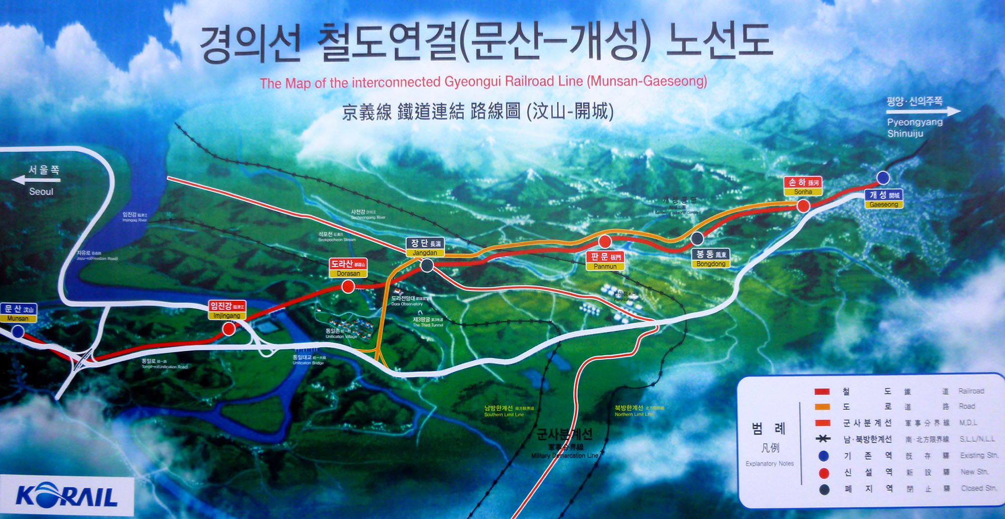 |
And inside was a diagram of how it is envisioned that the connections between the European, Russian, Chinese, and Korean railways might look:
 |
The inside of Dorasan Station was a little eerie. The reason was that here was this fairly new, spacious railway station and there were no travellers to speak of- no commuters, no groups of daytrippers, no people heading into town to shop, or returning with their packages. There were no trains either, just empty track in both directions (certainly empty to the North). That's what I mean about being eerie.
|
There were lots of interesting signs around, and a large sculptural work over along one side of the main hall. We took quite a few pictures here in the station, but there were a lot of duplicates. Here are the best of the remainder:

(Click on Thumbnails to View) |
Dorasan Station was the last stop on our DMZ Tour, so this time the bus took us back to Imjingak Park where the thirty or so people on our tour bus split back up into their individual tours. We got back in our small van and headed back into Seoul. We were dropped off downtown in the late afternoon, and we negotiated the subway system to get back to Insadong- to the same station we'd visited this morning.
Dinner in Insadong
We'd seen lots of restaurants of all kinds in the area around our hotel, but the only thing we knew was that we wanted a typical Korean meal. So we picked a small Korean cafe right across the street from the Ibis.
|
My other experience was my visits to the home of a professor at the local university. These visits, arranged through the Army Civil Affairs office, paired up soldiers with a local family as kind of a cultural exchange. The soldier got to see how typical Koreans lived (although a university professor was pretty high up on the food chain), and the Korean family got to learn more about us and practice their English. At those dinners, one would typically sit cross-legged around a large circular table, sampling tens of little dishes that had been prepared. Perhaps you've done something similar in an upscale Oriental restaurant or sushi bar.
This cafe was like those dinners. We ordered one or two of the entrees from the menu (which, thankfully, had pictures), and then in addition to the entree we were served perhaps eight different side dishes and a soup. The side dishes included kimchi, although I thought the kimchi they served was much more tame than what I'd sampled 45 years ago.
In any event, the food was uniformly delicious, and the cost quite reasonable- so much so (delicious and reasonable) that we would return here tomorrow night as well, figuring that we couldn't do much better but might do worse. The only thing we found that typically isn't done is sharing a single entree. This practice is, apparently, not done in most restaurants, although the entrees and noodle bowls were large enough that one might want to do so.
And, perhaps because we were obvious Westerners, we were given forks; I had to ask for chopsticks. (I noticed the next night that we were seated right next to a group of Koreans, and that they were also given forks, so maybe the practice of using chopsticks is a dying art.)
|
Korean cuisine is largely based on rice, vegetables, and meats (although Korean meals are much less "meat-centric" than ours are). Traditional Korean meals are named for the number of side dishes that accompany steam-cooked short-grain rice. Kimchi is served at nearly every meal. Commonly used ingredients include sesame oil, doenjang (fermented bean paste), soy sauce, salt, garlic, ginger, pepper flakes, gochujang (fermented red chili paste) and cabbage.
Ingredients and dishes vary by province. So what do Koreans actually eat? Well, the short answer is that nowadays, what with the homogenization of food production and shipment worldwide, they eat pretty much what we do, although there are differences and oddities. Grains are important in the Korean diet, although rice was not widely cultivated until about the year 1200. Prior to that, it was imported and prohibitively expensive. Today, it's a cheap staple; Koreans eat very little brown rice- almost always white.
Legumes have been eaten from the earliest times, soybeans predate rice, and are widely used in cooking today. Mung beans and azuki beans are also widely used. Condiments are divided into fermented and nonfermented variants. Fermented condiments include ganjang, doenjang, gochujang and vinegars. Nonfermented condiments or spices include red pepper, black pepper, cordifolia, mustard, chinensis, garlic, onion, ginger, leek, and scallion (spring onion).
Meat has always played an important role in Korean cooking. Beef is the most prized of all, because cattle held an important cultural role in the Korean home. Beef was not widely-consumed until the second half of the 20th century; it is prepared in numerous ways today, including roasting, grilling (bulgogi was always one of my favorite Korean dishes) or boiling in soups. Chicken is also important, evidenced by a number of myths. One myth tells of the birth of Kim Alji, founder of the Kim family of Gyeongju (one of Korea's most prominent) being announced by the cry of a white chicken. Given that a clan's founder's birth is always announced by an animal with preternatural qualities, chicken became instantly popular. Other meats, such a pork and fish, are also Korean staples.
Finally, Korean cuisine uses a wide variety of vegetables, which are often served uncooked, either in salads or pickles, as well as cooked in various stews, stir-fried dishes, and other hot dishes. Commonly used vegetables include Korean radish, napa cabbage, cucumber, potato, sweet potato, spinach, bean sprouts, scallions, garlic, chili peppers, seaweed, zucchini, and mushrooms.
|
I saw other traditions in action when I ate with the professor. The eldest male at the table was always served first, and the women traditionally ate separately elsewhere- save for the eldest woman in the family and the youngsters. It used to be that the eldest ate before the youngest, but now that tradition means only that the adults serve themselves before the young. Koreans used to eat quietly, but now that most families do dine together, they use the time to converse. One tradition still adhered to is that the younger members of the table should not pick up their chopsticks or start eating before the elders of the table or guests have done so, and they should not finish eating before the elders or guests. (I guess that "Can I go play X-Box?" is not usually heard when Korean families eat together!
In Korea, unlike in China, Japan and Vietnam, the rice or soup bowl is not lifted from the table when eating from it. This is due to the fact that each diner is given a metal spoon along with the chopsticks known collectively as sujeo. The use of the spoon for eating rice and soups is expected. There are rules which reflect the decorum of sharing communal side dishes; rules include not picking through the dishes for certain items while leaving others, and the spoon used should be clean, because usually diners put their spoons in the same serving bowl on the table.
I suppose, however, that almost all these rules (and many others) are now thought quaint, because the groups of people we saw in the cafe with us seemed to adhere to none of them. But I suppose it's like Emily Post or Amy Vanderbilt- their guidelines are fun to read about but rarely, except in high society, honored totally.
All that said, we had a great meal. This was the end of our first full day in Seoul, and we were looking forward to our city tour tomorrow- and some better weather we hope!
You can use the links below to continue to another photo album page.
 |
April 6, 2018: Seoul City Tour and Gyeongbokgung Palace |
 |
April 3, 2018: Traveling to Seoul |
 |
Return to the Index for Our Visit to Seoul |