|
July 11, 1970: A Further Tour of Camp Howze |
|
June 28, 1970: A Tour of Camp Howze |
|
Return to the Index for 1970 |
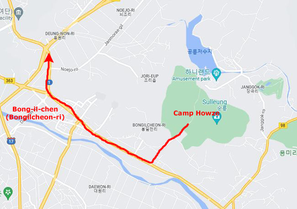
Last Sunday, I took you on a tour around the inside of Camp Howze, to show you where I work and where I spend my time. Today, I want to head outside the gates of Camp Howze to show you its neighborhood. I will be walking about a mile or so north through the town of Bong-il-Chen.
|
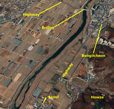
The area from our gate and extending a couple of miles to the north towards Paju is known to all of us as Bong-il-chen; the hyphens are just to help with pronounciation, so if you don't mind, I'll stop using them. Bongilchen (or, more properly, Bongilcheon) is a typical small Korean town. In the town live most of the farmers who work the rice fields that cover the valley of the Gongneung stream. There is a main road that runs northwest to southeast in front of Howze; if you leave the camp and turn left, you are headed southeast to Seoul about 15 miles away. If you turn right and go northwest, you will go through the town of Bongilcheon and eventually reach Paju (a much larger town) and the DMZ.
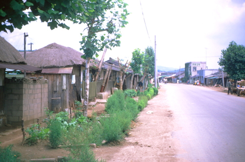
As you will see as we walk this morning through the town of Bongilcheon, it appears very "Third World" to Americans used to modern conveniences even in rural areas. Even in the smallest American towns, the streets will almost always be paved, everything is electrified, modern plumbing and running water are the norm, and so on. This isn't the case in Korea- at least not everywhere. There is electricity in the town, but it is certainly not ubiquitous. All but the main road are usually unpaved streets and alleyways. Indoor plumbing is pretty much non-existent, as is running water.
Still and all, the Koreans seem not to notice so much what they don't have; I suppose this is because they haven't had these things ever and for so long that the adage "You don't miss what you've never had" is probably quite true. But there are modern touches, and you will see many of them in my pictures. Sometimes, people are quite well dressed. You might see the occasional television or telephone. Of course vehicles of many kinds are far from unknown. I'll point some of these things out.
So let's leave Camp Howze for a while and walk out into rural Korea, circa 1970.
|
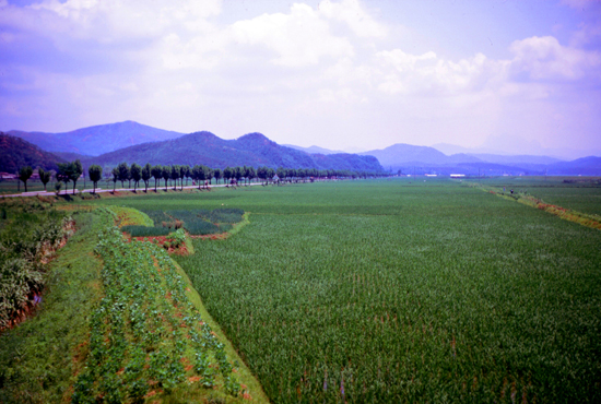
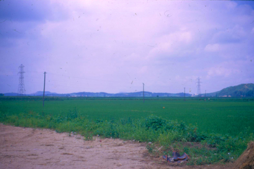
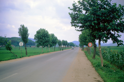
I walked from the camp gate to the highway and then turned north towards town. Before going very far, I walked on one of the berms that divide the rice fields, and this berm led me almost to the stream that runs near the road through the valley (and is the source of the water used to flood the rice fields). Rice is everywhere there is a plot of land that can be made flat enough to hold the water in which the rice grows.
Taken from out in the fields, this shot looks along the road towards Seoul. Seoul is at the base of the very faint mountain in the far background, right of center in the photograph. I will take quite a few pictures of the Korean countryside, and this one is fairly typical.
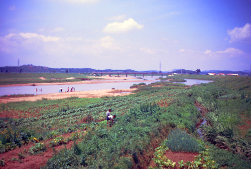
Now we can take a look in the other direction, and this time I can do a comparison with the way things look today.
|
|
But the biggest difference seems to be that rice is no longer being extensively grown; the irregular paddies have been replaced with cultivated fields of other crops- like the ones you see being grown in manually-cultivated fields in my own picture. But at least major landmarks are the same here, although this is one of the few times on the pages for this year that the comparison between then and now will be so easy.
|
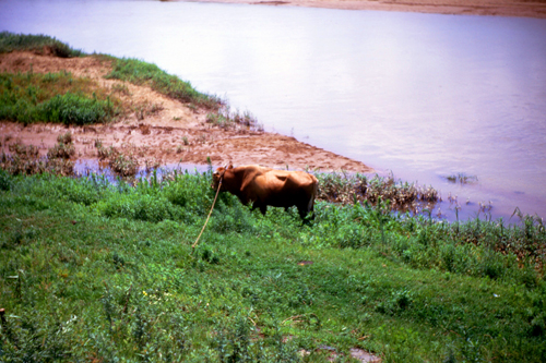
| "Here is a farm animal, just outside Bong Il Chen, Korea. This is the latest model John Deere has put out here. Low upkeep is about the best that can be said." |
That is the bit of narrative I wrote to my folks when I sent this slide home to them. I know it is snarky, but I was really just going for some actual humor. In today's aerial view, it seems obvious that the fields are being tilled mechanically- perhaps not with the large machines you might see in the American Midwest, but at least with mechanized equipment of some kind. This was not the case in 1970; I saw farmers tilling the paddies using "cow power" all the time. Given the lack of infrastructure, small size of the fields, and the fact that most were flooded with water meant that modern plows would have been useless.
You'll see many more pictures in this album of agriculture here in Korea, but for now let's continue our tour by walking northwest along the highway until we get into the town of Bongilcheon itself.
|
|
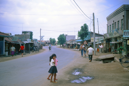
Now I have walked a few yards down the street seen in the last picture, and turned to look back.
|
|
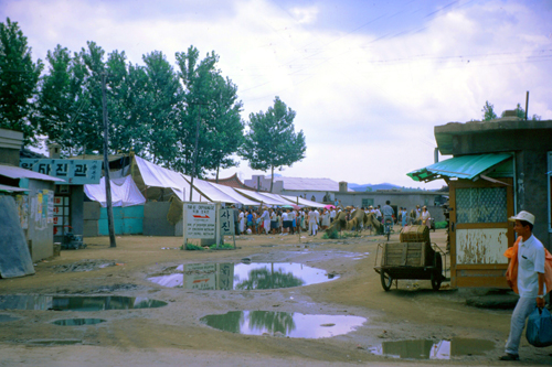
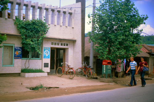
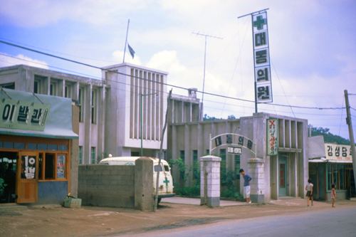
Actually, I walked entirely through the town of Bongilcheon, all the way to the point where the buildings stopped and once again we were in open farm country. The town is not all that big; my guess would be that a few hundred families live here. But it was a center for the area, with most of the services being located here.
|
|
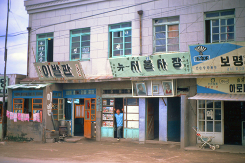
Now I walked back through Bongilcheon towards Camp Howze again, this time on the other side of the street so I could get some different photographs. Some of the buildings (the newer ones I suppose) are much more substantial, and the town of Bongilcheon had its share. (I haven't been to Seoul yet, so I have no idea what the capital city is like.)
|
|
|
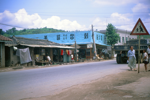
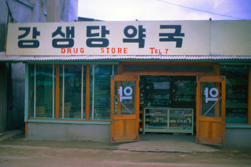
The reason this was done, I learned later, is that the store was one of the few in town that served both Koreans and Americans; there were lots of items in the store that one would find in any drug store anywhere- including drugs. If you needed something for cough or cold, you could find it here. They also sold cigarettes and candy and other stuff like that, some of it (particularly the cigarettes) familiar American brands.
Oh, you could tell what other stores were selling by what was displayed, but those stores catered mostly to a Korean clientele. This store, of course, will probably not excite the Barbour Drugs into merger talks, but it does suffice.
I also mentioned that quite a few buildings had phone numbers helpfully displayed, but what was odd was that apparently the phone numbers just started at one and worked their way up. In the States, our automated switching systems require numbers to all be the same length (except out in rural areas, I guess, where operators may still connect calls manually). I am not sure how the system works here, but I assume it is manual.
(I found myself humming the Glenn Miller song "Pennsylvania 6-5000" and thinking about how the tune would go if the number had been simply "7".)
|
The weather today was warm, but not oppressive. It was also fairly humid, but again not yet oppressive. That will come later in the summer.
The weather has been changing just in the few weeks I have been here. It is definitely warming up, and there are more and more clouds each day. My understanding is that the rainy season began a month ago, but that we have been in a dry pattern for a while. I am told that later in the summer I can expect downpours almost daily.
You can use the links below to continue to another photo album page.
|
July 11, 1970: A Further Tour of Camp Howze |
|
June 28, 1970: A Tour of Camp Howze |
|
Return to Index for 1970 |