|
July 5, 1970: A Tour of Bong-il-Chen |
|
June 20, 1970: A Finance Office Outing at The Tombs |
|
Return to the Index for 1970 |
Well, I have been in-country for a couple of weeks now, and am already familiar with the small area occupied by Camp Howze- enough so that I can today give you a tour of the area of the camp that I live and work in. This won't be an exhaustive tour of the entire installation, as there are portions of it where I rarely go.
|
I began my research with a Google Search for "Camp Howze Korea", and there I found two things. The first was a set of coordinates for where the camp had been, and the second was the fact that the camp had been deactivated and turned over to the Korean Army in 2005. Further research revealed that shortly thereafter, the entire camp area was given to the nearby city of Paju-ri, which immediately began to dismantle the old quonset huts and other buildings to redevelop the area. Finally, I found a reference to the city's plans to convert a thousand acres of the former camp to a monument for Korean adopteees after the War ended.
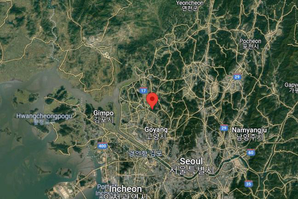
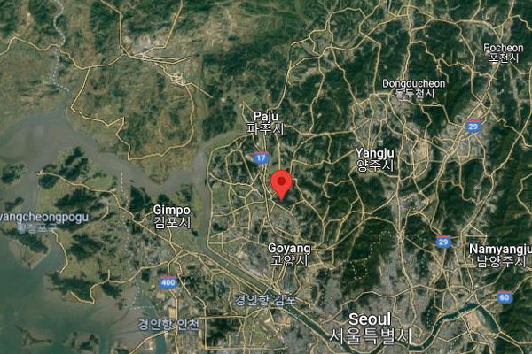
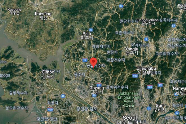
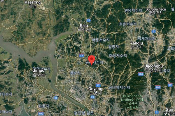
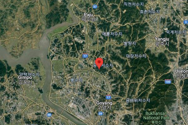
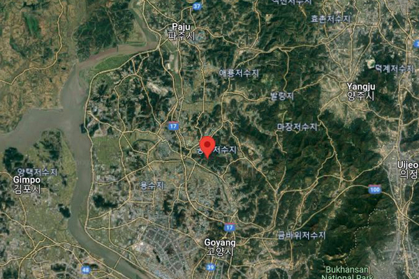
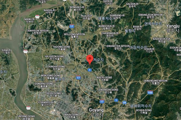
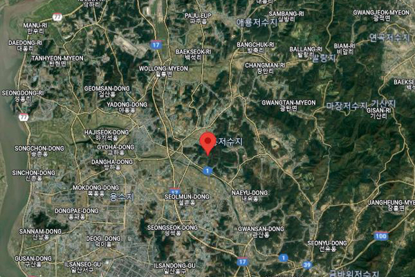
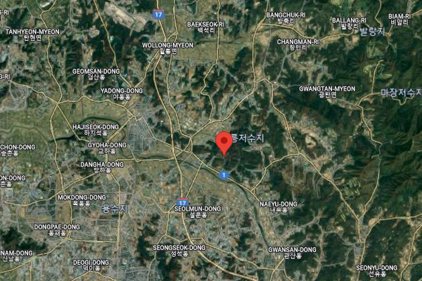
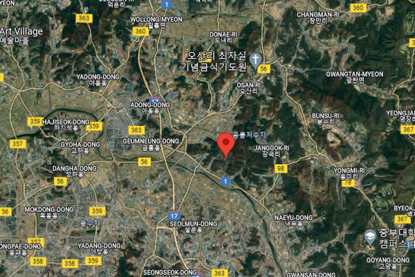
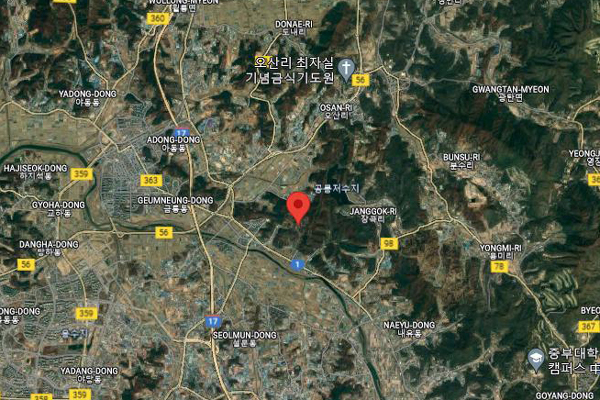
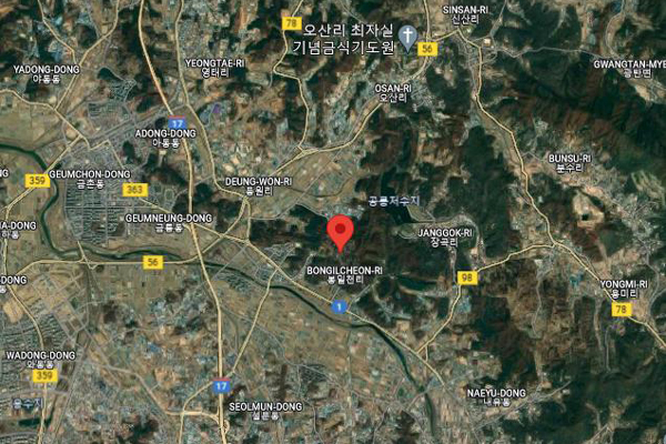
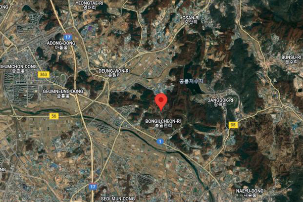
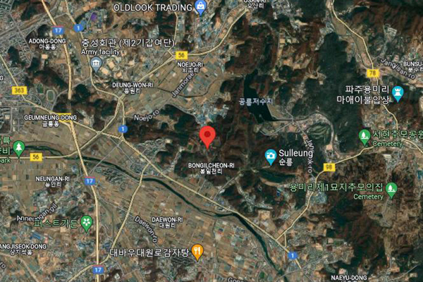
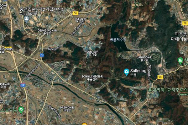
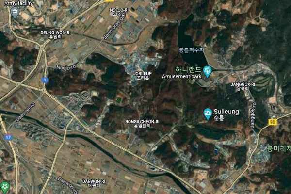
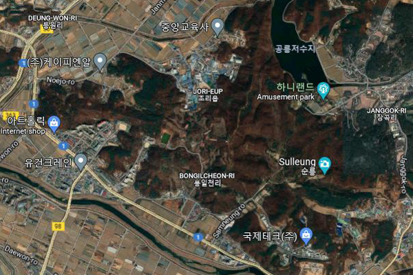
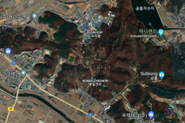
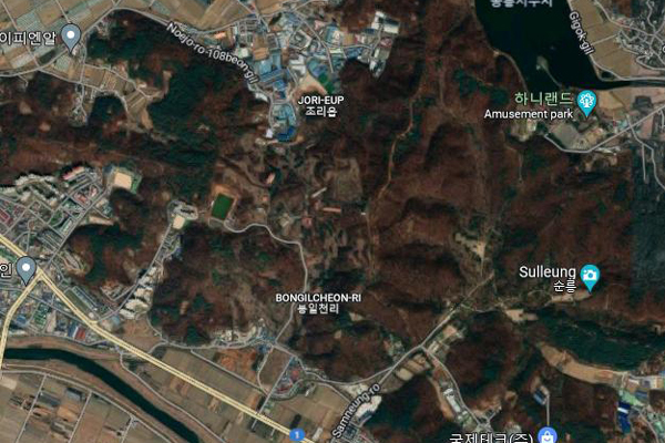
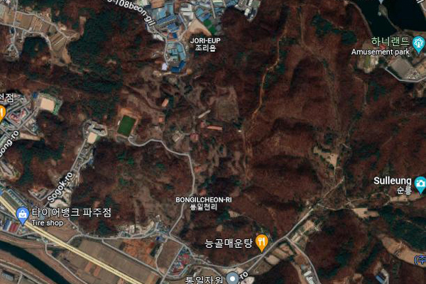
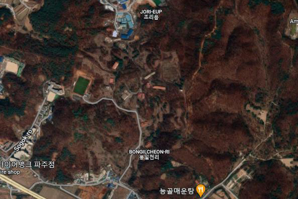
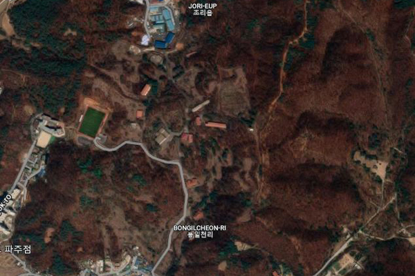
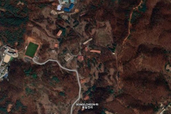
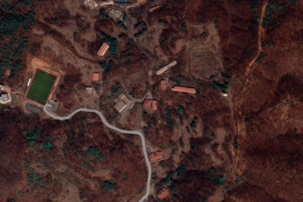
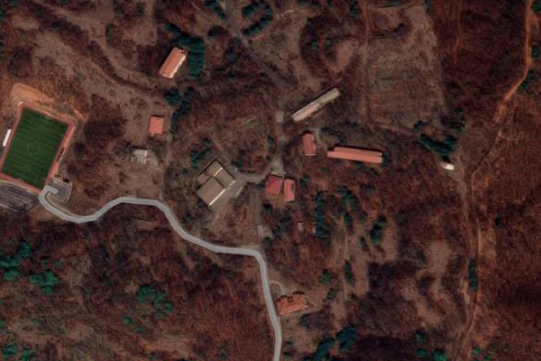
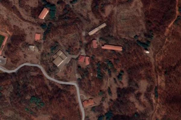
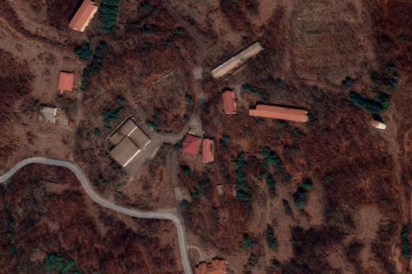
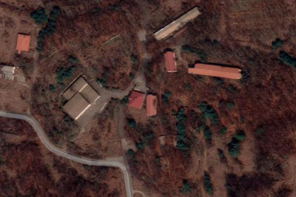
The upshot of all this is that I do not have an aerial view of the camp as it was when I was stationed there. Looking at the coordinates I found, there is literally nothing left of the camp itself- at least nothing recognizable. But I do want to at least show you where the camp was. So at left you will see a looping slideshow of images from Google Maps. We begin at a high level that shows Seoul; this will allow you to place where Howze was in relation to that metropolis. The slideshow then begins to zoom in closer and closer, until finally you can see the few commercial buildings that are, so far as I can determine, right in the center of the former area of Camp Howze.
So, sadly, there won't be any amazing comparisons of buildings at the Camp Howze I knew with those same buildings today; they simply aren't there.
But let's begin looking around Camp Howze, and I'll start the tour at my BOQ, which is a long, low building at the top of a hill towards the back of the camp (the front of the camp being down near the Seoul highway which leads north and south.
|
|
|
But now let's start walking through the camp and I'll show you some of the locations that I frequent.
|
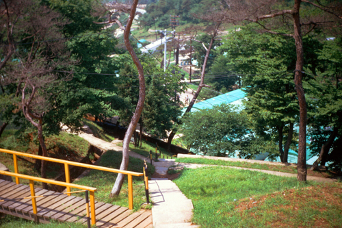
I should explain the layout here. The stairs you see to the right are the ones that lead up to a second BOQ on the same hill as mine. My own BOQ is behind me; to get to it, I and the other officers that live there just come up this road.
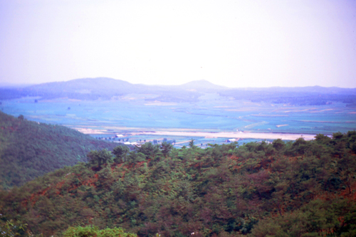
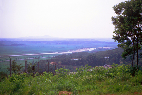
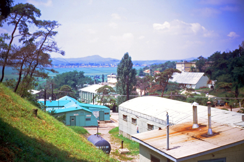
The reason for the road is not that any of us have cars, or even personal jeeps. Instead, this road leads up towards my BOQ but then turns north and goes to one of the camp's three or four water towers. There is a gravel path that leads fifty feet or so south to our BOQ. To get water pressure for the camp, trucks come up this road a few times a week bringing water to put into the large tank. Our BOQ is the southernmost building on this hill, and it is why we have such great views of the valley and mountains to the west and southwest.
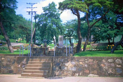
In this picture you can see the beginning of the stone porch that runs around the club, and I should point out that the road the trucks use turns out of the picture to the left and heads down towards the middle of the camp.
|
So how does this picture "fit" with the previous one? Well, in the previous one if you walk down to road and straight onto the Officers' Club patio, you will shortly have to turn right, and in the picture at right this happens at the corner of the white, tubular railing that surrounds the patio.
I have walked around the porch to the front of the club, and have paused to look back. Right in the middle of the patio there is an opening in the railing to allow you to go down a long series of concrete steps to get to the other buildings in Camp Howze.
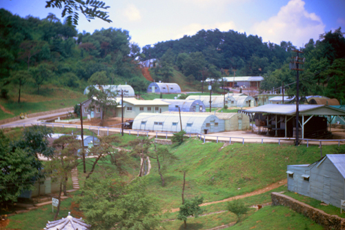
Being as how I lived up above the Officers' Club, I went up and down these steps at least a few times each day. So while I could have continued the jogging regimen that I began at Fort Lee, I found I really didn't need to, as going up and down the hills in which Camp Howze is nestled seemed to be exercise enough.
I took what I thought was an excellent shot of these stairs heading down into the camp proper, but I inadvertently forgot to wind the Argus between shots, and ended up with a double exposure. I did this numerous times while I had the Argus, even though I tried to remember to wind the film spool after each shot. More modern cameras (and I hope to get one quite soon), don't allow a second picture to be taken unless the film has been wound.
|
|
In the left-hand picture above, you can just see that the stairs down from the Club continue their descent on the other side of the concrete walk behind G-1, and that's where we will head next.
NOTE:
If you are curious, there are actually nine "staff officer functional responsibilities" now, although during my service only a fifth one was added to the original four. The original four are: G1 (Personnel), G2 (Intelligence), G3 (Operations and Training), and G4 (Supply). As a direct result of Vietnam, G5 (Civil Affairs) has been recently added. In future years there will be a series of reorganizations that will create G6 (Command/Control/Communications/Computers; also known as "C times 4"), G7 (Information Operations, "psychological warfare and operational security"), G8 (Finance), and G9 (Public Relations). At the moment, the Finance Office is a "dotted line" staff organization, but it will eventually become a full-fledged "solid line" staff position directly under the Commanding Officer.
|
|
I am going up and down the stairs that lead from the road to the various buildings that line it, if only to get better pictures.
|
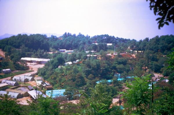
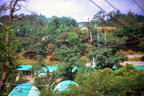
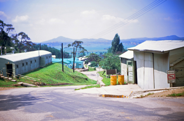
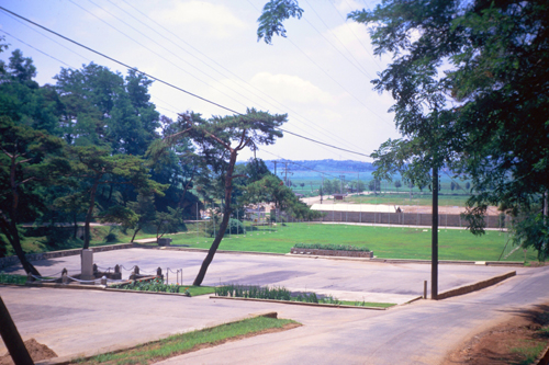
In this picture we are looking down the hill towards the Finance Office. As you can tell from the pictures so far, my BOQ is pretty much at one of the highest points in the camp (about the only higher structures are the water towers). From my lodgings, everything is downhill- all the way to the entry gate which is only slightly above the level of the valley floor. So in the morning, it's an easy (and quick) walk to work. Not so in the afternoon, as most everything is uphill. Going up and down these hills continually was good exercise, and was a contributing factor to keeping most all of us in decent shape.
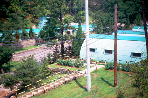
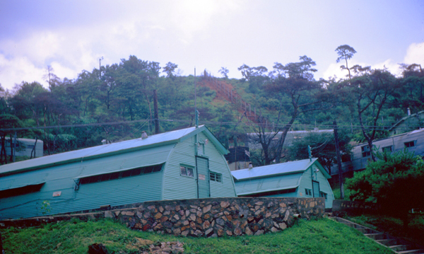
In this picture, the green-roofed complex of buildings is the Finance Office, which actually is three quonset huts joined together. We were just above street level.
The road itself began at the front gate and then climbs steadily through the camp, before eventually curving around and ending just below the Chaplain's Offices. The road branches occasionally, and most of the operational buildings are along it, with the barracks, BOQs, and quarters for the Colonels and above off of it. If you look at the picture above, left, note the stairs at the left just down the street. The left-hand picture below was taken from a ways up that walkway.
|
|
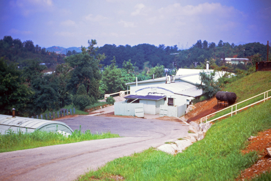
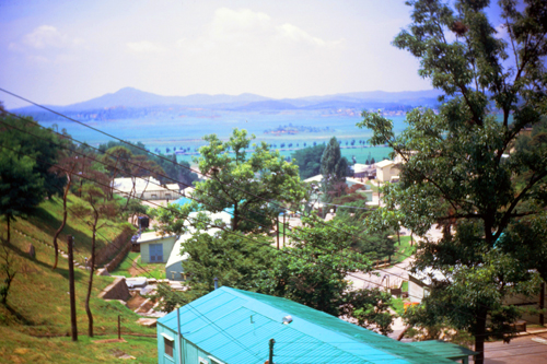
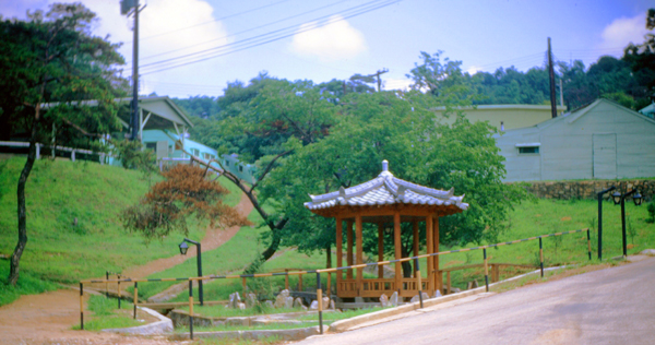
Camp Howze could be self-sufficient if need be; the generators could keep the installation powered for a few days if the local power happened to go out, and this happened a few times during my tour, but never for more than 24 hours. But the electricity in this part of Korea was surprisingly reliable. Next, I am going to continue down the hill, and you'll see the decorative Korean structure whose roof shows up in the right-hand picture above.
|
I suppose this might be a good place for a brief history of Camp Howze. Originally, the site was a US Marine Corps divisional level command post (1953–1955) for the 1st Marine Division. In 1955, when the Marines departed Korea, the 24th Infantry Division of the US Army placed their headquarters on the site. In 1957 the camp became the division headquarters for the 1st Cavalry Division, which in 1960 named the camp after Major General Howze, who had organized and trained the division from 1921–1925. The camp became 2nd Division HQ about five years ago.
Note from the present:
As I will discover next year, the camp will change hands again, as Second Division HQ will move to Camp Casey- part of a consolidation of commands that year. The 3rd Infantry Brigade (part of 2nd Infantry Division) will take over the camp as its HQ, barracks, and supply depot. (The Brigade is, as of my arrival here, stationed up near the DMZ.) In 1992, with the general lessening of tensions, the 3rd Brigade was officially inactivated and the Engineer Brigade, 2nd Infantry Division placed their headquarters at Camp Howze. The final transfer was in 2005 when the last tenants, two Engineer Brigades, were transferred to Fort Carson, Colorado, in support of "Operation Iraqi Freedom". The US formally transferred the land and buildings to the South Korean Government that year. In September 2018 a dedication ceremony was held for the Omma Poom park, which was constructed on the site of the former Camp Howze.
|
|
This pretty much completes my first tour of Camp Howze. I'll be doing more tours later on, and I will also give you a tour of the Finance Office itself, but for now I am going to head back up the hill to my BOQ.
|
But this picture will give you a good idea as to how high the hills into which Camp Howze is nestled actually are.
The Finance Office is one of the larger dedicated structures here at Camp Howze. Unlike the other areas, like G4 (Supply), Finance doesn't have satellite offices, or any personnel permanently stationed at any of the other smaller installations spread over the Second Division area. So all our personnel and equipment are in this one place.
I hope you got a lot out of this first tour of the place I will be spending the next thirteen months. As I learn more about the installation, I may return to show you new portions of it.
You can use the links below to continue to another photo album page.
|
July 5, 1970: A Tour of Bong-il-Chen |
|
June 20, 1970: A Finance Office Outing at The Tombs |
|
Return to Index for 1970 |