|
August 18, 2021: Santa Fe Trip Day 3 |
|
Return to the Index for Our Santa Fe Trip |
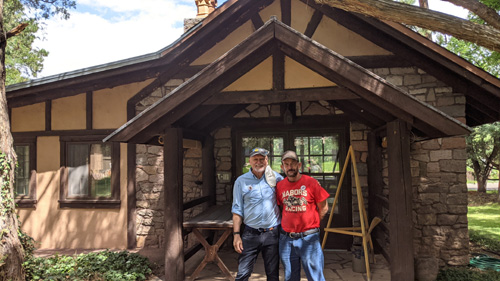
Joseph left this morning to drive to his new job in Colorado, so the three of us are going to drive out to Los Alamos to have a look around. For Fred and I, this visit will be somewhat of a repeat, as we have spent time in Los Alamos before, but it will all be new to Greg.
|
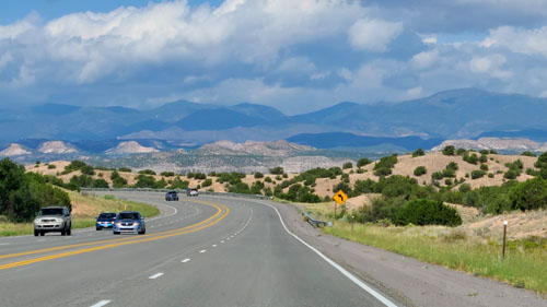
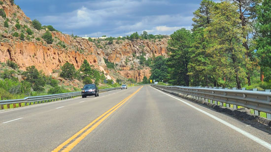
The scenery along this highway is always neat, particularly when you start climbing up onto the plateau on which Los Alamos is located. I was driving, but Fred got a couple of good pictures:
|
|
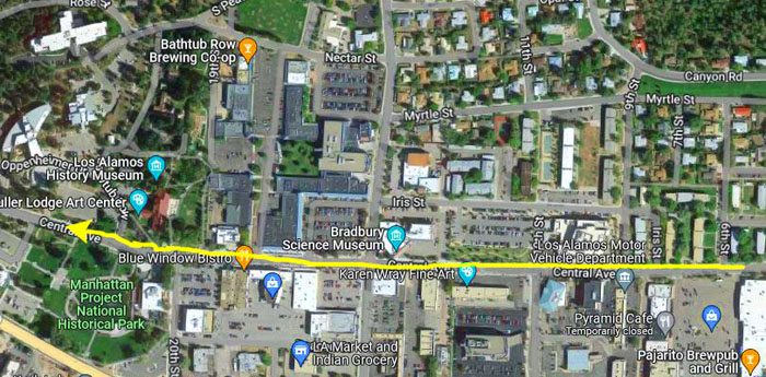
There is an intersection just below the Los Alamos plateau where Highway 502 continues on up onto the Los Alamos plateau while Highway 4 heads southwest towards Bandelier National Monument and Valle Grande. We of course continued on Highway 502; once on top of the plateau, it turns into a pair of one-way streets, with Central Avenue heading west right through downtown Los Alamos.
The Manhattan Project National Historical Park
|
Manhattan Project National Historical Park is a United States National Historical Park commemorating the Manhattan Project that is run jointly by the National Park Service and Department of Energy. The park consists of three units: one in Oak Ridge, Tennessee, this one in Los Alamos, New Mexico and one in Hanford, Washington. It was established on November 10, 2015 when Secretary of the Interior Sally Jewell and Secretary of Energy Ernest Moniz signed the memorandum of agreement that defined the roles that the two agencies would have when managing the park.
The Department of Energy had owned and managed most of the properties located within the three different sites. For over ten years, the DoE worked with the National Park Service and federal, state and local governments and agencies with the intention of turning these places of importance into a National Historical Park. After several years of surveying the three sites and five other possible alternatives, the two agencies officially recommended a historical park be established in Hanford, Los Alamos and Oak Ridge.
 |
The Department of Energy would continue to manage and own the sites while the National Park Service would provide interpretive services, visitor centers and park rangers. After two unsuccessful attempts at passing a bill in Congress authorizing the park in 2012 and 2013, the House and Senate ultimately passed the bill in December 2014, with President Obama signing the National Defense Authorization Act shortly thereafter which authorized the Manhattan Project National Historical Park.
|
|
There are also some facilities that are part of the park but not located here in downtown Los Alamos. These are some of the actual buildings and other sites involved in the Project. They are some distance from here and the only way to visit them it by guided tour, and we decided not to do that. Instead, we decided to go across the street to the History Museum. On the way, we walked through a kind of farmers market that seemed to have been set up today.
The Fuller Lodge Art Center
Los Alamos (from the Spanish for "the cottonwoods" or "the poplars") is recognized as the birthplace of the atomic bomb— the primary objective of the Manhattan Project conducted at the Los Alamos National Laboratory during World War II. The town is located on four mesas of the Pajarito Plateau, and has a population of some 12,000. It maintains its sense of history, but has become a gentrified mountain town with many restaurants, galleries, and shops- many of which cater to the thousands of tourists that visit the town year-round.
|
|
|
 |
In late 1942, the building and surrounding area was purchased by the US Army for the Manhattan Project, and eventually turned into Los Alamos National Laboratory and the county of Los Alamos. Today, the Lodge is home to the Fuller Lodge Art Center, with many additional areas available for special events or just visiting. Fuller Lodge is also one of the stops on the Historic Walking Tour of Los Alamos.
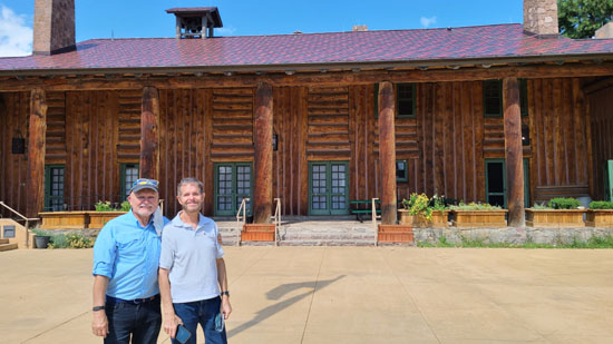
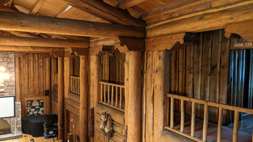
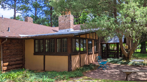
The Fuller Lodge itself is a beautiful building, made primarily of rough-hewn redwood logs, and it very much gives off a mountain cabin feel. There is a museum at one end that doubles as a shop where you can buy art done locally, and at the other end is the History Museum, with a large number of photographs and artifacts from the area- including its original settlement as well as the period of the Manhattan Project itself.
|
|
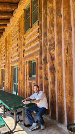
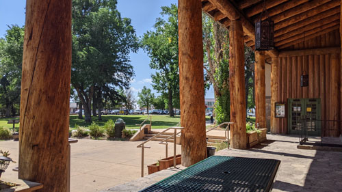
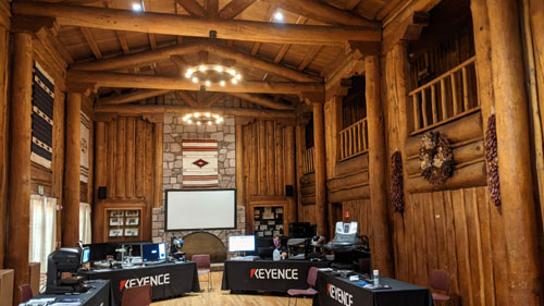
We took Greg into the lodge, which was just as beautiful and rustic inside as it was out. There are facilities and offices here, some art display rooms, but also a huge room that has been used for all kinds of functions during the building's history. (Today it appeared to be hosting a function put on by a company that makes all sorts of sensors and measuring equipment.) It looked like a rustic ballroom with huge timber beams and a large fireplace at one end. It was a beautiful room; indeed, the entire structure, which looked like a very large, very ornate log cabin, was very impressive. We walked up the stairs to the second floor to get different views of the ballroom and of the building's structure.
|
|
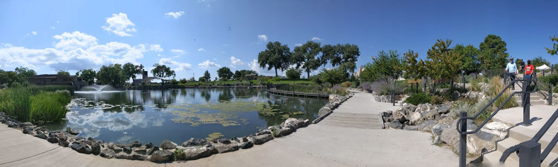
We walked back outside to follow a kind of historical trail that led to some buildings and other outdoor exhibits, and when we got outside I put together a panoramic view of the Lodge:
 |
The Los Alamos Walking Tour Trail
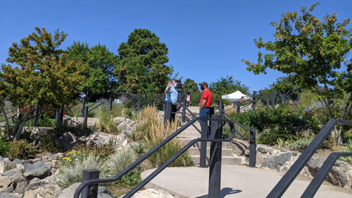
Outside, and extending northwards from Fuller Lodge, was a walkway, or trail, that led to and past a number of buildings and other exhibits from Los Alamos' past. This trail was part of a larger walking tour of Los Alamos, put together and maintained by Los Alamos Historical Society.
Los Alamos is built on the Pajarito Plateau between White Rock Canyon and the Valles Caldera. The first settlers on the plateau are thought to be Keres speaking Native Americans around the 10th century. Around 1300, Tewa settlers immigrated from the Four Corners Region and built large cities but were driven out within 50 years by Navajo and Apache raids and by drought. Both the Keres and Tewa towns can be seen today in the ruins of Bandelier National Monument and Tsankawi. The walking tour really focuses on Los Alamos history following its settlement. But let's just take a walk along the trail and see what there was.
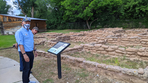
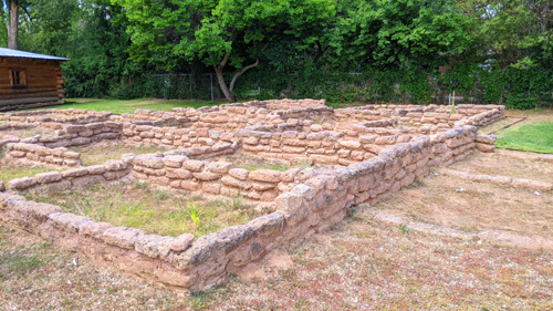
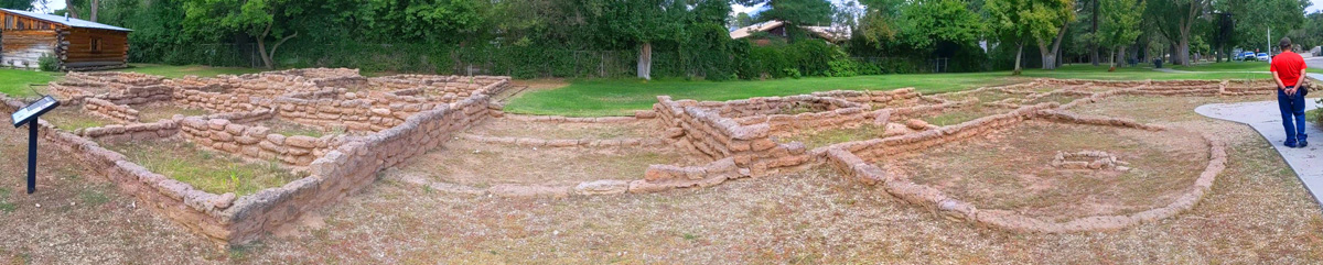
Ancestral Pueblo Site
|
|
Drought, depleted soils, declining numbers of game, and an increasing population caused the Ancestral Puebloans to leave the Pajarito Plateau around the 1500s. This site was reconstructed in the early 2000s with help from experts at Bandelier National Monument and input from local Pueblos.
 |
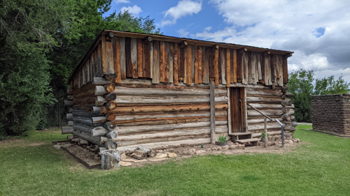
The Romero Cabin
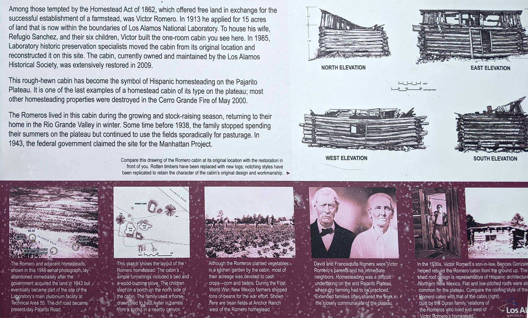 |
Victor Romero built his first homestead cabin on a nearby mesa in 1913. The Romero family rebuilt the cabin around twenty years later. Their homestead was appropriated by the government in 1942, and the cabin was moved here in the 1980s.
|
|
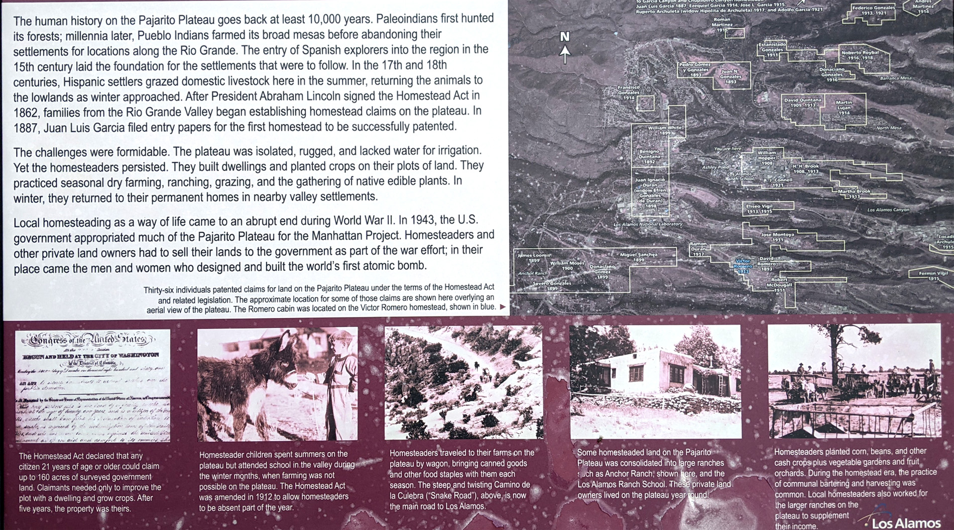
There was another sign nearby that discussed homesteading on the Pajarito Plateau, 1887-1942. Again, I have put the entire sign in the scrollable window below so you can read it. You will need to use both the horizonal and vertical scroll bars to see the entire sign.
 |
Bathtub Row
|
The school was closed when the government used its power of eminent domain to take over the Ranch School and all the remaining homesteads nearby that same year. All information about the town was highly classified until the bombing of Hiroshima. Incoming material for the Project was intentionally mislabeled as common items to conceal the true nature of their contents, and any outbound correspondence by those working and living in Los Alamos was censored by military officials.
At the time, it was referred to as "The Hill" by many in Santa Fe, and as "Site Y" by military personnel. The mailing address for all of Los Alamos was PO Box 1663, Santa Fe, NM. After the Manhattan Project was completed, the entire area reverted to civilian use, and slowly people began to re-inhabit and rebuild new homes and buildings. Today, the town is a haven for people who want to live in the mountains yet be near facilities and culture.
|
The former home of J. Robert Oppenheimer, the scientific director of the Manhattan Project, stands at the corner of Bathtub Row and Peach Street. Most of the homes are private property now and closed to the public. Two of the buildings are part of the Los Alamos History Museum Campus.
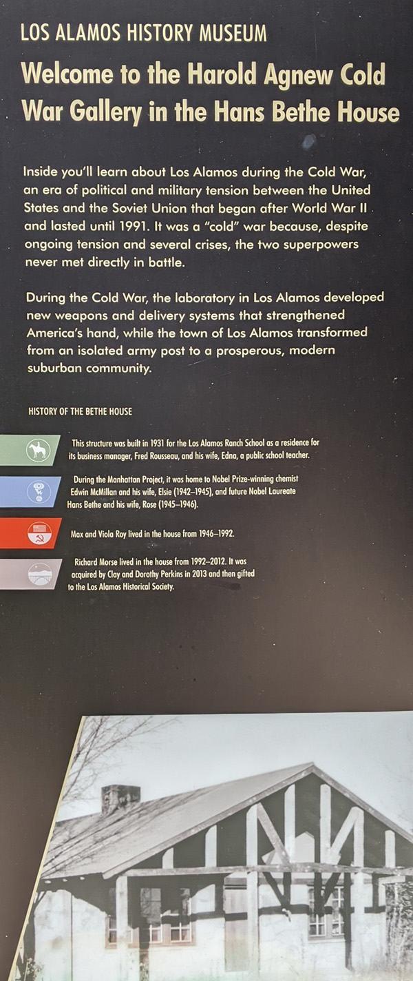
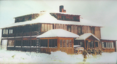
Cold War Gallery (Hans Bethe House)
|
 |
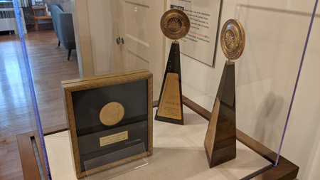 |
In that last picture, you can see what Nobel Prizes look like.
The Big House
|
During the Manhattan Project, the radio station KRS, housed in the Big House, was hard-wired directly into people's homes to keep it from being broadcast over the airwaves. The building also housed some of the first Project scientists who shared its one bathroom. The Atomic Energy Commission tore down the Big House to make way for the Community Center, a planned shopping center that is now known as Central Park Square.
The Oppenheimer House (part of Bathtub Row)
|
|
An invitation to one of Oppenheimer’s dinner parties was one of the most coveted social invitations in wartime within the tight knit Los Alamos community. Scientists could take a break from their top-secret work while Oppenheimer tended bar, fixing stiff martinis, and fellow scientists such as Richard Feynman and Edward Teller picked up musical instruments and added to the festive atmosphere.
Built in 1929, the Oppenheimer house served the Los Alamos Ranch School before the Manhattan Project took over. School director A.J. Connell’s sister May lived in the house in the Ranch School days, moving to New Mexico from New York. Adamant that she would not live in a “log cabin,” the school hired a local stonemason to build the house.
|
|
In June 1942, when Gen. Leslie Groves appointed Dr. Oppenheimer scientific director of the weapons development laboratory, the commander of the Manhattan Project had yet to choose a location for the secret laboratory. Oppenheimer, familiar with the Santa Fe area, played an instrumental role in the selection of Los Alamos. The Oppenheimer House is not yet open to the public; it is still being prepared with exhibits and such. But the car that General Groves used is already parked beside it.
Lunch and Our Afternoon in Los Alamos
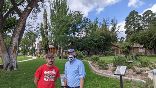
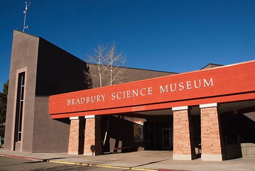
At the end of this area of the Walking Tour, we returned to the Fuller Lodge, and then walked across Central Avenue to get some lunch. We ended up at the Blue Window Bistro, the same place we ate with Guy a few years ago. After lunch, we walked down the street to the Bradbury Science Museum
|
In 1953, Robert Krohn, who was in charge of early nuclear tests at what was then called Los Alamos Scientific Laboratory, decided the Laboratory needed a museum to house historical weapons-research artifacts. Krohn convinced Norris Bradbury (Laboratory director, 1945–1970) that a museum could preserve the Laboratory's history and provide a place for official visitors to learn about the Laboratory's weapon programs.
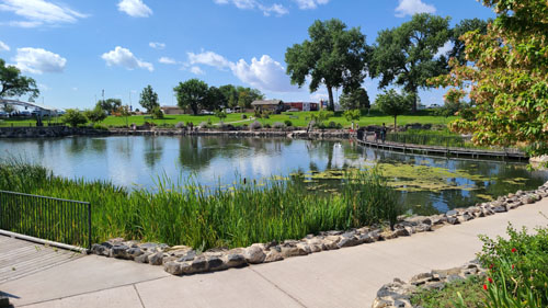
An old ice house on the bank of Ashley Pond across from Fuller Lodge became the first Laboratory museum. Already fitted with a vault door, the ice house satisfied security standards for housing the classified exhibits Krohn wanted to preserve. The ice house Museum opened to official visitors in 1954.
In 1963, Robert Porton, director of community relations at the Laboratory, expressed an interest in adding unclassified exhibits to the Museum. Bradbury approved the transfer of unclassified exhibits to an area open to the public, and soon World War II-era documents and photographs, tracing the development of the town and the Laboratory, were displayed with scientific memorabilia and working models of unclassified research projects. In its first year, 14,000 visitors from 50 states and 40 countries visited the Museum.
In 1965, the Museum was moved to larger quarters. The range and number of exhibits grew rapidly and included many hands-on models contributed by scientific groups and divisions within the Laboratory.
|
By 1987, annual attendance had reached 80,000, and parking space for visitors was disappearing. Laboratory officials began exploring options for relocating the Museum site. In April 1993, the Museum moved into its new and present location in the heart of downtown Los Alamos. The building was designed by William Agnew and Associates and is leased by the Laboratory from a private owner.
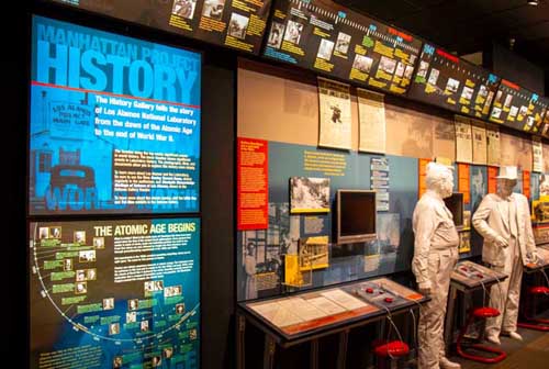
Today, approximately 40 interactive exhibits trace the history of the World War II Manhattan Project, highlight the Laboratory's current and historic research projects related to defense and technology, and focus on Laboratory research related to national security, nuclear weapons stockpile stewardship, and other fields. Recent additions to the museum's collections are exhibits about the history of supercomputers, the Los Alamos Neutron Science Center, Los Alamos' contributions to the Mars Science Laboratory (Curiosity rover), nanotechnology, algae biofuels, and high explosives.
We thought the museum, with all its movies, exhibits, and demonstrations was immensely interesting, but there was really too much to see and learn about in a single visit. I did pick up a museum magazine, "1663", to take home to read. (When the Manhattan Project began, all mail to the site arrived at "PO Box 1663".
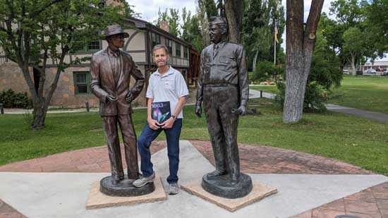
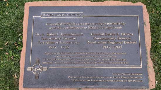
After the museum, we walked back up the street to the Fuller Lodge, as the car was parked just across the street. There, I stopped to pose for a picture by the statues of Oppenheimer and General Groves:
|
|
Our Santa Fe Trip Concludes
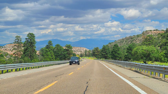
Late in the afternoon, we left Los Alamos and headed down off the Pajarito Plateau as we made our way back to Santa Fe. In the afternoon light, the mountains were shown to great effect:
|
|
The drive back to Santa Fe was very pleasant, and when we returned we had Greg come over to our lodging so we could sit on the upstairs balcony and have a drink or two.
|
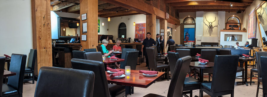
The restaurant was not very busy, so we had no problem getting a table and the food was excellent. Greg liked it too because the pianist was doing show tunes and encouraging patrons to sing along. The food was quite good, and we enjoyed the experience.
We left Greg after dinner and we returned to the AirBnB. The next morning, we picked Greg up and headed out of Santa Fe for our all-day drive back to Dallas. The weather was nice, and after a pit stop in Cline's Corners to pick up some snacks, we had a very nice drive home.
You can use the links below to continue to another photo album page.
|
August 18, 2021: Santa Fe Trip Day 3 |
|
Return to the Index for Our Santa Fe Trip |