|
November 17, 2019: An Excursion to El Jadida from Casablanca |
|
November 14, 2019: A Walking Tour of Barcelona/The Viking Jupiter Sets Sail |
|
Return to the Index for 2019 |
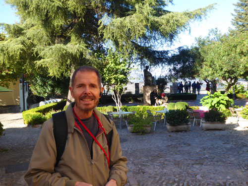
After leaving Barcelona the day before yesterday, we enjoyed a familiarization day at sea, and we were able to get into the routine of life on the he Viking Jupiter. I want to take you on a tour of the ship, of course, but I'll let that wait until we leave Casablanca tomorrow and have a few sea days with no excursions to talk about. A little after that, perhaps when we are crossing the Atlantic, I'll also tell you more about what sea days aboard ship are like. For today, though, let me tell you about our trip from Barcelona to Malaga and about today's shore excursion from Malaga to the ancient town of Ronda.
From Barcelona to Malaga
Not much happens on sea days- unless you want to relax at the pool, sleep in, go to a movie, or, in our case most days, go to bridge classes or play the game.
|
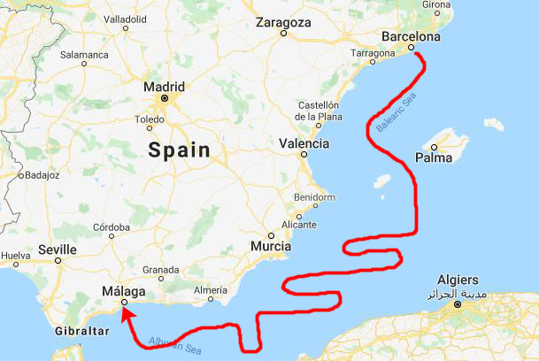
Now the route I marked on the map at left is pretty obviously not the exact route we took, but I wanted to emphasize that the Jupiter didn't steam directly from one port to the other. The ship actually cruises at a little over 20mph, which means that it should take about twenty hours to make the trip. But, leaving at 5PM and arriving at 7AM on the second day would allow almost twice that time for the journey.
What that means, and what the captain told us in the daily newspaper, we were taking our sweet time getting there- for a number of reasons. One was port scheduling- not just in Malaga but in all the other upcoming ports over the next three weeks. Another was that long cruises often arrange their schedules so that there is a sea day early in the cruise to both give the passengers a chance to get settled in, explore the ship, and so on, and also to give the crew a chance to prepare all the equipment and procedures necessary to facilitate a port arrival, disembarkation/embarkation, and port departure. (What he didn't say was that perhaps it's also the maritime equivalent of going around the block when you leave home on a long trip just to make sure you don't think of something you forgot before you get too far down the road.)
So we probably didn't stooge around as much as I showed on the map, but it was obvious that we had to make at least a few turns and do some backtracking to chew up all the hours we had available for the first cruise segment. We may also have slowed down a bit at night, when the slight increase in instability that occurs at very low speeds in open water would be barely noticeable.
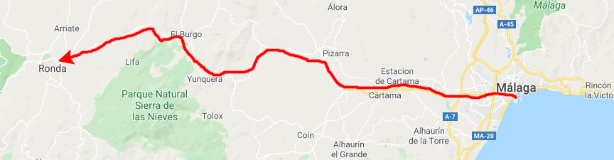
From Malaga to Ronda
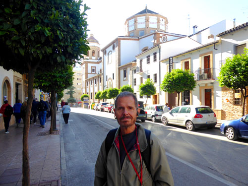
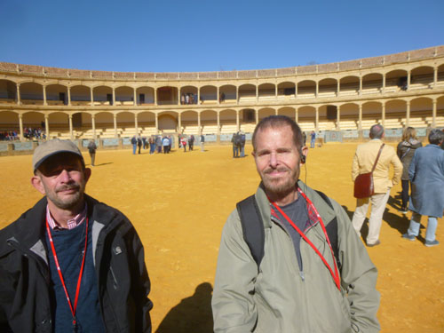
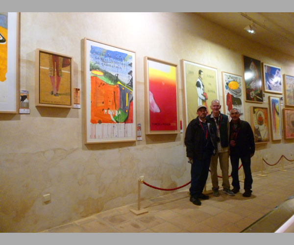
Today, Fred and I signed up for a shore excursion that cost a bit extra (since it wasn't a simple tour of Malaga itself). We are going to take a guided tour to the old Spanish town of Ronda.
|
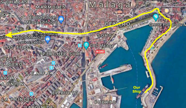
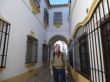
The disembarkation procedure on the Jupiter (if you will allow me, I am going to cease italicizing the name of our ship; although it's correct to do so, hardly anybody does, and it's a pain to add the style to change it all the time) turned out to be about the same as on any of the other cruises we've done. Once again, tours met in the small theatre on Deck 3, forward. That's where you get your bus assignment (if it is a popular tour and there's more than one bus being used). When your number is called, you troop down the starboard side of Deck 3 to the aft stairs, and then down to Deck 2 where the gangway is. After scanning your ship card, you are on the gangplank down to the pier, and that is usually where you meet your tour guide.
|
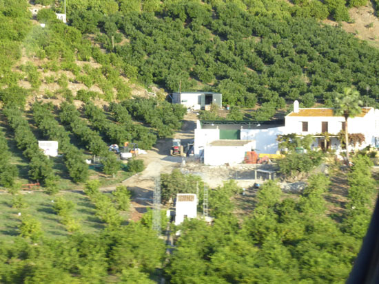
Aboard our bus, we headed north out of the port. In the aerial view at right, that's not our ship, of course, but it was docked in the same place. As we came around in front of the ship, Fred took a quick picture looking back at the Viking Jupiter.
I was sitting on the other side of the bus, so my picture is of Playa de la Malagueta- one of Malaga's prime beachfront communities. Our route took us around and along the beachfront street, so Fred had views to our left and up the hills where he spotted this the Alcazaba of Malaga- a palatial fortification built by the Hammudid dynasty in the early 11th century. This is the best-preserved alcazaba (from the Arabic for "citadel") in Spain. Adjacent to the entrance of the Alcazaba are remnants of a Roman theatre dating to the 1st century BC, which are undergoing restoration. Some of the Roman-era materials were reused in the Moorish construction of the Alcazaba. Ferdinand and Isabella captured M�laga from the Moors after the Siege of M�laga (1487), one of the longest sieges in the Reconquista, and raised their standard in the inner citadel. According to the architect currently restoring it, the Alcazaba of M�laga is the prototype of the military architecture used by the Moors, with its double walls and massive entry fortifications. Its only parallel is the castle of Krak des Chevaliers in Syria.
On my side, I didn't have a view of this old fortification, but rather the new beachfront apartments that have been built in modern times. The early morning sun is just reaching them, so I presume everyone is waking up and preparing for a weekend day at the beach across the street. The bus turned around a neat fountain and headed west along Paseo del Parque- a beautiful divided street that goes right through Malaga's largest park. It was still fairly dark in the park, so we didn't try to get any pictures. I hope we will come back at the end of the day when it is still light enough to get some good pictures of the beautiful greenspace.
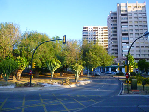
Eventually, the park ended and the street became Malaga's main thoroughfare heading west- Avenida de Andalucia. We were going through the Malaga central business district, and here are a couple of views out the right side of the bus:
|
|
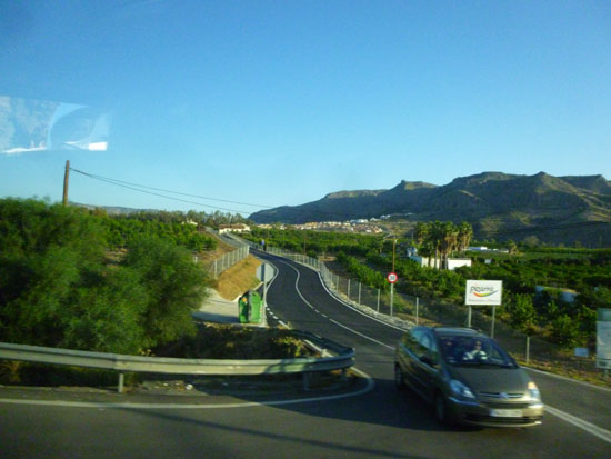
Our tour bus continued pretty much due west out of the city of Malaga into and through its western suburbs. At first, we were on a major highway- an expressway, actually. About ten or fifteen miles west, the expressway ended and the road turned into a good two-lane road, still heading west and northwest. I made my way to the front of the bus a couple of times to make some movies looking out ahead. Here they are:
|
(Mouseover Image Above for Video Controls) |
(Mouseover Image Above for Video Controls) |
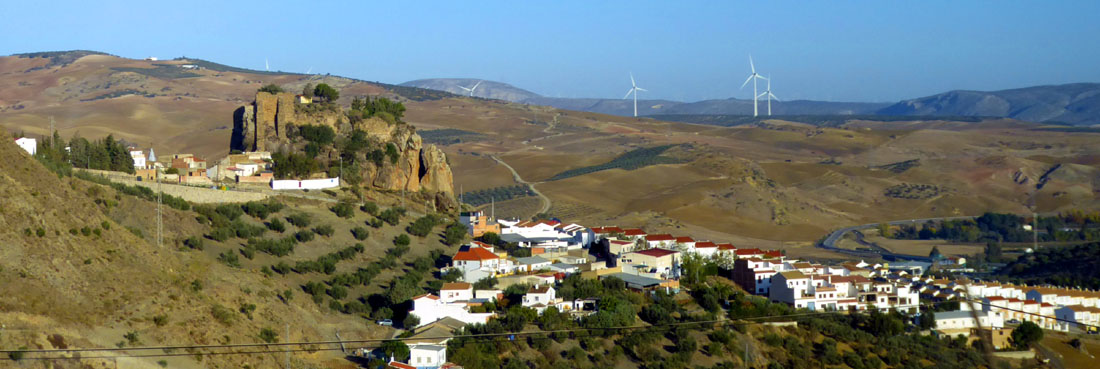
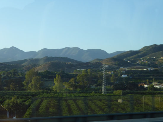
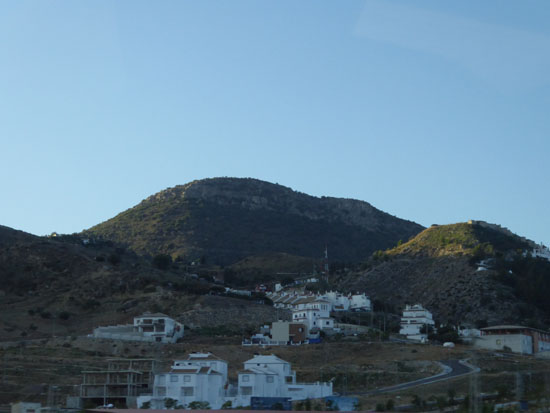
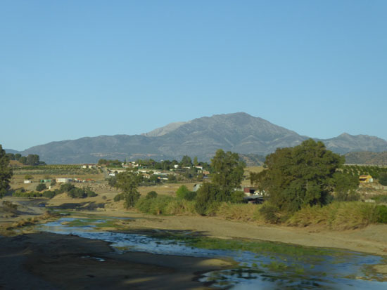
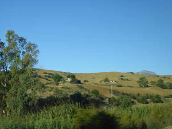
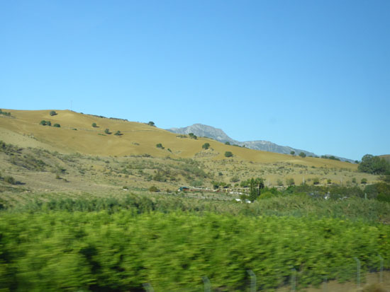
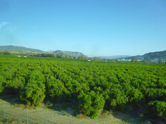
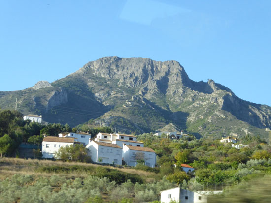
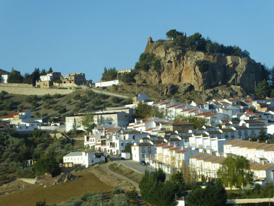
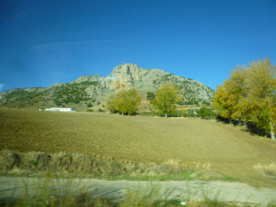
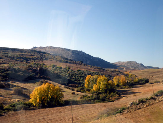
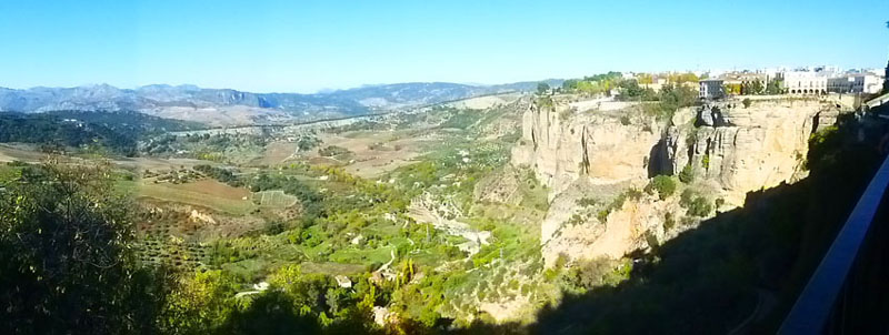
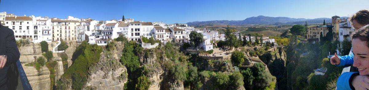
Once we got out into the very green countryside, the drive was really quite nice, and the views of the Spanish countryside very pretty. There was one place where we passed a town with an interesting rock feature right beside it, and at that point the bus slowed down considerably to allow for pictures. Fred was able to get a really nice panoramic shot:
|
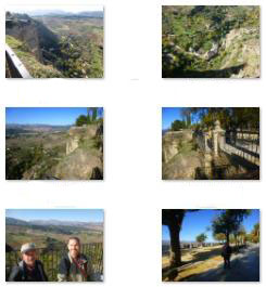
So the fifty-mile trip took a little over an hour and a half, mostly because we were on two-lane roads most of the time where the speed limit was 70KPH. We saw a lot of very nice scenery, and took a lot of good pictures. As has true before, even whittling them down to a good, representative selection still left me with quite a few of them, and I want you to be able to look at them easily and quickly.
|
|
|
|
Our Walking Tour of Ronda
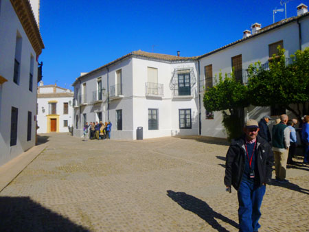
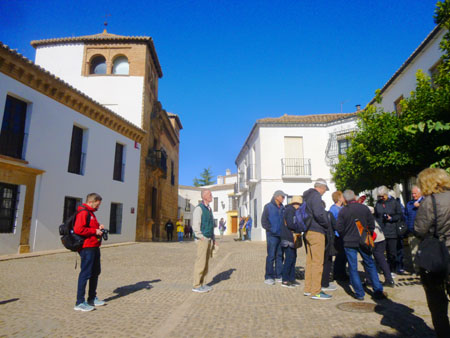
Our tour bus pulled into the local bus depot to let us off so we could follow our guides into and through the town of Ronda. We would return to this same location some hours hence for our return trip to Malaga.
|
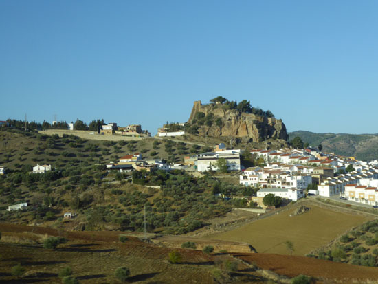
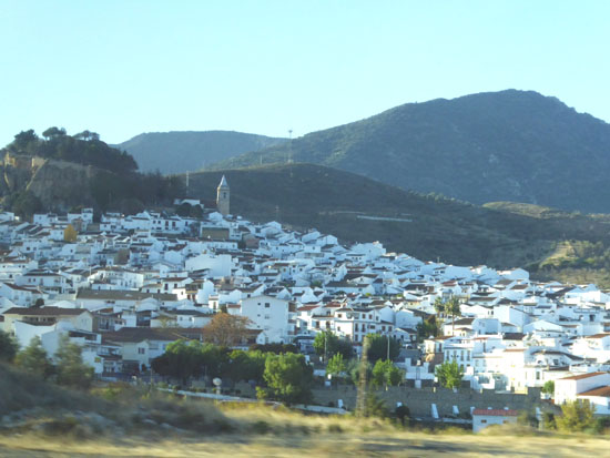
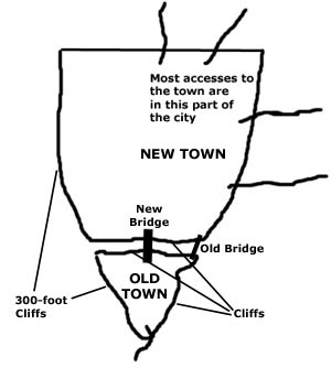
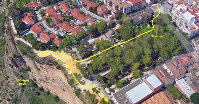
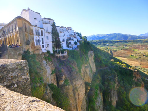
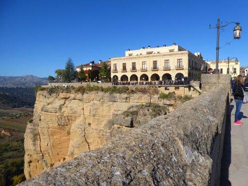
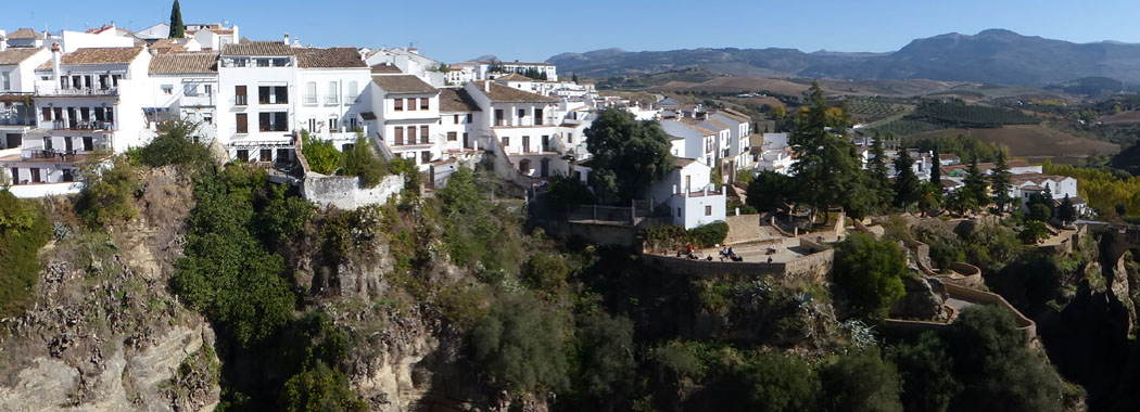
Ronda is situated in a mountainous area about 2,5000 feet above mean sea level. The Guadalev�n River runs through the city, dividing it in two and carving out the steep, 300-foot-deep El Tajo canyon above which the city perches. The Spanish fir (Abies pinsapo) is endemic to the mountains surrounding Ronda.
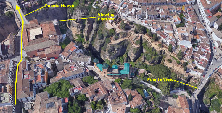
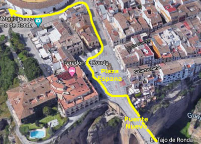
That little description of Ronda's geography given us on the bus by our tour guide didn't really prepare us for what we saw in the town. As it turns out, Ronda sits spectacularly on a high rock escarpment; this escarpment was created on two sides by the river. Imagine the town to be in the shape of an arrowhead pointing south. (See my little sketch at right.) From the upper left corner of the arrowhead shape, down to the southern point and around partway back up the other side you have sheer cliffs (although there is one road going down into the valley from the point of the arrowhead. The Guadalevin river currently cuts through the arrowhead just north of the point, and has created cliffs on either side of its course. So that with the exception of one road down, the southern point is isolated atop a mesa. This is the old town of Ronda.
The rest of the arrowhead is the new town, and all the rest of the roads that lead up into the city are at the top and the upper right of the arrowhead shape. The new town is connected to the old across the current canyon created by the river by two bridges. There is an old bridge pretty much on the eastern side of the arrowhead shape, and there is a new, higher bridge that connects the top of the arrowhead to the point, and this bridge is pretty much right in the middle of the shape. So it's easy to see that the old town was easily defended, and even when the town expanded to the north, even that area had good natural defenses on two sides.
|
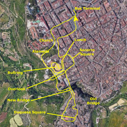
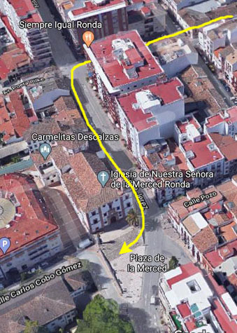
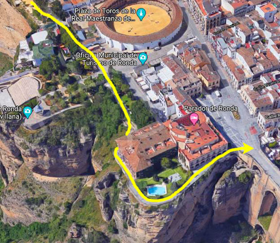
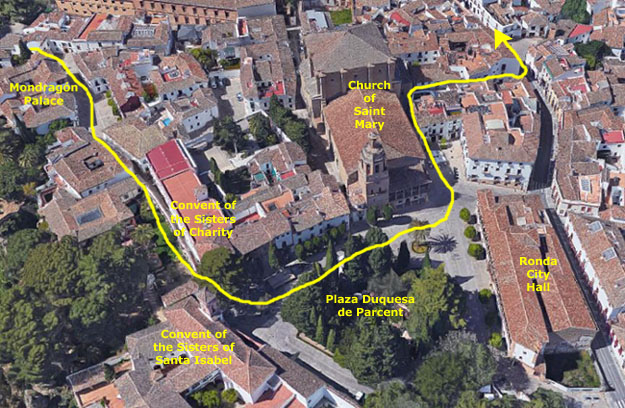
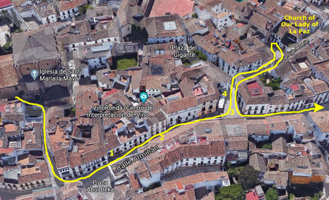
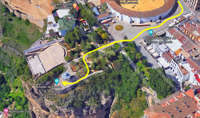
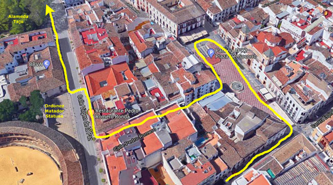
Of course, we'll look at the sights of Ronda pretty much in the order we saw them so that I can tie everything together along the walking route we took, a route that I have marked on the high-level aerial view of the town that you see at left. About the only time we'll see a picture out of sequence is if we photographed the same site more than once because we visited it more than once on our tour. For example, we photographed the outside of the bullring a few times as we walked by it heading south through town, but we took a good many more photographs later on when we had a tour of the bullring complex. In cases like these, I'll just pull all the photographs together into a single section.
At left is an aerial view of most of Ronda, and that view encompasses all of the area we covered on our walk. On that aerial view, I have marked the path that we took, in case you are interested. I have also marked on the map most of the significant stops we made or sights that we saw. This is just to give you a general idea of how we explored the town, and perhaps will give you kind of an index into the sections below. For scale, you might be interested to know that the aerial view covers an area that is pretty much a mile on a side.
So let's depart the bus and follow our guide down into Ronda and our first stop at the Church of Our Lady of Mercy.
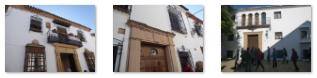
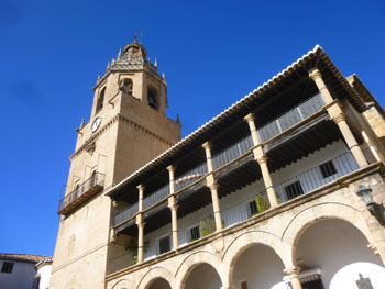
Iglesia de Nuestra Senora de la Merced
|
|
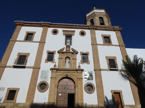
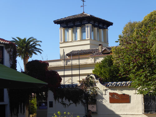
We continued down Calle San Jose for about three blocks, and then turned left to head south on Calle Jerez. We found the church on our right, just north of the small Plaza de la Merced.
|
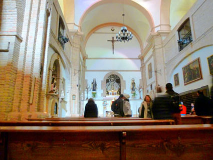
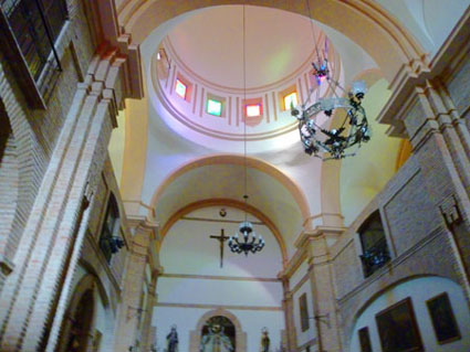
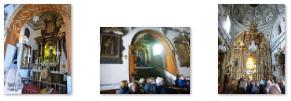
The church is covered with a dome on a drum with paired windows. The rectangular presbytery is covered with a barrel vault with lunettes. It has a square dressing room with a half-orange vault and pictorial decoration. I went inside to have a look at the simple sanctuary:
|
|
The facade consists of three masonry sections divided by vertical brick pilasters.
|
|
 |
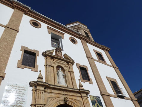
(Picture at left) Shown here looking south alongside the east side of the church, is the octagonal tower containing, of course, the church bells. The brick of the lower portion of the tower matches the brick used for the pilasters.
(Picture at right)
|
 |
The church holds a number of valuable or historic items, including a number of paintings from the seventeenth and eighteenth centuries. But the most famous item is the gold and silver reliquary inlaid with precious stones that contains the sacred hand of Saint Teresa of Jesus- a relic dating to the 1600s. Another oddity of this church is that when we walked around to the back of the building there was a little shop where the Carmelite nuns of the church made money by selling various pastries to visitors. Because the nuns had to come down into the shop to run it, the little room had its own entrance to the convent.
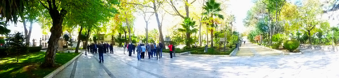
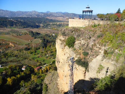
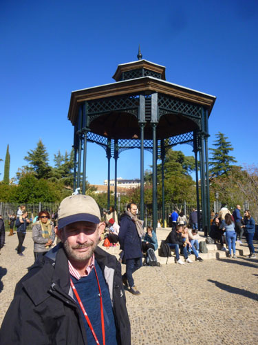
The Alameda del Tajo Park and Overlook
|
There, we listened to our guide and her historical explanation and just admired (and photographed) the views, before exiting the park to the south, still along the clifftop, towards the bullring.
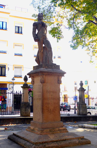
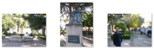
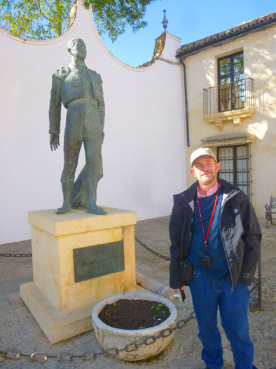
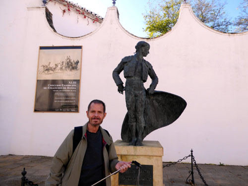
There were actually two statues that we stopped to see. Since a major fair held in in Ronda in 1954, the ladies of Ronda have been the official representatives of the city, and welcoming committee for visiting dignitaries. The role is exceptionally demanding, not only from the responsibility of the role, but also from the demanding schedule of training, and gown fittings before the build up to the whatever festivities are going on. These "Damas Goyesca", as they are known, are modeled on the ladies seen in some of Francisco de Goya�s paintings of bullfighting and pageantry from the late 18th century (much like the ubiquitous statues we saw last year in Madrid). So exceptionally popular have been the Dames Goyesca, that in 2009, a bronze statue of a Goyesca lady was inaugurated in Alameda park.
|
Martinez was known as the first matador to present the bullfight as an art form as well as a display of courage. After retiring, Romero was appointed the head of a bullfighting school in Seville. Although the school lasted only from 1830 to 1832, it had an enormous influence where Romero offered his knowledge to matadors-in-training. He is credited with the invention of the classical style of bullfighting in the School of Ronda and Pedro Romero's name is inseparable from Ronda's Plaza de Toros (bullring).
Although officially retired, he returned to the bullring in Madrid at age eighty, and in his last corrida became the oldest matador to kill a bull in an official bullfight.
Ernest Hemingway arrived in Spain in 1936 as a journalist at the outbreak of the Spanish Civil War. During that time he learned to love Spain and the Spanish way of life, and he came to spend a great deal of time in Ronda. Hemingway wrote numerous great works featuring Spain and particularly bullfighting, including �Death in the Afternoon�, �For Whom the Bell Tolls� and posthumously �The Dangerous Summer�. In addition, he created a bullfighter character for "The Sun Also Rises", and he told friends the character was modeled on Pedro Romero Martinez. There are numerous references to Hemingway around town, and we saw a couple of statues as well. Of Ronda, Hemingway wrote:
| "There is one town that would be better than Aranjuez [another beautiful town in Spain] to see your first bullfight in if you are only going to see one and that is Ronda. That is where you should go if you ever go to Spain on a honeymoon or if you ever bolt with anyone. The entire town and as far as you can see in any direction is romantic background." |
By the end of our tour, I had come to understand the attraction that Ronda had for Hemingway- and for another famous person who we'll get to in a minute. For now, though, we are going to head to the opposite end of the park to take in the views.
|
|
|
(Mouseover Image Above for Video Controls) |
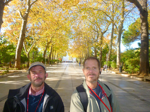
But still and all, even though they aren't Academy Award material, you may find them entertaining, if only for the fact that they do give you a taste of the ambience of a particular place. So play the short movie at right, and walk along with me and our tour group as we walk through Alameda del Tajo.
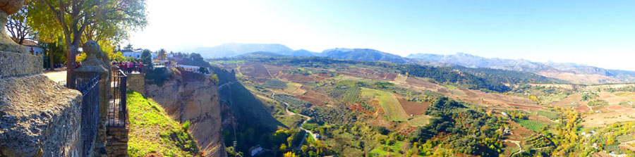
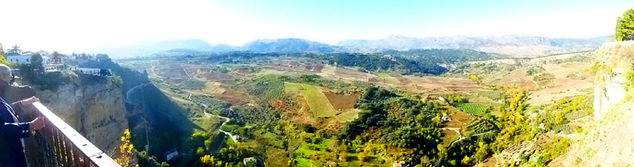
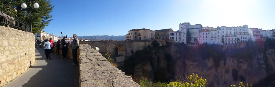
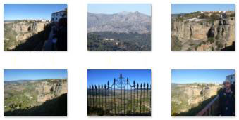
Well, when we got to the end of the pathway, we found ourselves, as promised, at the edge of the mesa-like formation on top of which much of Ronda is located. But no one really prepared us for the views that we would have; these views were, in a word, incredible. Below are two panoramic views of what we saw- the first one Fred's and the second one mine (but from a vantage point about a hundred feet further north).
| |
|
Here is a sampling of some of the many, many pictures we took, thinking we have rarely seen a view so beautiful from an actual city or town:
|
The Alameda is located just north of the Plaza de Toros; from the park all the way around south of the bullring there are overlooks like this with views like these. But the park is also a botanical garden, with a number of trees that are more than 200 years old, including Himalayan cedar, huge pine trees, and acacia. Next, our guide will be taking us along the clifftop to the Puente Nuevo (New Bridge).
From the Alameda del Tajo Park to the Puente Nuevo
|
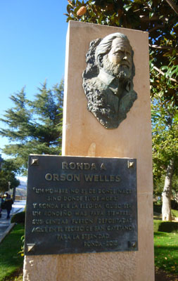 Orson Welles |
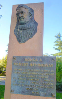 Ernest Hemingway |
As it turns out (this from our guide), Orson Welles, who died in 1985, had a "love affair" with Spain and all things Spanish- much like Hemingway. Welles was so much in love with the area that his ashes are resting at the bottom of a well on a country estate just outside Ronda- an estate which belonged to his great bullfighting friend Antonio Ordo�ez.
|
|
(Mouseover Image Above for Video Controls) |
For my part, I made a movie as we walked along and around the south side of the hotel by the canyon the river has cut and we got our first views of Puente Nuevo. You can use the player at right to watch that movie. The Parador is situated on a spectacular spot in the heart of the city, and is housed in the building that used to be Ronda's town. The location is incredible, with unparalleled views of the Tagus River, and the 400-foot deep ravine that it has cut.
|
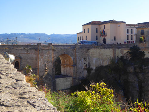
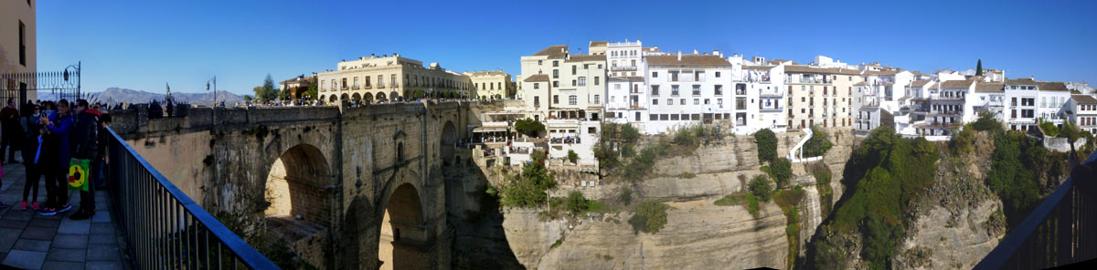
Construction of the first bridge that spanned the gorge at this height began in 1735, on a plan by the architects Jose Garcia and Juan Camacho for a single arch design. Unfortunately, this bridge was built too quickly and too poorly; when it collapsed in 1741, 50 people were killed.
The Puente Nuevo is the newest and largest of three bridges that span the Guadalevin River chasm that divides Ronda. The construction of this current bridge was started in 1759 and it took 34 years to build.
|
The bridge was pretty amazing, and we took a number of pictures of it as we approached it:
|
Crossing Puente Nuevo and Walking Calle Tenorio
|
|
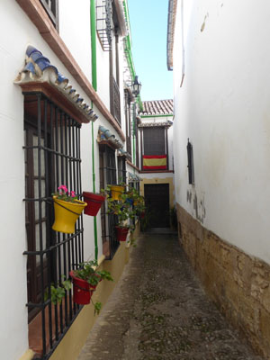
Calle Tenorio was a pleasant, typically narrow street. Of course, streets in most of the old town of Ronda were laid out long before any consideration was made regarding vehicles- walking was the transportation mode of the day. As a matter of fact, it seems that there is only one street through old town that can accommodate vehicles- the one that crosses the Puente Nuevo.
|
|
On our walk down the street to this point, we'd taken pictures of whatever seemed interesting (which was a lot), and some of these pictures are at the right.
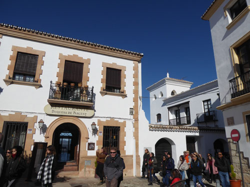
On the south side of this little plaza, just east of Calle Tenorio and catty-corner to the restaurant, was another historic residence. In that last picture, the restaurant is to my left (and the fellow in the picture is one of a couple that we met yesterday on our first Viking Jupiter sea day. Just adjacent to the restaurant to the south, at 19-20 Calle Tenorio and just behind me to my left, was the Casa de San Juan Bosco.
|
The Casa de San Juan Bosco is a modernist palatial house built at the beginning of the 20th century. It belonged to the Granadinos family, who gave it to the Salesian Congregation as last will to be used as a house of rest, healing, hospitality, and care for the ill and elderly members of the Congregation.
|
|
Having gotten this far into our walking tour, I find that the pictures we took of the views from the town on its high mesa out across the valleys really don't do those views justice; they are just an approximation.
|
|
Adjacent to Casa de San Juan Bosco is another small square, the Mary Help of Christians square (which sounds odd in the English translation) from the Spanish Plaza de Maria Auxiliadora that appeared on some nice tiles on one of the plaza's walls. There was another overlook here, but the views were pretty much the same as from the Casa de San Juan Bosco garden.
|
|
A Walk Through Old Town to the Plaza Duquesa de Parcent
|
|
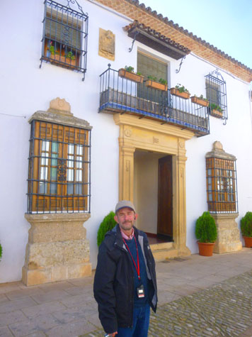
Although legend places it as the residence of the kings of the Taifa de Ronda, historical data relate that it is a palace of Andalusian origin, where in the fourteenth century resided son of the sultan of Morocco Abu al-Hasan 'Ali. After his death, Ronda came under the sway of the Kingdom of Granada and the palace became the residence of the last of the Nasrid governors of this area.
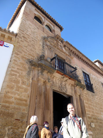
In 1485, Ronda was conquered by the Catholic Monarchs who established their residence in the palace during their stay in the city, after which it passed into the hands of Captain Melchor de Mondrag�n, whose shield appears over the door (seen in the picture at right) and whose name was given to the palace.
The facade is from the early 16th century, with two square brick towers standing out at its corners. The building was extensively renovated in the 1700s in the Baroque style, and various columns were added. We didn't go inside the museum, but the interior of the Palace is built around three courtyards. The entrance courtyard has a well, while the second is a typical Moorish "private" courtyard done in a mixture of styles. The third courtyard, which offers views out across the canyon, has a horseshoe arch and small garden. The interior includes a great hall with coffered ceiling. Outside the building there is a small square; adjacent buildings are private or belong to the nearby Church of St. Mary.
|
|
We continued through the side streets (whose names I didn't write down, so the path I showed on the aerial view above may be imprecise) towards the plaza of the Duchess of Parcent. Here are some views down the narrow, well-kept streets we traversed on our way to the plaza:
|
|
|
From the Mondragon Palace, we continued south to enter the Plaza Duquesa and its northwest corner. Just to our left was the entrance to a convent- one of two right here at the corner of the plaza. This one was the Convent of the Sisters of Charity. Just to our right, in a large building at the southwest side of the plaza was a second convent- this one occupied by the Sisters of Saint Isabel. Walking out into the middle of the plaza we found some statues and a fountain dedicated to the duchess, who was a civic patron of Ronda in the early twentieth century. We walked a bit further on and I turned back to take another picture- this one showing the northwest corner of the plaza.
|
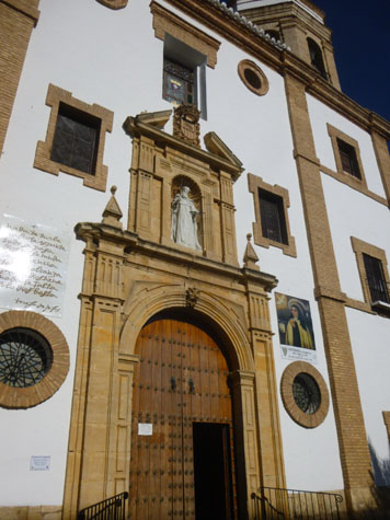
The main doors lead directly into a small vestibule which still contains one of the original columns of the cathedral built in the years immediately after Ferdinand and Isabella�s Christian conquest of 1485. Sadly an earthquake in 1580 demolished it and the church which stands in its place today is an incomplete replacement, though still very impressive both inside and out.
Archeological evidence suggests that the mosque itself had been constructed on top of an older Christian church dating from Visigothic times, however we also know that this was built on top an even older Roman altar, possibly a temple to Diana, which was built to honor the victory of Julius Caesar over the forces of Pompeii, Cneo, and Sexto in the battle of Munda (the Roman name for Ronda) in 45BC.
The balconies at the front of Santa Mar�a la Mayor were added later during the reign of Felipe II (1527-98) so that the nobility and gentry of Ronda could watch for nobility and gentry of the city to watch marksmanship tournaments (archers, not guns), bullfights and other events being held in the square. These events are no longer held, of course, as the square has been converted into the lovely square that it is today.
Entrance to the Santa Mar�a la Mayor is free for worshippers and Ronda residents, but there is a 4� ($5) fee for tourists. We would not have had time to see everything inside, so our group didn't go in, satisfying ourselves with more photos of the outside of the church:
|
|
|
We continued our walk, leaving the plaza by the northeast corner, going right alongside the church. Just northeast of the church, is a residential building and cafe. From the side of the church, I took a picture looking back towards the plaza, in which you can see the Ronda City Hall. Walking this way, our guide pointed out that the actual chapel of the church is behind the facade that faces the square, and we passed the ornate side entrance that leads directly into the chapel.
Walking Back to Puente Nuevo
|
I've marked our route on the aerial view, and I have also marked the locations of a few pictures that we took between the two churches. You'll be able to tell from comparing the aerial view to the pictures where each was taken, but I have marked them anyway:
|
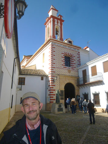
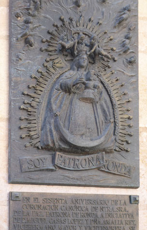
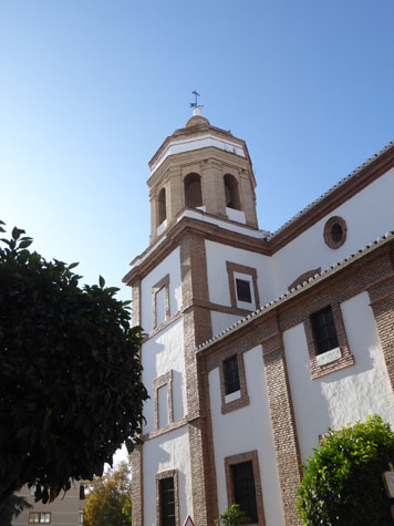
Our guide brought us up the side street to the entrance to the Iglesia de Nuestra Senora de La Paz- the Church of Our Lady of Peace.
|
|
Amongst the notable images taken was the Virgin de la Paz, the patron Saint of Ronda, which has been revered here for centuries, and from whom the church takes its present day name.
Beside the door into the church there is a dedicatory plaque dated 1898 which reads (if my broken translation is accurate):
| "On the sixtieth anniversary of the canonical coronation of our lady of peace, patron saint of round, at the initiative of miguel casa lopez and dna amalia rey, senior vice-brother and vice-treasurer." |
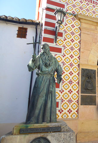
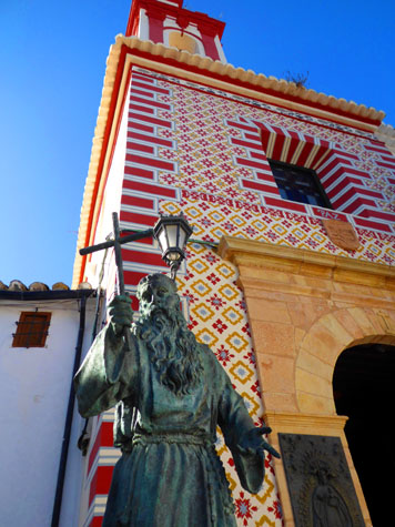
Before we go inside and look at the chapel itself, there was another feature outside.
|
|
Jos� Francisco L�pez-Caama�o y Garc�a P�rez was born in C�diz in 1743- descended from the Visigoth kings. Despite his noble ancestry, Joseph made little progress at school, receiving the nickname of the "dunce of Cadiz". He was rejected by the Observant Franciscan friars but later accepted by the Capuchin friars. At the age of 15 he entered their novitiate in Seville, and given the name Didacus Joseph. He became a member of the Order in 1759 and ordained to the priesthood in Carmona in 1766.
In 1771 he was assigned to one of the teams of friars who preached to residents of isolated, rural villages- those areas being a major focus of the Capuchins of that era. His biographers stated that the congregations marveled at the tender love he displayed to the crucifix he would hold while preaching, and the singular power of his words, which swayed his audiences and left an impression on their lives. He wandered throughout the entire peninsula on foot, preaching in this way to the various communities he encountered on the road.
Spain was embracing the Enlightenment- particularly in the upper classes; Didacus became a major force in promoting the traditional devotions and beliefs of Catholicism as part of the identity of the nation, and is seen as an early integrist in the development of Spanish culture, opposing Liberal Catholicism. He was a strong critic of the policy of consumerism (relying not on indigenous goods but on those from other countries) that was popular in government circles. For this, he was denounced to the Spanish Inquisition for attacking royal prerogatives. He preached at the Royal Court in 1783, but found that he had no effect on the nobility, and he left Madrid in disappointment. Leaving Madrid in disappointment, he later wrote: "I do not want the royal couple to remember me".
|
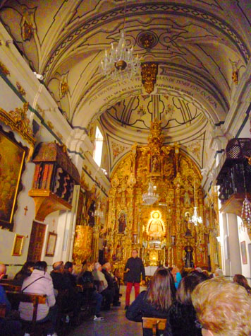
The building consists of a single nave covered by a Mudejar framework that, during the reforms of the 18th Century, was hidden by baroque vaults.
|
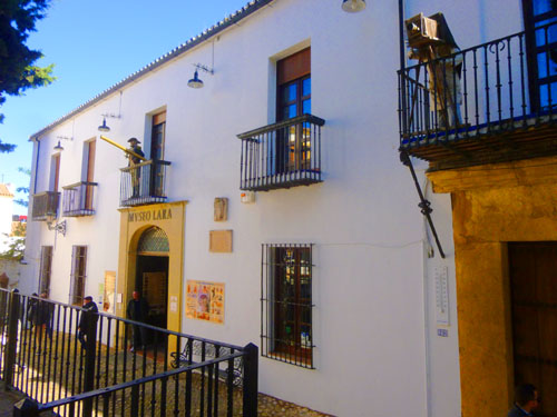
From this church, our guide led us back to the Calle Arminan where we continued north to the Puente Nuevo. One interesting site that we passed was the Museo Lara; tucked away in a historic building known as the "Palace of the Count of the Conquest of the Batanes Islands",� the museum has as much interest in the beauty of historic objects as it does in recreating the horrifying fantasies of sorcery.
|
Featuring exhibitions surrounding both the Spanish Inquisition and witchcraft, the lower levels of the museum turn sinister fairly quickly. The "Living inquisition" displays feature a number of historic torture devices including a full size stretching rack. Add to this an exhibit on witchcraft and a taxidermy mash-up featuring a life-size mermaid, well, you get the idea.
A little further towards the bridge (actually in the last block before it) we passed a tile mural that we'd seen earlier from across the street. The display was titled "Ronda to Romantic Travelers" and consisted of a beautiful map of old Ronda on ceramic tiles, surrounded by quotations from famous people, such as Washington Irving and Lady Tennyson, who'd spent time here. Each of those quotes, also on tiles, was in Spanish and in the particular visitor's native language.
Just past that building, we found ourselves at the east end and the north side of the Puente Nuevo.
The Views from the Puente Nuevo
|
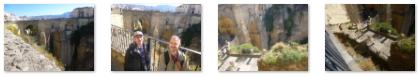
So our guide gave us twenty minutes here, and Fred and I went down to the platform to see what we could see.
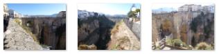
What we could see was pretty spectacular. From both the upper and lower levels of the viewing platform, there were expansive views to the east- to the new town on the other side of the canyon, down the canyon to the Puente Viejo, way out east to the mountains, and of course back at the Puente Nuevo itself. Let's begin with some panoramic views. Here are the three best. First, one from Fred:
|
Next are a couple from me, each one put together from four separate pictures:
|
The next one looks pretty much straight north. Notice the restaurant on the lower levels of the building across the bridge; the diners must have incredible views:
|
One of the reasons we would like to come back to Ronda sometime is to walk the pathways on the other side of the canyon from here, and get all the way down to the Puente Viejo.
|
(Mouseover Image Above for Video Controls) |
In addition, we took a number of very pretty still shots of scenes in and around the canyon, and the best of these are below:
|
Our guide called us up from the observation platform, and we continued across the Puente Nuevo back into Ronda's New Town towards our next stop at the bullring.
|
Along we way, Fred took some good pictures of typical street scenes here in Ronda:
|
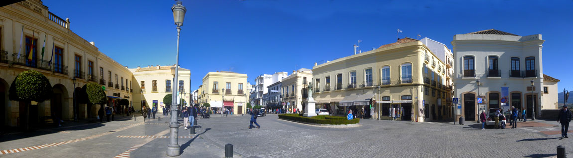
For my part, I stopped in Plaza Espana to take a series of pictures from the Hotel Parador around to the east side of the plaza that I could stitch together into a panoramic view:
|
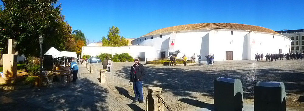
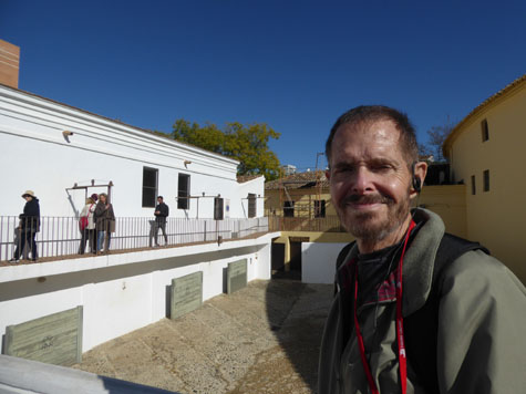
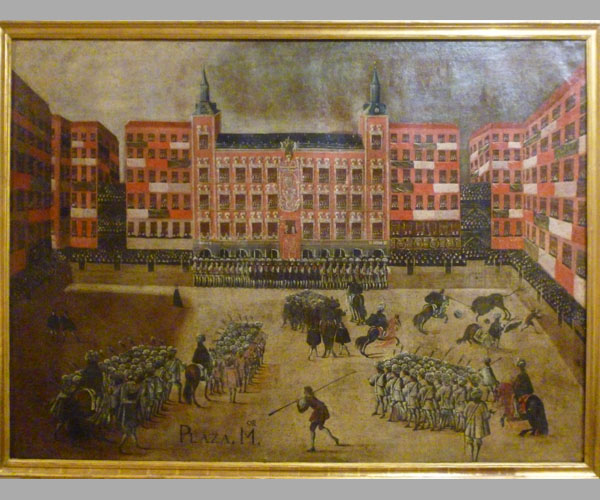
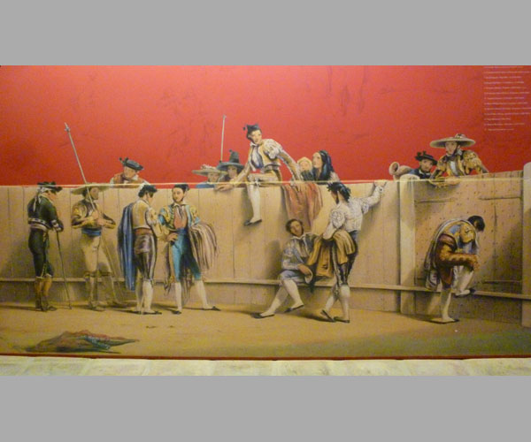
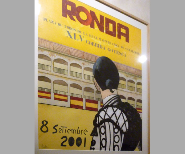
A Tour of the Plaza de Toros de Ronda
|
As it turned out, our guide led us around the south side of the structure to the tour entrance, where she picked up our included tickets and gave them to us. We went through the turnstiles into an open area where the animals used in the bullfights arrive at the facility. There appeared to be outdoor pens where they are kept (and a large entrance for livestock trucks).
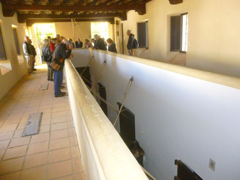
We went around one of the pens and up some stairs to a walkway along one of the auxiliary buildings and over a complex of outdoor chutes where bulls are funneled into an indoor chute. We also went inside, and found ourselves above the long, narrow chute where the bulls are prepared for entry into the arena.
We had someone from the facility describe the process to us, and then we went downstairs to find ourselves in the same chute that is used for the bulls. We went into the arena through the entry used for the animals, and were then free to walk around the inside of the impressive arena for a while. After about a half hour, our guide took us through an exit at the west side of the arena and into the bullfighting museum underneath about a fifth of the circle of the arena. We walked all the way through the linear museum to exit the arena through one of the doors on the south side. We then walked back around to Calle Virgen de la Paz to again gather with our guide to find out about lunch.
We took a lot of pictures here, so let me organize them into sections for you.
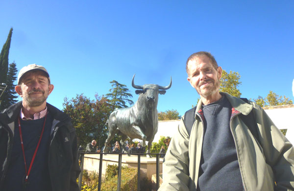
The Plaza
|
|
|
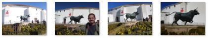
In the picture of the plaza above, you can see a couple walking away from the camera (just to the left of Fred). Beyond them, right back by the wall of the visitor center entrance, there is a neat sculpture of a bullfighter- which kind of balances the monument to the bull.
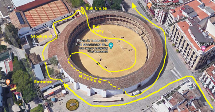
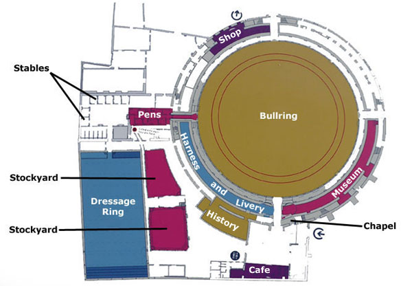
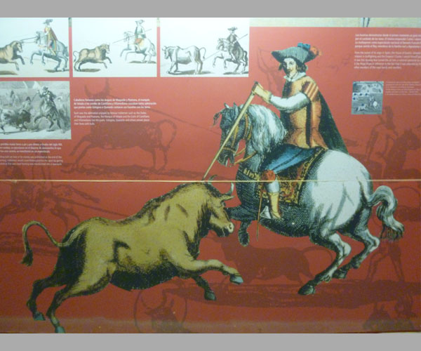
Before we start wandering around, it might be a good idea for me to duplicate here a diagram that we found in the entry building while our guide was getting the tickets organized.
|
Today, we will visit most of the complex, although we did not go into the gift shop, cafe, historical archives, or the harness and livery museum. Nor did we go inside the building housing the dressage ring.
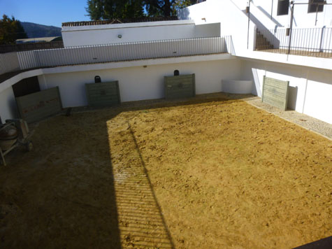
The Stockyards, Stables, and Pens
|
|
We walked on the catwalk towards the pens, and just before we got there we could look down into the stables; I assume this is for the horses that are used by people other than the matador out in the ring. Here is a view of the catwalk looking back the way we have come. Down below us, just before we entered the pens building, we could see a complex of chutes used to direct the bulls to specific pens. You can see another view of this maze of directional chutes here.
|
|
(Mouseover Image Above for Video Controls) |
When we got down to that level, we found that indeed it was just a long, dirt-floored hallway with these pens off to each side. We walked along the hallway and looked into a couple of the pens, but they were fairly unremarkable.
I thought I would make a movie of what the bull might see when it is released from its pen and is funneled down the corridor to come out into the bullring, but there were too many people in the way to make it very interesting. But you can use the movie player at right to watch the movie that I did make, which might at least give you a better idea of what the area was like- if not put you in the bull's shoes.
After we'd looked in a pen or two, our guide took us down the corridor and out into the bullring itself.
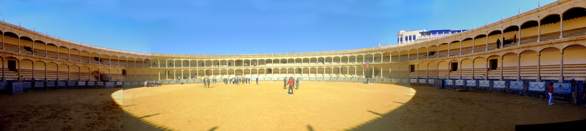
In the Bull Ring
|
The city of Ronda is home to the Real Maestranza de Caballer�a, the oldest and most noble order of horsemanship in Spain. In 1485 the Catholic King Ferdinand and Queen Isabella won Ronda back from the Moors and ended over seven centuries of Islamic rule. Construction of the bullring started in 1779 and finished in 1785.
|
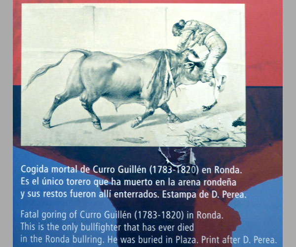
This Plaza de Toros is considered a rather small arena with only five thousand seats, but the bull ring itself is the largest in Spain. Ronda's first inaugural bull fighting event in May of 1784 resulted in a partial collapse of the stands, and the structure had to be closed temporarily for repairs. It reopened the next year with its second inaugural event, which is known as one of the greatest bullfights in Ronda's history. Rivals Pedro Romero and Pepe Hillo faced each other in front of the most noble families in Ronda.
Because of its rural location and the small size of the surrounding town of Ronda, this bullring does not host as many bullfights as other, larger venues such as Seville. But when it does, the arena's seats are almost always filled. I made two movies here in the bullring during the half hour we had to wander about, and you can use the players below to watch them:
|
(Mouseover Image Above for Video Controls) |
(Mouseover Image Above for Video Controls) |
I've never been inside a bull ring before, much less standing in the middle of the arena. From the outside, the Plaza de Toros seemed small, but when you view it from the floor of the arena, it seems much larger. The arena itself was beautifully built, as I hope our photographs show. Of all the pictures we took I have a selection of nine or so that you may wish to see:
|
Wandering around the arena was extremely interesting, but a half hour after we came out into it, our guide beckoned us to one of the exits from the arena. This put us on the pathway just below the seats, and we took that route a short ways around the seating area to the exit that led us to one of the entrances to the museum.
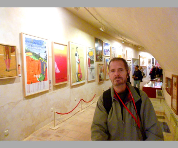
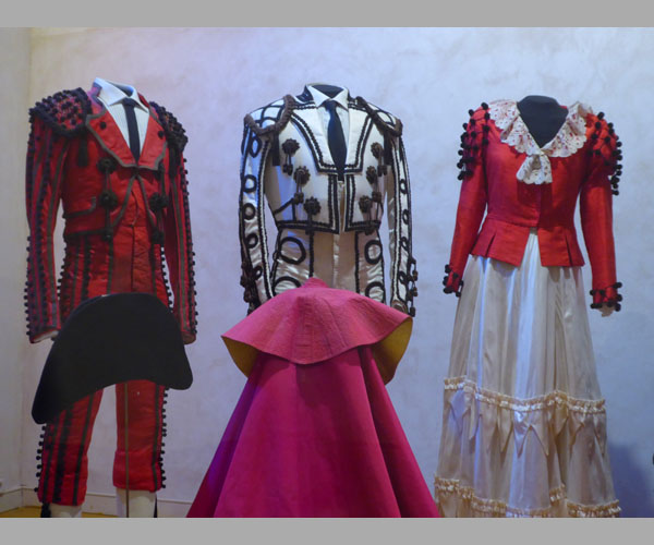
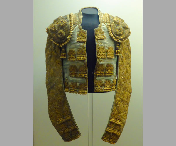
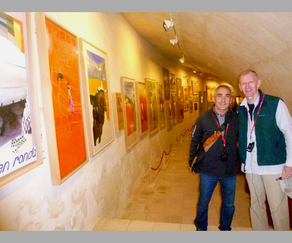
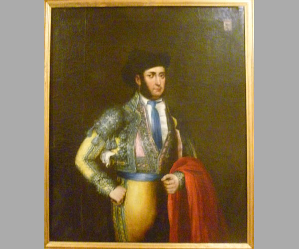
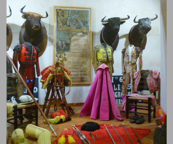
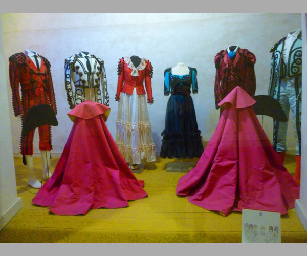
In the Bullfighting Museum
|
|
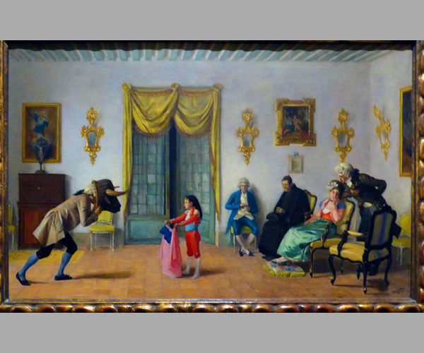
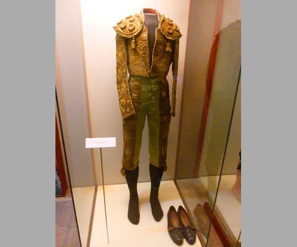
Fred and I took some pictures of some of the exhibits- basically whatever we thought was photogenic or interesting. Our pictures aren't a full catalog by any means, but there are enough of them that I've put them in a slideshow so that you can look at them quickly and easily.
The slideshow is at left. To move from one picture to another, just use the little arrows in the lower corners of each slide. You can refer to the index numbers in the upper left of each slide to see where you are in the series of 19 pictures. Enjoy walking through the museum with us!
At the far end of the museum, our guide took us back outside to the plaza, and then around to the northeast side of the complex where there were a couple more sculptures.
|
|
The Ordo�ez family, widely considered the second bullfighting dynasty of Ronda, participates in the spectacle along with the bullfighters and their assistants. They dress up in costumes reminiscent of the characters in paintings by Spanish romantic painter Francisco Goya.
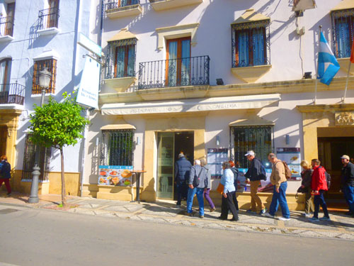
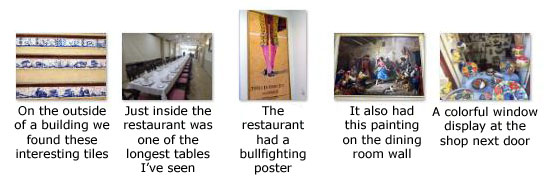
Lunch
|
Here are some of the pictures we took during lunch:
|
Mirador de Ronda
|
There were quite a few people here at the overlook, but we got some good pictures:
|
The views were great, but the overlook had another attraction- a very pretty wrought-iron gazebo. And occupying the gazebo was a young lady, Leticia Prados, playing the harp (and, not surprisingly, selling her CDs of the "Leticia Harp Experience").
|
|
(Mouseover Image Above for Video Controls) |
I think the film turned out pretty good, and you can use the movie player at left to watch it.
When we were finished at Mirador de Ronda, we went back by the south side of the bull ring and across the street into the interesting neighborhoods of Ronda.
The Plaza del Socorro
|
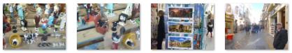
Sometimes I find it just as interesting to look in typical shops and such just to see how local folks go about their daily lives, and we often take pictures of window displays and stuff like that. On the way to the square, we found a few picture-taking opportunities:
|
(I was particularly amused by the windows full of miniature figures and objects. Make sure you don't miss seeing Scooby Doo on the little miniature television.)
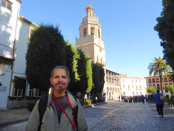
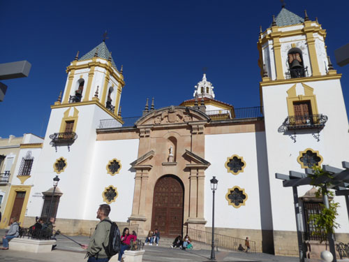
After just a long block, we came to the southeast end of Socorro Square. The Plaza del Socorro de Ronda is located in the urban center of the new area of the city. It is one of the most emblematic squares in Ronda, and also the busiest- as everyone who lives in or walks around Ronda seems to end up here at some point.
|
(Mouseover Image Above for Video Controls) |
Once the War of Independence against the French was over, this square had to be restored almost entirely, and it was at this time that most of the buildings surrounding the square were constructed.
This is a cozy pedestrian square, with important buildings, restaurants and terraces, and adorned with statues. The square is triangular in shape and in the center there is a fountain that is a meeting place for those visiting the square. A bit north of that is a monument to Hercules (with an inscription whose translation is loosely "Andalusia is for Spain and for Humanity").
|
During the years of the Franco regime, the square in which the church is located was known as "Plaza del General Franco", but in 1981, after the transition to democracy, the mayor of Ronda, Juan Harillo Ordonez, signed a decree which officially changed the name of the square to the current Plaza del Socorro, also ordering the removal of plates on the walls in memory of Franco.
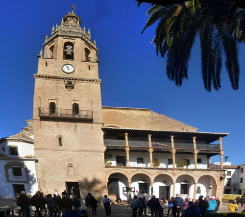
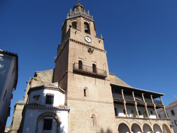
The current church is square and is organized internally in three naves. The church has Baroque plasterwork and a total of five domes- a main one in the center and the other four at the corners of the square. The rest of the roof elements are barrel vaults with lunettes and large stained-glass windows.
The facade is perfectly symmetrical, flanked by two quadrangular bell towers that are somewhat tapered as they rise. with the body of bells chamfered and in plan somewhat smaller than the base. Both towers are crowned by spiers of tiles. The entrance, located in the center of the fa�ade, is made of stone and has a half-point arched access hole between paired pilasters that support a broken pediment with a niche containing an image of the Infant Jesus. The entire cover is crowned with a curved pediment and a large imperial shield.
|
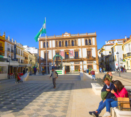
Its construction dates from 1900 to 1903, and it presides over an entire front of the square with its elegant main facade, and its construction established not only a cultural landmark but an architectural reference for the century that began then. Construction was overseen by Pedro Alonso y Guti�rrez, the Municipal and Diocesan Architect of C�rdoba. The three-storey building has strong Plateresque influences, but also has floral decorations and the prominent presence of a female bust at the apex of the pyramidal finish of the facade that shows modernist influences.
The facade facing the square shows a very pronounced symmetry. It has elongated windows, balcony running at the second level and an arched arcade gallery with neo-Gothic crests on the upper floor. Inside the building there is a large covered central courtyard that is the structure's focal point.
The building is culturally significant for Andalusia, as it was here that the Assembly of 1918 was held where the flag and the legend of the Andalusian coat of arms were approved.
We left the square via a different street, walking back to Calle Virgen de la Paz where we reunited with our group. When we were all together, we headed back north to the bus station and our return to Malaga. Walking around Ronda was immensely interesting and entertaining and well worth the cost of the excursion. The scenery was spectacular, and both Fred and I thought we would like to come back here and do some more exploring around the canyon- and most particularly visit the Puente Viejo.
Our Return Trip to Malaga
Our trip back through the Andalusian countryside was really pleasant, as the rural area of Andalusia was even prettier in the afternoon sun than it was this morning. All too soon we were back in the outskirts of Malaga, and soon after that were going back through Malaga's central park on our way to the ship.
|
(Mouseover Image Above for Video Controls) |
Here are a few of the pictures we took from the bus:
|
And here is the last set of pictures from our ride back to the port; most of these were taken as we neared that port:
|
We got back to the ship about 5PM ahead of a 6PM departure for Casablanca, and we had a nice evening on board. You'll get introduced to the ship shortly, but I'll wait until we have a couple of sea days after Casablanca.
You can use the links below to continue to another photo album page.
|
November 17, 2019: An Excursion to El Jadida from Casablanca |
|
November 14, 2019: A Walking Tour of Barcelona/The Viking Jupiter Sets Sail |
|
Return to the Index for 2019 |