|
March 6-25, 2019: Our Spring Trip to Fort Lauderdale |
|
February 23-27, 2019: A Visit to San Antonio |
|
Return to the Index for 2019 |
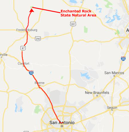
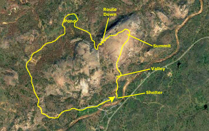
For some time now, Fred, Guy, and I have been trying to arrange a visit to Enchanted Rock, which is north of Fredericksburg, Texas. Last year, we actually drove up there only to find that the park was at capacity and we could not get in. This time, we decide to reserve a spot ahead of time and go on a weekday when we thought it would be less crowded. This time, everything worked out and we were able to see this famous Texas landmark.
|
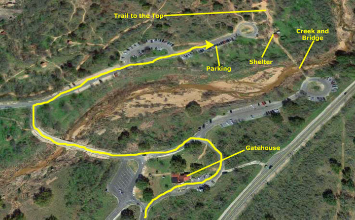 |
This time, we drove right into the park and, although we stopped at the gatehouse to show them our online tickets, we really didn't need to, as the park was hardly full. We drove across the creek and around to the eastern end of the parking area. There were plenty of spaces.
|
|
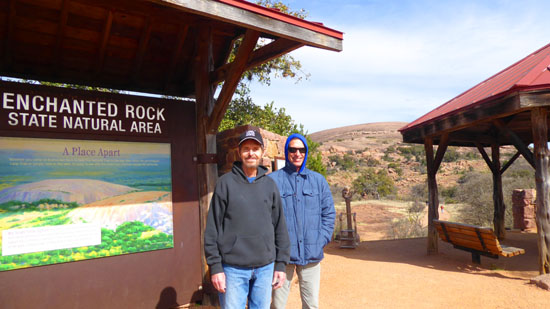
The Enchanted Rock State Natural Area, a part of the Texas state park system, includes over 1600 acres of land. The rock dome itself was designated a Recorded Texas Historic Landmark in 1936, and in 1971, Enchanted Rock was designated as a National Natural Landmark by the National Park Service.
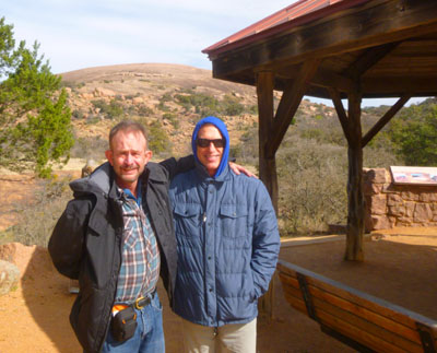
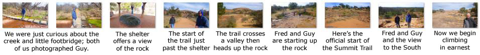
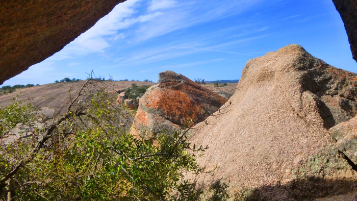
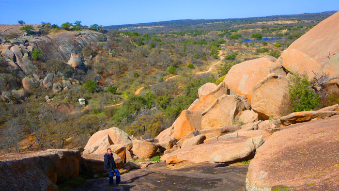
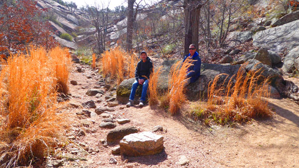
When we first got out of the car, it seemed very, very cold, and particularly the first pictures we took as we walked down to the little creek south of the shelter have Guy looking a little uncomfortable. But it didn't take very long, as we started out on the trail to the summit for the exertion to do its thing, and by the time we'd crossed the little valley between the shelter and the rock and were beginning the ascent, we were all beginning to rethink all the jackets and coats! Anyway, here, in time sequence, are the pictures we took as we walked to the beginning of the Summit Trail:
|
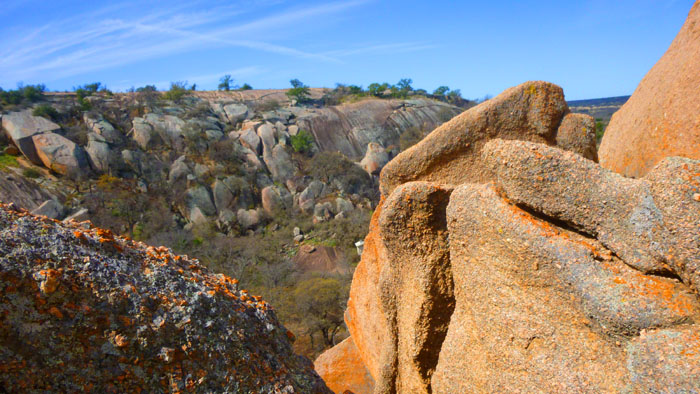
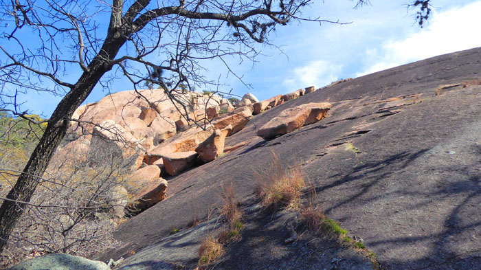
As we trekked up the bare rock to the summit, we recalled what we knew of this geologic feature, which is visible for many miles in the surrounding basin of the Llano Uplift. This weathered dome (a "monadnock" to geologists), is the visible portion of an igneous batholith called the Town Mountain Granite, formed in the middle Precambrian (1 billion years ago) as material intruded into the even older Packsaddle Schist. All of this was covered by sediment when this was an inland sea, only to be exposed as limestone was worn away over the eons since the sea retreated.
|
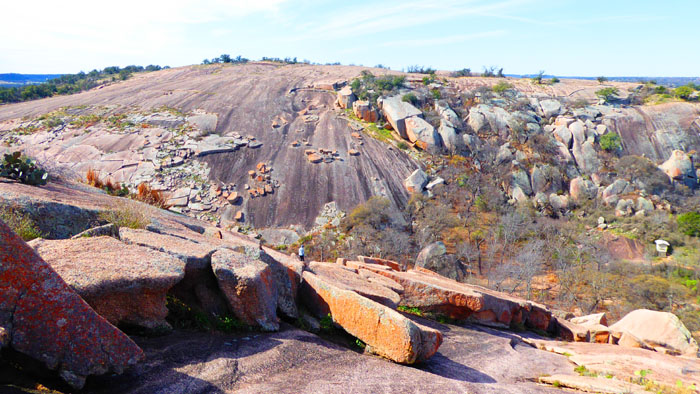
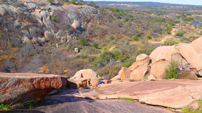
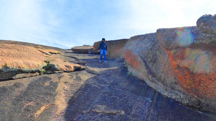
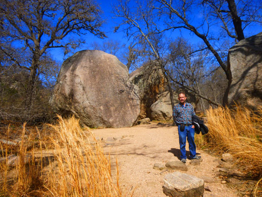
From the shelter, we followed the obvious pathway down and across a creek valley and then up the side of the batholith to the official start of the trail to the summit. From there, our route was across bare rock up to the top. After walking around the summit for a while, and not wanting to retrace our path, we went down the western end of the oval-shaped granite outcrop.
We had done this before, and knew that there were rocks that would allow us access down to the Loop Trail- one of the many trails in the Natural Area. This trail would take us north and then west and around a smaller rock outcrop, heading south and then east once more to the parking area. Getting a good walk in was one of the reasons we came up here today.
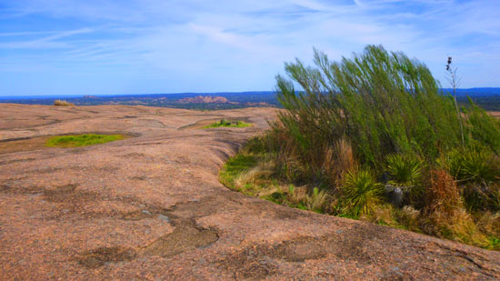
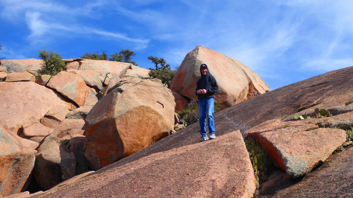
The route to the summit was for the most part across bare rock; there was no real trail, but of course we could see our destination. Here are a few of the many pictures we took as we made our way to the top:
|
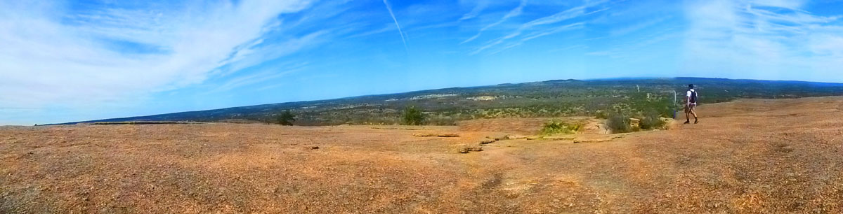
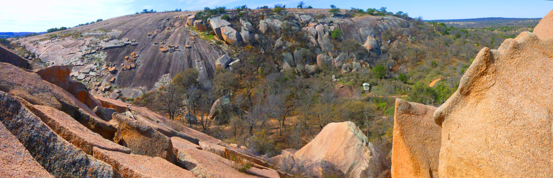
About halfway up to the summit, I stopped to look back and take a panoramic picture of the first part of our hike up:
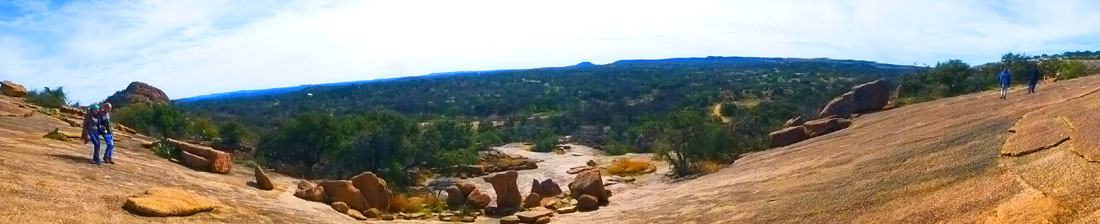 |
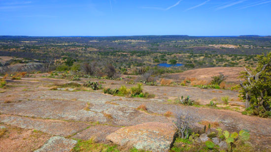
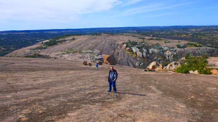
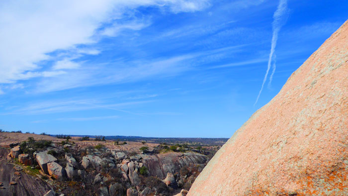
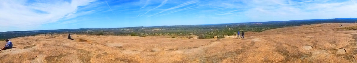
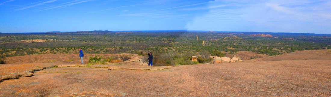
Fred and I have been to the summit of Enchanted Rock before, but it has been a while. We were reminded why this site is one of the most visited natural places in Texas as we walked around the summit taking in the unobstructed views in all directions. It was a great place for panoramic pictures. Most of the best of these looked west.
 |
Archaeological evidence indicates human visitation at the rock going back at least 11,000 years. According to the book The Enchanted Rock published in 1999 by Ira Kennedy:
| "These hunter-gatherers had flint-tipped spears, fire, and stories. With these resources, some twelve thousand years ago, the first Texans became the wellspring of Plains Indian culture. On the basis of archaeological evidence, human habitation at Enchanted Rock can be traced back at least 10,000 years. Paleo-Indian projectile points, or arrowheads, 11�12,000 years old have been found in the area upstream and downstream from The Rock. The oldest authenticated projectile point found within the present day park is a Plainview point type, dating back 10,000 years." |
|
|
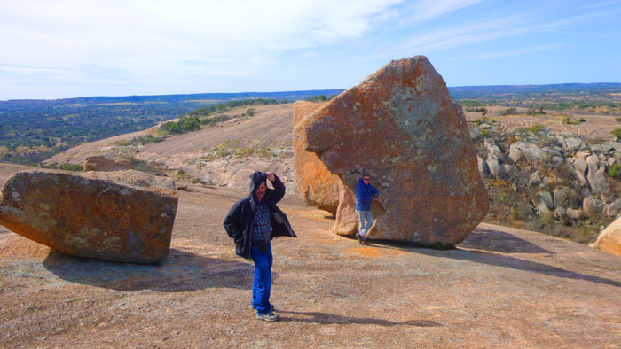
Above, you see Guy and Fred at the summit at the view beyond them to the west. And below is the view to the southwest.
|
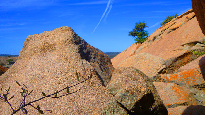
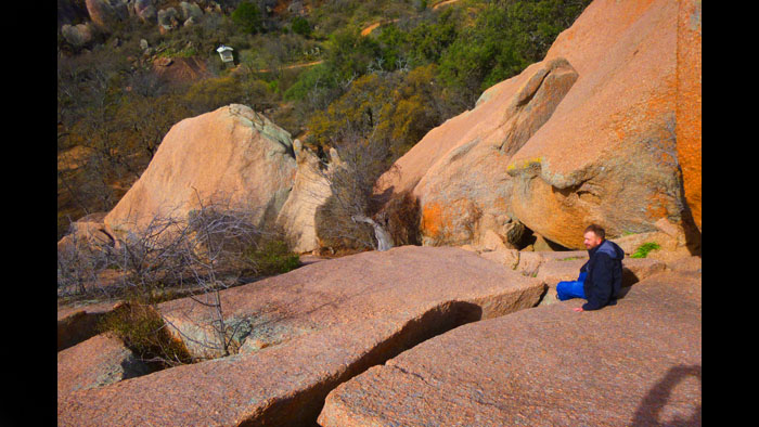
From the summit, we wanted to get down to the "canyon" that lies just west of Enchanted Rock itself, a valley that runs between it and a smaller rock outcrop to the west. Although this panorama was made as we were on our way down, here is a view of that secondarly, smaller rock dome just to the west of Enchanted Rock itself:
|
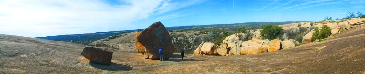
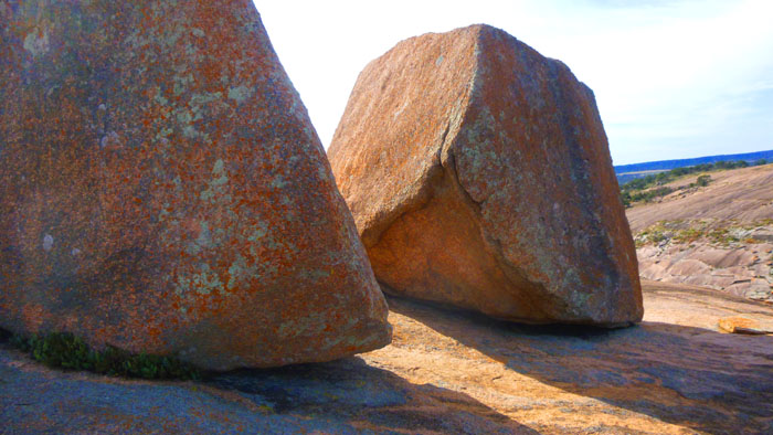
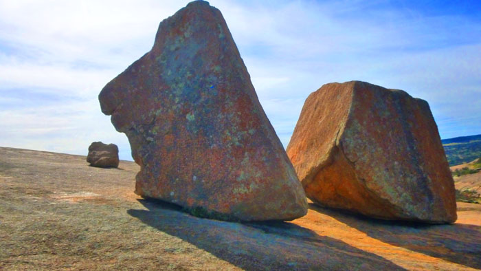
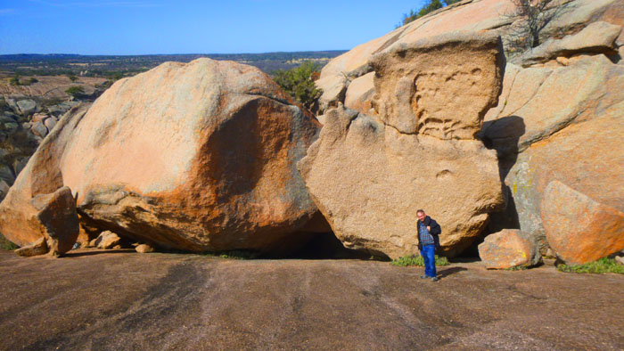
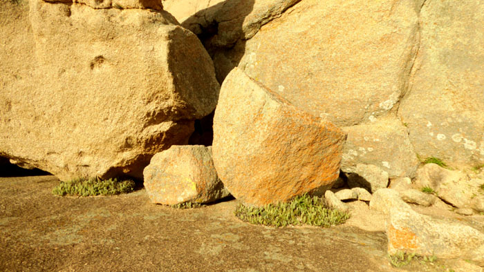
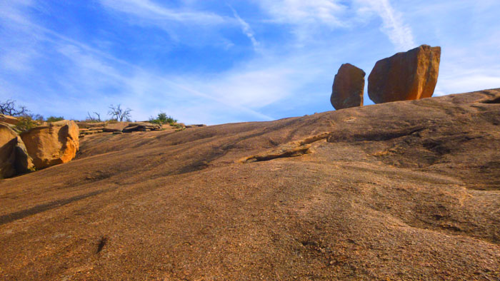
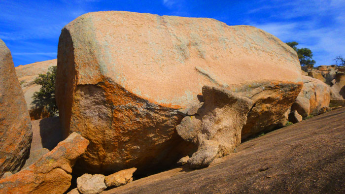
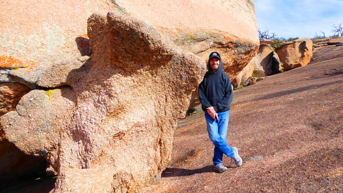
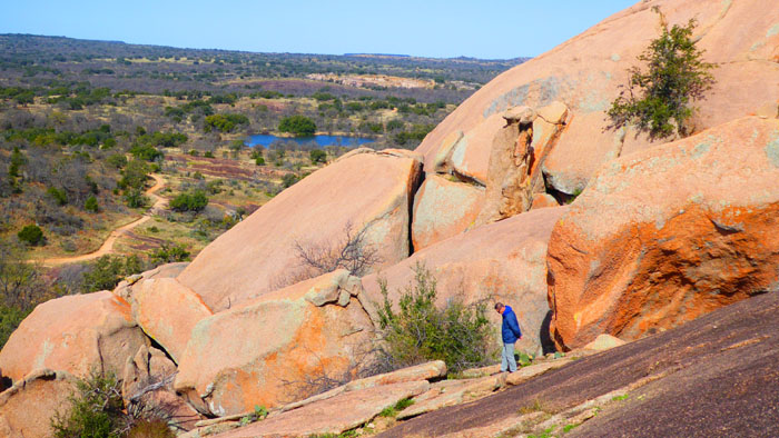
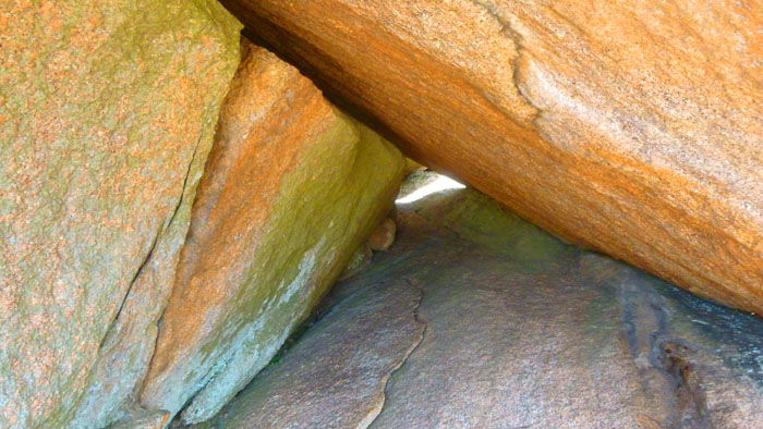
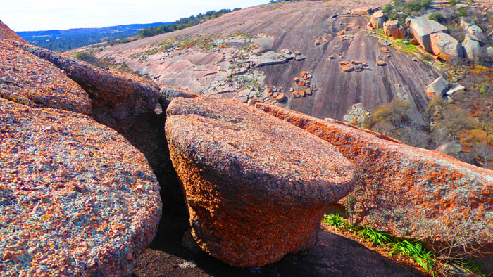
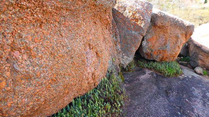
Fred and I have made this descent before, but since there is no marked pathway, we undoubtedly took a little different route this time than the last time we were here. One thing we saw that I hadn't remembered were the red rock boulders that we saw. It looked af the rock was a composite of clay and smaller rocks, but it wasn't, and I can only imagine that iron gives the rock its color (which much be spectacular if the sun is shining directly on it). While I was finishing up on the summit, Fred and Guy headed down the slope to some large, freestanding boulders that sit by themselves on the rock slope. Before I headed down, I made this panoramic picture of them:
|
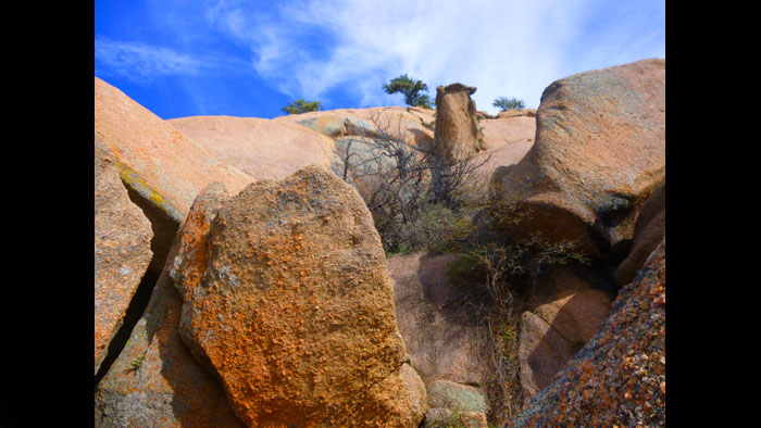
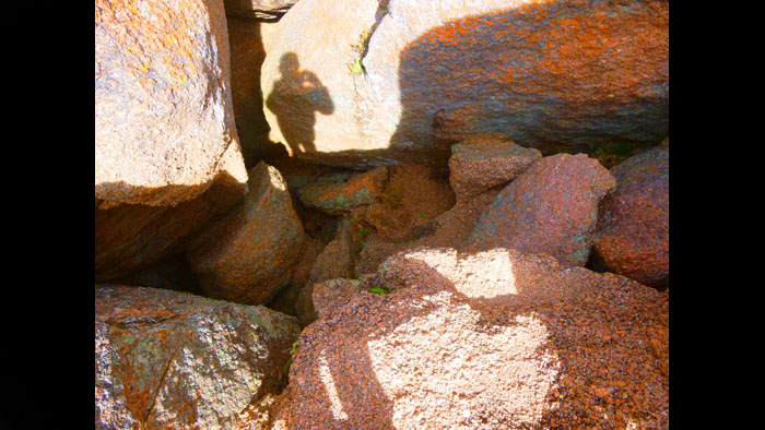
So we began to head down the slope, moving over to the side where there were large and small rocks that we could use as steps to get down into the valley (the smooth rock slope gets way too steep before you get down off it).
|
|
Rather that present you with twenty-seven thumbnails and have you click on them one after another, I've put these pictures into a slideshow, and that slideshow is at left. To go from one picture to the next, just click on the little arrows in the lower corners of each slide. You can check your progress through the twenty-seven pictures by referring to the slide numbers in the upper left of each image.
Have a look at what you would see if you came along with us on our way down off of Enchanted Rock!
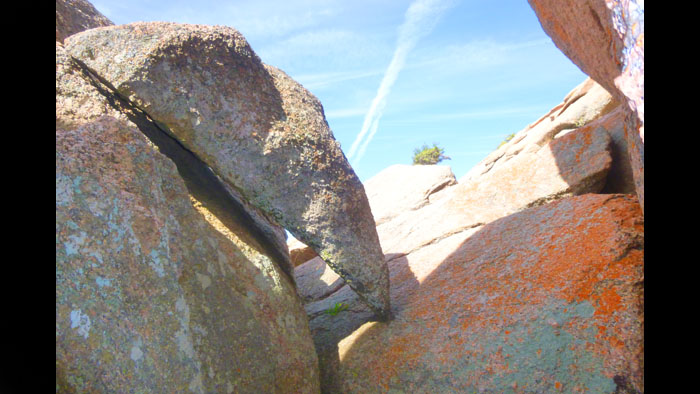
There were a couple of places where getting down was a bit tricky; there were so many ways you could go, that I guess not many people go exactly the same way. Guy seemed to have an easy time, but perhaps Fred and I were overthinking it.
|
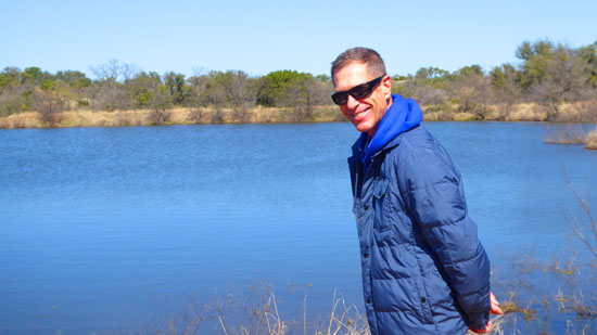
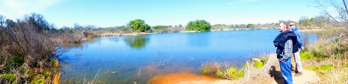
For the next hour and a quarter we made a large circuit of the western monolith. It was a pleasant walk, particularly since we were out of the cold wind that was blowing across the Enchanted Rock summit. Except for the lake we passed, the landscape was pretty but uniform, so we didn't take many pictures, but here are ones I do think are worth including here:
|
|
Finally, here is a nice panorama that I took on the shore of the little lake that we past early in our circuit:
We very much enjoyed our day at Enchanted Rock- particulary Guy, for whom it was a first visit. We drove back to San Antonio through Fredericksburg where we stopped for lunch, and arrived back at Prudence's house about four-thirty.
You can use the links below to continue to another photo album page.
|
March 6-25, 2019: Our Spring Trip to Fort Lauderdale |
|
February 23-27, 2019: A Visit to San Antonio |
|
Return to the Index for 2019 |