|
February 26, 2019: A Day at Enchanted Rock State Park |
|
December 28, 2018-January 17, 2019: Our Winter Trip to Fort Lauderdale |
|
Return to the Index for 2019 |
On Saturday the 23rd, Fred and I left Dallas for a short trip down to San Antonio to visit Prudence and Ron, Guy, and Nancy and Karl. We haven't been down to see everyone since early last December.
Getting to the Ruckman's House in San Antonio
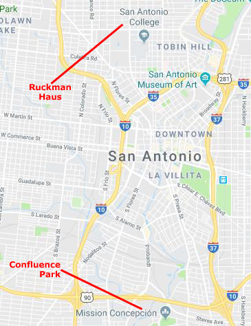
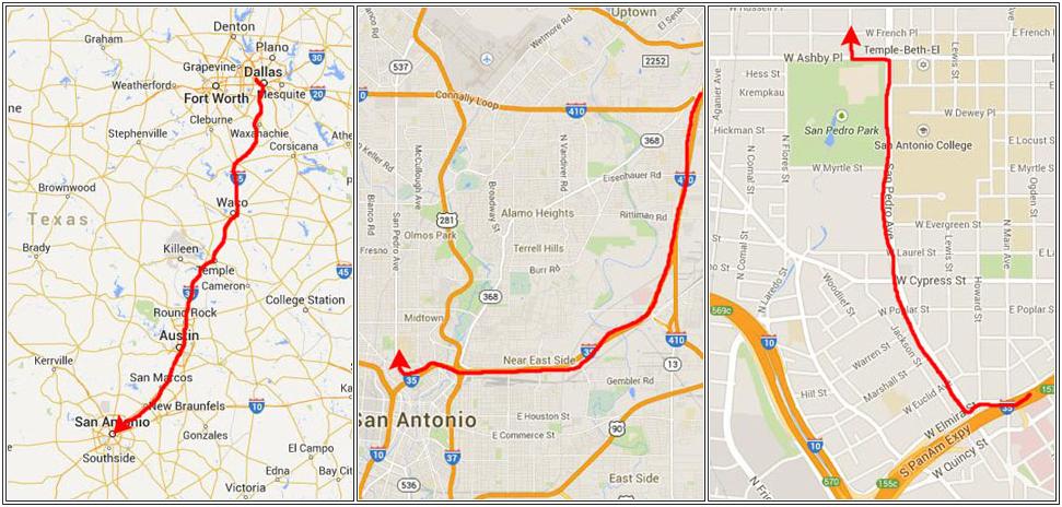
On the left-hand map below, you can see the normal route from Dallas down to San Antonio. Not much explanation is necessary; sometimes we take the bypass around Austin, but most times we don't, and the trip to the San Pedro exit in San Antonio is usually four hours plus.
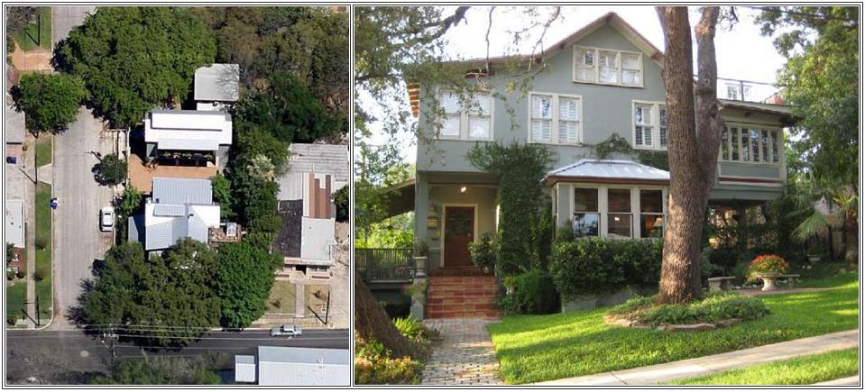
We head north on San Pedro Avenue a couple of miles and then either hang a left on Ashby and a right on Breeden or just a left on French to get to the Ruckmans' house on the northeast corner of Breeden and French.
 |
In case you have not seen them, I have put below first an aerial view of the Ruckmans' house (it is the house on the corner and the garage/apartment building north of it where Guy lives) and a front view of the house (taken in 2010).
 |
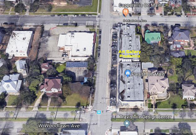
At Art Gallery Prudencia
|
Prudence has renovated her space a great deal, and today the gallery looks pretty amazing. She has more artwork in her gallery than she can display all at once, so she rotates it along with the various shows and exhibits that her artists hold. This afternoon, the gallery was still set up for the last event she had.
Now that the gallery is open, we usually stop there first when we drive down (unless it's a Sunday or Monday, the days the gallery is closed). She's always doing something new, and we like walking through the multi-room gallery looking at artwork that may have been put on display since we were here last.
|
I took quite a few pictures as Prudence showed us around the gallery, and I want to include some of them below:
|
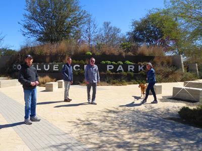
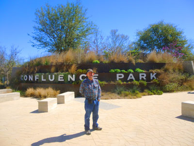
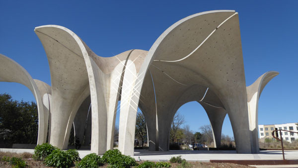
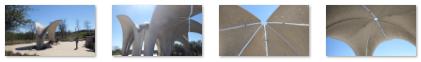
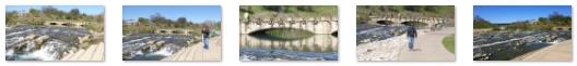
Other than hang out at the gallery, we did two other excursions of note. One was to a new section of the Riverwalk that we had not been to before- a place known as Confluence Park. The pictures from that outing are below. The other trip was a half-day trip that Fred, Guy, and I took to Enchanted Rock, which is up north of Fredericksburg. That trip will get its own album page.
Confluence Park and the River Walk
|
|
|
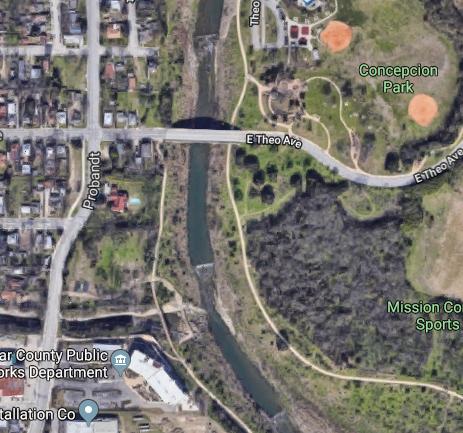
In early 2016 the River Walk was connected with another linear urban walkway, the San Pedro Creek Greenway. The greenway joins with the River Walk at the confluence of the San Pedro Creek and the San Antonio River near Mission Concepcion, which is how Confluence Park got its name.
|
But between us, Fred and I took a number of other interesting pictures of the structure, as well as the small "echo" of it that is located down the hill a bit towards the River Walk. Some of these pictures are below:
|
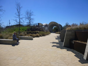
Between the parking area and the park pavilion were a couple of walkways, each lined with stone blocks or benches, with interesting landscaping and, along one path, a small building used to house the park facilities and a small exhibit of the characteristics of the San Antonio River Walk at this point.
|
(Mouseover Image Above for Video Controls) |
 |
 |
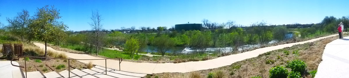
From the pavilion, we headed off to go walk along the river itself. We went down the stairs from the park down to the River Walk and turned right to head south. At the bottom of the stairs, I let my little camera create a panoramic view of the portion of the River Walk just below Confluence Park:
|
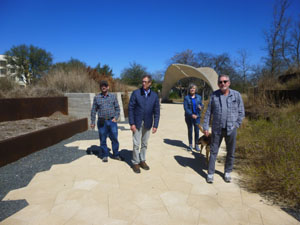
So with Prudence taking Jax, we headed south from Confluence Park just to see what we could see. The walk down to the point where the actual confluence occurs was about a quarter mile.
|
We continued walking south on that side of the river almost to Conception Park (so named for its proximity to one of the missions along the river). We eventually returned to re-cross the river, and at that point we walked a ways west up the urban walkway that parallels San Antonio Creek.
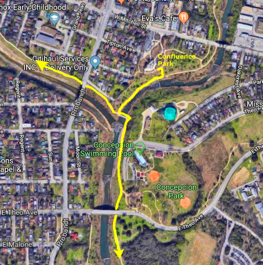
Walking down to the confluence, we has some nice views of the river, particularly when we went right down to it (there were numerous places along the walk where you could follow a path of maybe 20 feet right down to the water). Here are some of the pictures we took on the way to the confluence:
|
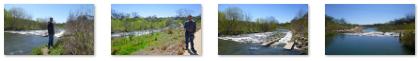
At the actual confluence, we made the decision to first continue a ways down the San Antonio River Walk and then, if we felt like it when we got back here, we might walk up the creek a ways. The bridge across the river here was pretty neat. It is made of heavy stone blocks, and it is securely anchored at each end.
|
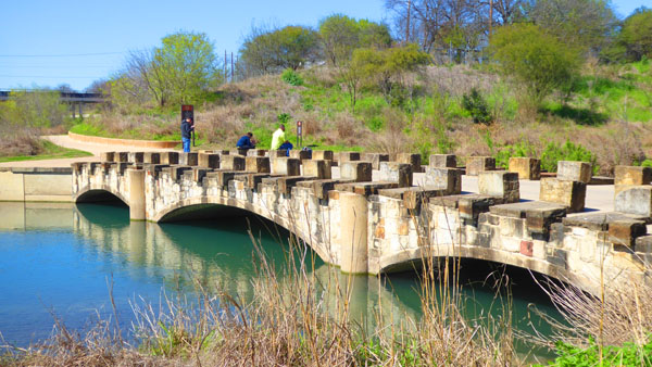
That's not say that the Confluence Bridge had no decoration; but that decoration, which consisted of many of the stone blocks having carvings on their tops or sides, would not be damaged in the occasional flood. Here are a few of those carvings:
|
Now, neither the San Antonio River nor San Pedro Creek are sizeable waterways, but they do have enough water flowing through them that they can generate some neat "rapids" (even if those rapids aren't very deep).
|
(Mouseover Image Above for Video Controls) |
Here are some of the pictures we took as we were walking along the pathway just south of the Confluence Bridge:
|
From the bridge, the walkway continues south on the east side of the San Antonio River, and after a short distance there were nice views looking back at Confluence Bridge.
|
Conception Park is north of Theo Avenue, and that's where we'd left Ron and Jax to sit in the sun right by the walkway that connects the park to the River Walk, and an unusual "viewing platform" that has a spiral walkway up to the top. Fred got a couple of good pictures of Ron and I here at the park, and I took a picture of the viewing platform:
|
On the way back, I stopped by a couple of signs about the river itself, and I thought you might want to read them:
We had another really nice visit down here with everyone, and other than this walk and the day trip that Fred, Guy, and I made to Enchanted Rock (see next album page), I just spent my time at the gallery helping Prudence. It's always like visiting family when we come down here, and we always enjoy it.
You can use the links below to continue to another photo album page.
|
February 26, 2019: A Day at Enchanted Rock State Park |
|
December 28, 2018-January 17, 2019: Our Winter Trip to Fort Lauderdale |
|
Return to the Index for 2019 |