|
September 16, 2017: Our Trip Home |
|
September 14, 2017: A Drive Around Île d'Orléans |
|
Return to the Index for Our Trip to Quebec City |
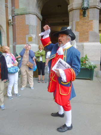
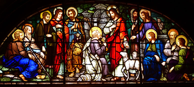
Today, Karl has arranged two tours for us. The first will be a half-day guided tour of the Old City here in Quebec City, and the second will be a guided tour of the Chateau Frontenac. We will do both of these once Fred, Guy, and the girls are back from their morning walk and we have all had some breakfast.
A Pre-breakfast Walk
Prudence has a habit of going for a walk before breakfast. In San Antonio, this is usually to take Jax over to the park. But when she travels, she (and, if they are along, her sister, Fred, and Guy) will typically just go out and walk around wherever she happens to be. This morning was no exception.
|
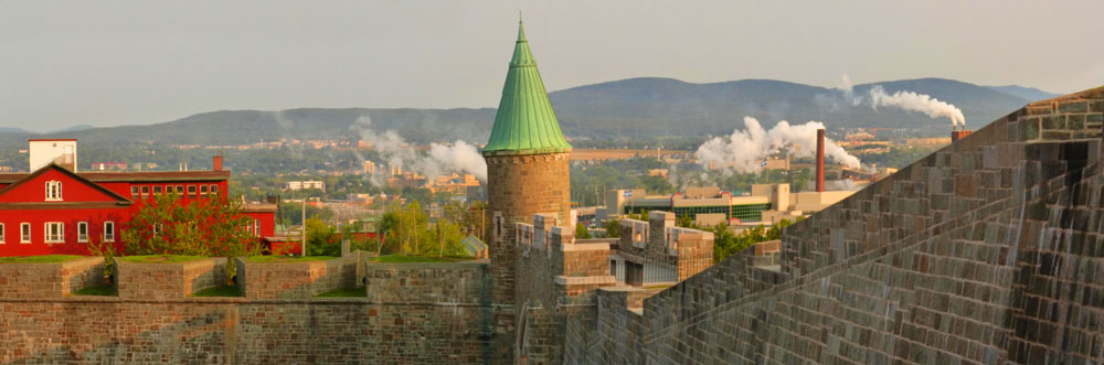
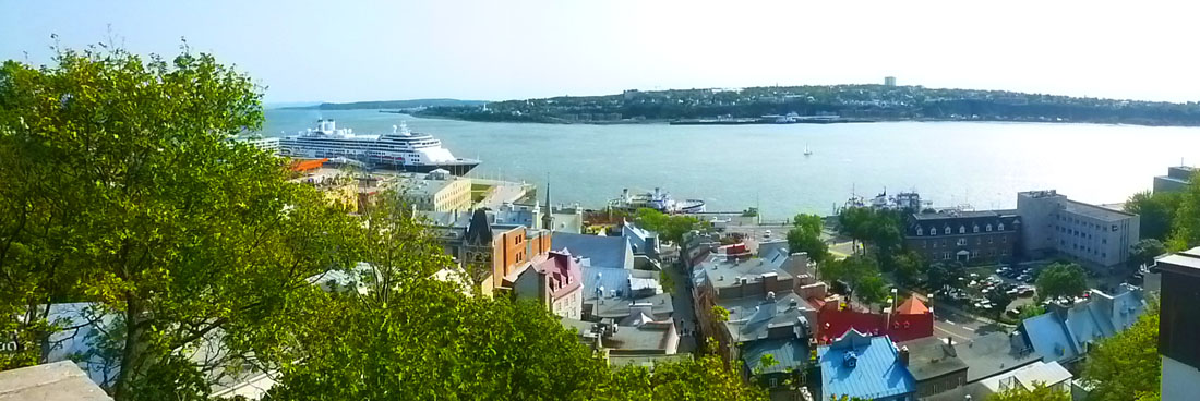
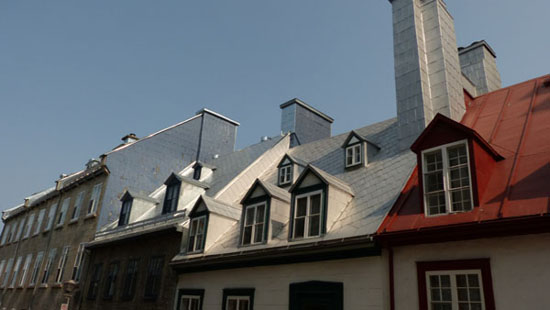
As they passed through the city walls, Fred went up on the wall itself to get a couple of pictures looking north along those same walls. I thought the pictures were both quite good, but then I realized that they could be merged into an even nicer panoramic view. That's the view that you can see at left.
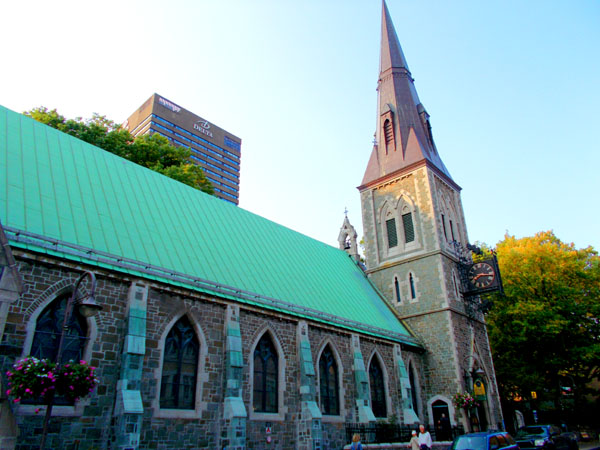
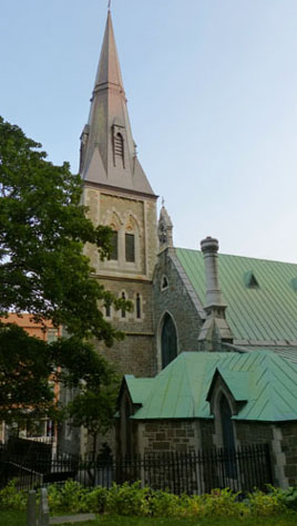
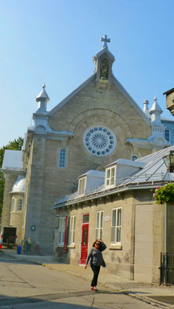
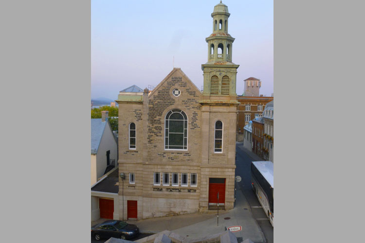
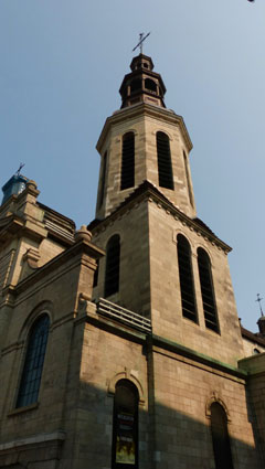
Judging from their photographs, they continued walking to the west, eventually arriving at St. Matthew's Church- a church building that we had passed on our walk to the Hobbit Restaurant a few nights earlier.
|
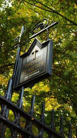
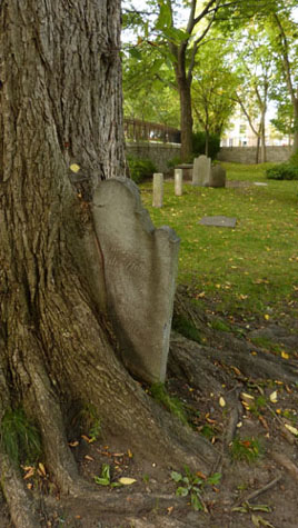
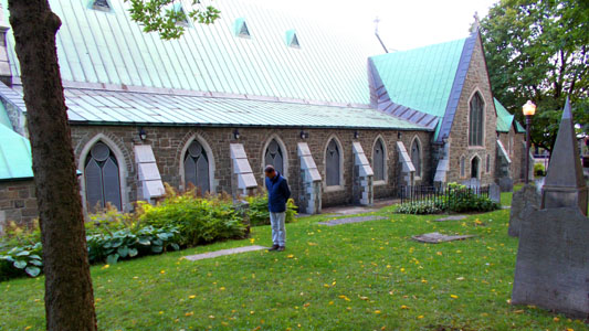
After New France was handed over to England in 1763, the need to bury Christians of different denominations in separate graveyards led the British government to acquire a plot of land on Chemin Saint-Jean where Anglicans (and later Presbyterians) would be buried. The first person was buried there in 1772.
Fifty years later a priest would sometimes celebrate mass in the gravedigger’s house for the French-speaking Anglicans from the islands of Jersey and Guernsey who had moved to Québec. Arched windows and a dome were added, confirming the new use for the wooden building that became known as St. Matthew’s Chapel. But the fire of June 1845 destroyed the building, along with the rest of the Saint-Jean district.
A stone chapel that could hold up to 500 people was inaugurated on the same site in 1849 and had to be enlarged several times to meet the needs of the growing Anglican population. Montréal architect William T. Thomas oversaw a series of major renovations between 1870 and 1882, while St. Matthew’s was formally erected as a parish. He made the chancel and nave bigger, added a transept, and had a towered gatehouse with chiming clock built.
Thomas was inspired by the Ecclesiological Society, then flourishing in England as a reaction to industrialization. The movement’s supporters hoped to find the roots of true faith in the Middle Ages. This explains why St. Matthew’s Church has a very pure Gothic style, like many other places of worship of its day in the United Kingdom, and why efforts were made to retain its green setting.
|
Québec City’s Anglican community dwindled throughout the 20th century, to the point that in 1954 when the time came to replace the grand polychrome slate roof, parishioners opted for a more affordable copper covering. In 1979 the community was forced to ask the City of Québec to take charge of both St. Matthew’s Church and graveyard.
The city acquired the historic church and graveyard for a symbolic dollar. It then converted the church into a library, taking care to preserve its authenticity and religious character so that visitors today can admire baptismal fonts from 1894, a marble pulpit, stained-glass windows, and original woodwork. An act passed by the Canadian government prohibited the graveyard being used after 1860 in order to reassure locals who believed the corpses to be a cause of epidemics.
|
|
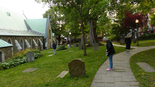
In line with Anglican tradition, the 8,000 to 10,000 people buried in the graveyard remain there to this day. This is why the new look recently given to the city park just outside St. Matthew’s encourages silent contemplation and the gravestones have not been removed. The gravestone belonging to Scottish soldier Alexander Cameron, who died in Lévis in 1759, and whose body was then transferred to St. Matthew’s graveyard, is thought to be the oldest in all Québec.
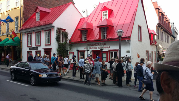
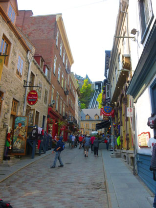
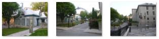
The four of them did make it as far as the Hobbit Restaurant before they turned south to head towards the Grande Allee. Along the way they passed a couple of examples of public art here in Quebec City:
|
|
When they reached the Grand Allee, they turned back towards the Manoir d'Auteuil, passing through the Orleans Gate on their way back to the hotel.
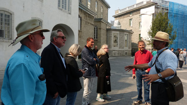
A Guided Tour of the Old City
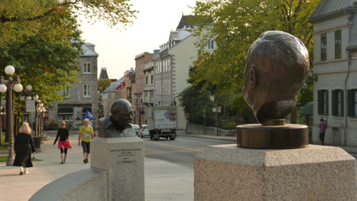
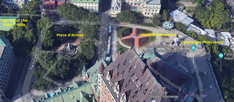
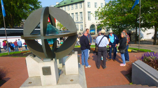
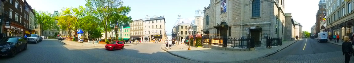
After breakfast, we all walked from the hotel to the Place d'Armes, the small park near the Holy Trinity Cathedral, and then across Fort Street to the small plaza adjacent to the Chateau Frontenac. This is where our tour guide met us. It is also the site of the UNESCO Monument and the monument to Samuel de Champlain.
|
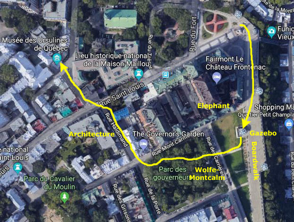
On that map, I have marked the various major stops that we made, and to take you along with us I'll organize this morning's pictures around those stops. I'll put each one in its own little section below.
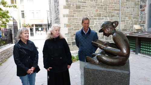
We followed a familiar route to get over to the plaza and our tour guide, although we did walk down one new street where we passed by an interesting; sculpture we hadn't seen before.
The Dufferin Terrace
|
The area is commonly referred to as "the Old City" or "Quebec's Old City" in English (and even sometimes as "the Latin Quarter", although that particular term is more often applied to the area around the Séminaire de Québec, the original site of Laval University.
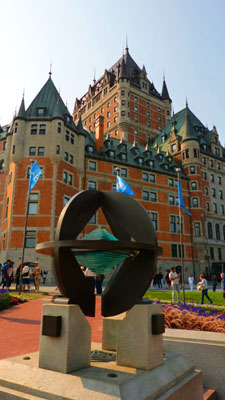
The Historic District of Quebec was insribed on the UNESCO World Heritage List in December, 1985 in recognition of its exceptional and universal value. The cradle of French civilization in America, this district with its architecture and urban landscape, bears witness to the historical role Quebec ha played as capital under the French, British, and Canadian regimes. As a strategic stronghold for almost three centuries, Quebec has conserved the principal features of its ancient defense system and is the only city in North America still surrounded by its authentic fortified walls.
|
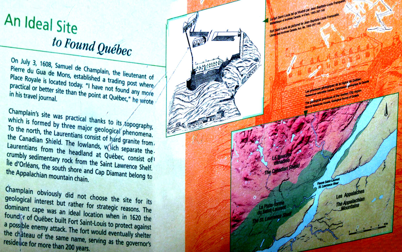
Much of information I have here for our tour came from our guide, although in some cases I've gotten information to supplement what he told us. Samuel de Champlain chose the Upper Town as the site for Fort Saint Louis in 1608. It has remained the city's military and administrative center because of its strategic position atop the promontory of Cap Diamant. It was occupied mainly by British government officials and Catholic clergy after the British Conquest, while French and English merchants and artisans lived in Lower Town.
|
|
The area declined and fell into disrepair in the 1950s but new building began in the 1970s.
Most of the buildings here date to the 19th century, although some structures from the 17th and 18th centuries remain as well. The area has several commercial streets like Saint Jean, Sainte Anne and De Buade. Some public administration and other institutions in the Upper Town are the Quebec City Hall (Hôtel de Ville), the Séminaire de Québec, the Ursulines Convent, and the Augustinian Monastery and l'Hôtel-Dieu de Québec. There are many hotels, including the Château Frontenac, the Old City being a very popular tourist destination.
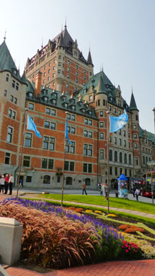
The monument commemorating the UNESCO designation is right in the middle of the little plaza, which is dominated by the Chateau Frontenac (which Nancy, Karl, and I will tour a bit later on in the day)- certainly the old city's most recognizable structure.
 |
 |
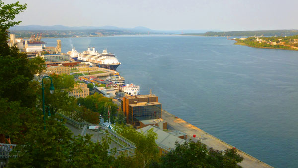
The Lower Town is a historic district located at the bottom of Cap Diamant. During 1608, Samuel de Champlain built a habitation where its remains can be found with Place Royale as its centre. It was restored with the goal of reconstructing the French flair from its origins. Construction of the Church of Notre-Dame-des-Victoires started during 1687 at this location and was completed during 1723. The area (which we'd visit later, as it turned out) has numerous museums, performance halls, theatres, and exhibition venues. It is also the site of the Port of Quebec, which includes a dock for fairly large cruise ships.
A funicular car allows for easy transportation up Cap Diamant connecting to Upper Town from the narrow Petit-Champlain road at the foot of the Cape to the top with a marvellous view of the city. Côte de la Montagne (a wrought-iron staircase that leads from the north side of the plaza all the way down to the Lower Town) is an option for the more energetic.
|
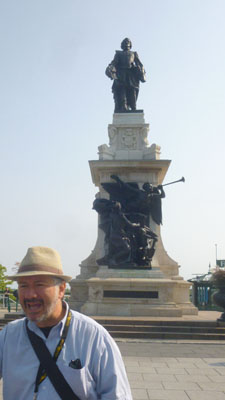
The project to build a monument to the founder of the city of Quebec dates back to the 1850s when the Society Saint-Jean-Baptiste of Quebec initiated the effort, but the cost was very much a problem. In the summer of 1867, Parisian sculptor Louis Rochet offered his services to build the monument on the condition that the city assume the costs of melting and materials. But the city was not ready for such an expense. In the spring of 1879, James MacPherson Le Moine presented a resolution to a meeting of the Quebec Literary and Historical Society supporting the idea of making the monument, but no action was taken.
In the fall of 1890, the Saint-Jean-Baptiste Society of Quebec relaunched the project and undertook to raise the funds to achieve it. The president of the company, Jules Tessier, sent a letter soliciting the support of the mayor and the aldermen; they created a commission to oversee the project.
A subscription committee set out to raise $30,000, and in 1896, began a contest to choose the artist. Eleven drawings and fourteen models were presented to a selection committee, and they chose the design from a young Parisian sculptor- Paul-Romain Chevré. When the funds were subscribed, the structure was built and dedicated in 1898. The monument is 50 feet high, while the actual statue is about 15 feet tall. On the monument's base are scenes from the city's history.
This project established Chevré's reputation, and is his most famous work. Oddly, reviews of the sculptor's work were decidedly mixed, with one critic advising the to take courses, calling the statue a "big sad musketeer". Over time, however, the work has become a popular piece of local heritage, and is sometimes considered the best representation of Champlain's character.
Governor's Park
|
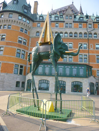
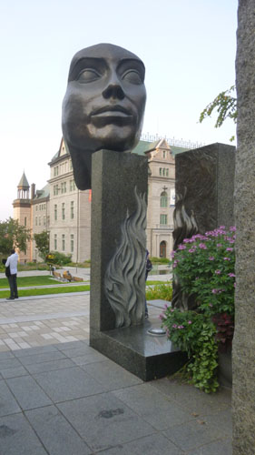
Right in front of the building (which is now a Fairmont Hotel), we passed the unusual sculpture that you can see at left. As it turned out, it was a sculpture by Salvador Dali. As you can see, it is a big bronze pachyderm topped with a golden pyramid; it has stood here since May of this year. Early next year it is set to travel from Quebec City to Montreal where it will take up residence for the next two years.
"The obelisk leads the elephant towards space and the legs are stretching to defy weightlessness," says art dealer Sylvain Fortier, an expert on Dali sculptures. "This elephant has bat ears, the tail of a pig and the beard of a goat," Fortier said. The title of the work is "L'éléphant Spatial" ("Space Elephant"), and it is actually for sale. Asking price: $3.6 million. Dali made the seven-metre sculpture in 1980, when he was in his 70s. It's one of an edition of eight, which means there are seven other copies in existence. This one is owned by a Swiss collector who has consigned it to Fortier with the goal of selling it.
|
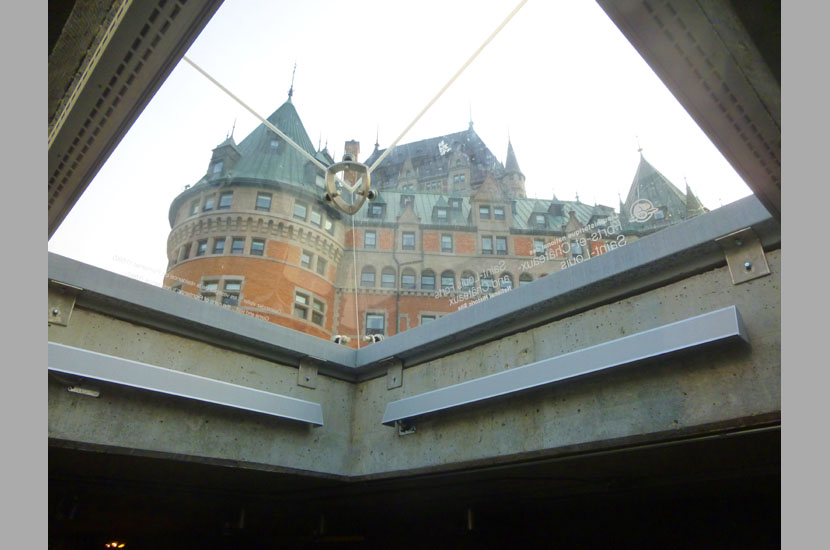
The glass enclosure at the right turned out to be a kind of skylight affair to the lower level underneath the boardwalk where you can walk through old ruins dating back 150 years.
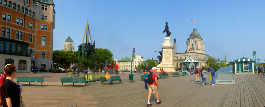
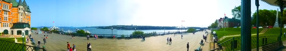
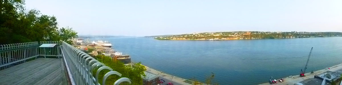
We continued past the hotel to come to Governor's Park on our right. Our guide led us up onto a covered platform with benches; the platform was constructed in 1884 and was, oddly enough, named "Princess Louise". There, he talked to us about the history of the British takeover, the Citadel, and the Plains of Abraham. From the platform, here is a panoramic view of the Dufferin Terrace and the St. Lawrence River in the background:
 |
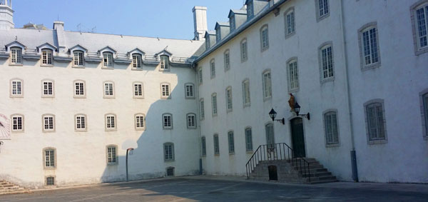
The platform was at the edge of the square block Governors' Park (Garden of the Governors)- a quaint park near the Chateau Frontenac. The park is surrounded on two sides by 19th century Victorian houses, on one side by the Chateau Frontenac, and on the fourth by the Dufferin Terrace.
 Chateau Frontenac |
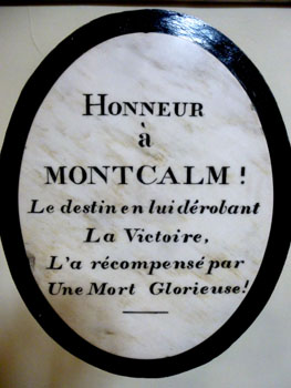
 Wolfe-Montcalm Monument |
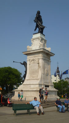
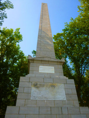
The Wolfe-Montcalm Monument is a 50-foot obelisk; it is the oldest monument in Quebec City, having been constructed in 1827. It is also the second oldest war monument in Canada, the first being Nelson's Column in Montreal; that monument was erected in 1809.
The mason who made the monument was John Phillips and the architect was Captain John Crawford Young of the 79th (Cameron) Highlanders. The monument commemorates the gallantry of the two generals, James Wolfe and Louis-Joseph de Montcalm, who fought (and both died) in the Battle of the Plains of Abraham; it is one of very few monuments to the victor and the defeated in the same battle. James Wolfe (1727–1759) was a British Army officer, known for his training reforms and remembered chiefly for his victory in 1759 over the French at the Battle of the Plains of Abraham in Quebec as a major general. Louis-Joseph de Montcalm-Gozon (1712-1759) was a French soldier best known as the commander of the forces in North America during the Seven Years' War. Montcalm met with notable successes, but British mobilization of large numbers of troops against New France led to military setbacks, culminating in Montcalm's death at the Battle of the Plains of Abraham.
The monument was unveiled in 1828 by Governor Dalhousie. The translation of the Latin on the monument, written by John Charlton Fisher reads "Their courage gave them a common death, history a common fame, posterity a common memorial."
We walked through Governor's Park to its northwest corner and the intersection of Rue de la Porte and Rue Haldimand, where our guide stopped to point out the marker for Sir Frederick Haldimand, for whom the street west of Chateau Frontenac was named.
|
|
We did stop to take a look at this renovation, which appeared to involve quite a bit of foundation repair. I thought it was interesting how the foundation was exposed and steel beams brought in to stabilize it temporarily. It seemed like a lot of effort.
|
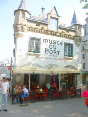
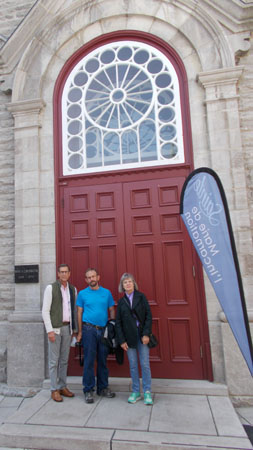
At the restaurant we headed up the street beside it (Rue des Jardins), which led to our next destination, the Ursuline Convent and Chapel.
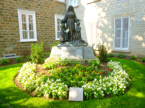
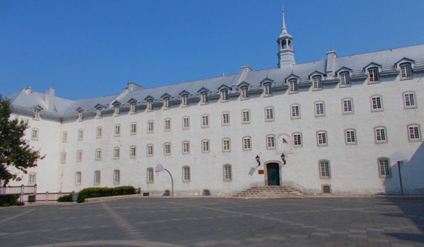
The Ursuline Monastery of Quebec City
|
|
Part of the Old Monastery with its fine timberwork and wooden staircase is the most imposing example of 17th century architecture still standing in Canada. The chapel altar dating from the 1730s is the work of the Levasseur family and is considered a masterpiece of Canadian wood sculpture. Large stone wings of mid-19th century date complete one of the most important complexes of religious buildings constructed in Canada prior to 1880. (Historic Sites and Monuments Board of Canada)
|
|
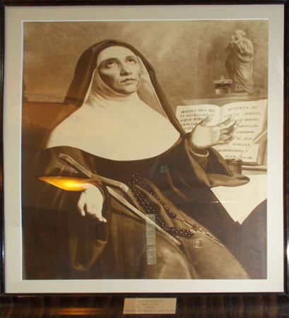
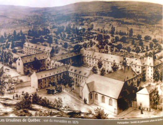
At the right is a photograph of a drawing of Marie de l'Incarnation, and below was an interesting artist rendition of how the Ursuline Monastery looked in 1879. Of course, in the century and a quarter since, the modern city of Quebec City has grown up around it.
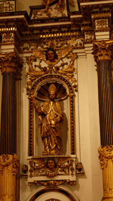
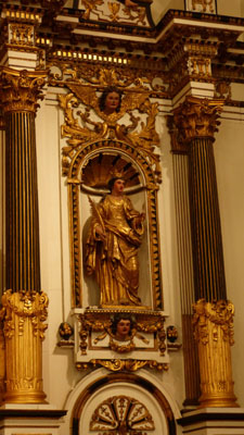
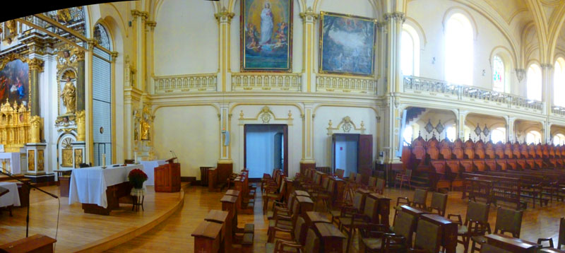
What our guide thought we should see was the chapel adjacent to the monastery office, so we went back outside and around the corner to the main door into the chapel. There were actually two chapels, situated at right angles to one another, but they seemed to share an altar area. One was closed to entry, I think because it is only used for actual services. The other is open all the time, and that's where we spent most of our time. Here is that chapel:
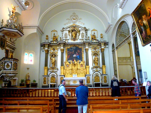 Altar/Sacristy Here you can see the altar area of the smaller chapel, and the pulpit at the left. To the right, through the opening, is the larger, second chapel. |
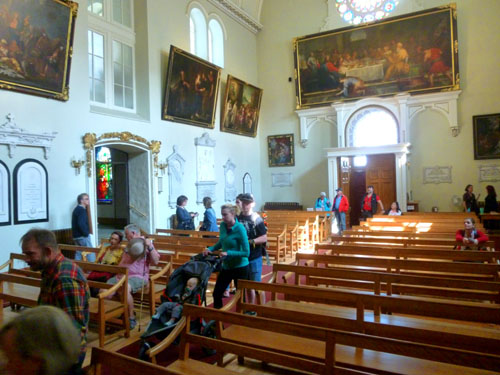 Nave Here you can see the doors through which we entered, and some of the decoration in the nave area where the pews are. |
Through the open doorway in the right-hand picture above, you entered a smaller room where the tomb of Marie de l'Incarnation (at least we assumed it was her actual tomb) was found. From that same room (more later) you could look into the larger chapel as well. Had it not been for the railing in front of the altar in the picture at left, you could also have gotten into the second chapel by going up and across in front of the altar.
|
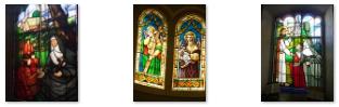
Below are some more pictures of this area of the church, and at left you can see two closeup pictures that Fred took of the icons on either side of the altar.
|
The door through which we entered had a small rose window above it, and between that circular stained glass window and the door below it there was a large painting depicting the "last supper".
|
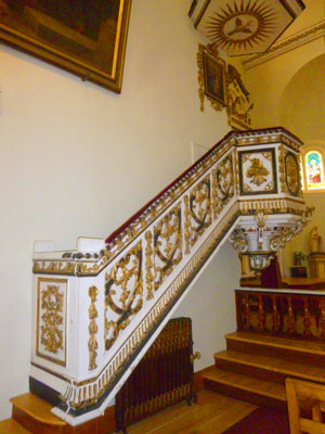
As you can see in the picture at right, there is a straight stairway up to the pulpit, which also had the traditional abat voix (sounding board) above it, done in the some style as the pulpit itself. The sounding board is not just a decorative structure; in many cases it is designed to help project the sound of the speaker. It is usually made of wood. The structure may be specially shaped to assist the projection, for example, being formed as a parabolic reflector. In the typical setting of a church building, the sounding board may be ornately carved or constructed. The term abat-voix, from the French word for the same thing (abattre (“to beat down”) + voix (“voice”)) is also used in English. Here is a close-up view of the decoration on the pulpit itself.
|
As I mentioned, there is another chapel at right angles to this one (and, frankly, I am not sure why), but let's go through the archway at the right side of the nave of the smaller chapel into the room from which we can see this other chapel:
|
As I said, this chapel was much larger, with an ornate ceiling and an organ. My guess is that this is the main chapel, but that it is only open for full services, with the smaller chapel, the one we were able to tour around it, used for daily devotions and always open to worshippers.
Back in the connecting room between the small and larger chapels, where Marie's tomb was, I stopped to admire the beautiful woodwork before returning to the small chapel.
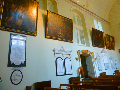
Before we leave, I want to comment on the various paintings and other decoration in the small chapel. We have seen in many churches that there are various plaques indicating tombs or dedications, and this small chapel was no exception. As a matter of fact, there were rather more than usual; here are some of them:
 |
 |
 |
From the Ursuline Chapel, our guide headed us out to see more of the old city.
Walking to Notre Dame Cathedral
|
Just near the Ursuline Chapel we came by a public sculpture called "The Feather and Hand". This sculpture, which is a large female hand holding a quill was located on the Rue des Jardins near the Ursuline Convent; it is a tribute to the women of the religious communities who have dedicated their lives to teaching.
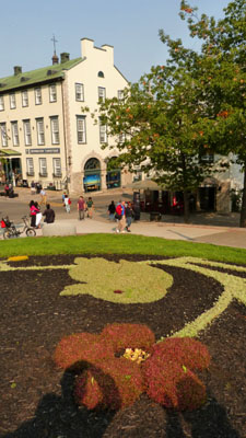
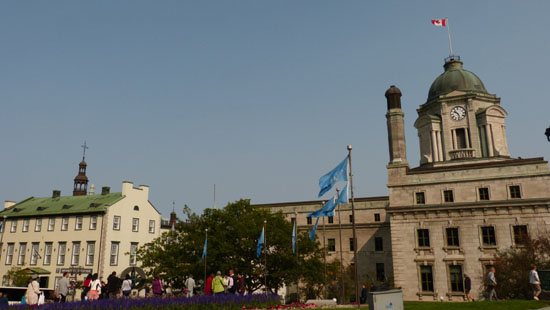
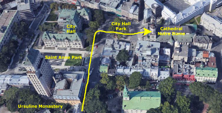
We walked north and crossed the east end of Saint Anne Park, the area I visited yesterday. The park or plaza is located just south of the City Hall of Quebec City; it is a pretty, restful space with a large water feature and a number of large flower sculptures.
As Nancy was walking along with us, she got a nice view looking back across the park space towards the Ursuline Monastery, and you can see that view here.
As we all walked north past the front of the City Hall building, I got a couple of good pictures:
|
|
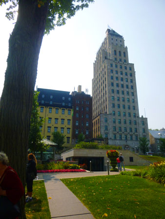
Just after taking the two picture above, I turned and looked back across Saint Anne Park to a skyscraper on the far side of the park. This, it turned out, was the Édifice Price (the Price Building), which has a bit of interesting history. It is (now) an 18-storey building that dates to 1930-1931, the tallest building in the Old Quebec historical district, and one of the oldest skyscrapers in Canada.
|
Although completed successfully, the building turned out to be little more than an extravagant nail in Price Brothers' coffin. The Great Depression pushed the company to the brink of bankruptcy, and the Price Family lost both control of the company and most of its fortune. Various restoration work was undertaken during the 1950s and '60s, mostly to the interior of the building.
In 1983, the building was acquired by the city of Quebec, which largely used it for its civil engineering division. More renovations were carried out, including the addition of two extra floors, a terrace on the 16th floor, and the installation of elevators. In 2001, the 16th and 17th floor became the Premier of Quebec's official residence, and in 2009, a tightrope walker navigated a 75-foot wire from the 13th floor of the building to the Château Frontenac's 15th floor.
The construction of the Édifice Price was heavily criticized in the 1920s, because the monumental construction was perceived as out of proportion within the historic area. Criticism continued after the construction, and a few years later the city council passed a by-law limiting building heights in the old town to 65 feet. Today, the building is considered an architectural monument in the capital and a defining element of the city's skyline.
Édifice Price was constructed in the art deco style of the time, as was the neighboring Clarendon Hotel, whose extension was completed a few years earlier. The design uses setbacks to gradually taper floor area down, yielding the typical elongated "wedding cake" shape which contributes in reducing loads and softens the building's visual impact on the city's skyline. The upper setbacks were later used to build balconies. Geometric motifs are carved in the Price Building's stone cladding, especially over the first few levels. The building is topped by a more classical, specifically Châteauesque, steepled copper roof, the final composition showing Beaux-Arts influences.
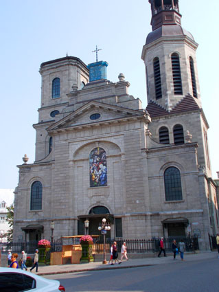
We continued past the City Hall, and then crossed City Hall Park to come to the front of the Notre Dame Cathedral- our next stop. I went a bit off to the side to get a picture of the front of the cathedral, and I also used the camera to make a panorama of City Hall Park. That panoramic view is below:
Cathedral-Basilica of Notre-Dame de Québec
 |
 |
The cathedral was designated as a national historic site of Canada in 1989 because:
| "...of its long and close associations with the history of New France; its influence on subsequent ecclesiastical architecture
and interior decoration in Quebec." - Historic Sites and Monuments Board of Canada, 1989 |
Four governors of New France and the bishops of Quebec are buried in the crypt, including François de Laval, Quebec's first bishop.
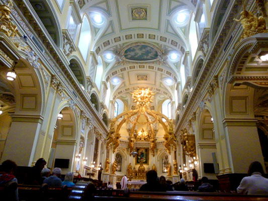
We all went inside the cathedral with our guide (although I lagged a bit behind because I was doing my panoramic view of the area between City Hall and the Cathedral. The inside was (as seems to be the case in almost all of the churches we've visited in our travels) quite beautiful.
|
A previous iteration of the church was destroyed during the Siege of Quebec in 1759. It was rebuilt from its original plans drafted by Gaspard-Joseph Chaussegros de Léry in 1743. The belltower was designed by Jean Baillairgé, who also oversaw construction. The interior was designed by Jean Baillairgé and his son François from 1786–1822. In 1843, François' son, Thomas, suggested a reconstruction of the façade to resemble the church of Sainte-Genevičve in Paris, resulting in the finest Neo-classic façade in Québec. The cathedral was richly decorated with impressive works of art: baldaquin, canopy, episcopal throne dais, stained glass windows, paintings, and chancel lamp (a gift of Louis XIV).
In 1922 the church was again gutted by fire, this time by the Canadian fraction of the Ku Klux Klan, and restored by architects Maxime Roisin and Raoul Chenevert. Raoul Chenevert added a presbytery beside the Cathedral in 1931-32.
In 2014 the cathedral celebrated its 350th anniversary. As part of the celebrations, a holy door was constructed- the second outside Europe and only the eighth in the world. The holy door was opened on December 8, 2013 and remained open until December 28, 2014. It again opened from December 8th, 2015 to November 20th, 2016 for the Year of Mercy after which it was sealed until 2025.
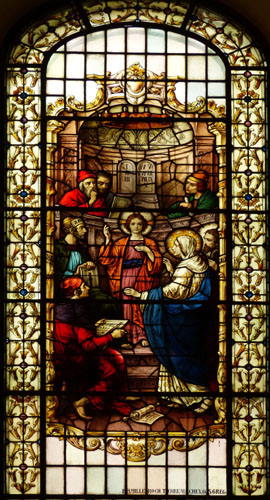
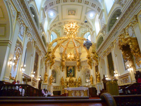
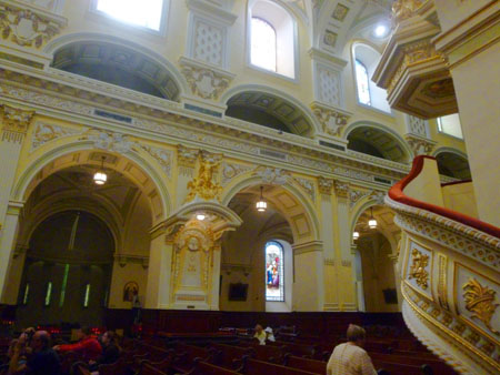
As I said, we found the interior to be quite beautiful, from floor to ceiling. There were also numerous side chapels (some under renovation) that each had their own character. Here are just a few of the many good pictures we took inside the cathedral:
 |
 |
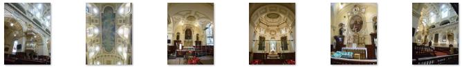 (Click on Thumbnails to View) |
I think that both Fred and I appreciate the extreme levels of workmanship that have gone into the decoration of churches (most notably, Catholic ones) worldwide. While I can muse that perhaps too much wealth has gone into them (to the detriment of the fortunes of many of the "common" folks), that decoration undeniably beautiful.
|
|
From the cathedral, we headed generally northeast for our next two stops.
Séminaire de Québec
|
(1623-1703) "In 1659, this pioneer of religious life in New France assumed the post of vicar apolstolic of the colony and in 1674 became the first bishop of the diocese of Quebec. In this role he established the ecclesiastical organization of the colony and in 1663 founded the Séminaire de Québec, which supported the developent of a colonial clergy. His strong views on public morality and the prerogatives of the church led to occasional conflicts with the civil authority. In 1688, Msgr. de Laval stepped down as bishop but remained in Quebec, devoting himself to prayer, charity, and the future of his seminary." |
The Séminaire de Québec is a Society of diocesan priests founded in order to sustain the mission of the Church in North America. In 1665, Laval joined this community to that of the Seminary of Foreign Missions of Paris under the name of the Seminary of Foreign Missions of Quebec, from which is derived the acronym SME, still in use today.
|
Until the English conquest in 1760, the Minor Seminary was a boarding school for students. Classes were held at the Jesuit College on the site of the present City Hall. When the Jesuits were suppressed after the Conquest, the directors of the Seminary took over. The Minor Seminary became a full-fledged teaching institution, a college, open to all boys interested in studying. In 1852, the high quality of teaching was recognized in a Royal Charter from Queen Victoria, leading to the founding of Université Laval, the first Catholic French-language university in North America. Université Laval and the Minor Seminary no longer have any legal ties with the Quebec Seminary. The Seminary spun off Université Laval into its own corporation in 1970 and the same was done with the Minor Seminary in 1987.
The services of the Séminaire de Québec currently include the Major Seminary, a vocations centre, a new diocesan Minor Seminary, the Catholic centre at Université Laval, the training of priests and other pastoral leaders, parish service, and theology studies. François de Laval's vision is at the root of the Séminaire de Québec's influence and success in education. His bequest of a large tract of lakes and forests northeast of the city known today as the Beaupré Seigneury, purchased from the Company of New France, has funded the work of the institution ever since.
|
|
The Camille-Roy Building has several pinnacles on which continuously fly the flag of the coat of arms of founder of the Séminaire de Québec, Bishop François de Laval, and the Jean-Olivier-Briand Building houses the priests’ residence and the Grand Séminaire. The Seminary was designated a National Historic Site of Canada in 1929. Since 1987 the Petit Séminaire de Québec has been a private Roman Catholic secondary school separated from the Séminaire de Québec. Many French-Canadian clergy of the 18th and 19th century, as well as innumerable academics, went through the Petit Séminaire before higher education became widely accessible. Until 1970, the Superior of the Seminary was also the Rector of Université Laval, which was originally an offshoot of it.
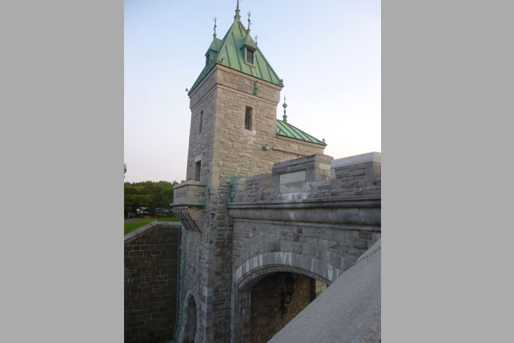
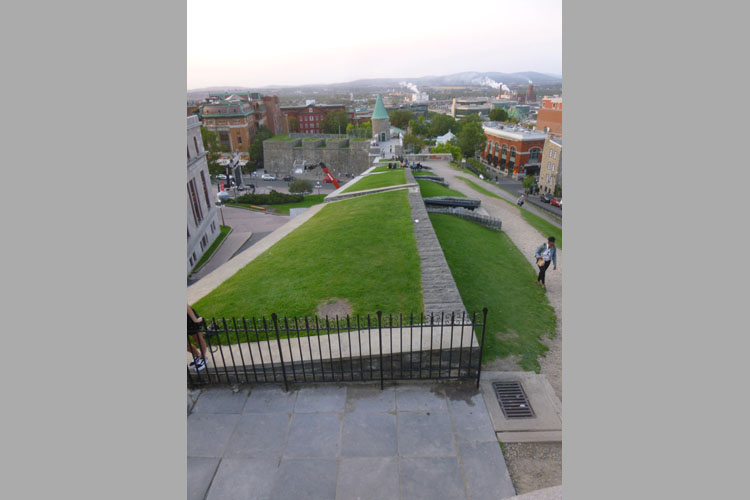
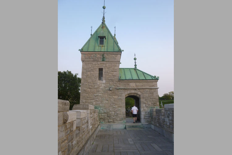
The Ramparts of Quebec City
 |
 |
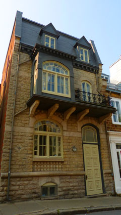
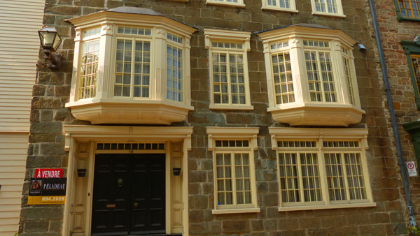
For Fred's part, he liked the buildings that we were passing, and I want to include a couple of the photographs that he took here:
 |
 |
We were heading to the ramparts that overlook the Lower Town (and we would head down to the Lower Town after visiting them). As it turned out, the place we stopped was the same place that Guy, Fred, and I had passed as we were schlepping our bags from the train station a couple of days ago. This time, though, we were going down to them, not coming up through them. Just before we reached the ramparts, Fred got a nice picture of Guy and an Upper Town street behind him.
Quebec City is located on a plateau overlooking the convergence of the St. Lawrence and the St. Charles Rivers, and the fortifications for the city of Québec began with the city’s founding in 1608 by Samuel de Champlain. The original fortifications were makeshift works, but throughout the 17th century, this first habitation was upgraded until, in 1690, the fall of Port Royal in Acadia led the French to properly fortify the city with its first walls- 11 redoubts joined by palisades. Here at the northeast palisade, the views were expansive:
 |
Although the Upper Town’s steep cliffs acted as natural defences for two of its three sides, its vulnerable west side, which faced the open countryside of the Plains of Abraham, was made the top priority of Québec’s fortification program, and by 1745 the enclosing of the Upper Town was complete.
|
|
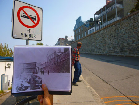
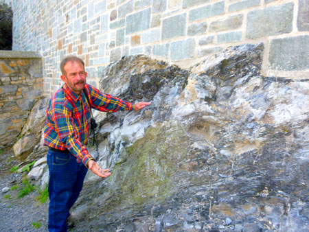
Our guide came with some old pictures of the place we were standing, and as he held it up to show us the current walls of the Upper Town, I snapped a picture and caught Fred as well. Finally, as we descended from the old walls to the Lower Town, we could see how the walls of the city fortifications were built essentially on bedrock:
|
|
Then we walked down the steep hill to the Lower Town for the next part of our walking tour.
Lower Town
|
When we turned south, we were walking along gentrified streets lined with eighteenth-century and nineteenth-century buildings that had been pretty much totally restored, and in many of these buildings we found art galleries and chic little shops (probably many of which are specifically designed to separate tourists from their money).
But one can't deny that the picturesque streets were fun to stroll through. I got the definite impression that Prudence and Nancy would have liked to go into many of the little shops and galleries, but we only had our guide for another hour, so that might have to wait.
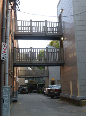
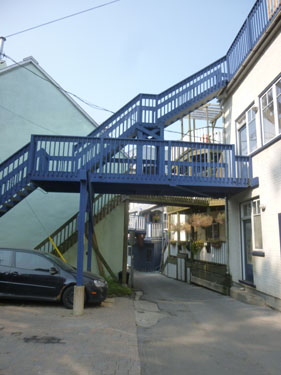
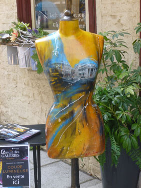
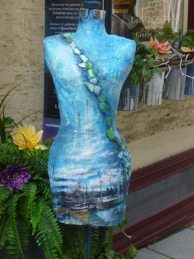
At one point, we walked down what was actually an alley behind a row of shops that had apartments above them, and our guide explained the profusion of what looked like fire escapes. When the buildings were constructed, taking up space inside with interior stairs was thought to be a waste, so, as in Montreal, the stairs were put outside. We saw these stairs in front in Montreal, but here in Quebec City, they were mostly in the back, where folks also parked their cars. You can see in the two left-hand pictures below, that newer structures were set on the far side of the alley so vehicles could pass underneath. In the two right-hand pictures are a couple of photos of part of a "painted lady" exhibition in one of the galleries:
|
|
|
|
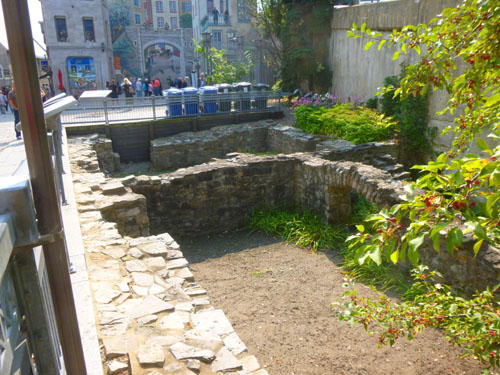
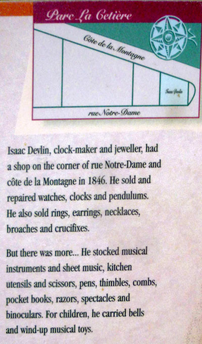
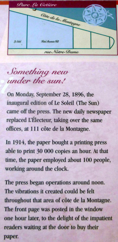
As we continued south, we came to what looked like an archaeological excavation at a place named Parc de la Getiere. That, as it turned out, was exactly what it was.
|
After I took the picture above, left, I found that there was a good deal of historical signage put up by the Historical Commission that talked about the various inhabitants of this little area, and you might be interested in what the signage had to say.
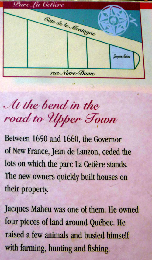
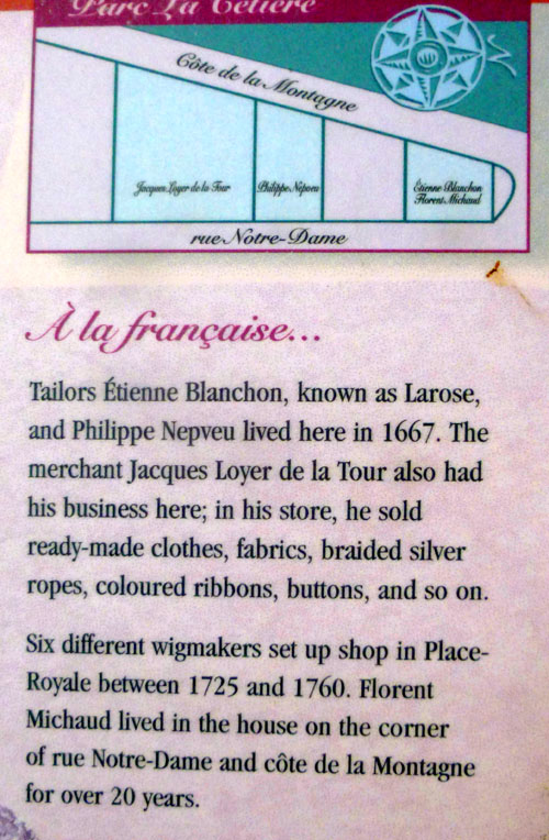
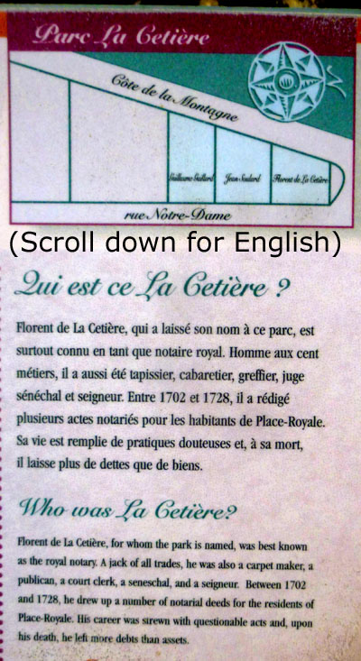
Each sign had a little diagram that showed how the area was divided into lots over the years, and each sign talked about some of the owners or inhabitants of these lots. Below are the English portions of the five signs so you can read for yourself the interesting history of this small area of the Lower Town.
|
|
|
|
|
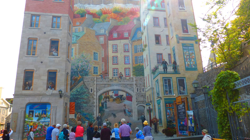
Just adjacent to Parc de la Cetiere is the Fresque des Québécois (you can see it on the side of the building in the background in the picture above of these ruins), and so that is where we headed next.
|
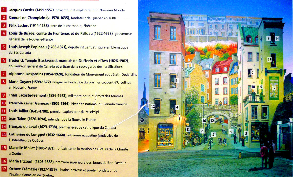
It also renders homage to the famous people who have marked the city’s history, including Jacques Cartier, Samuel de Champlain, the Count of Frontenac, Alphonse Desjardins, Thaďs Lacoste-Frémont, etc. along with Félix Leclerc and young ice hockey players.
The presence of this monumental mural design has had a radical impact on the image of Québec by restoring life and interest to an old and dingy wall and it participates in spreading the word about this old part of Quebec.
According to the Quebec Tourist Office, 3 million visitors a year come to admire and be photographed in front of this gigantic monumental mural design, a work that adds to the city’s identity and now one of its symbols.
We spent a fair amount of time here; this was one of the largest trompe-l’śil murals that we've seen, although it brings to mind others- notably a huge one of whales in Honolulu.
|
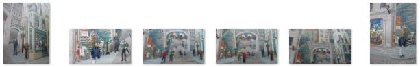 (Click on Thumbnails to View) |
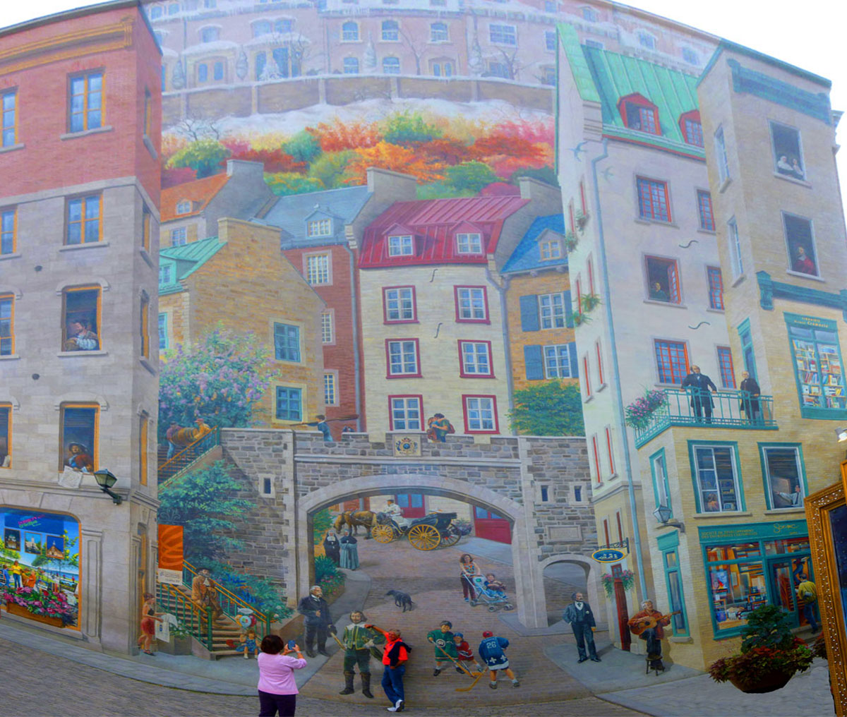
As we found out, many of the figures in the mural are people from real life- specifically, Canadian and Quebec historical figures. Off to the side of the mural there was a legend, pointing out who in the mural was actually an historical figure. I thought you might like to be able to browse the mural and the legend simultaneously, so I have put both of them in the scrollable windows below. The mural is first and the legend is below it. I know there is a good deal of scrolling involved, but if you want to learn who the figures are, that's the price you pay!
|
|
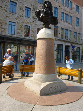
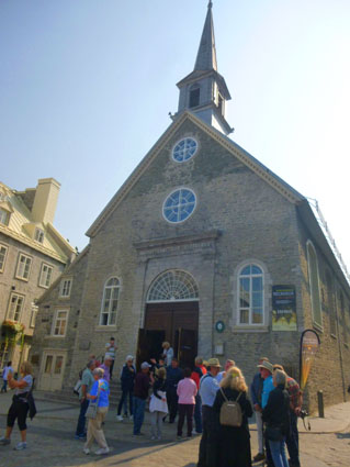
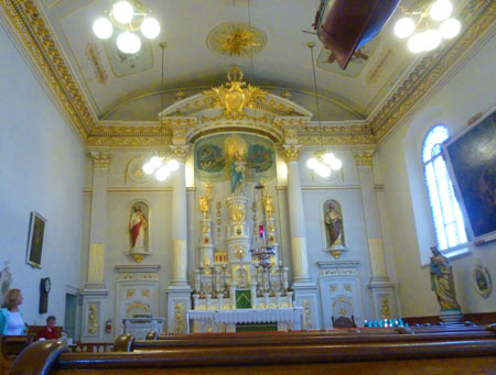
From the mural, we walked just a short distance down the street to the south, coming to a charming square right in front of the Notre Dame des Victoires church; this square is the Place Royale. We took a number of pictures here, and we can begin with my 300° panorama of the square. In that picture below, the church is at the right and the monument to Louis XIV at the left:
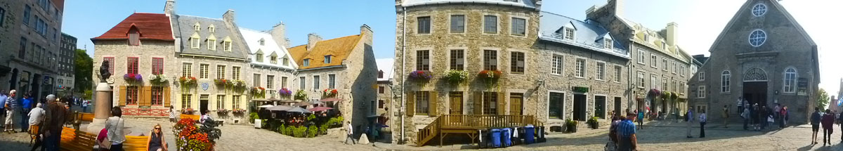
Place Royale burgeoned alongside the second habitation built by Samuel de Champlain between 1623 and 1626. On maps of the time, it was labeled a parade ground (place d'armes) or a marketplace- its main purpose from the 17th to the 19th century. This public square, with its houses for the most part rebuilt following a fire in lower town in 1682, became known as Place Royale in 1686 when a bust of King Louis XIV was erected at its center by the then Intendant (local governor) Jean Bochart de Champigny.
|
Here are some more pictures that we took here in the square, before going into the church:
 (Click on Thumbnails to View) |
Today, the name Place Royale not only refers to the square itself but also to the surrounding urban area. However, some historians contend that there was never really a "place royale" in Québec since, contrary to those built in France during the same period, the marketplace in Québec's lower town was never the subject of a well-thought-out and coherent architectural plan. Former names for the area are just as conflicting. In a map of Québec drawn by Jean-Baptiste-Louis Franquelin in 1688 the area is indeed called Place Royale, but it is generally thought that Franquelin was sucking up to the monarch in order to secure a well-paid position. So the locals simply called it the "market" or "La Place".
|
|
The church was largely destroyed by the British bombardment that preceded the Battle of the Plains of Abraham in September 1759. A complete restoration of the church was finished in 1816. Architect François Baillairgé led the restoration work.
The church, which was listed as a historic monument in 1929, remains a popular tourist attraction within the city, as well as a place of worship. It has undergone extensive restoration in recent decades, to restore its colonial French character. It was designated a National Historic Site of Canada in 1988 and plaqued in 1992.
In 2002, the church served as a filming location for the movie Catch Me If You Can, and again in 2004 for Taking Lives.
|
|
|
The funicular opened on November 17, 1879, and originally used the water ballast system of propulsion. The line was converted to electrical operation in 1907. On July 2, 1945, a major fire destroyed the structure, necessitating a rebuild that was completed in 1946. Since then, major renovations have taken place in 1978 and 1998. In 2004 it celebrated 125 years of operating.
In October 1996, a British tourist was killed when the cable snapped and the emergency brake failed to stop the cabin before it crashed into the lower station. As a result of this fatal crash, the funicular was closed and entirely revamped with modern technology. It reopened in 1998, technically as an inclined elevator, since both cabins are independent.
|
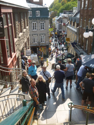
The Breakneck Steps are Quebec’s oldest staircase, dating back to 1635. They were originally called the “Champlain Stairs”, “Beggars’ Stairs”, and “Lower Town Stairs”, but were renamed to "Breakneck" due to their steepness. The stairs have been renovated several times over the years.
Nancy, and I would find out later that these stairs were actually just the first flight of stairs at this location that can take you from Lower Town to Upper Town. At the top of the Breakneck Steps, one turns left, walks a block up the street, and then begins climbing another eight or ten flights of stairs that come out, finally, on the Dufferin Terrace near Chateau Frontenac.
But we wouldn't find that out until after lunch, which we took at a restaurant right at the top of the Breakneck Steps.
|
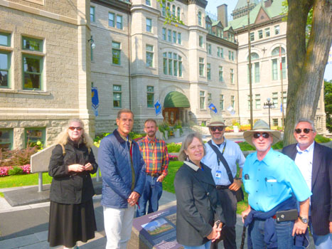
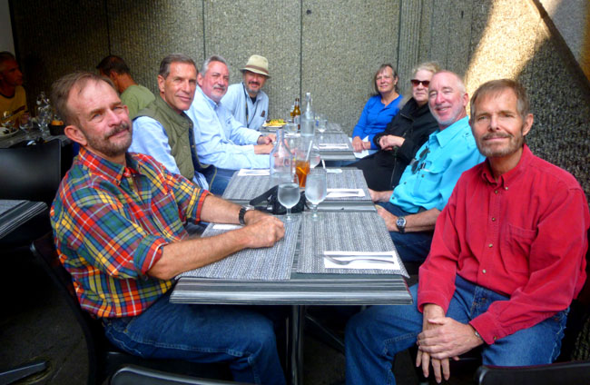
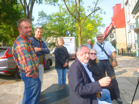
When we'd gotten seated at the restaurant (we were outside, right off the steps), I had the waiter take a picture for us. Left to right, around the table, are Fred, Guy, Ron Ruckman, our Guide, Prudence, Nancy, Karl, and myself.
While we were waiting, I heard a harp somewhere, and I got up from the table to see where the music was coming from. I found, at the top of the stairs by the street, a harpist playing and selling CDs.
After lunch, our guide headed home to his family and we discussed what we would do next. Karl had actually booked a tour of Chateau Frontenac, but Ron, Prudence, and Guy thought that instead of doing that, they would like to take the funicular to the top and then walk along the Governor's Promenade to some galleries that they'd seen earlier in the day. As it turned out, Karl, Nancy, and myself were the three who decided to go ahead and take that tour.
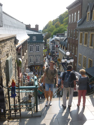
Time was short, so the three of us went up the street to the next long set of staircases that took us up to Dufferin Terrace and the Chateau, where we met the guide for our tour.
A Tour of Château Frontenac
From the restaurant at the top of the Breakneck Steps, Nancy and I trudged up the 200-step stairway to the plaza level at the Chateau Frontenac. I took a couple of pictures on the way up, and you can see them here and here. The stairs were exhausting, and I have to admit that I was pretty impressed that Nancy was amenable to walking up, but since our time before the start of the tour was short, she thought it would be the fastest way.
|
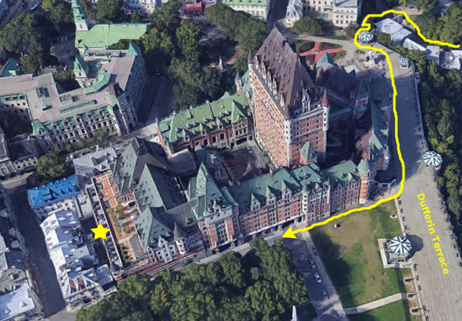
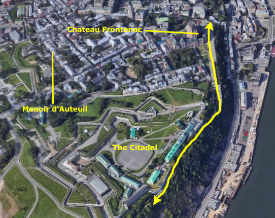
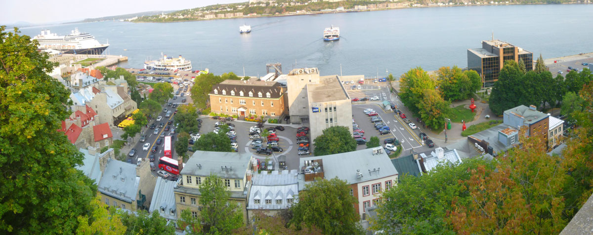
At left is an aerial view of the Château Frontenac. North of it you can see the plaza where our walking tour began this morning, and you can also see the beginning of the Dufferin Terrace- the wooden boardwalk that goes all the way down to the Citadel and the Governor's Promenade.
Nancy and I followed the route I marked in yellow, meeting up with our tour on the south side of the hotel. Our tour guide led us around to the hotel entrance around off Rue Haldimand, and that's where I recall first seeing Karl. We were a bit late for our tour, but that turned out not to be of consequence, and soon, after a short history lecture, we headed into the historic hotel.
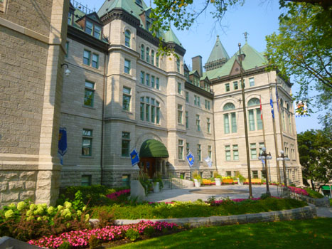
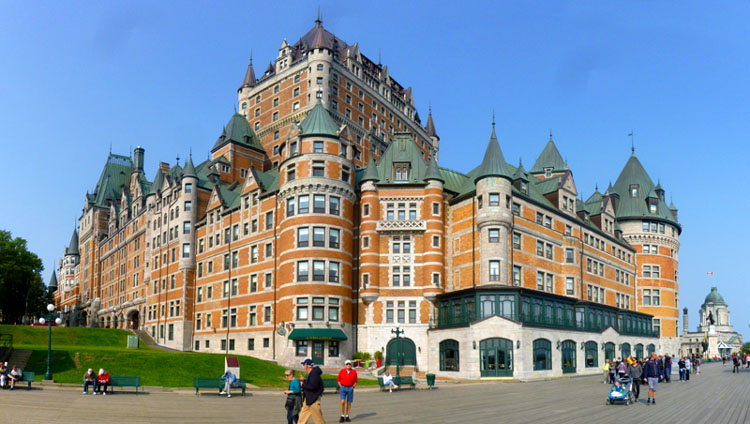
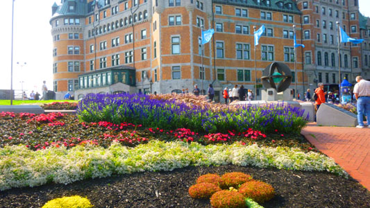
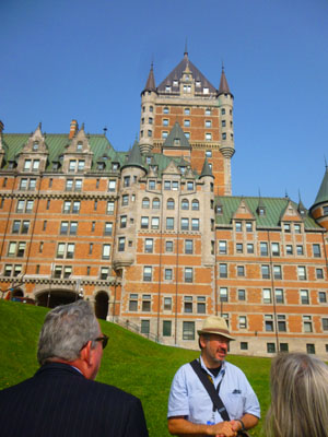
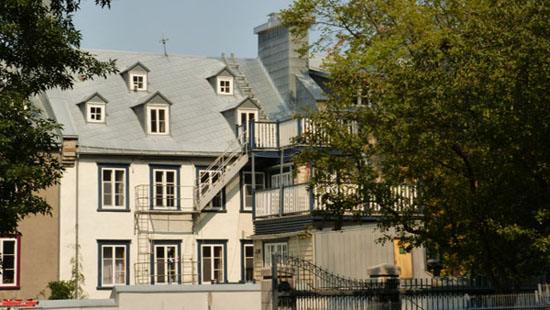
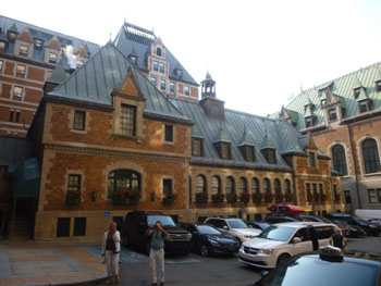
The Château Frontenac is one of Canada's grand railway hotels; it was originally an independent hotel, but after a number of transfers from one corporate entity to another, it is today operated as Fairmont Le Château Frontenac. Château Frontenac is situated on the promontory some 200 feet above the St. Lawrence River, and was designated a National Historic Site of Canada in 1980. Prior to the building of the hotel, the site was occupied by the Château Haldimand, residence of the British colonial governors of Lower Canada and Quebec. The hotel is generally recognized as the most photographed hotel in the world, largely for its prominence in the skyline of Quebec City. Currently, the hotel has more than 600 rooms on 18 floors.
|
Around the south side of the hotel, where we met our guide for the first time, there was a plaque nearby that I photographed, and you might want to read it:
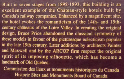
The Château Frontenac was designed by American architect Bruce Price, as one of a series of "château" style hotels built for the Canadian Pacific Railway company during the late 19th and early 20th centuries; the newer portions of the hotel— including the central tower (1924)— were designed by Canadian architect William Sutherland Maxwell.
|
|
The Château Frontenac was named after Louis de Buade, Count of Frontenac, who was governor of the colony of New France from 1672 to 1682 and 1689 to 1698. The Château was built near the historic Citadel, the construction of which Frontenac had begun at the end of the 17th century.
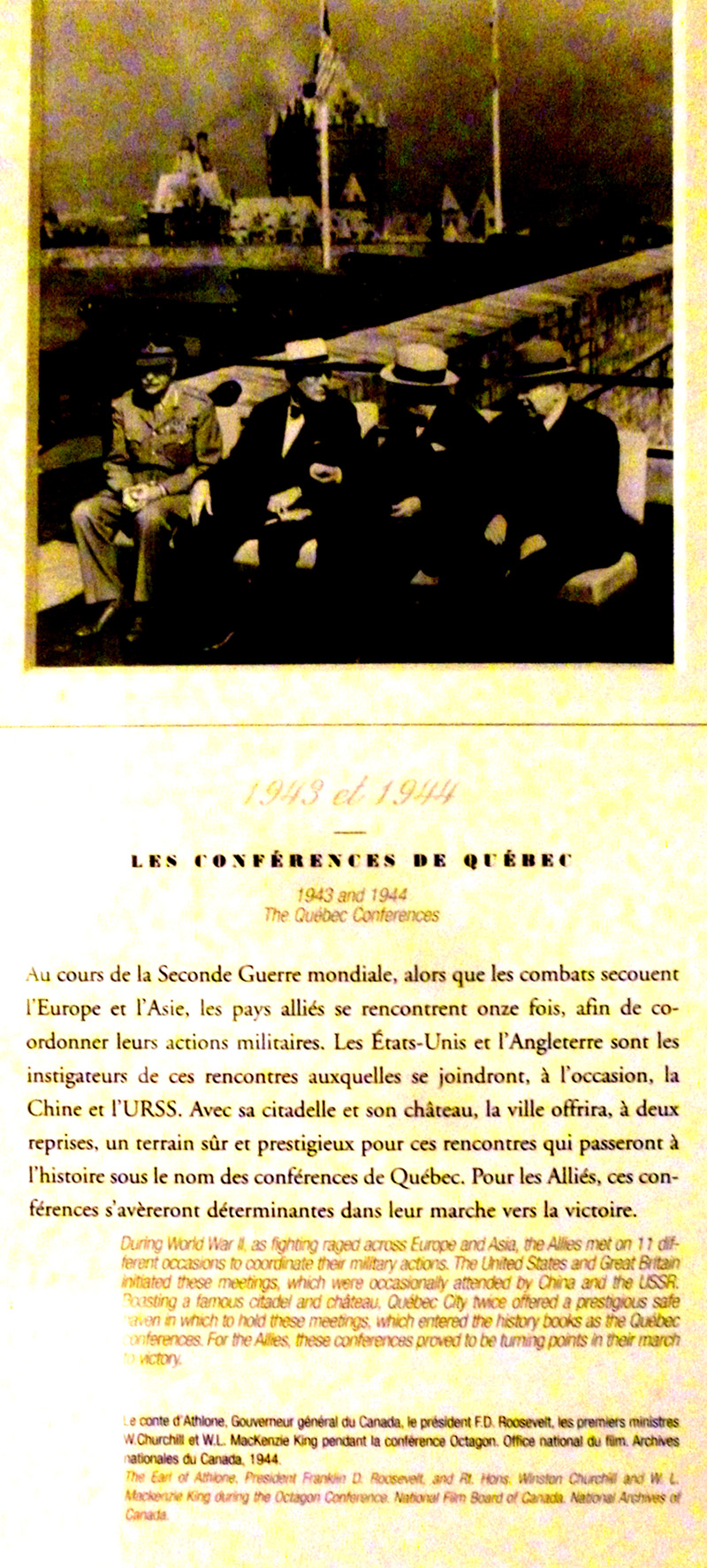
The Quebec Conference of 1943, at which Winston Churchill, Franklin D. Roosevelt, and William Lyon Mackenzie King discussed strategy for World War II, was held at the Château Frontenac while much of the staff stayed nearby at the Citadel.
Although several of Quebec City's buildings are taller, the landmark hotel is perched atop a tall cape overlooking the Saint Lawrence River, affording a spectacular view for several miles. The building is the most prominent feature of the Quebec City skyline as seen from across the Saint Lawrence.
|
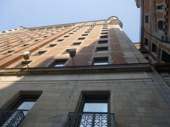
I also took a picture looking up the side of the hotel and one of the interior car park that you can see on the aerial view of the hotel above.
 |
 |
The World War II Allies' Quebec Conferences of 1943 and 1944 were held at the Château, this conference being the subject of one of the exhibits in the Hall of History. In 2011, when work began on the replacement of the main tower's copper roof (an $8 million project), the tower was such an iconic part of the skyline that an image of the roof was printed on polypropylene safety netting and hung from scaffolding to hide the refurbishing project from view.
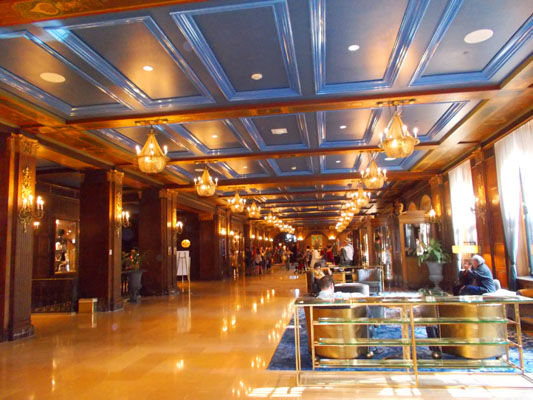
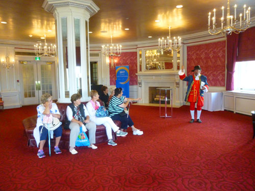
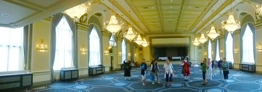
Our guide took us inside the hotel, and we wandered through many of the public areas. All along the way, our guide delivered almost non-stop patter, and I can't remember all of it. So let's just take a look at the inside of Château Frontenac via the pictures that Nancy and I took on the tour.
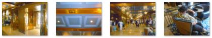
The Main Lobby
|
(Click on Thumbnails to View) |
Actually, the lobby seemed to be SO busy that it wore out the woman in the last picture!
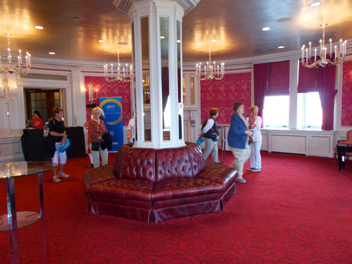
The Rose Room/Tea Room
|
|
The room had a beautiful fireplace that Nancy photographed while I was letting my little camera make a panoramic picture of pretty much the entire room:
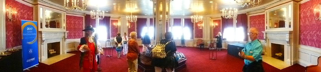
Nestled into the main castle turret, the Rose Room offers a breathtaking view of the river through its deep, spacious windows. Of course I had to go over to the windows to have a look, and the view was indeed spectacular. While the guide was talking, I took a series of six pictures and have stitched them together into a panoramic view. That view is in the scrollable window below:
|
Formerly a Tea Room, the Rose Room served for several meetings during the Second World War’s Québec Conferences in 1943 and 1944. William Lyon Mackenzie King, Prime Minister of Canada, played host to these historic meetings, welcoming British Prime Minister, Sir Winston Churchill, and US President Franklin D. Roosevelt. Below is our guide talking about this conference and my picture of the plaque on the wall describing it. You can read the plaque using the scrollable window:
|
|
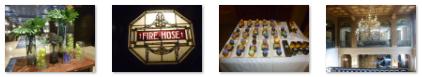
The Ballroom
|
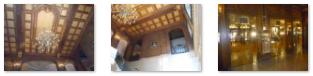
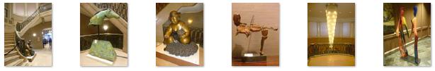
Art and Architecture
As we toured the hotel, we also snapped pictures of decorative elements that we thought were interesting.
|
  (Click on Thumbnails to View) |
When our tour was over, Nancy and Karl headed back to Manoir d'Auteuil to relax, but since there was more time before dinner, I thought I would stick around the Dufferin Terrace to see what else I could see.
A Walk on the Governor's Promenade
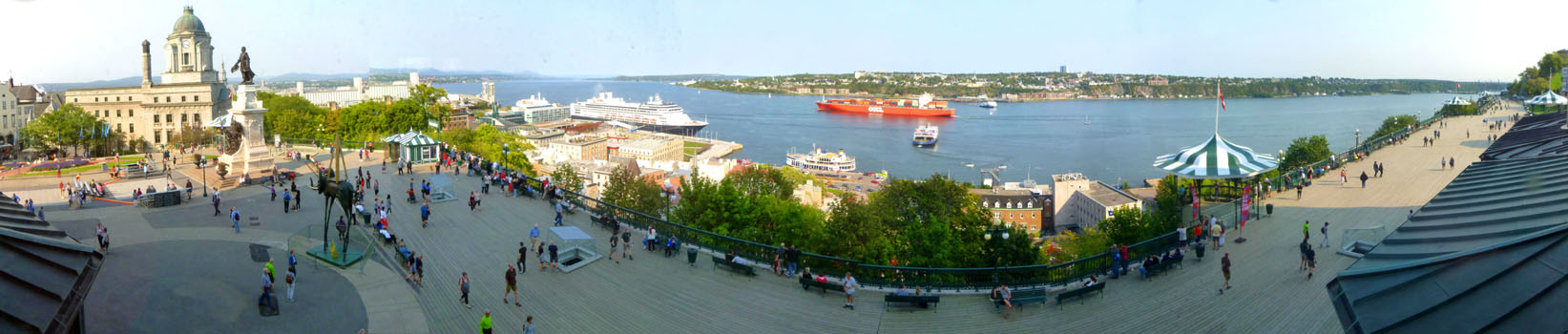
When the tour of Château Frontenac was concluded, I walked back outside to the Dufferin Terrace to the monument to Samuel de Champlain. There were some street performers there, but I didn't stop to watch them, but instead turned south to walk along the Promenade.
|
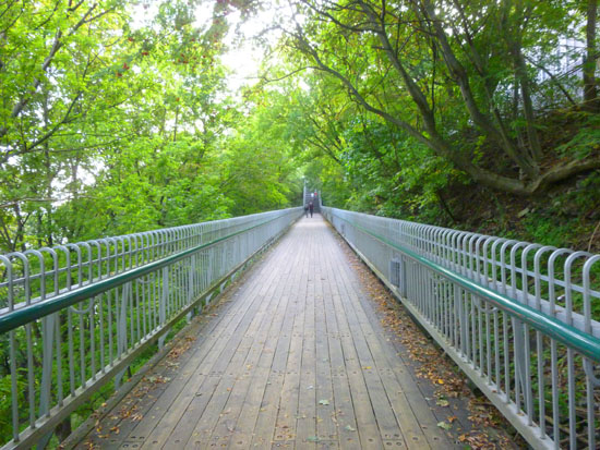
The elevated promenade stretches along the Citadel with the fortification wall on one side, and a gorgeous view of the St. Lawrence River on the opposite side. You can start at either end of the boardwalk. This is a great free activity where you can get some exercise, enjoy the scenery, and make your way from one destination to another.
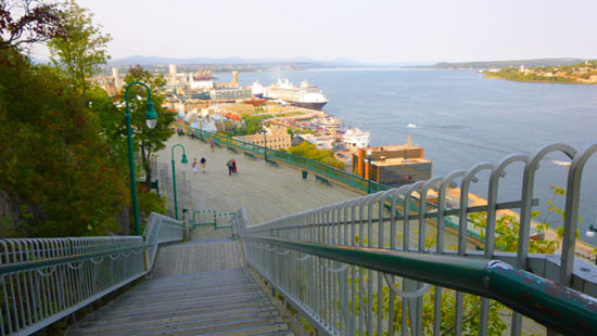
I started my own walk, of course, at the Château Frontenac, heading south along the boardwalk. Eventually, I reached the first of the multiple sets of stairs that would take me up more than 300 steps to the level of the Citadel, although I was outside its walls. The steps were strenuous, but I was buoyed by the realization that when I returned to the Château it would be all downhill.
Even right outside the Château Frontenac, I was treated to expansive view of the Saint Lawrence river down below, and I took a number of pictures as I walked along. The best of these views was constructed from three separate images:
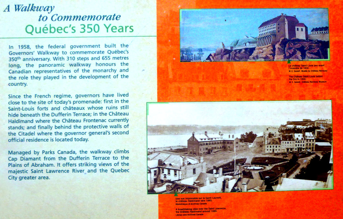
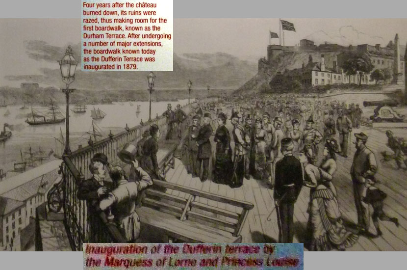
At the end of the boardwalk, I found the first of two major explanatory signs that I stopped to read. I thought they were interesting, and so will put both of them here for you to read. The first one talks about the Dufferin Terrace, and it is in the scrollable window below:
|
From the end of the boardwalk, I began my climb of the first two or three flights of stairs. At the top of the first flight, I turned to look back down and north along the Saint Lawrence:
|
There were actually two more flights leading up to an observation platform, with really beautiful views out across the Saint Lawrence:
The views were tremendous as I climbed more and more of the 300 stairs up to the level of the Citadel. Eventually, I found myself must below and outside its walls, on another observation platform, where I captured one more great view of the river.
|
At the Plains of Abraham, I turned around to head back to the Dufferin Terrace, and on the way back, I found a sign about the founding of Quebec City that I'd missed on the way up. This was a large sign, so I have put it in a scrollable window below:
|
I was happy that the walk was downhill all the way back to the Chateau Frontenac. As I approached it from the south, I got one last good view of the Dufferin Terrace and Château Frontenac. When I got back there, it was still not really late in the afternoon, so I thought I would check out what I had learned earlier was an exhibit/excavation below the Terrace itself of the earlier structures that sat on this site.
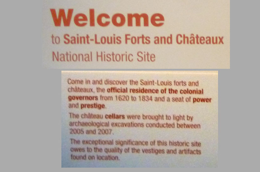
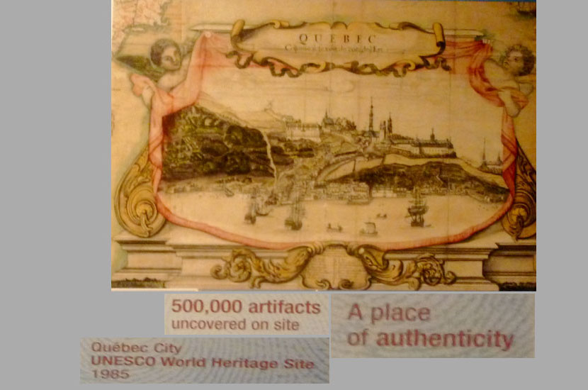
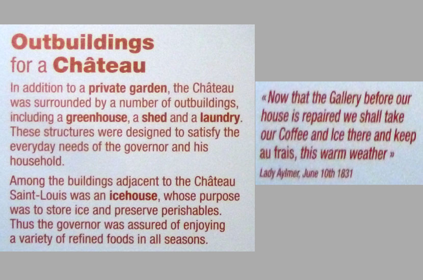
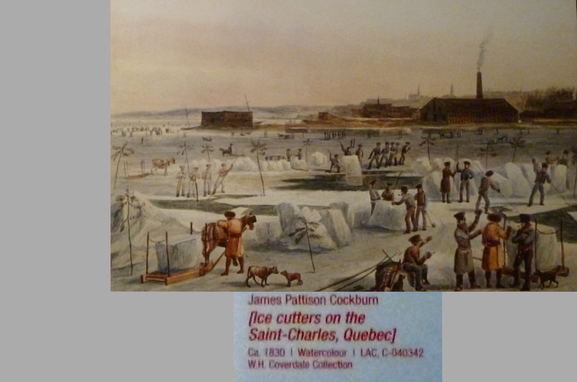
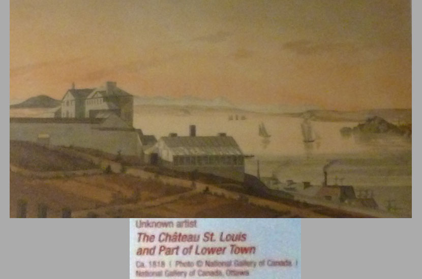
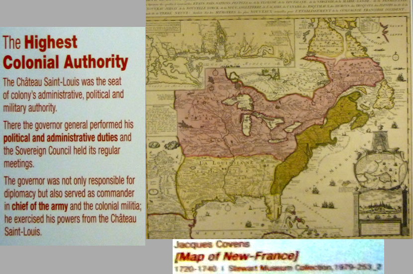
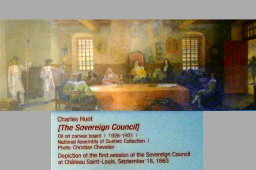
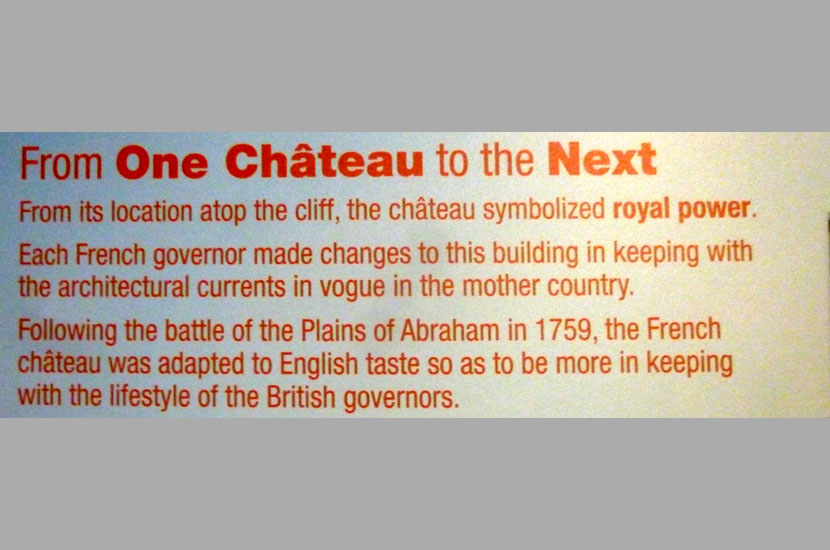
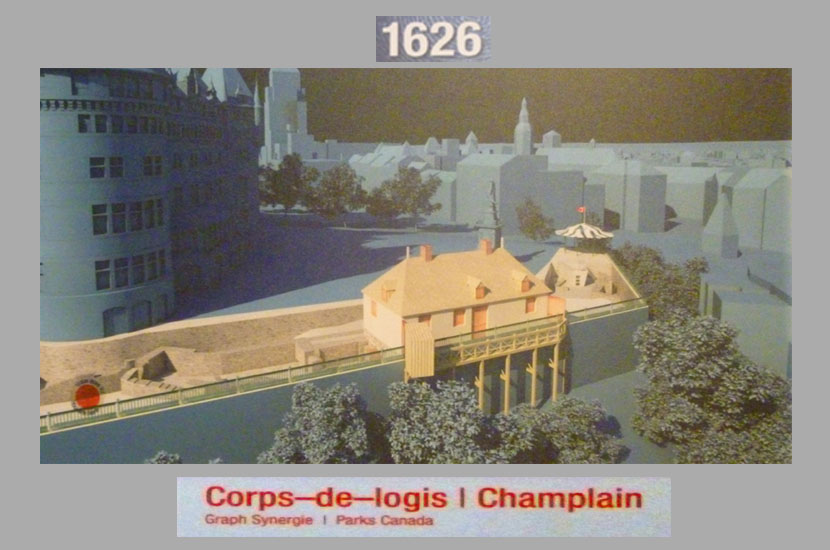
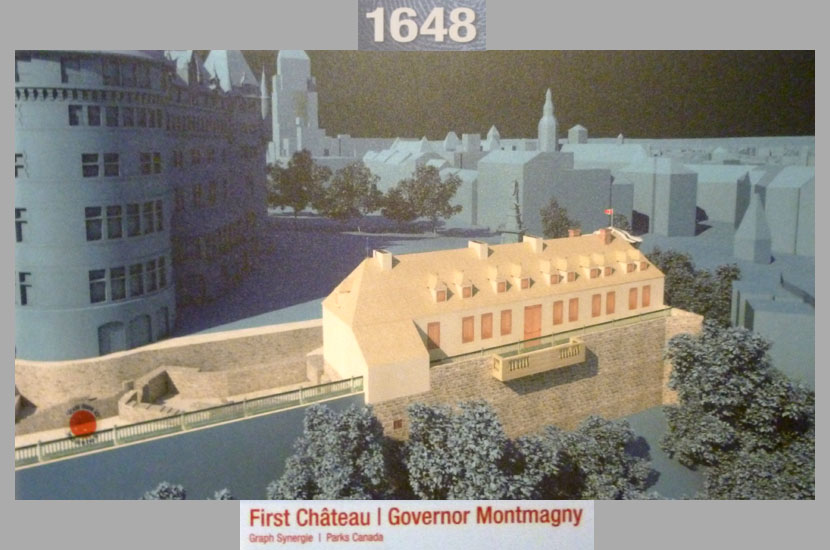
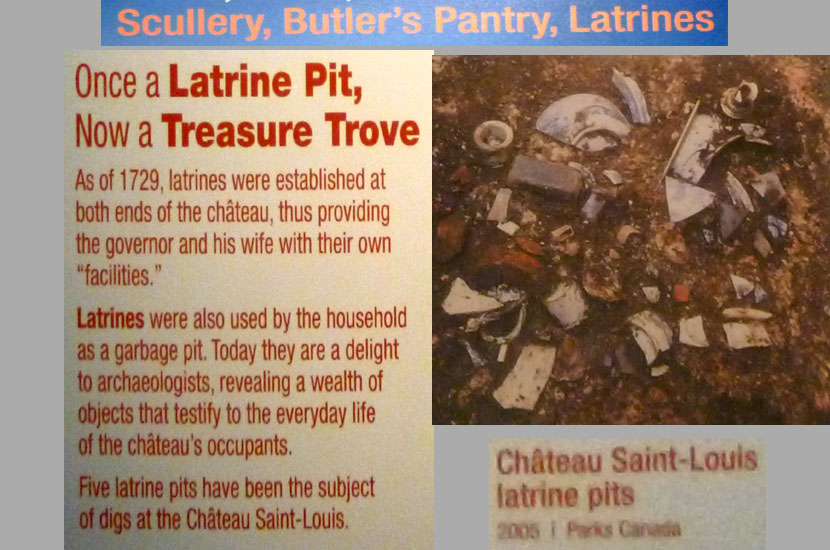
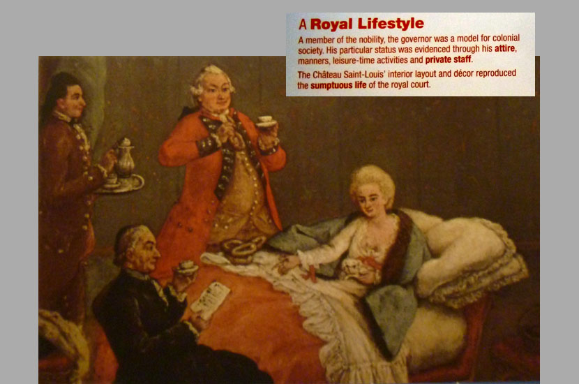
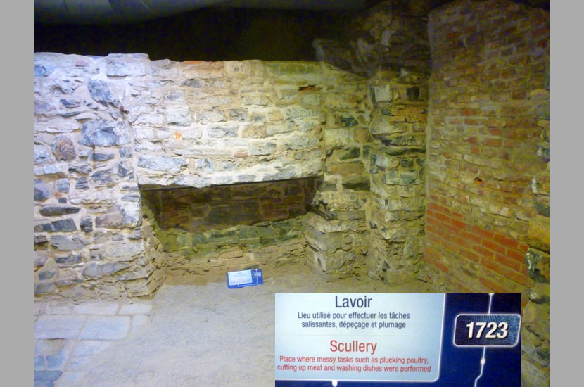
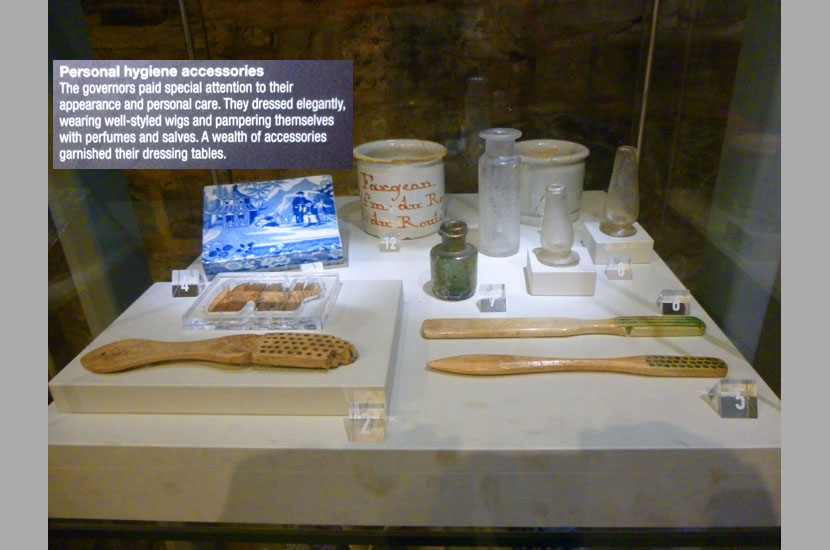
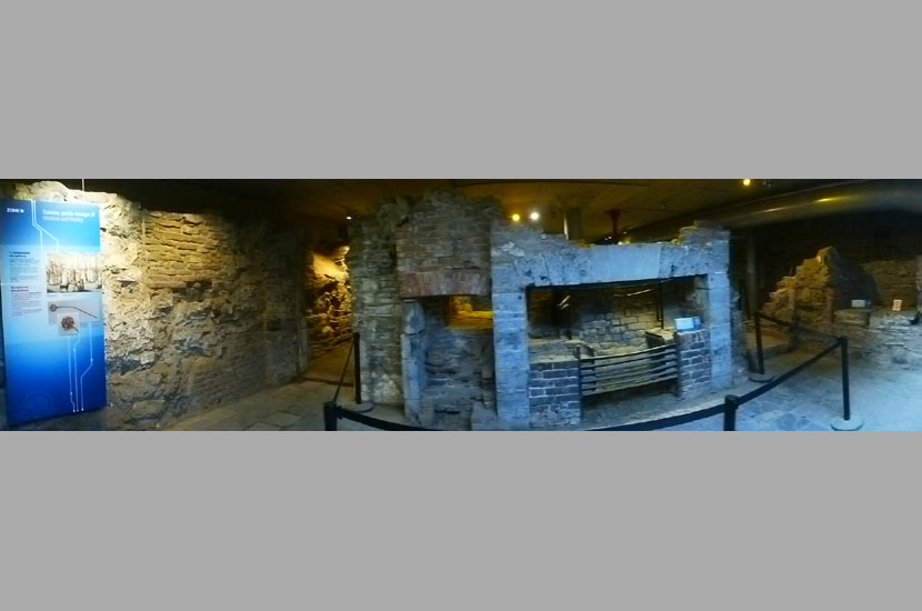
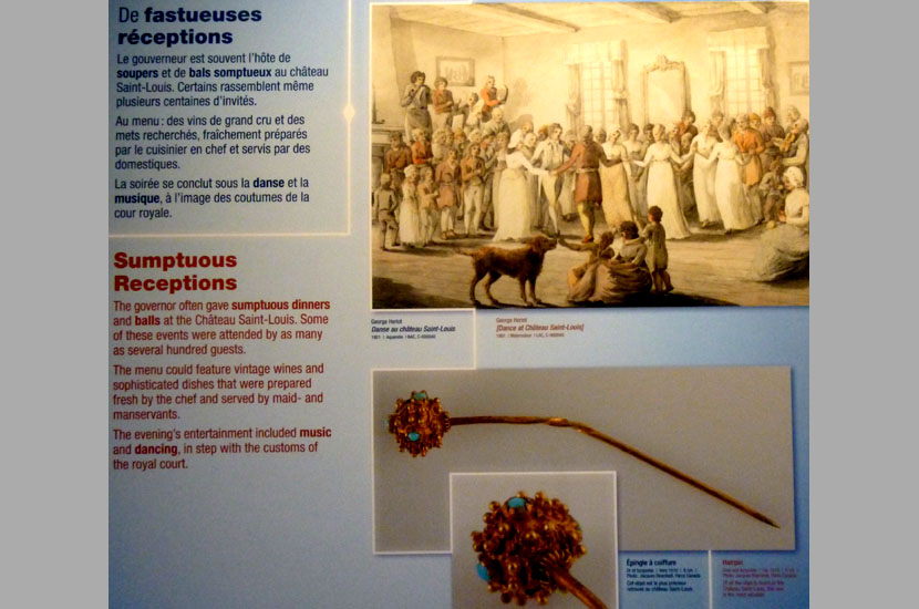
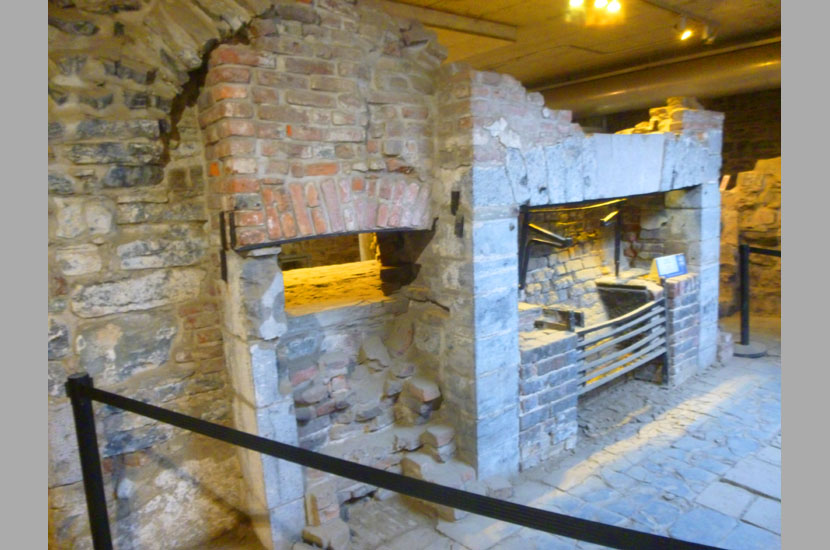
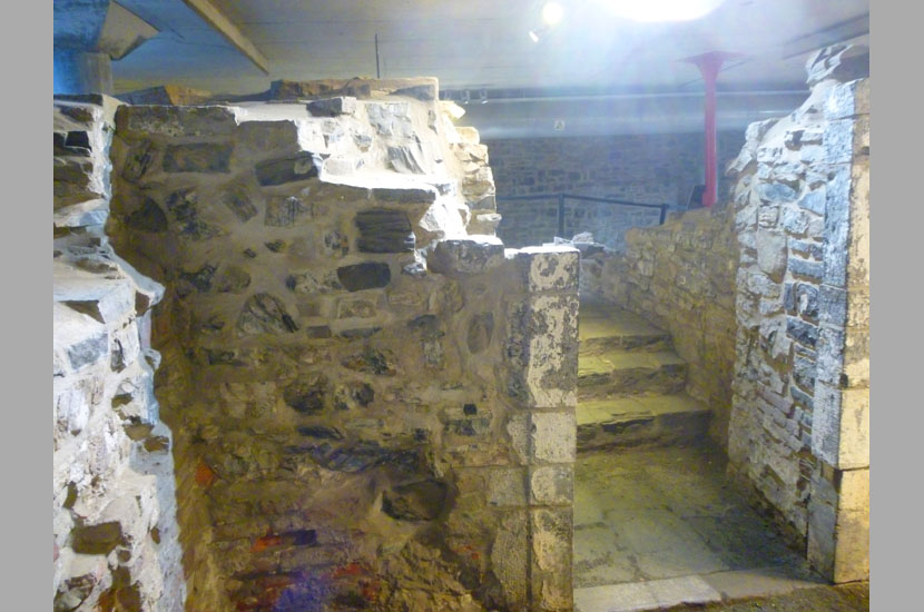
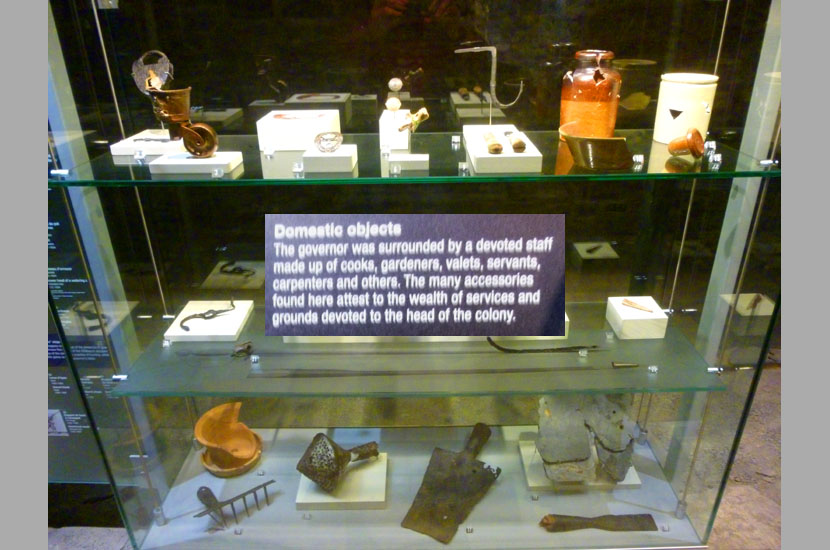
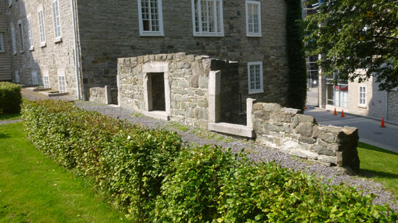
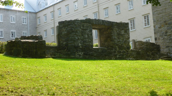
Saint-Louis Forts and Châteaux National Historic Site
The Château St. Louis was the official residence of the French Governor of New France and later the British Governor of Quebec, the Governor-General of British North America, and the Lieutenant-Governor of Lower Canada. The site on which these Chateaux were located (now occupied by the Château Frontenac) was designated a National Historic Site of Canada in 2002.
|
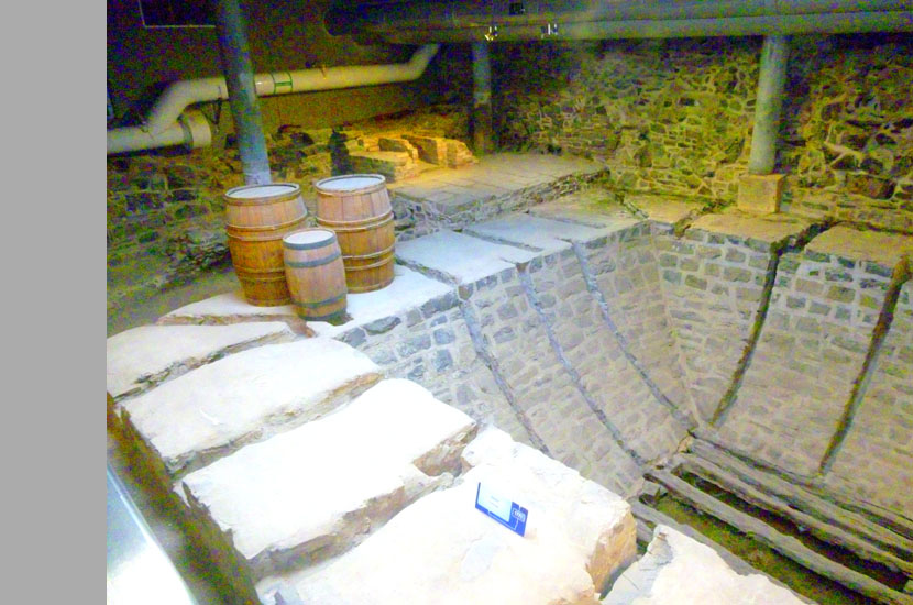
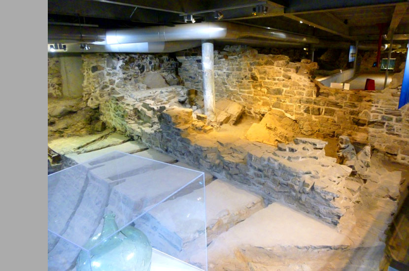
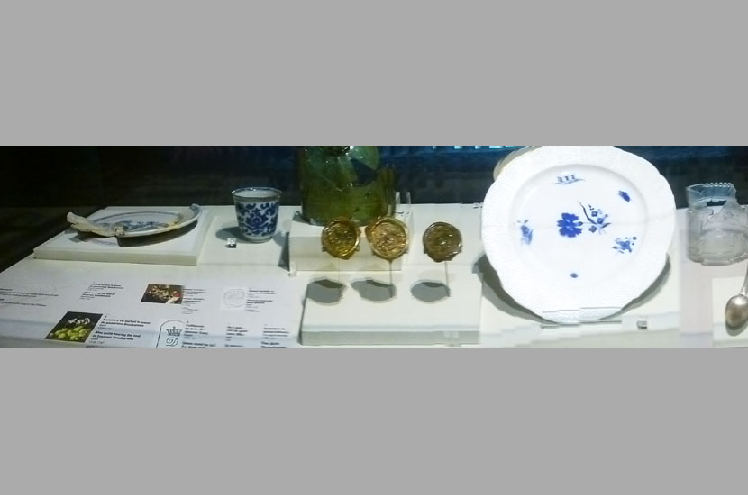
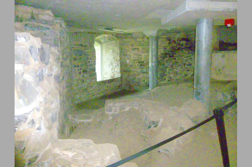
The area below the boardwalk was like a large museum, but one with a single "path" through the exhibits- a path that ended up somewhere below the Champlain Monument a couple hundred feet north. So I walked along that path through the exhibits, taking pictures of whatever I thought was interesting.
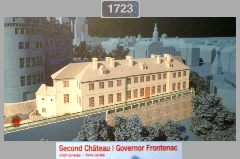
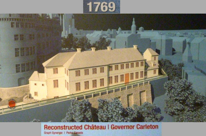
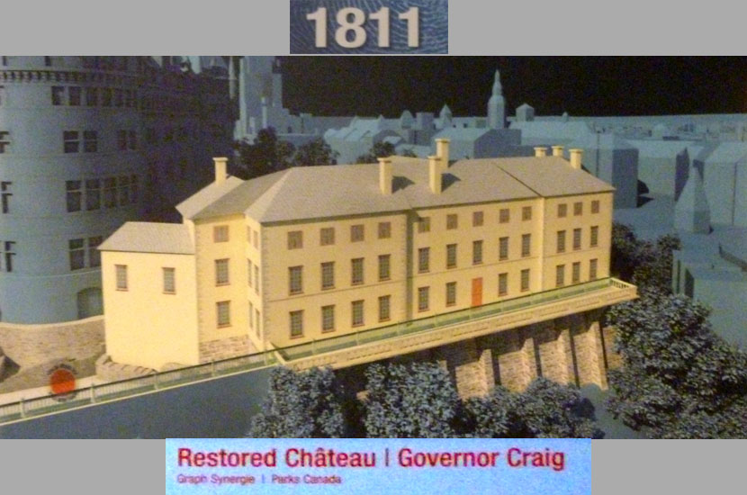
The first chateau was built under the direction of Governor Charles Huault de Montmagny in 1648 but by the 1680s it was in a state of disrepair. Construction of a replacement on the same site began in 1694 under Governor General Louis de Buade de Frontenac. Frontenac died there in 1698. A new pavilion and two new wings were added from 1719 to 1723 by Gaspard-Joseph Chaussegros de Léry. That building was then severely damaged during the Siege of Quebec after which time it passed into British hands. The house was gradually rebuilt in sections over the next forty years. In the meantime the governors split their time between the St. Louis and a new building, called the New Chateau or Chateau Haldimand after governor Haldimand. These buildings were destroyed by fire in January 1834. Afterward they were replaced by a series of terraces and, eventually, the Château Frontenac.
|
|
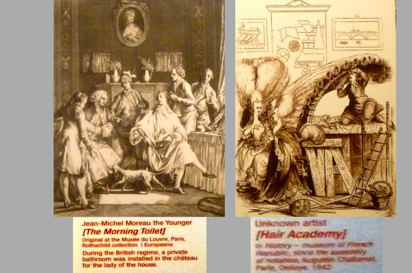
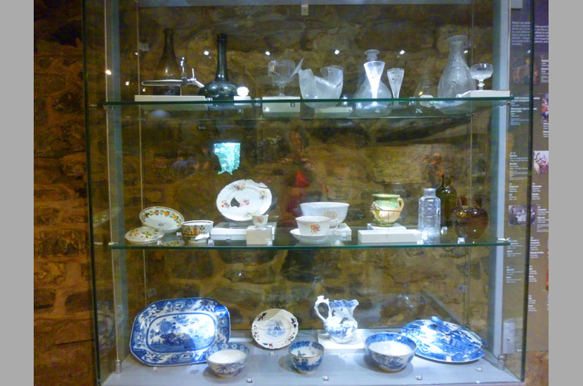
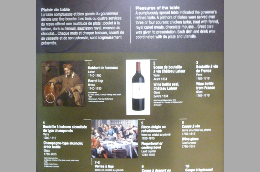
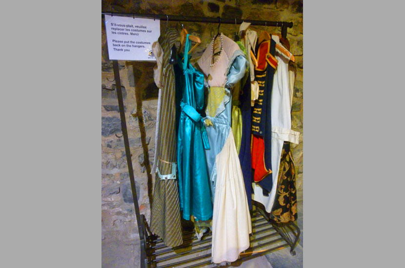
So come along with me and have a look at what I saw. I am going to present my photographs in a slide show. Unlike a show of just a series of pictures, though, this show will also contain information from the explanatory signs; these will usually precede any pictures I might have taken of the location or items described by the sign.
The slideshow is at right. As always, move from one image to the next using the little arrows in the lower corners of each image, and track your progress with the index numbers in the upper left.
I hope you enjoy walking through the exhibits with me!
I came up from the exhibit area quite near the Champlain Monument, and thought I would walk around a bit on my way back to the Manoir d'Auteuil.
An Evening In Quebec City
After Nancy, Karl, and I separated from the rest of our group to to to the Château Frontenac, they found their own way back to the hotel, taking some pictures on the way.
|
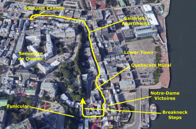
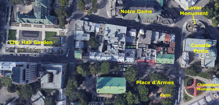
In this section, I want to include some of the pictures that we all took separately and together, and I'll just group them in little sections. To help illustrate where these places are, I have put an aerial view of part of the Old City at right, and have labeled the stops that we all made (not counting the old city walls; those were right across the street from the Manoir d'Auteuil, and you saw an aerial view of them on an earlier page).
Even though we weren't together at these stops, I'll aggregate the pictures of each one together.
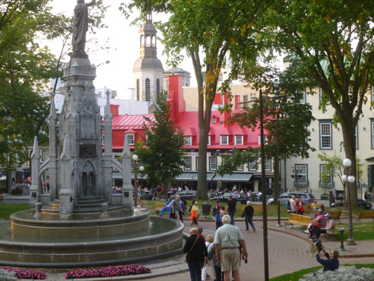
Place d'Armes
|
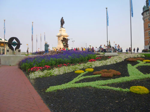
I enjoyed watching a comedian and a gymnast doing some performances in the middle of a circle of people, and then I walked across the street to the Place d'Armes- the small square just north of the Château Frontenac. In the center stands the monument to the Faith. Place d'Armes is part of a trapezium bordered on the north by Rue Sainte-Anne, on the south by St. Louis , on the east by Fort Street and on the west by the Rue du Trésor. It covers an area of about an acre.
|
|
|
Place d'Armes was created between 1640 and 1648 by Governor Montmagny to serve as a place for military exercises. After the construction of the Citadel in 1830, it lost its military function. In 1865, it becomes a public park, with a water basin in the center. That basin was eventually replaced by the fountain we see today.
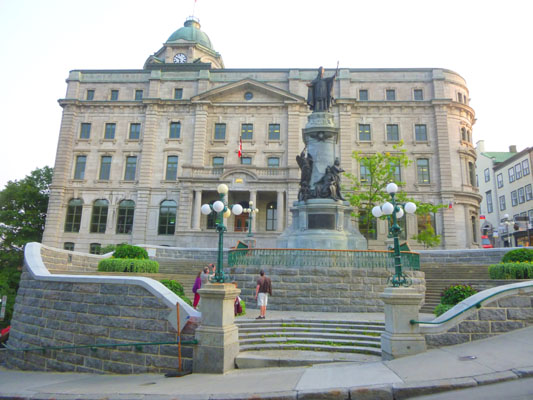
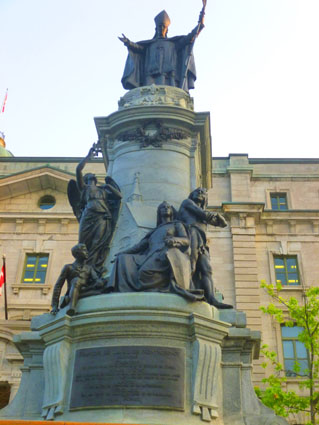
François de Montmorency de Laval Monument
|
Laval was born in France to a noble, although not particularly wealthy, family of ten. His mother encouraged his piety and charity, and he was admitted to a Jesuit society that aimed to inspire young people to adopt religious lifestyles, and encouraged regular prayer and spiritual practices. He took minor orders at age eight, and eventually got an excellent education at the College of La Flčche. It was during this period that Laval came into contact with reports of the Jesuit missions amongst the Huron in Canada, which influenced his desire to become a missionary.
The death of his father put the family in financial jeopardy, and the deaths of two elder brothers made him the head of the family. He wanted to continue his religious studies and practices, but his family encourage him to return home. Instead, he helped his mother set the family’s affairs in order and then renounced his rights of primogeniture. He returned to Paris, and at the age of 24 was ordained a priest. He was appointed an archdeacon, and devoted himself to establishing order in the parishes, providing relief for the poor, caring for the sick and engaging in different kinds of charitable activities. Years of successful spiritual activities, both individually and as a church official, earned him much commendation. Laval was now well known in the religious community and ready to take the next step in his life.
|
In 1659, Laval arrived in Quebec and immediately began work- having to deal with a sparse, spread-out population and moves by the Sulpicians to assert their authority. In 1674, Laval asked that the territory be made into a fully independent diocese, his request was granted, and he was appointed the first Bishop of Quebec. The monument itself had interesting bronze plaques on all four sides- three of them illustrating scenes from Laval's time as bishop:
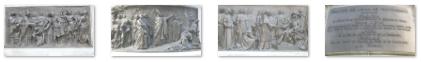 (Click on Thumbnails to View) |
Laval conflicted with the Governors of New France a number of times- notably over sale of alcohol to the natives. The support of Louis XIV increased his influence (and a future appointment as bishop); he even appointed the next Governor. His influence waned eventually, and by the mid-1660s had retreated from state affairs to focus purely on ecclesiastical matters. Once he was appointed bishop, however, he returned to the issue of alcohol sales, and in 1679 succeeded in obtaining a royal decree banning the trade.
In 1663, Laval opened the Grand Séminaire, its main goal was to train missionary priests; in 1668, the petit séminaire was added. Laval hoped the seminary would become a home for all parochial priests. Laval donated most of his own fortune to the seminary since it had now become his home as well, he obtained the income of three different abbeys in France, and demanded a 4% tax on farm production. Laval also took interest in practical education for craftsmen and farmers, founding a school of arts and crafts.
Laval continued to work on establishing and organizing a parochial system, and was successful. But his age eventually became a limiting factor, and in 1688, he passed on his responsibilities as a bishop. He continued to help the poor with his presence and his gifts of charity. He never missed a Mass or a day of fasting, despite his ever declining health. By 1707, he had developed an ulcer which eventually took his life in 1708. His body was placed in a coffin in the cathedral, but his heart was kept in the chapel of the seminary to which he had dedicated most of his life and fortune.
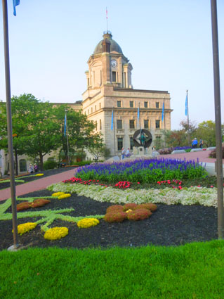
City Hall Garden
 |
 |
Prudence also got a nice picture of Fred, Guy, and Ron Ruckman, and you can have a look at it here.
|
|
|
I took two more pictures of note- one along Rue Jardins and another in City Hall Garden, and these are below:
 (Click on Thumbnails to View) |
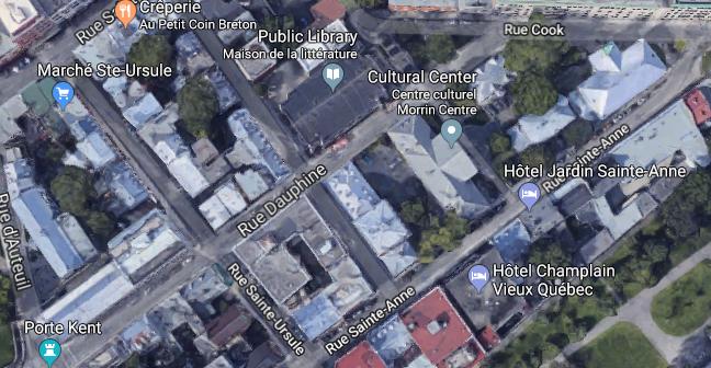
Morrin Center and The Wesley Temple
|
Standing in front of the Morrin Center, I found myself in a small plaza with an archway leading to the grounds of St. Andrews Presbyterian church on my right, and the Morrin Center (housed in an old building that had been used for many different things in the past- even as a jail at one time.
While I was standing here, I took a few pictures of the St. Andrews grounds:
 (Click on Thumbnails to View) |
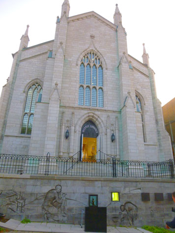
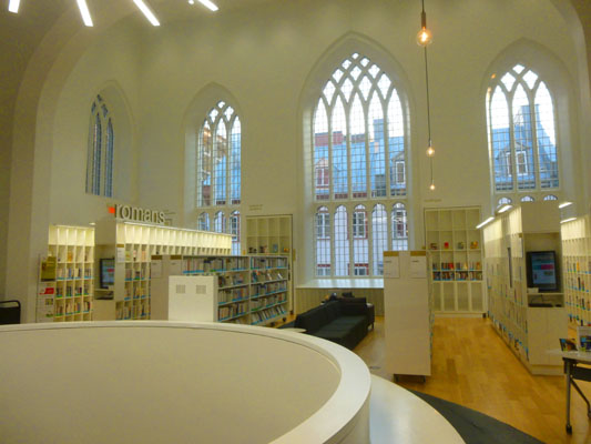
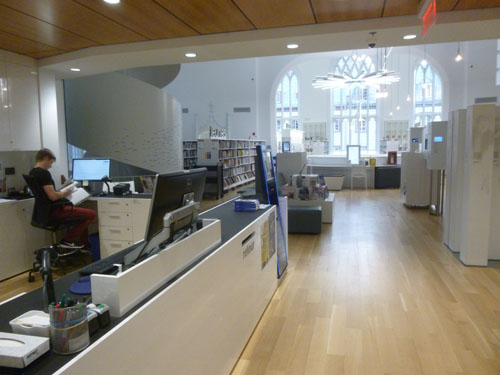
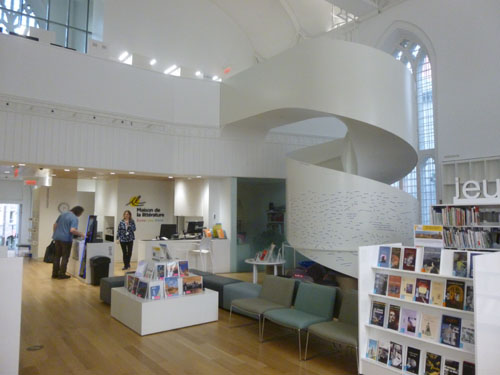
I continued past the front of the Morrin Center, crossed another street, and found myself in front of the church I wanted to visit. Only it wasn't a church any longer; it was the "Maison de la Litterature"- a public library. The first neogothic church to be erected in Québec City, Wesley Temple was built in 1848 according to plans by architect Edward Stavely as a place of worship for the Methodist community. The church was closed in 1931.
|
|
The Institute closed in 1999 and the library expanded into the space. The library, which serves the residents of Old Québec, features a writer’s residency program and hosts numerous literary events and programs throughout the year. The building is a designated Québec heritage site.
I have been in repurposed churches before. I especially recall one in Aberdeen, Scotland, that had actually been converted into a casino! Standing in the casino and looking up at the arched stained glass windows was an interesting experience. I had that same feeling here in the library; the view above, left, is, I think you will agree, an odd one. Here are a couple more views of the inside of the library:
|
|
I left the library, took a picture of the interesting basement windows, and rounded the corner to continue west towards Rue d'Auteuil. When I'd gone far enough to get it all in, I took a last picture of the library/Wesley Temple. The three stained glass windows at this end of the building are the ones you see in the interior picture above. I continued walking to Rue d'Auteuil and turned southeast to get back to the hotel. I passed another interesting old building before arriving back at the hotel and hooking up with everyone (who were, conveniently, on the bar patio having drinks).
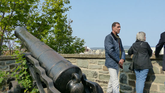
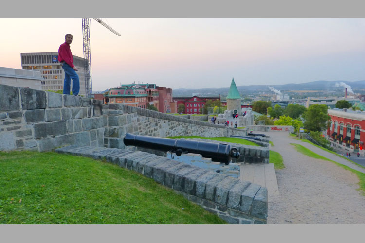
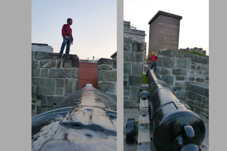
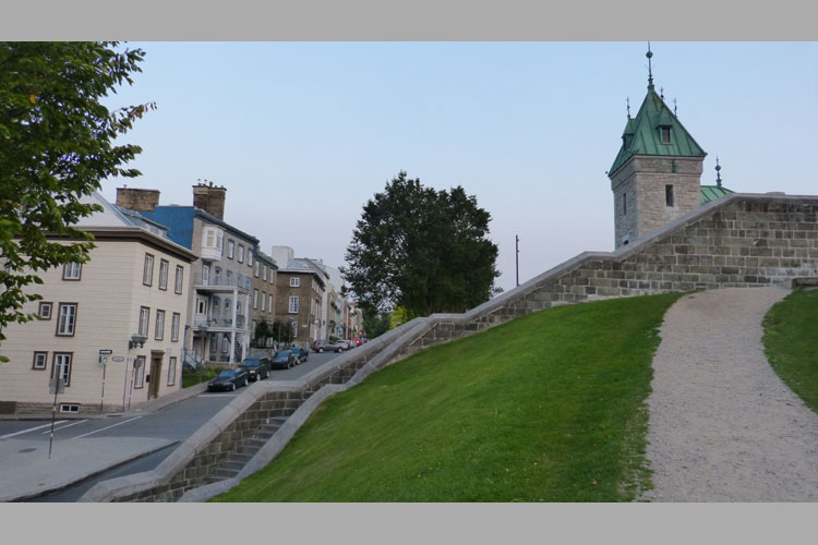
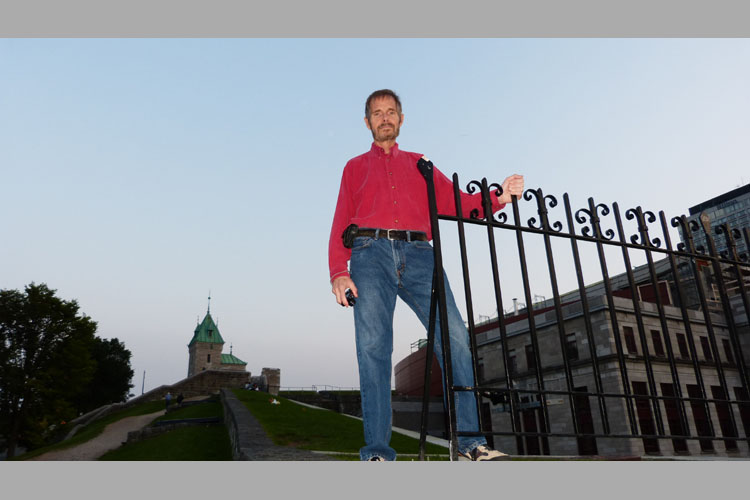
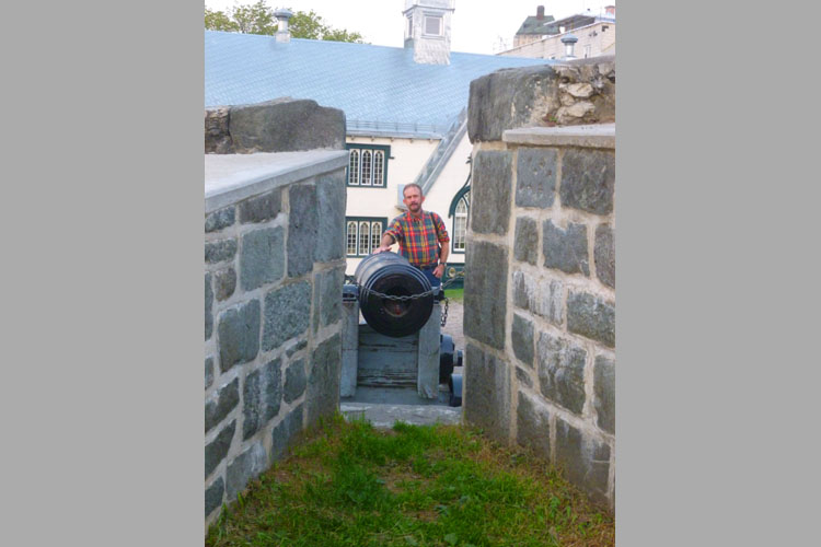
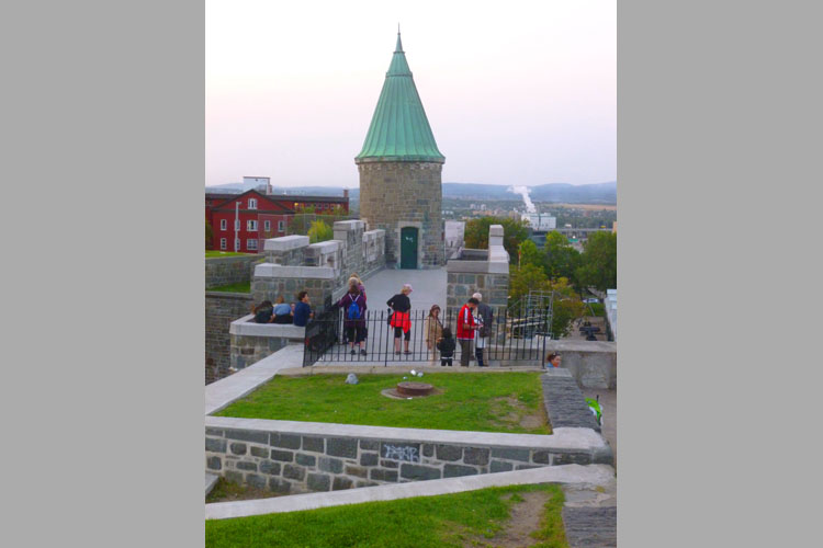
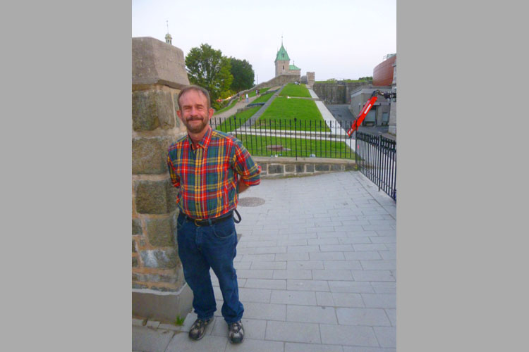
On the Old City Walls
|
|
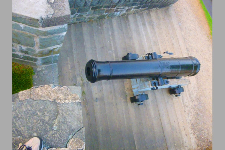
The walls are really neat, what with the turrets and cannon and all, and it was fun to walk along them. The only bad thing was that it was late afternoon, and the light was fading pretty fast, so the pictures aren't as bright and clear as they might have been.
Anyway, as with all the other slideshows in this album, you can move through the pictures using the little arrows in the lower corners of each slide, and you can track your progress with the index numbers in the upper left.
We hope you enjoy clambering around on the walls with us!
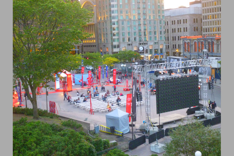
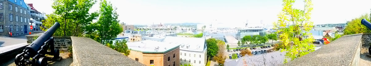
In addition to the pictures in the show, I took a number of panoramic shots, and I've selected two of them to include here. First, a view to the west and downtown:
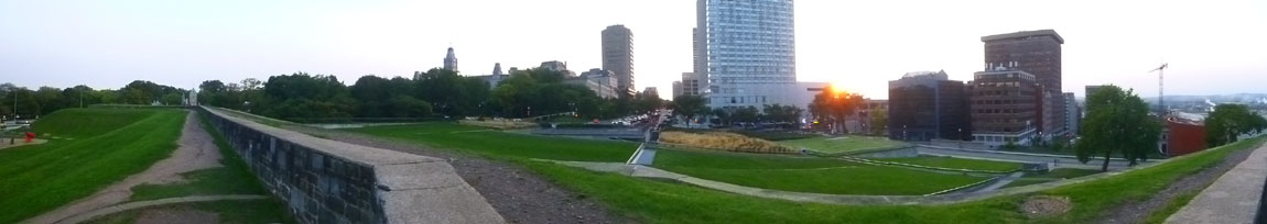 |
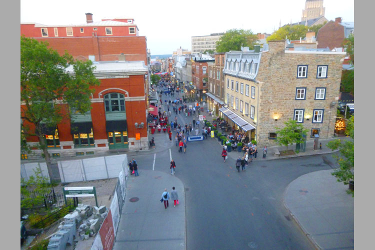
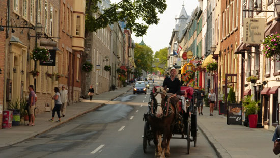
And now a view to the east, looking down to where the horses and carriages used for tourists in the Old City are housed during the day:
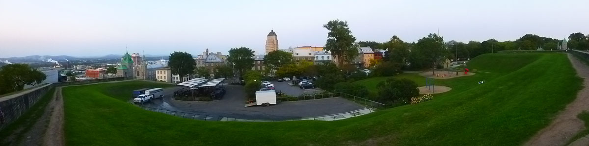 |
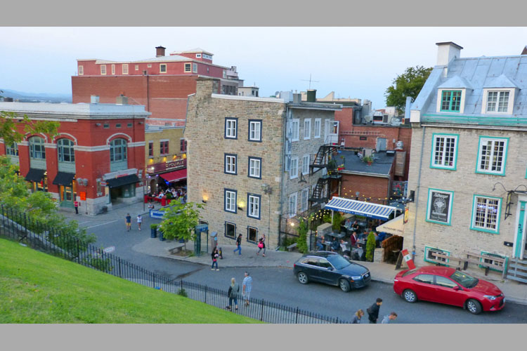
I want to end this section- and our last day in Quebec City- with two movies. One was taken at the end of our "wall walk", and I am looking down towards the area of the Old City where we will have dinner. The other was taken an hour later as we walked down that street towards the restaurant that Karl had picked out. You can use the players below to have a look at these movies:
|
|
|
You can use the links below to continue to another photo album page.
|
September 16, 2017: Our Trip Home |
|
September 14, 2017: A Drive Around Île d'Orléans |
|
Return to the Index for Our Trip to Quebec City |