|
September 15, 2017: An Old City Walking Tour |
|
September 13, 2017: A Drive to Montmorency Falls and Beaupre |
|
Return to the Index for Our Trip to Quebec City |
Early in our trip planning, Karl thought we might do a commercial tour of the Île d'Orléans, but none of them seemed to offer the comprehensive, at-our-own-pace tour that we wanted. So I suggested that we just rent an SUV for the day; in fact, we rented it for two days so we could also eschew commercial tours to Montmorency Falls and the Basilica of Saint Anne de Beaupre- the visits we made yesterday. Karl has already booked us a tour of the Anglican Church of the Holy Trinity and the Ursuline Chapel, so we will do those first today. Then, we'll take the SUV and drive to Île d'Orléans to spend the rest of the day there.
A Pre-breakfast Walk
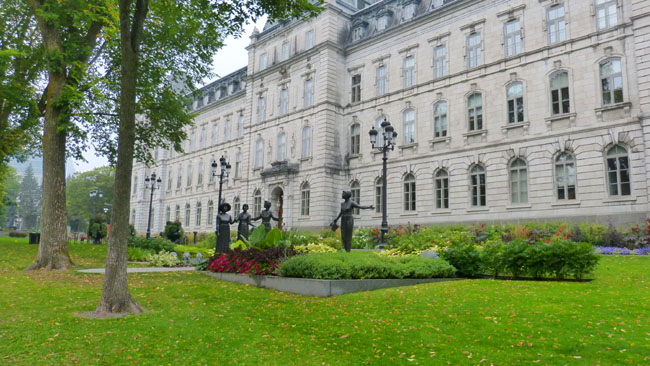
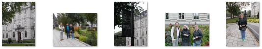
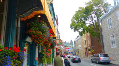
Prudence has a habit of going for a walk before breakfast. In San Antonio, this is usually to take Jax over to the park. But when she travels, she (and, if they are along, her sister, Fred, and Guy) will typically just go out and walk around wherever she happens to be. This morning was no exception. As we had done our first night here, they left the hotel and walked up to the Grande Allee, turned west and walked through the Orleans Gate. This brought them opposite the Quebec Parliament building.
|
 (Click on Thumbnails to View) |
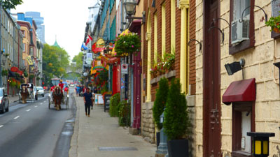
The four of them also walked along the Grande Allee a ways; this popular street has numerous hotels, bars and restaurants and, at its western end, many beautiful old residences. Here are the best of the pictures that the four of them took along the Allee before they returned to the Manoir d'Auteuil:
 (Click on Thumbnails to View) |
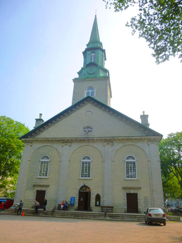
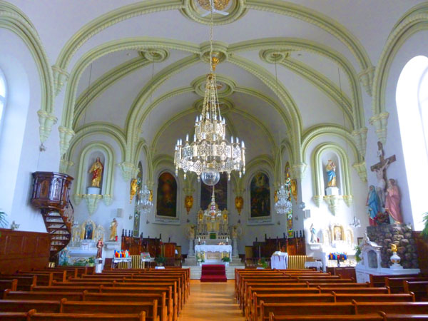
The Anglican Cathedral of the Holy Trinity
When Prudence, Nancy, Guy, and Fred had returned from their walk, we all sat down to have some breakfast at the hotel before heading out for a tour that Karl had booked for us. The tour would include the Anglican Cathedral of the Holy Trinity, the Ursuline Convent and Chapel, and a short walk around the old city.
|
 |
 |
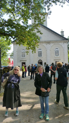
We got to the cathedral a little early; we were supposed to meet our guide right at 9:30 just inside the cathedral, and so we were early, we hung around outside for a bit.
|
|
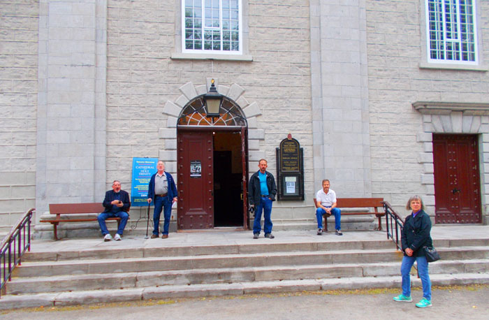
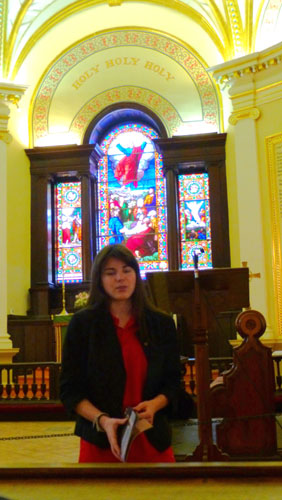
Our guide turned out to be young lady who, I believe, was a student at a local university and a specialist in the history of Quebec from 1600 to 1900. I don't recall there being a question we asked that she wasn't able to answer. She met us at 10AM right inside the cathedral, introduced herself, and began an explanation of the history of the cathedral.
|
|
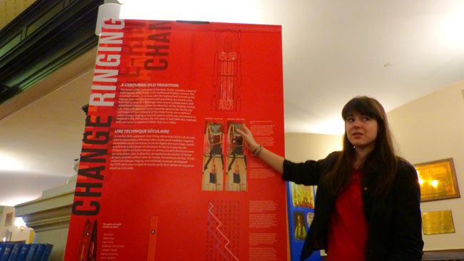
Each bell is rung by a bellringer who acts in collaboration with other team members, under the direction of the ringing master. Like their colleagues in many countries around the world, the bellringers of the Cathedral of the Holy Trinity use a method called change ringing, a musical system which was developed in England in the 17th century for this type of bell. With this method, bells are run in sequence rather than in a volley.
The bells themselves were founded by Whitechapel in 1830, and are the oldest change-ringing peal in Canada. Due to deterioration, they were brought down in 2006, sent to Whitechapel in London for re-tuning, and reinstalled in April 2007.
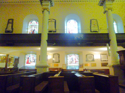
We were guided around the inside of the cathedral by this knowledgeable young woman, and her explanations of the history of the church and of the various elements of the interior decoration were all very interesting.
 |
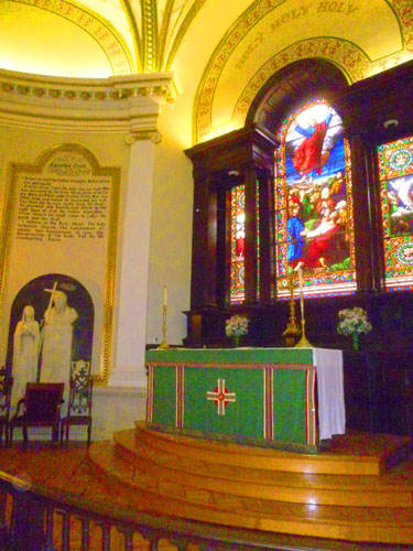 |
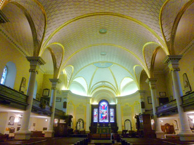
The "scale" of the church was very much "human-sized", as contrasted with huge cathedrals like Notre Dame in Paris, or other cathedrals we have visited in recent years in Prague, Quito, and, most recently, Montreal. The building itself is constructed of brick and wood- not massive stone. The exterior and the interior of the cathedral bear solid witness to the simplicity of British architecture. The façade includes certain embellishments, created by François Baillargé and inspired by Renaissance art, whereas the interior is inspired by the architecture of Antiquity.
Wanting to isolate the sanctuary from the city, they surrounded the building with a wall topped with a forged iron fence. The architecture of other Québec churches would be influenced by this church.
 |
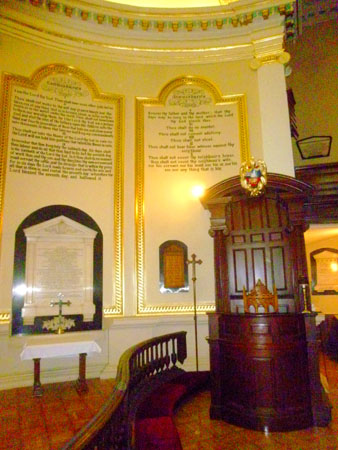 |
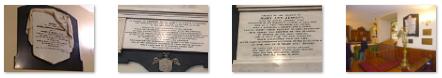
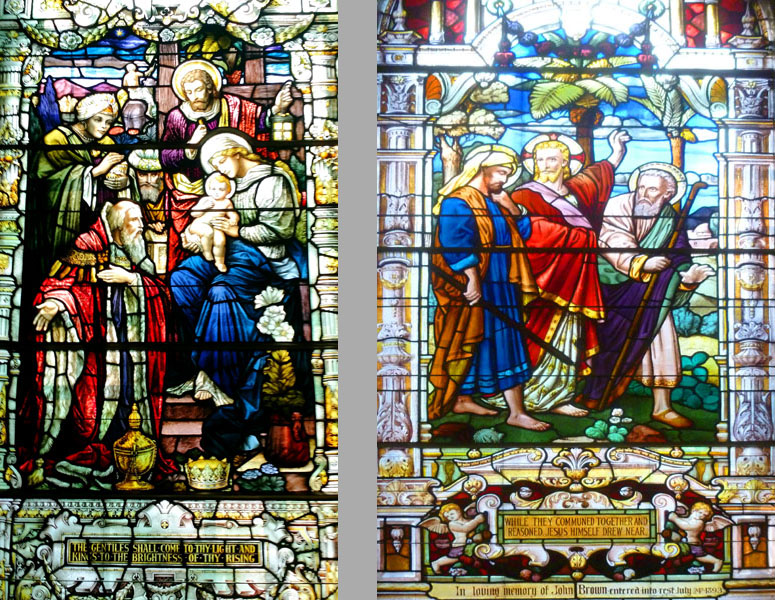
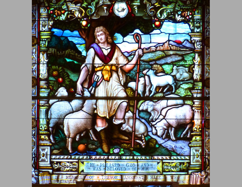
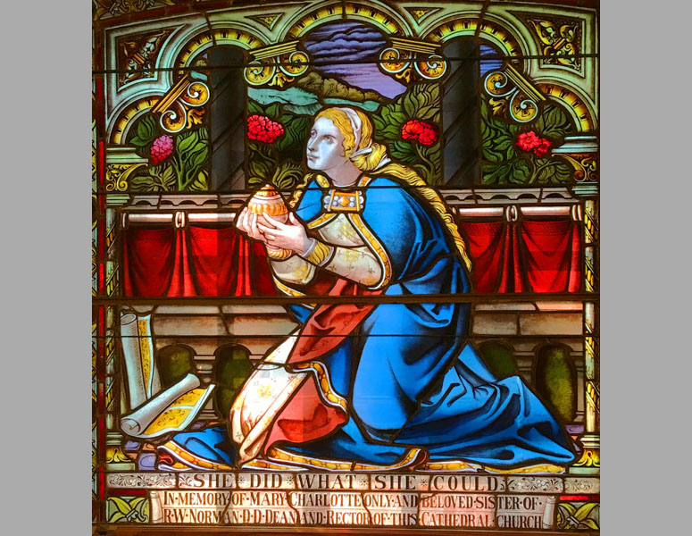
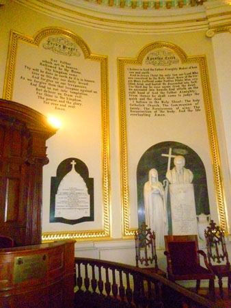
Three other decorative elements included the stained glass windows (which we'll have a look at in a moment), numerous wall plaques that commemorated noted church officials and parishoners, and the small display museum at the back of the nave. Here are a couple of pictures taken in the museum area and some views of those commemorative plaques:
(Click on Thumbnails to View) |
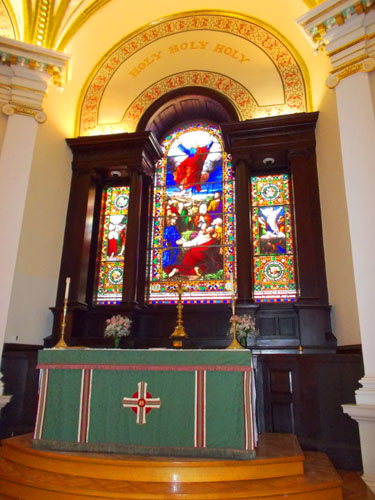
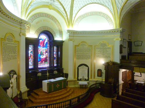
Actually, the chapel/nave was fairly small, perhaps a couple hundred feet from end to end. Here's a series of three views of the chapel- beginning with the altar, then looking at one side of the chapel, and finally looking back towards the entrance and the organ loft above it:
|
|
|
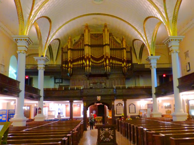
The cathedral offers several attractions not to be missed, such as the Royal treasury given by the King of England, and the closed pews sculpted in oak that came from the Royal forest of Windsor. You can see those pews in the pictures above, and you'll see them again when we head upstairs. Abundant in history, Holy Trinity is not only a place of worship, but it is also a sanctuary where God and history meet.
|
|
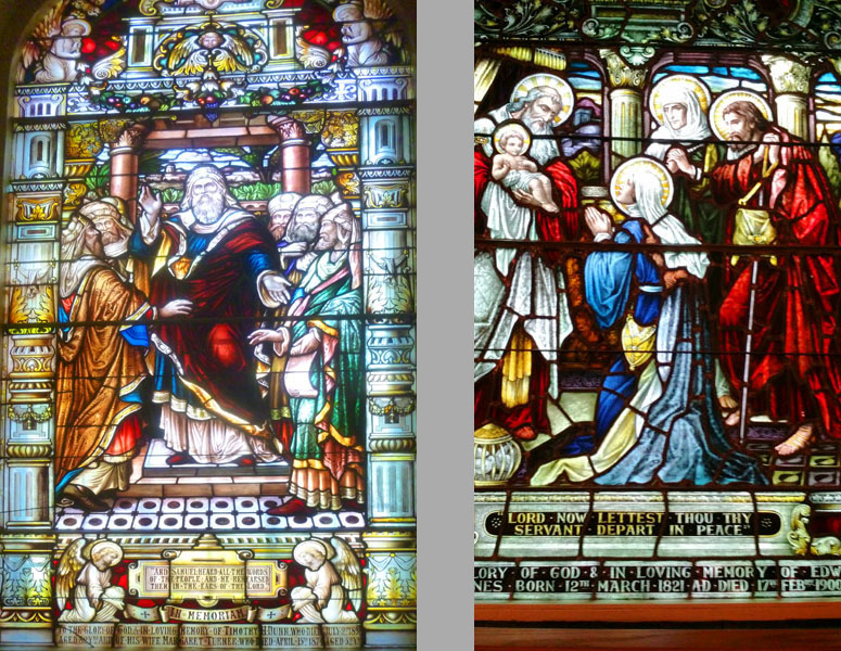
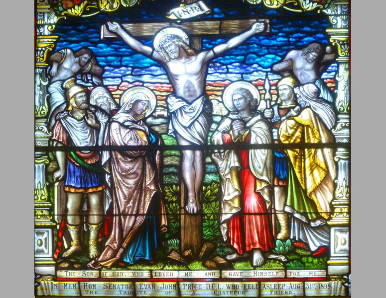
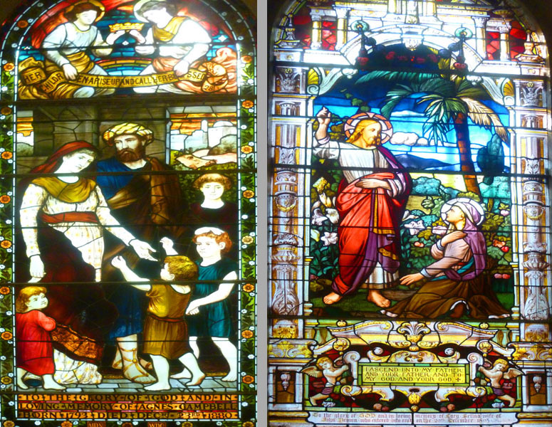
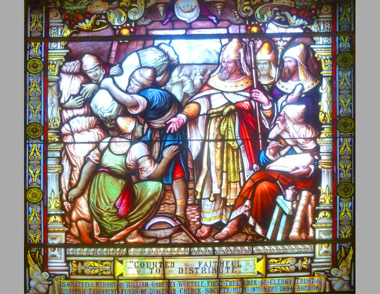
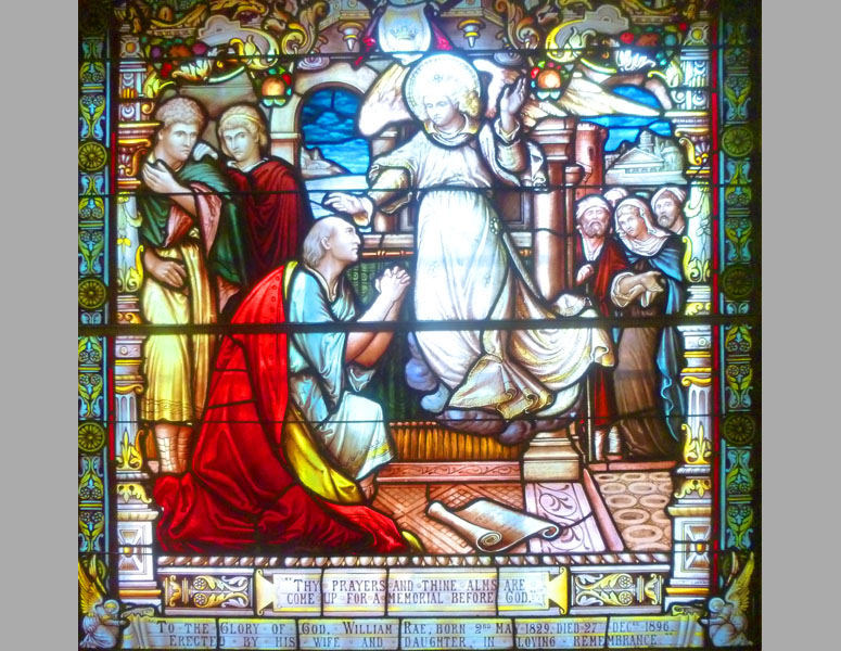
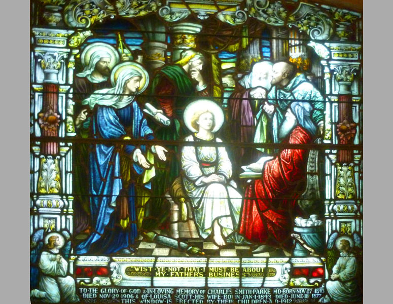
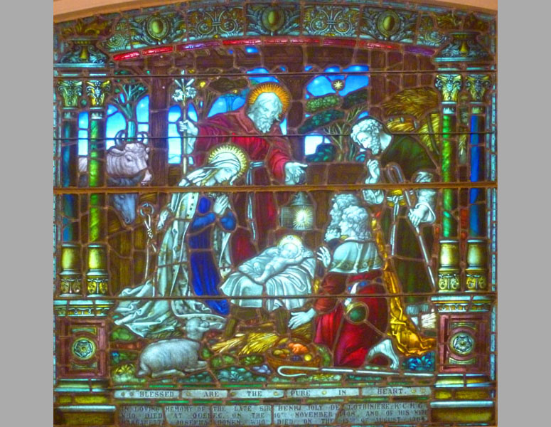
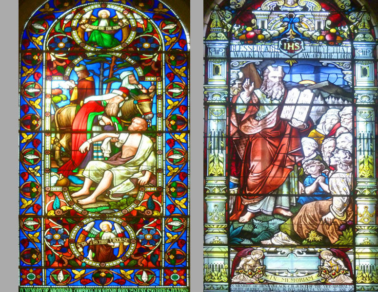
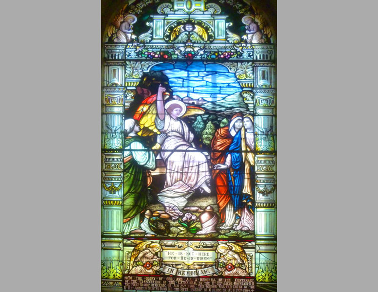
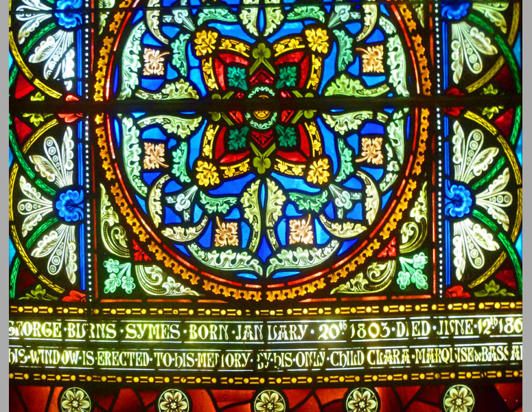
I have created a slide show of the images we captured of the stained glass windows. Each slide in the show has either one of the squarish downstairs windows or one or two of the tall ones we found upstairs. That slide show is at left.
As with all the slide shows in this photo album, you can move from slide to slide using the little "forward" and "backward" arrows in the lower corners of each slide. You can also track your progress through the show by referring to the index numbers in the upper left.
We all thought the stained glass to be quite beautiful, and I hope you enjoy looking at our pictures!
Before we follow our guide up to the organ/choir loft, I have a few more pictures that we took downstairs. Interestingly, while the church has its large organ upstairs in the organ loft, there was also a small organ off at the right side of the sacristy downstairs. Also, at the back of the nave was the area where objects from the royal treasury (given by the King of England) are displayed. Our guide also took us over to a large antique wooden chest that had a series of long, shallow drawers- maybe twenty of them. This chest contained the various table drapes that the cathedral uses throughout the liturgical year. We'd seen these before in churches, but we had no idea there were such a large number of them. We ended up photographing some of the more interesting and colorful of them:
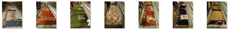 (Click on Thumbnails to View) |
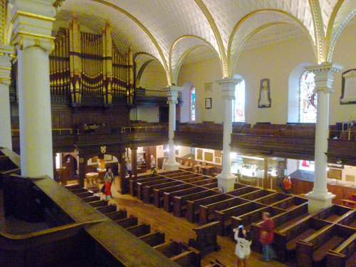
At the back of the cathedral, our guide took us up a spiral staircase to the choir loft and organ loft. There, we had nice views of the entire interior of the cathedral. Also, we could get close to the tall stained glass windows where most of our photographs of them were taken. Here are some views looking down into the nave from the loft- including one of the closed pews sculpted in oak that came from the Royal forest of Windsor:
 |
 |
We really enjoyed our visit to the Cathedral of the Holy Trinity. Next, we would be driving out to the Île d'Orléans, but first we had to get back to the hotel to our vehicle.
Back to the Manoir d'Auteuil
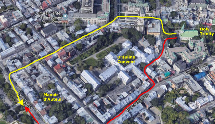
From the Cathedral, we took different routes back to the Manoir d'Auteuil. I needed to get back there quickly as it was time for me to "feed the meter" again to avoid what the hotel desk told me yesterday would be a hefty fine were a meter maid to come along. The rest of our group were going to walk more leisurely back- intending to stop at a couple of shops we'd passed this morning.
|
The rest of the group took the route marked in red that took them back via the shopping street we'd come down this morning. As it turned out, they walked right by the Ursuline Convent and its chapel, and they stopped in (not knowing that it would be a stop on our guided walking tour tomorrow). They took a few pictures there, but I won't include those here, but save them for our guided tour stop there tomorrow.
They did stop in at the store they wanted to visit; Nancy and Prudence got some souvenirs. About 45 minutes after we'd left the church, we met up again back at the hotel.
For my walk back to the hotel, I began by turning right outside the church grounds. There was an interesting street of shops and restaurants right beside the cathedral. I thought I would mention it later on when we might be looking for a place to have dinner. This street actually came off the southeast corner of a large square; the square situated between the Clarendon Hotel (one of the more famous here in the old city) on the south side and the old Quebec City Hall on the north.
In the panoramic view above, you can see part of the row of hotels on the south side of the square, the square itself, and the south wall of the Old City Hall towards the right. There were lots of benches and a great many flowers planted all around. There was also a large clock in a glass building at the southeast corner of the square; the clock was transparent so you could see its workings, but being inside a glass enclosure itself made it hard to photograph.
|
I walked through the square on a flower-lined walkway to the northwest corner of the plaza. There, where Saint Anne Street angles off to the southwest towards the Manoir d'Auteuil, I came across this intricately-decorated planter. At first, I thought someone had strung a garland around and around a large pedestal pot, but when I got close, I discovered that the whole thing was constructed out of a mesh-enclosed growing medium, so plants could be growing all over the outside of the planter. Really interesting.
At that intersection where Saint Anne Street took a turn to the southwest, there was a large building belonging to the Brothers of the Christian Schools of Québec. The Institute of the Brothers of the Christian Schools was founded by St. John Baptist de la Salle at Rheims (France) in 1680. Its mission was the instruction and Christian education of children, craftsmen and the poor, all in a spirit of great faith and enthusiasm. In Québec, they were first introduced in Montreal, where four brothers from France opened a school in 1837. Six years later, in 1843, they settled themselves on la côte des Glacis in Old Québec. In addition to having created several educational establishments throughout the province, they were also the pioneers for the faculté de Commerce (Faculty of Commerce) in Quebec City and were the founders of many trade schools. This large building houses not only a couple of the actual schools but is also the headquarters of the organization. On my left as I headed up Saint Anne Street was this charming little hotel.
|
As I headed up Saint Anne, I passed the back of St. Andrews Presbyterian Church. In that picture you can actually see the steeple of the church proper. It wasn't until I got a bit further up the street in walked down to the front of the Morrin Center that I was able to see the front of the church. The congregation's roots began with the British conquest of Quebec at the Plains of Abraham in 1759. Under the leadership Robert MacPherson, the chaplain of the British troops, and under the auspices of the Church of Scotland, a congregation evolved- led by him until 1765.
With the 1763 Treaty, and the coming of merchants from Scotland and New England, the congregation soon assumed civilian status and was known as the Scotch Congregation - in connection with the Church of Scotland. In 1802, in response to a petition signed by 148 persons, the present Church site was granted by His Majesty George III, although it was not until 1807 that construction began.
The long-contemplated Church was dedicated on November 30, 1810, on St. Andrew's Day, and appropriately named after the apostle. The building remains virtually unchanged but for the addition of the Vestry in 1900. On the same triangular site with the church are the Kirk Hall, first erected in 1829 as a Protestant School which continued as a flourishing scholastic institution for many years; and the magnificent Manse erected in 1837, which has been the residence of the ministers to the present time. William Reed was notably the church's organist from 1900-1913.
|
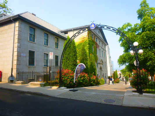
The Morrin Center is a cultural center here in Quebec City. It is designed to educate the public about the historic contribution and present-day culture of local English-speakers. The center contains the private English-language library of the Literary and Historical Society of Quebec, heritage spaces for events, and interpretation services.
The center is located in a former prison building that has been designated a National Historic Site of Canada. The site has been used for four different purposes. Between 1712 and 1808, it was a Royal Redoubt (a fort-like affair); in 1813 it became the Quebec City Jail. The site was a jail until 1868, when the city detention facilities were moved out of the old city. In 1868, the site was taken over by a private educational institution, and it was renovated bo become Morrin College.
When Morrin College was absorbed into a larger institution further west in 1902, the site became what it is today- the Literary and Historical Society of Quebec. In 2004, the Literary and Historical Society of Quebec became owners of the historic site through an emphyteutic lease. (In this type of lease, the owner of a plot of land can lease it to another entity in return for rent and, at the end of the lease period, the reclaiming of the land and any constructions that have been built on it.) In the last decade, the Society has broadened its mandate. The building was entirely renovated, and transformed into the Morrin Center, which not only houses the library but also acts as Quebec City’s English-language cultural center and a historical interpretation site.
When I got down to the front of the building, I noticed what appeared to be a church across the street. Indeed, the structure had been the first neogothic church to be erected in Québec City- the Wesley Temple. It was built in 1848 according to plans by architect Edward Stavely as a place of worship for the Methodist community. The church was closed in 1931, as most of the congregation had moved further west, out of the old city. The building became an Art Institute in 1944, and when it closed in 1999 the city came up with an innovative new proposal- to use it as a literary center and branch of the Public Library. Tomorrow, I will visit the inside of the building will show you some pictures of it.
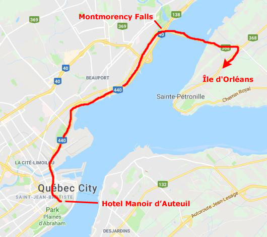
For today, though, I returned to the Manoir d'Auteuil just minutes ahead of everyone else. After they relaxed for just a bit, we all piled in the Explorer and headed off to Île d'Orléans.
A Drive Around the Île d'Orléans
When we first started planning this trip, Karl had found a couple of tours that would take you around the island, but these would stop where the tour operator wanted to stop- which would be only fairly commercial things. He also looked into renting scooters, but having seven of us trying to stay together on the highway was problematical- not to mention the safety factor. So I suggested that we just keep the SUV and us it for our tour this afternoon.
Getting Onto the Île d'Orléans
|
Île d'Orléans (eel de orleans) is located in the Saint Lawrence River about 3.1 mi. east of downtown Quebec City. The island was one of the first parts of the province to be colonized by the French, and a large percentage of French Canadians can trace ancestry to early residents of the island. This, as it turned out, included Guy Blair (something we hadn't known) and he came on the outing prepared to visit an old church that had a significant graveyard, hoping to find where some of his ancestors were laid to rest. He was successful in that, as it turned out, but I'll save more information about the church and Guy's relatives for our last stop of the afternoon.
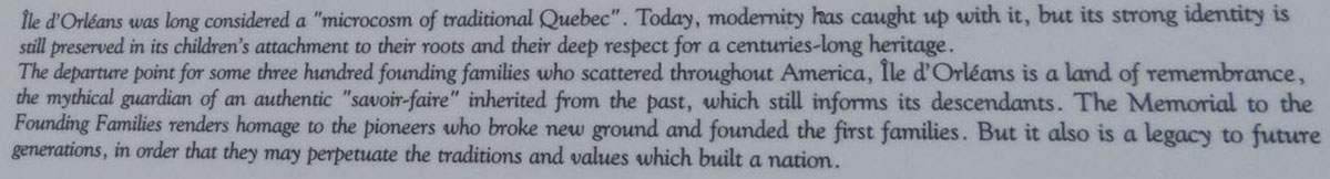
The island has been described as the "microcosm of traditional Quebec and as the birthplace of francophones in North America."
The island is accessible from the mainland via the Île d'Orléans Bridge from Beauport. Route 368 is the sole provincial route on the island; it crosses the bridge and circles the perimeter of the island. At the village of Sainte-Pétronille toward the western end of the island, a viewpoint overlooks the impressive Chute Montmorency (Montmorency Falls), as well as a panorama of the St. Lawrence River and Quebec City.
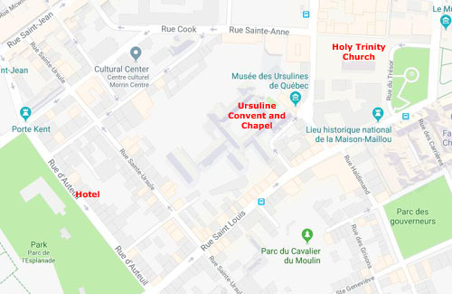
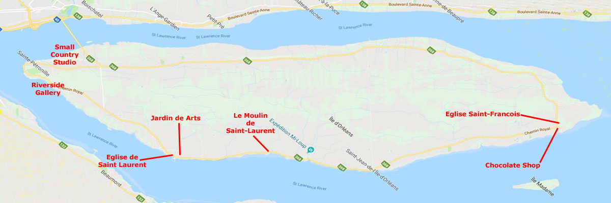
We had a map with us, but really wouldn't need it. We planned to simply turn right when we reached route 368 and then follow it all the way around the island; since it was the only route on the island, we would eventually return to our starting point- the road leading to the Île d'Orléans Bridge. To organize our island pictures, I'll just create a little section for each stop that we made. Below is a map of the island- rotated a bit so it is east-west rather than northeast-southwest (there's only one main road and very few actual streets, so the map is pretty simple); I have marked the stops we made on our counterclockwise circumnavigation of the island.
 |
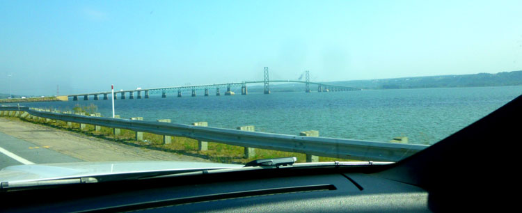
Back to getting onto the island, our route took us across the Île d'Orléans Bridge, and this was first photo opportunity that we had this afternoon. Since I wad driving, I asked Ron Ruckman to use my camera to get a few pictures as we approached the bridge and crossed it.
|
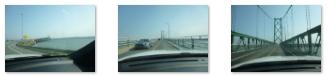 (Click on Thumbnails to View) |
The Island of Orleans is situated between the Laurentian Plateau or Canadian Shield to the north and the Appalachian Mountains to the south. Its north-eastern point marks the boundary between the St. Lawrence River and its estuary (the largest in the world), where fresh water begins to mix with salt water. Of irregular form with jagged coves and capes, the Island of Orleans is 21 miles long and 5 miles wide at the widest point. It is 47 miles in circumference, with a total surface area of 73 square miles. It has a hilly relief, small valleys, and gradual crests that reach a maximum height of about 500 feet at Sainte-Pétronille and Saint-Laurent in the south.
As we came to the intersection of the road across the bridge and the islands only route, we came across a visitor center, and so we stopped in for some recommendations of places to stop. Outside, Fred found a monument to Félix Leclerc (1914 – 1988), a French-Canadian singer-songwriter, poet, writer, actor and Québécois political activist. He was made an Officer of the Order of Canada in 1968, and was posthumously inducted into the Canadian Songwriters Hall of Fame. And just beyond the visitor center, we could see some of the expansive views for which the southern portion of the island is famous.
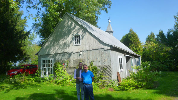
A Small Country Art Studio
|
The studio turned out to be in a detached garage, and the woman artist came out when she saw us drive up. We spent fifteen minutes or so looking at the art, but it wasn't to Prudence or Nancy's liking, and so we left fairly quickly. Before we did, I made a little panoramic view of the studio and house:
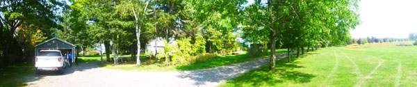
Leaving the country studio, we continued southwest on the main island road to the town of Sainte-Pétronille
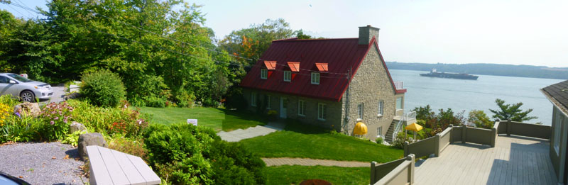
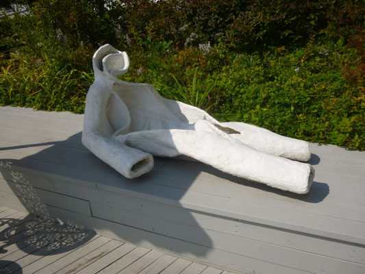
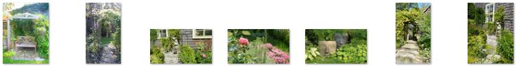
A Riverside Gallery
|
We rounded the tip of the island and, just outside the village limits heading northeast, we found a boutique gallery and stopped to investigate.
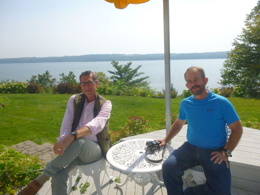
This particular gallery was down below the road itself- on the slope down to the St. Lawrence River. We parked at the top, just off the road, and then went down a walkway and stairs to the entrance to the gallery. You can see Karl and I up at the top of the walk here. Neither Ron nor I wanted to go inside the gallery; the beautiful sunlight and warm afternoon were too inviting. Fortunately, there was a shaded patio where we could sit. You can see in that last picture that there was an art installation there, too- the reclining figure shown in my picture below, left:
|
|
There was a little garden at the top of the hill near the parking area, and a little garden house as well. Fred and I took some pictures around that area, and here they are:
|
|
|
|
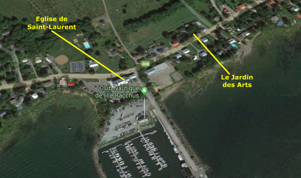
From the boutique gallery we continued northeast, now on the east side of the island, looking for a place to have lunch.
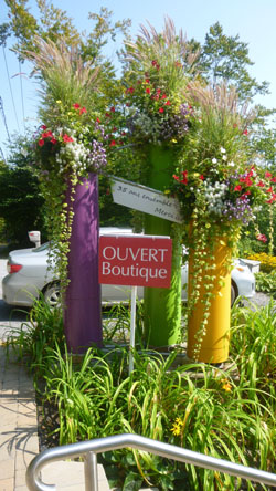
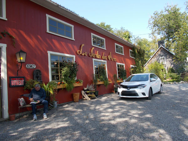
Le Jardin des Arts
|
The area had a little sign calling it the Enchanted Forest, and it was right next to a shop that sold garden supplies- like garden furniture and pottery for plants and flowers. They had a great variety of bird feeders and bird baths and bird houses and bird sculptures as well as water features and fountains.
Whether you are looking inside the shop, or wandering around the decorated garden in the back of the store, or strolling through the enchanted forest, L’Art au Jardin is where you will definitely find the art in the garden.
We took a number of pictures as we wandered around this outdoor garden, and I have put thumbnails for some of them below:
 (Click on Thumbnails to View) |
The other reason to stop here was the actual art gallery- Le Jardin des Arts. The gallery, the largest on the island, contained a wide variety of art crafted by almost 60 local Québec artists. Sadly, picture-taking was not allowed inside, so I just stuck my head in for a moment before heading back outside. Prudence, Nancy, Guy, and Fred wandered around for while, though.
|
Some of what was here was a bit kitschy, but there were useful items too, like island images, small sculptures showing the architecture of the homes of Île d’Orléans, and also doorstops, tissue boxes, key holders, trinket boxes, step stools, coasters, key chains, small furniture, and tiffany-type lamps. There were painted cups, teapots, plates, and bowls. This was why it took Prudence and Nancy a while to walk around, giving me time to go down the street to the local Catholic Church.
So no pictures inside, but we did take quite a few outside, and here are some of them:
 (Click on Thumbnails to View) |
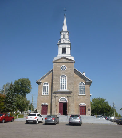
Église de Saint-Laurent
|
The first church was built in 1675 by the carpenter Charles Pouliot. It was 53 feet long and 21 feet wide, about 330 feet west of the current parish church. That first wooden church was replaced in 1697 by a stone church, but after a few years the congregation outgrew the church. In 1707, it was decided to extend it about 20 feet by the facade. Jean Maillou, author of the plans, did the masonry while Joseph Chabot made the frame and the steeple. An additional window was pierced in each drop wall and a small door in the wall on the right. The work, which took three years, was completed in 1710.
The original appearance of the church was modified again in 1774. A transept was added and the plan took the form of a Latin cross. This work was preceded in 1766 by the construction of a stone sacristy adjoining the apse. After all this work, that second church was demolished in 1864.
|
 (Click on Thumbnails to View) |
The pulpit was rebuilt in 1892, the benches were replaced in 1942 and, more recently, the communion table and the baptismal font were removed. The church has stained glass windows, executed by Bernard Léonard in 1900, as well as several goldsmiths, some of which date back to 1688.
The church of Saint-Laurent-de-l'Île-d'Orléans also has several paintings: "Saint Anne and the Immaculate Conception" (attributed to François Baillairgé, 1804), "The Martyrdom of St. Lawrence" (Vincenzo Pasqualoni, 1874), and "The Holy Family and the Transfiguration" (unknown artist, 1885).
Perhaps reflecting the fact that the parish church sits right by the town harbor, at the back of the nave, atop a wood cabinet, there was a large model ship. There was also a woman at the back of the nave doing a painting of the church interior; she was a local artist and she also had a couple of her works on display. Here is one of them. When I left the church to walk back to Le Jardin des Arts, I passed by the parish cemetery; the previous church building used to be on the far side of that cemetery.
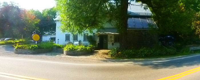
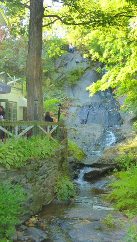
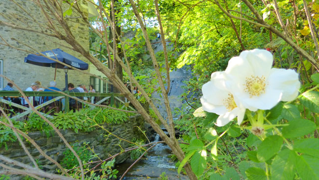
The Moulin de St-Laurent Restaurant
|
"The Moulin de St-Laurent Restaurant has been a family business for more than twenty five years. In December 1986, Yvon Premont, his sister Elise Premont and her husband, Jean-Victor Lachance purchased this historic building. The first objective is and always has been to continue tradition and hospitality, good wine, good cheer and good music; all within an enchanting and romantic setting.
A few years later the couple’s two daughters, Anne and Julie joined the team. Lodging was started in 1996. Luxury, riverfront chalets offer a unique concept; dining in the restaurant, accommodation and breakfast in the chalets facing the spectacular waves of the St-Lawrence. Nothing could be better than a short getaway or long stay.
In this historic building constructed under the French regime, you will be thoroughly tempted to savour a meal that responds to your expectations. Let yourself be warmed by the stone, the service and the wonderful cuisine."
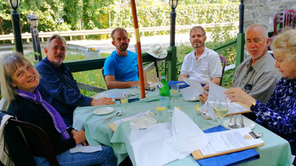
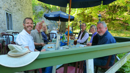
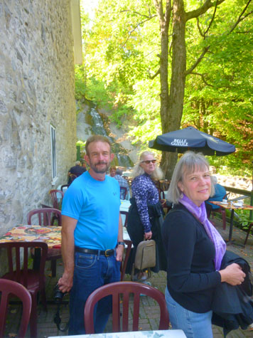
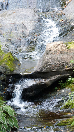
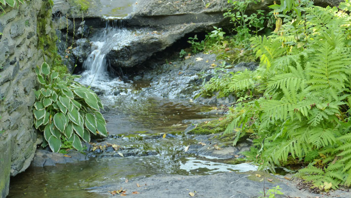
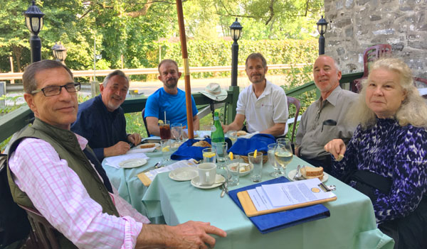
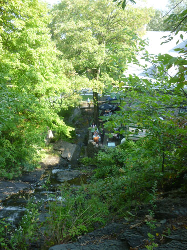
This restaurant is seasonal- only open from May to October. There was a large indoor dining room, but we opted for the outside patio, as the weather was wonderful and the patio had a nice view of the waterfall behind the restaurant. To get onto the patio, we crossed a small footbridge from the parking area. We found a table right at the end of the seating area and settled in for some lunch.
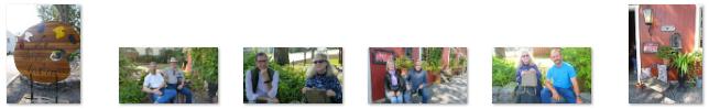
Between us, we got pictures of everyone at some point during our lunch. (I suppose we should have asked our waiter to take the picture for us, so there wouldn't always be somebody missing from the picture, but we didn't.) Here are the best of those pictures:
 |
|
While we were waiting for lunch to arrive, I let my curiosity get the better of me, and I got the idea that I would find my way up to the top of the waterfall to get a picture of what it looked like from there. (Little did I know that the top of the waterfall was at the corner of some property that didn't belong to the restaurant- at least not until someone came out of the back of the building to tell me and ask me to come on back down.)
 |
 |
The back of the menu had some more historical information: "This building dates back to the French regime (1720) when it was a water mill used to grind wheat into flour for the people living on the southern side of the island. The building remained a mill until about 1930. In 1963, a couple from Holland, Mr. and Mrs. Van Veen, purchased the mill and turned it into the fine restaurant it is today. In 1986, the restaurant was bought by a group of islanders, the Premont-Lachance family, whose greatest desire is to maintain that character and unique style which have made the establishment famous." This historical tidbit was borne out when, after lunch, Fred got a picture of Guy and the millstone that was used in the mill until 1921.
|
|
Oddly, he also took a picture related to the waterfalls when he was in the men's room. Here is what that sign said:
We use water from the waterfall to fill the reservoir for the toilets. This is the reason that the water may appear brown. -----Thank you for your understanding. |
We had a really nice lunch, and afterwards were off again on our drive around the island.
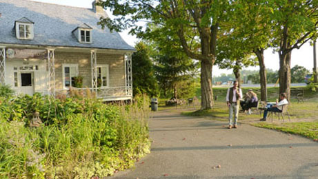
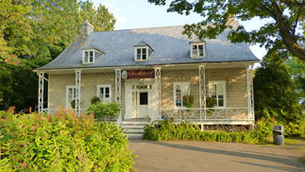
Chocolate and Church
|
The Parish of Saint-François-de-Sales was founded in 1679, named after Francis de Sales (1567-1622) and calling to mind Francois Berthelot, Comte de Jouy and de Saint-Laurent, representative of Paris in parliament and Seigneur of Île d'Orléans (1675) at the time the parish was established. It was also known as just Saint-François, and maps of the seventeenth and eighteenth centuries would show either one or the other form.
In 1845, the Parish Municipality of Saint-François-Isle-d'Orléans was formed, but abolished in 1847 when it became part of the County Municipality. In 1852, the local post office opened. In 1855, the parish municipality was reestablished. In 2003, the Parish Municipality of Saint-François became the Municipality of Saint-François-de-l'Île-d'Orléans.
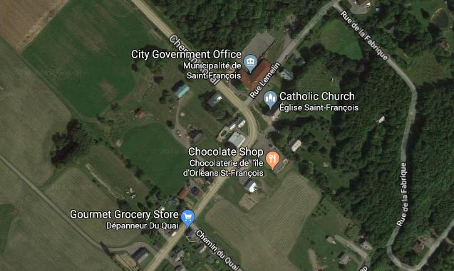
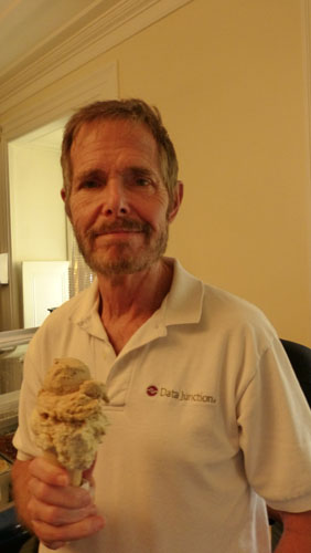
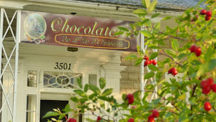
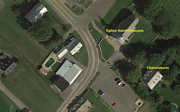
We might not have stopped here were it not for a sign we'd seen a mile or so back advertising an ice cream shop. Since we missed dessert at lunch, everyone was in a mood to stop. As it turned out, the shop was adjacent to a small park that had benches where you could sit and look down the long hill to the St. Lawrence River- a really beautiful spot in the fading afternoon light. Here are some of the many pictures we took around the Chocolate Shop:
|
| ||
|
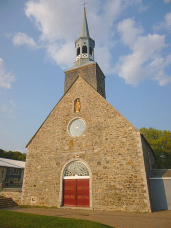
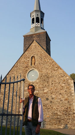
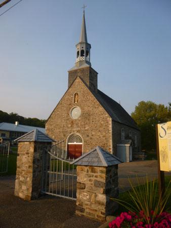
Adjacent to the Chocolaterie, there was a small parish church- the Église Saint-François-, and we walked over to have a look at it. The church of St. Francis is a place of worship of Catholic tradition erected around 1734 and rebuilt in 1991 and 1992.
|
|
In May 1759, with the announcement of the arrival of the English fleet, the inhabitants of the area evacuated the island. British troops set up a camp, and set up a hospital for their wounded in the church and presbytery of St. Francis. We know this due to a bit of graffiti, inscribed in 1759 and discovered following the 1988 fire in an old plaster layer. The author was David Chapman, the second gunner of the Neptune, which was the flagship of the fleet that anchored near the eastern tip of the island. The church continued to be witness to the history of the island of Orleans up to the present day.
 |
 |
 |
The church of Saint-François is of great heritage interest for its architectural value. The volume of the place of worship bears witness to the religious architectural tradition of New France. The religious buildings built in rural areas during the French Regime were particularly characterized by the simplicity of their plan and the sobriety of their facade. Erected by Master Mason Thomas Allard (1709-1762), the church of St. Francis presents a plan consisting of a rectangular nave with a single vessel and a narrower choir terminated by a semicircular apse. This type of plan, widely circulated in the 18th century, was inspired by that of the Récollets church in Quebec City. As for the facade, it includes only a portal with arched tympanum, an oculus and a niche receiving a statue. Although the place of worship has been largely rebuilt, the original Masonry Square is a representative example of 18th century Catholic religious architecture.
|
We did not get inside the church as it was closed, but I do know that the interior decor, originally very sober, was modified numerous times after 1770. In that year, the brothers François-Noël and Levasseur added a new altarpiece triumphal arch . In 1773, statues are added and the high altar is replaced. From 1835 to 1846, the interior decoration was redesigned; a new pulpit was installed in 1840. Some pieces of furniture are also brought up to date. The pews were rebuilt in 1850.
From 1953 to 1955, more restoration works were carried out. A bell tower with two lanterns replaced the previous one, statues of Denys Morisset are installed in the niches of the facade (which was cleared of its wood paneling) and the high altar of Levasseur was found and reinstalled in the choir. The church of Saint-François was classified in 1957- this being a program undertaken by the government of Quebec to catalog as many historical objects and artistic works as possible. More restoration was performed in the 1960s.
|
In 1985, a car coming from the northwest swerved (to miss an animal, it was reported) and hit the front of the church, causing the front to sink about eight inches. Restoration work was completed by the end of 1987. Sadly, in June of 1988, another car, coming this time from the south, crashed into the south side of the facade (the driver had reportedly fallen asleep); this ignited a fire that quickly spread throughout the building. Only the square plan of masonry was left. (It was this fire that brought the 1759 graffiti to light; it was saved, restored, and later relocated to the church.)
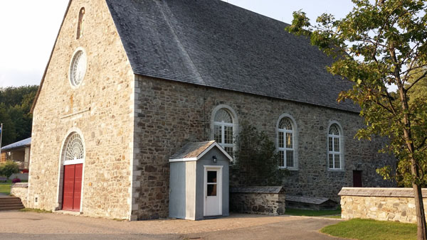
In 1991 and 1992, the place of worship was rebuilt from the remaining walls, according to the plans of the architects who relied on historical records and, where necessary, the forms that prevailed for the construction of churches in the eighteenth century. One more addition was made during that reconstruction; a stone wall, matching the church but fortified with a steel beam, was constructed in front of the church, and you can see that wall in the aerial view.
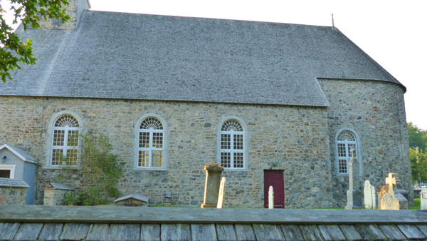
We had to content ourselves with walking around the outside of the church, which was productive as Guy found the tombstone of a likely relative ("Blais" being a common name in his family tree) in the graveyard just southeast of the church building. Here are a couple of good pictures of the church graveyard:
 |
 |
Done at the church and done with our ice cream, we headed on off along the island road, turning northwest right in front of the church.
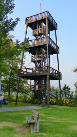
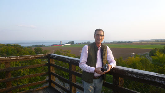
The Observation Tower
|
|
As you can see in Fred's good picture of the tower, it isn't all that high, but this end of the island is relatively flat, and so you don't have to be very high to see a long way.
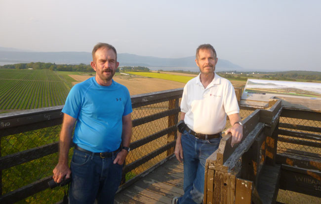
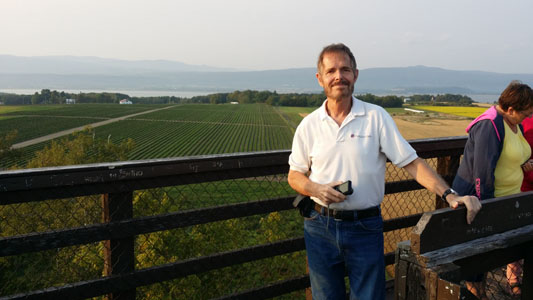
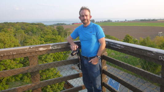
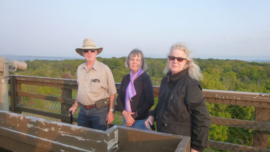
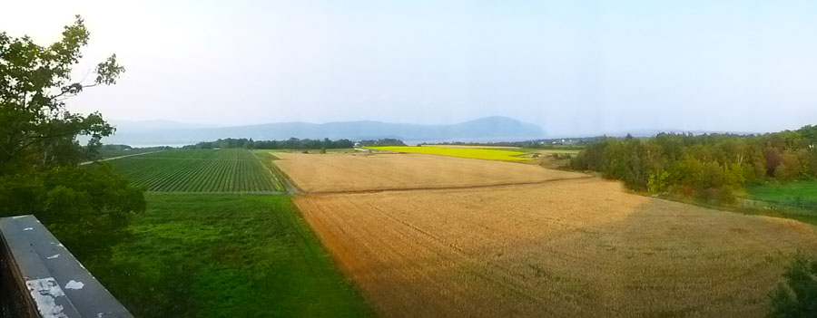
All of us climbed to the top at our own speeds; there, we were able to take in the expansive views in all directions.
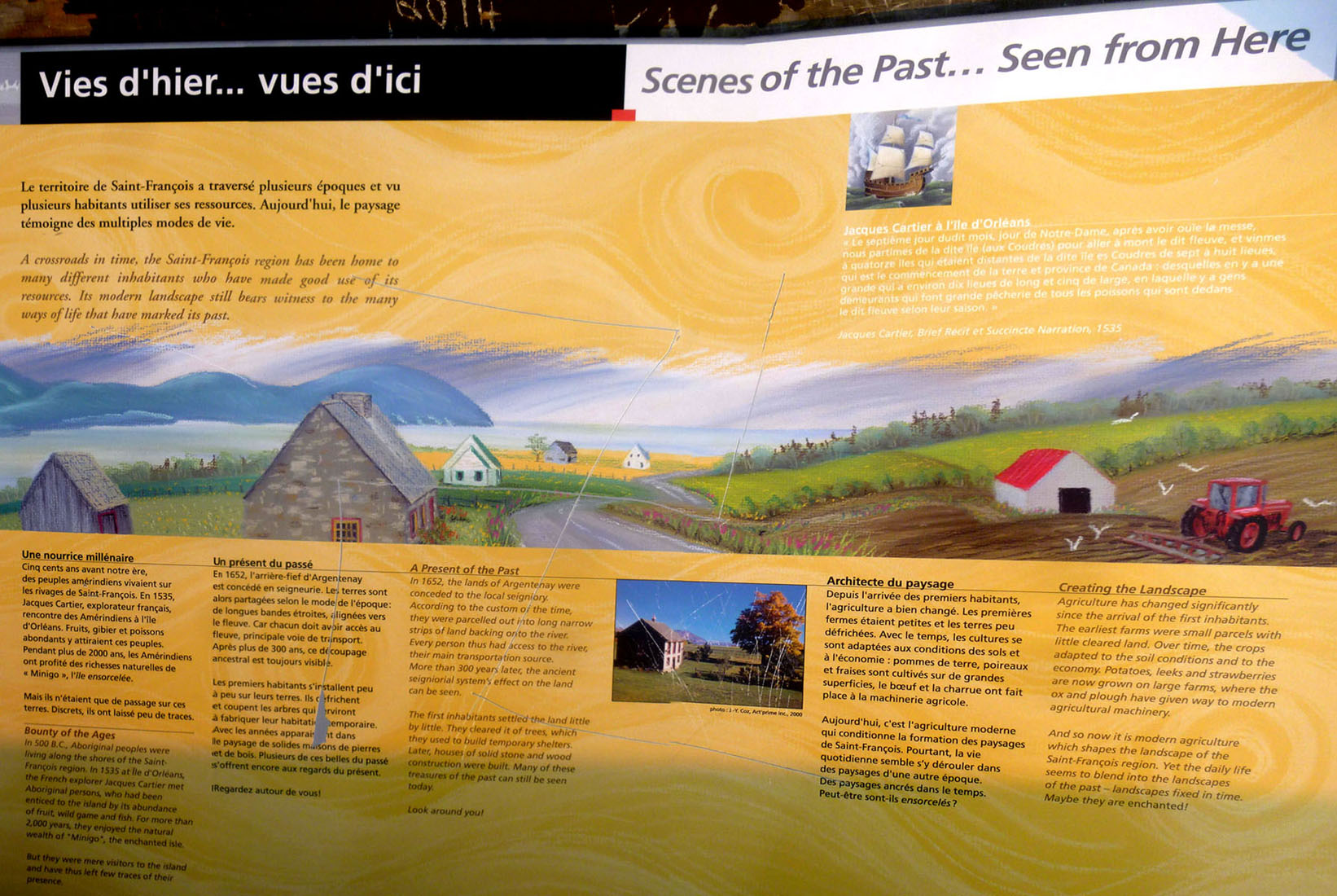
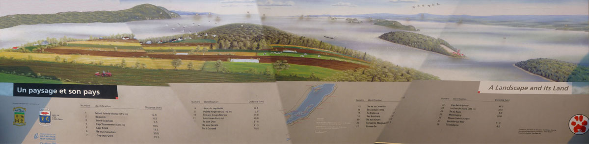
At the top, there was one of those mural-like photo boards that showed the major land features in the area and the distance to each one from the tower. To photograph it all, I had to merge 4 pictures (which, because of the lighting, gave some inconvenient changes in the combined image):
There were great views from the top; here are some of them:
|
|
|
|
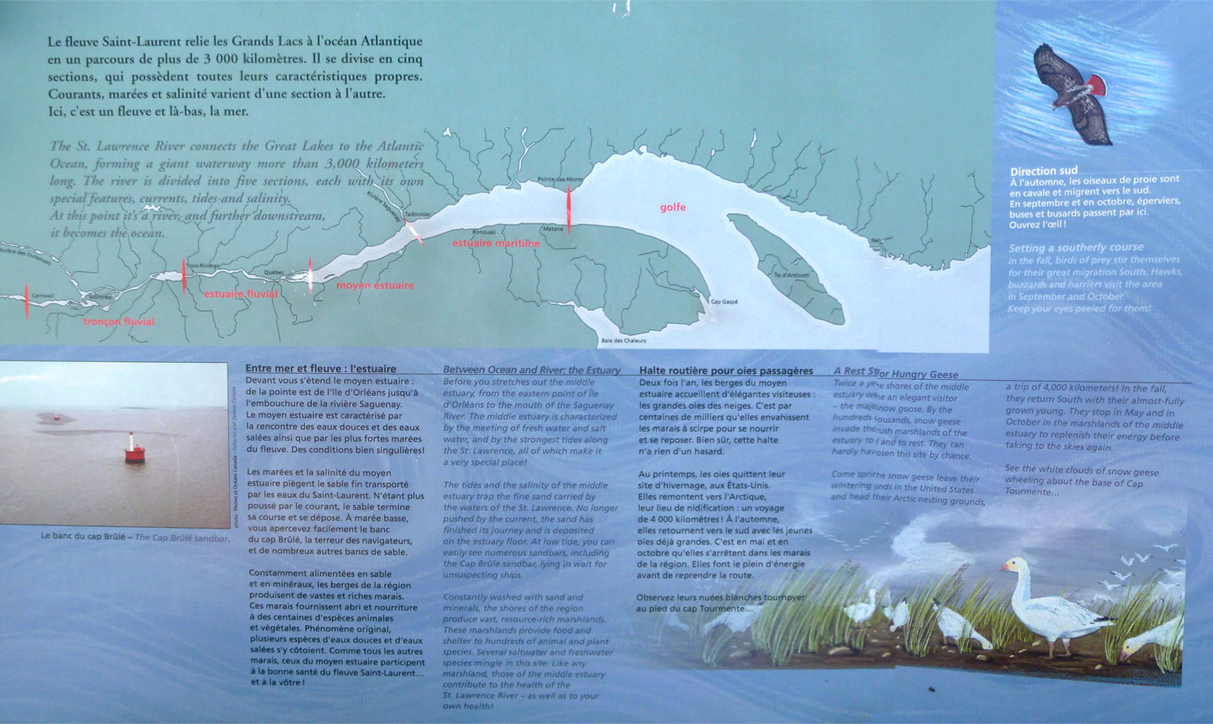
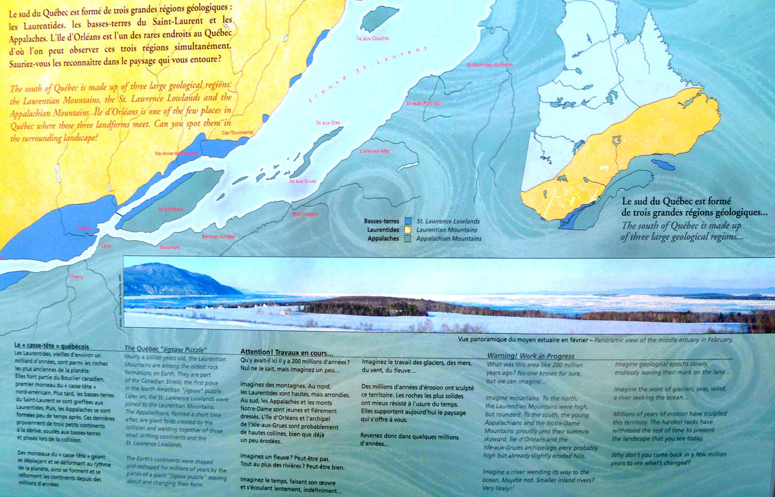
I know that most of you won't have the opportunity to visit the tower, but I wouldn't want you to miss some of the interesting plaques describing the tower and the surrounding area, so I have put photos of them below. To make them large enough for you to read, I have put them in scrollable windows so that you can move around each one, look at the pictures, and read the English narrative.
|
|
|
Before we leave the tower, here are the best of the many more pictures that we took from the top:
|
Here are more pictures from the top:

(Click on Thumbnails to View) |
From the tower it was off again northwest to continue our circuit of the island, now over two-thirds complete.
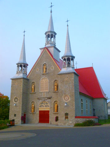
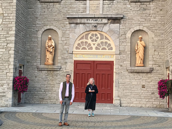
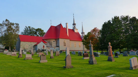
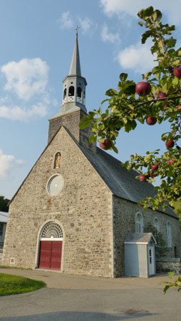
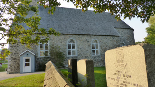
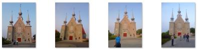
Église Sainte-Famille (Church of the Holy Family)
|
Although they are a bit repetitive, here are some more views of the church (from the front) in case you would like to see them:
 (Click on Thumbnails to View) |
Nancy also got a nice picture of her sister Prudence in front of the church.
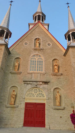
We first spent some time just wandering around the front of the church, admiring the decoration on the facade.
|
|
The bullseye above the central door was replaced by a large window in 1868. The five niches contained sculptures by the Levasseur brothers before being replaced by works by Jean-Baptiste Côté in 1889 and Lauréat Valličre in 1929.
The church is traditionally-oriented; it is on an east-west axis, with the choir facing the rising sun, symbol of the risen Christ. It is surrounded by a square, a cemetery, a presbytery and an outbuilding. The church of Sainte-Famille, a rare example of a Latin cross plan from this period, was classified as a heritage property in 1980.
Here is another, closer view of the the lower portion of the facade.
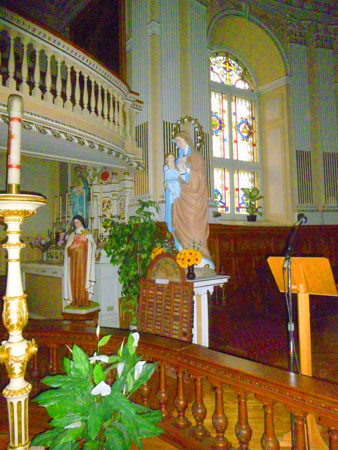
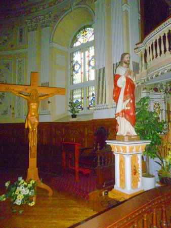
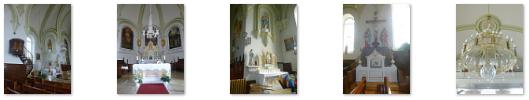
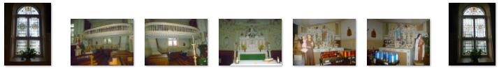
I didn't actually think that the little church would be open, but Guy tried the door and it was, so we were able to go inside and have a look at the interior of the little parish church.
|
The current interior decoration dates to 1812 when the original white vault was replaced with a vault decorated with caissons. Again, Baillargé was enlisted to take charge of the altarpiece and the decoration of the walls. In 1861, new benches made by Jean Pinchet were installed; in 1881, the lower gallery was extended; and in 1910, tribunes were added in the arms of the transept.
The interior decoration includes the many paintings that adorn the walls of the nave and the sculptures found throughout the interior. A Casavant organ was installed in 1942. The three bells imported from France were given names when they were installed in the steeples, and each is a different note. The bell ringing Sol is named Jesus-Benedict XV, the one ringing La is named Marie-Louis Nazaire, and the bell named Joseph-Paul Eugčne Alfred rings the note Si.
I thought that the interior of this little church was actually quite beautiful given the size of the church, its location, and the undoubtedly small number of its parishoners. Here are more views of the interior; I hope you will have a look at some of them:
 (Click on Thumbnails to View) |
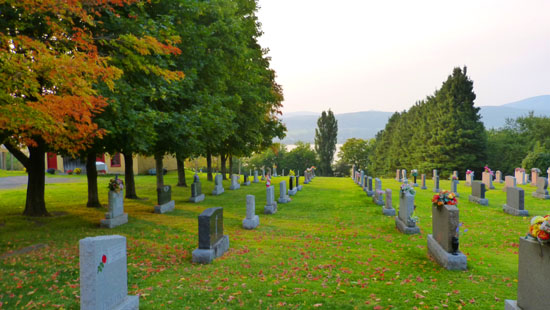
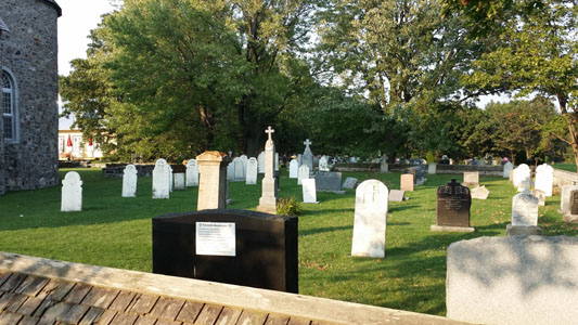
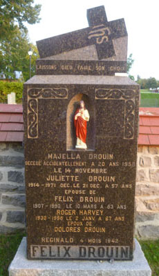
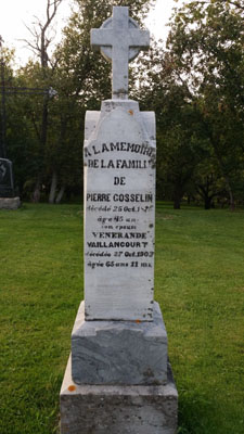
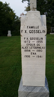
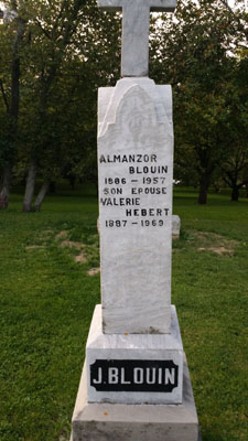
Guy had actually known about this church before we came on our trip, and it was one of the stops he wanted to make. The reason was that some of his own family had lived in this area, and he wanted to see if there were any trace of those family members in the church graveyard, and so looking around the monuments was what we did next. There were some memorials on both sides of the church (as you can see here and here), but the main area was southwest of the church proper.
|
|
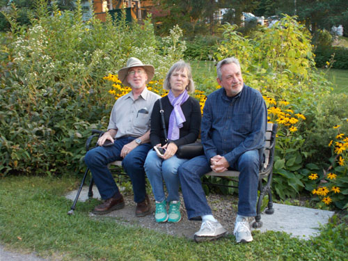
Guy wanted to examine all the gravestones, and Fred and I followed him around for a while. So did Prudence and Nancy, for a time, before they went over to the nearby garden to relax with Karl and Ron.
|
|
Over among the gravestones, Guy photographed a number of them that displayed some of the names in his family tree- including a couple that were fairly close to him. Fred and I also took a few pictures of some of the more interesting memorials. Here are some of those pictures:
 |
 |
 |
 |
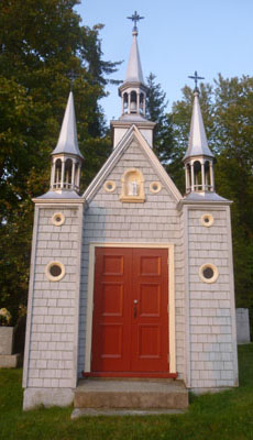 |
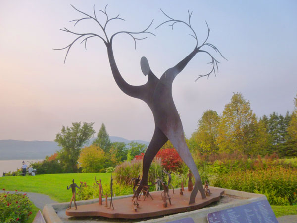
Adjacent to the church's graveyard there seemed to be some sort of parkland that sloped down to the St. Lawrence, a gazebo, and an interesting sculpture at the top of the slope. This area, we discovered, is the "Parc des Ancetres-de-l'Ile-d'Orleans" (Park of the Ancestors of Orleans Island).
|
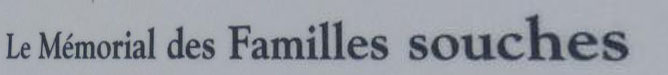
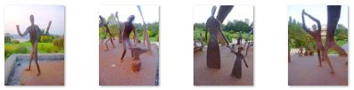
| "The François-Lamy Foundation is dedicated to the preservation and diffusion of the cultural and historical heritage of Sainte-Famille and Île d'Orléans. The Foundation is pleased and proud to welcome you to its commemorative and interpretive park and premises. By establishing the Parc des Ancętres and the Memorial to the Founding Families, the Foundation wanted to create an area dedicated to celebrating our ancestors who came from France. The settlement and founding of the original families made Île d'Orléans into the "Birthplace of French America". These green spaces are graciously put at the disposal of community members and visitors. The park features native species of flora and a landscape which is both picturesque and significant to our social and cultural history." |
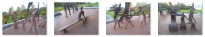
At the top of the hill, relatively near the church, we came across an interesting sculpture- a large figure surrounded by a number of much smaller ones. This turned out to be the "Memorial to the Founding Families". There was a descriptive plaque beside it, and here are the English translations of what it contained:

|
(Click on Thumbnails to View) |
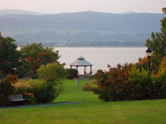
The Church of the Holy Family was the last stop on our circumnavigation of the Île d'Orléans, so we took the time to walk down to the riverside and relax in the gazebo that was part of Ancestors Park. As we left to head back up the hill to the car, we had a beautiful view of sunset over the St. Lawrence.
We finished the last mile or so of our trip around the island when we arrived back at the bridge to the mainland. We returned to the Manoir d'Auteuil where we all had a drink at the bar before heading out for some dinner at a restaurant a block from the hotel.
You can use the links below to continue to another photo album page.
|
September 15, 2017: An Old City Walking Tour |
|
September 13, 2017: A Drive to Montmorency Falls and Beaupre |
|
Return to the Index for Our Trip to Quebec City |