


 |
November 15, 2014: Santa Cruz Island |
 |
November 13, 2014: Santa Cruz and North Seymour Islands |
 |
Return to the Index for 2014 |
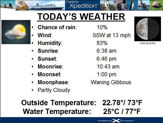
Today, we will be on San Cristobal Island. There will be a number of activities here- on shore, on the Zodiacs and on the ship. We'll have a morning hike, an afternoon Zodiac ride, an afternoon beach walk and then, on board the ship, we will circumnavigate Kicker Rock.
 |
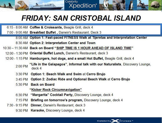 |
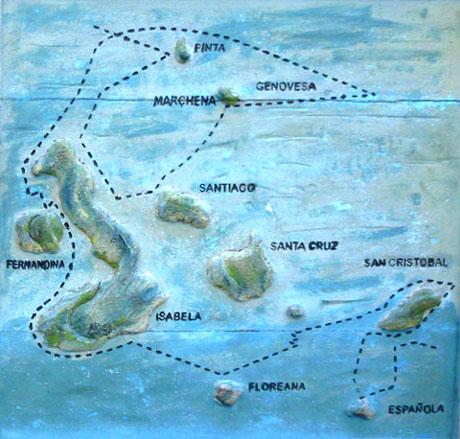
Today, we'll be getting up very early to leave the ship at 800AM to take one of the Zodiacs in to San Cristobal Island for our hike and visit to the Interpretive Center. Before we do that, though, we should probably orient ourselves to the island of San Cristobal, and specifically our morning activities.
|
Let's go ahead and look at some of the pictures we took as the Zodiacs transferred us from the Xpedition to the pier at Baquerizo Moreno. You can click on the thumbnail images below to see some of the pictures that Fred took on the way in to the pier:

|
The ride to the drop-off point for our hike was short, but interesting, winding as it did through the port's residential areas. Fred got a couple of good street scene pictures from the bus window, and you can have a look at them here and here.
Galapagos Shore Excursion (12a):
Long Walk at Tijeretas
|
| "A hike along a partly-paved path with a few steep sections provides a series of beautiful overlooks and vistas. At one stop an American-made cannon dating from the Second World War taken by the Ecuadorian Navy in the early 1970s for military exercises can be seen. Another vista offers a panoramic view of the northern coast of San Cristobal, including Kicker Rock (León Dormido). And in honor of his visit to the island, Charles Darwin is immortalized in bronze at another overlook and makes for a great photographic companion. Several endemic species may be seen, including the candelabra cactus, Galapagos iron wood, Galapagos cotton and be sure to look for lava lizards and the Chatham mockingbird, one of the rarest mockingbirds. Duration: About 2 hours" |
The bus from the pier, which carried about sixteen of us, dropped us off at the end of the road that curved north and northwest along the shore of the bay at Baquerizo Moreno. The bus from the port dropped us off at a wide place in the road where we disembarked and then listened to our naturalist for bit as he explained the area that the hike would cover. While he was talking, Fred snapped a picture of Puerto Baquerizo Moreno across the water from where we were standing.
|
 |
I also made a short movie as we were walking along, and it will give you a good idea of what this part of the hike was actually like. You can use the player below to watch it:
|
|
After a quick ten minutes or so, we came out onto a beach that stretched away to the north. Here, we found the first wildlife of the trek- some sea lions.
|
|
We took lots of pictures as well; click on the thumbnail images below to see the best of them:

|
I also used my camera to make a panoramic view of this lovely beach; you can see it below:
 |
We headed off again, away from the beach, this time on a boardwalk that led through the low trees and bushes. We were winding our way generally along the shore but inland to get to an obervation platform that looks out over a place called "Love Beach".
|
After a few minutes walk, which took us through a junction with the pathway that we would take on our return from the summit, we arrived at the overlook where there were excellent views out across the ocean and along the shoreline of San Cristobal.
We took a number of good pictures as we followed the walkway across the landscape and once we got to the overlook. You can click on the thumbnail images below to have a look at some of them:

|
San Cristóbal is the easternmost island in the Galápagos archipelago, as well as one of the oldest geologically. It is composed of 3 or 4 fused volcanoes, all extinct and home to the oldest permanent settlement of the islands; it is also the island where Darwin first went ashore in 1835. This island has the only natural freshwater source in the Galapagos- a lake called El Junco- and it was the existence of this water source that led to the island's early settlement of San Cristobal. As at Botany Bay, a penal colony was built here in 1880 for prisoners from mainland Ecuador; it was decommissioned mid-century and turned into a military base for Ecuador and export center for the island's products including sugar, coffee, cassava, cattle, fish and lime.
Here at the overlook, I did another panoramic shot:
 |
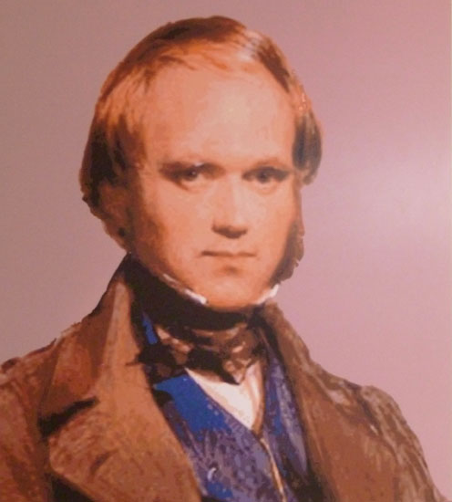
We came back to the main pathway from the overlook and followed it through the trees and then back out towards the shore to the Darwin Statue- the most famous spot on San Cristobal and one of the most famous in the islands. The statue is comprised of Darwin, of course, as well as a giant tortoise and a sea lion.
|
 |
I took a picture of the sign, but the wording was hard to read, so I have transcribed it here for you:
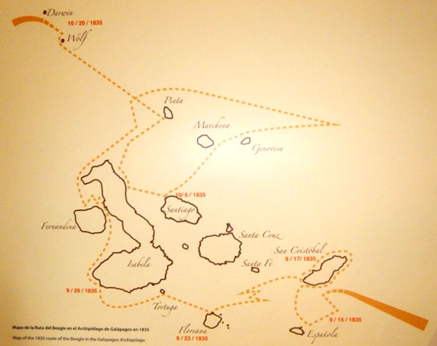
| "The HMS Beagle sailed from Callao Peru and, on 15 September, 1835, it reached the archipelago with scientist Charles Darwin aboard. Long after his trip back to England, he organized his notes and collections from his trip on the Beagle and proposed the theory of evolution by natural selection in 1859, based on his meaningful research experience in the marvelous Galapagos Islands." |
|
What we did next was walk down the stone path towards the shore. On the way, and we were quite some distance from the bottom, we passed an odd sight- a sea lion lying on the walkway. Everyone had to step around him carefully, but I found myself wondering how and why he had come up this far from the water; we had never seen one more than a few feet from or above the surf. The guide had no idea either.
|
|
We were supposed to go to the top of Tijeretas Hill for the expansive views, but when we got to the turnoff for the pathway up, we found that it was closed- apparently because damage to the stone path was being repaired. This was disappointing (and had I not been in a guided group I would have gone on up anyway), but there was little we could do. Instead, we turned back towards the Interpretive Center. I made a movie along the pathway, looking back towards the port, and you can use the player at left to watch it. We also took a few pictures along the path as well, and you can click on the thumbnail images below to have a look:
 |
After another twenty minutes of walking (much of that time accompanied by one of our friends from the Xpedition), we came to the Interpretive Center, entering the complex from the back.
Galapagos Shore Excursion (12b):
Interpretive Center at San Cristobal
|
| "Inaugurated in August 1998, the Interpretation Center provides an excellent overview of the natural history of the Galapagos Islands, including its volcanic origins, the remoteness from the continent, its ocean currents, special climate, the arrival of different species and their establishment.
The Human History exhibit highlights the most significant events related to the discovery and colonization of the Galapagos. In addition, the
reality of today's Galapagos is explored discussing the problems associated with development and the struggles of several institutions and individuals striving to conserve these precious islands.
The Center also has a tortoise named PEPE, which was once a pet and part of an exhibit in the Catholic museum of Puerto Baquerizo Moreno.
There will also be time afterwards for shopping if desired. Duration: About 1 hour" |
The work of the Interpretation Center in San Cristobal is one of the components of the project "Plan of Interpretation and Environmental Education for the Galapagos Islands. In the center are exhibits that take the visitor through the history of the islands in the context of nature, humankind and conservation.
Part of the Center is a Museum of Natural History; here the visitor can find explanations of the series of natural occurrences and circumstances (e.g., volcanism) that led to the creation of the islands. The islands themseves are described in a series of exhibits that highlight their remoteness from the continent, the surrounding ocean and ocean currents, the special climate in the islands and the arrival and subsequent evolution of different species, among many other topics.
The Human History exhibit narrates chronologically the most significant events related to the discovery and colonization of the Galapagos, and another portion of this series of exhibits describes the reality of today's Galapagos: the problems and the struggle of several institutions and individuals to conserve Galapagos.
The Exhibits
I didn't photograph everything, but what I did take pictures of I will include here. All the exhibits were in both Spanish and English, but all I'll include here are the English translations. As an example, here are the English sections of the very first display:
 |
 |
For some exhibits, there were numerous little sections of English, and for those, I might show you the entire display and add the English translations off to the side, keyed to the large picture. An example was the second exhibit we came to:
|
|
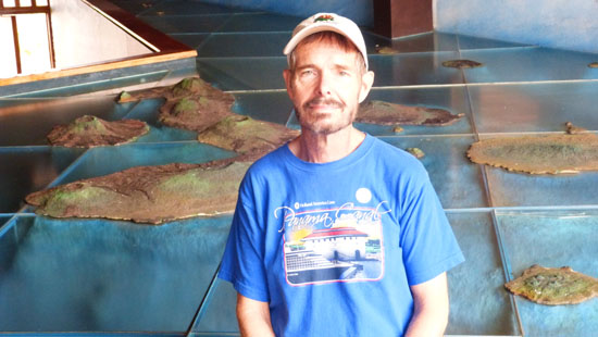
We next passed what I thought was an beautiful volcano picture, so I had Fred pose beside it; you can see that picture here.
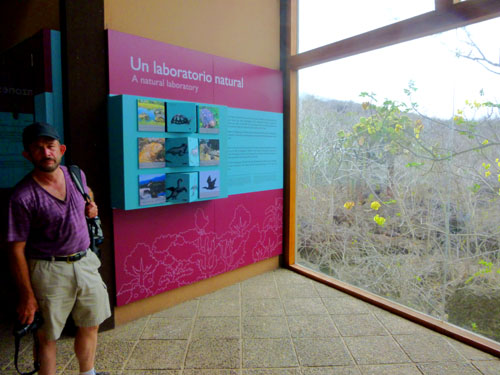
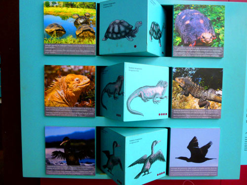
Over by a window, we found the first of many exhibits having to do with the Galapagos as a natural laboratory in which natural selection and evolution could play out:
 |
 |
 |
Next, we had a series of informative exhibits that talked about how the climate of the Galapagos is determined by the winds and the ocean currents. Here are the English portions of that series:
|
|
The next exhibit: How did the plants and animals arrive in the Galapagos Islands?
|
|
|
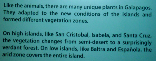
Next exhibit: Forests in the Galapagos
|
Here is the narrative that went along with the graphic:
 |
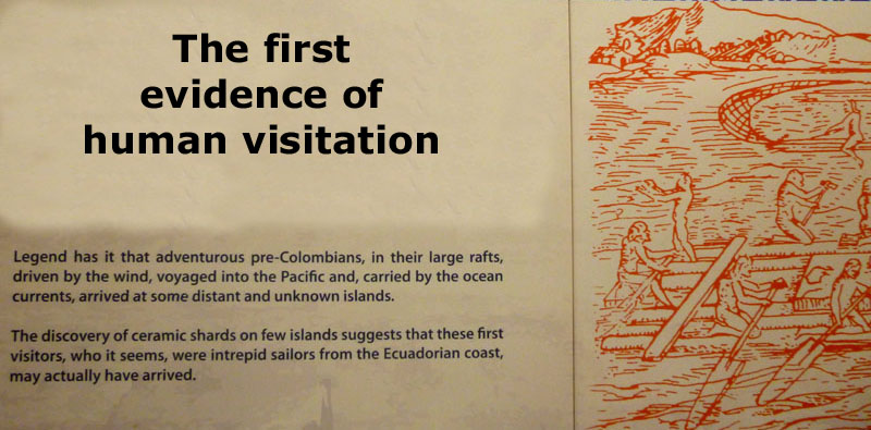
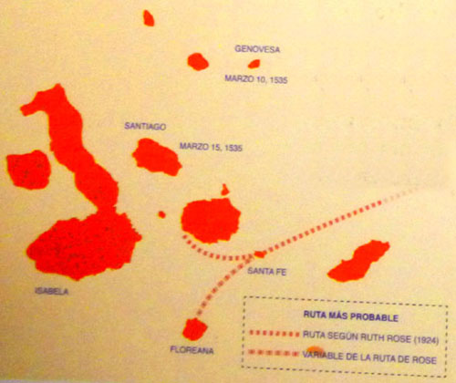
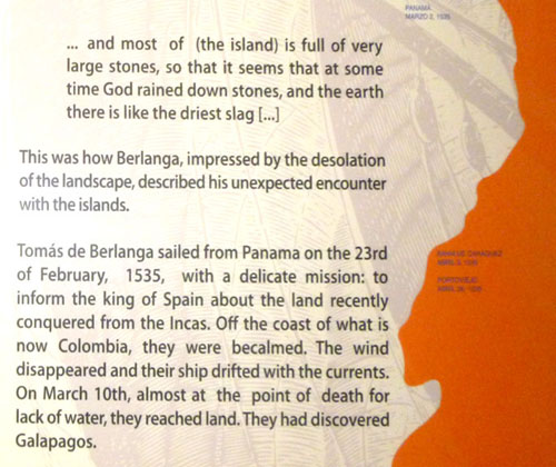
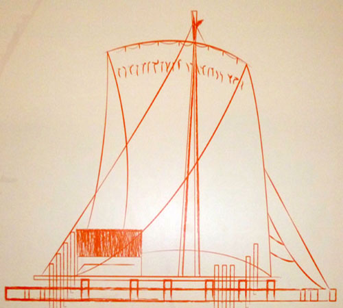
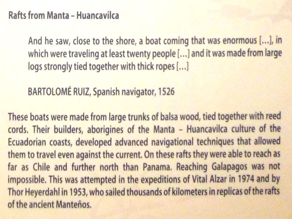
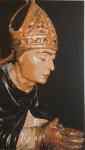
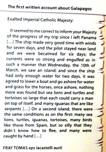
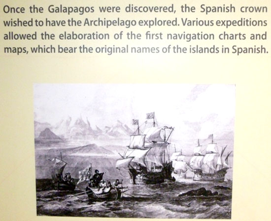
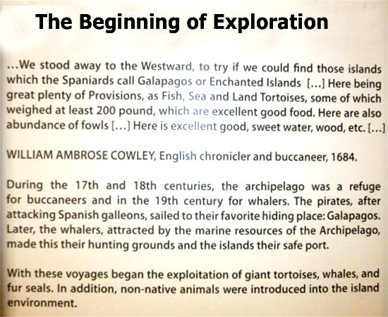
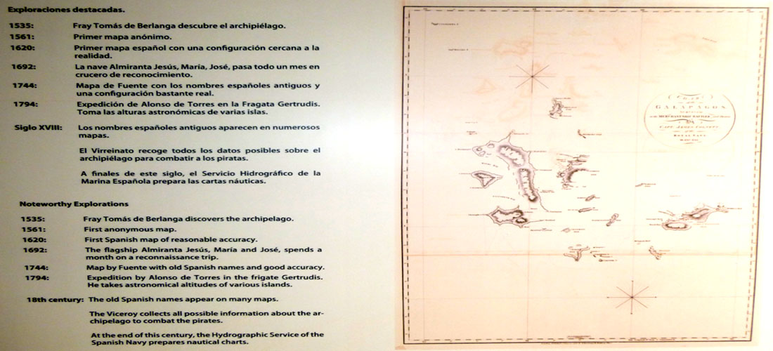
Next began a long series of exhibits chronicling the history of the Galapagos Islands. Of course, when I first came through, I was going the wrong way, having entered from the back of the exhibits, so in presenting this historical exhibit to you, I have reversed my photos to put them in chronological order. So now, have a walk through the historical timeline of the Galapagos:
 |
 |
 |
 |
 |
 |
 |
 |
 |
 |
 |
 |
 |
 |
|
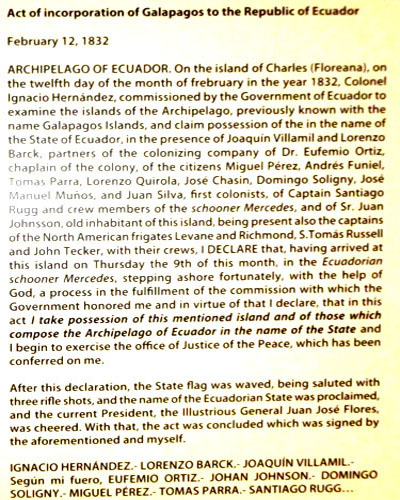 |
 |
|
 |
 |
|
 |
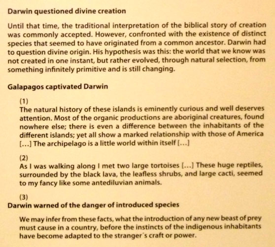 |
 |
 |
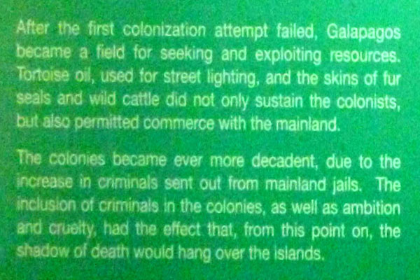 |
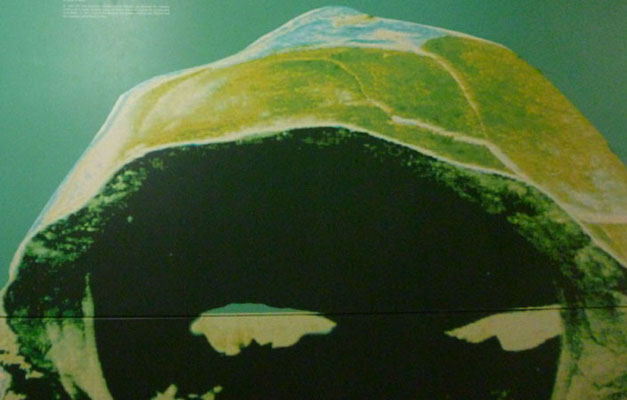
There were some exhibits about subsequent colonization efforst, but many of the wall displays did not photograph well. The next major colonization effort began in 1858 when Manuel J. Cobos, José Monroy, and José Valdizán formed the Orchillera Company. When this project failed, Cobos moved to El Progreso, a settlement on San Cristóbal, and focused his efforts on the production of sugar cane, coffee, and tortoise oil. From 1879, the “Cobos Empire” infamously used prisoners and indentured laborers, until his disgruntled “workers” assassinated him in 1904. From 1860, José Valdizán extracted orchil in Floreana and, in 1869, he won an exclusive 12-year contract from the government of Ecuador to extract orchil from Galapagos. Valdizán died during an uprising in 1878. The trade in orchil declined because of the discovery of large quantities of the lichen in Baja California and because of the development of synthetic dyes, beginning with mauveine developed in London in 1856.
The next historical account was 1897: Isabela Island- A Cemetery of Tortoises
|
 |
By 1905, there were 200 people living on Isabela, exporting sulfur and lime and using tortoises for meat and oil. Colonists also mined salt from James Bay on Santiago Island in 1886, from 1924 to 1930, and in the 1960s. They used the salt to cure fish and to fill the infrequent demand produced by heavy rains flooding the coastal Salinas saltpans on the mainland.
At the turn of the century, the Galapagos began to turn from a remote zoological laboratory and sometime zone of conflict into a civilized location to which settlers could move with reasonable assurance of safety.
|
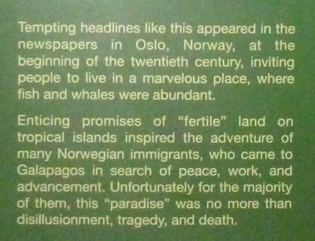 |
These settlements, however, were not successful. Life was extremely hard in the islands with little fresh water and land unsuitable for large-scale farming.
|
In an interruption of the historical account, there was an interesting display about a still-unsolved mystery on Floreana Island.
|
During the 1930s, other German families arrived in Santa Cruz to work with the Norwegian colony and lived, initially, by farming and fishing. However, San Cristóbal was more attractive to colonists because of its relatively easy access to water. This was the most populous island until the 1960s and, as a result, Puerto Baquerizo Moreno is the administrative capital of the archipelago.
And there the Galapagos remained, still an isolated, out-of-the-way destination for adventurers, tourists and the occasional immigrant. Until the run-up to World War II, that is.
|
In 1942, the US Sixth Air Force constructed the air base which was to have important long-term consequences for the islands. In 1943, this base was home to 2,474 US officers and men and 750 civilian laborers; as such, this was the largest colonization of the islands to that date. In 1941, the civilian population of the Galapagos Islands was 810 people. The arrival of so many people increased the demand for water, fish, and agricultural products, and threw a lifeline to the people eking out a livelihood on the islands. Base crews constructed a water pipeline from the highlands to Wreck Bay, in San Cristóbal, and used barges to transport water to Baltra Island. The availability of water in Wreck Bay made San Cristóbal more attractive to immigration and meant that people could move down to live in Puerto Baquerizo Moreno.
The greatest legacy was the construction of the first land-based airport in the islands—now modernized to serve as the main entry point for most travelers to the Galapagos Islands. The US closed the air base in 1946; residents dismantled the structures left behind, using the components to build many of the early houses in Puerto Ayora and Puerto Baquerizo Moreno.
|
The one continuing government presence seemed to be the penal colony, but the days of this institution were also numbered. As you can read in the excerpt from the last of the series of historical exhibits, the use of the Galapagos as a penal colony ended in 1959.
The fortunate circumstance led to the development of the Galapagos Islands into what it is today- a high-end eco-tourism destination. 55 years later, Fred and I became two of those eco-tourists.
 |
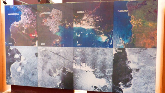 |
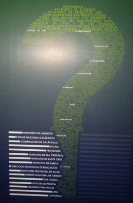
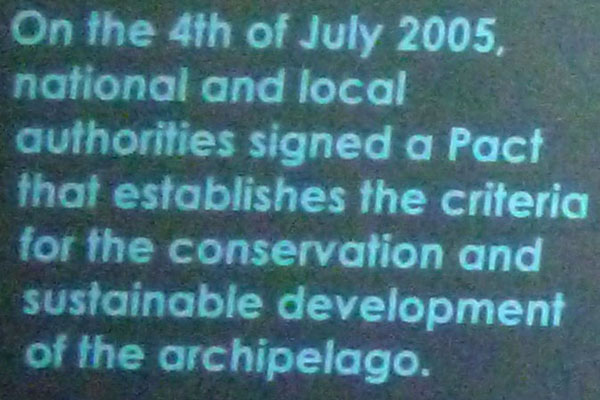
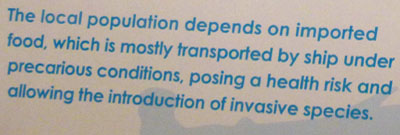
The remainder of the exhibits, many of which were quite interesting, had to do with the development of the Galapagos Islands. The thrust of these exhibits was that the administration of the islands must continually balance development with unwanted ecological impacts. This section of the exhibits began with a survey of land use around the world.
LAND USE IN WORLD NATIONS
One exhibit tracked land use by nation, and I thought it was interesting to compare how nations ranked. The key to the bar chart was as follows:
 |
 |
 |
 |
 |
To see the actual bar chart, first position this page just above the legend by clicking here. Now, just click the link "Show Chart" below. You will be able to scroll up and down the chart, and you can just close the pop-up window when you are done.
 |
 |
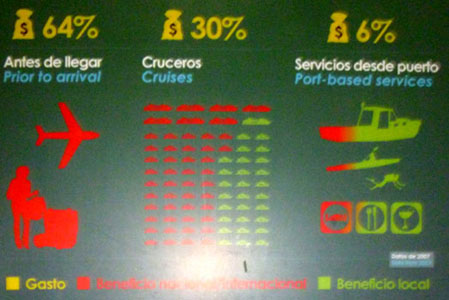
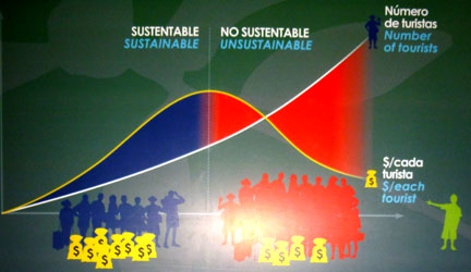
SUSTAINABLE TOURISM
 |
 |
 |
 |
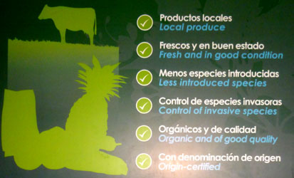
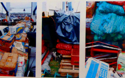
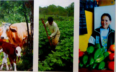
SUSTAINABLE FARMING
 |
 |
  |
  |
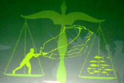
SUSTAINABLE FISHING
 |
 |
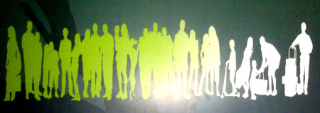
SUSTAINABLE POPULATION
 |
 |
|
|
|
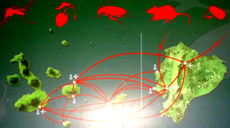
SUSTAINING INDIGENOUS SPECIES
 |
 |
There was another series of exhibits that just highlighted aspects of life in the Galapagos. While interesting, these exhibits don't really add much to your understanding of the islands themselves, and so I won't parse them and include them here.
When we were done inside the Interpretation Center, we headed outside to look around the rest of the Interpretation Center complex.
|

|
When we were ready to head back to town, we followed the winding walkway down to what is actually the Center entrance. There, we waited for a few minutes until the next shuttle showed up to take us back to the harbor.
Galapagos Shore Excursion (12c):
Walking Through Puerto Baquerizo Moreno
|

|
I had gotten a scratchy throat on the ship yesterday, and had a bit of a sore throat this morning, so it was fortunate that we put in to Puerto Moreno this morning; I was able to stop by a little grocery store and pick up a bag of what passed locally for Hall's menthol candy. Fortunately, I never developed a real cold and my throat felt fine after sucking on the candies for a day or so.
|
|
We began working our way back towards the pier, walking first along the beach and then along the beachside plaza that had been built along the water. As we walked along the beach just northeast of the wreck, we came across a good many of the ubiquitous sea lions laying all over the beach. Looking back from the northeast end of the sandy beach, Yoost got a nice picture of the sea lions and the beach with the shipwreck as a backdrop; you can see that picture here.
|
When we ran out of sand, we went over to the street to continue onto the bayside plaza. Right at the southwest end of this plaza, we came to one of the many statues and busts of Charles Darwin that are scattered throughout the Galapagos. I guess the islands to have him to thank for putting them on the map- almost literally. Also, Fred happened to notice a very interesting sign advertising a hotel/hostel. Read it closely and you will see what I mean.
|
Cat lovers that we are, we just had to stop and take a picture or two. The cat turned out to be very friendly, and looked not to have missed many meals, and so we assume that he was in someone's care.
|
|
Being an orange tabby, he was particularly interesting to Fred, who favors that coloring in cats. In any event, we got in some petting time before heading on up the plaza towards the pier.
The harbor here at Puerto Moreno is very picturesque, and I kept seeing potential jigsaw puzzles everywhere. At the southwestern end of the plaza I had Fred pose by a sign that listed, apparently, all of the Galapagos islands. You can see that photo here.
|
This plaza was a really nice place to just sit and relax; I am sure that on days that aren't as overcast as this one, there must be many folks out here- particular when the season is at its height and all the cruise lines are running as many cruises as they are allowed.
|
|
 |
I also thought I would make a movie looking around the harbor, and you can use the player at right to watch it.
Before we head back to the ship on one of the Zodiacs, I want to include one more panoramic view here. It was constructed from six different pictures taken of the entire harbor area from the shipwreck on the southwest to the long pier on the northeast. I think it turned out pretty well:
 |
We got back to the pier and we were waiting for the Zodiac when we noticed yet another example of just how widespread sleeping sea lions are around here. They will take a nap, it seems, literally anywhere.
Lunchtime on the Xpedition
|
 |
We arrived back on board about noontime, and shortly thereafter were having lunch. We had our choice of an Oriental buffet in the restaurant or hamburgers and hot dogs and some other stuff on deck at the Beagle Grill. Since we'd not had lunch at the grill yet, we opten for that. After lunch, there was a roundtable talk with the naturalists about day-to-day life in the Galapagos. We discovered that many of them actually lived here in the islands, but that a few lived on the mainland.
|
|
Coming up next this afternoon, we have opted for a Zodiac ride around Cerro Brujo and then a walk on the beach near that huge rock outcrop- remnant of a volcano cone. The earlier departure was for folks who just wanted to do the beach walk, and after they left the ship and arrived on the shore, Fred used his zoom to get a picture of them. You can see that picture here.
A short while before out own Zodiac was to leave the ship, we were gathering at the stern. While we were waiting, Fred used his zoom to get an extreme closeup of the base of Cerro Brujo; you can see how barren the vertical rock face is. Fred also took two excellent panoramic shots of Cerro Brujo, and I want to include both of them here:
 |
 |
Galapagos Shore Excursion (13a):
Zodiac Tour of Cerro Brujo
|
| "Cerro Brujo on the northwestern side of San Cristóbal provides a gorgeous fine white sand beach for relaxing, swimming, and walking.
The area is dominated by an eroding volcanic tuff cone that can be seen on the way to the beach along with various lava types, giant cracks, and cathedral-like crevices. Duration: About 1.5 hours" |
Let's take a closer look at the area we'll be traversing this afternoon.
|
Cerro Brujo is an ancient tuff cone formed by one of the many volcanoes that constructed the Galapagos Islands. Although we couldn't see it from ground level, the caldera is still intact; none of its walls have eroded to allow water into the caldera. Other, much older volcanoes, have eroded away, but these were much smaller islands where the cone was perhaps the only land poking above sea level. Cerro Brujo is part of a larger island, composed of multiple cones.
|
We left the ship on a Zodiac and headed towards Cerro Brujo, getting close to it and then paralleling it for a ways. I made a not-so-spectacular movie with a bit of wind noise, but it gives a good idea of what riding in a Zodiac is like. Use the player below to watch it:
|
|
As you can see on the aerial view above right, we went around one point and then continued along the coast of the Cerro Brujo volcano, heading towards a deep-cut crevasse that we were going to explore.
|
|
 |
Going alongside Cerro Brujo was very much unlike taking the Zodiac in to a beach; the steep rock sides of the volcano dropped straight down into the water, and I have no idea how far down those sides must go before they might begin to level out and form the lower slopes of the undersea mountain.
Take a look here at the dark rock side of the volcano as it dives beneath the water. Were the slope even moderately level underneath the surface, there would be waves at least beginning to break on the rock. The fact that the water seemed to just slosh back and forth against the cliff face led me to think that the sheer rock wall must go down tens of feet or even further. It would be immensely interesting to scuba dive here and find out what the cliff is like beneath the surface of the water.
After a few minutes, we came abreast of the crevasse. I have two pictures of it from a short distance out into the ocean. Fred took a picture a couple hundred feet out, and you can see that picture here. Yoost took another as we got a bit closer, and you can see his view here.
|
|
We did not go all the way inside the vertical canyon to the inside rock wall; I suppose that it would have been too dangerous if some large swell had come along and pushed us against the rock. I do know that it would have been very spooky to be all the way in, with the sheer rock walls rising up above you on each side. But we did get inside the enclosure, and so had rock walls on both sides of the craft and a view out the portal to the open ocean. While inside, Fred took a good picture looking up the sides of the canyon.
For my part, I was working on two panoramic views. The first one, which I took from my position sitting on the ladder at the front of the Zodiac, looks at our party with the canyon opening and the open ocean in the background:
 |
Inside the enclosure, our helmsman eventually slowly turned the Zodiac on a dime, preparing to head out of the canyon. Before we exited, though, I asked everyone to pose for a couple of pictures that I put together to show our party this time with the back wall of the canyon in the background:
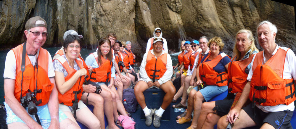 |
We came out of the crevasse and continued northeast along the face of the cliff and after just a minute or so we could see ahead of us the geologic feature that made this Zodiac ride worth the time; there was a natural bridge or opening in the rock that sloped down from the top of the crater into the sea.
|
Our own Zodiac did not get as close to the opening as the previous one; our naturalist said that the iconic views were from the other side, and so that's where we would go. We rounded the point at the northwest corner of the volcano cone rim, and then came back down the eastern side of the cone to get to the eastern side of the opening.
Our naturalist was right; the view through the opening from the eastern side of it was pretty amazing.
|
I thought it was interesting how the actual slope of the crater's side spanned the opening and then continued down into the water; it made me wonder how far down under the sea the opening actually went. (When some of us asked whether we could go through the opening, our naturalist said that no, we wouldn't, but he wasn't clear whether it was because the water was not deep enough, whether the wave action was too strong, or whether such passages were forbidden.) Take a look at my photograph of the outer rock pedestal.
There was a third Zodiac behind us, and while we were on this side of the opening, they were on the other, and Fred got some good pictures. Click on the thumbnails below to have a look at them:
 |
It was really interesting on this side of the opening, and we stayed here for a few minutes, turning the Zodiac this way and that so that everyone could get good pictures.
|
|
While we were here, I also took two panoramic views with my little camera. The first shows the western shore of San Cristobal as it stretches off into the distance:
 |
The other was a view of the folks in our Zodiac with the rock face and rock opening in the background:
 |
After floating around here for a while, it was time to head off for the second part of our afternoon excursion. Our Zodiac left the eastern side of the crater, rounded the point again, and then headed down the western side and paralleled the shore until we reached the beach at Cerro Brujo.
|
Galapagos Shore Excursion (13b):
The Beach at Cerro Brujo
|
| "The people of Port Baquerizo Moreno once mined salt from the back-beach lagoon for preserving cod, beef, and tortoise. Today it is a nice place to possibly observe lake and coastal birds.
Duration: About 1 hour" |
As you can see from the aerial view at right, our Zodiac came in to shore in a small inlet right south of the volcano crater and let us off. Then we all walked at our own paces down the beach to see what we could see.
The beach at Cerro Brujo was pretty, and pretty amazing; we saw quite a bit in our 90-minute walk. The only drawback to the late afternoon walk was that it was very, very cloudy, which lent a sombre cast to all our pictures. I can only imagine what the beach is like on a sunny afternoon.
Our Zodiac let us off on the beach about five, and then headed back out to the Xpedition to wait until it was time to come pick us up an hour or so from now.
The Beach at Cerro Brujo
 The Beach at Cerro Brujo |
If you compare the view above to the aerial view, you can see that the panorama was taken from approximately the middle of the large arc of beach that we walked. The little cove where the Zodiac let us off is very close to Cerro Brujo itself in the background at right.
|

|
It was really hard to choose the best of all the panoramic pictures we took of the Cerro Brujo beach. Three more of the very best of them are below:
 |
 |
 |
What you've seen so far of the beach at Cerro Brujo is what the beach itself looks like. What you haven't seen is what the ocean looks like from the beach. After all, the Xpedition is anchored offshore, and Kicker Rock is clearly visible as well.
|
We took other pictures, too, looking out to sea, from various stops during our walk, and each shows the view from a different perspective. Click on the thumbnails below to have a look at some of these pictures:

|
We took a number of panoramic shots as well, but due to the overcast, not many of them turned out well. I was able to construct a pretty good panoramic view from five separate shots, though, and you can see it below:
 |
Having looked at the beach itself, let's now investigate the wildlife that we found here.
Pelicans and Boobies
|

|
Seeing the still pictures is interesting enough, but what really brought the "feeling" of seeing the pelicans (and some boobies) at work home were the movies we took. When we reviewed them later, we found that many of them were quite good- if a bit repetitive. But watching the pelicans at work was so much fun that you should have the opportunity to do so, too. Below are players for four of the best of the ten or fifteen movies that Fred and I took of the feeding action this afternoon:
|
|
|
|
|
|
Juvenile brown pelicans have been observed foraging in the surface-swimming matter of other pelicans. They are occasional targets of kleptoparasitism by other fish-eating birds such as gulls, skuas and frigatebirds. To finish out this section on the pelicans, I want to include a very neat picture that Yoost took; he captured a pelican flying nearby over the water with the Xpedition anchored a mile or so away as a backdrop. Have a look at that picture here.
Yellow Warblers
|
Click on the thumbnails below to see four good pictures that Fred and Yoost took of the yellow warblers we encountered:
 |
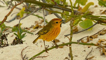
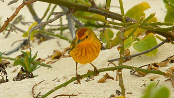
The mangrove warbler is one of the three warbler groups, and the group has 12 subspecies. Members of this group tend to be larger than other yellow warbler subspecies groups, averaging 5 in. in length and about a half ounce weight. The group resides in the mangrove swamps of coastal Middle America and northern South America; those yellow warblers found in the Galapagos Islands are their own subspecies. Within the group, the summer males differ from those of the yellow warbler in that they have a rufous hood or crown. The races in this group vary in the extent and hue of the hood, overlapping extensively with the other two groups.
Yoost found one very pretty specimen in some thin brush on the sand, and his pictures stood out. Here are three of them, cropped to show the bird close-up:
 |
 |
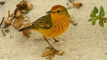 |
Sea Lions
|
Click on the thumbnails below to see some sea lions doing what they do best (or at least doing what they do most times we see them):
 |
I made two different movies starring the sea lions. In the first, which you can use the left-hand player below to watch, a pup is nursing. (This movie had a lot of wind noise, so since it is obvious what's going on, I eliminated the audio track). In the other movie, a young sea lion is playing in the surf; you can use the right-hand player below for that movie.
|
|
|
Below are clickable thumbnails for some other of the pictures we took of the sea lions this afternoon. In the rightmost picture, I am impressed that the sea lion can get into such a tight space- although I found myself wondering why.
 |
Other Photographs from the Beach at Cerro Brujo
|
We found a bird different from the pelicans, cormorants and boobies- near as I can figure it was a common gull of some kind. And I saw at least one lava lizard.
So we took pictures of these animals and a few additional beach scenes, and you can click on the thumbnails below to have a look at these last pictures from our walk on the beach at Cerro Brujo:

|
A Zodiac came to pick us up a little after six, and by six-fifteen we were back onboard and ready for our cruise around Kicker Rock.
Galapagos Shore Excursion (14):
Circumnavigation of Kicker Rock
|
| "This evening is the only excursion on your Galapagos adventure that doesn't involve going ashore. The captain will call you out on deck for our cruise around León Dormido (Kicker Rock), and our naturalists will be on hand to offer a description of this unusual rock formation- the last remnant of an extinct volcano. You'll want to bring your camera on deck for great views of this natural wonder. Duration: About 1 hour" |
When we got back from our shore excursion, Yoost, Greg, Fred and myself met up in the Discovery Lounge for some drinks and wine before going out on deck for the circumnavigation. We traded off taking pictures, and you can see them below:
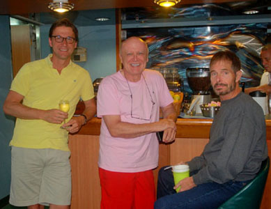 |
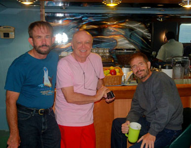 |
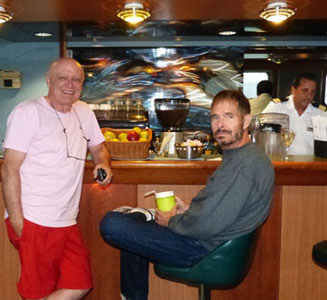 |
When we got up on deck, we could see Kicker Rock off the port side; we were heading right for it. When we got close to the rock, looking at it from the west, I took a panoramic view of the rock protruding above the waves; you can see that view below:
 |
As we got close to Kicker Rock, the ship began to turn to starboard to go around the south end of the rock. We began to see the slope on the south side of the rock, and when we came around the south end of it, we could look right up the slope of Kicker Rock. You can see that view here.
|
As we came around the south end of the rock and then cruised up the east side of it, each of us took a series of photographs in which you can see the rock turning in relation to the ship- until you reach that full-east, iconic view. Fred's series was the best, and you can click the thumbnails below, in sequence, to have a look:
 |
But the true appeal of this location occurs below the surface of the sea. The natural erosion of this ancient cone has created a channel between the rocks that provides the ideal habitat to view a variety of sharks and rays including Spotted Eagle Rays, White-tip Reef sharks, the ellusive Galapagos Shark and Hammerheads. Sadly, there was no snorkeling excursion on our itinerary; perhaps this is because not only is this an area for more expert snorkelers, the true beauty of the undersea world here is actually best experienced with SCUBA gear.
|
To view the slideshow, just click on the image at right and I will open the slideshow in a new window. In the slideshow, you can use the little arrows in the lower corners of each image to move from one to the next, and the index numbers in the upper left of each image will tell you where you are in the series. When you are finished looking at the pictures, just close the popup window.
The trip around Kicker Rock took about an hour, and it was really neat to see this iconic Galapagos landmark from every conceivable angle.
|
We went back into the Discovery Lounge for a while and finished our drinks, and then walked around the decks before dinner. We took a few good casual shots both before leaving Kicker Rock and during our walk, and you can click on the thumbnails below to see them:
 |
The last picture of the day was taken just before we went down for dinner, when I asked Fred, Greg and Yoost to sit down with four women we had made friends with during the cruise. You can see that picture here.
You can use the links below to continue to another photo album page.
 |
November 15, 2014: Santa Cruz Island |
 |
November 13, 2014: Santa Cruz and North Seymour Islands |
 |
Return to the Index for 2014 |