

 |
November 29-30, 1975: A Weekend in Los Angeles |
 |
June 8-12, 1975: A Week in Toronto, Canada |
 |
Return to Index for 1975 |

The Drive to Yellowstone National Park
|
The Bighorn National Forest is a U.S. National Forest located in northern Wyoming, and consists of over 1.1 million acres. It was created as a US Forest Reserve in 1897 and is one of the oldest government-protected forest lands in the U.S. The forest is well east of the continental divide and extends from the Montana border for a distance of 80 miles along the spine of the Bighorn Mountains, an outlying mountain range separated from the rest of the Rocky Mountains by Bighorn Basin.
Elevations range from 5,000 feet along the sagebrush and grass-covered lowlands at the foot of the mountains, to 13,189 feet on top of Cloud Peak, the highest point in the Bighorn Mountains. Around 99% of the land is above 4,900 ft. The forest is named after the Bighorn River, which is partially fed by streams found in the forest. Streams in the range are fed primarily by snowmelt and snowmelt mixed with driving rainfall.
Within the forest is the Cloud Peak Wilderness area in which no motorized or mechanical equipment is allowed. The only access into the 189,000 acre wilderness is on foot or horseback. There are 1,500 miles of trails in the forest, along with 32 improved campgrounds (we should have investigated that earlier), lodges, and three scenic vehicular byways. U.S. Route 14 in Wyoming, also known as the Bighorn Scenic Byway, crosses the middle of the 30-mile wide forest. The Medicine Wheel Passage (U.S. Highway 14A, the one we are on now) crosses in the north passing the Medicine Wheel National Historic Landmark, while the Cloud Peak Skyway (U.S. Route 16) crosses the highest pass in the forest (Powder River Pass at 9,677 ft) and is located in the southern section of the forest.
|
The Bighorn National Forest was established as the Big Horn National Forest in 1897, and encompassed 1,198,080 acres. The name was changed in 1908, and today the National Forest is about 50,000 acres smaller than it was previously.
The Bighorn National Forest contains primarily forest along with alpine meadows and lakes at higher elevations. The forest is primarily lodgepole pine, along with several species of spruce, fir, and aspen. While grizzly bears have not inhabited the forest since the early 20th century, black bears are widespread. Other large mammals include cougars, elk, mule deer, pronghorn, and moose. Coyotes are also present in this forest. Numerous lakes are found within the forest and most are naturally stocked with trout and at least 100 other fish species. Meadowlark Lake is a popular recreation area created by the construction of a dam built by Company 841 of the Civilian Conservation Corps in 1936. Water quality sampling from the lakes shows the highest acid rain deposition of any mountain chain in the Rockies.
I was pretty much bowled over by the scenery when we got up; it was made all the more interesting because it was pretty dark when we drove up into the forest, so we couldn't watch the views getting better and better. Here are two more pictures that I took before we started off for Yellowstone:
|
|
To get to Yellowstone, we had a couple of choices, and we decided to take the "northern route"- Highway 14A that would take us through Lovell and Cody. There were places along the road within the National Forest that it seemed to be under construction, or perhaps there wasn't room for two full lanes and shoulders, for there were places where the road seemed to be just one wide lane. So it was slow going in places, but very, very scenic.
|
|
We came down out of the Bighorn Mountains and headed on to Lovell, where we stopped for gas and to use the service station restroom to get a bit cleaned up. Then we had a stretch of driving through rather non-spectacular farmland to Powell and down to Cody. At Cody, we took Route 14 to Yellowstone.
|
|
The 325 feet high structure was designed by engineer Daniel Webster Cole and built between 1905 and 1910. At the time of its completion it was the tallest dam in the world. It was listed on the National Register of Historic Places in 1971 and named a National Civil Engineering Landmark just a couple of years ago. The land around the reservoir is maintained as Buffalo Bill State Park.
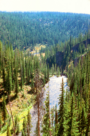
We continued west on Highway 14, passing through Wapiti, before once again coming onto National Forest/National Park lands. We were heading straight for Yellowstone National Park, with the Custer Gallatin National Forest on our right (north) and the Shoshone National Forest on our left. The scenery was pretty amazing, both right along the highway and ahead to Yellowstone:
|
|
There were times, driving along Highway 14 towards Yellowstone that the hills above us looked as if they might not stay above us, but other than the obligatory "Watch for Falling Rock" signs, nothing much changed as we headed into the park.
Yellowstone National Park
|
|
Since it is 2019 at the moment, I have a Yellowstone National Park Map available to me online, and so I have taken a copy of it and put it in the scrollable window at left. (The actual map, large enough to be readable, won't fit all at once on most any device, so that's why you have to scroll up and down and left and right to see it all.)
I have marked some of the places we stopped on the map, and a bit of our route through the park, and so you can return to this map as you wish to see just where we are.
We came into the Park at the East Entrance on Highway 14. To find that starting point, you will need to scroll down a bit and then all the way to the right where you can see my annotation "Park Entry". From there you will be able to follow the marked route from one remarkable site to another. I'm pleased if the map helps you at all, but if it doesn't, just ignore it and have a look at the many pictures we took of this amazing place.
|
The pass was named after nearby Sylvan Lake (derived from the Latin for "forest"); the lake was formed by frost action breaking the rocks. This park road through the pass is closed during winter (but I can report that now the Park Service keeps it open all year round at a cost, during the winter, of about a quarter million dollars a year). Alongside the road are pathways specifically allocated to snowmobiles and cross-country skiers.
The original road through the pass was designed by Captain Hiram Chittenden of the Army Corps of Engineers, and this Sylvan Pass route is the only way to enter/exit the park from the East Entrance.
|
|
In winter, ice nearly 3 ft thick covers much of the lake except where shallow water covers hot springs. The lake freezes over by early December and can remain frozen until late May or early June. Today, in mid-September, the temperature is quite mild- my guess would be about 70°.
Over on the other side of the lake, geysers, fumaroles, and hot springs are found both alongside and in the lake. After the magma chamber under the Yellowstone area collapsed 640,000 years ago in its previous great eruption, it formed a large caldera that today is partially filled by the waters of the lake. It is thought that Yellowstone Lake originally drained south into the Pacific Ocean via the Snake River, but today it drains north from its only outlet, the Yellowstone River, at Fishing Bridge.
The Mud Volcano
|
We turned North at Fishing Bridge to our next stop at the mud volcano, the first time I had seen anything of the sort. The Mud Volcano thermal area is an area of muddy hot springs and fumaroles located near one of the Yellowstone Volcano’s vents about six miles north of Fishing Bridge. The Sulphur Cauldron, one of the most acidic features in the park with a pH of battery acid, was the first feature we saw after we parked the car and headed out on a boardwalk trail.
There were lots of signs identifying the features here; we could see the Mud Cauldron from the pathway right in front of the parking area. It is a large area of mud and water heated by steam escaping from far below.
|
Further along the boardwalk we saw the Black Dragon’s Cauldron, a large, sizzling lake of mud. It was created in 1948 along a crack in the earth, and coated nearby trees in mud when it exploded into existence. Turning back towards the parking area, we came to the Grizzly Fumarole. The sign said that its appearance depended on recent precipitation; today it was basically just a hissing vent.
Finally, we came to the eponymous feature on the trail- the Mud Volcano. We were a little late to see the 30-foot high cone erupting mud high enough to cover nearby trees; by the time the park was established in 1872, it had apparently blown itself apart and become a crater filled with bubbling mud, as it looked today.
From the mud volcano stop, we drove up towards Canyon Village, stopped in the visitor center and museum there, and then continued north on the park road about fifteen miles until we came to a series of stops and overlooks for the Grand Canyon of the Yellowstone.
The Grand Canyon of the Yellowstone
|
Actually, the Upper Falls are the first of two cascades collectively called Yellowstone Falls. As the Yellowstone river flows north from Yellowstone Lake, it leaves the Hayden Valley and plunges first over Upper Yellowstone Falls and then a quarter mile downstream over Lower Yellowstone Falls, at which point it then enters the Grand Canyon of the Yellowstone, which is up to 1,000 feet deep.
|
Inspiration Point is a promontory cliff on the north rim of the Grand Canyon of the Yellowstone east of Yellowstone Falls on the Yellowstone River. The point was originally named Promontory Point in 1878 by W. H. Holmes but later given the name of Inspiration Point by G.L. Henderson, a park concessionaire in 1887. The point is a natural observation point over the rim of the Grand Canyon of the Yellowstone.
|
|
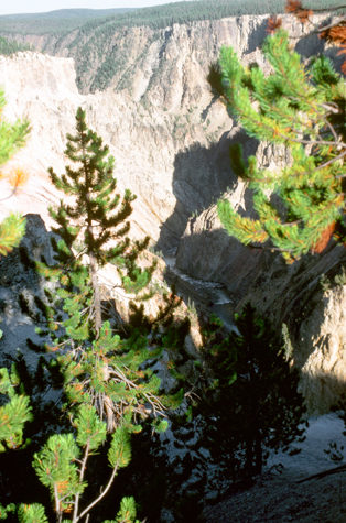
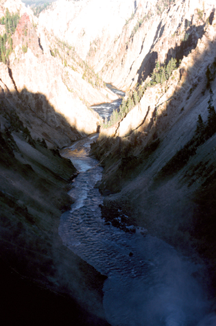
The Grand Canyon of the Yellowstone is one of the most beautiful places I have yet seen in my lifetime. This is only my second trip through the Western states (the first one being my own cross-country trip right after college), and on both of them I have seen some really incredible places. I think that the West must be chock full of them. Here are the other pictures I took in the area around the Grand Canyon of the Yellowstone:
|
|
 |
(Picture at left) This is the Grand Canyon of the Yellowstone, taken from the west rim of the canyon opposite Artist's Point, which is out of the picture to the right. The setting sun adds a beautiful accent to the view.
(Picture at right)
|
 |
When we returned from our last short hike it was getting dark, and we continued on towards the North Entrance to the Park, spending the night near the Park Headquarters. Just before nightfall, we ran up the road to Montana, so that I could cross that state off my list of states I've been to. Coming back into the park, we saw signs for the Gardiner Campground, so we drove in to see if we could find an open spot. Sadly, all the campsites were taken; Tony wasn't deterred and he asked someone if we could share a small part of their site. This would not have been something I could have done, nor if I were the site occupant would I have wanted to share the space, but Tony asked and they agreed, so we parked as far away from the campers as we could and I was able to use a blanket from my trunk to construct a makeshift lean-to against the car so we were at least partially sheltered.
Mammoth Hot Springs
|
The hot water that feeds Mammoth comes from Norris Geyser Basin after traveling underground via a fault line that runs through limestone and roughly parallel to the Norris-to-Mammoth road. The limestone from rock formations along the fault is the source of the calcium carbonate. Shallow circulation along this corridor allows Norris' superheated water to slightly cool before surfacing at Mammoth, generally at about 170 °F. Algae living in the warm pools have tinted the travertine shades of brown, orange, red, and green.
Thermal activity here is extensive both over time and distance. The thermal flows show much variability with some variations taking place over periods ranging from decades to days. Terrace Mountain at Mammoth Hot Springs is the largest known carbonate-depositing spring in the world. The most famous feature at the springs is the Minerva Terrace, a series of travertine terraces. The terraces have been deposited by the spring over many years, and are still being deposited today. (Some years after our visit here, and another that I would make in the future), there would be some minor earthquake activity that would have the effect of shifting the location of the spring that feeds the vents. This will cut off the water flow and allow the terraces to dry.
|
The Mammoth area exhibits much evidence of glacial activity from the Pinedale Glaciation. The summit of Terrace Mountain is covered with glacial till, thereby dating the travertine formation there to earlier than the end of the Pinedale Glaciation. Several thermal kames, including Capitol Hill and Dude Hill, are major features of the Mammoth Village area. Ice-marginal stream beds are in evidence in the small, narrow valleys where Floating Island Lake and Phantom Lake are found. In Gardner Canyon one can see the old, sorted gravel bed of the Gardner River covered by unsorted glacial till.
We spent about an hour here early in the morning, wandering around the boardwalks and looking at the travertine terraces. And if you are curious, yes, there was the occasional whiff of sulfur if you got close to the steam vents, but this was actually more evident south of here. Here are two more pictures that I took at Mammoth Hot Springs:
|
|
Mammoth Hot Springs to Old Faithful
|
|
As you can see from the picture of Fountain Point, above, it is a very chilly morning.
 |
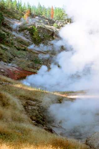
(Picture at left) Traveling down the Southbound road, there are innumerable hot springs, many of which, like this one, require a hike to get to. Early September in Yellowstone means some chilly mornings.
(Picture at right)
|
 |
We weren't about to have come all this way not to stop and see Yellostone's iconic feature- Old Faithful.
|
On the afternoon of September 18, 1870, the members of the Washburn-Langford-Doane Expedition traveled down the Firehole River from the Kepler Cascades and entered the Upper Geyser Basin. The first geyser that they saw was Old Faithful. Nathaniel P. Langford wrote in his 1871 Scribner's account of the expedition:
| "It spouted at regular intervals nine times during our stay, the columns of boiling water being thrown from ninety to one hundred and twenty-five feet at each discharge, which lasted from fifteen to twenty minutes. We gave it the name of "Old Faithful"." |
Eruptions can shoot from 4-9000 gallons of boiling water between 105-185 feet into the air, and these eruptions can last from 1.5 to about 5 minutes. The average height of an eruption is 145 feet. Intervals between eruptions can range from 60 to 110 minutes, averaging 66.5 minutes in 1939, and slowly increasing to an average of about 75 minutes today (1975), which may be the result of earthquakes affecting subterranean water levels. The disruptions have made earlier mathematical relationships inaccurate, but have actually made Old Faithful more predictable in terms of its next eruption.
Most folks think that the time between eruptions is constant, but it is in fact a bimodal distribution, with clusters of interval times centered on either 65 or 91 minutes. The best predictor of the time of the next eruption is the length of the prior eruption. When that time is less than 2.5 minutes, the next eruption will occur between 55 and 75 minutes later, but if the prior eruption lasts longer than 2.5 minutes, the next one will occur between 81 and 101 minutes later. But no matter, the time of the next eruption cannot be predicted to the minute, although there is an automated sign by the Old Faithful lodge that displays such an estimate. People like certainty, I guess, but we were told by a ranger that people either miss an eruption or have to wait a few minutes. No biggie; there are benches to sit on and neat scenery all around.
If you are ready to see what beautiful sights we'll see next, just click the button below:

 |
November 29-30, 1975: A Weekend in Los Angeles |
 |
June 8-12, 1975: A Week in Toronto, Canada |
 |
Return to Index for 1975 |