|
October 24, 2018: Chimayo and Ojo Caliente |
|
October 22, 2018: Driving to Albuquerque |
|
Return to the Index for Our Trip to New Mexico |
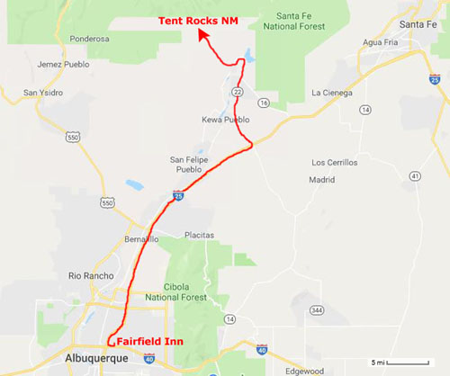
We awoke in the Fairfield Inn in Albuquerque and were disappointed to find out that there were showers outside. It was not a constant rain, and for that we were grateful, but we knew that we would be dodging showers all day long.
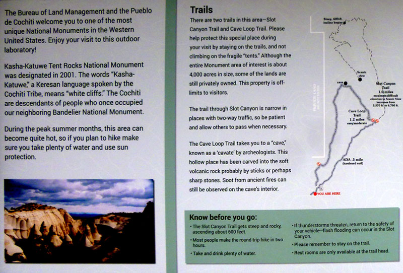
Kasha-Katuwe Tent Rocks National Monument
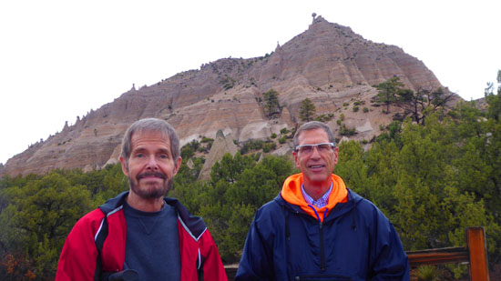
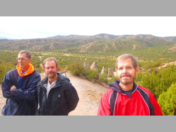
The first item on today's agenda will be the Tent Rocks National Monument. Fred and I have been there once before, when we did the slot canyon hike, and we thought that it would be an excellent hike for the three of us to do again.
Getting to Tent Rocks National Monument
|
|
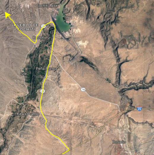
Passing through the pueblo, we saw our first signs for Tent Rocks, and we turned onto the park entry road heading northwest. After a couple of miles, we came to the entry station for the National Monument. We stopped and had a chat with the talkative ranger manning the gate- mostly about the threatening weather. The ranger was concerned that we might try the slot canyon hike; when it rains, that trail can quickly become impassable, and he encouraged us to avoid that trail if the weather didn't clear by the time we got to the hikes themselves. We promised we'd be careful, showed our Senior National Park Pass, and headed up the road to the parking area for the hikes.
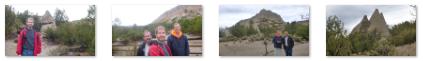
We reached the parking area about ten minutes later, parked, got our cameras and umbrellas and rain gear, and headed off to check out the hikes we might do.
|
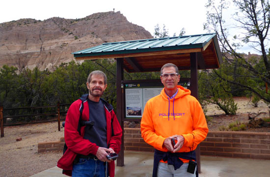
But Guy has never been here before, and we'd hoped days earlier that the weather would be good and we could repeat both hikes but, sadly, it turned out that it wasn't.
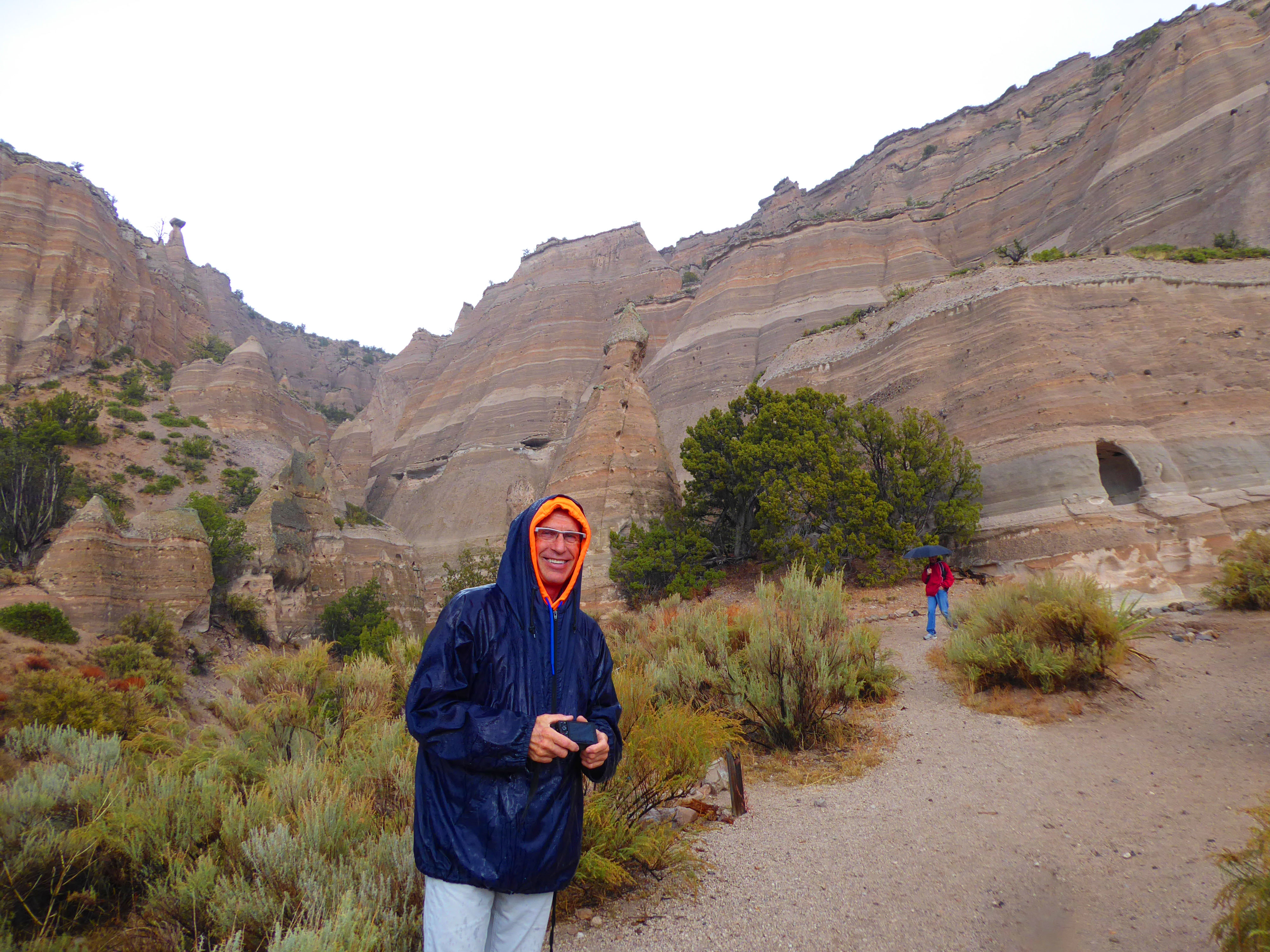
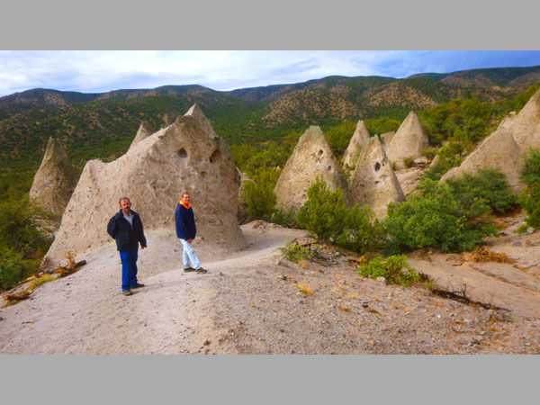
Today, it was already raining lightly when we left the car, so we thought that discretion would be the better part of valor and we eschewed the Slot Canyon Hike in favor of the Cave Loop Trail.
|
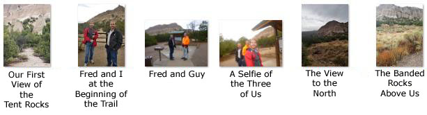
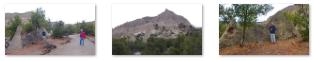
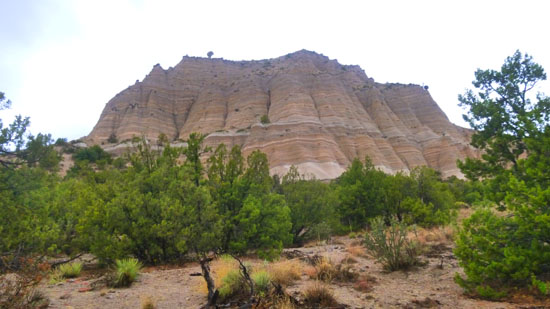
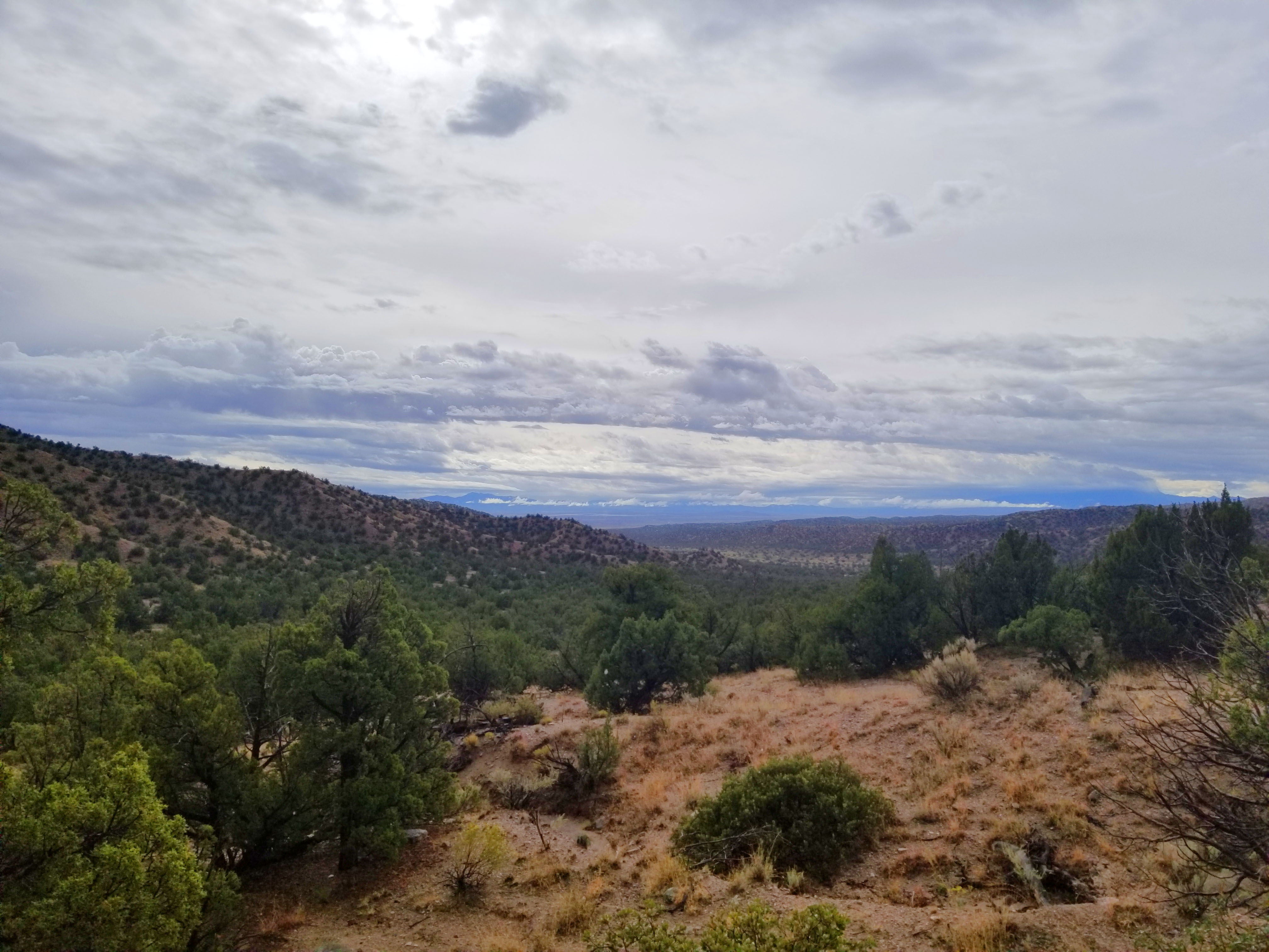
Even here at the very beginning of the trail, there were already expansive views out across the valley north of us, and we also took a number of pictures around the area at the beginning of the trail. Here are some of them:
|
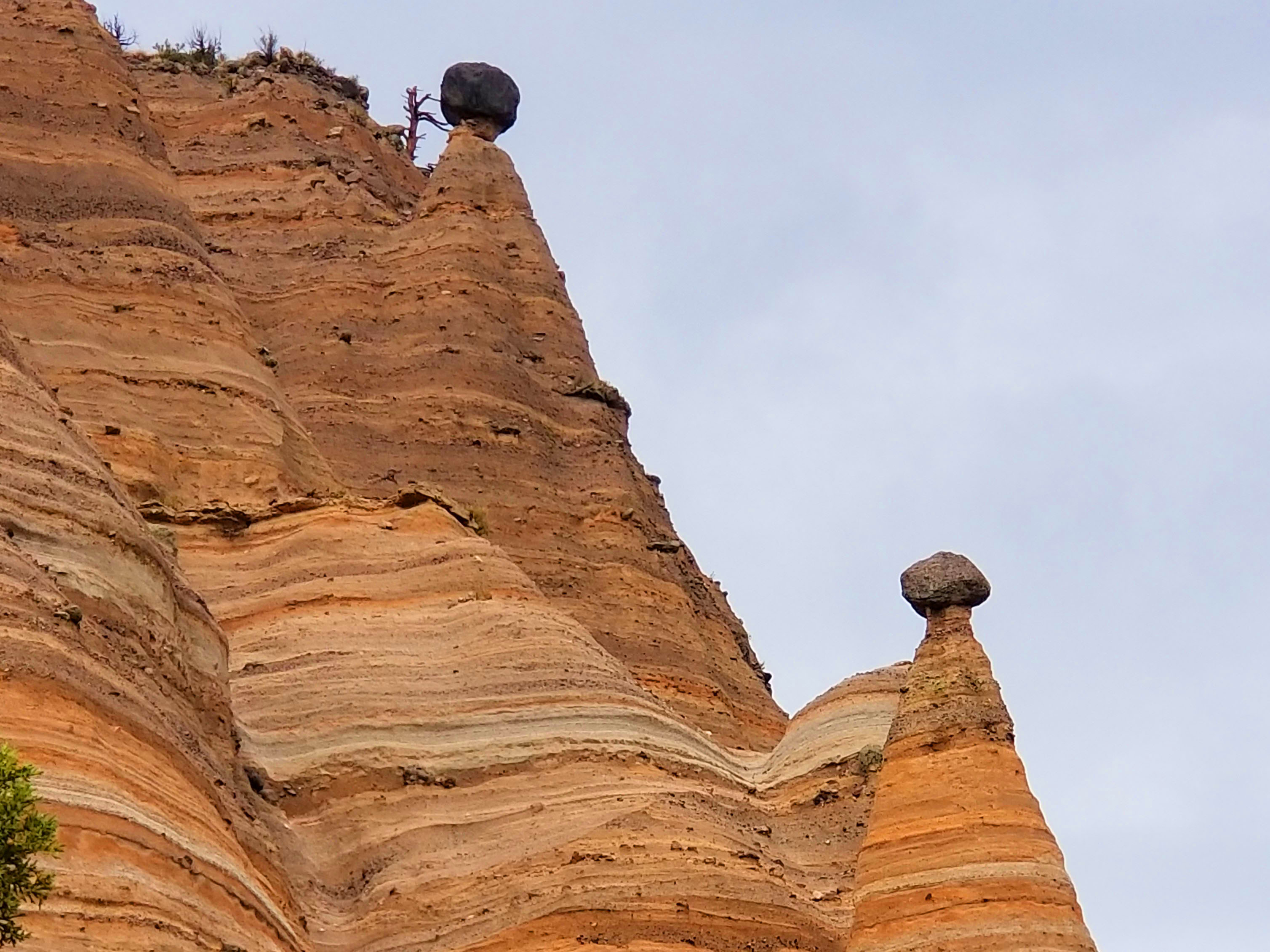
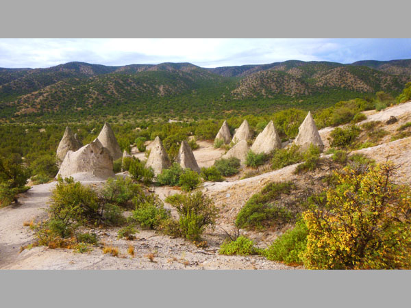
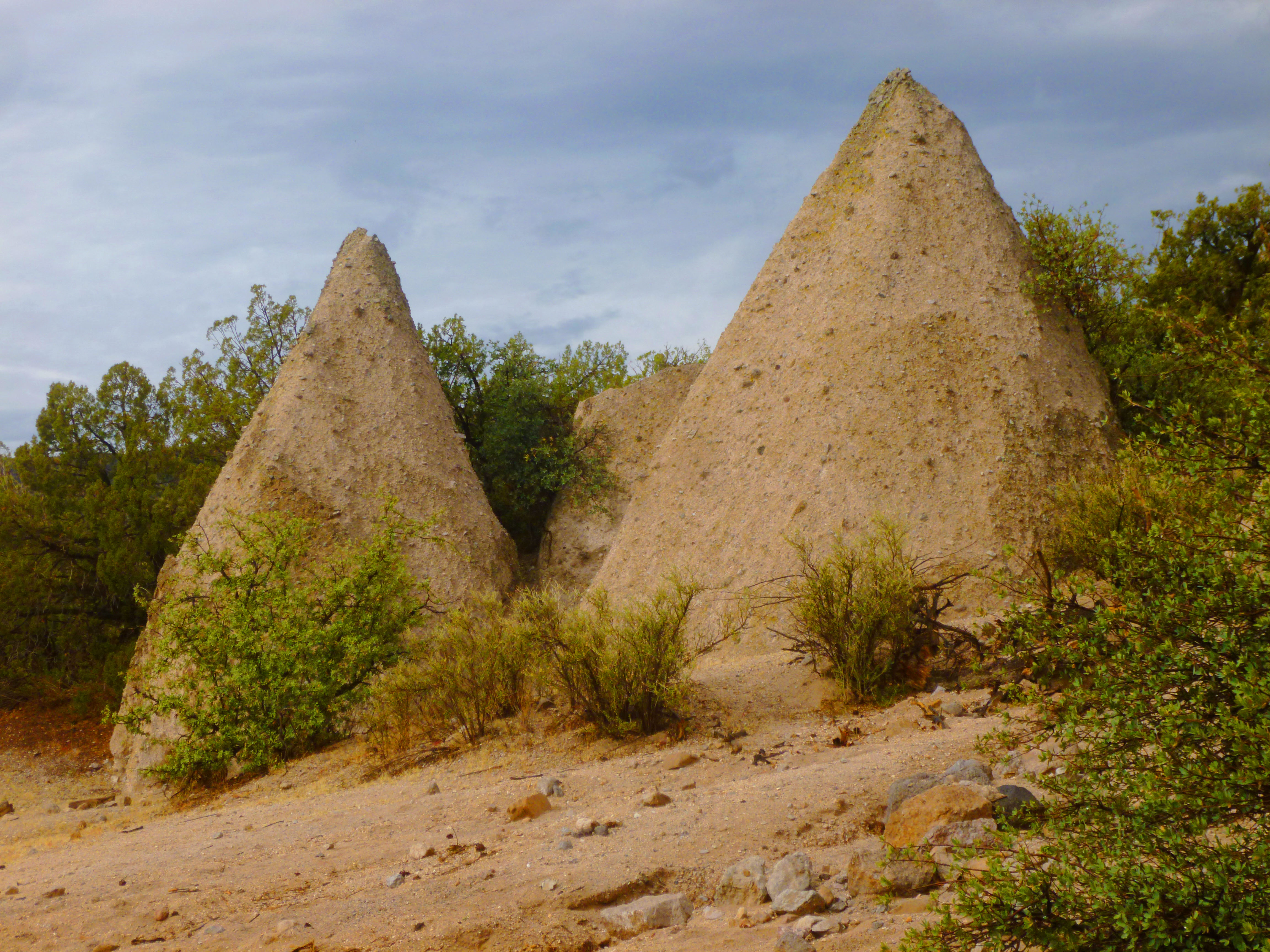
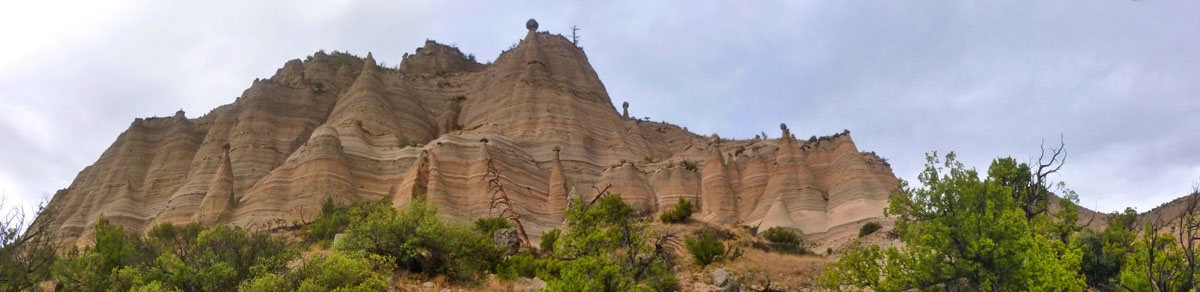
Even from the very beginning of the loop trail, we could see the numerous balanced rocks on the ridgeline off to our north. These caprock formations are very common here in Tent Rocks, and are formed in much the same way as the actual tent formations themselves. You can see them all the way up the ridge and on the face of the ridge as well.
|
|
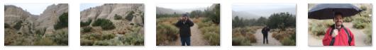
The first part of our walk was basically along level ground, and was during this part of our walk that the one substantial rain shower occurred:
|
When we got to the parking lot, there were only a couple of other cars there- due to the fact that this was a weekday, I guess, but more due to the weather. So we only saw a few other people on the common trail up to the point where the two trails diverged, and then we had the Loop Trail all to ourselves.
|
(Mouseover Image Above for Video Controls) |
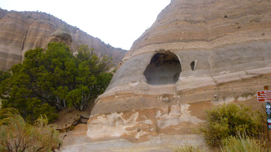
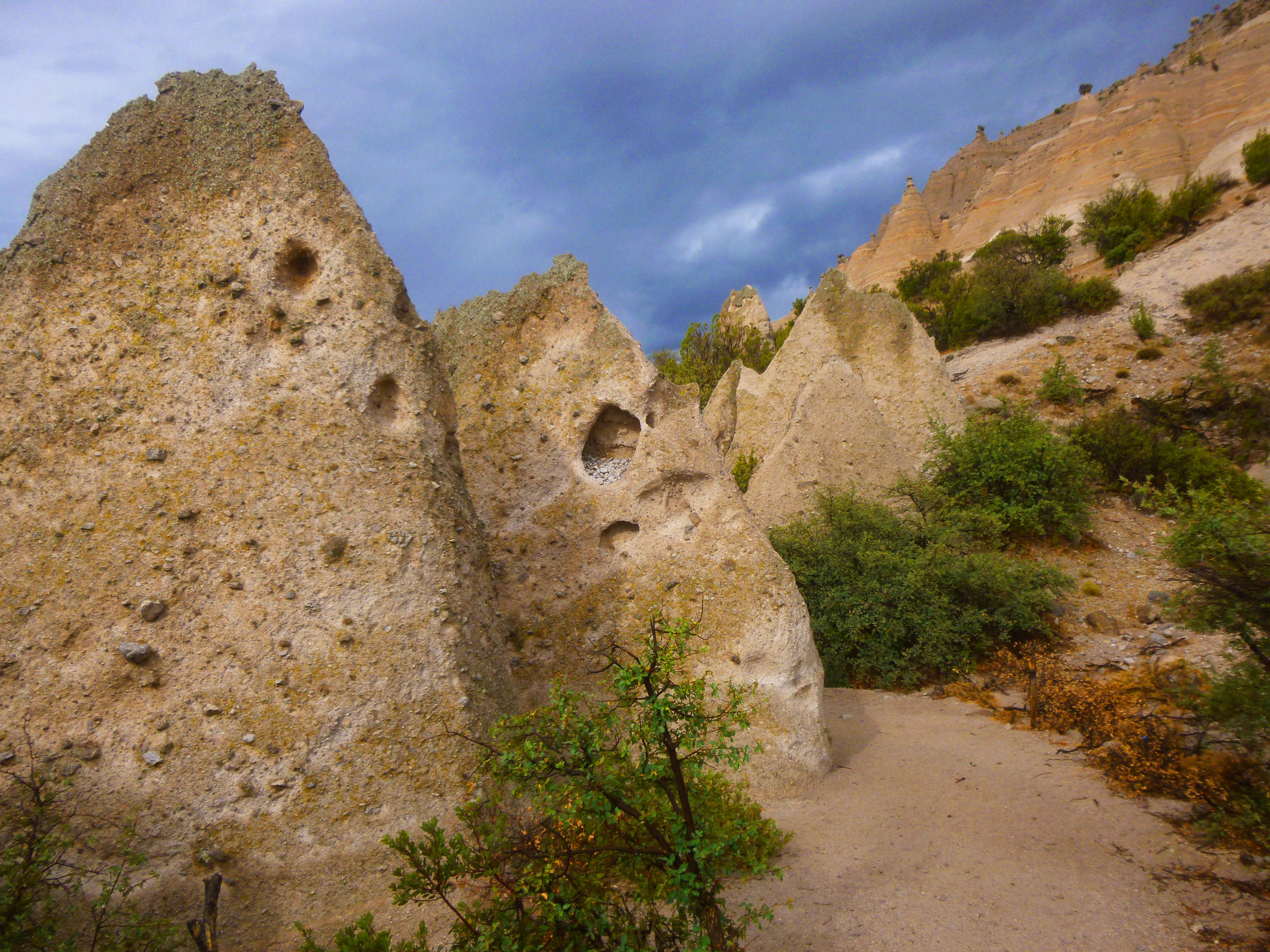
When we kept to the left at the trail junction to take the loop trail, we had a couple more light showers between there and the "hole in the cliff", one of the more interesting features in Tent Rocks. Here are some of the better pictures we took up to our arrival at the "hole in the cliff":
|
There were two interesting features along this part of the trail that you will probably want to learn more about- the banded colors of the cliff rocks and, of course, the "hole in the cliff". Fortunately, there were descriptive signs for each of them. So here are those two features and the signs describing them:
Read About the Cliff Colors Here |
Read About the Hole in the Cliff Here |
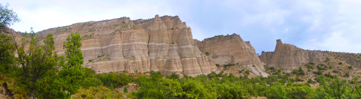
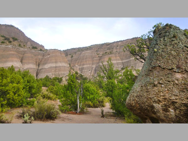
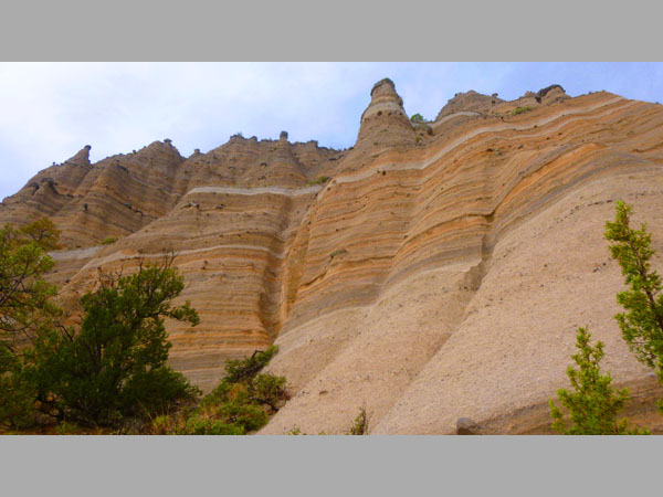
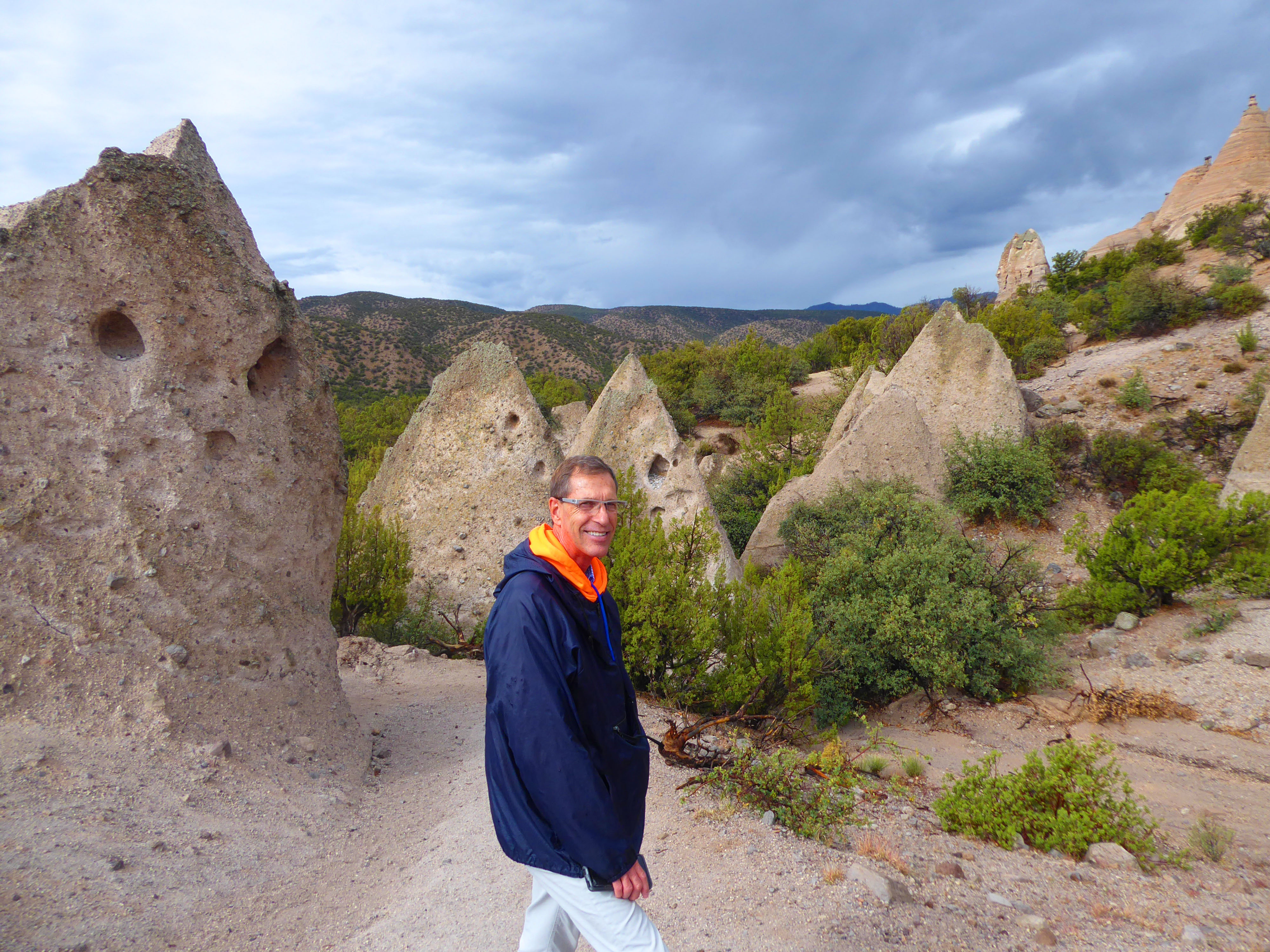
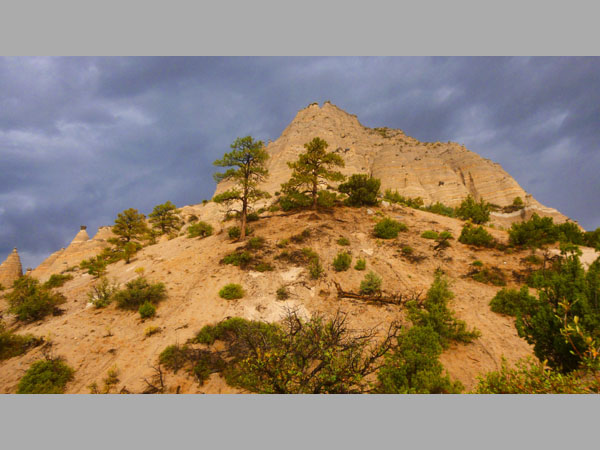
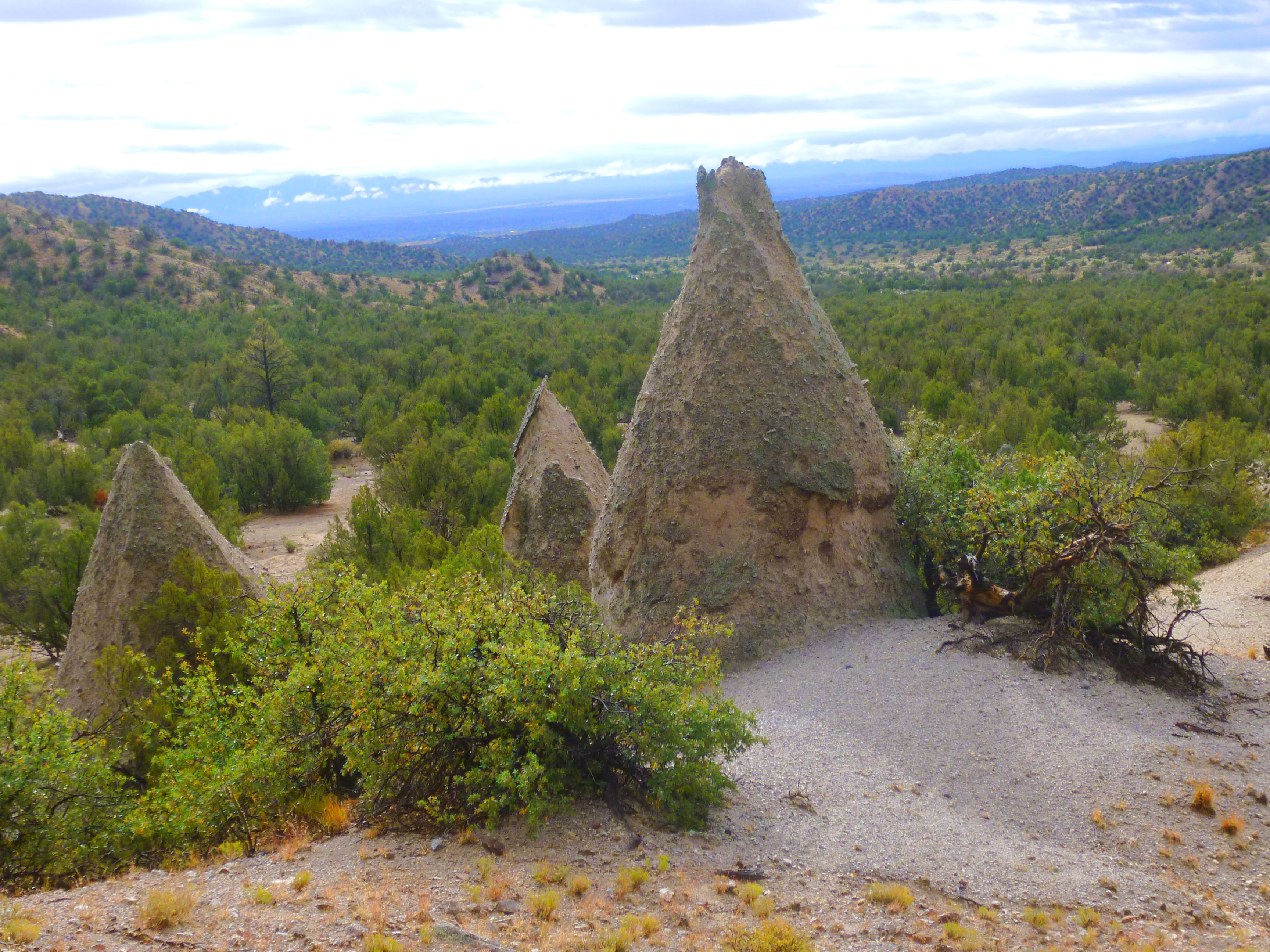
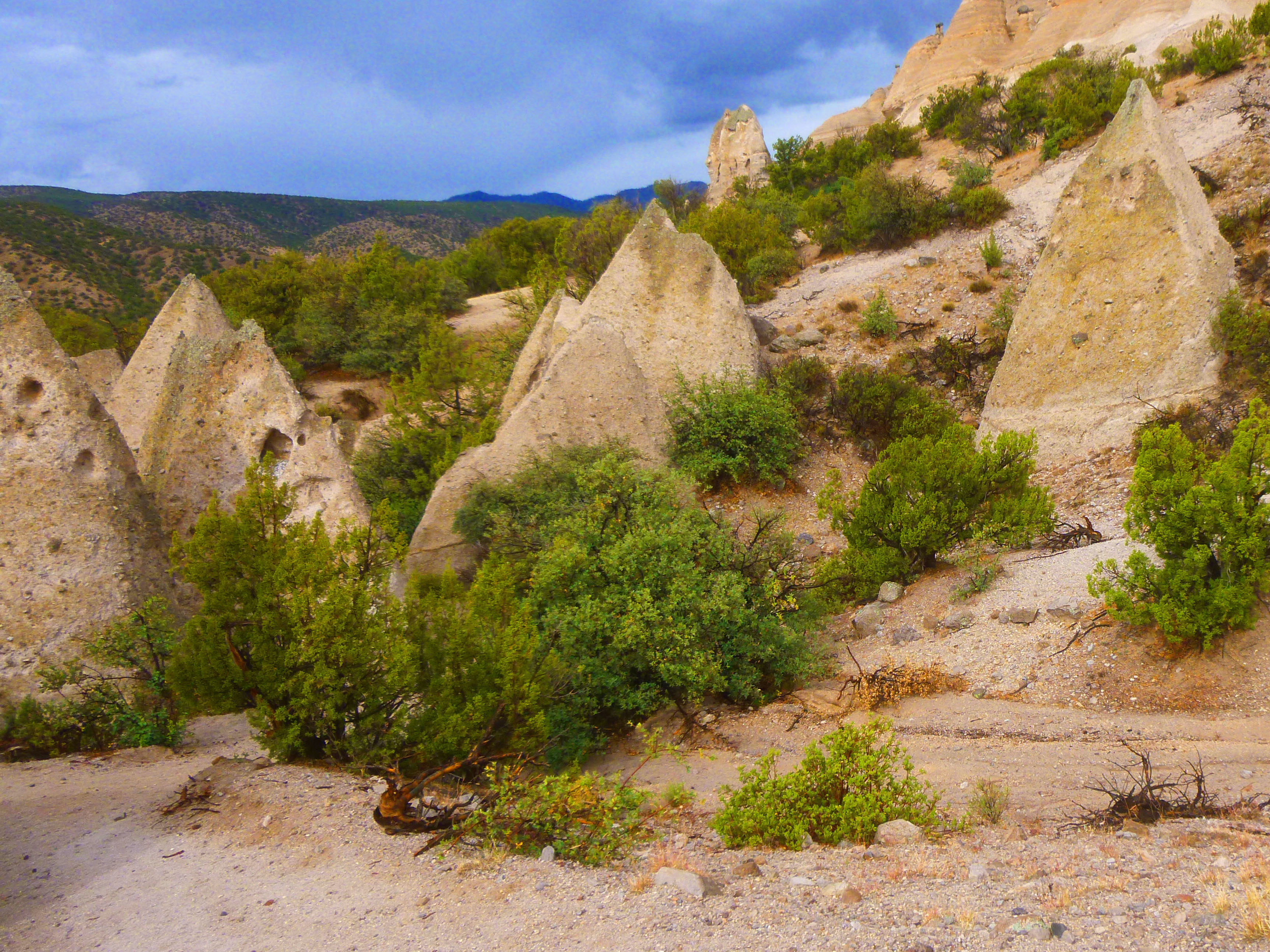
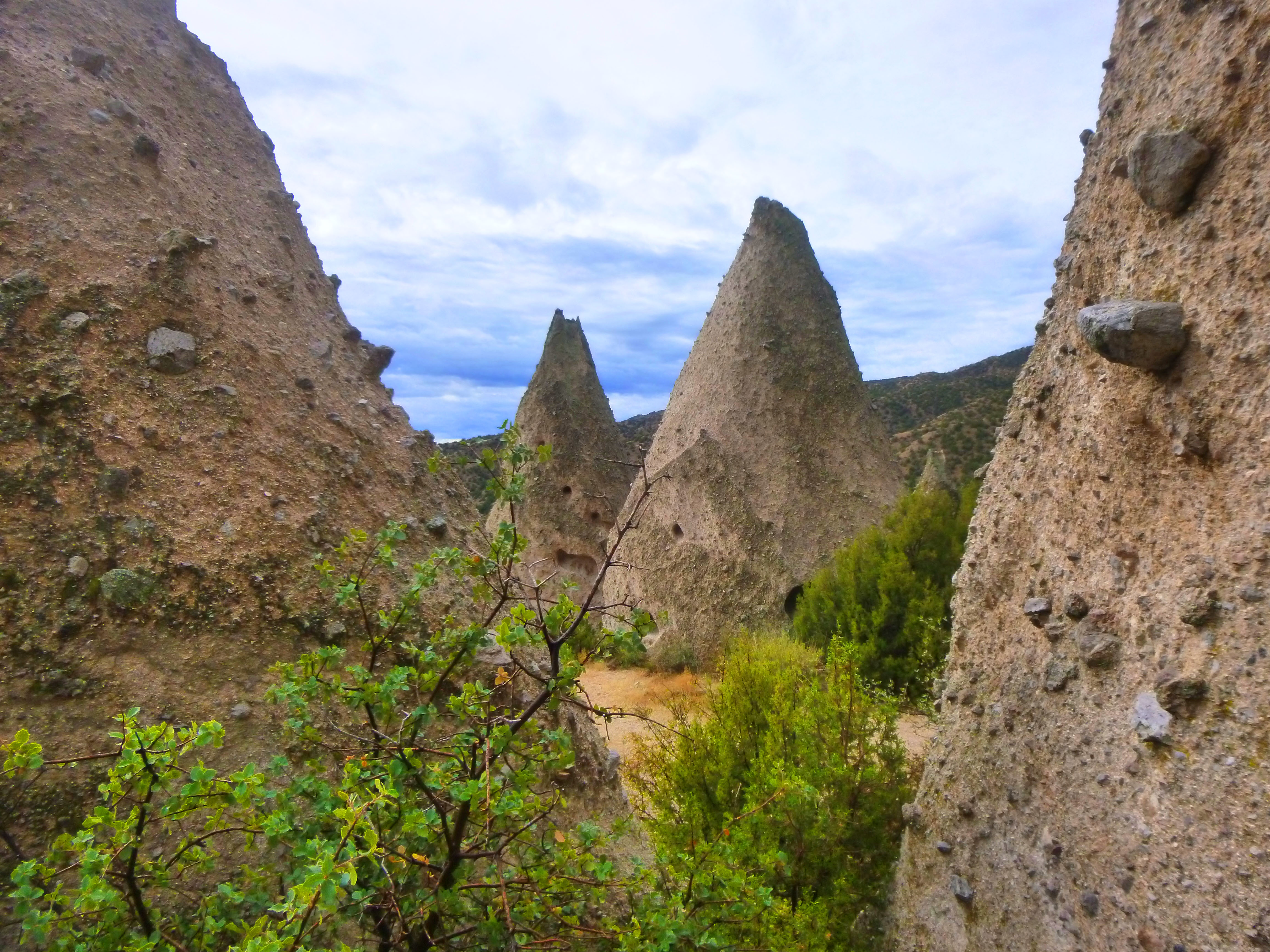
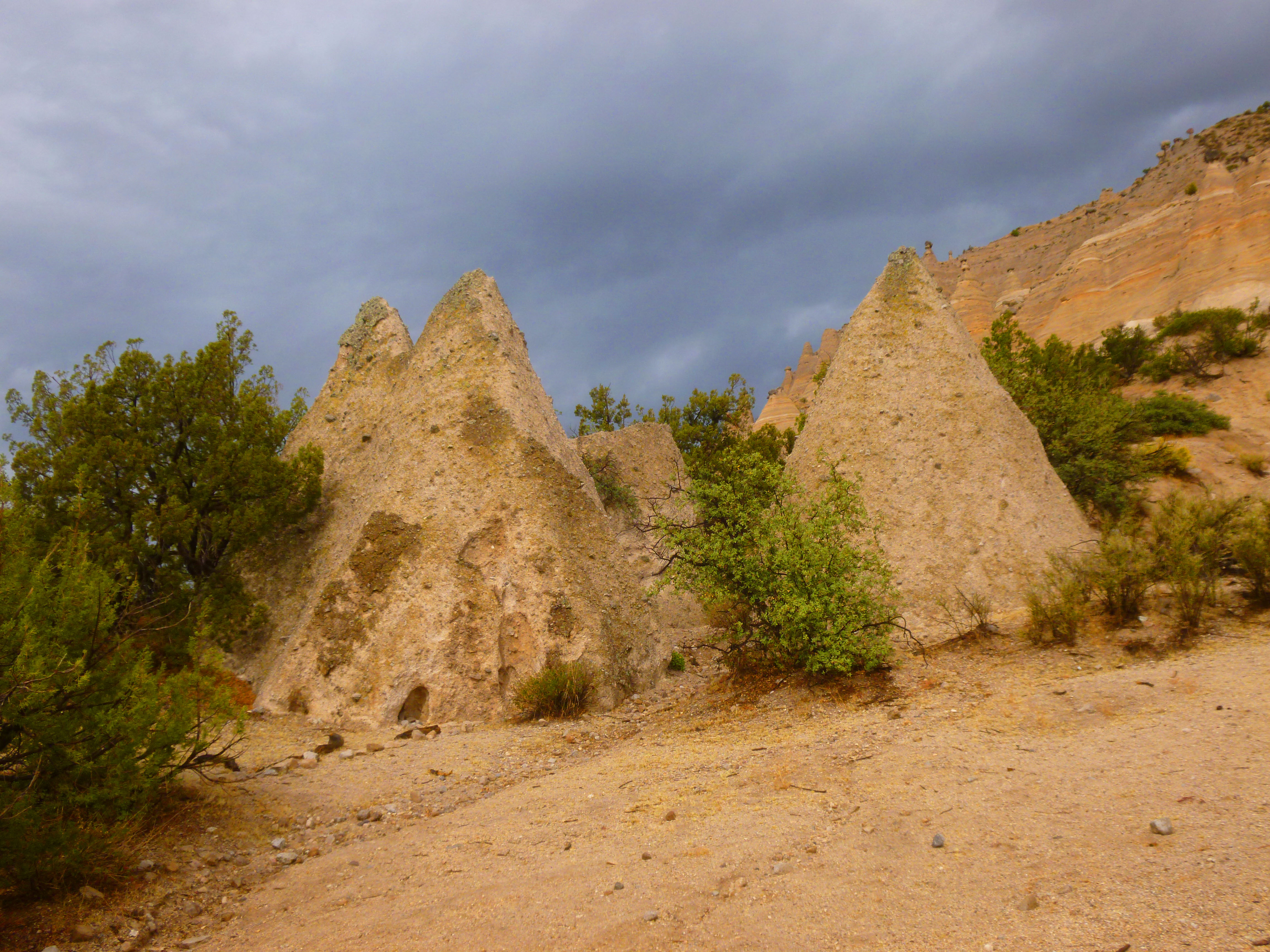
The Loop Trail, past the Hole in the Cliff, wanders up to the base of the banded cliffs, and then the path goes along those cliffs past numerous examples of the "tent rock" formations. Here is what the cliffs looked like as we left the Hole in the Cliff:
|
|
|
As you've seen earlier in this album, caprocks are formations where a harder rock layer sits atop a softer one, protecting that softer layer from some forms of erosion. When cracks appear in the caprock layer, crevices can form, wearing away the softer layers and leaving columns of rock that have a protective top.
There were numerous examples way up above us, but at one point the trail went right past this excellent example of a caprock formation.
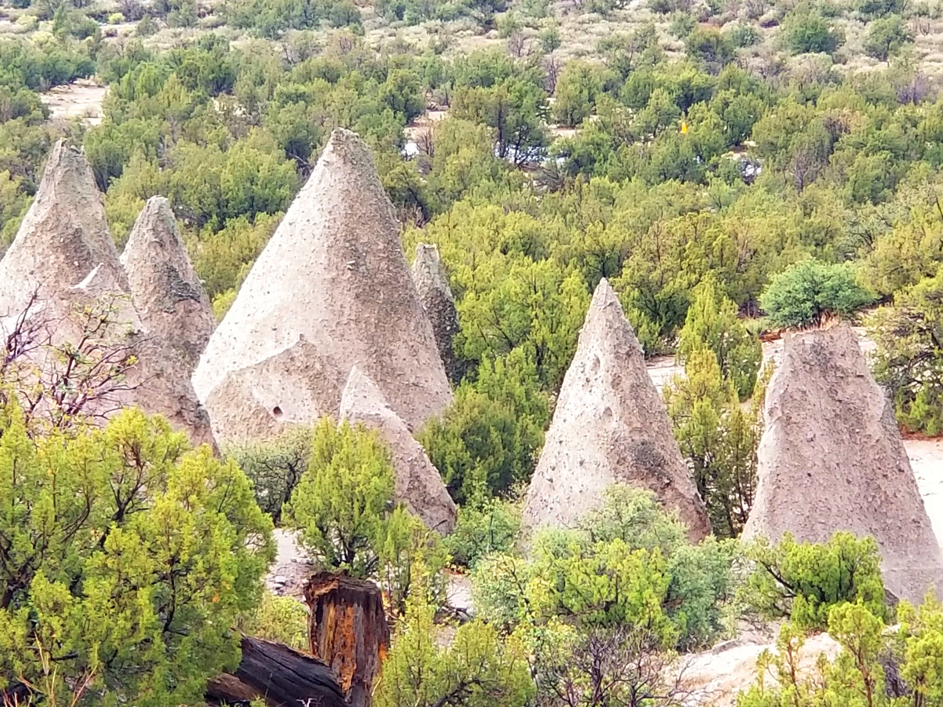
We took many good pictures of the tent rocks and other scenery along the Cave Loop Trail, and I've whittled them down by over half to about twenty pictures. These are in the slideshow at right. Use the little arrows in the lower corners of each image to move through the slides, and track your progress by referring to the index numbers in the upper left of each one.
We hope you enjoy looking at the scenery along the Cave Loop Trail.
Towards the end of the trail, we got another neat look back at the banded cliffs; here is that view:
|
Back at the trailhead, we found some additional signs that you might be interested in reading:
|
|
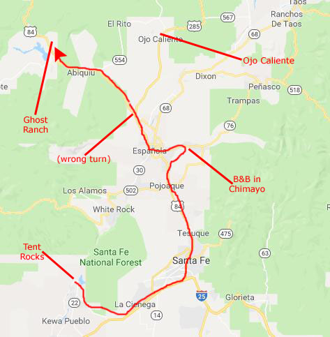
Back at the car, we thought that the best thing to do next, considering the weather, would be to head up to the Ojo Caliente Hot Springs, figuring that a shower or two wouldn't matter so much if all we were doing was lounging in a hot spring. As it turned out, we took the wrong road, and ended up at Ghost Ranch (which we'd planned to visit anyway, tomorrow or the next day). But before that, we wanted to drive to the B&B that Fred had reserved so we could check in.
The Drive to Ghost Ranch
As I said at the end of the section above, the next thing we did was actually to locate our B&B and go check in. I am going to postpone any information about where the B&B was until our last day, at which time we took most of the pictures around that property.
|
|
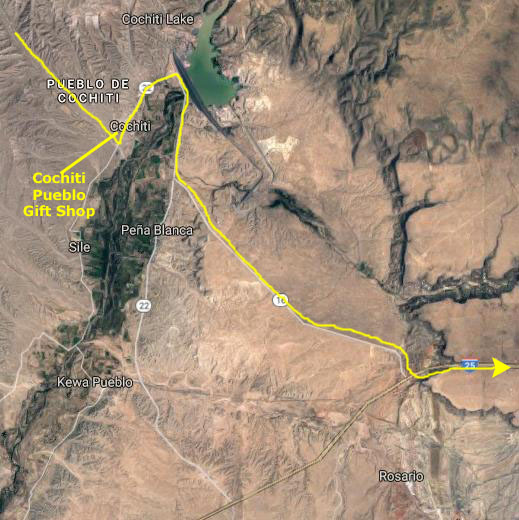
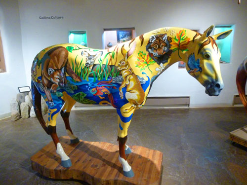
This time, we stopped at the Cochiti Pueblo Gift Shop to look around at the crafts made by the people in the surrounding pueblos, and then headed back by Cochiti Lake to the road south. I saw a sign for a shorter route to I-25, and so we took that, reaching I-25 north about ten miles later.
At the Interstate, we headed north, taking the exit for US Highway 84 through the west part of Santa Fe. A few miles south of Espanola, we found the local highway that would take us over towards Chimayo and the B&B. The B&B was on a private road that was a bit hard to find, even though Google Maps put us very close to it.
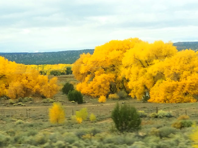
At Paradise Pond B&B, we checked in to our casita, dropped off our stuff, and relaxed for just a while before heading off again. We went back through Espanola and back to Highway 84 north. We went through some showers, and perhaps that's the reason that I missed the turn onto US 285 towards Ojo Caliente, By the time we figured out that we'd missed our turnoff, we were so far along that we continued on up the highway through Abiquiu towards Ghost Ranch.
|
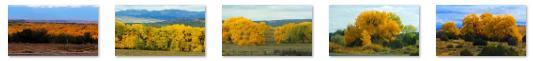
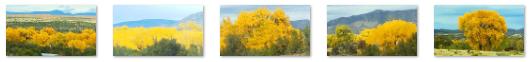
The riparian tree grows near streams, rivers, springs, seeps, wetlands, and well-watered alluvial bottomlands at elevations below 6,600 ft. elevation. This cottonwood is a large tree- 39�115 feet high- with a wide crown and a trunk up to 5 feet in diameter. Autumn colors occur from October�November, mainly a bright yellow, also orange, rarely red. This color was so striking that Fred and Guy took picture after picture as I drove. Here are some of them:
|
Our Visit to Ghost Ranch
Ghost Ranch is a 21,000-acre retreat and education center located close to the village of Abiqui�. It was the home and studio of Georgia O'Keeffe, as well as the subject of many of her paintings. Ghost Ranch is also known for a remarkable concentration of fossils, most notably that of the theropod dinosaur Coelophysis, of which it has been estimated that nearly a thousand individuals have been preserved in a quarry at Ghost Ranch.
|
The canyon was first inhabited by the Archuleta brothers, cattle rustlers who enjoyed the coverage and invisibility that the canyon provided as well as their ability to see for miles down the valley. They created two jacal homes and would move stolen cattle throughout the night to Box Canyon. By transporting the cattle through streams, footprints would be lost and they could not be tracked. Stories of people staying with the Archuleta brothers who had gone missing (and their clothing on the men) circulated around the area. One day one of the brothers made a transaction without the other, and claimed he had buried the gold for safety. The second brother killed him, and kept his wife and daughter hostage until they admitted to knowing where the gold was hidden. Although the mother and daughter feared the rumored spirits of the canyon, they mustered up the courage to sneak away at night through the Chama Valley. A group of local men then came to the ranch, fighting through their fear, and hung the remaining brother and his gang from a cottonwood tree that still stands next to one of the casitas on the property. Other visitors who stayed in the casita later on noted that they could hear voices of a man and a woman fighting.
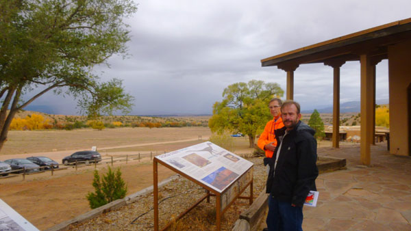
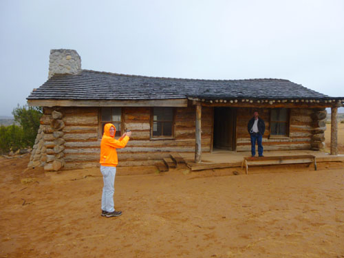
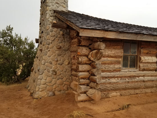
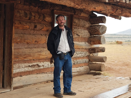
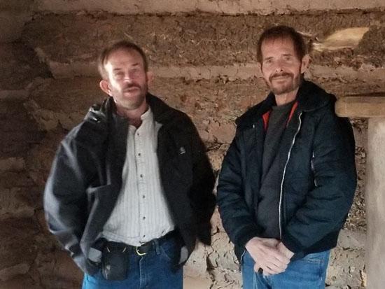
Coming into the property from Highway 84, we passed what looked like an old frontier cabin, and we thought that we would stop to have a look at it on the way out a bit later on. We remembered the drive in from some years ago, and we knew to drive to the office/visitor center, which was in a building right by the museums and some of the lodges. In front of all these buildings is a large open area from which you can see the surrounding mountains.
|
A man named Roy Pfaffle won the deed to the ranch in a 1928 poker game, but his wife, Carol Stanley, recorded the deed in her own name, deciding to name the place Ghost Ranch. She moved to the ranch in 1930, after divorcing Pfaffle. Stanley constructed guest quarters and created an exclusive dude ranch that was visited by many of the wealthy and creative people of the time. One of the most influential people to visit Ghost Ranch was Arthur Newton Pack, writer and editor of Nature Magazine. Pack's daughter suffered from bouts of pneumonia, so he and his family had to move to an area with a drier climate, and he came to Stanley's ranch. Although her clientele were wealthy, Stanley was having trouble breaking even, and she sold the ranch to Arthur Pack in 1935.
|
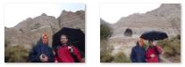
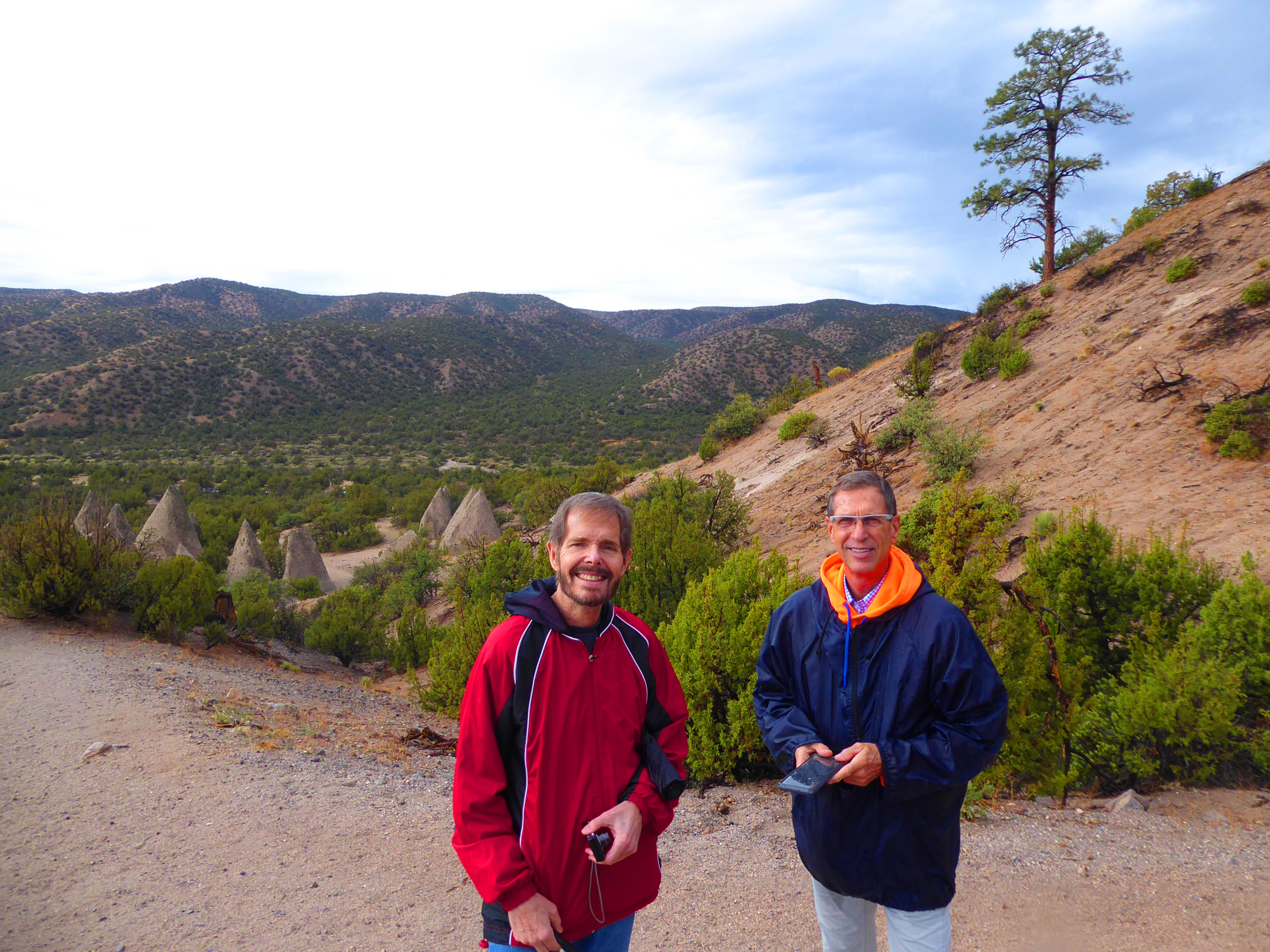
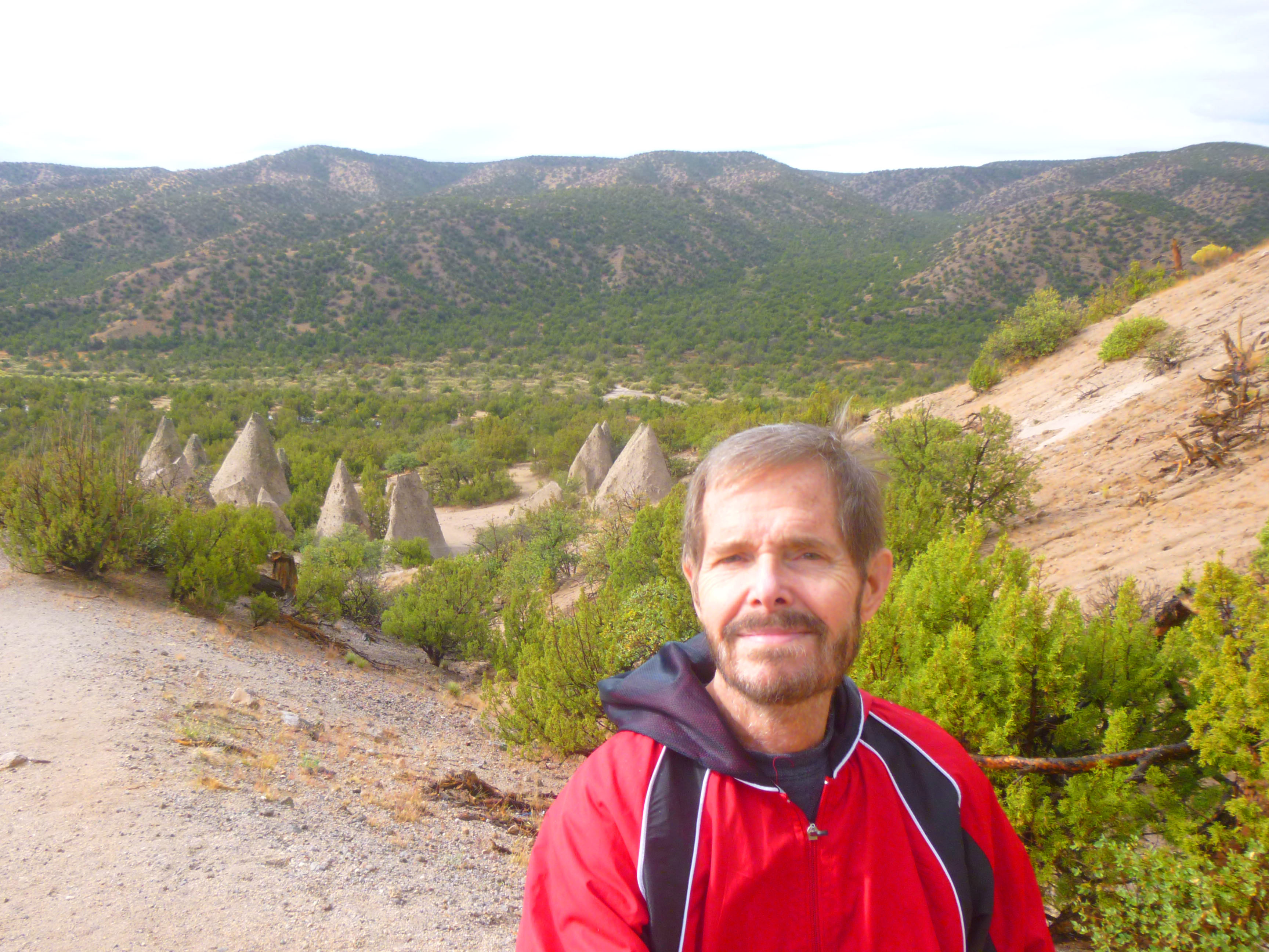
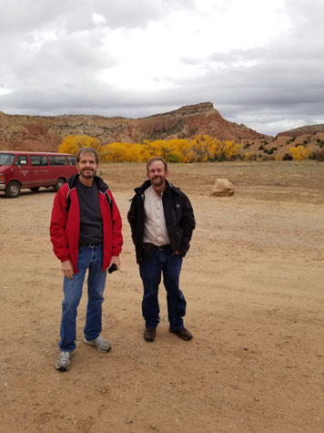
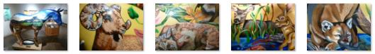
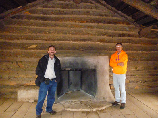
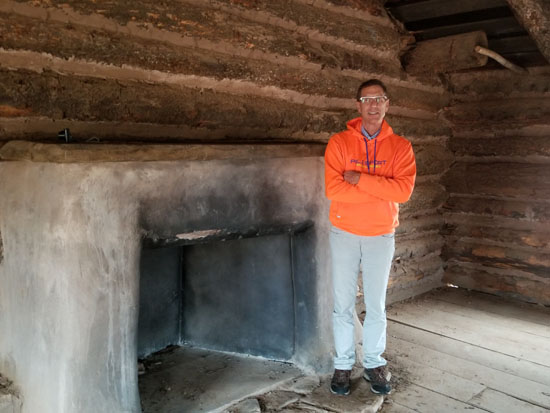
Here at Ghost Ranch was saw more of the beautiful yellow Fremont Cottonwoods and a number of our pictures (see thumbnails below) featured them. Guy took a nice picture of myself and Fred that you can see at right, getting some of those cottonwoods in the background. We wanted to hike to the chimneys- two tall rock formations at the end of a two-mile trail (5th picture below)- but we decided against doing a hike because we could see a substantial rainstorm making its way across the valley from the west towards us (4th picture below). We opted instead to look around the visitor center and the museums, where we learned quite a bit about the history of Ghost Ranch.
|
Part of that recent history involves the artist Georgia O'Keeffe. She knew Arthur Pack, and when he told her that the Piedra Lumbre was "the best place in the world", she came to visit the ranch. She fell in love with the geography of this part of New Mexico, and was soon splitting her time between living in New York and the area of New Mexico between the ranch and Santa Fe. She enjoyed having alone time, and was often very demanding of the Packs when she was at the ranch. Cerro Pedernal was a key geographical feature that could be often found in her paintings.
|
|
We also learned much about the ancient history of this area. 200 million years ago Ghost Ranch and the American Southwest were located close to the equator, and had a warm, monsoon-like climate with heavy seasonal precipitation. Ghost Ranch includes a famous paleontological site preserving Triassic dinosaurs. Fossil bones were found here as early as 1885. In 1947 the paleontologist Edwin H. Colbert documented the discovery of over a thousand well-preserved fossilized skeletons of a small Triassic dinosaur called Coelophysis in a quarry here. In 2007, fossil remains of dromomeron romeri, one of the archaic group of animals recognized as basal dinosauromorphs, were found in the Hayden Quarry. In 2010, a team of scientists reported the discovery of daemonosaurus chauliodus, a basal theropod species that lived 205 million years ago, here at Ghost Ranch.
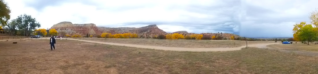
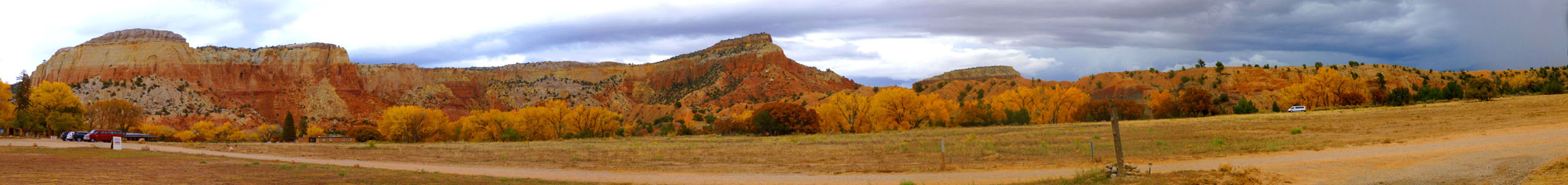
Outside, the rain was almost here, and so before it started I took a series of five pictures of the mountains surrounding the central part of Ghost Ranch, and I have put them together into the panorama below. It's a huge picture, so I have put it in a scrollable window.
 |
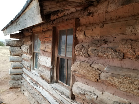
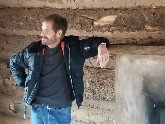
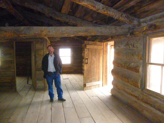
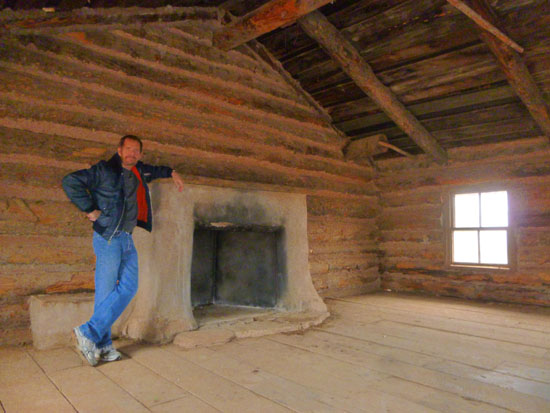
The Ghost Ranch Cabin
|
Postscript:
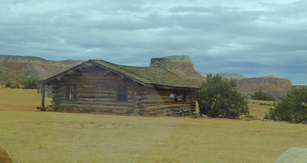
It was not until I began working on this photograph album page that I found out that the cabin we'd visited was not at all what we thought it was, and I discovered that only by chance. I was looking at a map of Ghost Ranch online and, at the location where this cabin was, there was the notation "City Slickers Cabin", which led me to investigate why it might have been called that.
The answer?
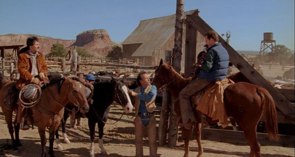
|
(Mouseover Image Above for Video Controls) |
That's right; the cabin in that movie is the cabin we walked through. So did the producers just use this old cabin for filming? Nope. They built it, the farmhouse next to it, a large barn, and the calf ring for the movie. The staff at Ghost Ranch, on whose property the cabin was built, liked it so much they asked the film's producers to let it remain after the film was completed.
So the cabin we walked through was only about 25 years old- which accounted for its good condition!
Here's another interesting comparison. Below, left, is a picture we took of the cabin; the picture looks east. Note the mesa in the background. Below, right, is a still from the movie, taken from a position just east of the cabin itself, and showing the large barn that was built for the movie. Same mesa.
|
|
So much for movie trivia. We left Ghost Ranch and headed back to Espanola through occasional rain showers. We stopped in town for some supper (pizza at Pizza Hut, if you must know, and ice cream at Baskin-Robbins) before heading back through the dark to the bed and breakfast.
|
October 24, 2018: Chimayo and Ojo Caliente |
|
October 22, 2018: Driving to Albuquerque |
|
Return to the Index for Our Trip to New Mexico |