|
May 10, 2018: The Madrid Condo and Trip Home |
|
May 8, 2018: A Walking Tour of Madrid |
|
Return to the Index for Our Visit to Madrid |
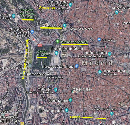
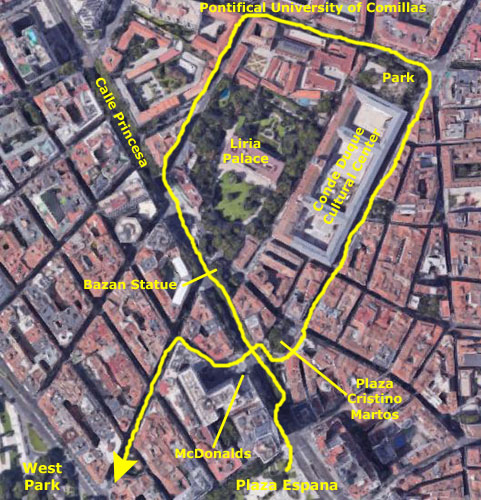
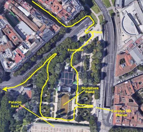
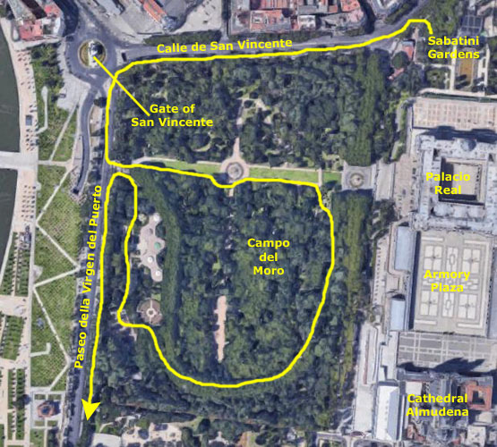
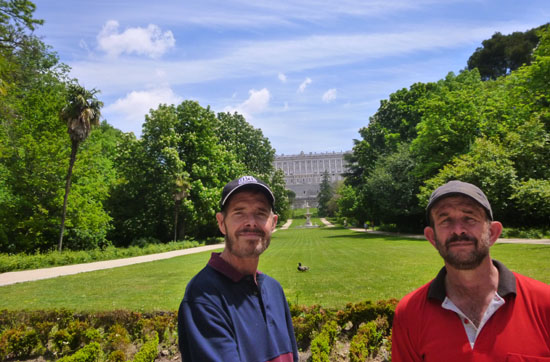
Today, Fred and I are on our own, and we plan on spending the day in the area of Madrid north and west of the Royal Palace, intending to concentrate on gardens and squares. We aren't familiar with the city, but lots of points of interest were marked on our map throughout this area, so we are simply going to try to see as much as we can on this, our last day in Madrid.
|
First, when we leave the condo we'll head to the Embajadores metro station to catch a train to Plaza Espana. When we arrive, we plan on walking through the plaza to see a major fountain and also a monument to Cervantes. When we leave the square, we will head northwest along Calle de la Princesa into a district known as Arguelles. We've seen some points of interest there on our map.
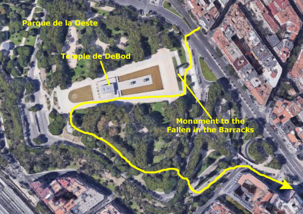
Next, we will head southwest to the Parque del Oeste- another large park like El Retiro. The main stop we want to make here is to see the Temple de Debod- a reconstructed Egyptian temple. There are also supposed to be great views from this park, which is up on a hill. When we leave the park we will make our way south towards the Royal Palace to walk through the Sabatini Gardens, part of the Palace complex but on the north side of the Palace itself.
The Campo del Moro is a huge open area west of the Royal Palace; it was once part of the palace complex, but is now separated from it to be open to anyone wanting to walk through its green oasis.
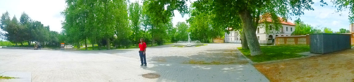
Finally, and this was something we hadn't quite planned, we will spend some time walking along the Manzanares River for about a mile of its length west of the Royal Palace and the Cathedral Almudena. As we discovered when we left the Campo del Moro, the area along the river where it runs through Madrid has been turned into gardens, fountains, and beautiful walks. It's a "riverwalk" but there is very little commercial development right on it, making it a pastoral area.
We'll be walking the river from south to north so as to end up at the metro station at the northwest corner of the Campo del Moro, so we can take a train back to the condo.
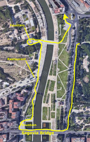
I've not marked our route on the aerial view, but I have marked the various stops we made; I think you can "connect the dots" to see what our actual route must have been. So put on your walking shoes, and come along with us as we spend a day in northwest Madrid!
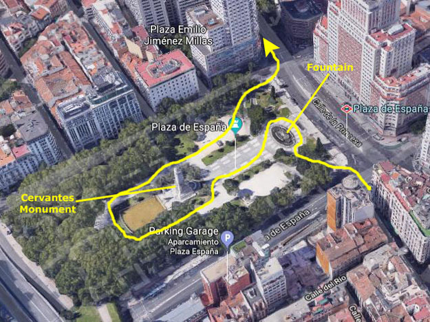
Plaza de Espańa
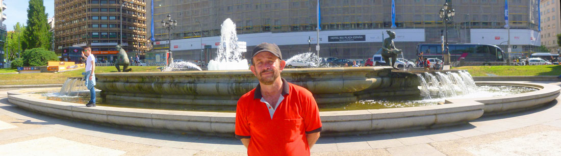
This morning we left the condo and headed a couple of blocks down the street to the Embajadores metro station to get to Plaza de Espańa. Walking around yesterday with Greg got the two of us familiar with navigating the ticket-buying process for the Madrid Metro, so we had no problem (save for actually finding a ticket machine) buying our tickets to Plaza de Espańa and getting down to the platform.
|
|
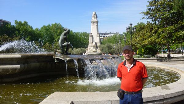
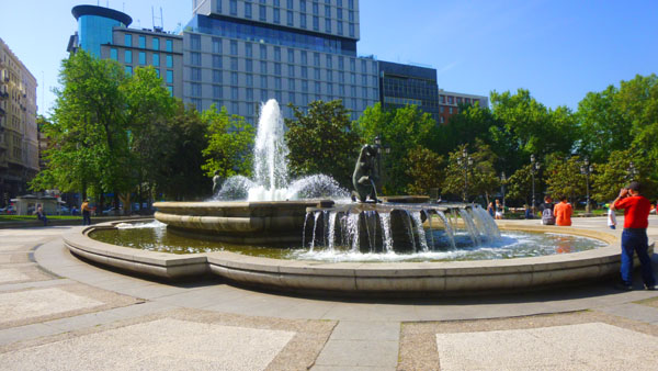
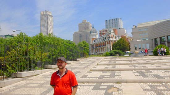
Before we walk around the plaza, you can have a look at the aerial view of it at left. The stairs up from the Plaza de Espana metro station were across the street from the northeast corner of the square, so we had to cross over to get to it. We first stopped by a large fountain on the north side of the square, and then walked to the center of the square to see the monument to Miguel Cervantes (the author). Then we circled around the monument and went back north to exit the square at its northwestern corner.
|
It features a monument to Miguel de Cervantes Saavedra and is adjacent to two of Madrid's most prominent skyscrapers. Additionally, the Palacio Real (Royal Palace) is only a short walk south from the plaza.
The main features of the Plaza de Espańa are the large fountain at it northeast end, the monument to Cervantes in the middle of the plaza, the pond south of that, and the woods at the far southwest end.
|
The fountain was very pretty, and we snapped away all around it. Here are the best of our pictures of it- even if you don't look at all of them:
|
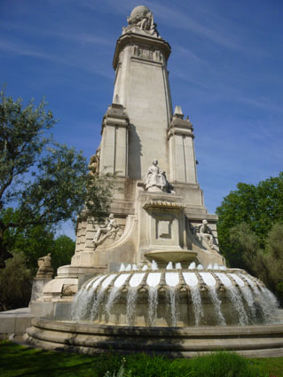
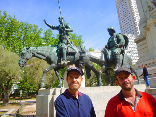
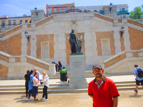
From the Fountain of the Birth of Water, we began our stroll south through Plaza de Espańa towards the Cervantes Monument. Along the way, it became obvious that Madrid has a contingent of mounted police. As we walked down through the center of the plaza, I took a picture of one of the two tall buildings that are adjacent to the plaza; this one is the Torre de Madrid. When we got closer to the monument, I was able to get a good picture of Fred and the Cervantes Monument.
|
|
(Mouseover Image Above for Video Controls) |
At the top of the monument, arrayed around a globe, are representations of five continents- all of them reading the work of Cervantes. (I wonder which continent, other than Antarctica, is not represented.)
Coming from the fountain, we were actually at the back side of the Cervantes Monument, so we walked around its south side to get to the front of it, and we could see that on both sides of the monument there were figures from Cervantes' work. In front of the statue of Don Quixote and Sancho Panza, there is a large rectangular pond; the view from the south end of this pond, looking across it and beyond the monument, is one of the most typical views of the Spanish capital, since just behind it you can see the buildings of Torre de Madrid and Edificio Espańa.
|
The figures that make up this side of this iconic monument include a seated Cervantes, and at his feet are the bronze statues of the titular character and his squire. The sculptural set was finalized with the figures of are the statues of Don Quixote and Sancho Panza. The set was finalized when the figures of Dulcinea and Aldonza Lorenzo were added, also characters of the Cervantes novel.
Here are three more views of this beautiful monument:
|
From the south end of the park and the pond, we walked around the other side of the monument and went back up to the northwest corner of Plaza de Espana, to exit from there onto Calle de la Princesa to walk through the Arguelles neighborhood.
In the Arguelles Neighborhood
So from the Plaza de Espana, we headed northwest up Calle Princesa towards a neighborhood that seemed on the map to offer some sights for us to see.
|
Then we came back down towards Calle Princesa by Madrid's largest cultural center, through a small square, and then across the avenue again to have a snack. Then we worked our way south towards West Park.
As we left the plaza, we passed by yet another neat Madrid building before we crossed the intersection at the northwest corner of the plaza and headed up Calle Princesa. No sooner had we got onto the tree-shaded avenue than we saw some folks on one of those ubiquitous tour buses that we have seen in just about every foreign city we have visited- including Seoul, Singapore, Dubai, Muscat, Jerusalem, and Chania. But we enjoyed the walk- and the ability to go where we wanted to see whatever seemed interesting.
|
As it turned out, we were able to come through the little square at the top of that monument and learn that the double staircases were part of a monument to, of all people, the bacteriologist Jaime Ferrán.
(I don't recall ever seeing a monument to a bacteriologist before, and precious few monuments to men and women of science, so I chalked that up to the different view that other countries have towards such things. We seem to favor politicians, presidents, and military folk, whereas Europe seems much more focused on anyone who advances the quality of life for average folk.)
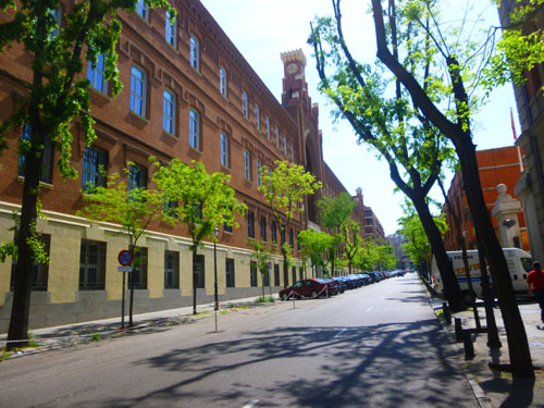
Another block or two further on, we came to a crosswalk that seemed to be right at the southeast corner of the grounds of the Liria Palace, and when we looked across the street we were about to cross, there was a monument on the other side. When we got there, we found that the monument was dedicated to Emilia Pardo Bazán (1851 – 1921), countess of Pardo Bazán, who was a Spanish novelist, journalist, literary critic, poet, playwright, translator, editor, and professor. She is known for introducing naturalism into Spanish literature, for her detailed descriptions of reality, and for her ground-breaking introduction of feminist ideas into the literature of her era. Her ideas about women’s rights for education also made her a prominent feminist figure.
Here at the corner of the Liria Palace grounds, we found that it was a museum, and so we decided not to go in. There were some other sculptures here on the grounds and on the sides of the palace itself that Fred found photo-worthy, and you can see a couple of these here and here.
|
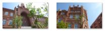
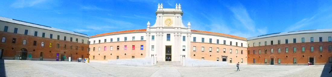
Comillas Pontifical University is a private institution run by the Society of Jesus. Pope Leo XIII founded the Seminary of St. Anthony of Padua in 1890 in the town of Comillas, Cantabria, in order to educate local candidates to the priesthood. In 1904, the seminary was raised to the status of a Pontifical university when Pope Pius X granted the school the power to confer academic degrees in theology, philosophy and canon law. In 1978, the school was expanded to include Schools of Engineering, Law, and Business and Economics. Nursing was added some six years later.
|
We continued down the street, and I photographed an interesting residential building that actually overlooked a small, sunken park catty-corner across the intersection. That was where we went next.
We were going to turn south by the little park anyway, so we went down the park stairs to where there were some older men playing what at first I thought was bocce ball, but which I later found out was a game called Pétanque. Pétanque is a relative of other outdoor bowling sports (including bocce); all of these sports share the objective of playing one or more balls towards a target ball. In Pétanque the objective is to score points by having balls closer to the target than your opponent after all balls have been thrown. This is achieved by tossing balls closer to the target (cochonnet) or by hitting the opponents' balls away from the target, while standing inside a circle with both feet on the ground. As it was here, the game is normally played on hard dirt or gravel.
We left the park and continued down Calle Conde Duque walking south again, and this brought us by the ornate entrance to the Conde Duque Cultural Center. These former military barracks were designed by the Baroque architect Pedro de Ribera and constructed in the early 1700s. After being entirely remodelled, they were reopened in 2011 as one of the most representative multidisciplinary cultural centres in Madrid. When you come through the arched entrance, you're on an old parade ground, and the center's entrance is across from you. Here's a panoramic view:
|
From the cultural center, we went back out to Calle Conde Duque and continued south to Plaza Cristino Martos.
|
|
From earliest times, there was a fountain here- fed by ancient aqueducts. That ornate neighborhood fountain actually went missing in the 1870s. The old fountain has not returned, but as we would see shortly another fountain has taken its place.
At left you can see the square's most interesting building- Casa Antonio Mingote. Don Antonio Mingote Barrachina, 1st Marquis of Daroca (1919 – 2012), also simply known as Mingote, was a Spanish cartoonist, writer, and journalist. He drew a daily cartoon in a Madrid newspaper from 1953 until his death in 2012. The building that carries his name is decorated with cartoons- some that he drew and some in his style. Here are a few of them:
|
The square is actually above the level of the Calle Princesa, and leading down to that street is the double staircase of the monument to the bacteriologist Jaime Ferrán.
|
|
|
Tuberculosis is another disease in which Ferran was always deeply interested. Some of his ideas on the transmission and virulence of tuberculosis were revolutionary. He died in 1929 and is buried in Barcelona.
From the Ferran Monument we needed to head south towards West Park, our next destination, and we could see that in a plaza by the buildings across Calle Princesa there were a number of places where we might get a snack for lunch, so we headed over there. We crossed Calle Princesa right in front of the Emilia Pardo Bazán monument, and reaching the plaza decided to just stop at McDonalds for a burger and a drink. Then we made our way through the plaza to a street that would take us south to the park.
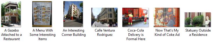
Walking down Calle Ventura Rodriguez towards the park, we took some random pictures of some interesting street scenes that we found quirky or interesting. Here are some of those candid shots:
|
At the bottom of Calle Ventura Rodriquez, we reached Calle Ferraz, and the Park of the West was across the street.
Parque del Oeste
The Parque de la Oeste will be the first of numerous parks and gardens that we'll see today. The Western Park occupies a good chunk of northwest Madrid, but before the 20th century, the land that the park currently occupies was the main landfill of the city. In 1906, Madrid's mayor, Alberto Aguilera, requested landscape artist Celedonio Rodrígáńez to design a place for walking and relaxation.
|
We plan on strolling through this end of the park, exiting at its far southern tip- the point closest to the gardens of the Royal Palace, which will be our next stop.
No sooner had we crossed Calle Ferraz and walked over to the stairs up into the park than we came to the first of the many monuments that are sprinkled throughout the park.
|
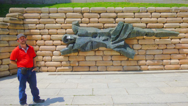
In July 1936 the barracks, then on the outskirts of Madrid, was the headquarters of an Infantry Regiment under the command of Colonel Moisés Serra Bartolomé. On July 19, General Fanjul, part of the coup attempt, entered the barracks, proclaimed a state of war, and demanded the backing of the troops housed there (as well as some 140 young cadets who were also there). He expected reinforcements from other encampments involved in the coup, but these did not come.
That afternoon, the barracks was surrounded by loyal government troops loyal to the government; on the 20th they began an air and ground siege. After a few hours, a white flag was raised by some of the troops, although it is unclear whether the whole barracks wanted to give up. With air support, the barracks were retaken- with great loss of life, including many of the young cadets. General Fanjul, his son, and other officers were tried and executed by the middle of August. The building itself, severely damaged in the seige, was in ruins by the end of the Civil War; those ruins remained into the 1960s. Around 1970, the site was given to the City of Madrid for a park.
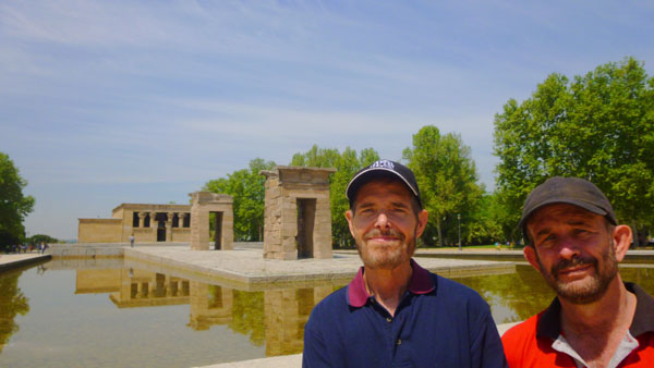
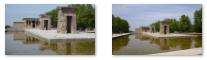
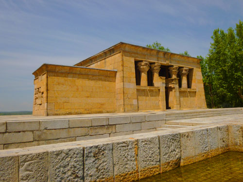
The park of the Cuartel de la Montańa was inaugurated on July 20, 1972 (when Francisco Franco was still in power), and in memory of the men who died in its defense this monument was erected. It consists of the bronze figure of the mutilated body of a man, placed in the center of a wall built in the form of sandbags. On the same day, the Templo de Debod was also inaugurated; it is on the site once occupied by the barracks. To see the temple, we walked up the broad stairs to it.
|
|
You might wonder why the temple is now here in Madrid, thinking perhaps that this is another example of a European country looting the cultural heritage of some other nation (and certainly that has happened). But your clue as to why the temple is here and not still on its original site in Egypt should be just where in Egypt that site was.
|
The temple was to be rebuilt in one of Madrid's parks, and it was fortunate that it was just at this time that plans for the new Parque del Oeste, near the Royal Palace of Madrid, were taking shape. The temple was moved here in 1969 and opened to the public in 1972.
The reassembled gateways have been placed in a different order than when originally erected. Compared to a photo of the original site, the gateway topped by a serpent-flanked sun was not the closest gateway to the temple proper. It constitutes one of the few works of ancient Egyptian architecture that can be seen outside Egypt and the only one of its kind in Spain.
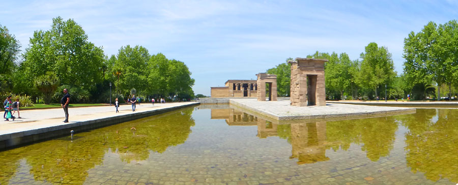
I made two panoramic pictures of the temple. The first was from the front of it:
|
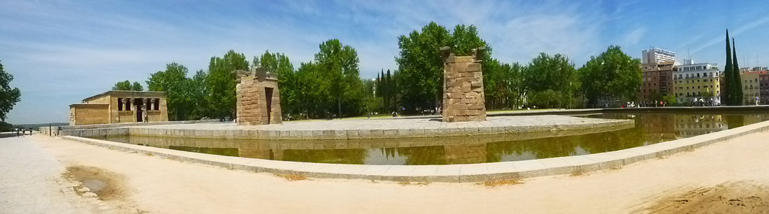
And another was made when we walked around the south side of the temple installation and were walking towards the temple building itself:
|
We continued walking towards the other side of the park (which is very narrow here) and came abreast of the temple proper. The overlooks were just ahead of us.
|
Here are just a few of the views from the overlook:
|
The views from the overlook were very nice, although the hill we were on was not so high as to make them really impressive.
|
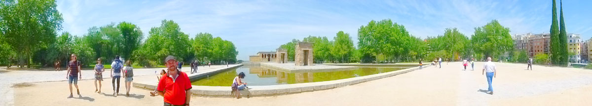
And here is one more panoramic view of this part of the park which, as we were approaching lunchtime, was filling up with office workers and picnickers:
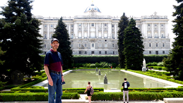
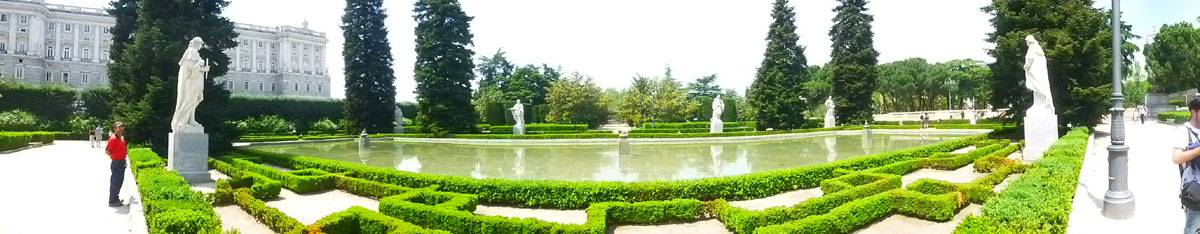
Sabatini Gardens
From the Parque del Oeste, we descended to street level and walked along a typical residential street to the south to cross Cuesta San Vincente to the north end of the Sabatini Gardens. Then it was up again, via some long, sloping stairs, to the gardens themselves.
|
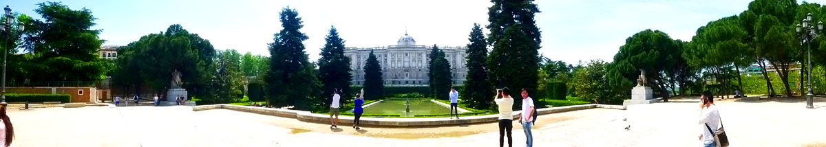
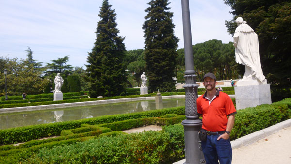
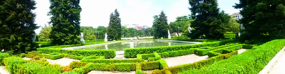
The Sabatini Gardens are actually part of the Royal Palace complex; they were opened to the public by King Juan Carlos I in 1978.The gardens have a formal Neoclassic style, consisting of well‑sheared hedges and trees in symmetric geometrical patterns and shapes, adorned with a pool, statues, and fountains. The tranquil array is a peaceful corner from which to view the palace.
Coming up onto the level of the gardens, we found ourselves on on open plaza with views to the northeast- including the Spanish Senate building (the curved building at right):
From that plaza, we walked through some trees and past a nice circular fountain to come around where we could get our first view of the Palacio Real.
|
Just from the short time we were here today, it was obvious that this would be an ideal place to chill, relax a little bit, read or just people-watch. I mean, look at the quiet pool, the statuary, the manicured hedges and trees, and the shade, and this would appear to be an ideal spot to relax.
But locals will tell you that some of the attraction of the Sabatini Gardens lies in some of that quirkiness I mentioned already. It's like going to IMDB and looking through the trivia for just about any movie; there are always surprising things you wouldn't have expected, and in the same manner there are oddities connected to the Sabatini Gardens.
For example, take the name "Sabatini Gardens". The "Sabatini" refers to Italian (not Spanish) architect Francesco Sabatini (1722–1797), and you might think that he was the architect of the gardens. But he wasn't; in fact, he had nothing at all to do with them. Sabatini designed, among other things at the Palacio Real, the royal stables (which were previously located at this site).
|
Sabatini died in 1797; the gardens were not begun until the stables were cleared away in 1933. And the gardens weren't completed until the 1970s when they were opened to the public in 1978 by Juan Carlos I after Francisco Franco died.
|
So that's the oddity; the Sabatini Gardens are one of the very few landmarks in Madrid whose name refers not to their creator, or to their benefactor, but to the creator of something that had stood in its place before!
|
(Mouseover Image Above for Video Controls) |
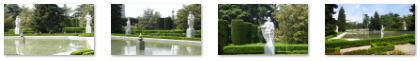
Here are a few more views from the upper level of the gardens. There are a couple of the Palacio Real, and two of the statues atop the pedestals beside the stairs down to the pool:
|
As we walked down the stairs from the upper level to the level of the statuary and pool, I made a movie looking around the garden. And a street performer kindly added a musical soundtrack.
Once down at the level of the pool, we first walked over to the east side of the gardens as we saw an interesting stairway up to the street level and also a monument we wanted to investigate.
|
Charles III (1716 – 1788) was King of Spain (1759–1788), after ruling Naples as Charles VII and Sicily as Charles V. He was the fifth son of Philip V of Spain, and the eldest son of Philip's second wife, Elisabeth Farnese. A proponent of enlightened absolutism, he succeeded to the Spanish throne on 10 August 1759, upon the death of his half-brother Ferdinand VI, who left no heirs.
In 1731, the 15-year-old Charles became the Duke of Parma and Piacenza, as Charles I, following the death of his childless granduncle Antonio Farnese. In 1738 he married Princess Maria Amalia of Saxony, daughter of Augustus III of Poland and an educated, cultured woman who gave birth to 13 children, eight of whom reached adulthood. Charles and Maria Amalia resided in Naples for 19 years.
As King of Spain, Charles III made far-reaching reforms such as promoting science and university research, facilitating trade and commerce, and modernizing agriculture. He also tried to reduce the influence of the Church and avoided costly wars. His previous experience as King of Naples and Sicily proved valuable. He did not achieve complete control over the State's finances, and was sometimes obliged to borrow to meet expenses. Most of his reforms proved to be successful and his important legacy lives on to this day. Historians have written that Charles III was probably the most successful European ruler of his generation. He had provided firm, consistent, intelligent leadership. He had chosen capable ministers and his personal life had won the respect of the people.
|
(Click on Thumbnails to View) |
You might wonder about the wisdom of putting valuable statues in the middle of a public park, but the Sabatini Gardens have hours when they are open and hours when they are not. And when they aren't, there is security around, so the statues and the whole landscaped ensemble are relatively protected from vandalism.
So, that’s the Sabatini Gardens: a beautiful (if completely artificial) place set out in central Madrid, named after an architect who didn’t build it, and filled with statues that were never meant to stand there. Quirky enough for you? Here is one last panoramic view of the pool, gardens and statuary:
|
We walked back to the north end of the gardens to find the stairs down to the street that would lead us (we thought) to our next stop in the Campo del Moro Gardens. Just before we descended the stairs, we got a good view of that street- Cuesta San Vicente.
The Campo del Moro Gardens
From the Sabatini Gardens, we made our way down to Calle San Vincente where we thought we would find an entrance into the Campo del Moro- a large park that occupies the slope of land that extends from the Palacio Real to the Manzanares River valley.
|
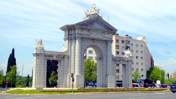
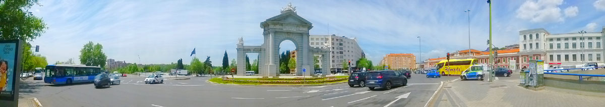
Coming down from the Sabatini Gardens, we could look down Calle San Vincente all the way to a gate or monument we could see in the distance. The entrance that I thought we would be able to enter to get inside the Campo del Moro is just at the left in that picture. We walked down to the entrance where we found a military guard shack and an obliging guard who spoke English quite well.
This was not a public entrance, he explained, as the road was actually used by officials coming and going from the Palacio Real. He pointed us in the direction of the western side of the park where he said we'd find the public entrance. No problem, as we would have walked down that way in any event, so we headed on down Calle San Vincente. While I was talking to the guard, Fred snapped a picture of one of the park's two major fountains- the Fountain of the Tritons. We hoped that when we actually got inside the park we'd be able to get closer to that fountain to have a look.
Walking down Calle San Vincente, we were walking just outside the walled Campo del Moro, heading down towards the west. We could see the Puerta de San Vincente ahead of us down at the intersection. Over on the other side of the street, we passed the Estación del Norte (North Station), which was built with French resources to be the terminal station for the railway connecting Madrid with the French border. The Modernist building has a façade flanked by two towers.
After losing its function as a railroad station, the Estación del Norte was closed for several years until it was renovated and reopened to serve as an important transport junction with the Metro and local and long-distance bus service. It has also become a leisure and cultural center and a mall with all kind of stores and restaurants.
|
|
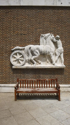
Down at the intersection, we came to the Puerta de San Vicente- a monumental gate created by the architect Francesco Sabatini that has stood here since the late 1700s. In 1726, the Marquis of Vadillo commissioned a monumental gate here to replace a ruined earlier one. The gate, which consisted of three arches, was adorned with a statue of St. Vincent, for whom it was named. That gate was demolished in 1770 when the area was reorganized. Soon after, King Charles III commissioned Sabatini to build the new gate, which was completed, along with a fountain, in 1775.
The new gate was a bit closer to the river than the previous one, built of granite and limestone, and ornamented with two Doric columns on the outside and two pilasters, also Doric, in the interior. It was crowned by a triangular frontispiece topped with a military trophy. But in 1890 or 1892 the gate was dismantled to improve traffic in the area; pieces of it were supposed to have been taken to a municipal storage facility that was once nearby. A hundred years later, the city of Madrid decided to re-erect the gate in the same place (although this time it would be in the middle of a traffic circle) but not all the original pieces could be located. That necessitated the construction of a replica, based on old descriptions, drawings, and a photograph or two. Some molds were found for the upper cornices, and enough column fragments remained so that they could be reconstructed also. So the gate you see here is mostly only about a quarter-century old.
As we turned the corner to head south to the entrance to the Campo del Moro, I did a panoramic view of the gate and its intersection:
|
A short ways down the street, we came to what is apparently the only public entrance to the Campo del Moro. Probably because it was the only entrance, there was a short line to get in. The Campo del Moro is the capital's most meticulously maintained park as it lies with the direct line of sight of the Royal Palace. The positioning of the park, behind and below the palace, means that it is often completely overlooked by most visitors who miss out on one of the best green areas of the city.
|
The Campo del Moro Madrid were once the private grounds of Spain’s nobility and the gardens stretch out from rear of the Palacio Real in a westward direction to the Manzanares river valley. The Campo del Moro was styled as to reflect an English garden and hidden in the grounds are ornamental pools, tree lined walks and wide lawns. The Moorish Gardens are a perfect place to escape the tourist crowds and are highly recommend for visitors who wish to discover the hidden side of Madrid.
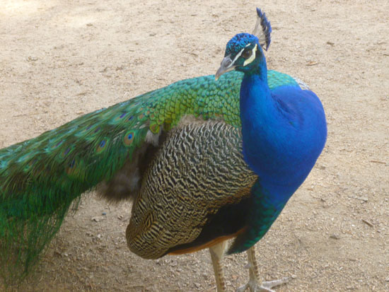
Immediately after beginning our walk, we could tell that this park seemed to be well-kept-up, and that seemed to reflect the value that Madrid places on this huge oasis. But we learned from one of the park signs that Campo del Moro is actually managed by the National Trust of Spain, and not the local government of Madrid.
|
|
(Mouseover Image Above for Video Controls) |
Perhaps it's just because we don't see them very often, but we found the peacock very photogenic, and we took a number of pictures and movies. Some of the best were Fred's closeup views of the bird's feathers. So if you would like to see more of the peacock, you can look at some of the pictures and watch some of the movies below.
|
|
(Mouseover Image Above for Video Controls) |
(Mouseover Image Above for Video Controls) |
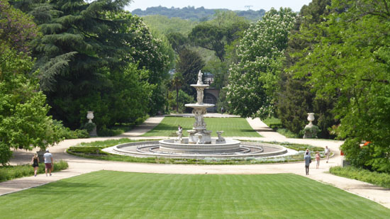
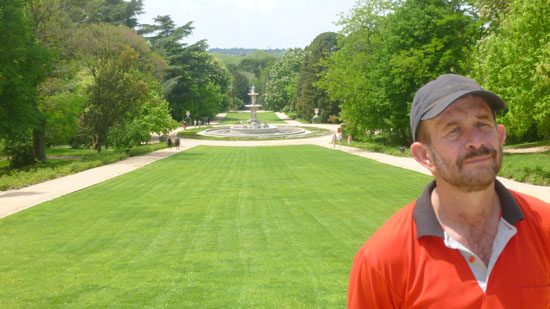
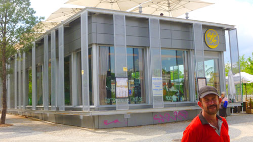
These gardens beneath the Palacio Real were designed to mimic the gardens surrounding the palace at Versailles; nowhere is this more in evidence than along the east–west Pradera, a lush lawn with the Palacio Real as its backdrop. The gardens’ centerpiece, which stands halfway along the Pradera, is the elegant Fuente de las Conchas (Fountain of the Shells), designed by Ventura Rodríguez, the Goya of Madrid’s 18th-century architecture scene. This fountain, which was not on when we passed by, made the Pradera even more striking. In addition to the pictures you've already seen, you might also be interesting in looking at one of Fred's closeup views of the fountain.
|
|
When we got to the top of the Pradera, we were right below the balconies of the Palacio Real, and the views back west down the Pradera towards the Paseo Virgen were very pretty; a couple of them are above. Incidentally, the name "Campo del Moro" translates into "Park of the Moors", a name that dates back to 1109. The early 12th century saw multiple skirmishes between the Muslim Moors and the the Christians crusaders. During on major invasion the Moorish leader Yusuf Ali camped his troops on these grounds before an unsuccessful attack.
|
|
For the rest of our visit, we just wandered through the southern part of the garden, down the walks and past a pond. Here are some of the pictures we took during this part of our walk:
|
This area was only developed as a garden fairly recently, as it was not possible to connect the area to the Royal Palace, which was situated at a much higher altitude. This position was exploited to create one of the best views in Madrid, with the Royal Palace looming beyond an expansive green tapestry, surrounded by monumental fountains within an ample and shady romantic garden.
Walking Along the Manzanares River
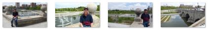
We weren't quite sure what we would do after the Campo del Moro, but when we walked south along Paseo de la Virgen we could see that the river next to us had, apparently, been turned into something of a Madrid Riverwalk, and so we decided to go over and have a look.
|
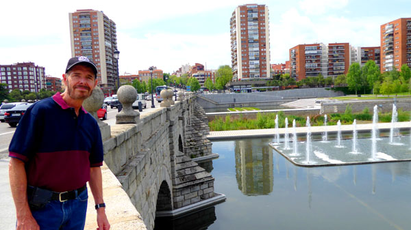
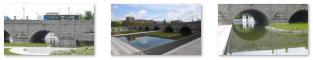
The Bridge of Segovia was designed by Juan de Herrera under a commission from King Philip II of Spain; it was built from 1582 to 1584 and has a total of nine arched spans. The bridge cost about 200,000 ducats- which is about $60 million today, and it is composed of bricks of granite. The bridge was declared a Cultural Monument in 1996.
|
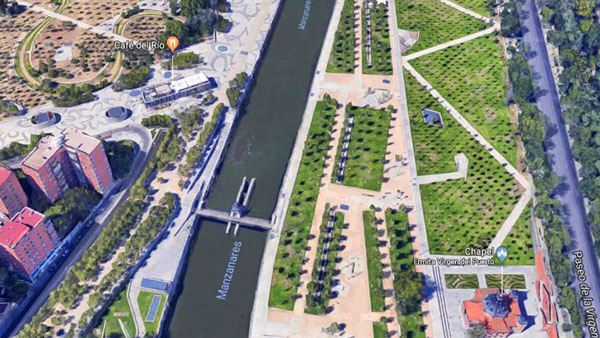
This bridge, of course, crosses the Manzanares River, which has its headwaters in the Sierra de Guadarrama, passes through Madrid, and eventually empties into the Jarama river, which in turn is a tributary to the Tagus. In its urban section, the Manzanares River as it appeared to us today was not much of a river, and is only in some parts navigable by canoes. But years of channeling and damming have at least created an urban ribbon of water which, at many times of the year, can be six feet deep.
|
|
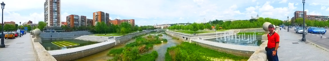
Comparing what we saw today with the aerial view indicates that there must be times of the year when there is a good deal of water in the river, and it may be for those times that what appeared to be dams and spillways have been constructed. Certainly there was not much water flowing in the river today.
The river Manzanares, although small and relatively unimportant geographically, has had a great historical importance due to its close relation to the city of Madrid. The city was founded by the Moors as a citadel overlooking the river in the ninth century. The river is featured in many paintings of the late 18th to early 19th-century painter Francisco de Goya; these show traditionally dressed Madrileńos in activities like dancing or having picnics next to the river.
From the middle of the bridge I let my little camera make a panoramic view. In this and other pictures you can see clearly that the river channel was not nearly full today:
|
The Manzanares was also an important defense line for the Republican forces during the Siege of Madrid in the Spanish Civil War, and many bunkers can still be seen along it. The Bridge of Segovia was of crucial importance because of its strategic location. There, nationalist forces were repeatedly repelled and denied access to Madrid’s city center.
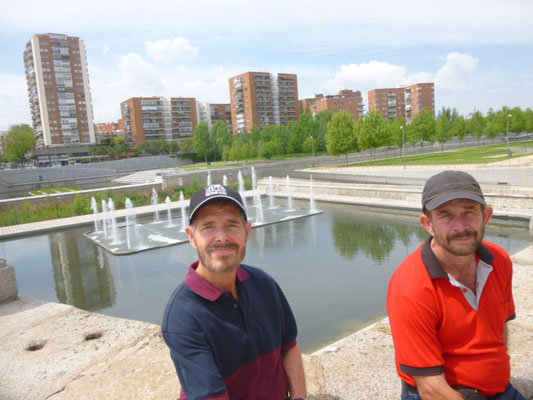
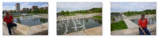
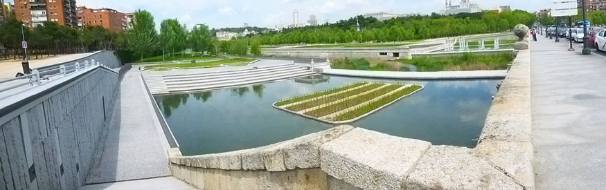
When we got to the other side of the Segovia Bridge, we could see that there were walkways, fountains, and pools that have turned the course of the river into a landscaped promenade. And it appeared that the work had been done in such a way so as to ensure that if and when the river floods, what has been constructed will not be swept away or even damaged by being submerged for a time. Here are some views of these features of the Manzanares "riverwalk":
|
|
As we began walking up the west side of the river, we could look back at the central spans of the Segovia Bridge, and ahead of us at what appeared to be a dam. With so little water in the river, it was hard to see how the dam might work.
|
|
Finally, we came to the entrance to the park that had appeared on our left; it turned out to be the Casa de Campo (Spanish for "country house")- the largest public park in Madrid. The park got its name because the entire area (almost seven square miles) was once a royal hunting estate.
|
(Mouseover Image Above for Video Controls) |
|
Inside this huge park is an amusement park and the Madrid Zoo. In 1936–39, during the Spanish Civil War, the front lines of the Siege of Madrid ran through the Casa de Campo, where the Republicans had halted a nationalist offensive in November 1936. There are trails crisscrossing the park for running, walking, and mountain biking, and some of the less frequented parts of the park showcase Madrid's natural semi-arid beauty with red soil and scruffy pine trees.
|
We didn't actually go into the park; it would have taken us much, much longer than we had to see a tiny fraction of the park. But here near the riverside entry we did take a number of other pictures, and some of them are worth including here:
|
We walked back to the east side of the Manzanares and up the hill towards the Puerto San Vincente. We walked around the back side of that monumental gate (we saw its front side earlier before we went to the Campo del Moro) and into the Príncipe Pío station.
|
(Mouseover Image Above for Video Controls) |
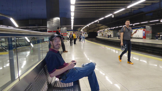
The station has three levels. The highest level is elevated, used by Cercanías trains and has an island platform. The middle level is partially underground, used by Madrid Metro lines 6 and 10 trains and has a dual-island platform and four tracks in a cross-platform interchange. Line 6 trains use the two inner tracks while Line 10 trains use the two outer tracks. The lowest level is used by Line R trains. It has two side platforms and both of them are used by trains to and from Ópera station.
We are going to head down to the lowest level to catch a train that will take us back to the Embajadores station near the condo.
An Evening Walk and Dinner
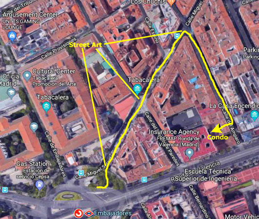
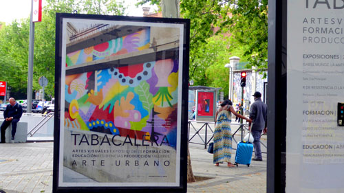
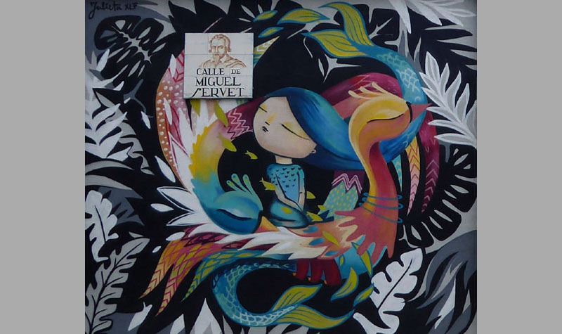
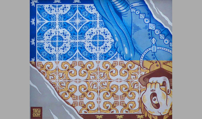
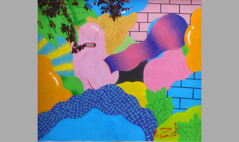
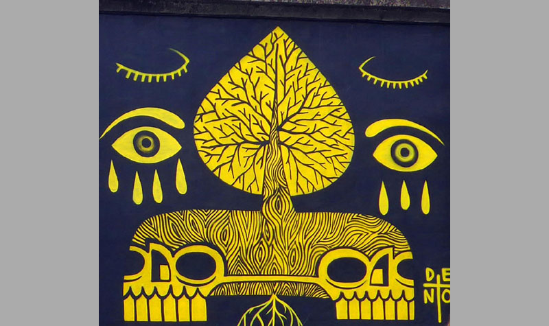
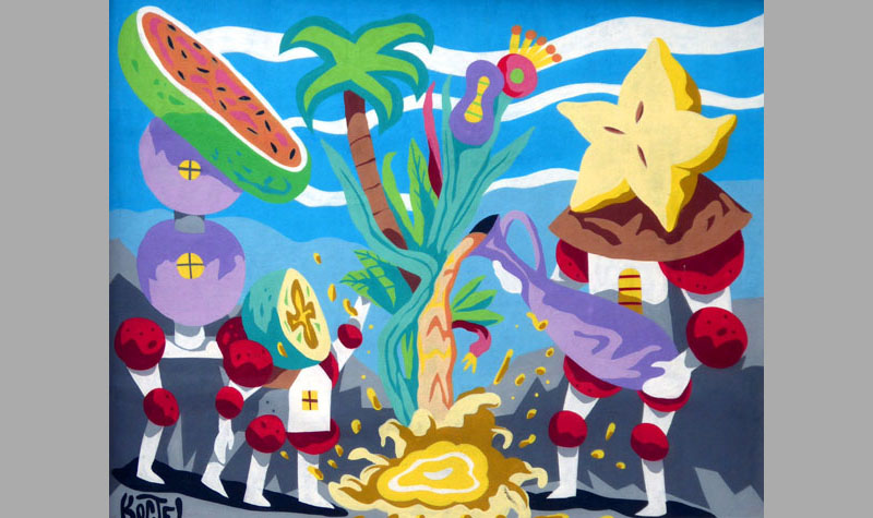
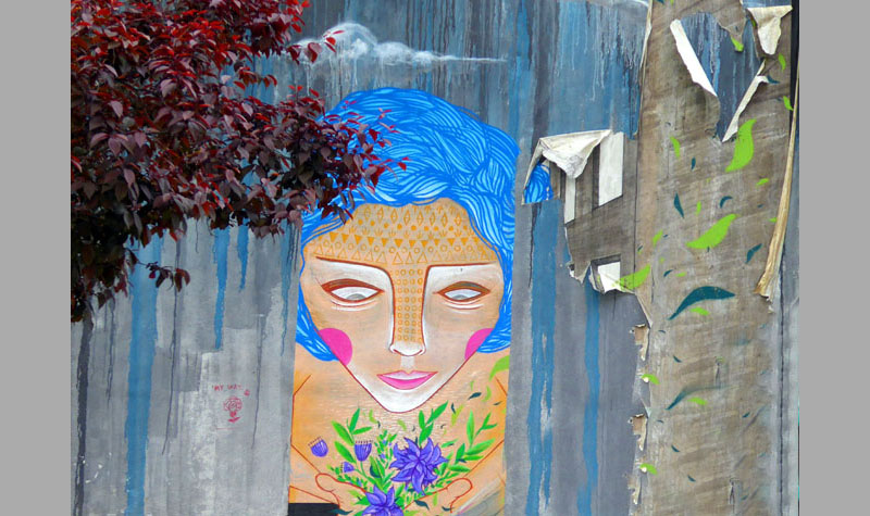
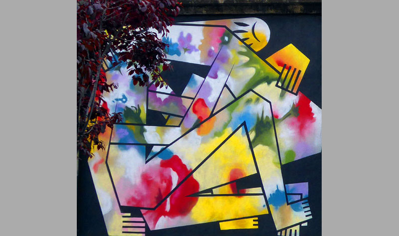
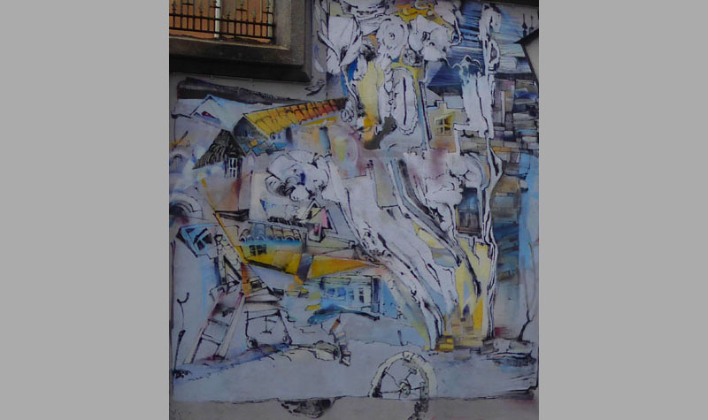
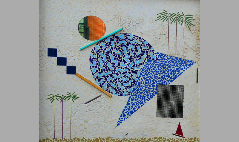
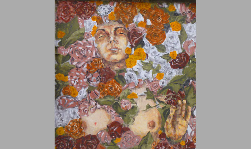
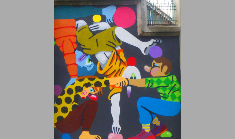
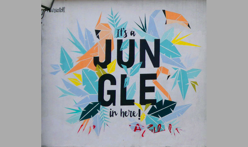
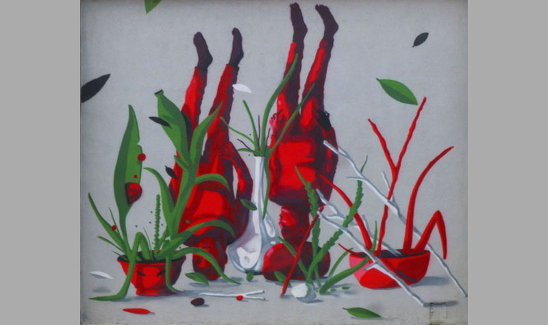
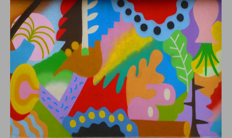
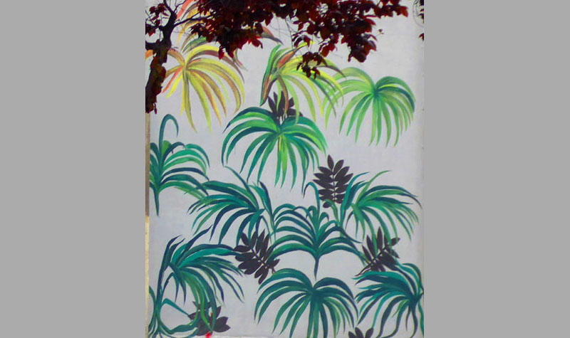
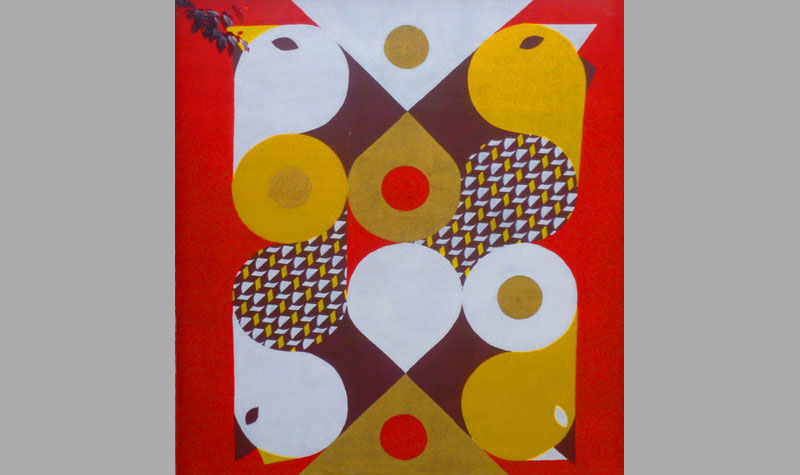
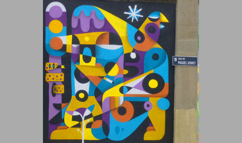
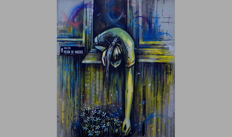
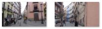
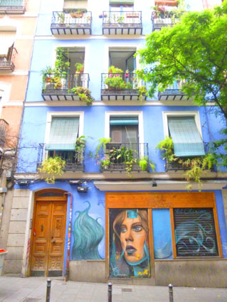
When we came up from the underground Metro at Embajadores, we saw a sign advertising what was apparently a semi-permanent exhibition of "street art"- in this case, wall paintings along Calle Miguel Servet.
|
|
As with many organizations like it around the world, it also seeks to play a role in social transformation- in this case bringing art out of the museums and into the spaces where people live. This particular organization is headquartered in the old Fábrica de Tabacos de Embajadores (Embajadores Tobacco Factory)- a building which itself has been listed on Madrid's register of historic places. That building was, apparently, behind this decorated wall on the north side of the Embajadores square.
|
|
I wanted to keep a record of these artworks, and let you look at them, too, and the best way to do that is in a slide show. It's easy to go from one artwork to the next- just use the little arrows in the lower corners of each slide. There are 23 slides (one of which has two tall narrow works on it), so you can track your progress through the show by referring to the index numbers in the upper left corner of each slide. Enjoy looking at the street art along Calle Miguel Servet!
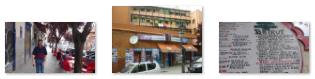
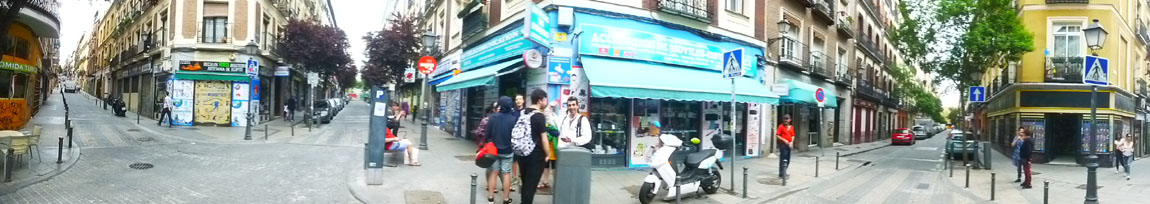
We continued up Calle Miguel Servet to Calle Amparo, finding a little restaurant we would come back to for dinner. Here are some street scenes along Miguel Servet:
|
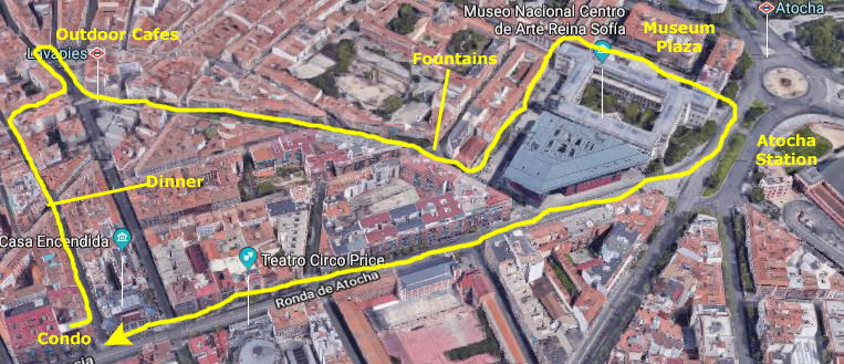
Before dinner, we went back to the condo (which was just down the street) for a little while; then we came back up Calle Amparo to the little doner kabap which was on the corner at Miguel Servet. After we finished eating, we decided just to wander through the area north and west of the condo, just to see what we could see this evening.
|
Right after we finished eating, we continued north through some of the narrow neighborhood streets, and that's where Fred got these views:
|
When you get back into these narrow residential streets, it is interesting how they encourage people to gather at the intersections, where four or more streets might come together. And once you get off the main streets, the side streets are almost exclusively residential, although you will see a few cars parked or moving slowly along.
|
|
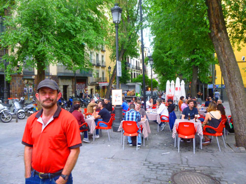
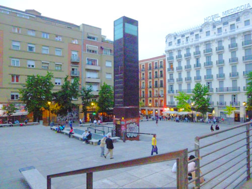
When we reached the Lavapies square, we found that almost the entire square was given over to outdoor restaurants and that most of these were full. But this seems typical of most European cities, since they are not given over to the automobile as are most American cities are.
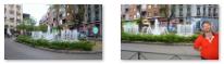
From Lavapies, we just walked in the direction of the museums and Atocha, and found this charming little square with a nice fountain:
|
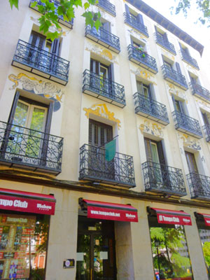
One of the buildings bordering the square where we found the fountain was also one of those with interesting, whimsical decoration; it was, as you can see, a restaurant and bar.From that square we walked over towards the Reina Sofia museum and the Juan Goytisolo plaza in front of it.
|
|
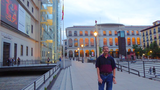
On the west side of the plaza is the beautiful building housing the Madrid Conservatory of Music, and the front of the Reina Sofia Museum, with its distinctive glass elevator towers is located on the south side of the square. (The north side is commercial buildings, and the east side is a large hotel.) There is an obelisk in the center of the plaza and also a monument to Goytisolo.
East of us there was a passageway to Atocha, and we could see the station getting lit up at dusk. So we walked through the passage and across the street so I could get a last picture of Fred and the Atocha Station.
It was 9:30 and getting dark, and we had to be up early for the cab that would be picking us up at 7AM for our trip to the airport and our flight home, so we decided to end our walk here and head back to the condo. Walking through Madrid today and yesterday has been a real treat, but having been away from home now for about six weeks, we are ready to head back. But Madrid is on our list of places to return to, as we have just scratched the surface of what there is to see.
You can use the links below to continue to another photo album page.
|
May 10, 2018: The Madrid Condo and Trip Home |
|
May 8, 2018: A Walking Tour of Madrid |
|
Return to the Index for Our Visit to Madrid |