|
May 1, 2018: A Transit of the Suez Canal |
|
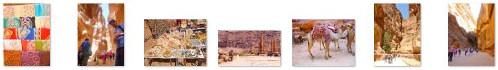
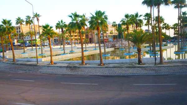
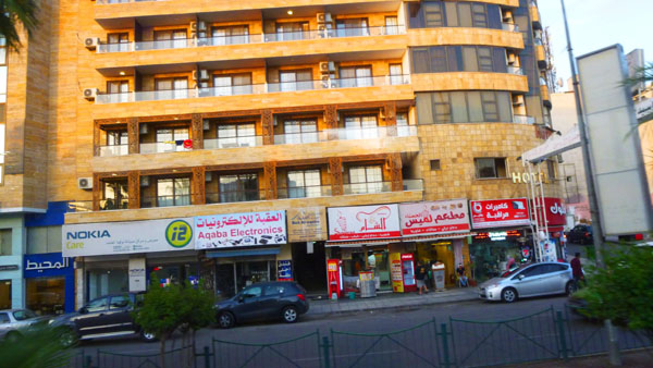
April 22, 2018: A Walking Tour of Dubai (UAE) |
|
Return to the Index for 2018 |
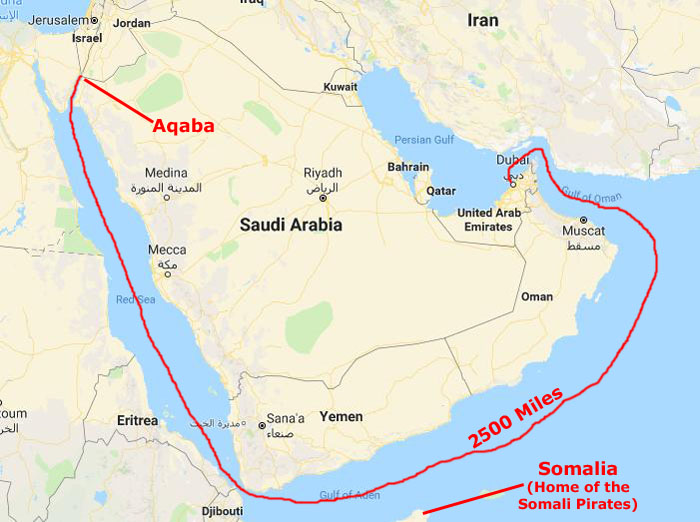
We steamed out of Dubai on the evening of April 22nd, and awoke on the 23rd as we made our way through the Strait of Hormuz and down into the Gulf of Oman, a little over 100 miles into our 2500-mile trip to Aqaba, Jordan.
|
That's where the fun began. The captain announced that at night the ship would be dimming its outside lights so as not to attract the attention of Somali Pirates. And, he went on, if we did attract their attention, then the "security personnel" that had come on board in Dubai would help the crew with any problems that might arise. (This explained the rather large gentlemen that we saw occasionally on the ship that we thought were construction personnel.) We started thinking that they should have brought Tom Hanks on board.
For the next three nights, as we passed by the Horn of Africa and into the Red Sea, these precautions continued, and it wasn't until we were north of Eritrea that nighttime activities resumed up on deck (although they had never slacked off in the interior of the ship). Since it is highly unlikely that we will take a cruise with this routing again, this was our first and last experience with even the risk of piracy at sea.
Our time on board settled into a routine during these six days. We'd arise, have breakfast, and then I'd go reserve a table in the card room for our bridge game. We'd play (mostly Greg, Zoran, Susan, Richard, Fred, John Lambert, and myself rotating in and out) until twelve-thirty. Then we'd break for lunch, and reconvene about 2PM for another couple of hours- until we got run out of the card room so they could set up for a cocktail party for their Pinnacle and Diamond frequent-sailors. Fred and I would do our time in the gym, and then we would alternate between dinner in the dining room or dinner in the Windjammer Cafe. After that, Fred and I would usually take in the evening show and then wander the ship after that. Lots of people think cruises are boring, but there is always a lot to do, even during this longest series of continuous sea days that we have experienced.
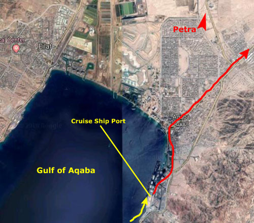
Docking in Aqaba
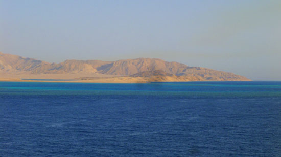
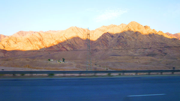
By the morning of April 29, we were getting close to the cruise ship port in Aqaba, at the very top of the Gulf of Aqaba. For the last day or so we have been heading north in the Gulf with Egypt on our left and Saudi Arabia on the right.
|
|
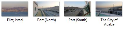
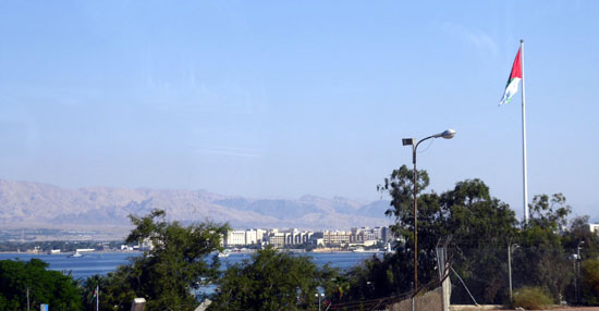
The captain pointed out the last point of land that we passed that was actually part of Egypt; the border with Israel was just north of that, and so for the last few miles we had Israel on our port side. Jordan has been on our starboard side for the last hour or so. So as we pulled into our dock, we could see the city of Eilat, Israel, ahead on our left and the city of Aqaba straight ahead (and of course the dock was in Aqaba as well. As a matter of fact, Fred took out his zoom and got a pretty incredible closeup shot of Israel-Jordan border crossing.
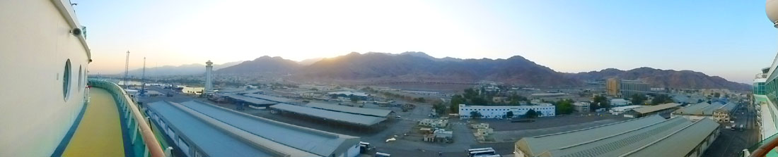
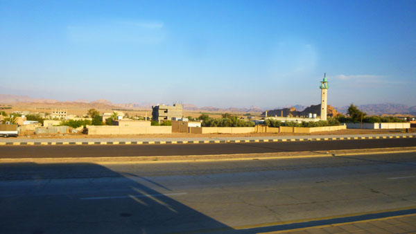
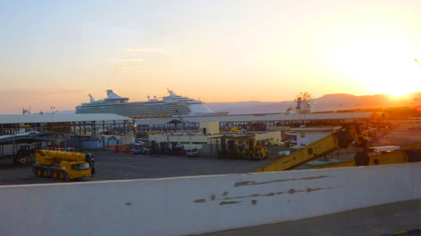
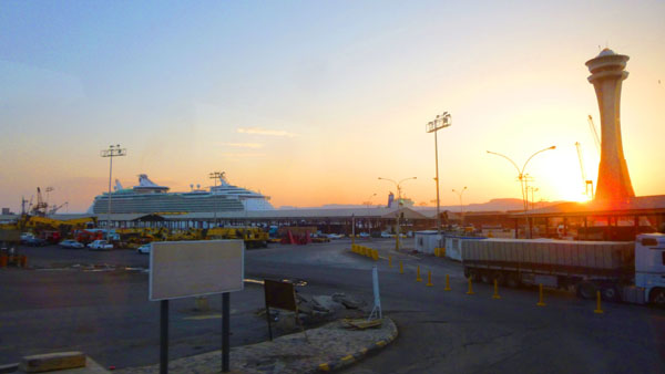
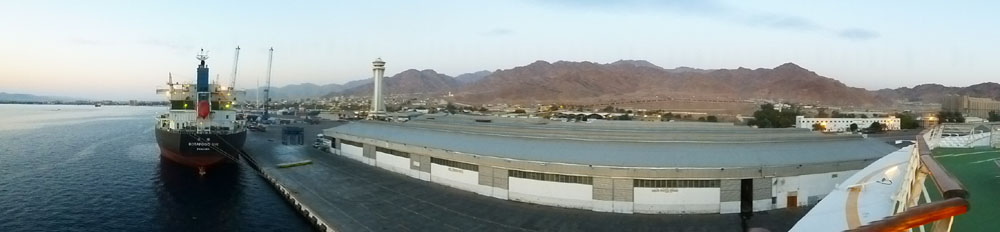
As we settled into the dock, I took a panoramic view of the cruise ship port. The view looks east, and everything you see is in Jordan.
|
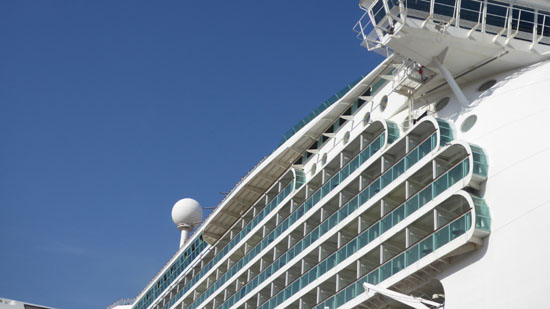
I usually like to be up on deck when we come into ports; I find the work that the crew and the staff on shore do to bring the ship to rest against the dock very interesting, and one can always watch the other preparations for excursions and stuff.
|
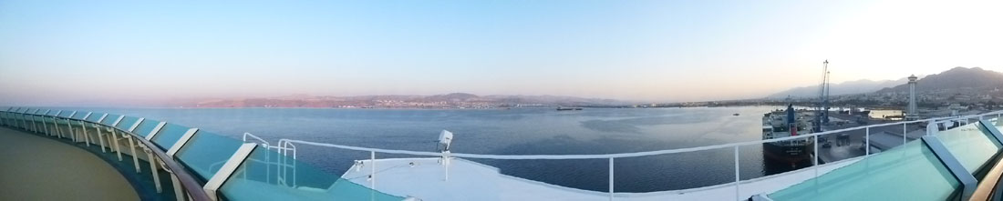
Here is an interesting view (as much for the way the panoramic function in the camera dealt with the bow of the ship itself) looking across the north end of the Gulf of Aqaba and the cities of Eilat, Israel (to the left) and Aqaba, Jordan, to the right:
|
I should say that we actually arrived in Aqaba a few hours early; if I didn't say so earlier, it is about five-thirty in the morning, rather than 8AM, which I think was supposed to be our docking time. We hurried into port because we had a medical emergency (one of four or five on this cruise); a passenger went into kidney failure yesterday, and the closest hospital was here in Aqaba. I didn't photograph them, but there were two ambulances waiting for us at the dock. As Susan later told us, the medical officer told her that when the man got to the Aqaba hospital, they refused him admission as they did not have the facilities necessary to deal with him. Apparently, he had to be rushed over to Eilat's hospital, and this took a good deal of diplomatic legerdermain.
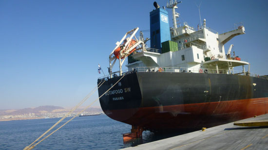
A few hours later, when we got off the ship for our excursion to Petra, we got some pictures of the area of the ship where our cabin was and of the cargo ship docked ahead of us:
|
|
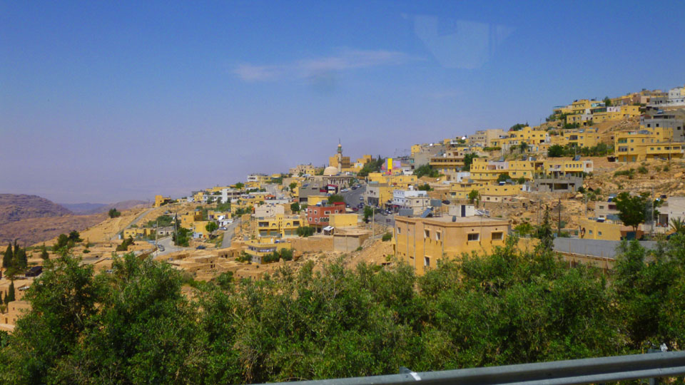
The Drive to Wadi Musa
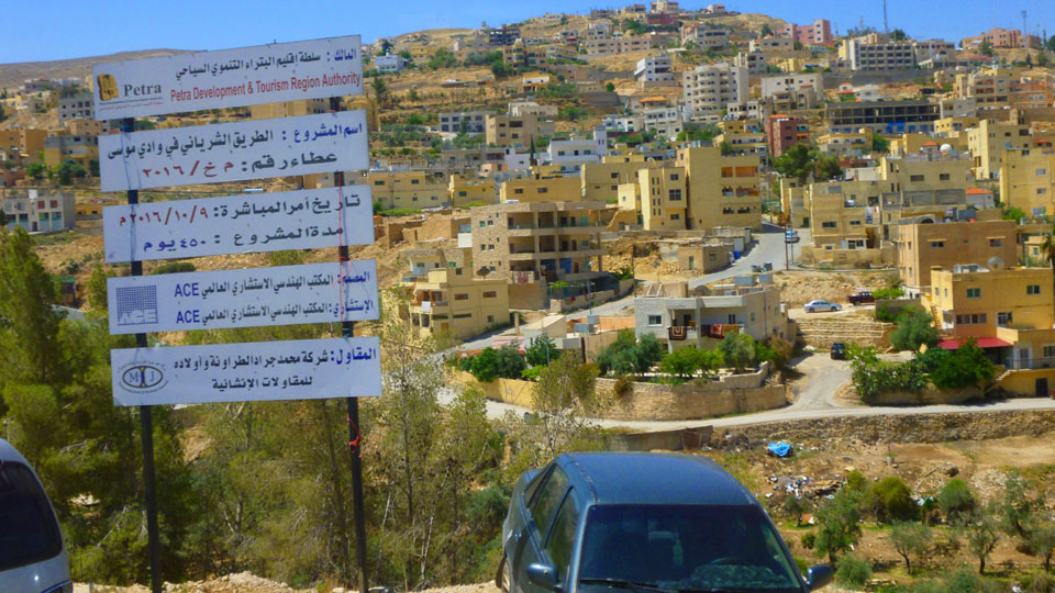
We were off the ship at 9AM to board our tour bus for the excursion to Petra. To get there, it's a 2-hour ride north through Jordan to the town of Wadi Musa.
|
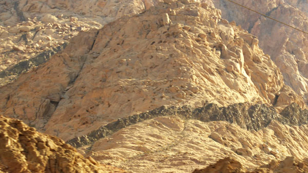
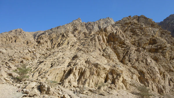
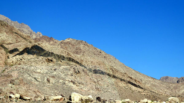
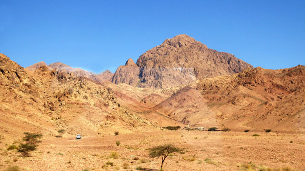
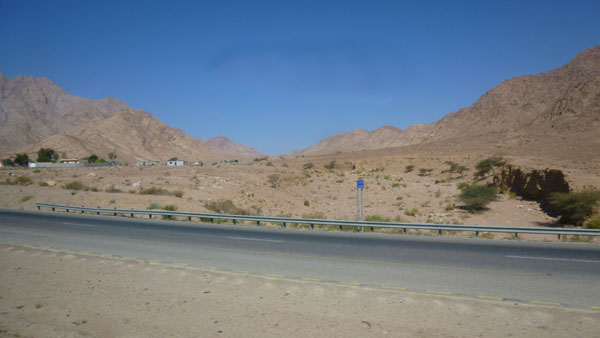
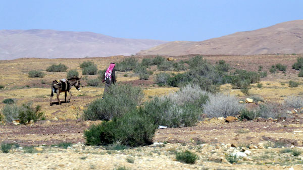
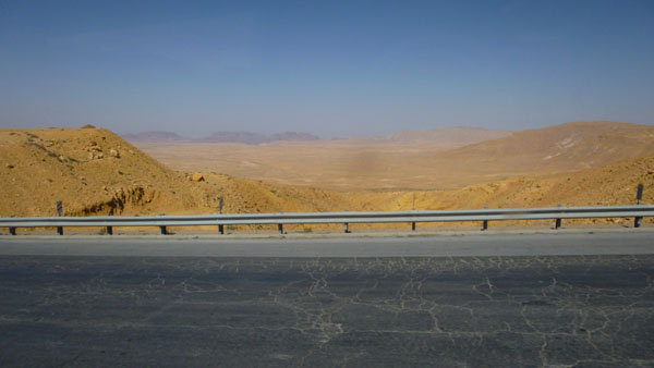
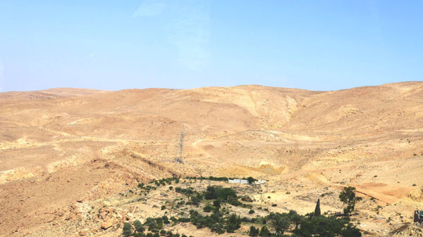
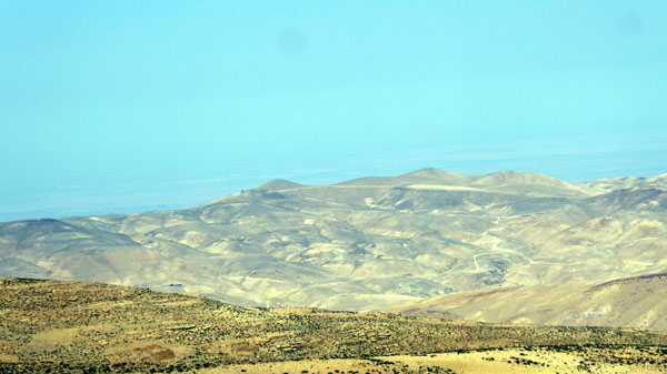
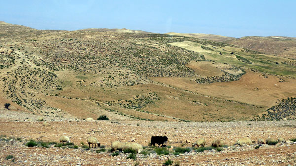
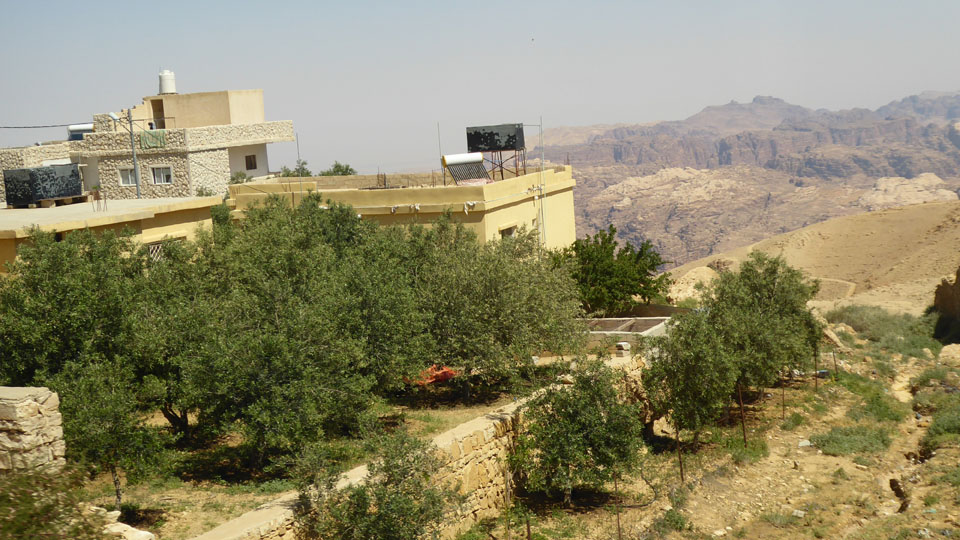
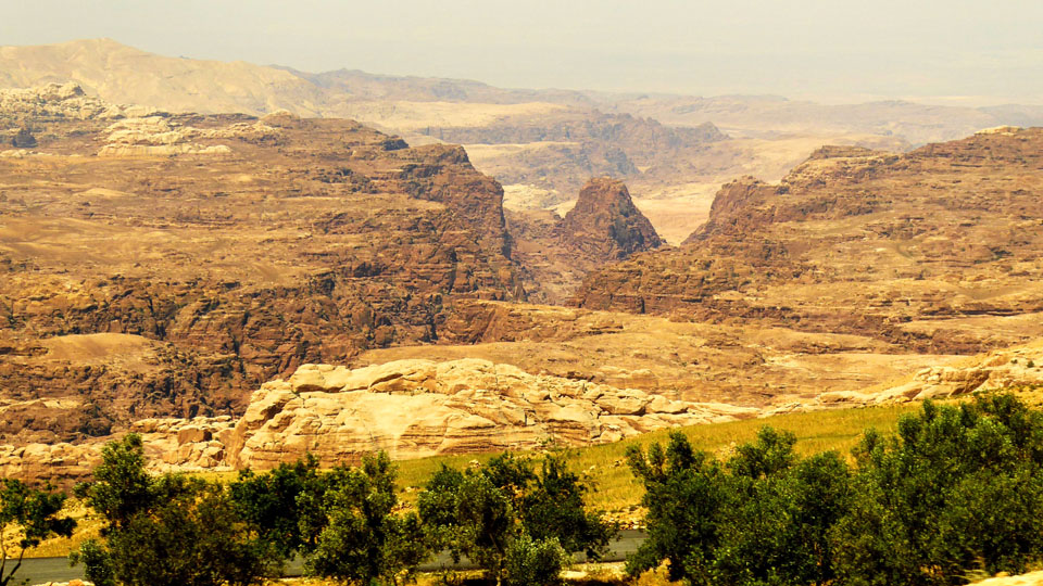
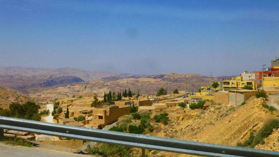
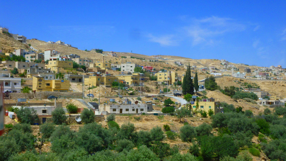
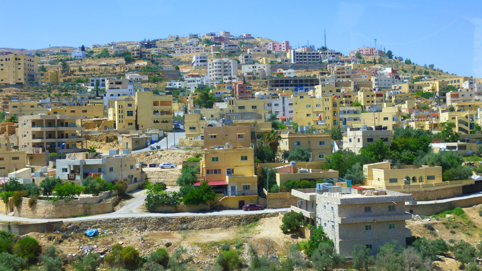
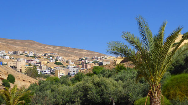
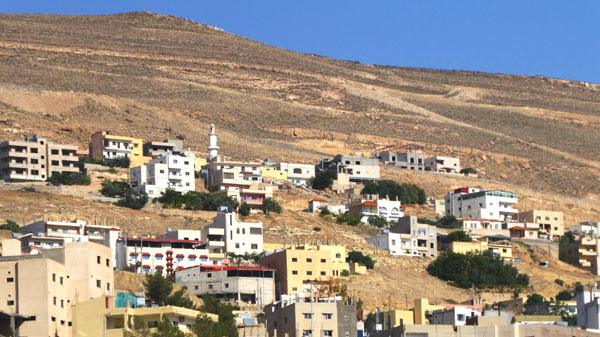
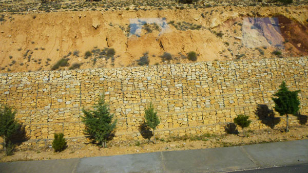
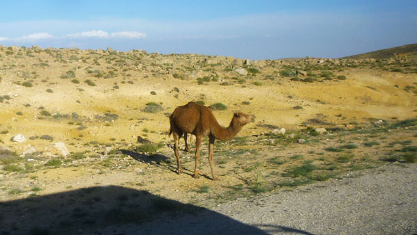
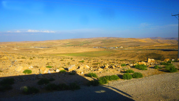
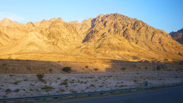
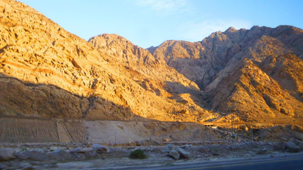
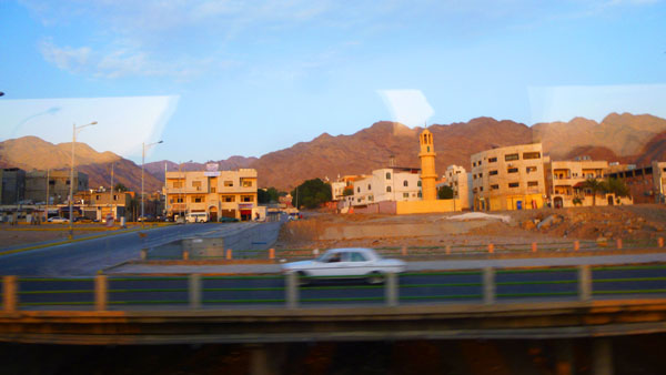
Most of the drive, after we got to the outskirts of Aqaba, was through terrain that was just as desolate as the aerial view would seem to indicate. Most of our trip will be through the Jordan Valley and the Wadi Araba Rift- collectively referred to as the "Jordan Depression".
The Jordan Depression, that runs from Wadi Araba (near Aqaba) to the Dead Sea; it is a very distinctive landscape, forming part of the Rift Valley that extends from North Syria down to East Africa. This linear feature runs north-south with significantly lower elevations than the Highlands to the east and the mountains to the west, and in Jordan extends about 200 miles from Lake Tiberias to the Gulf of Aqaba.
The Depression gradually rises from the Gulf of Aqaba over a distance of about 60 miles up to about 800 feet above sea level, and then drops gently towards the Dead Sea (1200 feet below sea level). Continuing on, the depression then rises in elevation from the level of the Dead Sea to the level of Lake Tiberias- 600 feet below sea level. On average, the Jordan Depression is about ten miles wide. The road we will be following is just up the slope on the west side of the rift.
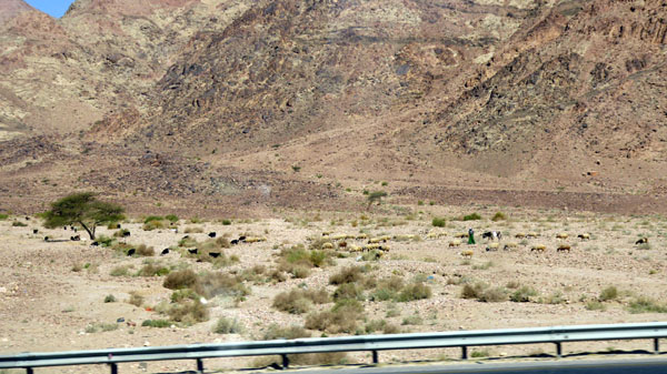
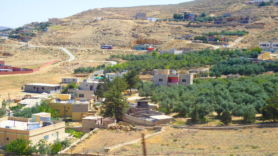
This region is the lowest depression on earth (with the Dead Sea at 1200+ feet below sea level) and includes the Jordan River, flowing through the Jordan Valley, which is considered the food basket of Jordan. The Jordan Valley (with its dams) and the Southern Ghor (highland area) with its surface water are among the most important agricultural areas, since there is a permanent supply of water from the Yarmouk River. Due to high temperatures and their location below sea level, these two regions are the most important areas for producing winter vegetables. The Ghor has approximately 90,000 acres of farming land, all of which is irrigated. We could see some of these areas during the first part of our trip.
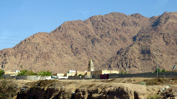
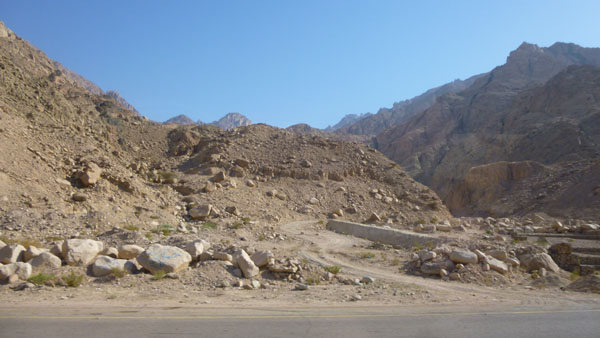
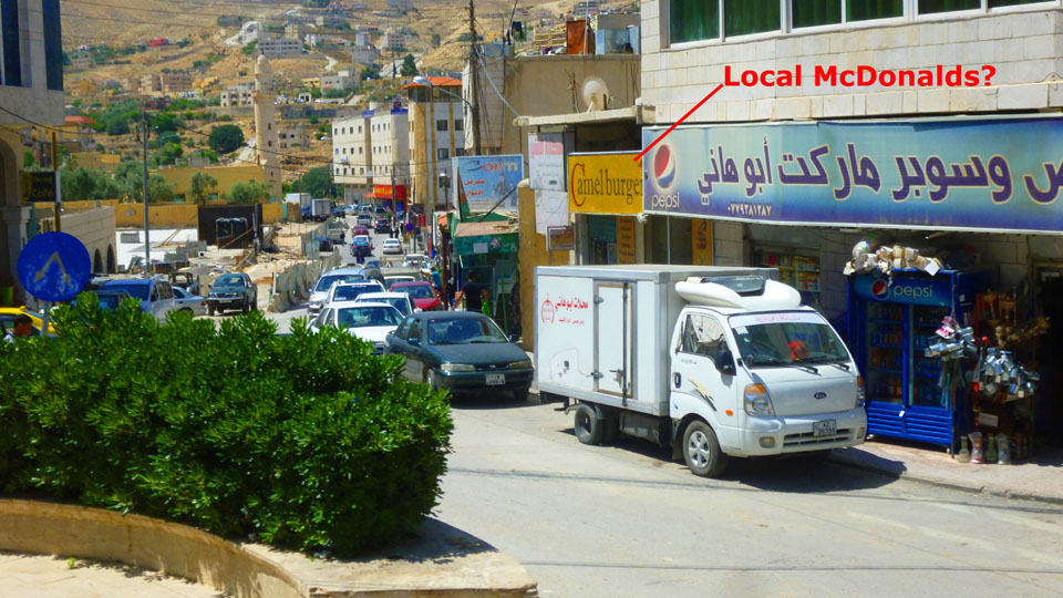
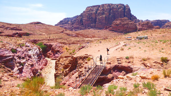
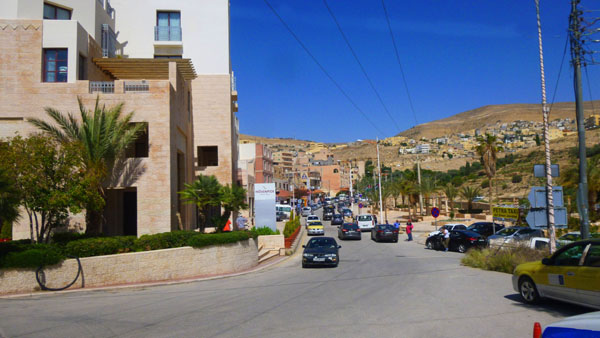
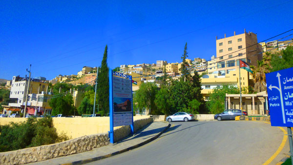
The first part of our trip (only a few miles) was to get us through the eastern part of the city of Aqaba and up to the beginning of the mountain pass that would take us east to the Wadi Araba Rift and into the Jordan Depression. Along the way, from the port to the pass, we saw some interesting things.
|
|
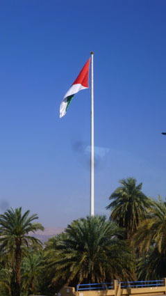
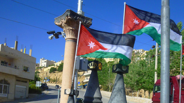
The flagpole, which can be seen from Israel, Egypt, and Saudi Arabia, was built and dedicated in 2004.
Incidentally, if you are curious, the five taller flagpoles are located at Ashgabat, Turkmenistan (426 Feet), Panmunjom, Korea (525 feet), Baku, Azerbaijan (531 feet), Dushanbe, Tajikistan (541 feet), and Jeddah, Saudi Arabia (560 feet).
|
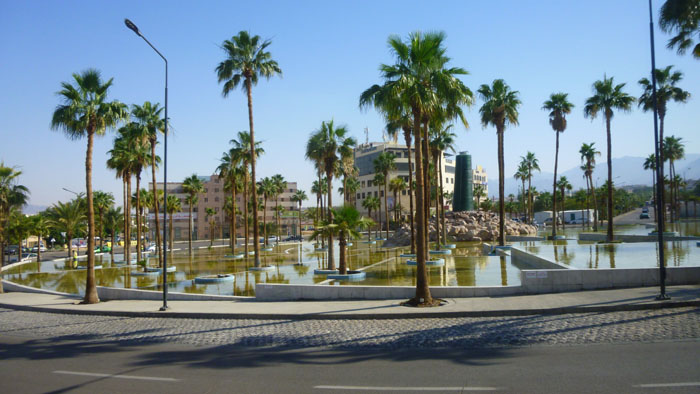
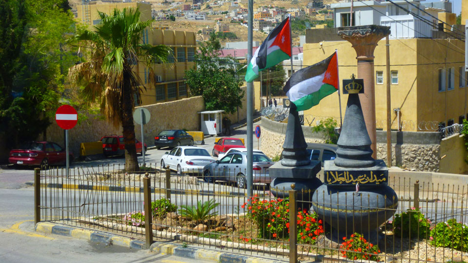
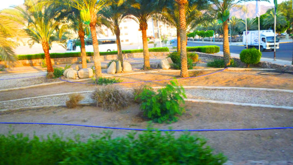
I've tried to locate information about this water feature so I can tell you when it was built and to whom and to what it was dedicated, but I can't seem to. Check that; a hotel that I emailed in Aqaba has kindly located the pools for me; they are located in one of the traffic circles along Al Hussein bin Ali Street- Princess Haya Circle. The reason I could not find it is that the Google aerial view is out of date, currently showing only grass and trees, so I assume the pools are a recent construction.
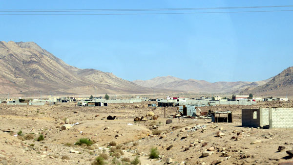
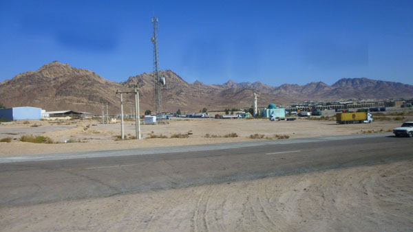
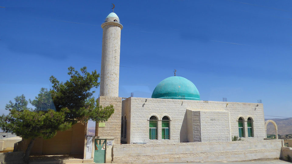
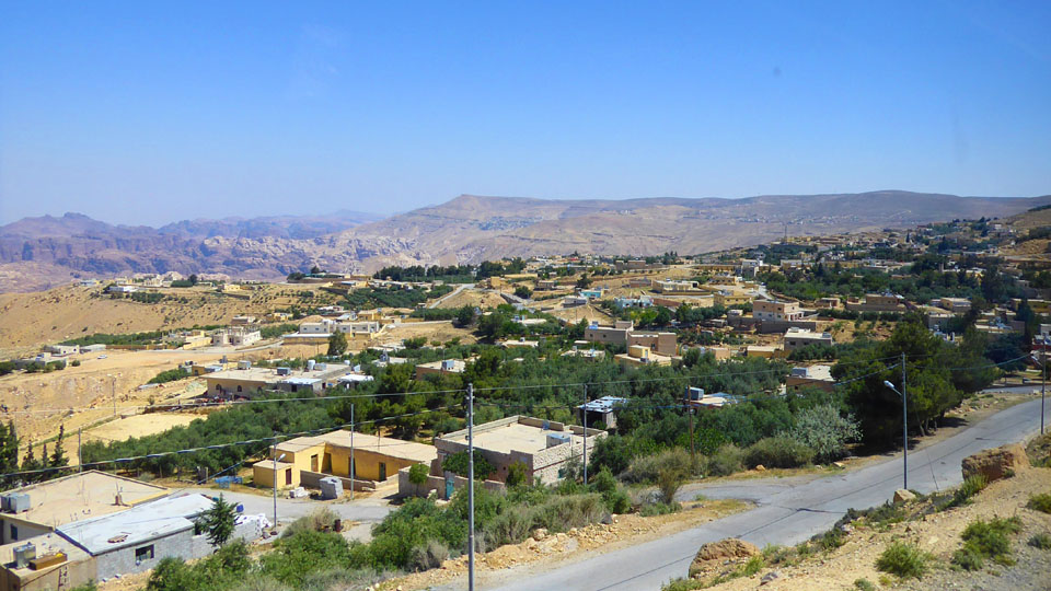
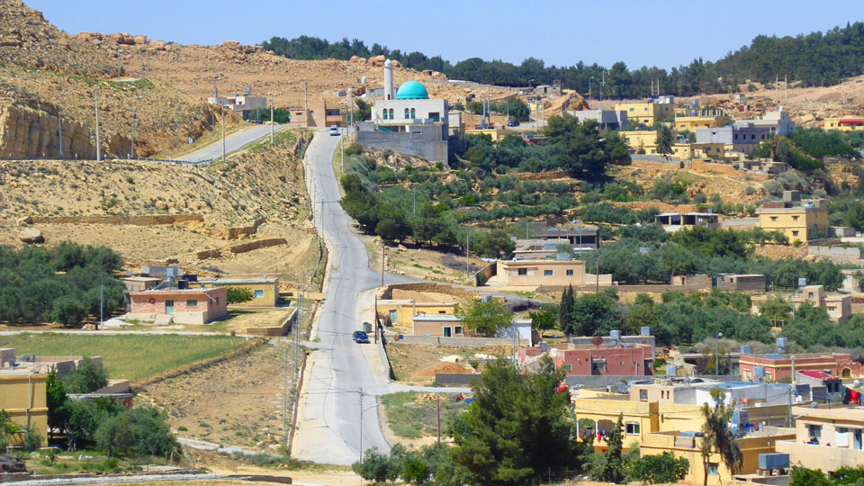
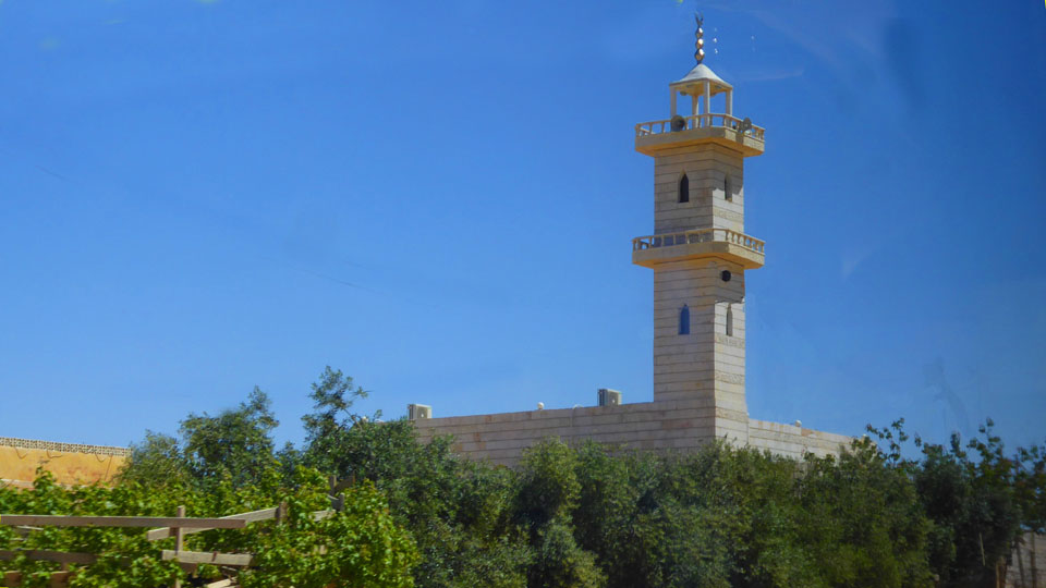
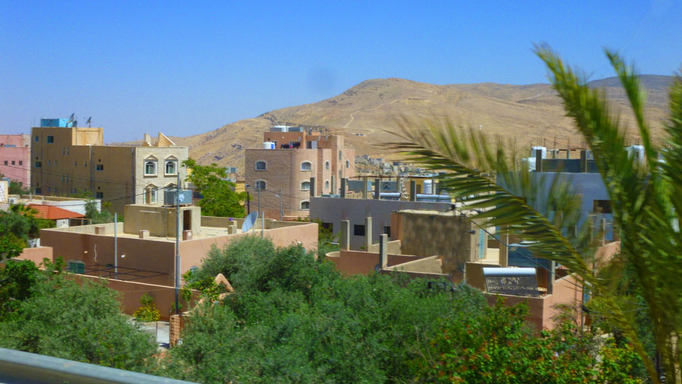
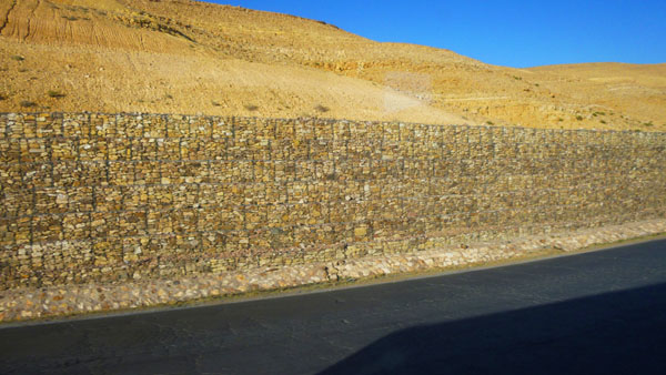
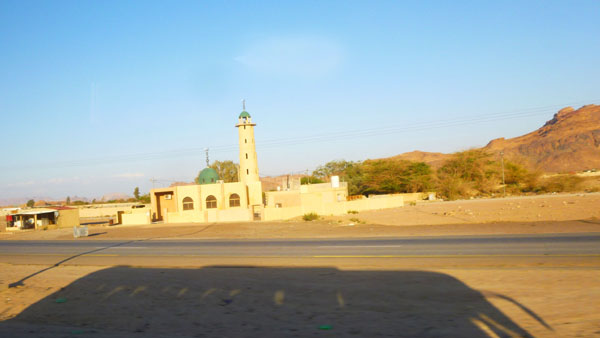
As we moved northwest, the landscape became more arid. To our right were barren mountains, but to our left were the suburban areas of Aqaba. You can see the Al Zahraa Mosque in the distance- it is very new and a relatively small mosque.
We continued northwest until we'd left Aqaba behind- perhaps five miles- and then our tour bus turned to the east to follow the main road that would take us through the mountain pass into the interior rift valley.
|
|
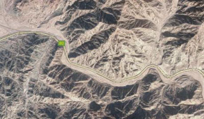
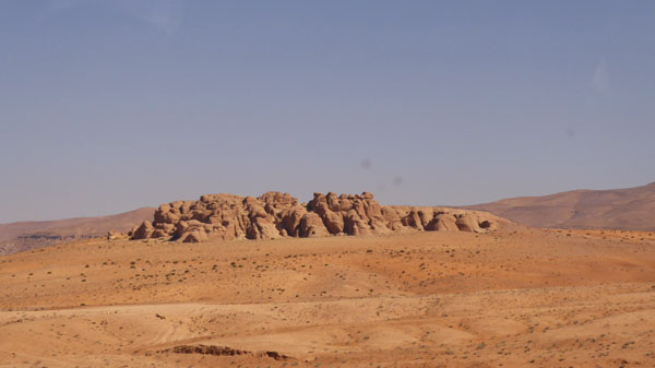
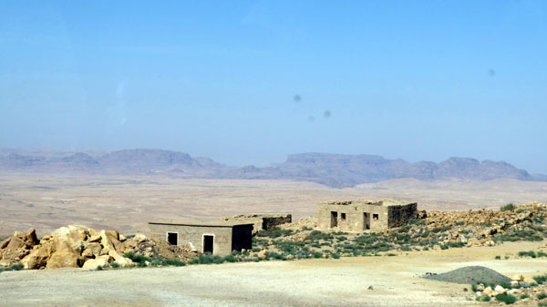
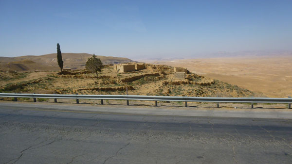
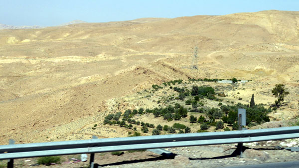
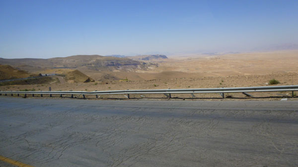
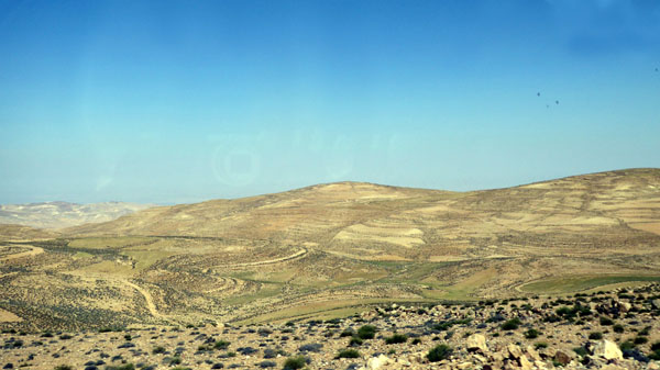
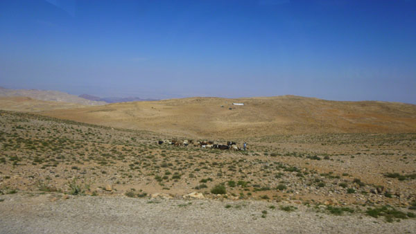
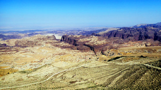
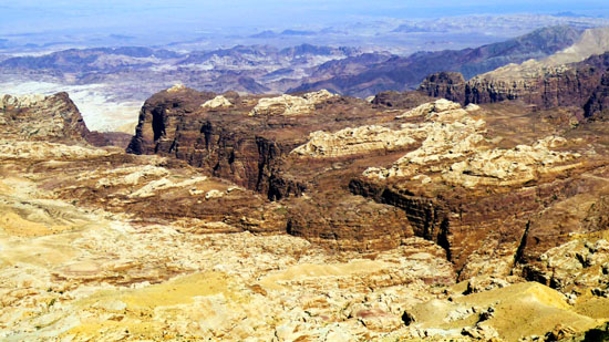
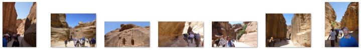
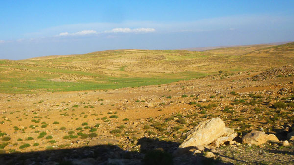
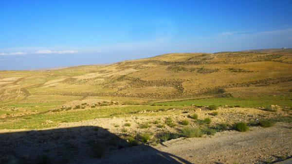
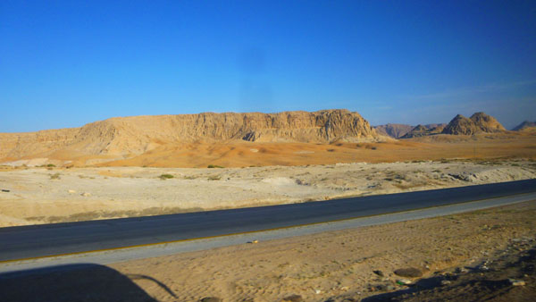
As you can see from the small aerial view above, the pass goes through a very desolate area, with craggy, ore-veined mountains on either side of the modern highway. We saw no evidence of civilization through the pass- not until we came out into the Jordan Depression. Our first leg continued up the west side of the valley to out pit stop, and both Fred and I took quite a few pictures out the windows. I've selected the best of these pictures to include here, and they are in the slideshow above, left. To move through the pictures, use the little arrows in the lower corners of each one. Track your progress with the index numbers in the upper left. These photos are all very representative of what we saw on the way to our first stop.
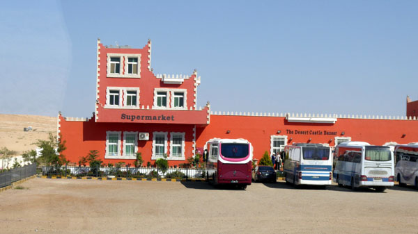
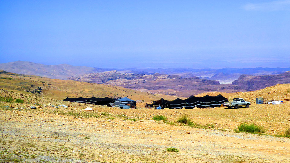
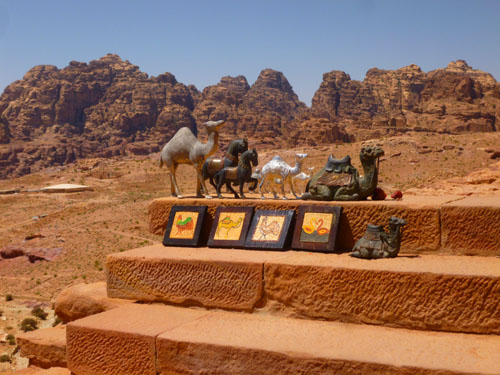
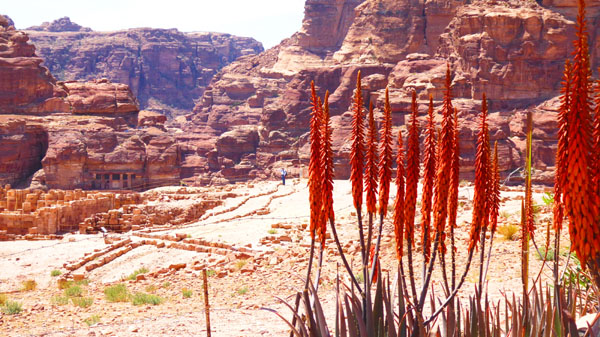
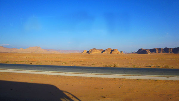
Our pit stop came about halfway to Wadi Musa, at a store/restaurant that overlooked a barren, but beautiful landscape. We took quite a few pictures of that vista; here are the best of them:
|
|
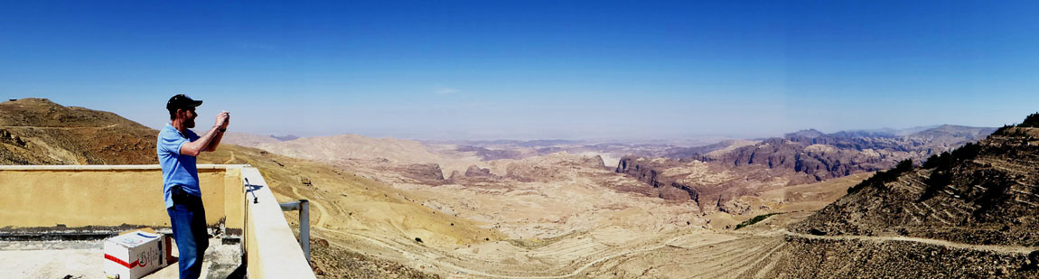
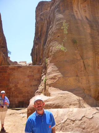
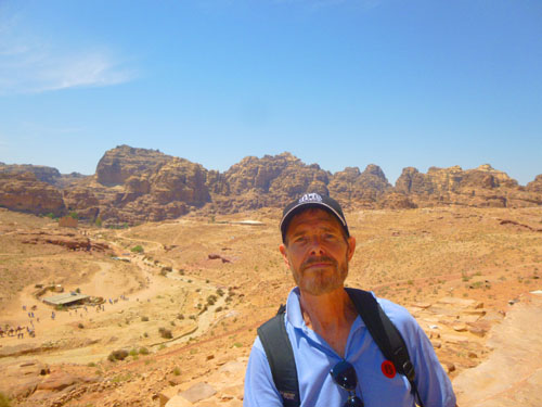
When we went inside the store to use the facilities, which were on the lower level, we found stairs up to the rooftop, where really great views were available in all directions. While I was taking the pictures above, Fred was creating a panoramic picture of me doing so:
|
|
Here are more of the many pictures we took while we were here at our pit stop:
|
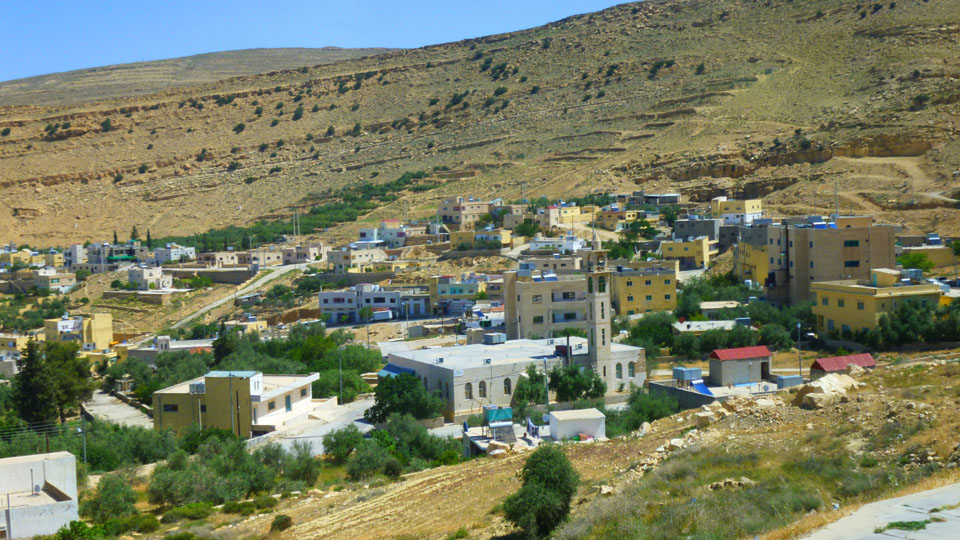
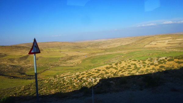
We were at the rest stop for perhaps a half hour before we all shepherded ourselves back onto the bus and we headed off for the last fifteen or twenty miles to the town of Wadi Musa- gateway to Petra.
|
|
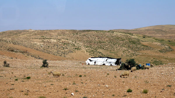
To let you look at these pictures quickly, a slideshow is again the method of choice, and the slideshow for our pictures between the rest stop and Wadi Musa is at right. Use the little arrows in the lower corners of each image to move from one to another, and track your progress through the show by referring to the index numbers in the upper right. Enjoy looking at these typical Jordanian scenes.
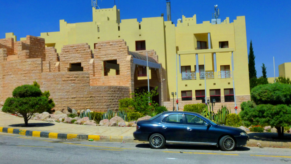
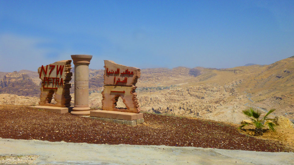
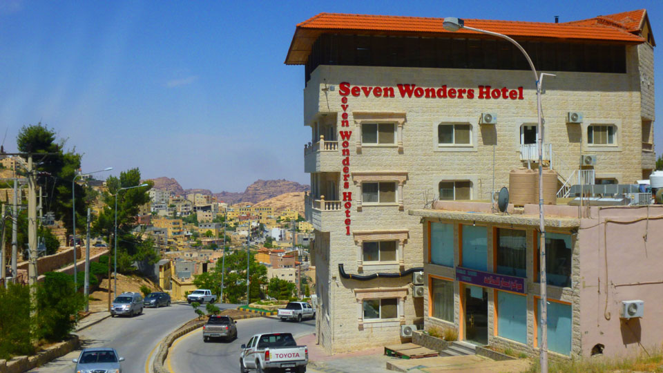
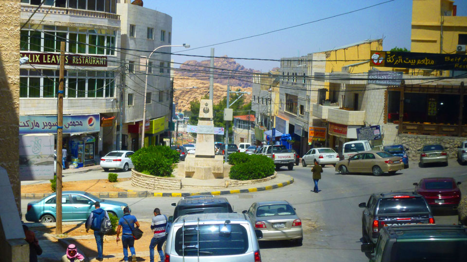
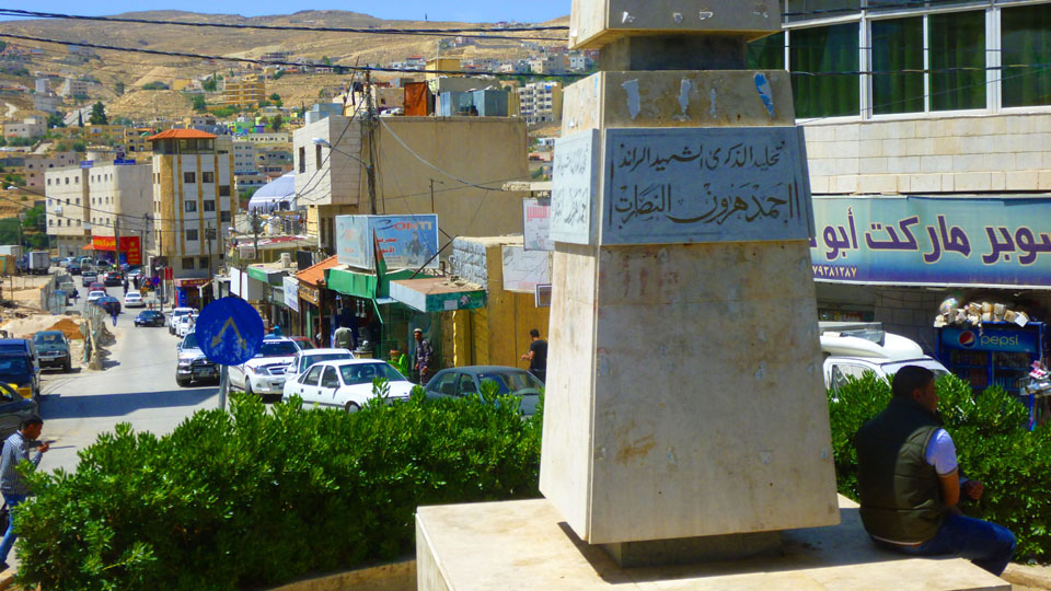
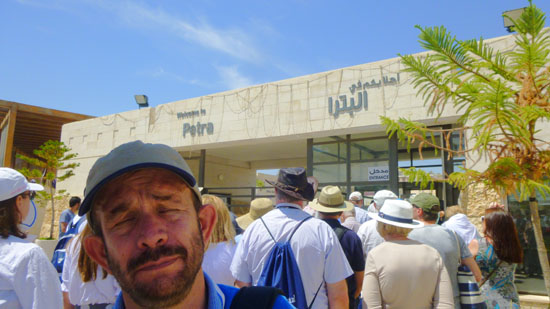
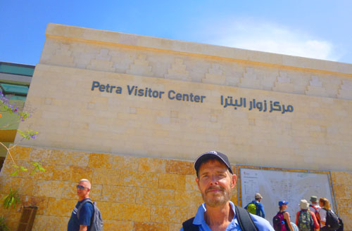
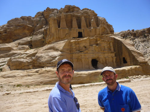
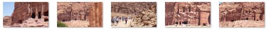
The bus stopped in front of the Palace Hotel, where our tour guide told us to return for our lunch. He set a time for us to be back for lunch- a time that would give us over four hours to explore Petra. The administrative details out of the way, he led us down the street about a quarter mile to the entrance to Petra.
A Tour of Petra: The Red Rose City
Petra was such an interesting place, and we took so many pictures of it, that I need to organize them into their own sections. But I also want to give you the opportunity to take yourself back to the top of this page at the end of each one. So rather than have subsections here, I will continue to use top-level sections for our time here in Petra. In this first, introductory section, I want to describe Petra generally, tell you a bit about our day here, and also include the pictures we took here in the entry.
|
Petra, originally known to its inhabitants as Raqmu, is a historical and archaeological city that lies on the slope of Jabal Al-Madbah in a basin among the mountains which form the eastern flank of Arabah valley that runs from the Dead Sea to the Gulf of Aqaba. Petra is believed to have been settled as early as 9,000 BC, and it was possibly established in the 4th century BC as the capital city of the Nabataean Kingdom. The Nabataeans were nomadic Arabs who invested in Petra's proximity to the trade routes by establishing it as a major regional trading hub.
The trading business gained the Nabataeans considerable revenue and Petra became the focus of their wealth, drawing the envy of its neighbors. The earliest recorded historical reference to Petra was when the Greek Antigonids raided the city in 312 BC. The Nabataeans were, unlike their enemies, accustomed to living in the barren deserts, and were able to repel attacks by utilizing the area's mountainous terrain. They were particularly skillful in harvesting rainwater, agriculture, and stone carving. Petra flourished in the 1st century AD when its famous Khazneh structure ("the treasury")� believed to be the mausoleum of Nabataean King Aretas IV� was constructed, and its population peaked at an estimated 20,000 inhabitants.
|
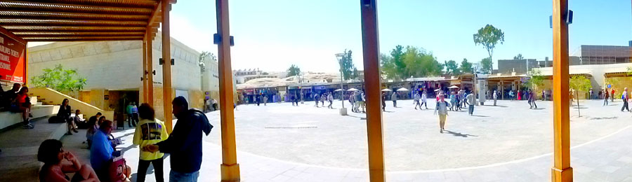
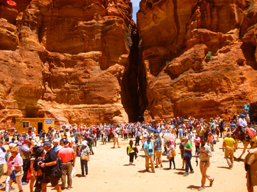
There was a map posted inside the ticket gates that gave us an idea of what lay ahead for our tour. The city itself is accessed through a three-quarter-mile-long gorge called "the Siq" (al-Siq), which leads from the Visitor Plaza all the way down (descending some 200 feet) directly to the Khazneh ("The Treasury"). Famous for its rock-cut architecture and water conduit system, Petra is also called the Rose City due to the color of the stone out of which it is carved.
Petra has been a UNESCO World Heritage Site since 1985. UNESCO has described it as "one of the most precious cultural properties of man's cultural heritage". In 2007, Al-Khazneh was voted in as one of the "New Seven Wonders of the World". Petra is a symbol of Jordan, as well as Jordan's most-visited tourist attraction. Tourist numbers peaked at 1 million in 2010, the following period witnessed a slump due to regional instability. However, tourist numbers have picked up recently, and around 600,000 tourists visited the site in 2017. I have no idea what the total for 2018 will be, but I would think it would be large, based on how many people we saw today, and many of whom you will see in our pictures. We consider ourselves lucky to see Petra.
|
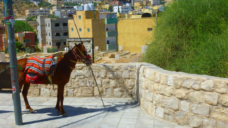
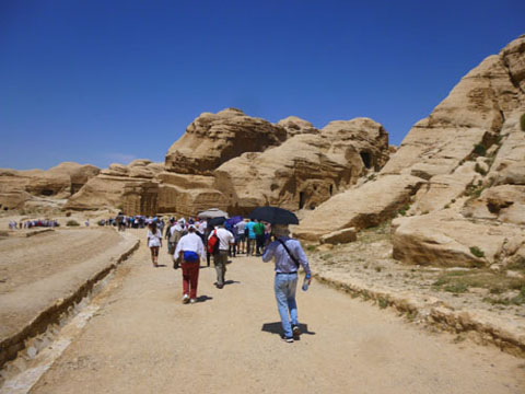
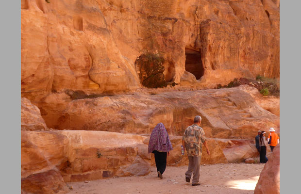
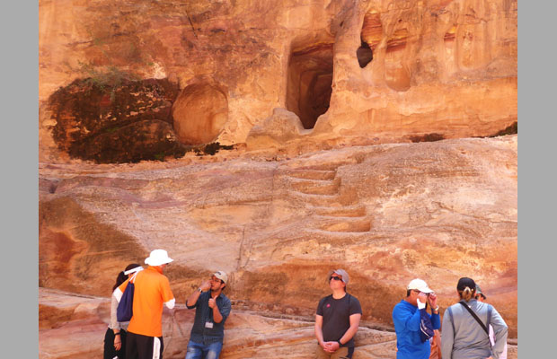
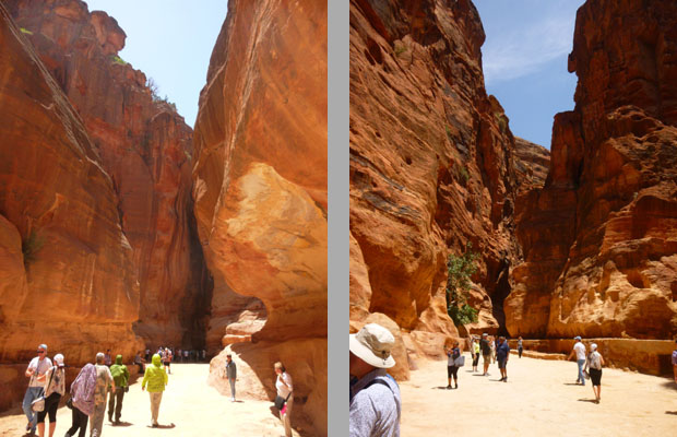
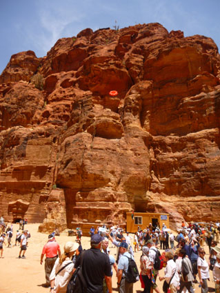
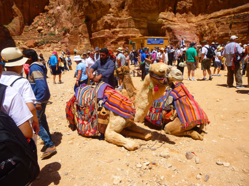
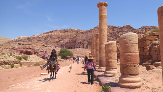
In the entry plaza, we milled about for a bit as people visited the facilities. Off to the left there was a terraced, shaded pavilion that offered a place to rest and view the entire entry area, including the Visitor Center. When everybody was ready, we headed over to the gate that led out to the top of al Siq. There, our guide pointed out, anyone who wished could hire one of the donkeys, horses, or carts to take them down the mile-long Siq. I believe we had one couple do so, and although we were not together as a group coming up from Petra, based on how much walking and climbing Fred and I did today, I wouldn't be surprised if quite a few of our group availed themselves of the service coming up. Then the rest of us of all started out down the trail to the top of the Siq.
|
We didn't visit every major site here; there was simply not enough time. Even so, tracing our route is useful. We began walking down the open gravel path called the Bab al-Siq, traveling generally west and eventually coming to the beginning of the slot canyon known as the Siq. Going through that canyon wound a bit, but we were still heading generally west until we came to The Treasury.
From the Treasury, the path continued west, turning north after the Street of Facades to go below the Royal Tombs, and then turning west again to the rest of the Petra site. For convenience, when I talk about a place we stopped, I won't use directions (North-South) as that can be confusing if you don't know which direction the path is heading at that point, but instead just say that something is either on the left side of the path or the right side of the path.
If any of this is confusing, just return here and look at the aerial view to find out where something was located relative to the path we were following.
Petra Tour Part 1: Walking Down al-Siq
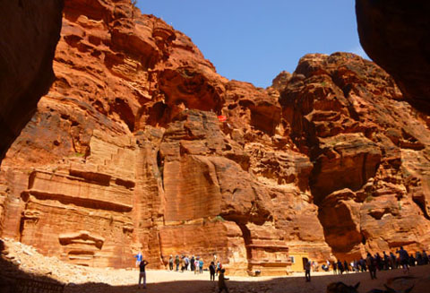
Our introduction to Petra was our walk first along the Bab al Siq and then through the Siq itself to come out in front of The Treasury. "Bab Al Siq" is Arabic for gateway to the "siq", with "siq" being a deep, narrow cleft in rock- quite similar to a slot canyon in the American West. The Bab Al Siq is a half-mile long gravel pathway from the general Petra access to the famous rocky cleft of the Siq. Pedestrians walk on one side of the path, while donkeys, horses, and carriages go by on the other.
|
|
|
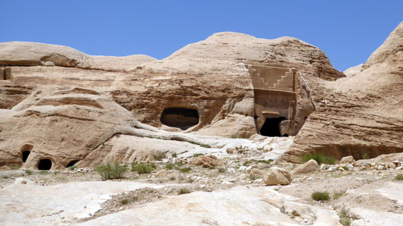
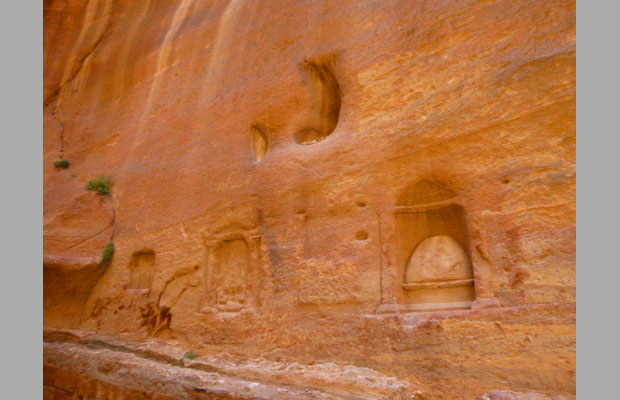
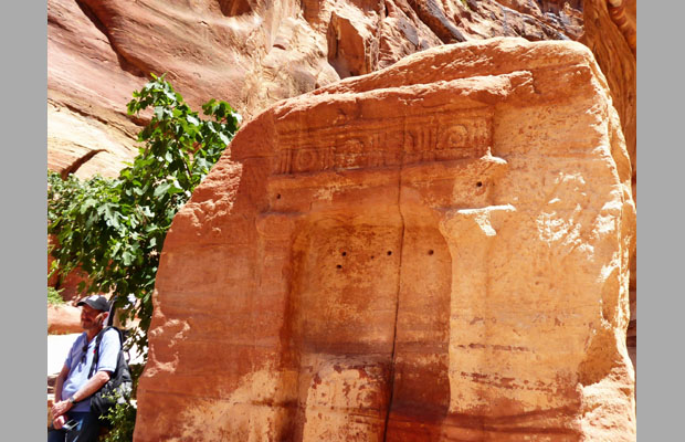
The area, Bab al Siq, was named by Petra's Bedouin inhabitants. This area contains several rock-hewn monuments and memorials, including the Djinn Blocks and the Obelisk Tomb.
The area traces a path that follows the course of the Wadi Musa ("Valley of Moses"), the meandering riverbed the flows from the Ain Musa spring into Petra. The Bedouin believe that Ain Musa is the spring that gushed forth when Moses smote a rock in Biblical ltimes. The valley was formed as a result of floodwater erosion and the Nabataeans carved water cisterns and channels to divert the water and carry it into Petra for their use. The Bab al Siq terminates at the start of the chasm of the Siq.
|
The gabled facade below the tomb marks the placement of a triclinium, a funerary dining hall with benches carved along three of its sides. Here, banquets, where wine was served, were held in honor of a god or an ancestor. Here are some additional views of the obelisk and triclinium:
|
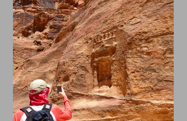
On a cliff face on the right side of the path is a double inscription in Nabataean and Greek that refers to a burial monument erected by a man named Admanku (or "Abdomanchos" in Greek). The presence of Greek writing bears testimony to the influence of Hellenic culture on cosmopolitan Petra. The inscription indicates that the tomb was to be used for himself and his family, probably in the reign of Malichus II (40- 70 AD).
|
We took a number of other pictures here and before we entered the Siq itself; here are some of them:
|
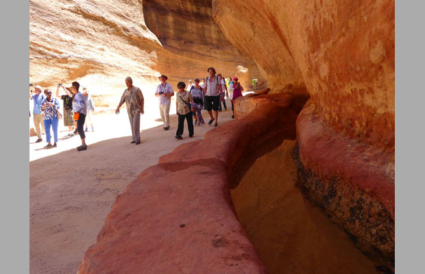
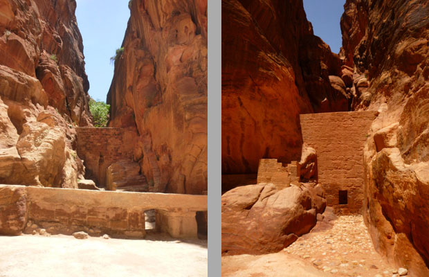
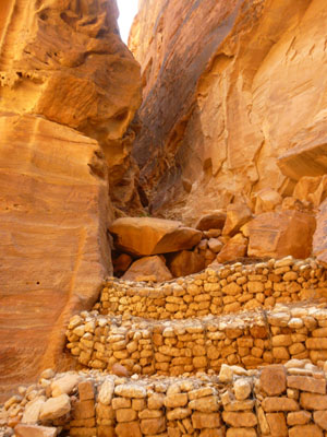
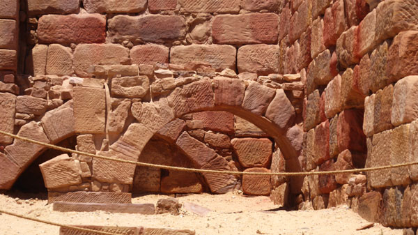
A bit further down the trail, right where the rocky cliffs on either side were getting higher and closing in, we found The Tunnel. This impressive engineering feat was probably built in the third quarter of the first century BC, when the Nabataeans started building structures and there was a need to protect them from the flash floods common to the area, and to protect those walking through the Siq. The tunnel is 250 feet long and was cut in the rock to divert flood waters away from the Siq into Wadi Al Mudhlim and to Wadi Al Mataha. The water diverted through this tunnel helped to supply the Nymphaeum inside the city.
|
This dam was renovated by the government in 1964 in the same way it was originally built by the Nabataeans. This dam was built to protect their capital from floods that arrived during the seasonal rain from the mountains and hills across the valley.
The dam protected the city of Petra by redirecting the flood waters into a tunnel, which was later titled the "Dark Tunnel". Proving to be successful, the dam thus represented the Natabataeans' skillful and modern infrastructure. During the excavation, it was found that the original name of the old city was Raqeem. However, upon their arrival, the Greeks renamed the city "Petra", which means "the rock".
As the pathway narrowed, we took a succession of pictures, the best of which are below. Note your first look at some of the water channels as well as remnants of the old city gates (in the sixth picture in the row). These are remnants of the abutments and the side niches of a Nabataean arch that once crossed the entrance of the Siq. It collapsed in 1896 because of an earthquake.
|
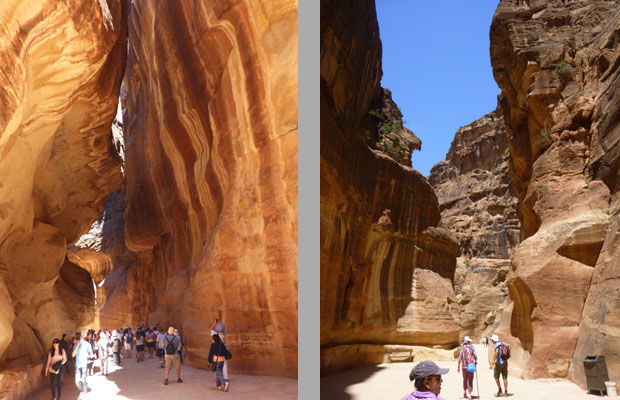
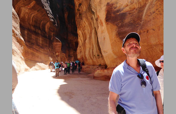
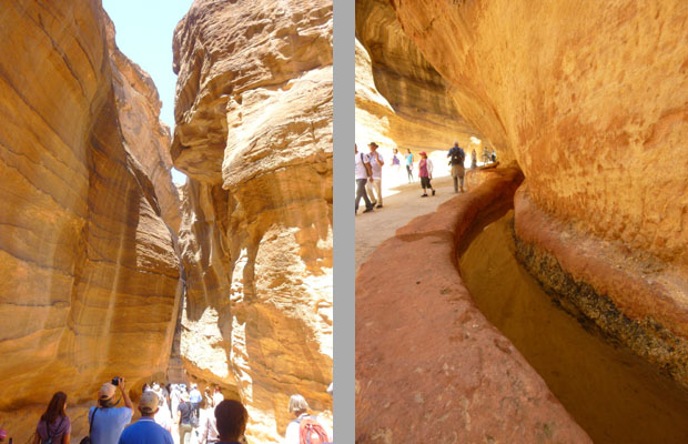
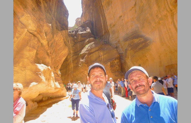
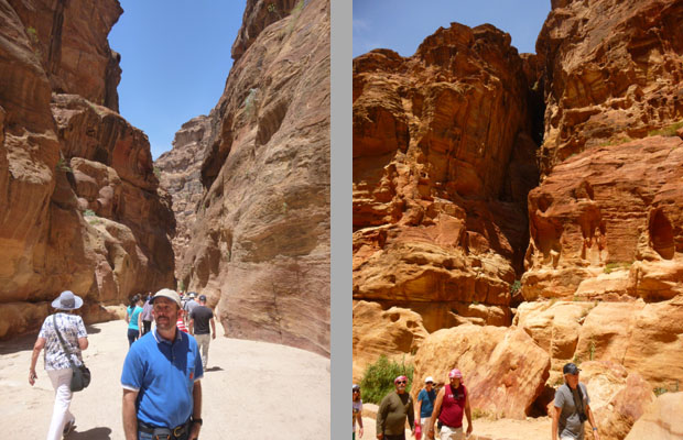
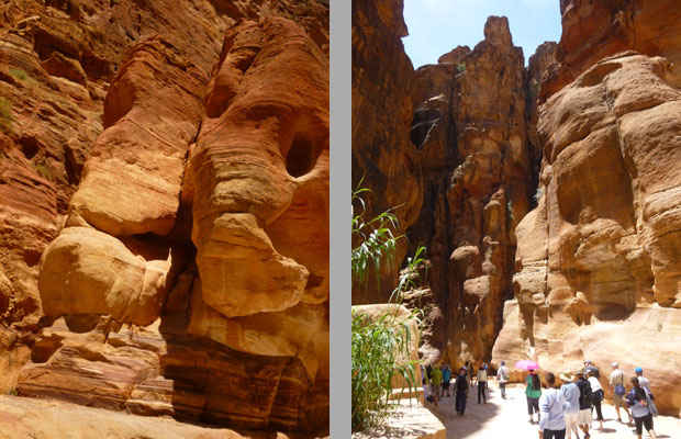
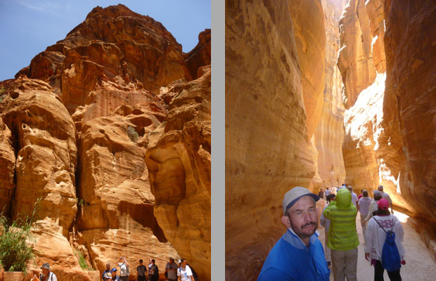
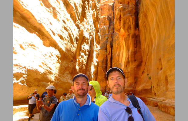
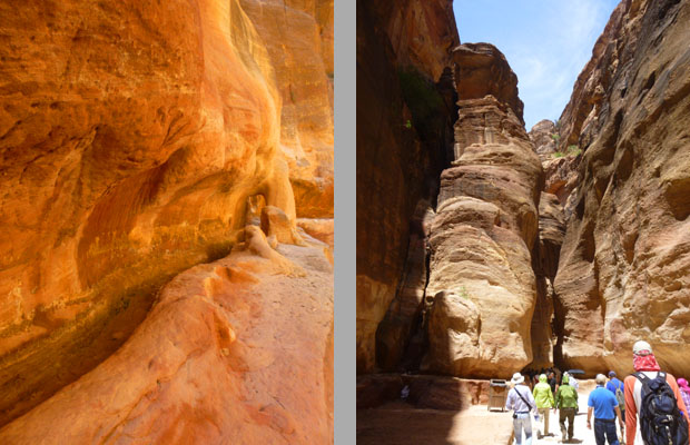
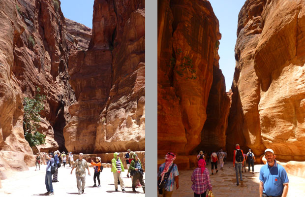
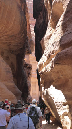
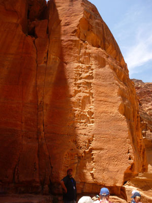
The Siq is the main entrance to the ancient Nabataean city of Petra. It is a deep gorge, a natural geological fault split apart by tectonic forces, approximately a mile long. At some points, it is only 10 feet wide; sometimes it widens up giving way to more open spaces. The vertical cliffs are up to 250 feet high. It starts at the first Dam and ends at the opposite side of the relatively open canyon where The Treasury is located. Most of the rock is natural although some of it was sculptured by the Nabataeans. Walking through the narrowing canyon was really neat, reminiscent of the hiking in the slot canyons near Palm Springs.
All along the way through the Siq there are ancient rock-cut water channels, with some remains of terracotta pipes, all created to draw water from Wadi Musa (the Valley of Moses), from outside the city to the inside. In some areas, there are conserved parts of the main road, originally built by the Nabataeans, probably towards the end of the 1st century BC.
|
|
The Siq is not only a passageway, but an attraction on its own sake, worth looking not only upwards to appreciate its impressive rock formations, but also paying attention to the many small items you can see along the way. In many parts, there are testimonies of the Nabataean cult, like the votive niches and idols or aedicula, which are small indentations with a pediment. There are more than thirty of these along the Siq, and most of them have betyls (from the Aramaic "beth-el" meaning "house of god"), which are idols of the Nabataean cult, mostly related to the main god Dushara. Some of these also have small altars to burn incense.
Aspects of the Siq were decorated with Nabataean sculptures, mostly representing gods. It is believed that the statues of gods and their sculptures were situated very close and even adjacent to the channels due to the Nabataean belief that water was sacred. In addition, on the left side there are idols called Sabinos Statues. This wall of cult-niches and baetyls has been created on behalf of a person named Sabinos who was the master of religious ceremonies to honor Dushara at the ancient town of Adraa (today Dar'a in Syria). He and other masters visited Petra in the 2nd or 3rd century AD to honor Dushara there as well. Nearby is strongly weathered relief sculpture of a merchant leading two camels. In the wall behind the group, there is a water channel carved in the rock.
In a broader part of the Siq, there is a freestanding outcrop of rock with two small votive niches on the western side. This another aedicula with two pilasters, Nabataean capitals, a triglyph (vertically channeled tablets) and metope (rectangular architectural element that fills the space between two triglyphs). Inside there are two small deity representations- the betyls.
|
|
(Mouseover Image Above for Video Controls) |
Petra Tour Part 2: The Treasury (Al-Khazneh)
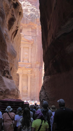
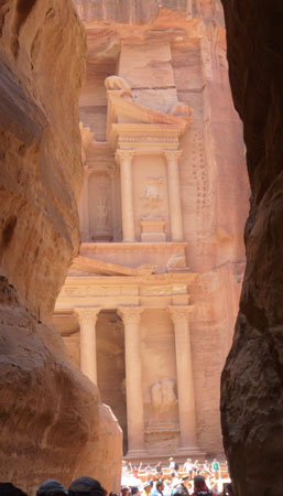
We'd been descending steadily all along the Siq- quickly at first and then more slowly once we got into the actual canyon. At the bottom of the Siq, the "street" narrowed and went around a large rock outcrop, and we could see the Al-Khazneh ahead.
|
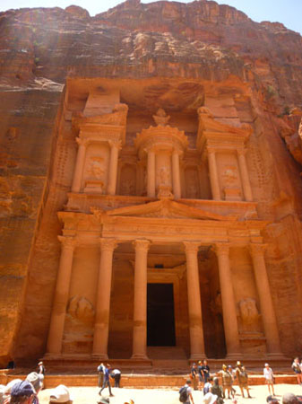
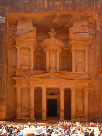
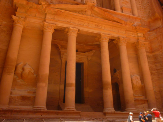
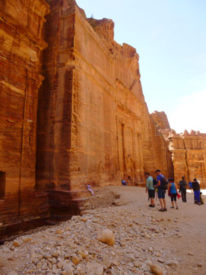
Al-Khazneh is a 125-foot-high mausoleum for a Nabataean king, carved deep into the red sandstone rock face during the 1st century BC.
The name "Khaznet Fir'aun" (Treasury of the Pharaoh) is not Nabataean; that's the name given it by local Bedouins long, long after Petra was abandoned. They believed that an Egyptian pharaoh in pursuit of the Israelites commanded its construction in order to deposit his treasure in the urn at the top. While the facade is remarkably intact, a close inspection reveals hundred of bullet holes and chips caused by them; the Bedouins shot the urn with their guns trying to break it and release the supposed gold and gemstones.
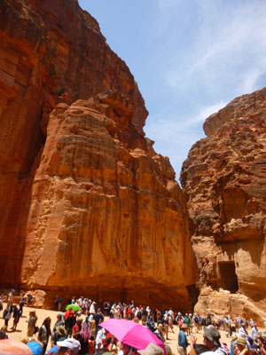
I thought it was pretty amazing how the Siq opens up quickly to put you on the opposite side of the plaza in front of The Treasury; that area is large- 750 feet wide and 225 feet from Siq opening to the Treasury, and the entire area is surrounded by high rock faces.
|
If you look closely at the two pictures at right (one picture includes the rock face and some sky so you can get a better idea of how massive the facade actually is, and the other picture has had the perspective adjusted for a better view of the facade's elements) you will see that the entire structure was actually carved out of the existing cliff face.
Every feature had to be planned ahead of time, and the stonemasons had to know just what rock to chip out and what rock to leave. There was no margin for error; they could not go back and add rock. That's what makes this, and many of the other structures in Petra so interesting- they weren't constructed they were actually carved out of existing mountains.
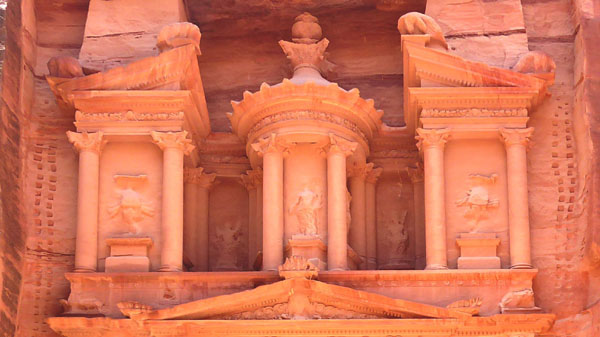
The Treasury is intricately decorated with Corinthian capitals, friezes, figures and more. The Treasury is crowned by a funerary urn, which according to local legend concealed a pharaoh�s treasure; it was that belief that influenced the Bedouins to shoot at the building.
|
The funerary urn is actually on top of the tholos. The urn is actually about 10 feet high (and is marked by lots of bullet holes!). There is really no evidence that the urn contains anything at all; it is not even hollow, as x-ray analysis has revealed. It is also one of the few features on the facade that appears to have been carved elsewhere and then installed on the tholos, which was carved out of the rock. But the Bedouins thought that it might contain gold and gemstones, and that belief is one reason why the structure is usually referred to as "The Treasury"; the full name of the structure is "Khaznet Fir'aun" which means "Treasury of the Pharaoh". The current thinking is that the urn actually represented a memorial for royalty.
Incidentally, look again at the picture at left; notice the two vertical rows of slots located on either side of the upper fa�ade. These were used as foot holes for the sculptors, and as supports for scaffolding structures. They can be found in several monuments of Petra.
The purpose of the Treasury is unclear: some archaeologists believed it to be a temple, while others thought it was a place to store documents. However, the most recent excavation here has unearthed a graveyard beneath the Treasury, and so it is likely that it was, like many of the other structures we'll see today, a tomb.
|
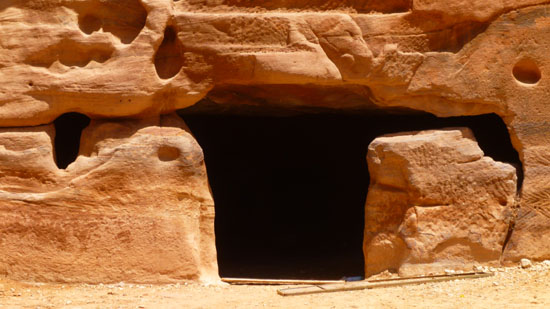
The Treasury comprises three chambers, a larger middle chamber with smaller ones on either side. Again, it is important to realize that these rooms were actually hollowed out of solid rock. Entry to the three rooms here at The Treasury is not allowed, but later on today we'll go inside another tomb and see that these rooms look for all the world as if they were constructed, not sculpted.
Our photos of The Treasury were of necessity repetitive (only one area from which photos were possible, and we could not get very close), here are a few more in case you would like to look at them:
|
While there is only one level in the interior, the facade has two floors, and the elaborate carving of this two-story, Hellenistic-style facade demonstrates the engineering and artistic genius of the Nabataeans. But let's turn our attention to the activity in the open area in front of the Treasury. Of course, we entered this area through the entrance from the Siq.
When we came into the plaza, there were facilities to our left (which I went over to use) and a stone stairway up the rocks which seemed to head up to the top of the cliffs. I thought there would be good views, and I thought about heading up there, but I didn't think there was time and I also wanted to get back to our group. From up there, I took a picture looking across the Treasury facade before heading back down to the front of the Treasury. Ahead of me, which would have been to our right when we came out of the Siq, there was another cliff and more steps leading up into the rocks again. From our map, heading in this direction would also give access to the rest of the Petra site.
Here are a couple of pictures to show you what the crowds here in front of the Treasury were like:
 I'd Walk a Mile to Ride a Camel |
 The Entrance from the Siq |
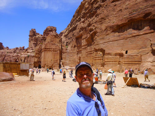
Back in the open area, I continued looking around for anyone from our group, but I couldn't see anyone- even Steven, who stands out in any crowd for being six feet five. But I was particularly looking for Fred. I had not been gone to the facilities long, and I couldn't imagine they'd moved on from the Treasury already. When we'd come into the area from the Siq, our guide had turned us loose with instructions to be back at the hotel dropoff point by a certain time, so I didn't see the guide, either. I spent quite some time looking around before I realized I'd lost everyone- especially Fred. Reluctantly, I decided to continue on through the rest of the Petra site on my own, hoping to run into him. I began by making a couple of movies here in front of the Treasury:
|
(Mouseover Image Above for Video Controls) |
(Mouseover Image Above for Video Controls) |
Having gotten separated from Fred, all I could do was tour around on my own, hoping to run into him. I began by looking at a few other items of interest here in front of the Treasury.
|
|
At the base of this rock cliff, there is another Nabataean tomb, but this one almost looked as if it had sunk into the ground. There was no sign to tell me, but it looked as if the doorway to the tomb had once been a ground level, but perhaps water had washed sediment into the area through the Siq or from the rock cliffs around. I don't really think there was time for that to have happened, but that's what it looked like.
The other thing I noted was the bright red umbrella halfway up the cliff, and when I focused in on it, I could see people up there. Once again, I thought about going up there, because I could see that there was a kind of trail that began just behind the administrative kiosk at the base of the cliff, and I could see one or two people on it heading up or down. Again, though I would have liked to have gotten a view of the Treasury from there, I thought it a better use of my time to see the rest of Petra and, I hoped, reconnect with Fred.
So, instead, I followed the majority of the visitors through the narrow passage to the rest of the site. Here are a few more pictures I took as I left the Treasury and headed down to the Street of Facades:
|
|
|
Petra Tour Part 3: The Street of Facades
For the rest of the Petra pictures on this page, I am going to have to just aggregate the pictures that Fred and I took, since I was never able to spot him again until I returned to the hotel drop-off point. I am very sorry that we got separated, and I suppose I should have asked him to wait somewhere while I stepped over to the facilities back at the Treasury, but I wasn't gone that long and didn't think to take the precaution. As a result, any of the rest of the Petra pictures that have either Fred or myself in them are selfies. I wish we'd been able to see the various ruins together, but we weren't.
|
|
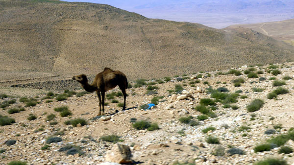
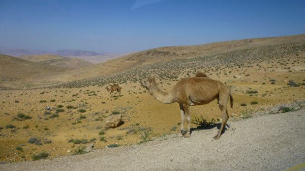
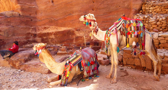
I guess I didn't think about it when we saw a couple of camels from the bus earlier, but there were at least twenty of them here at Petra, all of them available for riders, and all of them, it seemed, brightly decorated.
I have never ridden a camel before, and didn't take this opportunity to do so (although I might have if Fred had been with me and he could have taken a picture). We passed a few of them in the Siq, and another camel and rider passed me here in the Outer Siq (with the rider offering the use of the animal, of course).
|
The tombs are fairly homogenous in type and appearance with vertical facades featuring crow-stepped attics and simple rectangular entrances. The design style is said to be Assyrian, based on the similarity of the tombs' stepped designs to Mesopotamian architecture dating to the seventh and sixth centuries BC.
What is interesting in Petra is that the different styles overlap and merge gradually from tomb to tomb, indicating how Nabataeans drew from different influences in their architecture design, including Assyrian, Hellenistic, and Roman. From a distance, close up, and even from inside, these were amazing constructions:
|
We began by passing facades that lined the left side of the path, but there were actually facades on the right side cliff face as well, but these did not begin until you got almost to the end of the facades on the left (and got past the triclinium that was near the Treasury).
|
|
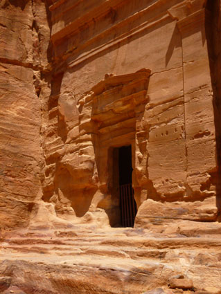
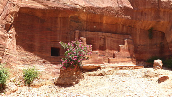
This tomb, built in the first century AD, was a family tomb that contains 17 shaft tombs. Each shaft is comprised of two levels; one person would be buried and then a separating slab inserted so that another person could be buried on top. Inside (entry was not allowed, so I'll have to let the sign speak here) there is an inscription on the left wall that attributes the tomb to the Nabataean family of Zayd Oawmw bin Yaqum. If you examine the walls closely, you would spot some obelisk shapes carved into the rock. These are what the Nabataeans called "nefesh", and they usually represent the souls of the deceased. Hence, you will see obelisks used throughout Petra.
The facade is interesting because it shows how resourceful the Nabataeans were in their construction. Notice the column carved out of the rock on the right side, and the pediment above the door. This style of column is typically Nabataean. The facade is topped by side half Assyrian crow steps and an Egyptian cavetto. On the left side of the facade, there is a groove in place of the column and part of the pediment; it seems the rock on this side was weaker and instead of carving out of the rock, carved stone insets were inserted in the grooves to mirror the right side.
I have two more pictures from the right side of the path through Petra- one Fred's and one mine:
 Stair Steps Carving |
 Interesting Tomb Entrance |
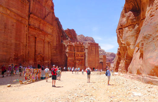
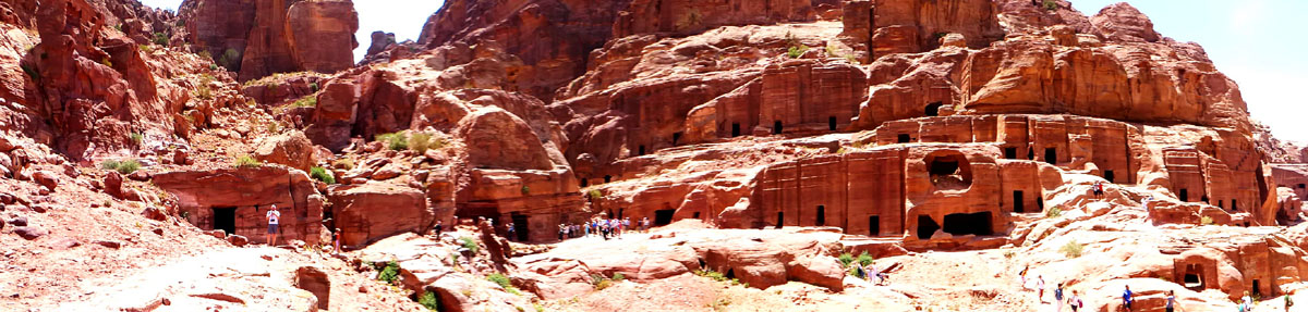
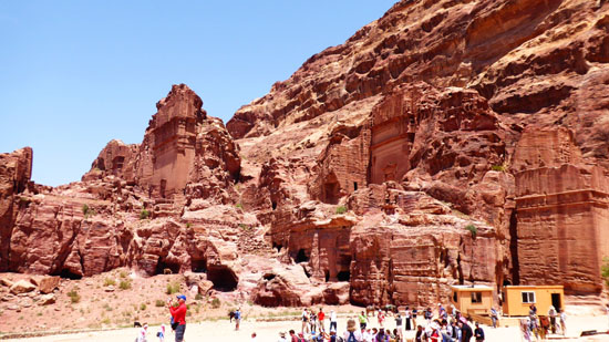
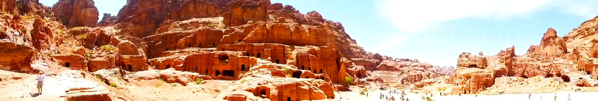
Eventually, the street descended and opened up to a very broad area with tombs and constructions on both sides. On the left side, the tall, regular facades became a landscape of lower, yet still rectangular tombs, and also tombs that were curviform, that looked more sculpted- almost like a Hobbit village.
|
Indeed, the area was so wide, that you could easily see that running through the center, held back by stone walls, was the now-usually-dry Wadi Musa. One could easily imagine a time when water, brought from long distances, ran through it continually. Walking down the wadi, we came by the Uneishu Tomb (named after an inscription on a stone found close to it), with double cornice and a single, monumental crow-step crowning it.
|
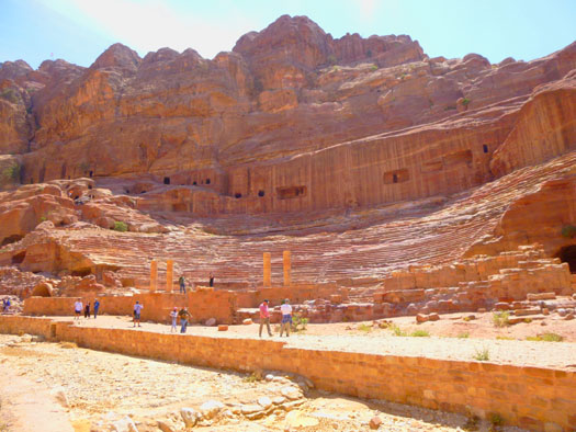
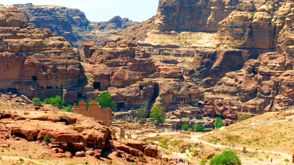
This cliff face with the large cluster of tombs arranged in ascending rows was pretty incredible. The area is also called the "Theater Necropolis", because it is adjacent to the huge Petra theatre and because some specialists consider it the oldest burial ground in Petra. Here are more great views of the area:
|
From out in the middle of the wadi, I had my little camera put together a panoramic view of the Theatre Necropolis, and it is below:
|
We have walked far enough that now we can get good views of the facades and tombs on the right side of the path- including the Uneishu Tomb. Just before reaching the Theatre, I found that the light was better for pictures of that side of the Wadi, and so I took a few more. Here are the two best of them:
|
|
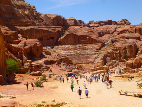
Petra Tour Part 4: The Nabataean Theatre
|
Here is a selection of views Fred and I took of the Petra Theatre; you will note many similarities to other Roman-style (and even Greek-style) amphitheatres that have appeared in this album:
|
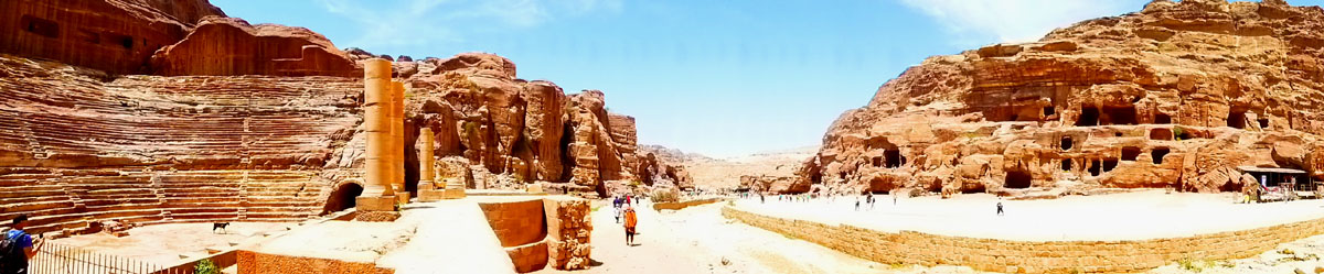
In case you haven't been through this album chronologically, I can point you to some of the other amphitheatres (and theatres) that we have visited (although my memory is not complete and I have not gone through the album to pick them all out). One of the first was Ephesus, in Turkey, and one of the two theatres we explored there was probably the largest of the Roman theatres we visited. We stopped at one in Lisbon, Portugal, and we visited the theatre in Cartagena, Spain, twice on two separate cruises. During our tour of the Roman Forum (in Rome, of course) we visited one of the theatres there, and of course also visited the Colosseum (the only enclosed theatre we've seen). The last one I can remember was built into the side of the Acropolis, in Athens, Greece. But I have checked, and there are literally hundreds of Roman theatres across the area covered by the Empire- and even some outside it. Here is a good panoramic view of the theatre- constructed of four separate images:
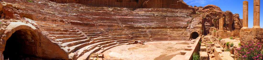 |
You can see in the pictures above the similarities that exist between the amphitheatres of the ancient world. Most were constructed of "Roman concrete", although the amphitheatre here was carved out of rock, for the most part. Their design, with its semicircular form, enhances the natural acoustics, unlike Roman theatres constructed in the round.
|
|
(Mouseover Image Above for Video Controls) |
Here is another panoramic view of the Petra Theatre, showing the Wadi Musa and the cliff structures opposite it as well:
|
So from the Theatre, I continued to walk down the left side of Wadi Musa towards the main expanse of the Petra site. Passing some beautiful ruined carved columns I followed the curve in the wadi, and then looked across to the right side of the trail and wadi to get a first glimpse of the Royal Tombs.
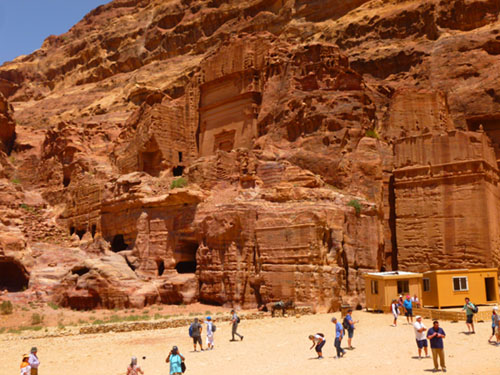
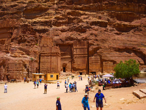
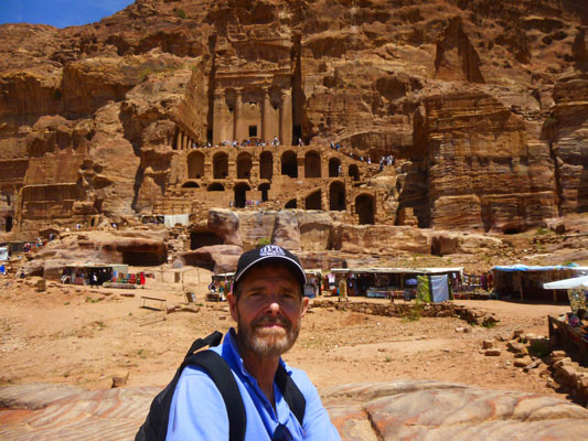
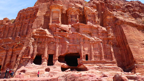
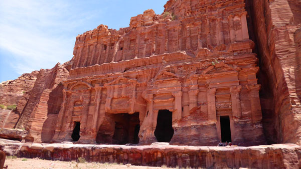
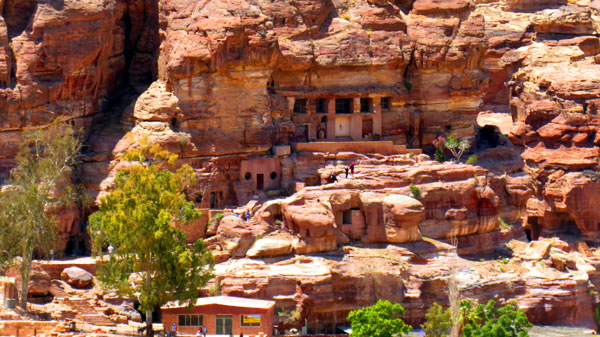
Petra Tour Part 5: The Royal Tombs
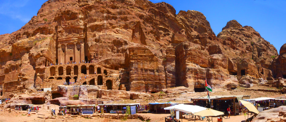
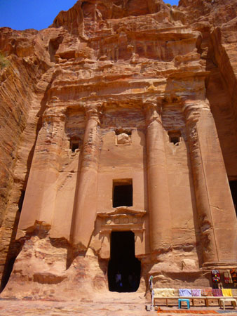
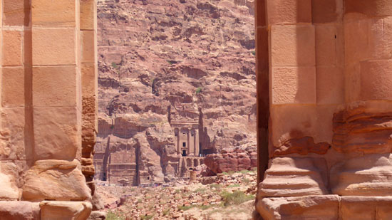
The Street of Facades was just that- a street with shallow facades that sometimes had small rooms in them. Some were tombs, but most were not. On the other hand, the Royal Tombs were exactly that- royal in concept and execution and tombs in which the dead were interred. They were also up high on the cliff face. Here is what they look like head on (in a picture taken somewhat later from further in to the Petra Site:
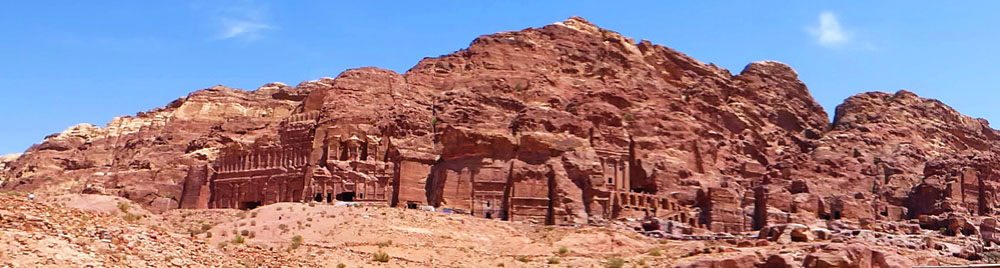 |
Sculpted out of the western slope of the Jabal al-Hubta rock massif, on the right side of the path through Petra and the Wadi Musa, are the so-called "Royal Tombs"- a series of large mausoleums with impressive fa�ades. Because they are high up on the cliff, there are majestic views overlooking the center of Petra.
|
This king reigned during the first four decades AD, a period considered the zenith of the Nabataean Kingdom, and his tomb occupies center stage.
On the very top of the facade there is an urn after which the tomb is named. The three burial niches high up on the fa�ade, and the large forecourt� originally with colonnades on both sides (of which only the northern one is preserved)� are unique. In the Byzantine period, when the tomb was converted into a church, a substructure of arched vaults was added, and you can see them in every picture of the tomb. It is for these reasons, presumably, that there is a marked trail up to that tomb, and it is by far the most visited in the entire row. In every picture we took from down below, we could see tourists on the forecourt and on the trail up and down. Of course, both Fred and I made the trek up there, although, as it turned out, we did this at different times. So let's go up there now and have a look.
|
|
On my way up, I stopped on the large rock you can see to the left of my head, and there I made my first movie:
|
(Mouseover Image Above for Video Controls) |
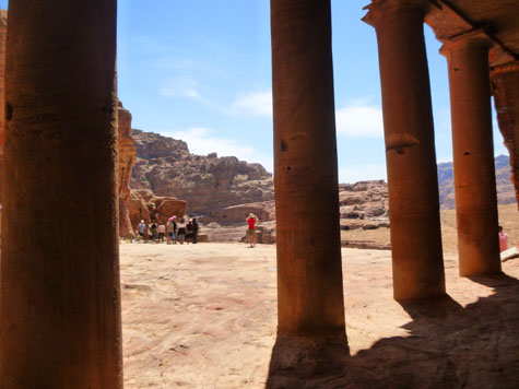
This turned out to be such a great vantage point that in addition to the movie I took a still picture of this beautiful view of Petra from this same spot, before I turned and continued on the trail up, which led up flights of stone stairs to the forecourt of the tomb. That last picture is interesting because you can see that a great deal of restoration work has been done here at Petra to make certain places more accessible. There used to be a hiking path here, but the Jordanian Culture Minstry had steps created to blend in with the landscape. You can also see that modern retaining walls have also been constructed to shore up the forecourt above.
|
|
To the left of the entrance to the Urn Tomb, I found a colonnade that appeared to be holding up a wall of stone. Closer inspection revealed that the entire forecourt area had been chisled out of the sloping mountainside, and that at the same time a rectangular area had been dug into the sandstone- like a huge niche. And when you get close to the columns, you can see that they are not the same piece of sandstone as what is above and below them. They were not carved out of the mountain, but created elsewhere and then put in the places that they now occupy. There used to be a colonnade on the right side of the tomb as well, but it has not survived. But this work did create an area of shade that was accessible via a doorway from the inside of the Urn Tomb, but why, no one is really sure. It seems like a lot of work to go to to accommodate visitors to the tomb itself.
|
(Mouseover Image Above for Video Controls) |
Both Fred and I visited the forecourt, and both of us went inside the tomb. I happened to go in via the doorway from the colonnade, although Fred, from his pictures, went in the main entrance. On my own way in, I took this picture in a room off the main hall.
|
For my part, I was still wondering why, if these were tombs, some of them had so much space inside. One things of a mausoleum being quite small or, even if it has a large, ornate facade, there is little interior space to speak of. I would have thought that rooms of this size would better have been used as actual living spaces rather than just examples of a royal who could afford to have so much space wasted in his honor. In any event, you can see from Fred's picture at right that the interior of the Urn Tomb was positively cavernous.
|
(Mouseover Image Above for Video Controls) |
|
I'd been moving fairly slowly through Petra, constantly on the lookout for Fred or any other group members, but I never did see anyone. I could have spent a bit more time looking at some of the other "royal tombs" in this row, but I'd been a little out of sorts earlier and I thought that I would just end my tour here at the Urn Tomb. I took a few more pictures, one of which looked further into the Petra site, and I could see that there was more than I could cover in the time I had anyway, so I resolved to head back.
When Fred was up here, though, he went a little further around the row of tombs here in the area of the "Royal Tombs", and got a few good pictures of some of the other tombs here.
|
The name is based on a mistake made in the 19th century when somebody thought that the capitals of the carved columns were Corinthian, but in fact, they are Nabataean. Nabataean capitals are different from Corinthian in that they are floral-decorated "horn capitals".
There are four water basins in the front and on the side, which were used in the cleansing rituals. There are four rooms inside the tomb, three of which are square-shaped and lie on the left with one on the right that has an area of 125 square feet.
From in front of the Corinthian Tomb, Fred took a nice picture looking back towards the Theatre.
|
The lower part consists of 12 decorated columns and four gates. Above the threshold lie 18 pillars. The four gates of the cemetery lead to four rooms for burial, with some graves carved in the walls. This name was given to the cemetery as it resembles a palace. Here are more views of these tombs- some taken later on from the Colonnade Street:
|
Later, when I reconnected with Fred back at our boarding spot/lunch place, I found that he (Fred) had moved more quickly than I and had gone further and seen more. So while I, myself, only have a few more pictures that I took here and on the way back, I will continue with one more section devoted to the part of Petra that Fred saw but I didn't. Before we take a look at those pictures, here are the last two pictures of note that I took from here at the Urn Tomb:
|
|
Incidentally, in both of the above pictures, you can see the next site that Fred visited- the Byzantine Church. It is the ruin that is covered by the white roof as continued excavation is ongoing.
Petra Tour Part 6: The Byzantine Church (375-600 AD)
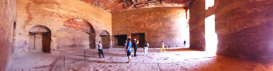
The Byzantine Church, a triple basilica with three apses to the east and three entrances to the west, and accessed from a stone-paved atrium, was built starting in 450 AD in several phases, using stones from Nabataean and Roman buildings that had been destroyed by the 363 AD earthquake.
|
This complex comprises the Petra Church, Blue Chapel and Ridge Church. The Petra Church is in the plan of a tripartite basilica, measuring around 75 by 45 feet, with three inscribed apses and three corresponding entrances. It was probably built in the last half of the fifth century AD.
The Blue Chapel was named for the four blue Egyptian granite columns that were presumably moved there from a nearby Nabataean monument, while the Ridge Church is a simple building made up two, five-columned wings, with a large cistern under the nave that was fed by rain from the roof.
This complex of three churches was built over earlier Nabataean buildings and tombs, which remained in use throughout the Roman period before Christianity became dominant in Petra in the 5th century, at which time some buildings and tombs were converted to churches. The finely-carved capitals of the columns in the Blue Chapel, for example, are Nabataean, suggesting that these may have been recovered from an earlier temple.
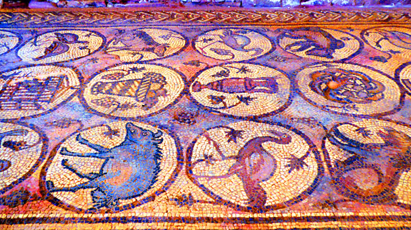
|
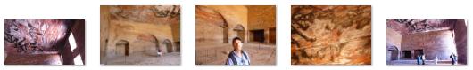
The subjects in the medallions are varied. There are objects (like baskets, bowls, and vases), animals (such as peacocks, boar horses, and elephants), six human figures, and personifications (like the four seasons, the ocean and earth, and wisdom). The mosaics are located in the left and right aisles.
Here are more of the mosaics:
|
Around the year 600, the basilica burned down, and was hit later by several earthquakes, burying the floor mosaics which saved them from destruction.
|
In 1993, in a storage room of the church, 152 papyrus scrolls were uncovered by accident. The scrolls were carbonized during the early 7th-century fire and are still being restored and deciphered. They are documents belonging to one family� including property contracts, out-of-court settlements and tax receipts� and provide an invaluable glimpse into everyday life in Petra between 528 and 582 AD.
Petra Tour Part 7: The Colonnaded Street
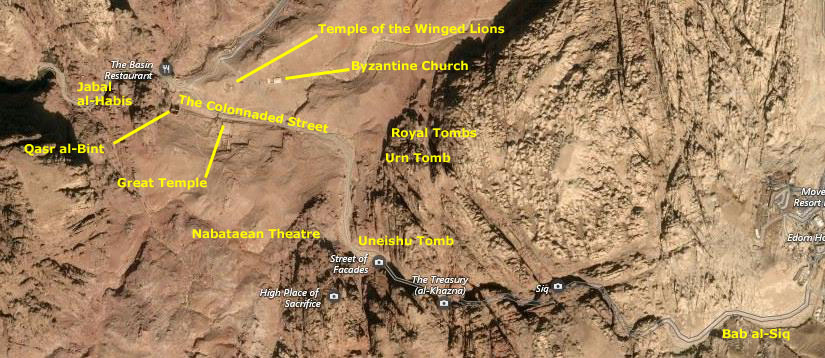
The last section of the Petra site that Fred visited (but I didn't) was an area known as the "colonnaded street", named for the plethora of ruined columns that line it and that also form part of the individual buildings and sites along it. These sites included the Great Temple, the Qasr al-Bint, the Winged Lions Temple, and, at the far end of the site, the facades and tombs on the Jabal al-Habis.
Structures on the Jabal al-Habis
|
The trail continues, becoming quite steep going up to the Crusader fort on top of the mountain. There, a wide plateau extends facing south, offering spectacular views of Wadi Farasa and Wadi Thughra (two more of the dry streambeds that crisscross Petra), as well as of the city center (the colonnaded street) and the Royal Tombs to the east.
|
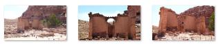
In the same picture, find the three "windows" in the lower part of the dark cliff at left. These are the remains of a tomb that was begun but only one-quarter of its facade was completed. The reasons why tombs such as this one remained unfinished could be that the carvers reached a point in the rock where they have been unable to continue, as geological factors played a role in Nabatean architecture, or the family or person who commissioned the tomb ran out of money or died before the monument was completed.
This unfinished fa�ade reveals a lot of information about both the effort expended and the process used by Nabatean masons in carving deeply into the irregular cliff face. The initial excavation into the cliff face created a scaffold-like platform from which the mason could finish the tomb's architectural details, as he worked his way slowly downward, chipping away at the unfinished rock with his hammer, pick, and chisel.
The Temple of the Winged Lions
|
Fred did not have a closer picture of the entire Temple site; I think it was because it is fairly large and he might not have been able to get it all in. You can see in the picture at left that the site is pretty extensive.
This sacred complex, thought to have been built by the Nabataeans during the first century AD, with an ascending staircase and a grand entrance flanked by columns, had an inner cultic chamber with a raised podium. The columns around it were adorned with unique �winged lion� capitals that gave the sanctuary its name.
At the site, he ran across what appeared to be some fallen columns. The huge circular column pieces ("drums") came from one of a pair of columns that originally stood approximately 40 feet high. They supported the roofed entrance of the Temple. The drums weigh about 3500 pounds each and were originally secured with concrete and probably plastered and painted. Corinthian-style capitals once topped the monumental columns. The building of columns from individual drums helped resist seismic activity, although this did not save the columns or the temple from the earthquake of 363 AD.
|
Flanking aisles with columns created a narrow corridor around which the podium could be circumambulated in ritual procession, while the inner walls of the chamber, painted in vibrant colors and adorned with elaborate moldings, featured shallow niches for the display of objects and gifts offered to the goddess.
An unusual feature of the temple is its adjoining workshops, for grinding pigment, working marble, processing oil, and hammering metal.
Something else interesting at the Temple of the Winged Lion was the use of traditional archways- scarcely seen elsewhere in Petra. The arch is one of the oldest architectural constructions; they appeared as early as the 2nd millennium BC in Mesopotamian brick architecture, but their systematic use started with the ancient Romans, who were the first to apply the technique to a wide range of structures. So, here at the Temple, we see the influence of Rome here at Petra.
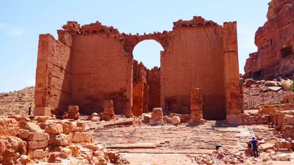
The Qasr al-Bint
|
|
The monument is almost square (about 100 feet on a side) and is set on a podium. It is built with blocks of rose sandstone with an inner fill of smaller stones and mortar. It was the main temple of Petra and it still stands to a height of 70 feet. Qasr al-Bint is a typical Hellenistic temple where only priests could enter inside and worshippers remained outside in the open temenos, or holy area, where they may have offered animal sacrifices. It is approached by a flight of 26 marble steps, and four stucco-covered Corinthian columns between pilasters decorated the northern facade.
The temple sanctuary is divided in three compartments. The middle one protected an altar platform that housed images of the deity. The two lateral ones had a kind of mezzanine or balcony. They were accessed through stairways logged in the walls. It is believed that this temple was dedicated to Dushara, the main Nabataean god, and the goddess al'Uzza. Qasr Al-Bint had remarkably rich inner and outer stucco decorations, remains of which can still be seen on site. In both its architectural layout, and its decorative scheme, the temple is one of the most original monuments of the Hellenized Near East.
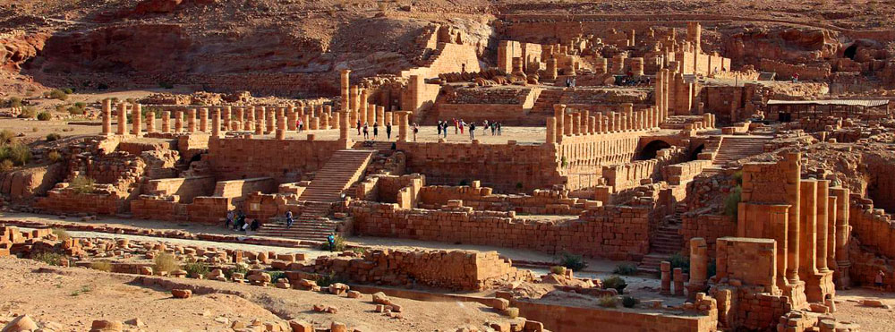
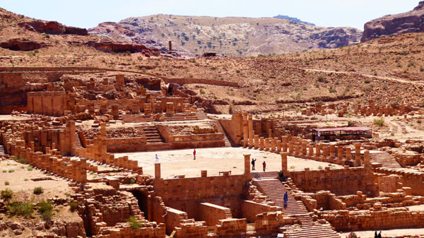
The Great Temple
|
While Fred got some pretty good pictures of it, which we'll see in a moment, I wanted one professional-looking picture to include here- simply because the site looked so amazing. So I have borrowed a panoramic view of the site that I found on a Jordanian government site detailing art treasures in that country. You can compare some of Fred's pictures to this one, which of course was taken at the best possible time in the best possible light.
At the heart of the ancient city extends a wide colonnaded street. It was built at the end of the 1st century AD, on the traces of an older road. It follows the east-west topography of Wadi Musa, starting at its confluence with Wadi Mataha, where the ruins of the Nymphaeum (public fountain) can still be seen.
|
The Great Temple is one of the major architectural components of metropolitan Petra. Constructed at the end of the first century BC, it was enlarged during the first 100 years AD. The precinct itself measures 60,000 square feet. Located to the south of the Colonnaded Street, it includes a monumental staircase a monumental staircase, a large sacred open-air plaza (Lower Temenos) paved with hexagonal stones enclosed on both lateral sides by triple colonnades.
|
The evidence suggests that this building served primarily as a civic complex under the patronage of the Nabataean royal house. The structure's downtown location outside the Qasr al-Bint temple precinct points strongly to its secular function, although religious activities may also have taken place in this grand complex. Other features of the Great Temple Complex are a subterranean drainage system and baths, which were uncovered in the west of the temple; and a workshop for producing plaster molds, found at the south end. Between the Great Temple and the Qasr Bint, a Nabataean bathhouse was excavated, which is believed to have been used for ritual purification ceremonies.
Here are two more good pictures Fred took before heading back out of the Petra site:
 In this picture, Fred has framed the Urn Tomb, which is about a half a mile away, between two of the columns just west of the Great Temple. |
 Fred has begun his walk back along the Colonnaded Street, and is being passed by an Uber rent-a-donkey that someone has called. |
Returning to the Mariner of the Seas
Visiting Petra was incredibly interesting; it reminded me most of our visit to Ephesus, in Turkey, years ago. There were many fewer free-standing ruins here, but the ones that existed were larger in scope and scale. And then Ephesus didn't have the sandstone cliffs and the carved facades, either. But, our visit over, both Fred and I have independently headed back to the hotel for lunch.
Leaving the Petra Site
|
|
(Mouseover Image Above for Video Controls) |
(Mouseover Image Above for Video Controls) |
The World Heritage city of Petra with over 600 rock-cut tombs, offers such a wealth of attractions that it was apparent pretty early that to really see the site, and especially to do any of the hikes and climbs, one should really be here for a couple of days. And it seemed that the many hotels we passed in Wadi Musa (the town) were evidence that this is what a lot of people do. Even so, the visit to Petra was pretty magical.
The Trip Back to Aqaba
|
|
The trip back had me sitting on the scenic side of the bus, and I found that the afternoon light was excellent for taking pictures; the only shadows (until we got back to the port) were those cast by the bus itself. Anyway, I took quite a few pictures on the way back- the town of Wadi Musa, the beautiful scenery in the Jordanian Rift Valley, some candid views out in the valley, views as we came into Aqaba, and finally a couple of views of the port as the sun was going down.
I went through all those pictures, narrowed them down as much as I could, and have put them in the slideshow at left. As always, should you or any of your IM Force be caught or killed, the Secretary will disavow any knowledge of your actions. LOL (Use the little arrows to go from one image to another and track your progress with the index numbers in the upper left.)
Leaving Aqaba
|
We wouldn't actually leave the dock until after dark, so our last pictures from Aqaba were taken before we went back to the stateroom, the gym, and dinner in the dining room:
|
At dinner, much of the conversation was about our upcoming transit of the Suez Canal, which will take place the day after tomorrow on May 1st. Having been through the Panama Canal, we are anxious to see what a canal without locks is like.
You can use the links below to continue to another photo album page.
|
May 1, 2018: A Transit of the Suez Canal |
|
April 22, 2018: A Walking Tour of Dubai (UAE) |
|
Return to the Index for 2018 |