|
June 15, 1970: My Arrival in Korea |
|
June 4, 1970: A Visit to Judy's House |
|
Return to the Index for 1970 |
Well, the time has arrived for me to depart for my 13-month overseas tour in Korea. I am fortunate that Korea was available and that I had a choice between it and Vietnam. I've seen Vietnam so much on the news that I feel, like most Americans do, that I've already been there. So I am looking forward to seeing a part of the world that I am not likely to see again (although little did I know that this assumption would be incorrect).
My Trip to Seattle and McChord AFB
|
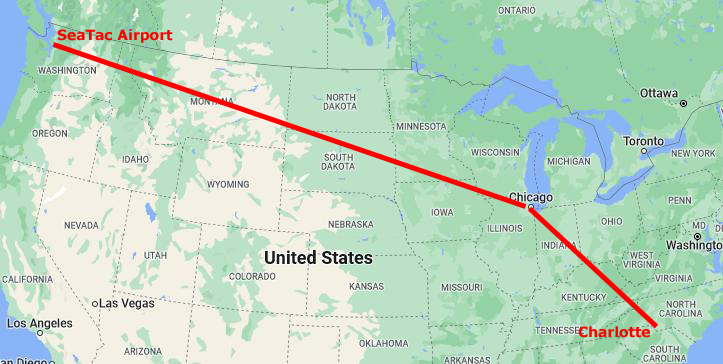
At left is a map detailing these first two legs (out of three) of my trip to Korea.
The flight to Chicago was only the second or third flight that I ever remember taking. I took a plane years ago up to Muskegon to visit my Aunt, and my parents tell me that I was on a plane with them as a very young child, but that I don't remember.
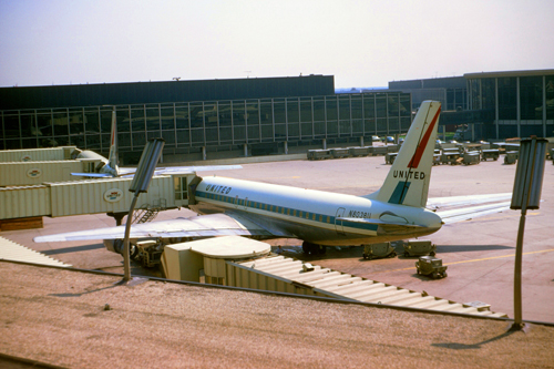
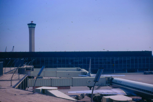
I'd always thought that the Charlotte Airport was pretty big, but I wasn't prepared for O'Hare Airport in Chicago. It seemed to go on forever, and there were flights to just about everywhere. There were TV screens in the concourses that listed the departing and arriving flights, and just here in the domestic terminal there were flights coming from and going to all the cities I'd heard of, and many that I hadn't.
And the concourse was busy! In Charlotte, flights were infrequent enough that the concourse would only have a lot of people if a flight were just departing or one had just arrived. But in Chicago, flights were departing and arriving every few minutes throughout the day, so there were always lots of people passing through. This was also the first time I had landed at an airport and then gotten on another plane without ever leaving the airport itself. In later years, I would come to understand that the vast majority of the folks who pass through an airport do exactly that- they simply change planes. In big, tourist-oriented cities like New York or Los Angeles, you might find sizeable numbers of people ending or beginning their journeys there, but most were like me.
|
|
I found the whole experience of flying pretty amazing, and I wondered what it might be like to travel by air frequently. (Note from the present: Years later, I would come to understand exactly what this would be like, and I would also come to know many airports, particularly Chicago O'Hare, very, very well.)
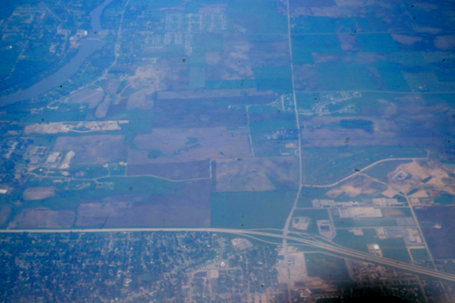
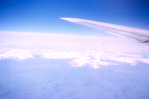
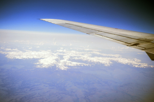
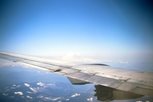
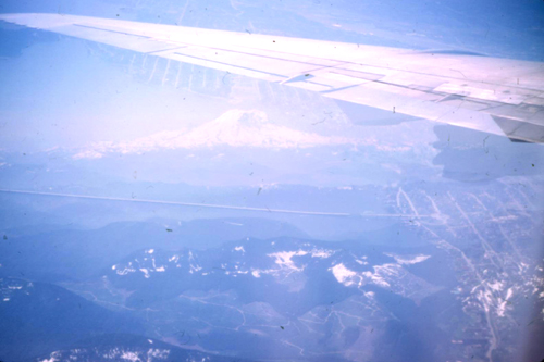
The United flight to Seattle-Tacoma Airport (Sea-Tac) was one of the neatest experiences I've had so far. I made sure to get a window seat, and I put the old Argus camera to good use, capturing a good many scenes of the landscape that we flew over.
|
|
|
|
|
|
In the last pictures you can actually see the snow-capped Mt. Rainier in the distance. I took only one picture as we descended into the Seattle area for landing at Sea-Tac Airport. It was an interesting bridge over what I came to learn (from the Seattle map I bought) was Lake Washington.
|
Interstate Highway 5 runs north-south through downtown Seattle (actually from the Canadian Border, through Washington, Oregon, and California, and all the way to the border with Mexico), and I guess a fair number of drivers who come to Seattle from the east on I-90 want to get on I-5 to go one way or the other. But at the moment, there is no interchange between I-90 and I-5, as the multi-lane I-90 has not yet been brought across Lake Washington.
The Interstate Highway System, while largely completed, is not yet finished in some sections, and the connection from Bellevue to I-5 in downtown Seattle is one of those. This bridge is called, if you are curious, the Lake Washington "Floating Bridge" (as the center section does actually 'float' on huge pontoons).
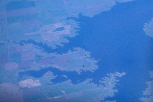
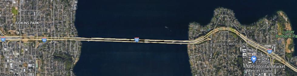
(Note from the present: The bridge across Lake Washington would not be brought up to Interstate standards until 1990, when the old bridge- the one in my photograph at left- was closed for reconstruction. There was a major accident that delayed this reconstruction, and so the bridge we see today didn't actually open until 1993. Here is an aerial view of the present-day bridge:
|
While you can't tell from the aerial view, there is a high hill at the western end of the bridge, and I-90 actually goes through a tunnel before it comes out in downtown Seattle and gets to it's major interchange with I-5.
|
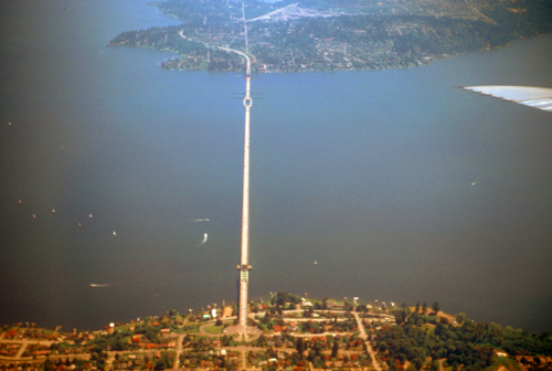
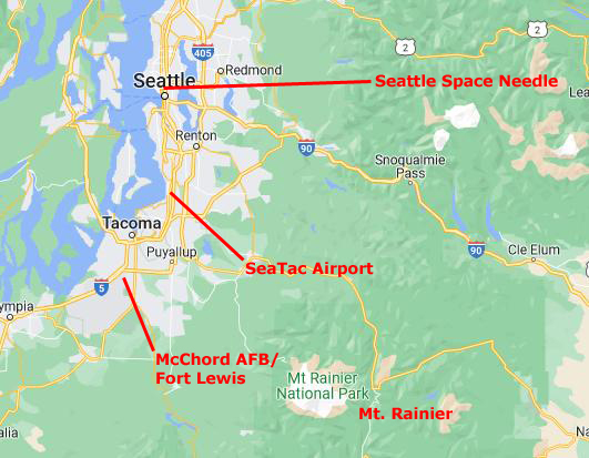
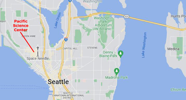
There are at least a couple of things I want to do while I am here in Seattle on the Government's dime. I have always wanted to see the Seattle Space Needle that is just north of Seattle's downtown core. There is an entire park there, a leftover from the Seattle World's Fair.
In addition to that man-made marvel, I also want to visit a natural one- Mt. Rainier. The National Park is southeast of the Seattle-Tacoma metro area, and it is necessary to have a car to get there as well.
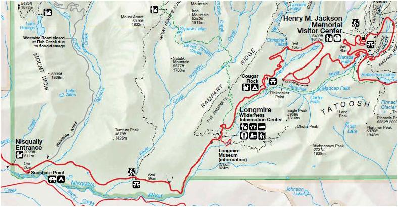
On the map at left, I've marked the locations of these stops I want to make, so you can get a feel for the area that I'll be traversing in the next couple of days.
After my cross-country trip, I'll get settled into the BOQ, rent my automobile, and have a good dinner at the Officer's Open Mess. Tomorrow, I'll make my first trip up through downtown Seattle to the Space Needle.
The Seattle Space Needle and Pacific Science Center
|
The Century 21 Exposition (also known as the Seattle World's Fair) was held April 21, 1962, to October 21, 1962, and nearly 10 million people attended the fair.
As planned, the exposition left behind a fairground and numerous public buildings and public works; some credit it with revitalizing Seattle's economic and cultural life. The fair saw the construction of the Space Needle and Alweg monorail, as well as several sports venues, and performing arts buildings. Unlike some other world's fairs of its era, Century 21 made a profit.
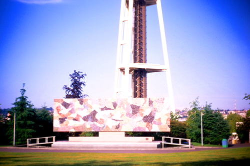
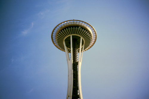
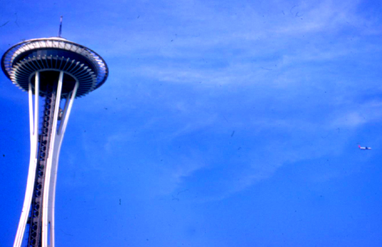
The Space Needle observation tower is a landmark of the Pacific Northwest, and a symbol of Seattle. Built in the Seattle Center for the Fair, it was, for a time, the tallest structure west of the Mississippi River at 605 feet high. While it may look fragile, it was built to withstand 200 MPH winds and 9.1 magnitude earthquakes. It also has 25 lightning rods. With my Dad's camera, I was actually not able to get back far enough to get the entire structure in a single photograph, so all I can include here are pictures of the base and the upper level of the tower.
|
|
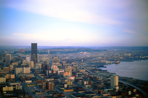
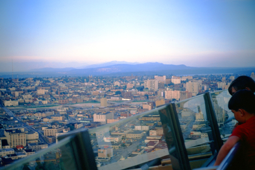
The observation deck is 520 ft up the structure, and there is a rotating restaurant just below it. From the top of the Needle, one can see not only the downtown Seattle skyline but also the Olympic and Cascade Mountains, Mount Rainier, and Mount Baker, as well as Elliott Bay and the surrounding islands. There is a bank of elevators to take visitors to the top in a 41-second, 10MPH trip. Of course I had to go up to the top, and I got some excellent pictures from there:
|
|
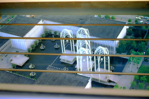
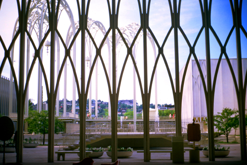
Being at the top of the Space Needle was very interesting. One of the views I got from the top looked down on the Pacific Science Center, and when I came down from the top of the Needle, I walked over there to get another picture from ground level of what I'd seen from above.
|
|
I thought that the beautiful filigreed arches of the Science Center were pretty amazing. The Science Center is a museum, and if I hadn't wanted to drive around the area a bit I probably would have gone in. Instead, I walked over to the huge dome fountain between the Science Center and the Needle to have a look. It was one of the largest fountains I'd seen in a long time.
|
The architecture of the Space Needle is the result of a compromise between two designs- one, a giant balloon tethered to the ground and the other, a flying saucer. Yet a third designer contributed the hourglass profile. The "hovering disk" of the Space Needle is home to two restaurants, both of which are part of the rotating structure.
Construction of the Space Needle was delayed because of difficulty locating an appropriate plot of land within the upcoming World's Fair site; when the location was finally acquired, only one year remained before the World's Fair would begin. The privately built and financed Needle was built by a construction team working around the clock. The foundation is a block of concrete built below ground level. The block is 30 feet by 120 feet, weighing 6000 tons (including 250 tons of reinforcing steel), and requiring 500 concrete trucks a full day to fill. The structure is bolted to the foundation with 72 bolts, each one 30 ft long.
The domed top is so perfectly balanced that it only requires a motor the size of an average garbage disposal to turn it. Even with all of the over-engineering, the Needle was completed on time, in April 1962, at a cost of $4.5 million.
I really enjoyed wandering around the Fair site. Although the Fair has long since closed, what was intentionally left behind has become the nexus of a major tourist attraction for the Pacific Northwest.
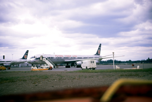
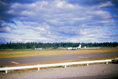
McChord Air Force Base
|
McChord Air Force Base was originally named Tacoma Field in 1927 when a local voting measure voted to create a municipal airport. This airport would be purchased by the United States government in 1938 and renamed McChord Field in May 1938 in honor of Colonel William McChord, who had died in an aircraft accident in Virginia. The early work and construction of the base prior to the start of World War II occurred under the Works Projects Administration.
McChord Field served as a critical piece of defense infrastructure during World War II, training bomber aircraft pilots who would participate in the allied invasion of Italy, southern France, and the Doolittle Raid. McChord Field became McChord Air Force Base in 1948 with the formation of the United States Air Force as a separate division of the armed forces from the United States Army.
|
In 1947 Tactical Air Command moved the 62d Troop Carrier Group to McChord Field from Bergstrom Field, Texas. Headquarters Army Air Forces directed each Army Air Force have a tactical group assigned to establish a Wing headquarters. Thus, the 62nd Troop Carrier Wing (TCW), constituted on 28 July 1947, was activated at McChord Field on 15 August.
The Wing was deactivated in 1950 but reactivated a half year later to support the Korean War. During 1952 and 1953, the 62nd airlifted troops, blood plasma, aircraft parts, ammunition, medical supplies, and much more, to the Far East. Foreshadowing its support mission a decade later, in 1954 the 62nd transported a replacement French garrison to Dien Bien Phu, French Indochina. Between 1955 and 1957, the 62nd began to fly missions to the Alaskan arctic regions, carrying 13 million pounds of supplies and equipment to build the DEW (Distant Early Warning) Line. The resupply of the DEW Line stations kept the Wing occupied until 1969.
By then, the 62nd Troop Carrier Wing was reassigned to the Military Air Transport Service (MATS), becoming something of a service-wide military air cargo operation. It carried out missions to the Arctic, helpe transport United Nations troops and supplies to the Congo, and was also responsible for worldwide airlift of nuclear weapons and associated equipment. In 1968, McChord AFB was reassigned to Military Airlift Command (MAC), ferrying equipment and troops (like me) to their duty stations in the Far East and elsewhere.
A Day at Mt. Rainier
|
Mount Rainier National Park was established on March 2, 1899 as the fifth national park in the United States. The 370-square-mile park encompasses all of Mount Rainier, a 14,410-foot stratovolcano. The mountain rises abruptly from the surrounding land with elevations in the park ranging from 1,600 to over 14,000 feet- the highest point in the Cascade Range. Around it are valleys, waterfalls, subalpine wildflower meadows, old growth forest and more than 25 glaciers.
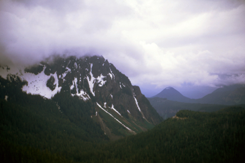
The volcano is often shrouded in clouds that dump enormous amounts of rain and snow on the peak every year and hide it from the crowds that head to the park on weekends. This was to be my lot today as well. While it did not rain or snow, the sky was basically overcast, so classic pictures of Rainier with blue sky for a background were not possible today. It reminded me a great deal of the two trips I made to Mt. Fuji in an attempt to get some really good pictures of it.
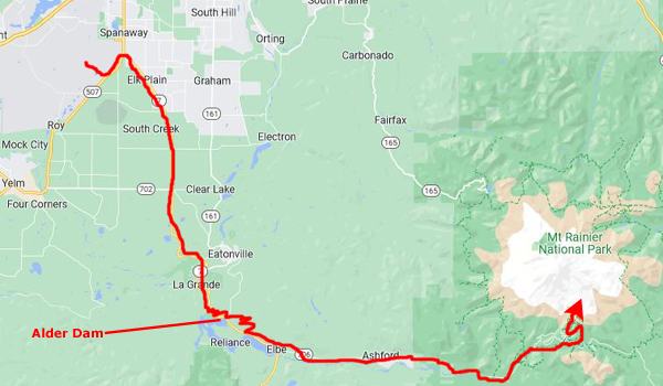
The drive from McChord to the West Portal of the park on Washington Highway 706 was a very scenic one, and there was lots to see along the way.
|
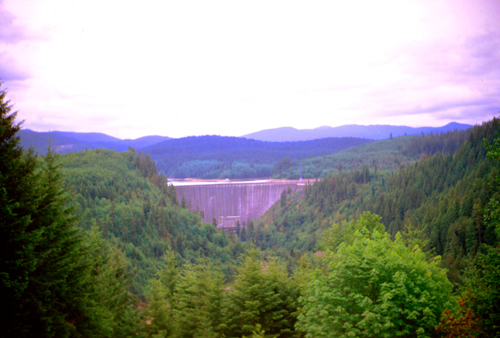
Alder Dam is a concrete thick arch dam on the Nisqually River. The construction began in 1942 and was completed in 1945. At this time Alder Dam was among the tallest dams in the United States, although this title has since been surpassed. The impounded water behind the dam forms Alder Lake, stretching about 7 miles upstream with a capacity of 241,950 acre-feet. With 28 miles of shoreline, the lake is a popular recreation spot close to Mount Rainier National Park.
Water from Alder Lake is sent into two generators at the base of the dam, each of which produces 25 megawatts for a total nameplate capacity of 50 megawatts. Two miles downstream is LaGrande Dam, site of the first dam in the area, dating from 1912, and rebuilt in 1945 at the same time as Alder's construction. Most of the energy produced at the dam is sent to the city of Tacoma, about 25 miles north. Both Alder and LaGrande dams are owned and operated by Tacoma Power.
The name of the lake and the dam recalls the former small town of Alder, which was flooded in 1945 by the impounded water of the lake and disappeared.
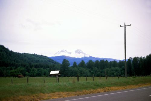
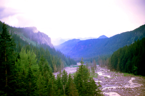
Driving past Eatonville and heading East, I began to get some good views of the mountain in the distance.
|
|
It took me about 45 minutes to get from Eatonville to the park headquarters, which is actually outside the park itself about ten miles from the actual entrance. A few minutes later I reached the Nisqually Entrance at the extreme southwest corner of the park.
|
Later studies of Native American use of the area concluded that aside from its use by prehistoric humans, there was no evidence of later Native American habitation of the park, although research and interviews revealed that it was used for hunting and gathering and for occasional spirit quests. Before they entered into treaties with the United States in 1854-55, as many as five local Native American Indian tribes used the area that is now the park.
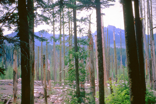
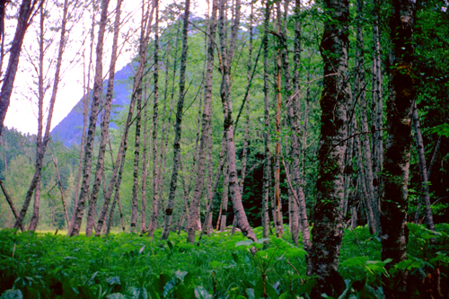
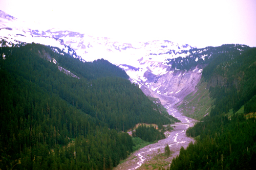
I drove into the park and for ten miles or so on the way to Longmire, had beautiful vistas of snow-covered mountains, heavily-forested slopes, and numerous streams on the lower slopes of the mountain. Some of these were relatively empty now, but I assume that later in the summer will be overflowing with snowmelt.
|
|
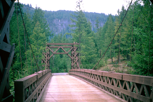
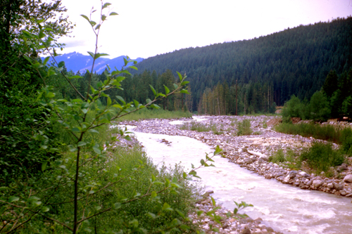
I passed by a number of mountain streams, and one particularly large one. I stopped to photograph it, and found a wooden bridge spanning it, carrying a park road across. So I walked across the bridge, photographed the stream, and walked back. Here are the bridge and the stream:
|
|
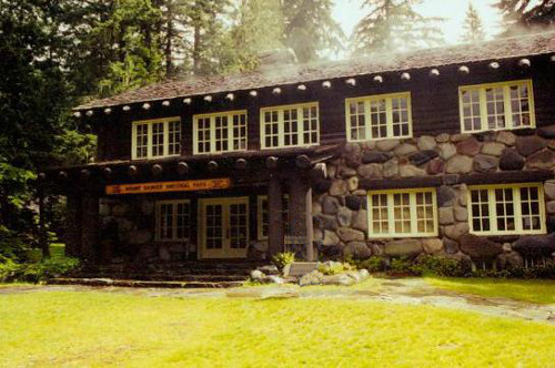
The next place I stopped at to get out and walk around was Longmire- the Wilderness Information Center.
|
|
On March 2, 1899, President William McKinley signed a bill passed by Congress authorizing the creation of Mount Rainier National Park, the nation's fifth national park. It was the first national park created from a national forest- The Pacific Forest Reserve created in 1893.
|
John Muir had visited Mount Rainier in 1888; he and nine others accomplished the fifth recorded ascent to the summit. (This trip played a role in reinvigorating Muir and convincing him to rededicate his life to the preservation of nature as national parks.)
At the time national forests, called forest reserves at first, were being created throughout the American West, under the utilitarian "conservation-through-use" view of Gifford Pinchot. Muir was what came to be known as a "preservationist". He wanted nature preserved under the more protected status of national parks.
But during the 1890s there was more public support for creating national forests than national parks. During that decade, Muir and his supporters were only able to protect one national forest as a national park. When the Pacific Forest Reserve was created in 1893, Muir quickly persuaded the newly formed Sierra Club to support a movement to protect Rainier as a national park. Other groups soon joined, such as the National Geographic Society and scientific associations wanting Mount Rainier preserved as a place to study volcanism and glaciology.
Commercial leaders in Tacoma and Seattle were also in support, as was the Northern Pacific Railway. The effort lasted over five years and involved six different attempts to push a bill through Congress. Congress eventually agreed, but only after acquiring assurances that none of the new park was suitable for farming or mining and that no federal appropriations would be necessary for its management. Later, of course, as the National Park System expanded, federal appropriations were indeed used for support of the various parks, including Mount Rainier.
|
|
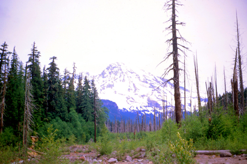
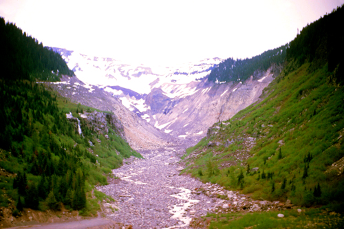
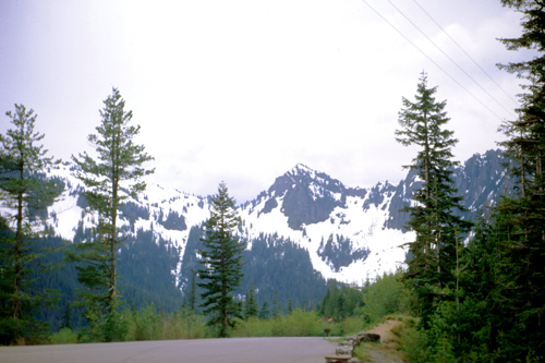
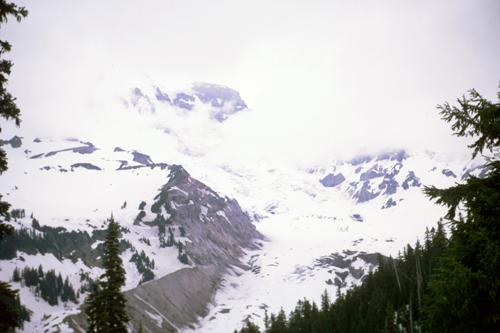
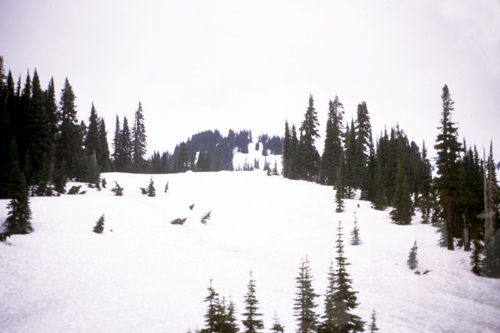
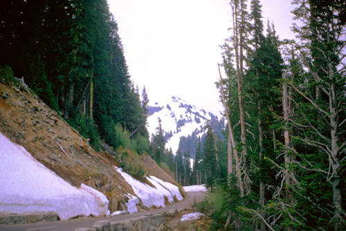
Once I passed through Longmire, the road began ascending steadily and the views, like the ones above and below, got better and better. The only thing that would have improved the trip would have been if this had been one of the relatively rare clear days on the western slope.
|
|
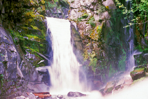
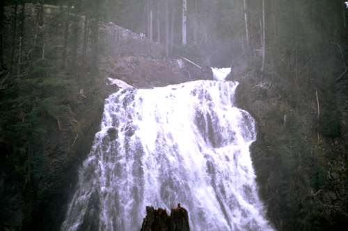
As I continued up the park road past Longmire, I stopped at a number of overlooks and waterfalls.
|
|
Note from the present:
I want to say something interesting about the right-hand picture above. This waterfall, as I said, was reached after a short hike, and it was marked on the park map I'd gotten at the entry station. I would visit Mt. Rainier two more times, each time bringing someone new to see it. And each time (once in 1987 and once in 2001) we would hike to this exact same waterfall. So this won't be the last time you will see this picture.
Soon, I found the turn-off to the Visitor center, and as I headed up the steep park road, the scenery got even more spectacular.
|
|
About 3 PM, the clouds began to move in, and I couldn't get any more pictures of Rainier itself. Looking at the snow-covered slopes going up into the clouds, one can imagine the kind of cloudy dream world that must exist on the summit.
|
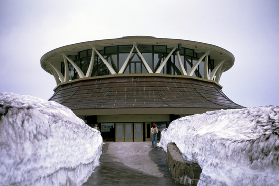
Mount Rainier was a pilot park in the 1960s "Mission 66" program to expand National Park visitor services. The plans for the Paradise Visitor Center as a day-use facility came about as a compromise when the program was still trying to determine whether overnight lodging would be feasible. Construction began in 1964, and was to include a restaurant, museum, information center, ski rental shop and a warming hut. The building was completed in 1966.
The structure's round shape and distinctive roof were intended to fit its surrounding mountain landscape, and a flyer produced for the opening ceremony spoke of "the swooping, bough-like shape of the beams, the branching 'tree' columns, the 'switchback trail' ramps, and the sloped 'cliffs' of the stone base." But the center's modernist style common to many of the program's projects and a distinct departure from "National Park Service Rustic," was always controversial. Drawing frequent comparisons to a flying saucer, it reminded others of a sunken Seattle Space Needle.
Inside, the Center did seem sparse and cavernous, although part of that was probably due to the weather. I have to admit, the latticework windows you can see at left offered expansive views 360° around. I spent some time looking at the exhibits before going outside to take in more of the mountain scenery here in the Tatoosh Range.
|
Paradise is the most popular destination for visitors to Mount Rainier National Park. Two-thirds of the people who visit the park in any given year go to Paradise for the views and to stop in at the Visitor Center. I came in via Longmire, along State Route 706; there is another entrance on State Route 430 from the north, but that road is closed in the winter. The Nisqually entrance via Longmire is open to autos year-round.
Paradise is the location of the historic Paradise Inn and Paradise Guide House, built in 1916 and 1920 respectively. In 1966, the park built the Henry M. Jackson Visitor Center, the uniquely-interesting round building with entrances on the ground floor and a 360° bank of windows on the second providing views in all directions.
|
The roof of the original structure was not designed to handle the copious amounts of snowfall in the Paradise area each winter; melting it to avoid a roof collapse used up hundreds of gallons of diesel fuel each day. Additionally, by the 1990s, the building no longer met building and accessibility codes, despite ramps and other features that required a disproportionate amount of space.
All this led the National Park Service to replace the Jackson Visitor Center (the name had been changed to honor Henry "Scoop" Jackson, the longtime U.S. Senator from Washington) with a more traditional design. The National Park Service began construction of a smaller, more energy-efficient visitor center in 2006. The new Henry M. Jackson visitor center opened in the Fall of 2008. Demolition of the building you see here was accomplished in 2009.
I could see from my short visit to Mt. Rainier, that returning here at some point, perhaps at some time of year where the weather would be better, would be a neat thing to do. But with the weather deteriorating this afternoon, I returned to McChord AFB for supper and my last night in the United States for quite some time.
I spent the next day driving around for a bit, returning the car, and getting some information at the Officer's Club about Korea and what I might expect. Late in the afternoon, I reported to the MATS terminal for my flight overseas.
You can use the links below to continue to another photo album page.
|
June 15, 1970: My Arrival in Korea |
|
June 4, 1970: A Visit to Judy's House |
|
Return to Index for 1970 |