|
Sea Days Aboard the Viking Jupiter |
|
Our Ship: The Viking Jupiter |
|
Return to the Index for 2019 |
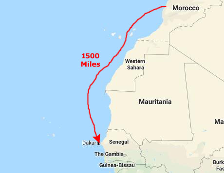
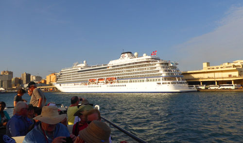
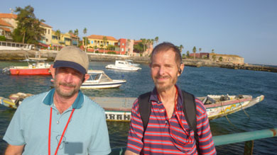
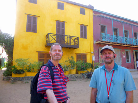
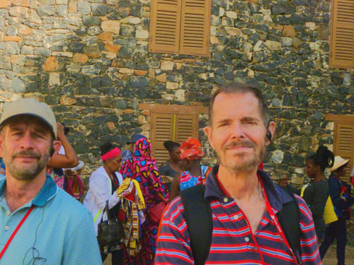
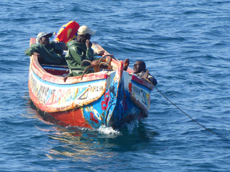
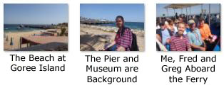
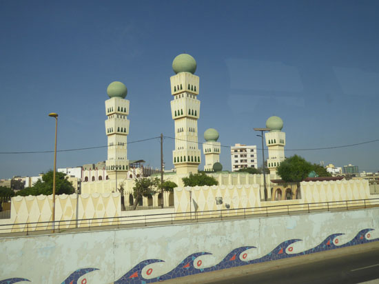
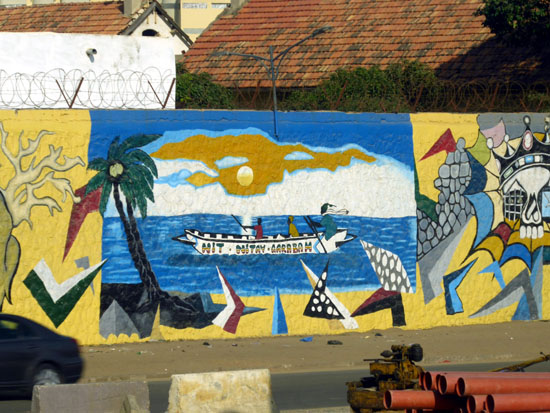
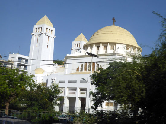
Well, we have been at sea for the last three days, enjoying the relaxing shipboard activities that have become routine for those days on the water. Today, however, we are making our third port- a new city in a new country on our list. Dakar, Senegal is only the second city we have been to on the African continent (Casablanca being the other). Today, we will be joining a shore excursion that will feature a tour of Goree Island- infamous as a jumping off point for many of the ships that brought slaves to the New World. The tour will also include lunch on the island as well as a city tour in Dakar- including a visit to the African Renaissance Monument.
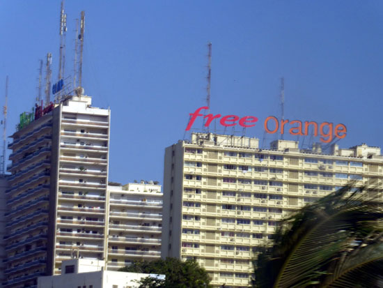
Arriving in Dakar, Senegal
As I said, we've been at sea for three days on our trip to Dakar from our last stop in Casablanca, Morocco.
|
|
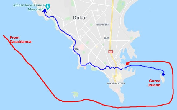
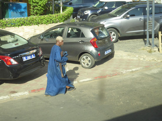
In fact, we docked in an area that was surprisingly "un-touristy"; there was only a small building handling tourism, a building we never even entered when we debarked for our excursion.
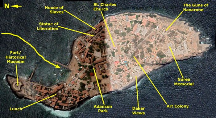
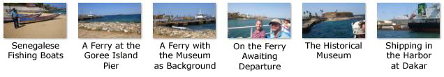
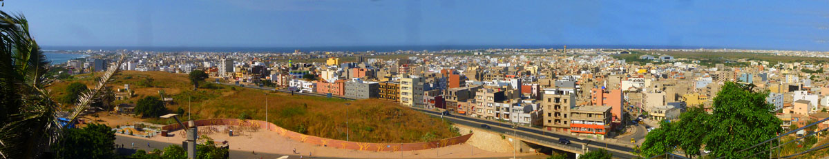
Looking at that map of Dakar, you can see pretty much where we went. We took a ferry to Goree Island and back, and then we walked through the port to board a bus for our tour of the city, visit to the African Renaissance Monument, and return to the ship.
A Sobering Visit to Goree Island, Dakar, Senegal
I say "sobering" because this was far from your typical sightseeing tour. What was always in our minds (at least the three of us) was the history of what happened at this site we are visiting. I have never visited the site of one of Germany's WWII concentration camps, but I would imagine the feelings would be similar.
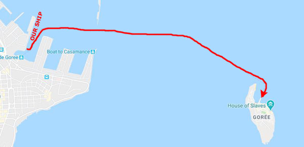
Getting from the Ship to Goree Island
|
|
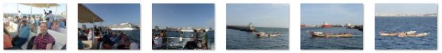
When both of our tour groups were on board, the tour ferry left the dock and headed out to leave the harbor for the two-mile trip across the strait to the island.
|
|
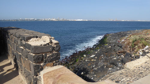
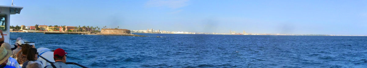
On the way across the strait over to the 45-acre island, our tour guide kept up a running commentary to introduce us to the island itself. �le de Gor�e is one of the 19 "communes d'arrondissement" (i.e. districts) of the city of Dakar and famous as a destination for people interested in the Atlantic slave trade. Many say it was one of the two or three prime centers of that trade, although a rather larger group of historians dispute that view.
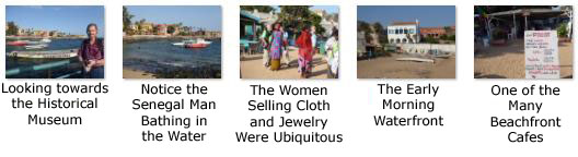
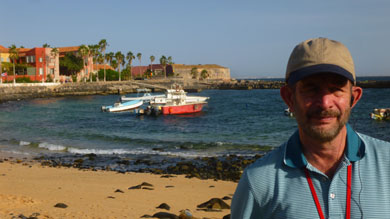
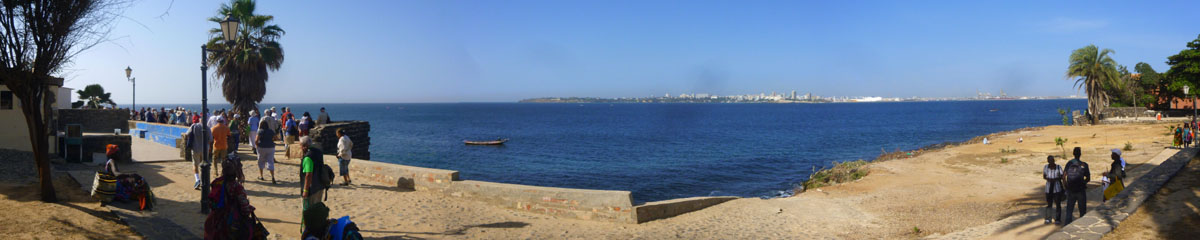
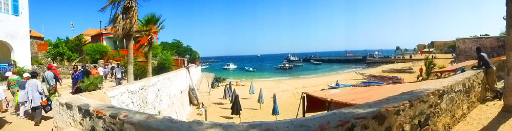
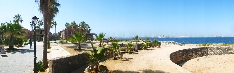
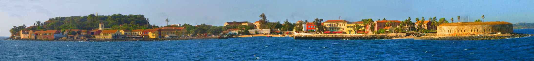
Goree Island's population as of the 2013 census was 1,680 inhabitants, resulting in a population density about half that of the city of Dakar. Gor�e is both the smallest and the least populated of Dakar's 19 districts. The island is a UNESCO World Heritage Site, and its name is a corruption of its original Dutch name "Goedereede", meaning "good roadstead" (a sheltered stretch of water near a shore where ships can ride at anchor). Fifteen minutes after leaving Dakar, we had our first view of Goree Island a half mile away. When we got a little closer, I made a very wide panoramic shot of the east side of the island, and it is in the scrollable window below:
 |
Moving over to the other side of the ship, I made a panoramic picture looking back across the north end of the island towards the city of Dakar in the distance:
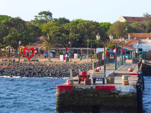
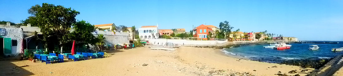
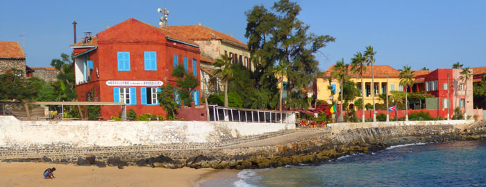
The ferry slowed down, of course, as we got closer to the dock at Goree Island, and we were able to get some really nice pictures of the east side of the island, where all the hotels and most of the restaurants are located. Some of the best of these pictures, taken from different distances from the pier, are below:
|
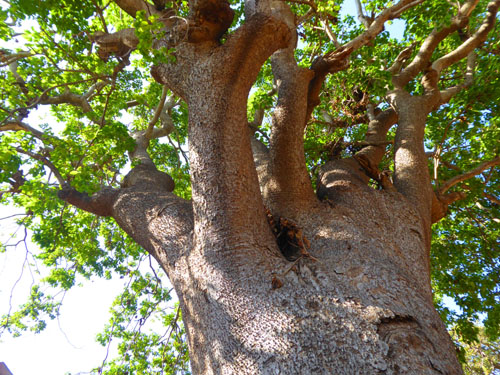
Gor�e is a small island (3,000 ft north to south and 1200 feet wide) sheltered by the Cap-Vert Peninsula. Now part of the city of Dakar, it was a minor port and site of European settlement along the coast. Being almost devoid of drinking water, the island was not settled before the arrival of Europeans. The Portuguese were the first to establish a presence on Gor�e c. 1450, where they built a small stone chapel and used land as a cemetery.
|
|
(Mouseover Image Above for Video Controls) |
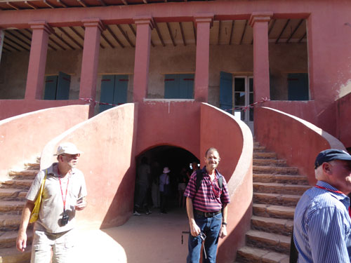
In a few minutes, we will be disembarking and joining our tour guide for our walk around this historic area. Before diving in to that tour, though, let me set the stage for what our guide has said we will see.
|
From there, we'll head to the south coast of the island for the views of Dakar, and then we will take a path that will lead us through Goree's artist community (and shopping opportunity) up to the highest point on the island, there to visit the Goree Memorial and climb on the Guns of Navarone. (I'll bet you thought they were somewhere in the Mediterranean, didn't you? Won't you be surprised.)
Coming down from the hill, our guide will lead us to the island's iconic location- the House of Slaves. We will get a chance to walk through the same rooms in which future slaves were kept and see the same views that were the last ones of Africa that those slaves would see. Just down the street from that locale is Goree's most famous sculpture- the Statue of Liberation.
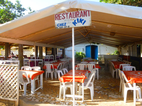
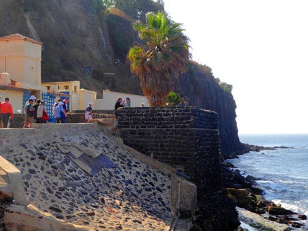
Finally, we have lunch scheduled at a local restaurant and then a visit to the old Portuguese Fort at the north end of the island- now a historical museum. So with that overview in mind, let's follow our guide into the center of Goree Island.
Walking to the Center of Goree Island
|
|
From some distance across the sand (we were heading towards the south and an opening in the waterfront buildings that gives access to the interior of the island), I looked back and thought this view of the hotels and restaurants along the waterfront was interesting:
|
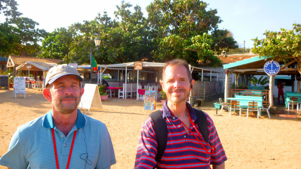
I lagged behind the tour group just a bit because I found some other interesting views right here at the beachfront.
|
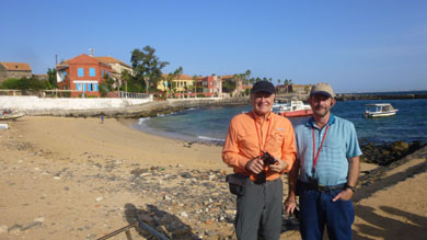
And here are a few more pictures of the three of us on the beach at Goree Island:
|
|
|
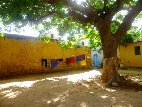
So the three of us caught up with the group and we went through a gap between the beach buildings to find ourselves coming into a large open area known, our guide said, as Adanson Park (not really a park as you and I might think of it, but rather an open area used for some recreation (there was a playing field nearby) and all sorts of public gatherings. Right in the middle of this area, I later found some sort of performance platform- kind of like a small bandshell- with someone apparently calling it home.
|
There were lots of interesting scenes here, looking around this open area, and we took a number of pictures of the buildings bordering it. Have a look at some of them:
|
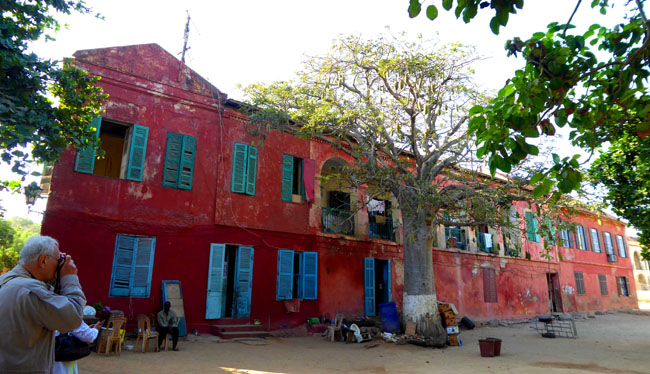
There was one large, long, red stucco building, most of which looked almost unoccupied (although there was one section at the far end where the windows had been redone and there was an airconditioner in one of them). I never got the chance to ask our guide whether this building was anything special, but Fred did get a good panoramic picture of it.
|
|
(Mouseover Image Above for Video Controls) |
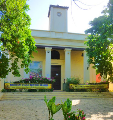
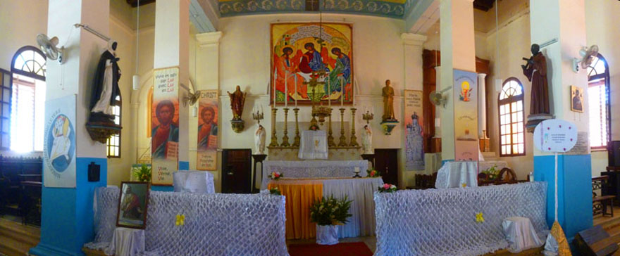
St. Charles Church
|
|
After the French invasion in 1677, control of the island seesawed between the French and English as a result of the various wars fought by France and Britain. The island was notably taken and occupied by the British between 1758 and 1763 during the Seven Years' War before being returned to France at the Treaty of Paris. For a brief time between 1779 and 1783, Gor�e was again under British control, until ceded again to France in 1783 at the Second Treaty of Paris. The island then remained in French hands until Senegal was granted indepedence in 1960.
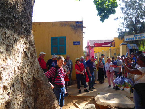
As we were walking along, listening to this history, I happened to look through a doorway and found myself looking into the eyes of a woman doing some sort of household chore; she seemed interested in the attention; when I smiled at her she readily smiled back.
We passed what looked like a clinic of some kind, but was in fact the island's hospital. When our guide pointed it out, I went up on the steps to look into the courtyard at the locally-made replica of Michaelangelo's "Pieta".
|
After the decline of the slave trade from Senegal in the 1770s and 1780s, the town became an important port for the shipment of peanuts, peanut oil, gum arabic, ivory, and other products of the "legitimate" trade. The population of the island fluctuated according to circumstances, maybe reaching 1500 Africans and Creoles along with a few Europeans. During the 18th and 19th centuryies, "M�tis"- Franco-African Creole merchants- were the prominent citizens. M�tis women ("signares") owned ships and property and were also famous for cultivating fashion and entertainment.
In 1794 France abolished slavery, and the slave trade was replaced by legitimate trade, and Goree's merchants established a presence directly on the mainland in Dakar. Many of the established families started to leave the island. In 1872, Goree became a French commune with a major and council; one African deputy was elected to the French National Assembly, serving until 1934. The island's population declined from a peak of 4,500 in 1845 to 1,500 in 1904. In 1940 Gor�e was annexed to the municipality of Dakar.
|
|
During the British occupation of Gor�e from 1758 to 1763, the church served as a warehouse, but when the French took over again, the royal government decided to appoint a governor for the islands, and he restored the church to its purpose.
|
|
The cornerstone of the current church of Gor�e was laid on April 11, 1828, the day of the feast of the King of France Charles X. For this reason, the building was placed under the patronage of Saint Charles Borromeo (1538-1584), archbishop of Milan. The building was completed in 1830.
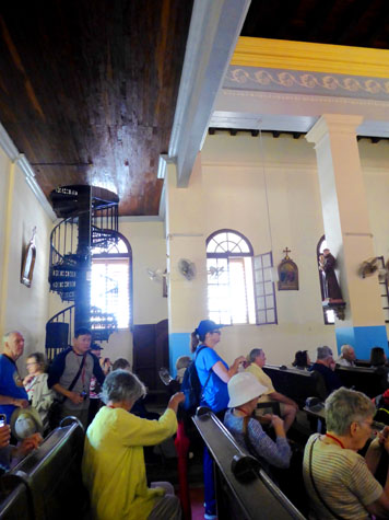
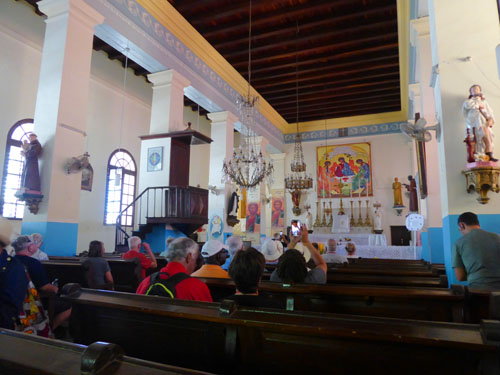
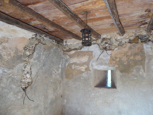
The architecture of this church is very similar to that of a village church in France of the time. Inside the church, there are beautiful old crystal chandeliers, a clam shell, stone, a marble altar, and so on. The staircase leading to the loft is in a spiral with an iron ramp, forged in the workshops of the French Navy, and outfitted with wooden steps.
I found the inside of the church very pleasing, although far from opulent. I suppose this is because I didn't get the impression that the citizens of the area had been taken for a ride in forking over a great amount of their own wealth to make opulent a building that was, in the final analysis, very much a luxury.
|
This gave Fred and I an opportunity to take a number of pictures around the nave, and I've selected some of them to represent the large number that we took. These pictures are at left.
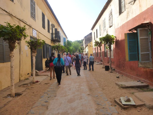
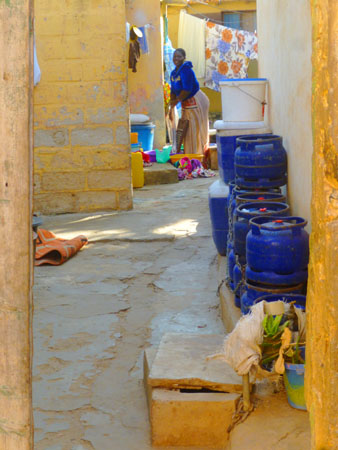
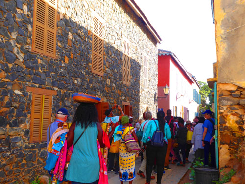
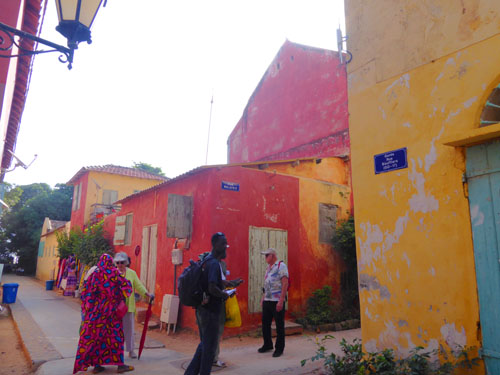
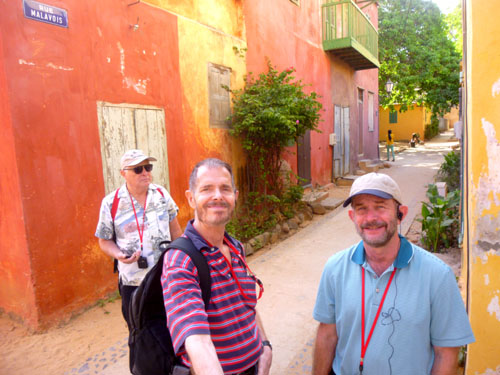
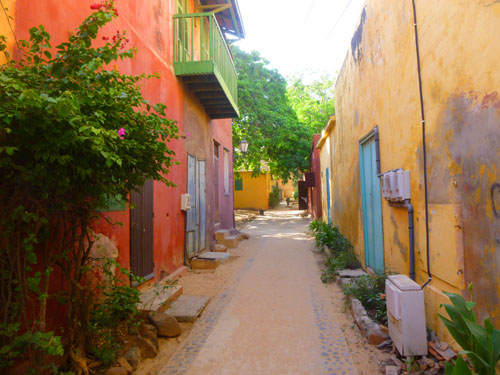
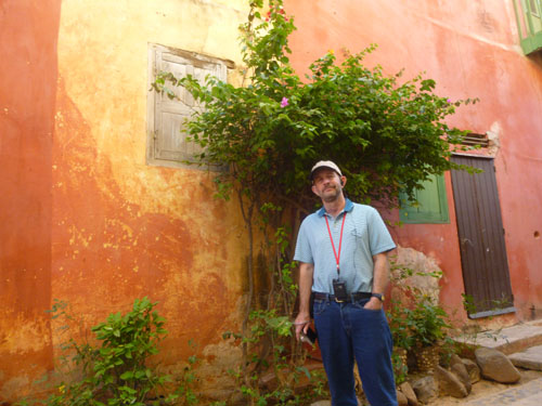
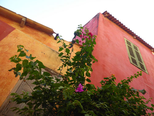
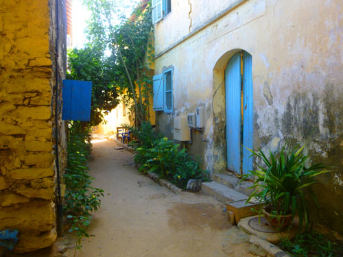
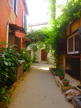
The Back Streets of Goree Island
|
|
|
We did see one guy in his studio making some of the sand paintings we saw later on, but that was about it.
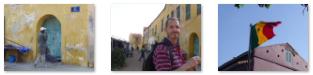
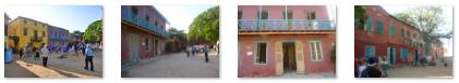
Anyway, just wandering through the streets was very interesting, and the three of us found lots of street scenes, buildings, and people worth taking pictures of. We tended to photograph the same things, giving me the pleasant task of picking the best picture when that happened.
A nice selection of our pictures is in the slideshow at right. Use the little arrows in the lower corners of each picture to move from one to the next, and refer to the numbers in the upper left to track your progress. I hope you find the street scenes as interesting as we did.
During the last part of our walk before we came out at the base of the high hill at the south end of the island, it seemed as if the buildings and residences got a bit nicer, which just goes to show that everyplace has its strata.
|
|
|
We passed one hexagonal structure that apparently used to be a communal water source but is now a large planter. One of the reasons that Goree Island was settled so late was that at least in its early days had almost no drinking water. I do not know if current technology has remedied that, and I neglected to ask our guide where drinking water comes from.
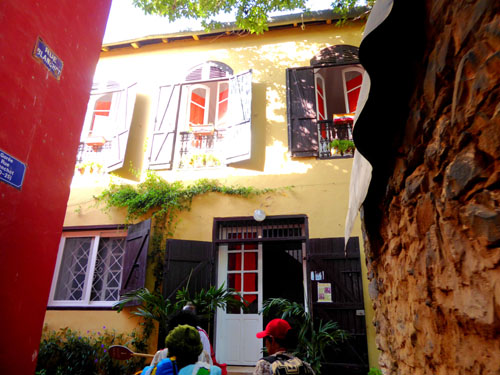
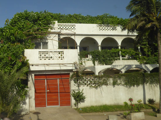
Just before the end of this part of our walk, we came up a narrow street and turned to the left in front of probably the nicest residence we'd seen so far, only to find out that it is now a hotel for tourists.
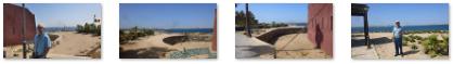
The Western Plateau of Goree Island
As soon as we came out onto the shore, we could see that the views were indeed quite good across the strait to Dakar:
|
Here are two more individual views looking across the strait:
|
|
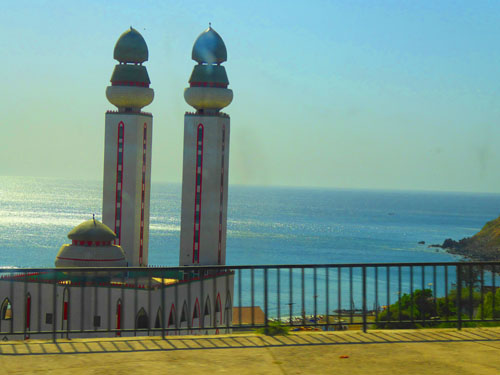
Our guide took us a hundred feet or so south along the coast to show us Goree Island's only mosque. It was not very large, and actually didn't look much like a mosque, situated as it was right on the shore above a viewpoint. (Beyond the mosque, the shore was too steep and rocky for foot traffic.)
|
|
The mosque, built in 1822, is one of Senegal's oldest buildings, and the only mosque on Goree Island(the majority of whose residents are Muslim). Currently, the Goree Island residents are working with representatives from Turkey to perhaps enlarge and rebuild the mosque. A plaque out front reads: "O you humans, we have created you from males and females. We have distributed you in peoples and tribes so that you recognize each other for Allah. The most honorable among you are the most pious. Allah knows everything and observes everything".
Fred took a couple more pictures that I want to include here:
|
|
Oh, and on that right-hand picture above, if you thought I was being hyperbolic:
|
(Mouseover Image if Video Controls Not Visible) |
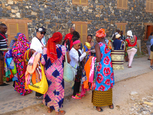
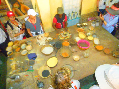
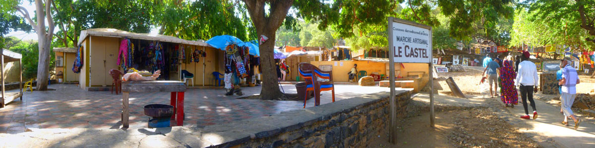
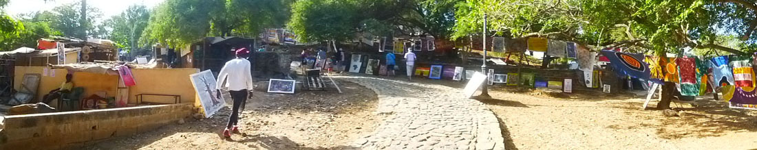
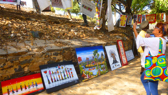
The Art Colony
|
Here is another view of the market from just a little further up the stone path and up the hill:
|
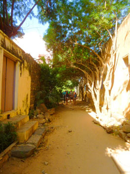
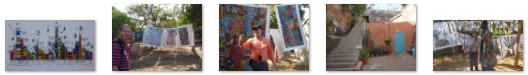
The stone path sloped up the hill, and all along it artists had laid out their creations for the tourists to peruse and, one would hope, walk away with (as Greg did and as I was tempted to do).
|
|
We followed our guide up the stone walkway to come out on the top of the hill, and found the views from there to be worth the walk up.
At the Top of Le Castel
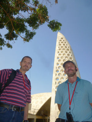
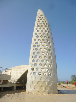
The Almadies Memorial Replica
|
|
Over the centuries each of the American communities of African origin has developed its own local cultural identity, but each has retained a more or less substantial part of its original heritage, even though that original heritage has undergone quite considerable change, and they are therefore well placed to serve as intermediaries between all the population groups involved in this tragic episode of world history. It was for this reason that His Excellency Mr Abdou Diouf, President of the Republic of Senegal, decided to erect a memorial dedicated to the whole of Africa and its diaspora.
In response, a construction project for a Memorial for Africa and its Diaspora was initiated by the Senegalese Government. Although a site on Goree Island was considered, as the island had a reputation for being a major site involved in the slave trade, local statutes did not permit the erection of a monument of that size; nor was the island so easy to get to for the many that would want to visit. So the plan was to build this vast complex on the Almadie site.
|
|
This replica of the Gor�e-Almadies Memorial, in reinforced concrete, was constructed in 1999 here on the Castel. Since its inauguration in 1999 by H.E. President Abdou Diouf, a vast controversy has ensued with a view to its demolition! Despite this controversy, twenty years later the replica has not yet been demolished by the Senegalese authorities.
During a 2003 meeting organized by the special team for activities related to the study of the slave trade and its implications, the Director-General of UNESCO commented on the disputed presence of the replica and recommended that all questions linked to the integrity of the site be referred to the World Heritage Center.
Recalling the provisions contained in the World Heritage Convention, notably those concerning the preservation of the global character of the inscribed property, the World Heritage Centre wrote a letter that same year to the Senegalese authorities requesting them to undertake, as soon as possible, the necessary steps to demolish this monument which greatly affects the authenticity and the interpretation of the property, both by its material and its monumental size.
We asked our guide why, if the recommendation to demolish the replica was made 17 years ago, it is still standing, he shrugged and said, in effect, that sometimes things move slowly in Senegal. He thought, like most people, that taking into account the time lapsed and the political sensitivities and affective links with the Gor�e-Almadies Memorial project, the experts will probably be discussing the issue long after he retires from the tour guide business.
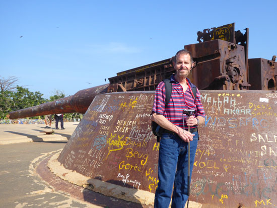
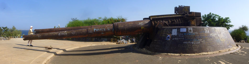
The Guns of Navarone
The Battle of Leros was the central event of the Dodecanese campaign of the Second World War. A garrison of anti-Mussolini Italian soldiers on the island of Leros in the Aegean Sea was strengthened by British forces in 1943. The battle began with German air attacks on 26 September, continued with German landings on 12 November, and ended with the capitulation of the Allied forces four days later- in what would turn out to be the last major defeat suffered by British forces in the war.
|
The film, directed by J. Lee Thompson, starred Gregory Peck, David Niven, and Anthony Quinn. The basic plot involves the efforts of an Allied commando unit to destroy the seemingly impregnable German fortress that had been installed on the island.
Although the picture was filmed at numerous locations and in numerous studios, the production team could not find quite the location they wanted for many of the scenes in which the commando unit has to scale the island's cliffs- at least not until someone told them about Goree Island in Senegal. There, Thompson found just the site he needed, and, consequently, many of the stars of the film traveled here to film those scenes. Included were some scenes with the guns themselves.
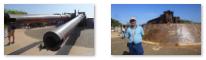
After the film wrapped, the government of Senegal told Thompson that they would welcome a donation of the guns used in the film, and when he agreed, the guns themselves were permanently installed atop the Castel here on Goree Island. So the guns you see in our pictures here are the same guns used in the 1961 film!
The guns are just props, of course, but they certainly seemed authentic. Lots of tourists come to visit the site, and I am sure all of them take pictures of themselves climbing all over the emplacement. We were a bit more restrained.
|
|
One more interesting thing our guide told us was that here atop the Castel is a colony of folks known as the Baye Falle. They are like Muslim hippies, and they concentrate on music and art, living around the castel and selling their art to tourists. (Apparently, some of the artists down below the hill are also members of this sect, something we didn't know on the way up.)
The House of Slaves
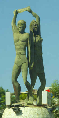
|
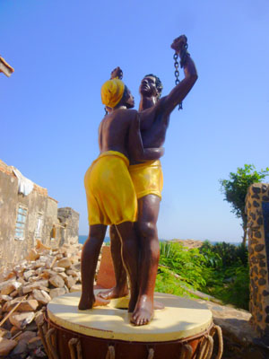
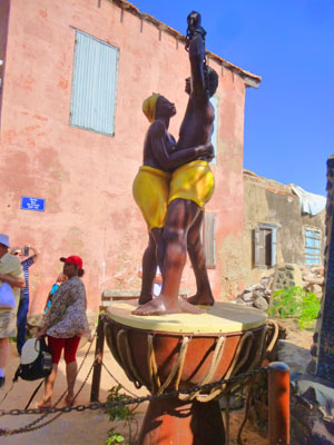
When we got to Rue St. Germain, the first street in from the water east of Goree Island, our guide stopped us at the Statue of Liberation.
|
|
The sculptors were Jean and Christian Moisa, and the statue was donated and erected on July 31, 2002.
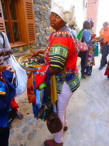
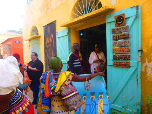
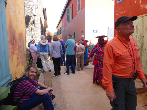
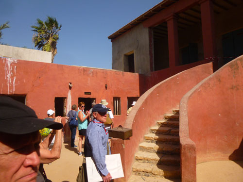
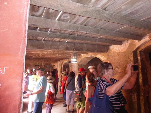
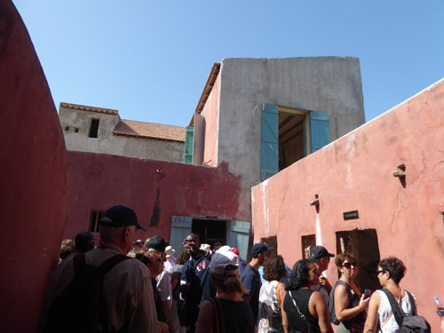
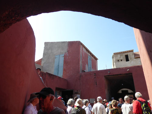
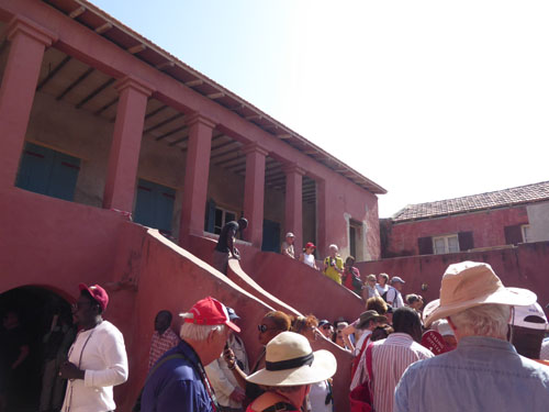
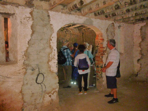
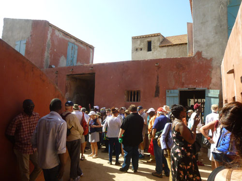
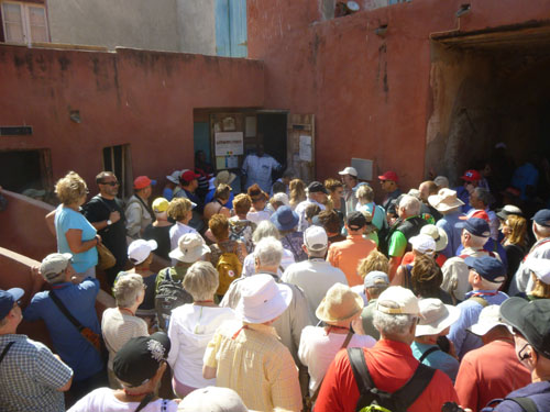
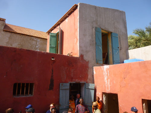
After a brief stop at the statue, our guide took us the short distance up the street to the Slave House, and had us wait outside for a few minutes while he went to arrange our entry and pick up our tickets. This was by far the most congested place on Goree Island, and there were lots of people in the narrow street outside.
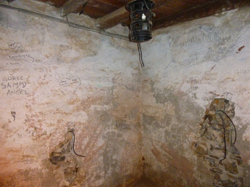
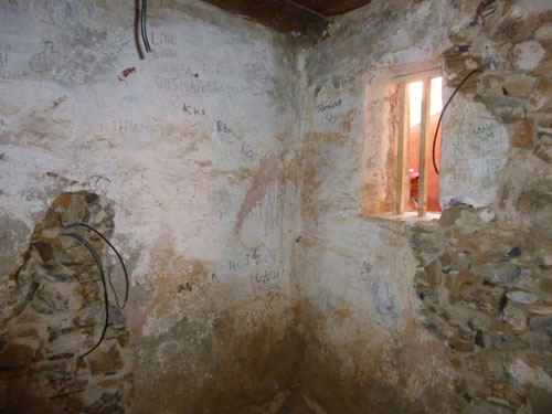
The House of Slaves (Maison des Esclaves) and its Door of No Return is a museum and memorial to the Atlantic slave trade. Its museum, which was opened in 1962 and curated until Boubacar Joseph Ndiaye's death in 2009, is said to memorialize the final exit point of the slaves from Africa.
While historians differ on how many African slaves were actually held in this building, as well as the relative importance of Gor�e Island as a point on the Atlantic slave trade, visitors from Africa, Europe, and the Americas continue to make it an important place to remember the human toll of African slavery.
|
The House of Slaves was reconstructed and opened as a museum largely through the work of Boubacar Joseph Ndiaye (1922 � 2009). Ndiaye was an advocate of both the memorial and the assertion that slaves were held in the building in great numbers and from here transported directly to the Americas. Eventually becoming curator of the Museum, Ndiaye claimed that more than a million slaves passed through the doors of the house. This belief has made the house both a tourist attraction and the site for state visits by world leaders to Senegal.
Since the 1980s, academics have downplayed the role that Gor�e played in the Atlantic slave trade, arguing that it is unlikely that many slaves actually walked through the "door of no return", and that Gor�e itself was marginal to the Atlantic slave trade. Ndiaye and other Senegalese have always maintained that the site is more than a memorial and is an actual historic site in the transport of Africans to British, French, Spanish, Dutch, and Portuguese colonies of the Americas, and thus undercounted by Anglophone researchers.
|
|
|
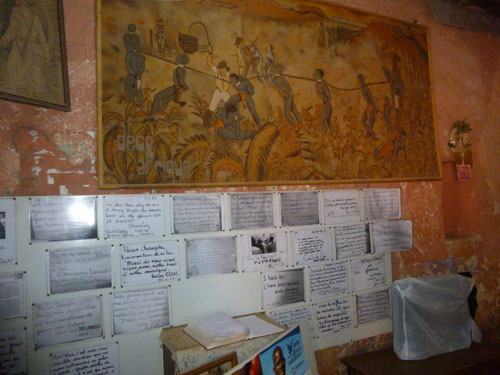
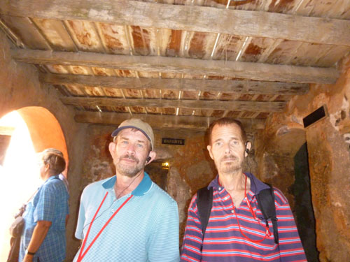
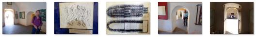
We took quite a few pictures in this building, and I have put some of them in the slideshow at left. Look through the pictures (using the arrows in the lower corners of each picture) and you can see what we saw.
In his 1969 statistical work, historian Philip D. Curtin, argues that while enforced transports from Gor�e began around 1670 and continued until about 1810, in total some 200,000 enslaved Africans were transported from all of Senegal and Gambia- most of these from Saint-Louis, Senegal, and James Fort, Gambia. He has also been quoted as saying that the actual doorway memorialized on Goree was historically insignificant, as it was built very late in the slave trade (which Britain banned in 1807). But other Africans have said that Goree was significant, with more than 100,000 slaves passing through here. But even those who argue Gor�e was never important in the slave trade view the island as an important memorial to a trade that was carried on in greater scale from ports in modern Ghana and Benin.
Regardless of who's right, the House of Slaves did make an impact, and I think the pictures allowed you to share in that. I didn't try to make many movies as the House of Slaves was so very crowded, but here are the two I did make:
|
(Mouseover Image Above for Video Controls) |
(Mouseover Image Above for Video Controls) |
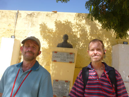
Lunch
|
|
|
His signature issue was to ensure that Africans in the French colonies maintained their French citizenship. He was very successful in recruitment for World War I, and was re-elected to the chamber. He worked to introduce social reforms, although his efforts were often stymied. He was mayor of Dakar from 1920 to 1932, and was also undersecretary of state for the colonies in 1931-32. He died in 1934 in France. Incidentally, his son was the first black person to play professional soccer in France.
|
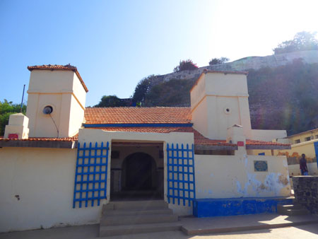
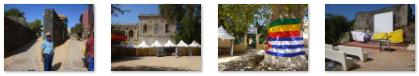
The IFAN Historical Museum
|
|
(Click on Thumbnails to View) |
|
I wanted to try to do a 360° view around the open plaza area, but I couldn't get my little camera to go around more that about three-quarters of the way. So instead I took a series of eight pictures and stitched them together using Microsoft's Image Composite Editor (a great program, and free from Microsoft). Here are the eight pictures, and below them, in a scrollable window, the resulting stitched image:
|
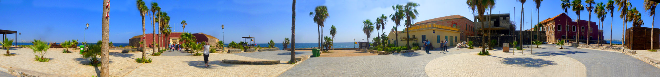 |
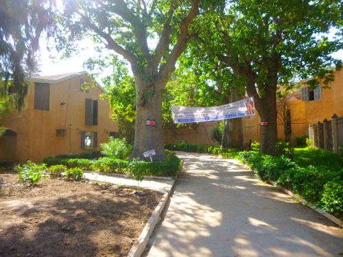
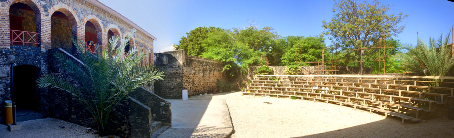
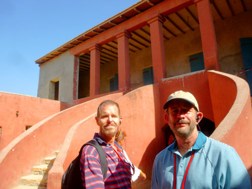
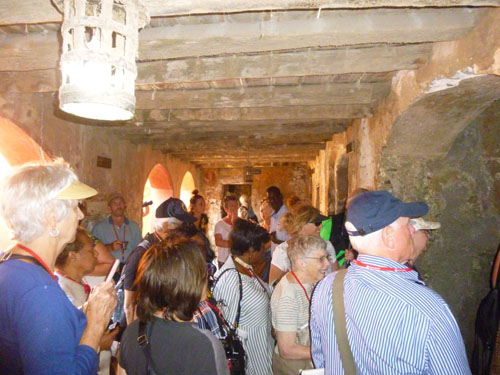
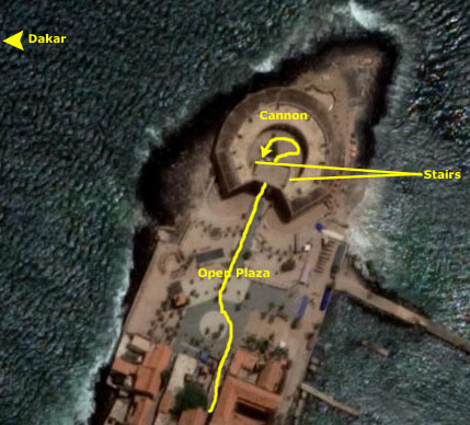
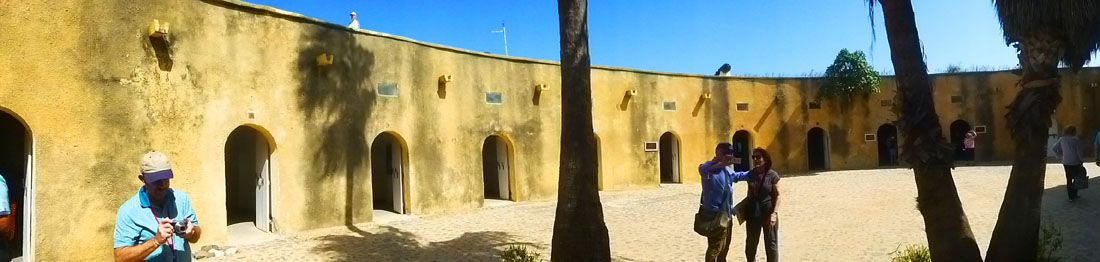
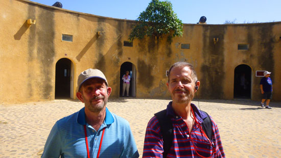
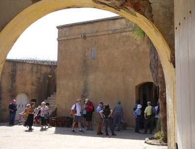
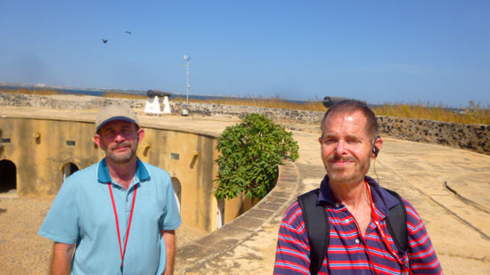
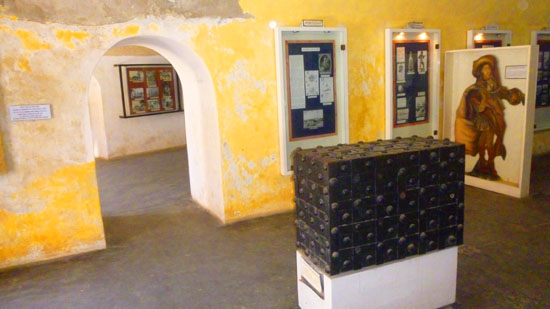
From the plaza, we followed our tour group into the Historical Museum. The museum itself is inside the old fort, and there are three areas of it. First of all, when you come through the entrance, which is actually the old main entrance to the fort across what used to be a moat, you come out into a circular area that looks like this:
|
As you can see, the old circular part of the fort is two stories, with various rooms inside and the cannon on top (you can just see a couple of them in the picture, but we'll go up there in a moment). Inside the structure, as it turned out, each one of those openings leads to a separate room, but the rooms are connected inside via doorways like the ones you see here. So you can begin at the left or right when you come into the courtyard, go through the first doorway into an exhibit room, and then continue around the circle from room to room without having to go back outside. I would assume that the creators of the museum simply made use of the structure of the fort as they found it.
|
|
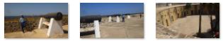
Take a look at the picture at right, which is looking out from one of the exhibit rooms back at the entry building. You can see the opening that our group came through, and you can see one of the stairs leading up to the parapet. There are identical stairs on either side of the entry building. The actual stairs were quite steep, as you can tell from this picture I took from the parapet looking down the stairs.
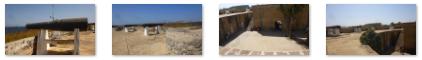
The last of the three areas accessible to visitors is the rampart itself, so let's go up there first. We climbed up the stairway to our left (as we entered the fort) and at the top I took this picture looking back down into the courtyard.
|
We took lots of pictures here; the are a little repetitive, but here are a representative group of them:
|
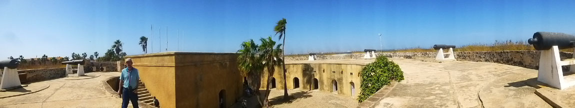
And here is one last picture- a panoramic view of the rampart and cannon as well as the courtyard and entry building:
|
I was most interested in the outside of the historical museum, but we did have time to walk through some of the exhibit rooms as well.
|
|
The historical museum was interesting, and I wish I'd had the time (and the language skills) to have gotten more out of the exhibits that were on display, but all too soon our guide was calling us back outside for our walk back to the pier and our return to Dakar.
Returning to Dakar
|
|
We arrived back at the ferry pier in Dakar, and our guide led us out of the harbor to the bus we would be taking on our city tour.
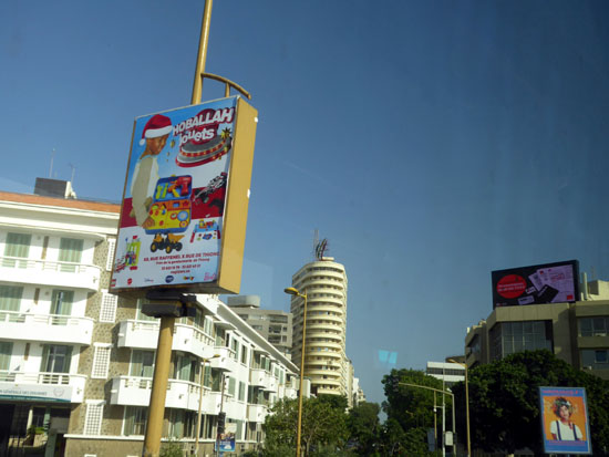
Touring the City of Dakar
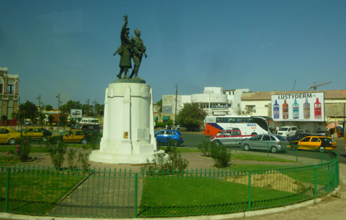
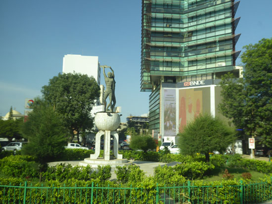
Taking bus tours, while informative and a good way to see a lot in a short time, are inherently bad for people like me who like to document what they see. The tour guide is usually pointing things out rapid fire, but, unless the building/park/palace/statue has a photographable sign, it's hard to both take a picture and record what you took the picture of.
|
|
Incidentally, while the statue itself was photogenic from the bus, neither of the photos that Fred or I took of it really show its detail, so I have obtained a stock photo of it for you to see. If you want to see the photo of it taken by Robert Harding, just click on the statue.
And while we are at it, there is also something else in the picture you might want see close up, and that's the billboard for an oddly-named skin lotion. Click on that billboard in the background at right and you can see Fred's good close up view of it.
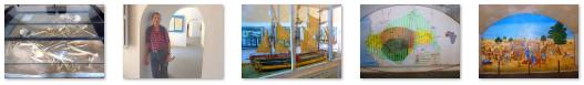
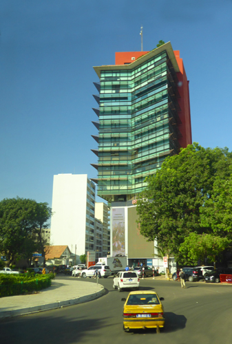
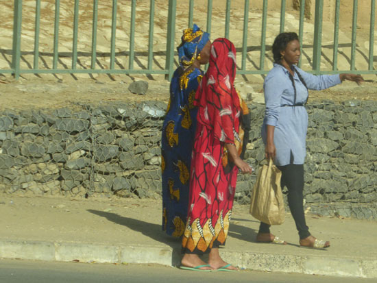
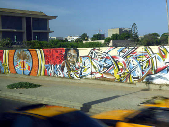
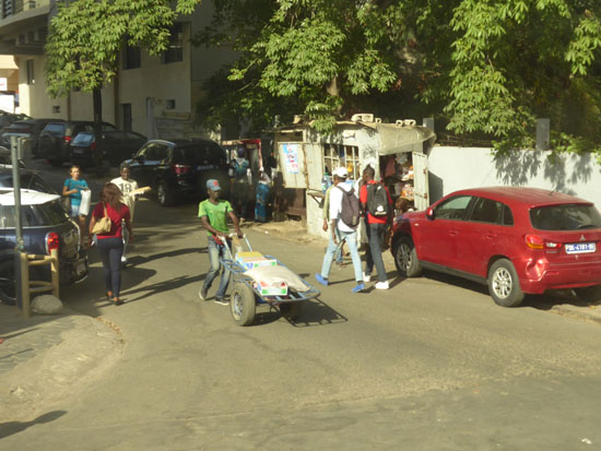
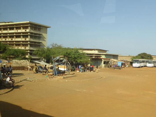
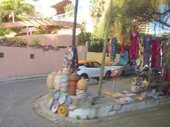
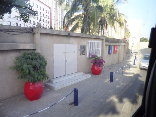
So the tour bus made its way over to the coast highway so we could drive along the ocean north to the African Renaissance Monument. As we made our way through the city, we captured some typical Dakar street scenes- just to document what Dakar is like (a slice of life, so to speak). Here are some of those pictures:
|
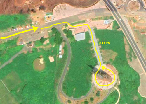
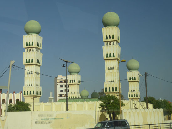
When the tour bus reached the coast road, we headed north. If you refer back to the overview map of Dakar at the top of this page, you will see our route. The ride would take us up towards an area of the city called Ouakam- birthplace of politicians and writers. Ouakam is one of the four original Lebou villages of the Cap-Vert Peninsula.
|
|
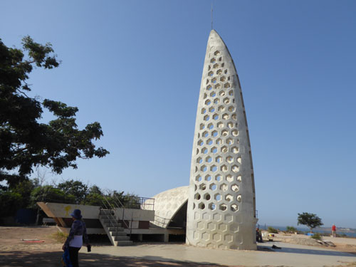
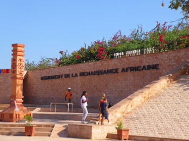
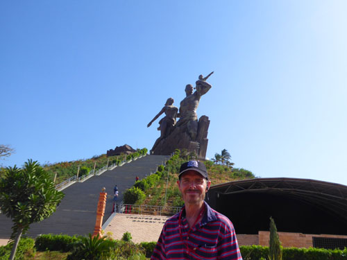
Just past the mosque, we turned west again, still following the shoreline. We didn't know it at the time, but we were very close- less than half a mile- from the westernmost point on the African continent. A bit further north, we turned right into the parking area for the African Renaissance Monument.
|
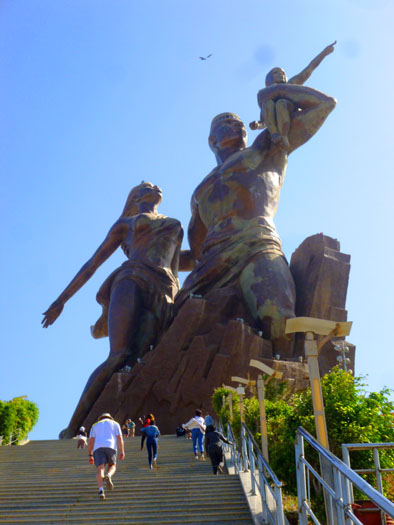
Site preparation on top of the 300-foot high hill began in 2006, and construction of the bronze statue began in 2008. Originally scheduled for completion in December 2009, delays stretched into early 2010, and the formal dedication occurred on 4 April 2010, Senegal's "National Day", commemorating the 50th anniversary of the country's independence from France. It is the tallest statue in Africa.
As we were driving up to the parking area, we got our first view of the African Renaissance Monument.
The project was launched by then Senegalese president Abdoulaye Wade who considered it part of Senegal's prestige projects, aimed at providing monuments to herald a new era of African Renaissance.
|
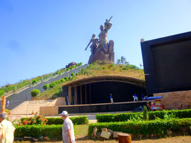
This concept has been further popularized by former South African President Thabo Mbeki during his term of office, heralding the beginning of The African Renaissance, and it continues to be a key part of the post-apartheid intellectual agenda. It has found new expression and momentum within the International Decade for People of African Descent through the Door of Return initiative which is coming out of the historical Maroon community of Accompong Jamaica in cooperation with Nigeria, Ghana and Zimbabwe. Driving up in the bus and parking, we could see that the monument is part of a large park with a performance stage:
|
|
On 3 April 2010, the African Renaissance Monument was unveiled in Dakar in front of 19 African heads of state, including President of Malawi and the African Union, Bingu wa Mutharika, Jean Ping of the African Union Commission and the Presidents of Benin, Cape Verde, Republic of Congo, Ivory Coast, Gambia, Liberia, Mali, Mauritania and Zimbabwe, as well as representatives from North Korea, and Jesse Jackson and musician Akon, both from the United States, all of whom were given a tour.
|
|
The monument has not been without controversy. Thousands of people protested against "all the failures of President Wade's regime, the least of which is this horrible statue" on the city's streets beforehand, with riot police deployed to maintain control. An opposition leader described the monument as an "economic monster and a financial scandal in the context of the current economic crisis"; the colossal statue cost $27 million (which was actually paid by a Senegalese businessman in return for 100+ acres of land he wanted from the government).
|
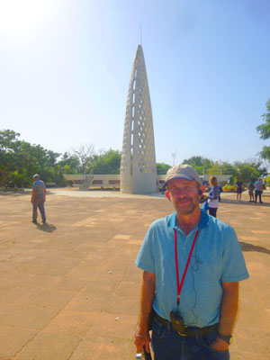
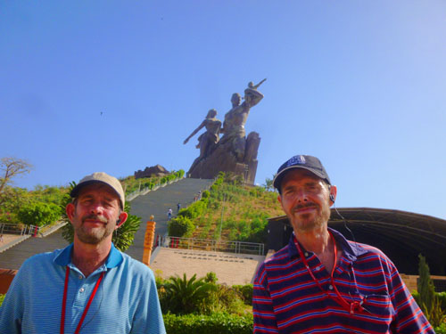
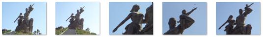
While I was climbing the stairs, Fred was back at street level taking pictures of the statue with his zoom lens, and many of his pictures were quite good (including this one of me partway up the stairs):
|
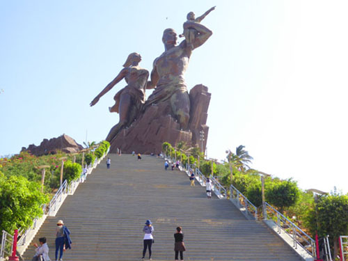
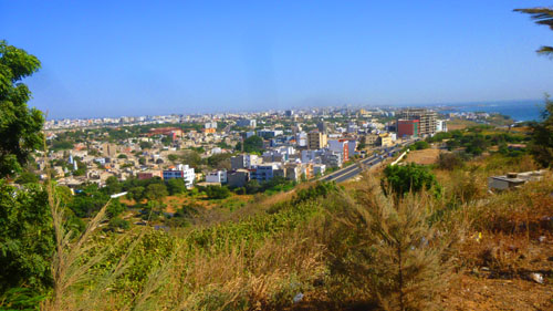
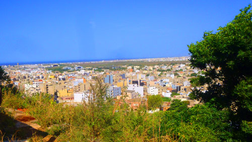
Actually, once I got to the top, I have to say that you can't really appreciate the monumental sculpture from up here. You are way too close to it, and looking directly up at it, so if you didn't already know what it was, you would almost not be able to tell from here. Take a look at this picture looking up at the statue that I took from as far back as I could get and you will see what I mean. There was a broad plaza all around the statue, and the views from here were pretty neat:
|
|
Senegalese opposition leaders also questioned the style of the project, while art critics argued that the body shapes are cartoon-like, with only vaguely African facial features. It was also suggested that the monument is a stark representation of the macho sexism of African authoritarian rulers. The statue's design was derided internationally because of false claims of its Senegalese origin, actually having been designed by a Romanian architect and built by a North Korean sculpting company famous for various projects and large statues throughout Africa since the 1970s. The general opinion seems to be that it is more in keeping with the monumental, heroic statues popular in Communist countries to glorify the worker, and less of a work intended to inspire Africans to take pride in their culture. "Black Panther" did a better job of that, though, and it didn't cost Africans anything.
I did one panorama from the north side of the monument, stitching a few pictures together:
|
After walking around at the top for a while, I could look down the stairs and see folks beginning to make their way back to our bus, so I took that as my cue to head back down. I got back to the bus in plenty of time; most folks hadn't even gotten on yet, but when we were all aboard we headed back to the ship.
Our Tour Returns to the Ship
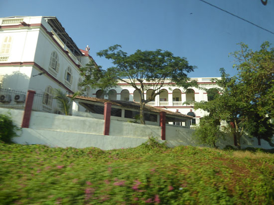
After we got back aboard the bus, it departed for the port and our ship. Our route took us back south along the same coastal road we'd come north on, but instead of cutting through the city to the port, we continued on that road around the south side of Dakar to the port.
|
|
|
But to give you a slice of Dakar life, I want to include a good many of Fred's good pictures here. And so you can look at them easily and quickly, once again we'll use a slideshow, and that slideshow is at right.
To go from one picture to another, use the little arrows in the lower corners, and track your progress through the 28 images by referring to the index numbers in the upper left. I hope this selection of pictures gives you a good idea of what modern-day Dakar is like- at least in the downtown and tourist areas.
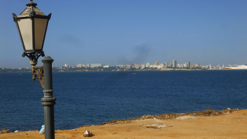
Back on board ship there was time to wander around and take some pictures of the harbor area of Dakar before the ship was moved over to the refueling dock (since once we leave here, the next stop will be South America and running out of gas mid-ocean is considered in captain's circles as being something of a faux pas). Here are some of those harbor views:
|
At sailing time, we didn't actually sail from Dakar (or course, we never actually "sail", although that's the term traditionally used), but we sidled a quarter mile over to the refueling dock.
|
Anyway, the last pictures we took today were of this tying-off procedure, and you can see some of them above, left. I know they might not be interesting to you, and that's OK. Skip them if you wish and join us on our stretch of sea days as we cross the Atlantic Ocean to arrive in Recife, Brazil.
Dakar Postscript
In doing my research for this page, I came across a twelve-year-old article that was published in a California newspaper. I thought you might find it of interest, as I did, so I am copying it below.
By CHRISTOPHER BURNS, Associated Press Writer
Tuesday, March 31, 1998
ILE DE GOREE, Senegal (AP)
This notorious symbol of the African slave trade, the final stop on President Clinton's tour of the continent, is a mecca for American blacks in search of their roots. The stone pathways and colonial-style homes in pastels of yellow, orange and pink off the westernmost point of Africa make it seem more like a quaint vacation spot. It's also a symbol of war and peace: "The Guns of Navarone" was filmed at a fort here, and atop the cliff Gregory Peck scaled to attack Nazi troops is a colony of Baye Falle. The Muslim counterculture sect, stressing music and art, lives amid the gun turrets.
For centuries, this now-peaceful retreat was a living hell for waves of humanity enslaved and packed off to the Americas in crowded ships. The reddish-colored House of Slaves is now a deeply moving pilgrimage site for many black Americans, especially after the 1970s TV series "Roots" and the new Steven Spielberg film "Amistad."
Visitors take the half-hour ferry ride from the port of Dakar to discover this rocky 50-acre island with portside cafes and schoolchildren playing under baobab trees. Clinton and his wife, Hillary, were flying to Senegal today from Botswana and are scheduled to visit Goree Island on Thursday. Mrs. Clinton visited here last spring without her husband.
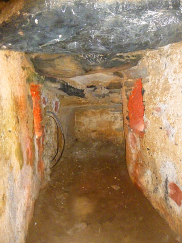
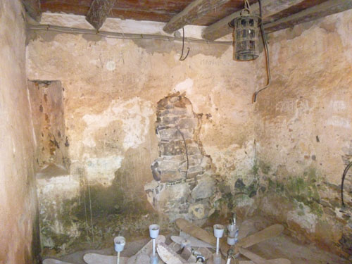
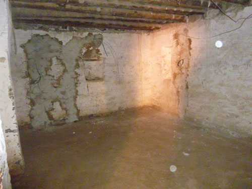
Red bougainvilleas and vines cover the cracked white walls winding along the pathways. The only transportation is foot power. As the museum's guides explain, slaves were stuffed into pens, inspected, priced and branded like animals. Fed once a day, they were held there for months on end. Those who struggled were chained to the walls and their rooms partially flooded with seawater as punishment. Others were kept in solitary confinement in a dark, cone-shaped cubby hole. Through the green "Door of No Return" leading to the sea flowed a stream of enslaved humanity, forced onto ships headed for another world.
The sight of the sea is strangely foreboding, a terror that echoes from the past. Outside that door, raw meat was thrown into the water off the rocky shore to attract sharks that would frighten slaves from jumping off the vessels. There's some debate on just how large the slave trade was on the island, but the symbol remains.
"You see it on the movie screen, but when you're up close to it, you really feel it," said Akua Pokua, a 36-year-old mother from Ghana, after touring the house. "It's mind-boggling. "We Africans weren't particularly blameless," she said. "The collaborators here sold the slaves. I think everybody's to blame, I guess."
Across the island, at the fort that attracted Hollywood's eye, the Baye Falle hung their laundry on clotheslines strung across empty gun turrets turned into small dwellings. One turret was turned into "Cafe Touba." A multicolored plastic tricycle sat atop a munitions bunker inhabited by artists. "May peace prevail on earth," read a signpost in several languages, planted in another turret at the fort called Le Castel.
"It's founded on tolerance. You really feel at home," said Ousman Fall, 25, in a black New York Yankees beanie, a stone necklace and a sweatshirt urging the legalization of marijuana. Even the marketplace is far more relaxed than the aggressive atmosphere in Dakar, where merchants hustle for business and where street kids buzz around tourists to gently lift their wallets."
You can use the links below to continue to another album page.
|
Sea Days Aboard the Viking Jupiter |
|
Our Ship: The Viking Jupiter |
|
Return to the Index for 2019 |