|
June 25, 2019: The Dior Exhibit at the DMA |
|
April 21, 2019: A Visit to the Dallas Arboretum |
|
Return to the Index for 2019 |
It's been a busy Spring, but before it gets too hot and Fred needs to stay home to make sure things get watered, we are going to take our third trip down to Florida.
Getting to Fort Lauderdale
|
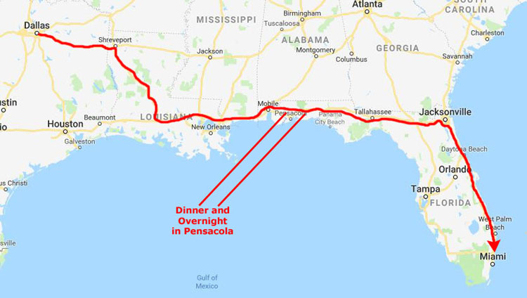
The Mississippi River Bridge at Baton Rouge is one of the most interesting highway features on the way to Florida. (There are really only three other interesting highway features on the whole trip- the 30-mile bridge across Henderson Swamp and the Atchafalaya Basin, the tunnel under Mobile Bay, and the beautiful bridge that takes I-295 across the St. Johns River west of Jacksonville.)
Unfortunately, the design of the approaches and exits from the Baton Rouge bridge tends to cause massive traffic jams. Today we were lucky, and traffic moved relatively smoothly.
From Baton Rouge and the Mississippi River, it takes us another hour and a half to get across Louisiana to the Mississippi border. The trips across Mississippi and Alabama are an hour each, so we are heading east from Mobile about six-thirty or seven. This puts us north of Pensacola right about dinnertime about eight. After dinner, we have now developed the habit of staying near Pensacola so we don't have to do a lot of driving at night. We have two hotels here to choose from; this time we've chosen the La Quinta motel about ten miles east of where we have dinner.
|
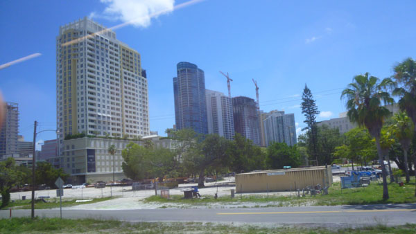
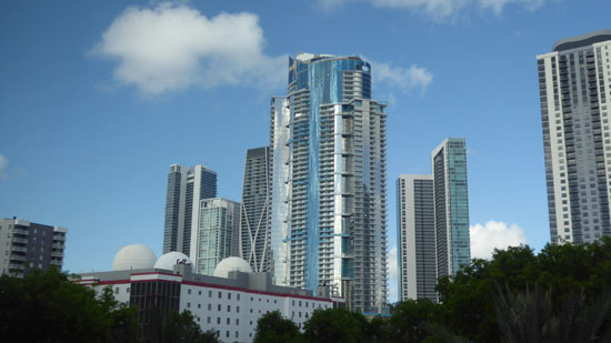
I-295 connects up with I-95 south of the city and we simply take that south for another kind of boring 300 miles down to Fort Lauderdale. This is another boring part of the drive, but it gets us to the condo around 5PM, depending on traffic in Fort Lauderdale on I-95 (which can be horrendous).
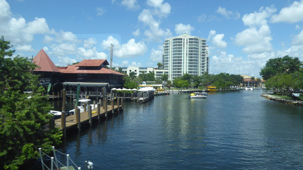
We unloaded everything at the condo, got Bob and Cole situated (and fed) and the laptops all set up, and then retired to the dock for a celebratory frozen drink. Then, as is our custom, we headed down to the Floridian Restaurant for dinner. I wish we had transporter technology, but the drive is not a hard one- although sections of it can be boring.
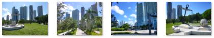
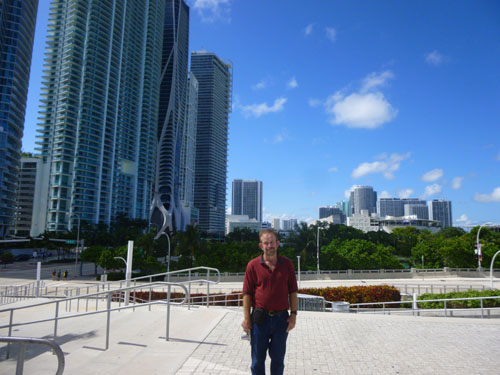
We have been here to Florida so many times that we have pretty much photographed everything worthwhile anywhere nearby. The pictures we take now are just candid shots around the condo, at the dock or perhaps at an Art Fair or other event that occurs while we are here. So I've begun the practice of just grouping the pictures for these Florida trips by topic.
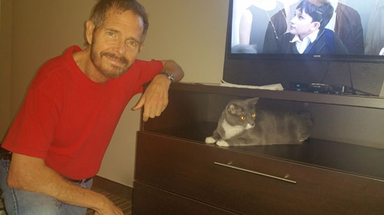
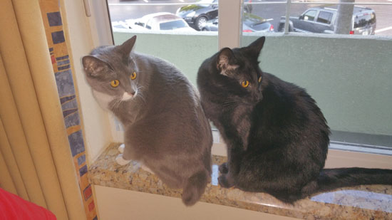
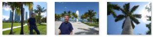
Bob and Cole in Fort Lauderdale
We have had the cats with us so often that taking picture after picture of them, cute as they can be, doesn't seem to hold the allure that it might have had the first couple of times they were here with us. So out of all the pictures we did take, I've selected just two representative ones to include here.
|
|
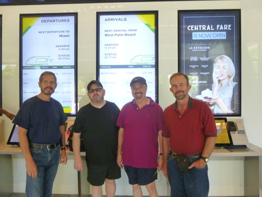
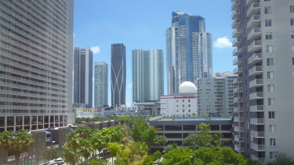
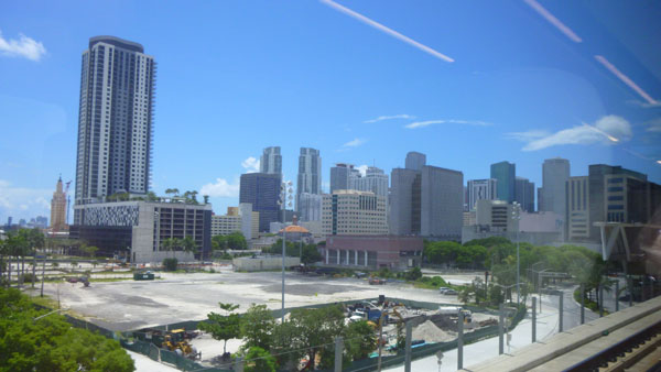
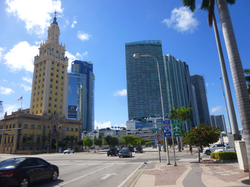
An Excursion to Miami on the Brightline
For our last few visits, Ron Drew has been keen for the four of us (he and Jay, Fred and I) to make a day of it and either take the new high-speed Brightline to either West Palm Beach or Miami. Ron wanted us to try it, but plans hadn't seem to work out until this time. So we bought tickets online and on Sunday the 19th Ron and Jay picked us up an took us over to the Brightline Station in downtown Fort Lauderdale for our excursion down to Miami.
|
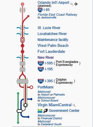
Virgin Trains USA began operating in January 2018. As of November 2019, it is the only privately owned and operated intercity passenger railroad in the United States. Earlier this year, Virgin Trains announced that it had secured funding to extend its route to Orlando, Florida. The extension will consist of 40 mi of new track allowing for speeds of 125 mph. The project will also include upgrading 129 mi of existing track to allow for passenger trains to operate at 110 mph. When completed in 2022, it will be the only higher-speed passenger rail, known to most people as High Speed Rail (HSR), operated in the United States.
In 2012, Florida East Coast Industries announced plans to operate passenger rail service between Miami and Orlando; the cost was projected to be $1.5 billion. In March 2013, All Aboard Florida applied for a $1.6 billion Railroad Rehabilitation & Improvement Financing loan, and in late 2014, for a $1.75 billion private activity bond allocation, the proceeds used to repay the original loan.
When Environmental Impact Statements were submitted and approved in 2015, site work began at the Miami, Fort Lauderdale and West Palm Beach stations; right of way improvements along stretches of the corridor were also undertaken. On November 10, 2015, All Aboard Florida announced that the service would operate under the name Brightline. Service between Miami and West Palm Beach began on May 19, 2018.
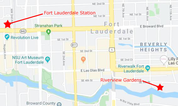
At the Fort Lauderdale Station
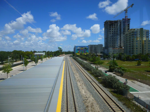
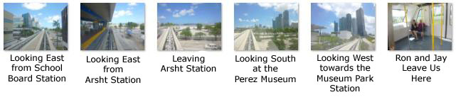
We took so many pictures on and around the Brightline System and I need to break them down a bit. I'll do that by having a section for pictures taken at the Fort Lauderdale station, a section for those taken at the Miami Central station, and, finally, a section for the pictures taken on the train itself.
|
|
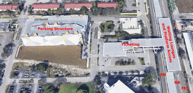
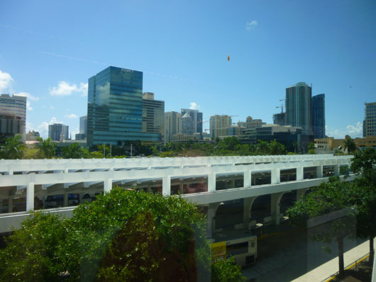
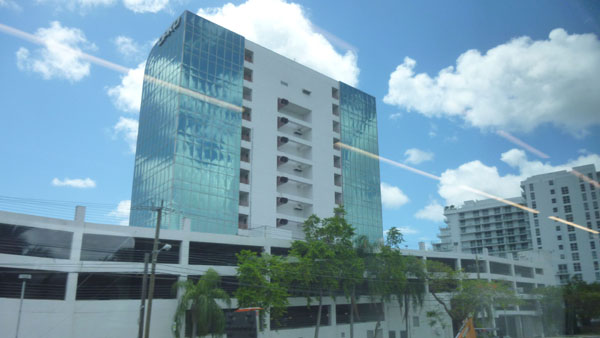
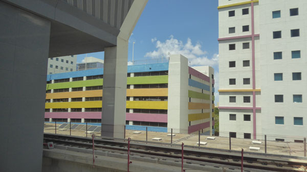
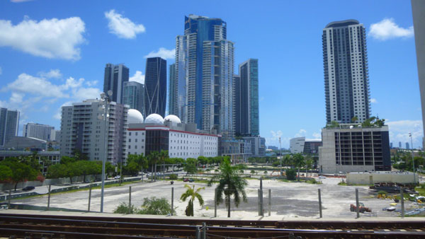
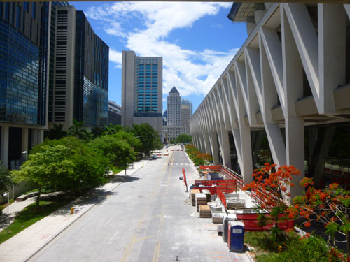
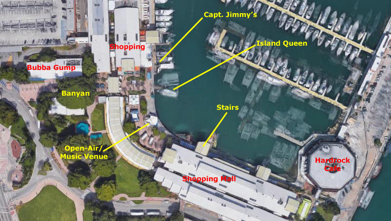
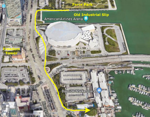
To describe the Fort Lauderdale Station, it might be helpful if you could see it in aerial view.
|
Crossing over to the main building, we passed a group of "solar trees", which are actually generating power for the station. Heading into the station, we found that on the ground floor are the ticketing machines and some roving clerks to help passengers as needed. The ticketing lobby was nicely done, and there were some mural wall maps of the three stations currently open.
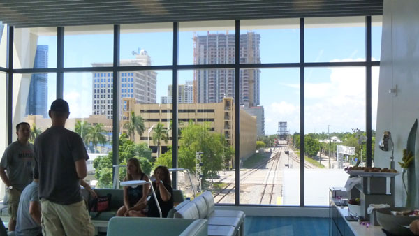
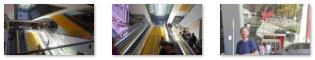
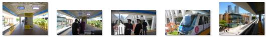
Once you have a ticket, you can use it to access the escalators lead up and to the east to cross over the southbound track and into the platform structure. On the upper level are waiting lounges and some kiosks selling coffee, drinks, and a small selection of food items. From this level there are escalators down to the platforms. You can go down these escalators when your train is announced, at which time the scanner at the top of the appropriate stair will scan your ticket and allow you to descend to the platform. This system keeps the platforms relatively uncrowded, as only those persons actually boarding a particular train are allowed down when it arrives. This upper level area was great for picture taking; here are some of those pictures:
|
|
|
|
Ron's been talking about this project for a few years; there were a number of obstacles in the way, one of which was how the Florida East Coast Railway's freight trains were going to share the tracks with the Brightline trains.
|
So, I can only imagine that the Brightline has to be precisely scheduled so that it never interferes with a freight train. I do know that, from experience, there are only three or four freight trains a day (although there may be more after midnight when the Brightline isn't running), so perhaps having the computers work out the schedules for the two isn't all that difficult. And of course, there is the three-track section from here up to Sunrise (more than a mile) where the two trains could pass each other.
So sharing the tracks of the FEC (Florida East Coast) railway might not be as complicated as I might have thought.
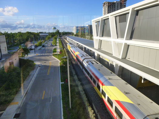
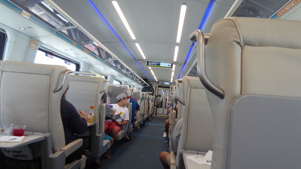
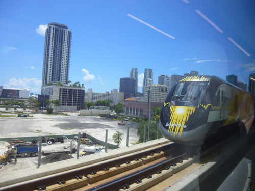
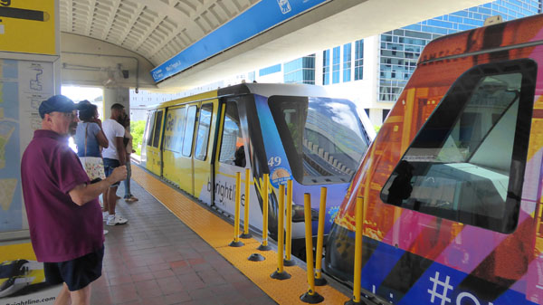
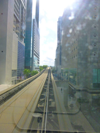
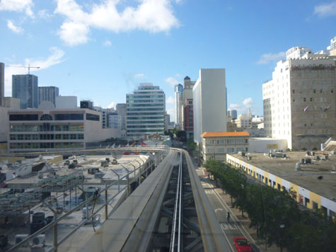
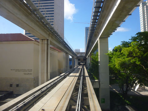
On the Brightline Train
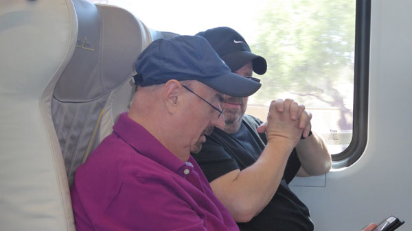
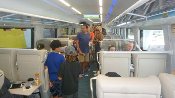
Our own train to Miami arrived and departed right on time. We'd reserved seats online, which was good, as the car we were in was pretty full. There are classes of service; we had opted for the promotional "One Year Anniversary" fare of just $5 each way. We took quite a few pictures while riding on the Brightline- most of them on the way down to Miami. Not all of our pictures turned out well, but I want to let you look at the ones that did.
|
|
|
Just use the little arrows in the lower corners of each image to move from one to the next, and track your progress by referring to the index numbers in the upper left of each image. The slide show "wraps", so going forward from the last image will take you back to the first.
The picture at right was taken as we were coming in to the Miami Central station, and another Brightline train is heading out for West Palm Beach. The trains were clean, comfortable, fast, and sleek, and reminded me of the trains we've ridden in Europe.
I also made a couple of movies on the train down to Miami so you can experience the ride for yourself:
|
|
|
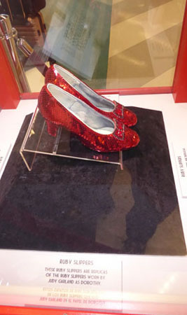
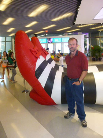
At the Miami Brightline Station
The Virgin Miami Central station was a large place, particularly considering that it only services two tracks. There was a lot going on- there were quite a few restaurants, some performers, and even, oddly enough, a display of "Wizard of Oz"-themed stuff. The trains arrive on the upper level and there are escalators and stairs down to street level. Here are some of the pictures and movies we took in the Miami Central station:
|
|
|
|
(Mouseover Image Above for Video Controls) |
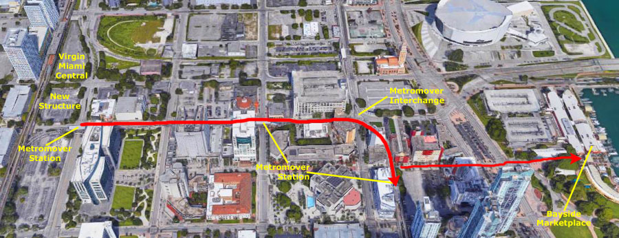
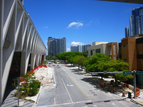
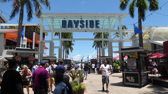
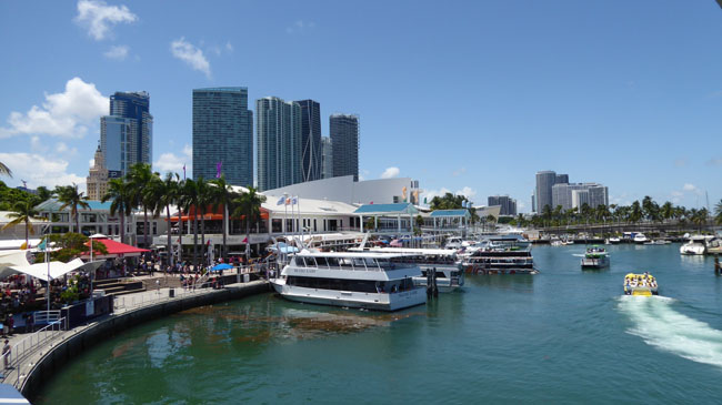
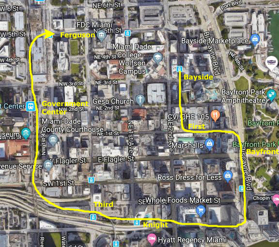
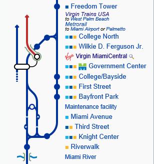
Getting to the Bayside Marketplace
Our first destination today will be a touristy area over on Biscayne Bay called the Bayside Marketplace. To get there, we are going to try Miami's Metromover system. Ron Drew has used it before, but for the rest of us it will be our first time on the system.
|
One thing to notice is that this aerial view (courtesy of Google Maps) must be some years old, because neither the Virgin MiamiCentral station nor the building(s) south of it show up on the view; they haven't been constructed yet. The new station was not actually completed and opened until early this year, part of a 9-acre complex extending to the south that also includes 3 million square feet of residential, office, commercial, and retail development. Originally named simply MiamiCentral, it was renamed to its current name just a month ago. So you won't see the actual station on the aerial view, but you will see the Metromover stations and tracks, as they have been around much longer.
We came out of Virgin MiamiCentral on the east side, and walked a block south to the Metromover Station that we could see that was built over the street.
|
The system is composed of three loops and 21 stations. The stations are located approximately two blocks away from each other, and connect near all major buildings and places in the Downtown area. It has heavy weekday ridership (about 125,000 people per day) and one of only three downtown people movers in the United States (Jacksonville, FL, and Detroit, MI, being the other two) and by far the most successful. It has been a catalyst for downtown development. Here are some more of the pictures we took at the station:
|
While we were waiting for the next Metromover train, I took a couple of pictures from the station platform looking south and north along 1st Avenue. The view south looks at the Dade County Courthouse:
|
|
As for the trip over to the Metromover station nearest the Bayside Marketplace (the College-Bayside Station), we took both movies and pictures. First, here are the two best movies:
|
This movie was made in the Ferguson Station as the Metromover train arrived and we got on board. |
This movie begins at the station near the Christ Church and continues as the train rounds the curve to the south and approaches the College-Bayside station. |
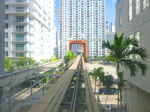
Here are some of the still pictures that we took while we were riding the Metromover train over to the College-Bayside station:
|
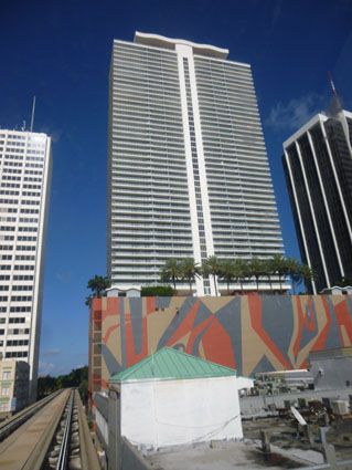
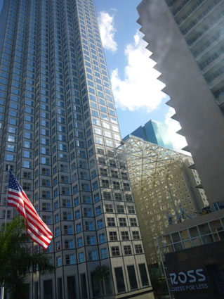
As you can see on the aerial view at the beginning of this section, once we got off the Metromover, we had to descend to street level and then walk about four blocks east along NE 4th Street to cross Biscayne Boulevard to enter the Bayside Marketplace complex. Along the way, we took more pictures of beautiful downtown Miami:
|
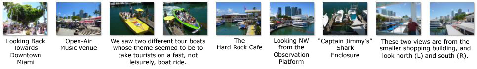
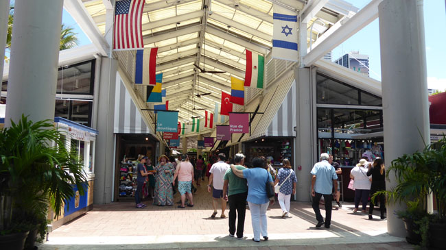
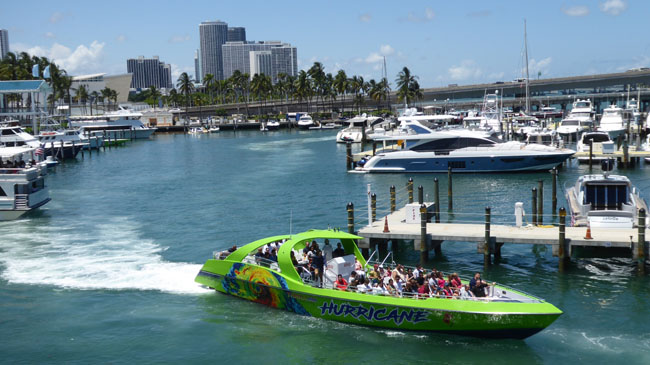
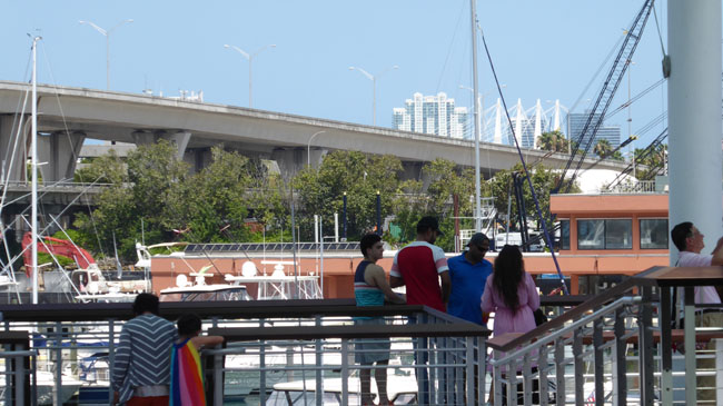
At the Bayside Marketplace
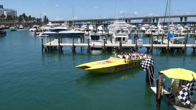
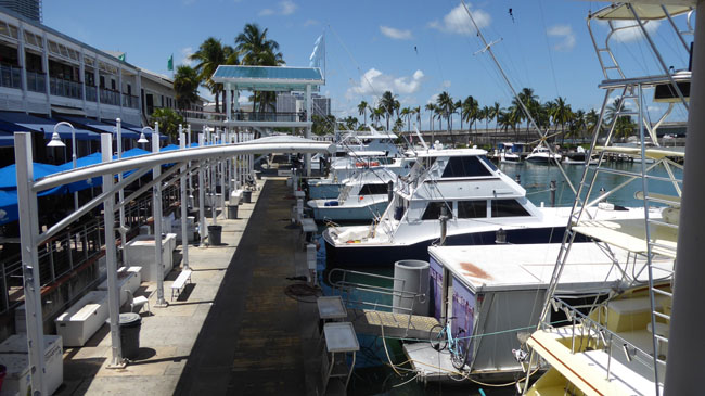
We spent a fair amount of time at the Bayside Marketplace. I had been here before years ago when Ty, Scott, Fred, and I took a boat down from Fort Lauderdale to have lunch.
|
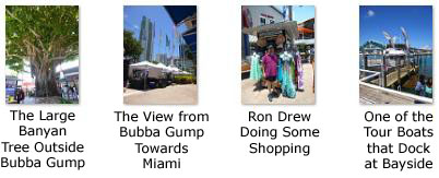
When we arrived from the Metromover, it was lunchtime, so we stopped in at the Bubba Gump Shrimp Company (which was the first eatery we happened to come across, although it turned out there were lots of others).
|
|
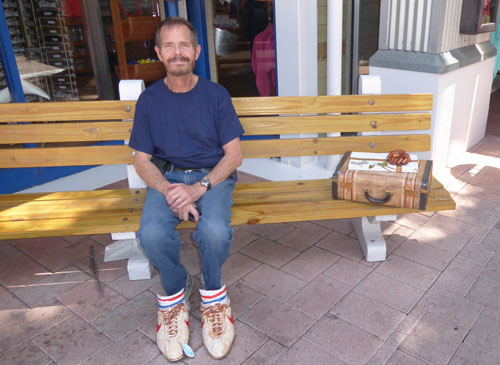
The movie theme carries along even outside the restaurant, where each one has a replica of the bus stop bench on which Forrest is sitting when the movie opens. There is a replica of the suitcase he had with him, and even the special sneakers he was wearing in that opening scene. (Note that there also a box of chocolates on top of the suitcase, which recalls Forrest's line "Life is like a box of chocolates; you never know what you're gonna get.") The replica is designed for idiots like me to sit down and try to emulate his posture (and put their feet into the sneakers), thus creating a "photo op". No telling how many pictures like the one at right have been taken.
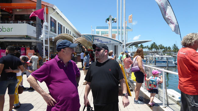
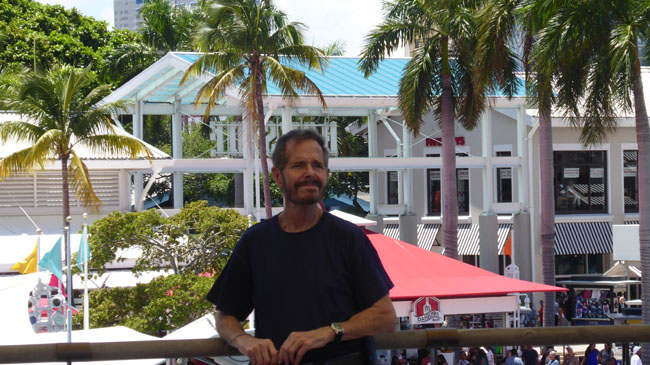
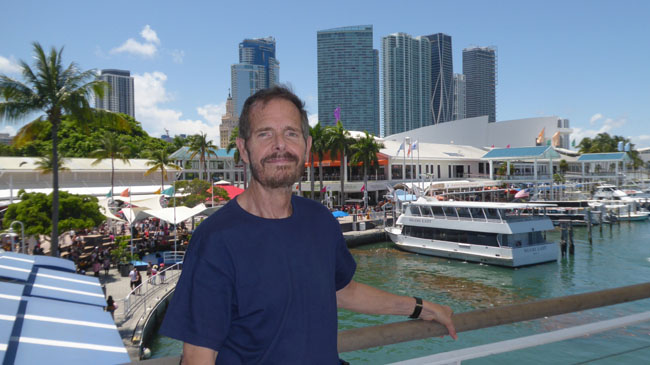
After lunch, we spent quite some time just wandering around to see what there was to see. Ron and Jay stopped into some of the stores, while Fred and I took lots of pictures.
|
Here are some more eclectic pictures from our walkaround:
|
Here's another group of pictures from our walk around Bayside Marketplace. I would have put them in a slide show, but a couple of them deserve a few words of comment:
|
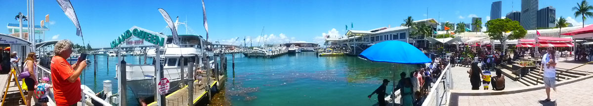
I made some panoramic pictures, too:
|
|
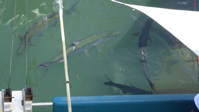
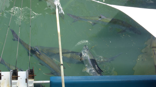
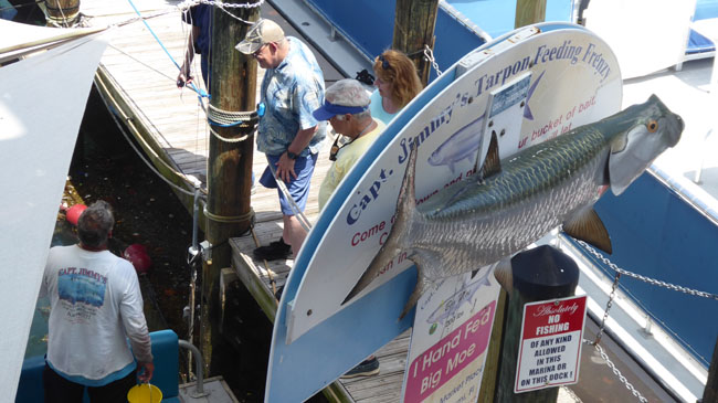
I also made a couple of movies. One was made as I walked around the open area at the Marketplace. Because I had to watch where I was going, I couldn't hold the camera as steady as I wanted, so you'll notice significant shakiness in spots (and I apologize for that). The other movie was taken at Captain Jimmy's as someone (Captain Jimmy, I presume) fed the sharks.
|
(Mouseover Image Above for Video Controls) |
(Mouseover Image Above for Video Controls) |
Fred took many of the same pictures that I did, and I've tried to eliminate those cases where we took essentially the same shot. But I want to include the best of Fred's pictures here, too.
|
|
Just click on the little arrows in the lower corners of each picture to move forward or backward in the slideshow, and track your progress by referring to the index numbers in the upper left.
As with all slideshows, moving forward from the 14th picture will take you back to the first (and moving backward from the first will take you to the 14th). Enjoy Bayside Marketplace!
On the Metromover: Northern Extension
When we were all done at Bayside Marketplace, the four of us walked back to the College/Bayside station and decided to just ride the system to its northern terminus. Riding was free, so we just wanted to see where it went.
|
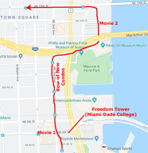
From Bayside Marketplace, we walked back across Biscayne Boulevard (that view looks north towards Freedom Tower, part of Miami-Dade College) and then down 4th Street to the College-Bayside Metromover station again, went up to the platform, and waited for a "School Board" train. On the train, I began with a movie (Movie 1)- filmed as the Metromover went from the College-Bayside Station to the first station on the northern extension- the Freedom Tower Station:
|
(Mouseover Image Above for Video Controls) |
Originally completed in 1925 as the headquarters and printing facility for the newspaper The Miami News, the 255-foot, Mediterranean Revival-styled Freedom Tower got its name because in the second half of the 20th century it was used to house services involved in processing Cubans fleeing to Florida. Today, it is used as a contemporary art museum and a central office to different disciplines in the arts associated with Miami Dade College. In 1979, it was added to the U.S. National Register of Historic Places. Leaving the Freedom Tower station, we looked off to the east at the American Airlines Center- one of Miami's sports and performance venues over on the east side of Biscayne Boulevard.
|
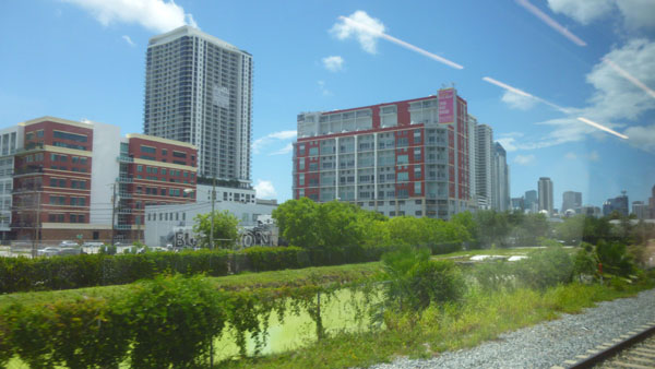
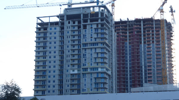
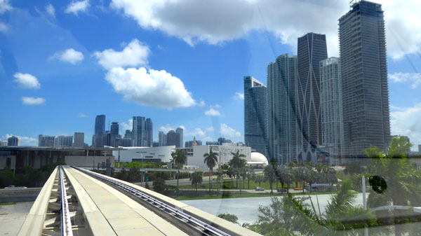
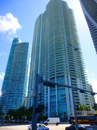
So in this view from the Metromover, looking north from the Freedom Tower station, those new condos are at the right and yet more new buildings on the west side of the tracks at the left. None of the buildings at left are on the current aerial views available to me, which means they are all very, very new.
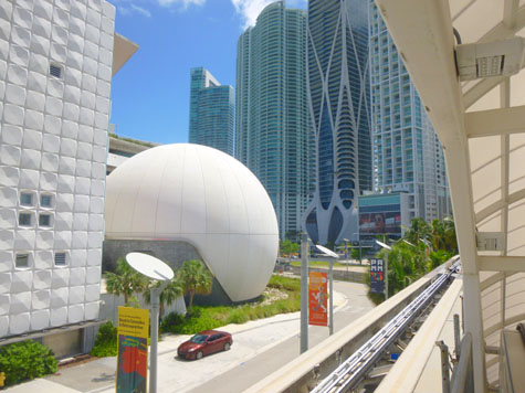
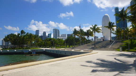
Behind (to the west of) these skyscrapers, the Metromover makes a stop at the Eleventh Street Station. Then, after passing to the west of these new towers, the track turns to the east, coming around between the northernmost of them and I-395. This brings it past the Frost Science Museum, with its distinctive spherical planetarium, at which point it makes a stop at the Museum Park Station.
The Museum Park Station is the stopping point not only for the Science Museum, but also for the Perez Art Museum and Ferre Park- a large bayside park between the two museums on the north and the American Airlines Center on the south. The folks living on the east sides of the new condo towers must have incredible views as they would see the park, the museums, Biscayne Bay, Miami Beach, the American Airlines Center, and Bayside Marketplace.
|
(Mouseover Image Above for Video Controls) |
Then, when the train started up, I started another movie, and that movie will take us to the next station, the Adrienne Arsht Center Station. (The Arsht Center is a performing arts center north of I-395.) You can use the player at right to watch it.
|
The four of us continued one more station to the current end of the Metromover's northern extension. I think that Ron said that the Metromover would eventually go either to the airport or it will connect up with some other way of getting there on public transit. But here, the train just switched tracks to head back south to the downtown Omni Loop.
|
You might not understand the last picture, but when Ron and Jay made their Brightline reservations, they decided to head back to Fort Lauderdale earlier than Fred and I. They thought that they would be "walked out" earlier than us and that they should get home earlier than us as tomorrow is a workday for Jay.
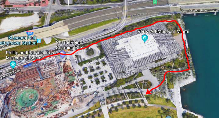
So when Fred and I got off at this station to see the museums and Ferre Park, Ron and Jay stayed on to ride back to Virgin MiamiCentral and their Brightline train home. Fred and I don't plan to actually go inside either museum, as we would only have a short time in either and admission is a little steep. So we plan to walk around them, through the park, and back down Biscayne Boulevard to Bayside Marketplace again.
Walking Around the Perez Art Museum
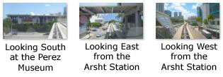
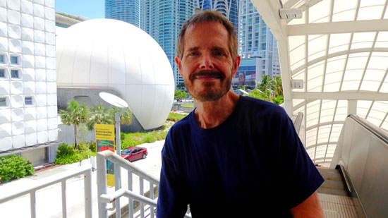
We got off the Metromover at the Museum Park station, and before we went down to ground level, took a couple of pictures.
|
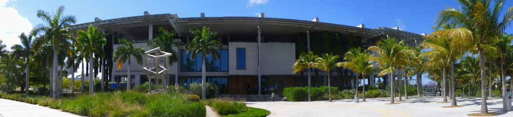
|
In March 2011, Miami native Phillip Frost and his wife, Patricia, donated $35 million to the construction of a new science museum in Downtown Miami. The museum was designed by the New York studio of global firm Grimshaw Architects. The new 250,000 sq ft Philip and Patricia Frost Museum of Science opened on May 8, 2017 here in Museum Park. The new museum includes: the Frost Planetarium, a 250-seat full-dome screen with a diameter of 67 feet and a 16-million-color, 8K projection system; a three-story, cone-shaped, 500,000-US-gallon aquarium with a 31-foot diameter oculus lens at the bottom for viewing the fish, rays, and sharks; and the Knight Learning Center with four classrooms.
|
In November 2010, construction began on the new Perez Museum of Art, a structure designed by Swiss architects Herzog and de Meuron. The structure is meant to resemble Stiltsville, which is the name given to a group of wooden houses built on stilts that stand off the coast of Key Biscayne in Biscayne Bay. The three-story building has 200,000 square feet, composed of 120,000 interior square footage, and 80,000 exterior square footage. Inside the museum, display spaces can be illuminated by floor-to-ceiling windows, which can also be blocked off or used as backdrop. Otherwise the rooms get clinically even light delivered by strips of fluorescent tubes, though spotlights can also be used. A grand staircase- nearly the entire 180-foot width of the platform� connects it to the waterfront.
In 2016, the museum's permanent collection contained over 2,000 works, particularly 20th- and 21st-century art from the Americas, Western Europe and Africa. The museum had originally anticipated some 200,000 visitors in its first year; that figure was surpassed in the museum's first seven months.
|
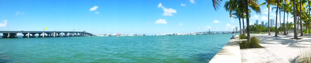
Speaking of Biscayne Bay, here is a really nice camera-generated panoramic view of the part of the bay from the bridge to Miami Beach on the left all the way around to the city of Miami on the right:
|
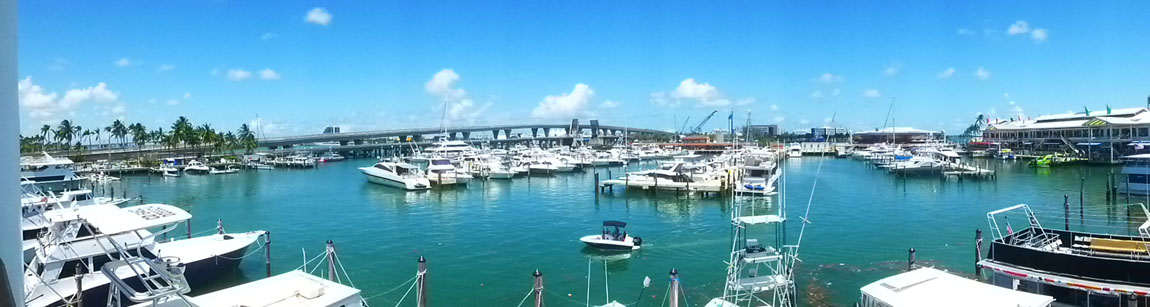
You can barely see it in that picture above, but here is a closeup of the new Miami Cruise Ship Terminal. I also made another panorama, this time manually constructed from five separate images, of just the area of Biscayne Bay right in front of the museum:
|
Here is another view of the high porch/patio at the east end of the museum and you can see the new development of North Miami Beach in the distance.
|
(Mouseover Image Above for Video Controls) |
|
Walking around outside the museum was pretty interesting. We decided not to go inside the museum, for with only a couple of hours left in the day, it didn't seem to be a good use of $25 a person.
In Maurice A. Ferr� Park
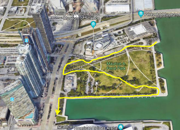
From the museum, we were basically just going to head generally south on foot to get back to Bayside Marketplace, where we would be able to get the Metromover again back to the Brightline station.
|
|
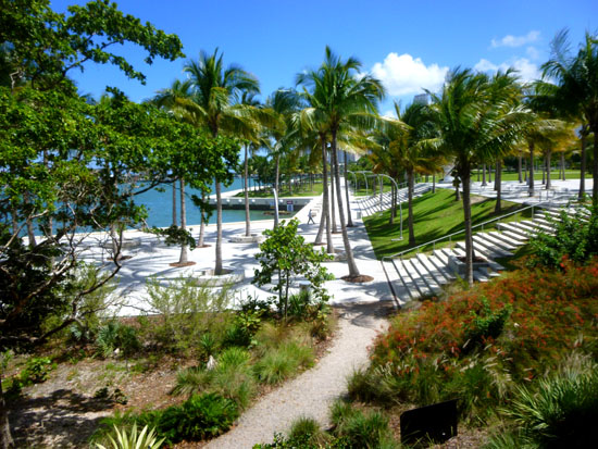
Maurice A. Ferr� Park (formerly Museum Park) is a 30-acre public, urban park in downtown Miami, Florida. The park opened in 1976 as Bicentennial Park on the site of several industrial boat slips served by the Seaboard Air Line Railroad. For some time it was named "Bicentennial Park" to celebrate the bicentennial of the United States in that same year.
|
|
From the early 1900s to the mid-1960s, Bicentennial Park was the location of the Port of Miami, until it eventually moved to neighboring Dodge Island in the mid-1960s. The port at what is today Bicentennial Park was then a bustling cargo, trade and passenger port, with the offices of Clyde Mallory Lines at the park. Once the port moved out to Dodge Island, the land was cleaned up of industrial residue from decades of port trade, and the park was designed, finally opening up in 1976, as downtown's second large park after Bayfront Park.
In May 1994, the Omni Loop of the Metromover opened, which brought a Metromover station to the park, but that station was closed in 1996. When the row of new residential buildings began to open after 2010, the station (located just west of them) was renovated and reopened as the Museum Park Station to provide direct access to the art and science museums. In early 2019 the Park was officially named Maurice A. Ferr� Park to pay tribute to the former Miami and his legacy.
|
|
|
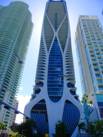
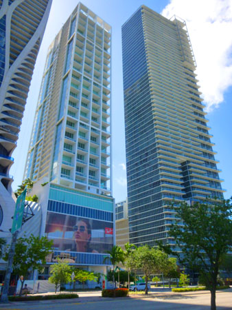
I thought the buildings pretty neat, particularly the middle one, with its distinctive exterior ribbing and bulbous ground floor lobby area (looking from some angles like a skinny turnip having just been pulled from the ground. These buildings, positioned as they are adjacent to the museums and also across the street from such a nice palm-shaded park, would seem to be a very desirable place to live- although I haven't investigated how much you might have to pay for the privilege.
Walking Back to Bayside Marketplace
The ride north on the Metromover had been a bit deceptive; I thought we had gone further than we had. All that lay between us between the park and Bayside Marketplace was one of the large slips and, south of it, the American Airlines Center (a sports and performance venue).
|
The American Airlines Arena is a sports and entertainment arena that was constructed beginning in 1998 as a replacement for the Miami Arena. It is home to the Miami Heat of the National Basketball Association. The arena is close to the Government Center station on the Miami Metrorail, and the Freedom Tower station on the Metromover.
The American Airlines Arena seats about 20,000, with the usual number of premier seating areas and private boxes. The venue can also host concerts, with the seating capacity varying depending on how the stage is organized. The building also houses the Waterfront Theater- Florida's largest- that seats from 3000 to 6000 depending on whether it's hosting a concert, family event, musical theatre, or other stage show. From across on the north side of the old ship dock, I think this is the Waterfront Theatre at the back of the complex.
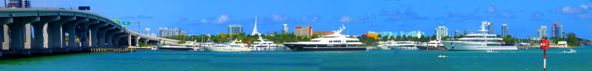
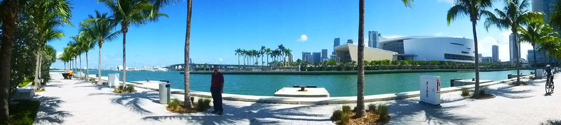
Standing over on the north side of the ship dock, here is an interesting panoramic view looking south:
|
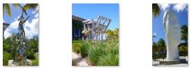
So to get back to the Marketplace, we followed the general route on the aerial view above. And coming around the west end of the inset ship dock, we got this view looking out Biscayne Bay, and also at that end of the dock was a sculpture entitled "Flora the Dreamcatcher". The sculpture (Spanish: �Flora la Recogedora de Sue�os�) was given to the city of Miami by Cuban master Cundo Bermudez to represent his body of work and his love of Miami and South Florida. Bermudez was always grateful for the hospitality that he received when he settled in Miami from Cuba, and said that the bronze sculpture is "a symbol of Hope for all immigrants, an inspiration of the love of the City of Miami and the love that Miami exudes to all that come here and makes us feel we are home". Bermudez died in 2008, and the sculpture was moved from City Hall to its permanent spot here in Museum Park.
We continued walking south past the arena.
|
|
|
|
We got back to the entrance to Bayside Marketplace, spent a little more time there (the pictures from which are in the earlier section devoted to the Marketplace), and then we returned to the Metromover station to head back to the Virgin Trains Brightline station.
On the Metromover Through Downtown Miami
When we got back to the Bayside Station, we could have waited for a train going north and counterclockwise around the downtown loop to get back to the Ferguson Station where we'd started. But since we had some time, we decided to wait for a southbound loop train and just take it on a clockwise circle around the downtown loop- just to see what it was like.
|
|
We got up to the platform at the Bayside Station and did not have to wait more than a couple of minutes for a train heading south.
|
|
(Mouseover Image Above for Video Controls) |
I have no idea which came first, the building or the Metromover, but this was unique in my experience, so I made a movie as the train headed down the track and through the building in the distance to the First Street Station. You can use the player at right to watch that movie.
As we stopped at the station, Fred got a picture looking back north along the track. Just leaving the station, Fred got another picture looking back at the First Street Station while I was looking ahead out the front window. At this point, the track curves to the east (to the left) to get over to Bayfront Park.
|
|
(Mouseover Image Above for Video Controls) |
The Metromover continues south until it reaches and then curves around the skyscrapers that sit approximately at the southeast corner of the downtown Miami core- some of the tallest buildings in the city.
We are riding at the moment on one of the trains of the "Downtown Inner Loop". These trains (two cars long) run clockwise around the downtown area, and this loop serves all the downtown stations. There is also an Outer Loop that runs counterclockwise, and this loop includes the extension south to the financial district along Brickell Avenue as well as the extension north to the museum district and the Arscht Center. Both Loops share the tracks that run around downtown. This unusual pattern, a circular central loop where the trains running counterclockwise are those running from and back to destinations outside the loop, whereas trains in the opposite clockwise direction are only running a tight inner circular route, is also followed by the New York JFK Airport AirTrain system. The inner loop generally runs tandem two car trains while the outer loops only run with single cars. Each car can carry over 90 passengers.
|
|
For my other movie of our ride on the Metromover, I saw that the Knight Station was actually going to be inside a structure, and so I filmed as we came into this station. Use the movie player below to watch.
|
(Mouseover Image Above for Video Controls) |
I took two more pictures as we headed up the west side of the downtown loop:
|
|
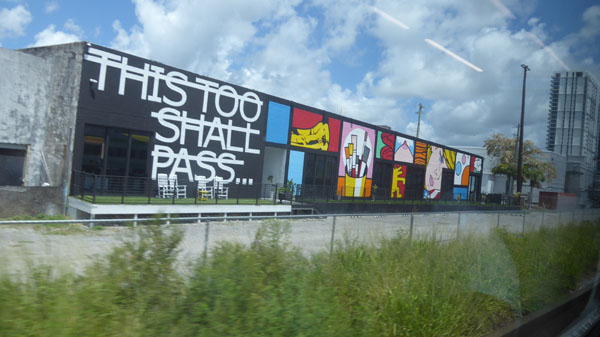
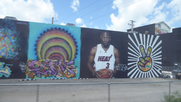
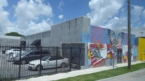
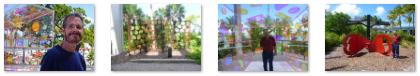
We got off at the Ferguson Station and went downstairs to walk back to the Brightline Station. I turned and took a picture of an outer loop train stopped at the station. After a very pleasant ride back to Fort Lauderdale, we walked home from the Brightline Station. On the way, we walked on SE 2nd Street which goes under a parking garage. On the wall we found this very colorful mural. I liked my picture of the mural, but Fred did take another picture of the mural and me. We continued on back to the condo, following a route we don't usually walk, and, in a testament to how much building is going on around here, ran across a new building we hadn't even known was back here (as it isn't tall enough for us to see from the condo (although not that long ago it would have been the tallest or second tallest building in town).
This was a neat day trip down to Miami; we will have to do it again sometime, and arrange to visit both the Perez and the Frost Museums.
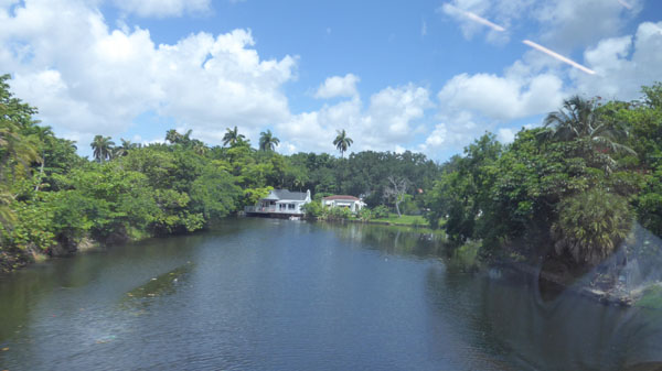
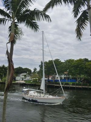
Boat Traffic on the New River (Installment 47)
|
|
|
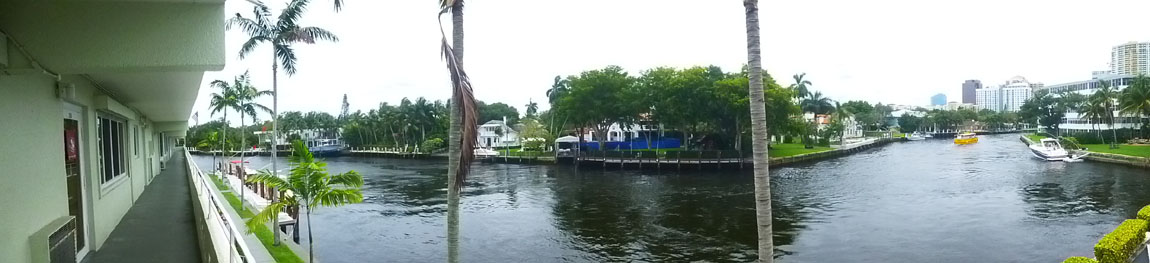
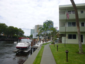
Around the Riverview Gardens Condo
|
(Mouseover Image Above for Video Controls) |
|
|
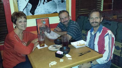
Miscellaneous
|
|
So this was yet another nice trip to Florida. On our departure, I put the Internet service on a "seasonal hold" as it is unlikely we will be back down here until after Christmas. In the Fall, when we would normally return, we have a trip to the Pacific Northwest with the Ruckmans and Gleims, a trip to Chicago with Mario and Steve, and a cruise with Greg.
You can use the links below to continue to another photo album page.
|
June 25, 2019: The Dior Exhibit at the DMA |
|
April 21, 2019: A Visit to the Dallas Arboretum |
|
Return to the Index for 2019 |