|
September 12, 2017: The Ramezay Chateau and Museum |
|
September 10, 2017: Art and Nature in Montreal |
|
Return to the Index for Our Trip to Montreal |
Today's major activity will be a guided walking tour of some of the parts of Montreal that tourists don't usually get to see. Our guide will be a millenial who knows this part of the city well. Since the only other activity today will be a visit to the Bonsecours area near the hotel, I will also use this page to describe some of the other locations we visited during our stay- most of which we walked through or by multiple times- so I can aggregate all the different pictures taken on different days together in one place.
Touring the Quirky Area of Montreal
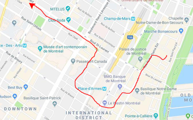
This morning, Guy went down to the Basilica of Notre Dame to a service, and then when he returned to the hotel we all headed up to Rue d'Notre Dame and headed down to Place d'Armes to meet our tour guide for the morning who was going to lead us and some other folks on a walking tour from Place d'Armes, through some of underground Montreal, over to Chinatown, and then up St. Laurent Boulevard.
|
 (Click on Thumbnails to View) |
It was pretty obvious that our guide had been living in the area for some time, as she seemed to know all the twists and turns of the route we took- which led us into and through some buildings into the underground Montreal area and back out again. She also knew a neat Chinese bakery along the route, but more about that in a bit.
|
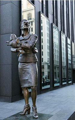
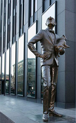
She stopped at the corner by the poodle to tell us about the artwork. There are two elements; the statue nearest the Basilica is of a dashing-looking English man, holding his pug, and giving a superior stare at Notre-Dame Basilica, symbol of the religious influence on French Canadians.
The other statue, right at the southwest corner of the square, is of a woman in a Chanel-style suit, holding her poodle against her, and who is giving an offended look to the Bank of Montreal's head office, a symbol of English power. Both statues have been given exaggerated noses stuck high into the air.
With their masters oblivious to each other, the two dogs on the alert seem to have already sniffed out the opportunity to unite.
The art installation was inspired by the Commedia dell'arte and Two Solitudes from novelist Hugh MacLennan. These two snobs set up an ironically touching scene of the cultural distance between English and French Canadians.
Our guide led us down St. James Street (now rue Saint-Jacques) past some very interesting old architecture and past the front of The Molson Bank Building at the corner of St. Peter and St. James streets. The edifice was constructed in 1866 to be the headquarters of the bank founded by William Molson (1793-1875), noted for starting the Molson breweries. It was the first building in Montreal to be built in the Second Empire style; the bank later merged with the Bank of Montreal in 1925.
|
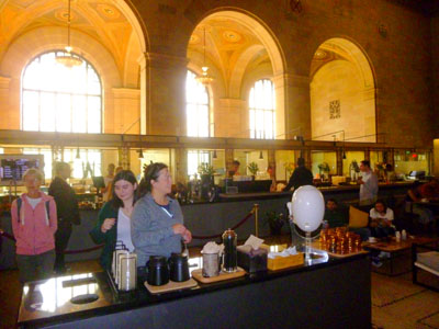
Going through the doors still takes you into the beautiful main hall of the now re-purposed tower. The building is the new headquarters of the Crew Collective- an invite-only community where project leaders can meet top freelance designers and developers, or establish studios to design and build those projects. It is a design creche, and currently occupies most of the tower.
But the really interesting thing is what Crew Collective has done with the ground-floor main hall, which used to be a bank lobby, of course. The teller windows have been repurposed for order and delivery windows for the Crew Collective & Caf�, which is open to the public. Even the cafe is far from traditional; it features super-fast (free) WiFi, silence pods (for doing focused work), as well as amazing coffee (from Caf� Saint-Henri, one of Montreal's most popular coffee houses). The cafe area has fifty-foot-high ceilings and 12,000 square feet of space, which makes it certainly the biggest caf� in Montreal (and probably the prettiest, too). Our guide brought us into the building to see this most interesting example of how buildings in Montreal are not torn down but repurposed.
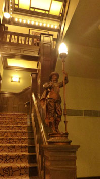
A bit further down the street is Le Hotel, notable for the two interesting sculptures outside. You can see them here and here. And just a bit further down the avenue, we crossed the street, went past one of Montreal's many bicycle rental stations, and then into a building that would give us entrance to underground Montreal.
|
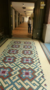
Elsewhere in this photo album, on another page for our Montreal trip, I've described Underground Montreal just a bit. I said that much of the downtown area is connected below street level- in kind of one continuous shopping mall. I think that the other day I showed you a picture of Place Desjardins- one of those huge indoor spaces that extends a good many levels below the street.
|
Wanting to have customers all year, various means have been employed. In suburban areas, we find the huge enclosed shopping mall, where customers have only to get inside the climate-controlled space. But in downtown areas, retrofitting is necessary. In Houston and Dallas, most buildings are connected via underground tunnels, and it is in these underground spaces that you find many of the stores, restaurants and such. In Minneapolis and St. Paul, buildings are connected at the second level via skywalks, and the second level of most downtown buildings is given over to department stores, smaller stores, restaurants and specialty shops.
Montreal took advantage of its Metro system to connect some 70 city blocks underground; one can almost literally go from one end of downtown to the other without ever going outside. Sure, the connections can be complicated, but that's what the ubiquitous "you are here" maps are for. Working here in the past, I walked eight blocks underground from the Queen Elizabeth hotel to the Complex Desjardins- through buildings, up and down escalators and stairs, and past innumerable stores.
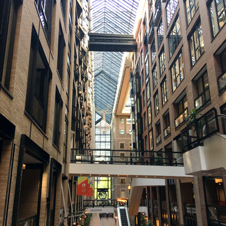
The area we walked through just now was a bit different. Here, a narrow street between two rows of buildings has been entirely enclosed with a glass roof to create another indoor space. Catwalks have been built to connect the buildings. Perhaps this was done when the buildings became the hotel- I'm not sure. But now there is this indoor space which, we found, is of course connected to the larger underground city of Montreal.
|
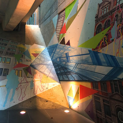
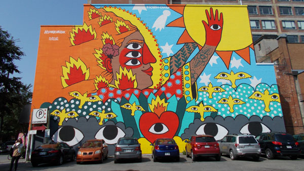
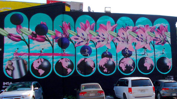
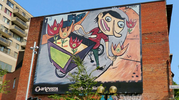
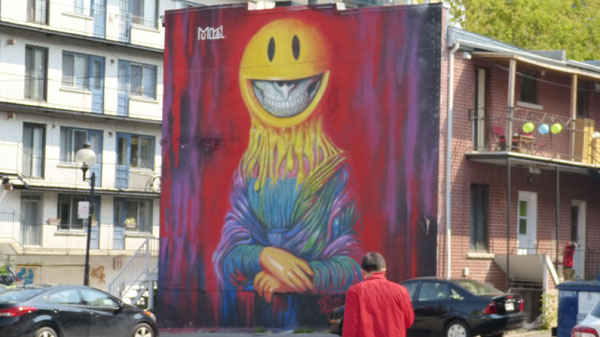
I've done some research, and Montreal has more public art per capita than any city in North America, and only a few cities in the world. I must say that after having walked around for a few days now, it adds a great deal to the enjoyment of the visitor, and I would assume to the residents as well.
Our guide took us the length of this atrium and then through some doors, down some stairs and along a corridor to the west to come out into the Place Jean-Paul Riopelle. Actually, we came up into the colored-glass enclosed lobby of the Palais de Congres (Montreal Convention Center) that borders the square- which you can see through the windows in that last picture. Place Jean-Paul-Riopelle contains eighty-eight trees from eleven different species, including the Sugar Maple and Bitternut Hickory. These mature trees are planted in a random pattern reminiscent of a computer printed circuits. Inside the convention center, these trees are reflected in this interesting sculpture installation.
|
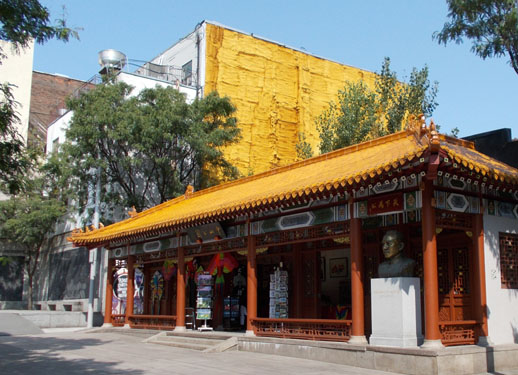
This gave everyone a chance to sit down for a bit and enjoy the pastries, and also wander around just a bit to take a few pictures. Here are a few of those pictures that we took in Chinatown:
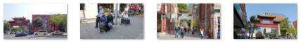 (Click on Thumbnails to View) |
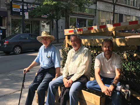
From Chinatown, we headed northwest along Rue Saint-Urbain. This whole area can best be described with the word "quirky". There were all manner of ground floor shops with what were apparently apartments up above. The shops weren't your typical chain stores, but all kinds of small mom-and-pop affairs (including one of the most interesting second-hand shops I've ever seen). While Guy, Nancy, and Prudence went inside, Karl, Ron, and I sat down outside.
 |
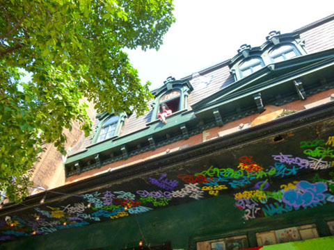 |
I took a picture of the apartment above the shop, thinking that there was someone in the window, but when I saw what it actually was, I took a quick close-up. If you can't tell what you're looking at in the right-hand picture above, just click on the figure in the window.
|
|
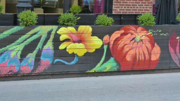
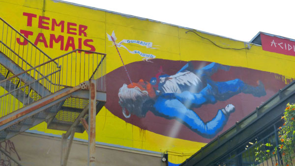
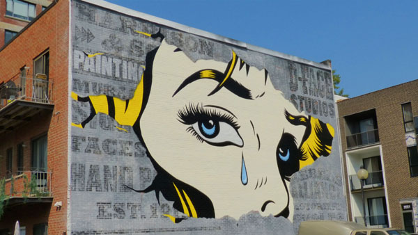
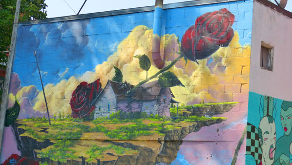
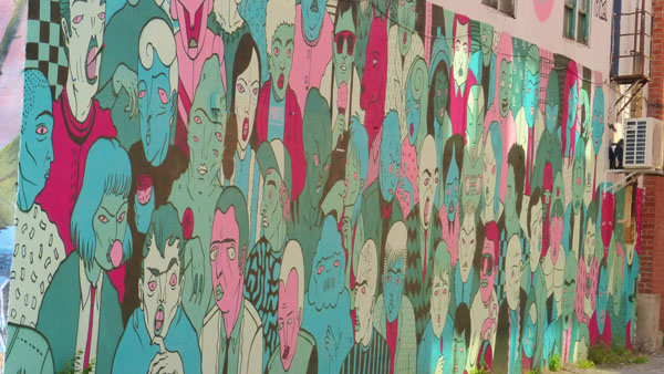
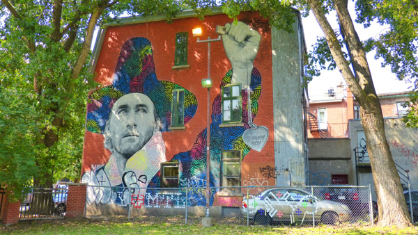
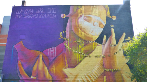
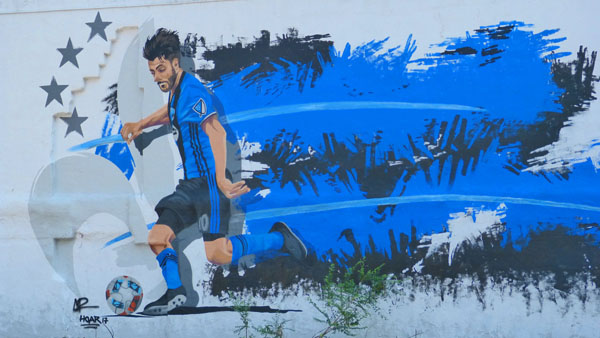
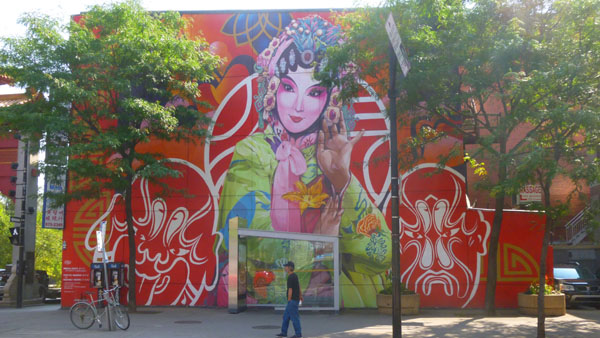
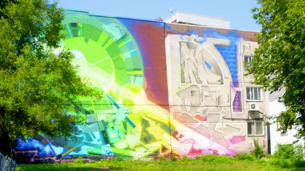
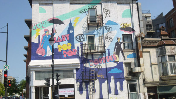
I've put a number of the pictures we took of these colorful murals into a slideshow, and that show is at left. As will all the slideshows in this photo album, you can move from picture to picture using the little forward and backward arrows in the lower corners of each image. And you can see where you are in the show by referring to the index numbers in the upper left.
Our guide ended our tour at the top of Rue St. Urbain, leaving us to head back the way we had come. We'd taken most of our pictures on the way up the street, we did take a few more on the way back. A couple were taken at Station 16, an art gallery that we had passed on the way up the street. Of course Prudence, Nancy, and Guy wanted to stop in, so stop in we did. It wasn't a large gallery, but everyone seemed to enjoy spending a little while doing so. Here is a picture Nancy took of Guy and Karl in the gallery. This was a bustling area, and everyone we passed seemed to be on his way to somewhere- except perhaps this guy. Eventually, we found our way back to the Montreal Convention center, and again we went through it to get back to Rue St. Jacques that we'd walked earlier. On the way through the center, we got two more very nice pictures of the colored-glass-enclosed promenade. You can see those pictures here and here.
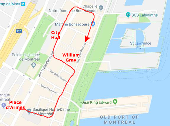
We arrived back at the William Gray, just in time to relax for a little while before heading back to the Basilica Notre Dame, which would be the first stop on our afternoon walking tour.
Vieux Montreal
This afternoon, we met another tour guide- an older gentleman this time- who took us on a walking tour of the area between Place d'Armes and the Notre Dame Basilica to the area a few blocks north of the Hotel William Gray. Our first stop was actually the Notre Dame Basilica, and it was this afternoon that we spent a fair amount of time there. But I have already aggregated all the pictures of the Basilica onto one of the previous pages, so we won't repeat them here.
|
We continued a bit further north, and then turned down Rue Bonsecours to the Chapel of Our Lady of Good Help and finally the Market Bonsecours.
I'll show you some of the pictures from along our route, although when we get to some of the areas where we took lots of pictures I will put them in their own sections.
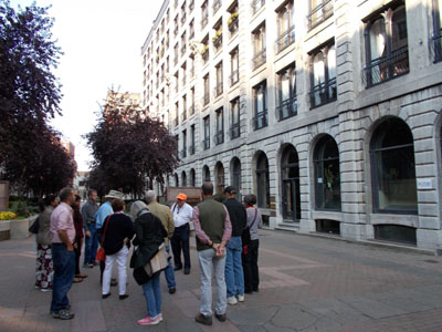
We began our tour, as I said, with the Basilica Notre Dame. After we'd been inside for a while, and taken all the pictures we wanted, Fred, Guy, and I met back outside on the street alongside the church. Across the street was a great example of classic Montreal architecture, and I had Fred go across the street so I could get a picture of him and it. Another interesting shop on that side of the street was this Chinese tea emporium.
When everyone else was done inside as well, we all met back outside the front of the Basilica, and I got a nice shot looking up at the facade. Standing there in front of the Basilica, our guide stopped to talk a bit about where we would go on our walking tour.
|
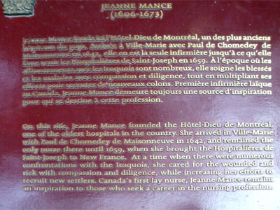
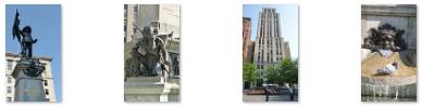
Nancy's picture of our guide talking to our group and my picture of the historical marker are at right.
In case you have difficulty reading the marker, here is the essential information about Jeanne Mance (1606 � 1673): she was a French nurse and settler of New France, arriving two years after the Ursuline nuns came to Quebec. Among the founders of Montreal, Canada, in 1642, she established its first hospital, the H�tel-Dieu de Montr�al, in 1645. She returned twice to France to seek financial support for the hospital. After providing most of the care directly for years, in 1657 she recruited three sisters of the Religieuses hospitali�res de Saint-Joseph, and continued to direct operations of the hospital until her death.
|
At the far end of the street, just before we turned to head back up towards Rue Notre Dame and a visit to City Hall, I got a picture of Nancy coming towards me.
Down at the far end of the street we came across yet another of the multitude of "public art" installations that are sprinkled through the city.
|
The artist was born in Gu�rin, Qu�bec, in 1923. She has exhibited her work in Montr�al since 1995. She began her artistic formation at l��cole des Beaux-Arts de Montr�al in 1945, but it was not until thirty years after, and eight children later, that she finally began to sculpt and create full time.
Rose-Aim�e B�langer�s inspiration comes from the simple moments of everyday life. In her feminine sculptures, her �rounds� as she likes to call them, the expression of the eyes is essential to their understanding and appreciation. The emotions are amplified by the sensuality of the curves. The artist currently lives and works in the northern part of Ontario.
Incidentally, the English translation of the title of that particular sculpture is "The Gossipers".
Passing this sculpture we found ourselves back on the pedestrian street of Rue Saint Paul, walking northeast towards the William Gray Hotel. Here are a couple of scenes from along this street:
 |
 |
We turned northwest a block before the hotel to come out on Rue Notre Dame with the Hall of Justice on our left. We turned northwest again to head to Place Vauquelin and City Hall.
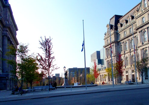
Place Vauquelin
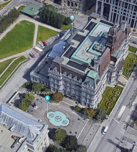
Back up on Rue Notre Dame, we continued northeast, passing first the Place Vauquelin and then the Montreal City Hall. We have passed through Place Vauquelin numerous times during our stay, but I have brought all our pictures of this square together in this section.
|
|
The square was a part of the fief given in 1658 to Lambert Closse and ceded to the Jesuits in 1692. It passed to the Crown in 1763 and was the site of the old prison until 1836. In 1846, the Quebec government took over the prison and demolished it in 1850 so that it could build a new courthouse. The demolition of the old prison freed up the space on the east side of the new courthouse. In 1858, that land was used to create a square called "Neptune Square". At its centre, a fountain was built featuring a statue of Neptune, God of the Sea. In 1895, the square was given an additional structure for a newspaper stand.
In 1902, the city of Montreal rented the land at the annual rate of one dollar. In 1924, following the reconstruction of City Hall, the square was renamed "City Hall Square" for a short time. We will visit City Hall next; the south side of that building borders the square. Here is a view of City Hall from Place Vauquelin.
|
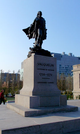
Six years later, following a public subscription, the square was renamed Vauquelin Square and a statue of Jean Vauquelin, created by Paul-Eug�ne Benet, was erected within it. It was unveiled on June 22nd, 1930. Vauquelin was the captain of a French navy ship that distinguished itself in the defense of Louisbourg during the Seven Years' War. The monument is 22 ft high; the statue itself is a little over 9 feet high.
On June 5th, 1833, then-mayor Fernand Rinfret unveiled a plaque to commemorate Jacques Viger, the city's first mayor.
In 1966, the square was refurbished into its current shape and the monument was moved slighly further north. Until then, vehicular traffic had been permitted on either side of the statue between Notre Dame Street and the Champ-de-Mars. At that time, the statue of Neptune was removed from the fountain, and it was reconstructed. Additional changes were made to the square in 1984.
|
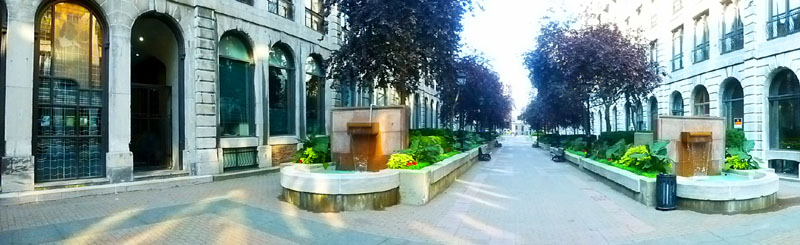
Some other good pictures of Vauquelin Square that we took over the course of our stay were this nice picture of the fountain and the statue as well as a late afternoon picture of the fountain and City Hall.
One other view from Place Vauquelin was this view of the huge new hospital complex that is still under construction to the northwest- on the other side Champ-de-Mars and beyond the Metro station.
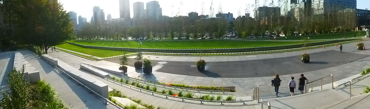
Speaking of the Champ-de-Mars Park, it was really just a large open area perhaps a little smaller than a football field. It is bordered with trees and there is a section of the old city wall that has been excavated for people to see. There are stairs down to the level park from Place Vauquelin, and on the far side of the park more stairs down to the level of the streets west of it. I make one panoramic view of the park:
From the Place Vauquelin, we simply walked a bit further up the street past the Montreal City Hall.
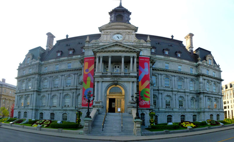
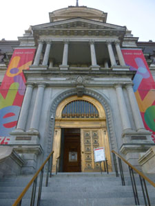
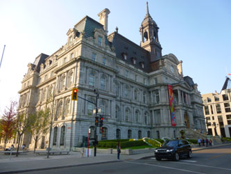
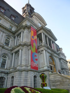
The Montreal City Hall
The five-story Montreal City Hall (French: H�tel de Ville de Montr�al) was designed by architects Henri-Maurice Perrault and Alexander Cowper Hutchison, and built between 1872 and 1878 in the Second Empire style. It is located here in Old Montreal, adjacent to both Place Vauquelin and the Champ de Mars. As one of the best examples of the Second Empire style in Canada, and the first city hall to have been constructed in the country solely for municipal administration, it was designated a National Historic Site of Canada in 1984.
|
The architect Louis Parant was commissioned for the reconstruction, and he decided to build an entirely new building with a self-supporting steel structure built inside the shell of the ruins. This new building was modelled after the city hall of the French city of Tours.
Other changes included a remodelling of the Mansard roof into a new Beaux-Arts inspired model, with a copper roof instead of the original slate tiles. The building is really a magnificent structure, and I wanted to get a picture that would do it justice. So I crossed the street and took my picture in three sections, eventually stitching them together into the image you see at left.
In 1967 Charles de Gaulle, the president of France, gave his Vive le Qu�bec libre speech from the building's balcony.
It was late afternoon when we came by the front of the building, so it might have been better if I had come back one morning and taken these same pictures so the sun could light up the front of the building. On other days, as we passed by this building, we each got other pictures of it in different lighting conditions and from different angles. Here are some of those pictures:
|
|
|
|
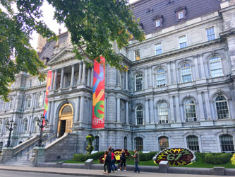
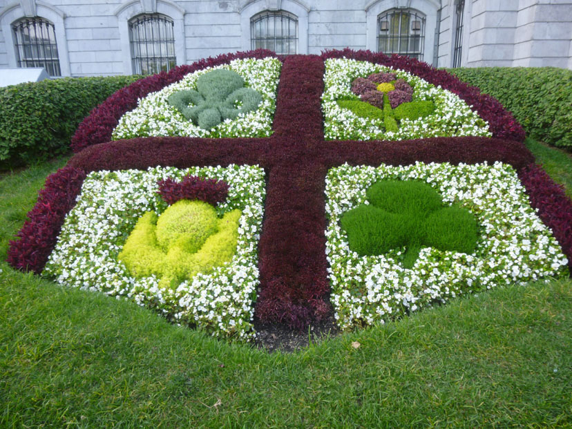
In front of the City Hall, along the sidewalk on either side of the entrance, there were seven floral displays- three on either side of the entrance and one at the northeast corner of the building. (There was also a a tall floral display on either side of the entrance steps.) The seven displays were celebrating or commemorating historical events and such and they were very well done. If you want to see some of them close up, just click on the small images below:
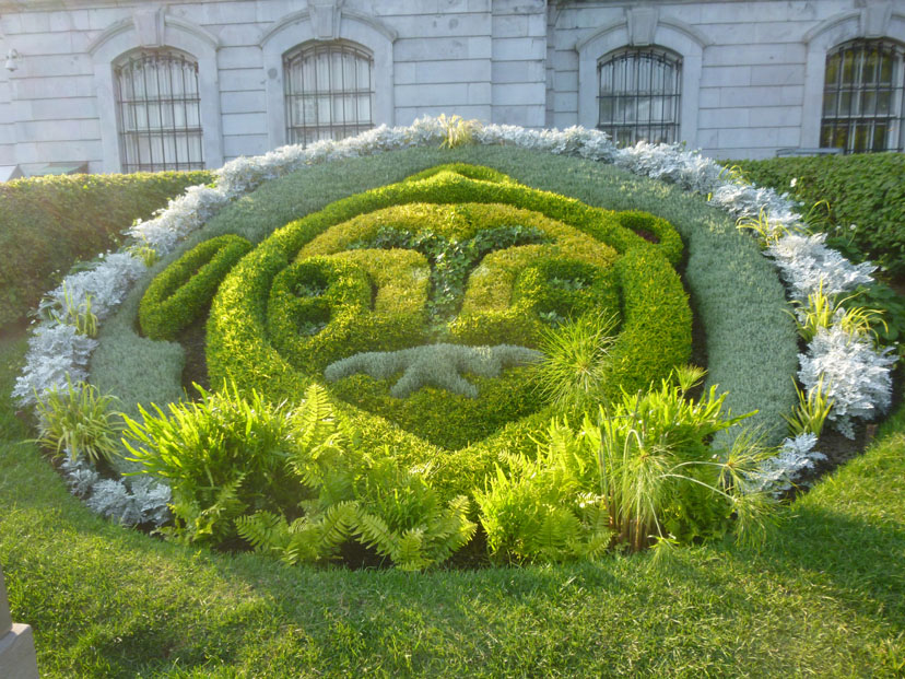 2017: The Year of the Indigenous Peoples |
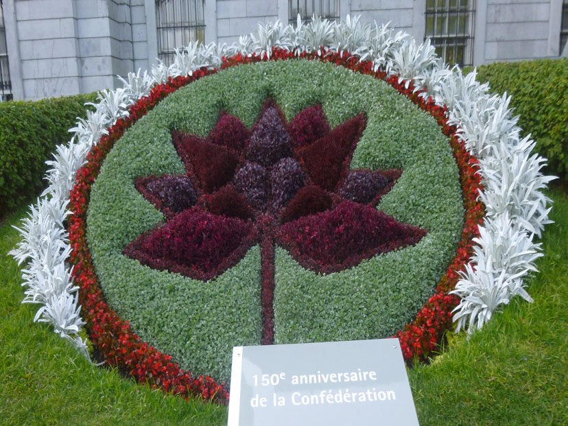 150th Anniversary of the Canadian Federation |
 Commemorating the Indigenous Peoples of Canada |
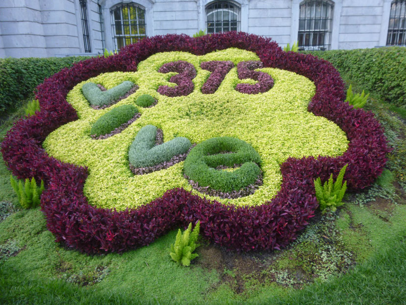 The 375th Anniversary of Montreal |
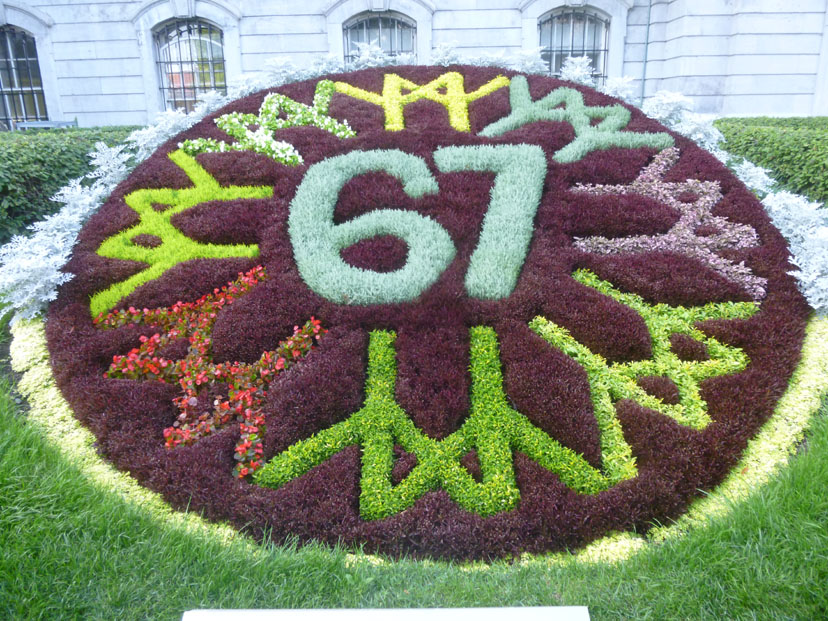 The 50th Anniversary of Expo 67 |
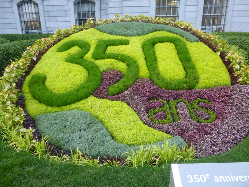 The 350th Anniversary of Lachine |
 The 37th Assembly of French Mayors |
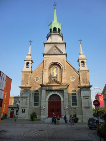
The Bonsecours on Rue Saint Paul
From the Montreal City Hall, we walked another block northeast along Rue Notre Dame and then turned right to head down Rue Bonsecours towards the St. Lawrence River. This brought us to Rue St. Paul and the last two stops on our tour- the Notre-Dame-de-Bon-Secours Chapel and the Market Bonsecours.
|
St. Marguerite Bourgeoys, the first teacher in the colony of Ville-Marie and the founder of the Congregation of Notre Dame, rallied the colonists to build a chapel in 1655. In 1673, returning from France, Bourgeoys brought a wooden image of Our Lady of Good Help; with this as an inspiration, the stone church was completed in 1678. It burned in 1754, the reliquary and statue being rescued.
After Montreal was conquered by British forces during the French and Indian War, the church was attended by Irish and Scottish troops and families, and saw fundraising to build Saint Patrick's Church, Montreal's first anglophone Catholic parish.
In the 19th century, the chapel came to be a pilgrimage site for the sailors who arrived in the Old Port of Montreal; they would make offerings to the Virgin in gratitude for her "good help" for safe sea voyages. In 1849, Mgr. Ignace Bourget, Bishop of Montreal, gave the chapel a statue of the Virgin as Star of the Sea, which was placed atop the church overlooking the harbour. Emphasizing the connection of the chapel and the port, the chapel is often called the Sailors' Church.
The chapel now also houses the Marguerite Bourgeoys Museum, dedicated to the life of St. Marguerite Bourgeoys and to the early history of Montreal and the chapel site. Below the chapel, the crypt is being excavated as an archeological site, which visitors can see. First Nations and French colonial artifacts have been discovered, along with the foundations of the first chapel and the fortifications of the colony. The church's prominent spire can also be climbed, offering views of the Old Port and Saint Lawrence River. In 2005, Marguerite Bourgeoys's mortal remains were brought back to the church, where she now lies in the sanctuary.
We did not find out about some of the interesting aspects of the chapel until later, but it wouldn't have done any good had we known about them when we arrived at it; when we passed by the church a bit after 5:30, it had already closed.
|
|
We walked a ways down the street, back to the southwest this time, back towards Place Jacques Cartier and our hotel, to come along in front of the Bonsecours Market. Here, our guide stopped for the last time to tell us a bit about the history of this two-story domed public market. For more than 100 years, it was the main public market in the Montreal area, and it also briefly accommodated the Parliament of United Canada for one session in 1849.
Named for the adjacent Notre-Dame-de-Bon-Secours Chapel, the market opened in 1847; it's design was influenced by Dublin's Customs House.
Our guide knew that at least some of his charges would want to go inside the market to shop around, and so he had made this his last stop, giving us some history and describing the shops that we might find inside.
|
As the market was also a venue for banquets, exhibitions and other festivals, Browne was charged with adding a 900-square-meter concert hall and banquet hall. Closed in 1963 as a farmer's central market, it was slated for demolition. Today, the market is multi purpose facility. There is, of course, the upscale mall that houses outdoor caf�s, restaurants and boutiques on the main and second floors. But there are also rentable halls and banquet rooms on the lower and upper floors, as well as municipal office space the is least to both private and public agencies and organizations.
The Bonsecours Market was designated a National Historic Site of Canada in 1984, and in 1990 the building was featured on a stamp issued by Canada Post and designed by Raymond Bellemare. The $5 stamp features an image of the Bonsecours Market, which was designed by Montreal architect William Footner and constructed from 1842-45.
Ron and Karl headed back to the hotel when our guide was finished, but Nancy, Prudence, and Guy went into the market to see what they could find. I am not sure where Fred went, but I found that one could go directly through the building to come out on a high porch on the river side of the structure. There were double stairs down to the street from there.
|
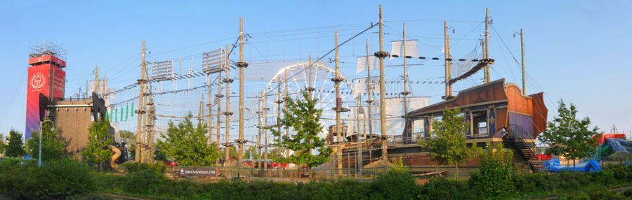
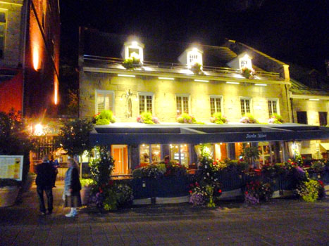
I went down the stairs to walk along the street to see what I could see. I got far enough up along the river to get a different view of the ferris wheel and tower that I'd seen in my panorama, and when I came back down the street to hook back up with everyone, I got this view of the Bonsecours Market building. When I got back inside, I found it was closing time for all the interior shops, so I looked around for everyone and found them completing a purchase or two. Then we all walked the few blocks back to Place Jacques Cartier, and we passed this cute sidewalk cafe right at the corner of the square.
|
It turned out to be a nice place to eat. Ron didn't join us; I think there was a game on TV that he wanted to watch over in the hotel bar, so the six of us went over to eat. The restaurant actually had a huge interior courtyard, in addition to more traditional rooms. While the courtyard was open to the sky, there were huge umbrella-like affairs that could be opened up when it was either raining or very cold. I couldn't quite figure out how they would keep all the rain from coming down on the diners at the edges of the room. As you can see in this inside view looking up, there were lots of hanging plants and stuff, but you can also see that the tenting didn't quite cover the opening. So if ran came i at the edges, I would think that diners on the periphery of the courtyard area would get wet. I did notice that there were numerous large heaters scattered around the room, so I guess that in cold weather the restaurant is warm enough.
Dinner brought our last full day here in Montreal to and end. Tomorrow we will see a few things in the morning, but at noontime we will be taking the train to Quebec City for the second four days of our trip to Canada.
You can use the links below to continue to another photo album page.
|
September 12, 2017: The Ramezay Chateau and Museum |
|
September 10, 2017: Art and Nature in Montreal |
|
Return to the Index for Our Trip to Montreal |