|
September 10, 2017: Art and Nature in Montreal |
|
September 8, 2017: Our First Evening in Montreal |
|
Return to the Index for Our Trip to Montreal |
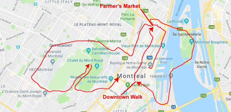
Today, Karl has set us up with a bus and walking tour of Montreal. The tour will make its first stops at the Place d'Armes, where we will also get a tour of the Notre-Dame Basilica. We will get back in the coach and we'll head further downtown where we will see some interesting sculptures and buildings and get an orientation to Montreal's Metro. The tour will then take us north through some interesting neighborhoods where we will stop for lunch at the large farmer's market that is there. Then we'll drive out onto Ile Saint-Helene, and then south and back through downtown, around the far side of Mont Royal and then up to the top for the views. From there, the tour is supposed to come back along Sherbrooke Street to the William Gray. (As it turned out, Fred, Guy, and I hopped off the tour bus near the Montreal Museum of Fine Arts so we could walk back to the hotel in the sunlit afternoon.
Place d'Armes
As is her habit, Prudence went out for a walk before breakfast; sometimes Fred goes with (especially in San Antonio), but this morning it was just Prudence and her sister Nancy. They walked down by City Hall about a block away, and across Rue Notre-Dame found a little plaza with a sculpture by Jules LaSalle, installed in 1988 and commemorating Marguerite Bourgeoys. Bourgeoys was the French founder of the Congregation of Notre Dame of Montreal. She lived in Fort Ville-Marie (now Montreal) as of 1653, educating young girls, the poor, and natives until her death at the turn of the 18th century. Declared a Saint by the Catholic Church, she is also significant for developing one of the first uncloistered religious communities in the Catholic Church.
|
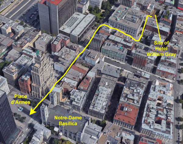
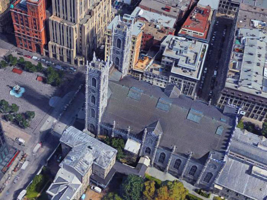
At left is a 3D aerial view that has the Hotel William Gray in the upper right and the basilica in the lower left. You might not notice it in this view (although if you have already viewed the previous album page I've already talked about it), but the Hotel William Gray doesn't exist! Where the hotel is now is just a hole in the ground in the available aerial views.
I have emailed the hotel to find out exactly when the structure was completed, and that will tell me how out-of-date the aerial views actually are.
In any event, the tour coach was outside the hotel right at 9AM; we got on the coach with the other five or six folks who were on the tour, and the bus headed off. The foot of St. Vincent is permanently blocked, as the street at its foot is a pedestrian street, so vehicles can't go down and turn onto it. So taxis and buses have to back up a short distance to head south a block and then turn to go northwest back to Rue Notre-Dame.
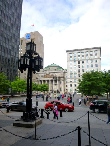
The coach headed south to bring us right to Place d'Armes, where we all got off and congregated around our tour guide in the plaza while she told us about it and the buildings around it.
Place d'Armes is a square in Old Montreal quarter of Montreal, in Quebec, Canada. In the centre, there is a monument in memory of Paul de Chomedey, founder of Montreal. Buildings that surround it include Notre-Dame Basilica, Saint-Sulpice Seminary, New York Life Building, Aldred Building, Bank of Montreal head office and 500 Place D'Armes.
|
|
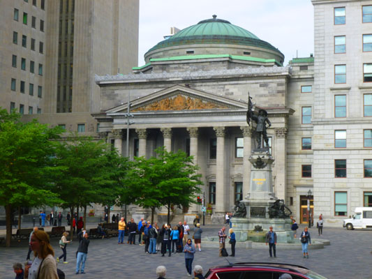
On the opposite side of the square from Notre-Dame Basilica is the Bank of Montreal's Main Branch. The Bank of Montreal is the oldest bank in Canada, founded in 1817; this building used to be the head office of the bank, but the head office was moved to Toronto in 1977 due to political instability in Quebec.
Looking a lot like Rome's Pantheon, the neoclassical structure was built in 1847; it was actually inspired by the design of the former headquarters of the Commercial Bank of Scotland in Edinburgh.
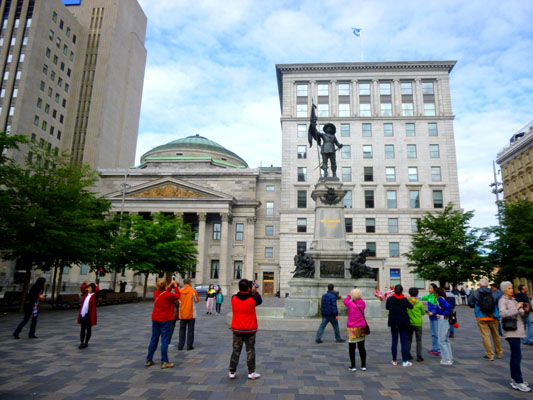
It was here in the square that our tour group stopped to hear our tour guide talk first about the square and then about the basilica that were shortly to enter. (Groups are metered into the basilica, so I think she had a few minutes to kill.) Place d'Armes is the second oldest public site in Montreal; it was called "Place de la Fabrique" when it was first developed in 1693, at the request of the Sulpicians, then later renamed Place d'Armes in 1721 when it became the stage of various military events. From 1781 to 1813, it was used as a hay and wood market, then developed as a Victorian garden after it was acquired by the city in 1836. The current dimensions of Place d’Armes correspond roughly to a plan begun in 1845 and completed in 1850, when Notre-Dame Street was finished. But it was not until the demolition of the original Notre-Dame Church in 1830, and its bell tower in 1843, that the square would assume its current size.
|
During the 1890s, a series of commemorative plaques was produced for the first time in Montreal, at the instigation of the Antiquarian and Numismatic Society, which took an active role in the project to build the Maisonneuve Monument. For its part, the Société historique de Montréal in 1892-93 had an obelisk erected in memory of the founders of Montreal. The Francophones and Anglophones of Montreal found common ground in the commemoration of the personalities of New France, with each cultural group highlighting its own heroes. Arrayed at the four corners of the base of the monument are sculptures of Charles Le Moyne (Indian fighter, fur trader, and, with 10 slaves, Canada's second-largest slaveowner), Lambert Closse (Indian fighter, public notary and merchant), Jeanne Mance (nurse, settler, and the founder of Quebec's first hospital), and a fourth sculpture representing the Iroquois.
|
Fred took another picture of the Maisonneuve Monument to get me standing in front of it; you can see that picture here.
He also got a picture of the interesting clock atop the red brick New York Life Building.
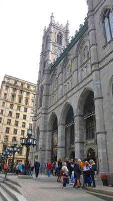
After perhaps fifteen minutes of explanation about the square, we headed across the street to go inside the Notre Dame Basilica.
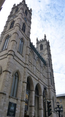
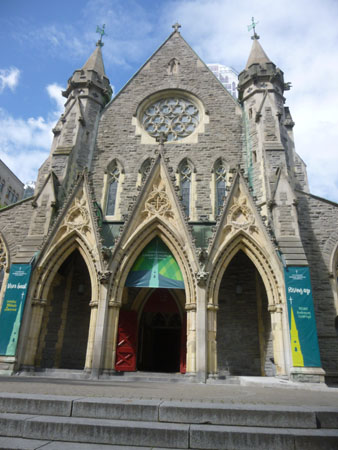
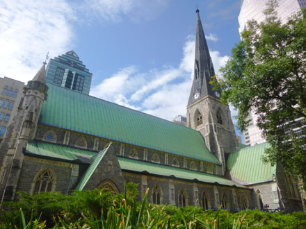
The Notre-Dame Basilica
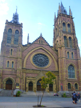
Notre-Dame Basilica (Basilique Notre-Dame de Montréal) is located east of Place d'Armes square at the southeast corner of Notre-Dame Street West and Saint Sulpice Street. It is located next to the Saint-Sulpice Seminary and faces the Place d'Armes square.
|
François Baillairgé, an architect, re-designed the interior decoration of this first church and choir in 1785-95; he continued as designer and worked on the facade & vault decoration, completing both in 1818.
The church served as the first cathedral of the Diocese of Montreal from 1821 to 1822.
By 1824 the congregation had completely outgrown the church, and James O'Donnell, an Irish-American Anglican from New York City, was commissioned to design the new building. O'Donnell was a proponent of the Gothic Revival architectural movement, and designed the church as such. He is the only person buried in the church's crypt. O'Donnell converted to Roman Catholicism on his deathbed perhaps due to the realization that he might not be allowed to be buried in his church if he didn't.
This new design called for the larger church to be built further to the east, opening up the area which is now the Place d'Armes.
The main construction work took place between 1824 and 1829. The cornerstone was laid east of the current Place d'Armes on September 1, 1824. The sanctuary was finished in 1830, and the first tower in 1841, the second in 1843. On its completion, the church was the largest in North America. It remained the largest in North America for over fifty years. The church was essentially completed when a new pipe organ was built in 1858 by Samuel Russell Warren.
|
|
|
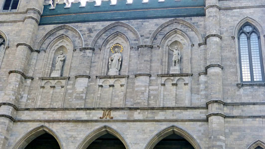
The details of the front facade were interesting, and Fred got a good picture (seen at left) of the three sculptures above the doors.
Those three statues on the façade of the Basilica (which were completed shortly after the second tower was finished in 1843) represent (from left to right) Montreal (the Virgin Mary), Quebec (Saint John the Baptist) and Canada (Saint Joseph).
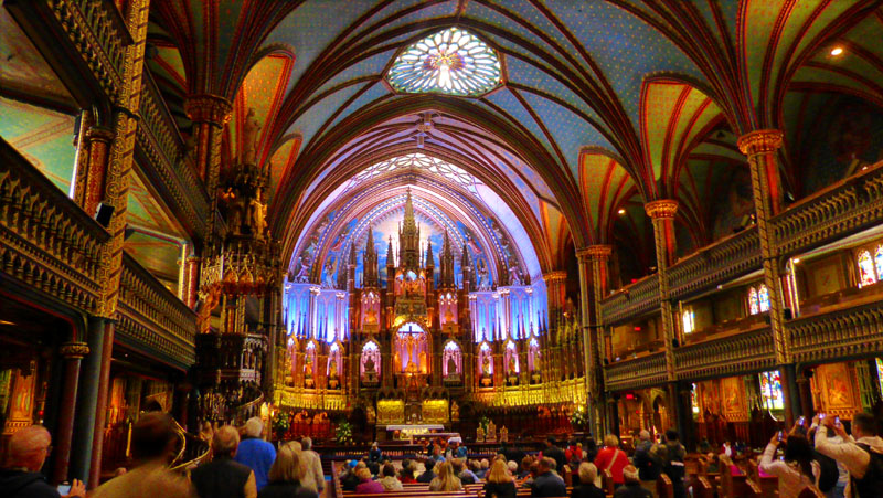
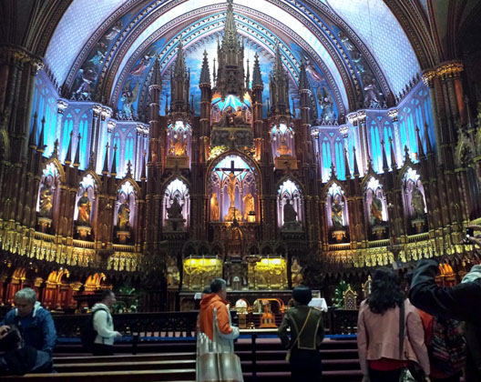
After all this explanation, and after answering a few questions, our tour guide led us inside the basilica. There was much to see inside, and the interior was quite as beautiful as our guide had promised it would be (and as some of us had read ahead of time would be the case). We altogether took so many pictures that it will be almost mandatory for me to organize them by each particular feature of the inside of the basilica.
The Nave: Pictures and Movies
|
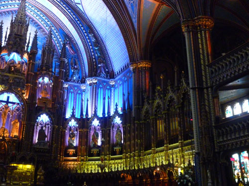
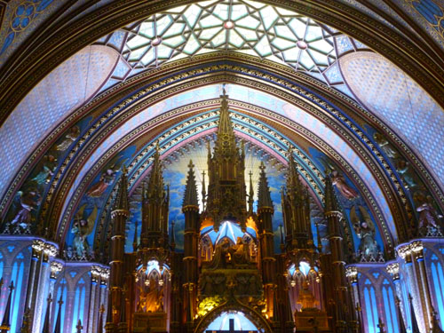
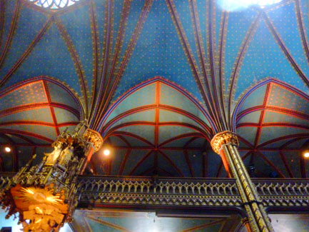
In that picture, you can see all the major features that we'll look at in more detail below. First, note the two gallery levels above the main floor; we did not get up to see them, but we could tell that they had chairs, rather than pews. This picture shows clearly the lovely blue accents which, when lit up, literally glow, giving the altar an ethereal appearance. You can see the pulpit on the left side and some of the smaller chapels along the walls.
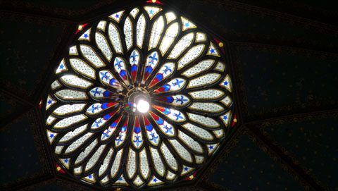
Note, too, the amazing decorative elements on the columns, the balustrades, and the arched ceiling. In an unusual approach, note also that this church has a rose window at the top of the nave (in addition to those at the front and on the sides of the church). As you can see if you look closely at what many of the tourists are doing, capturing this view is something every visitor does. Fred just did it better than most.
Now that you've seen what the interior of the church looks like generally, we can take a look at the particular elements of the church interior that we found interesting.
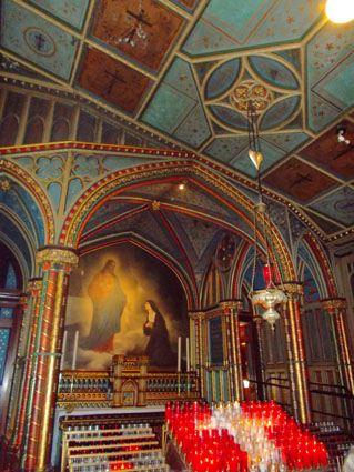
Side Chapels
|
While we were at the back of the nave (and I always find churches confusing to talk about directionally, because when you are outside the building, and standing outside the entrance, you speak of yourself as being in front of the church, but when you go through the entrance and any vestibule to enter the nave, then inside the building you speak of yourself as being at the back of the church) I did make one movie that shows some of these side chapels.
|
 (Click on Thumbnails to View) |
I, for one, found these side chapels to be interesting, and I photographed a number of them. I had to use my flash, but many of the chapels had paintings on their back walls, and it is almost impossible to keep the flash from reflecting from the oil paint. But I think that the pictures turned out well.
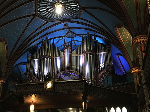
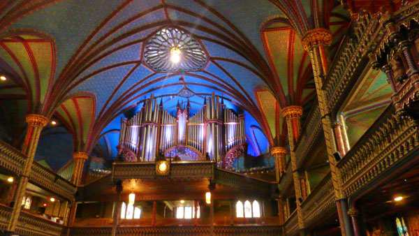
The Pipe Organ
|
|
Fred took one other picture that I thought was worth including here, a view from a bit further back that shows more of the choir loft on either side of the organ, and also shows the decoration of the church's columns and ceiling. That picture is at right.
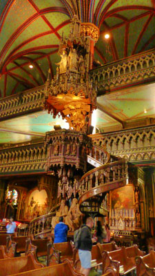
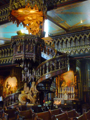
The Pulpit
|
|
I suppose that had I a mind to, I could go back through the pictures we've taken on trips to Europe (where ornately-decorated cathedrals, basilicas, and churches are common) and put together a collection of "pulpit pictures". But it seemed to us as if this particular structure was more ornate than most.
This particular pulpit was constructed of very, very dark wood, and was very ornately-carved. So let me include two more pictures that I took, close-up, of the pulpit so you can see how rich the wood was and how beautifully carved and turned it was. One is a picture of the spiral staircase seen from the back, and another a closeup view of the top of the pulpit seen from the front.
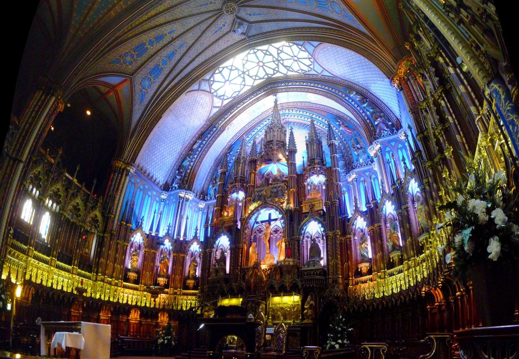
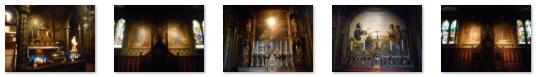
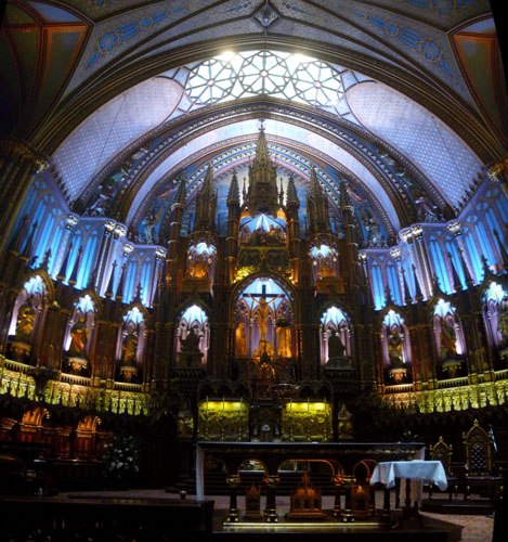
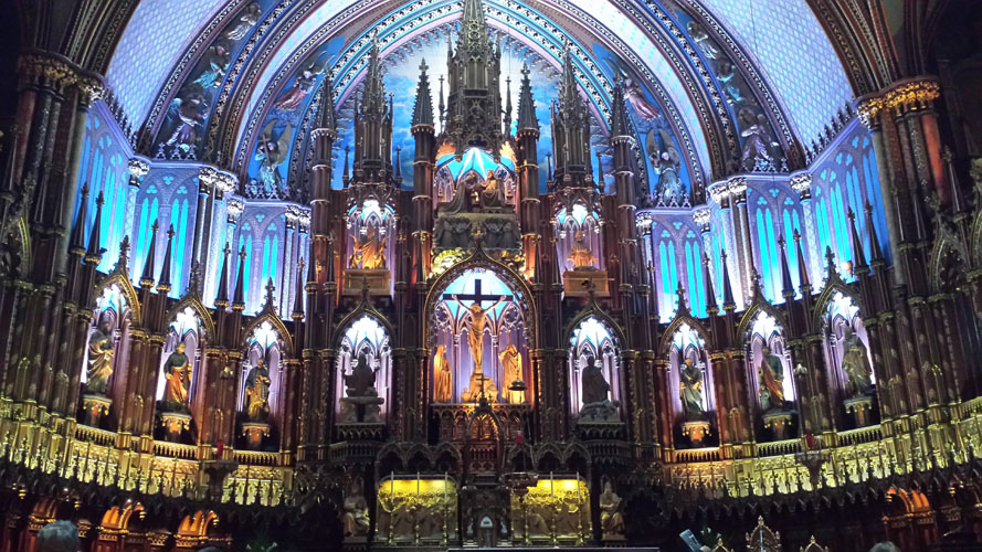
The Altar Area
|
So I got quite close to the altar and took a series of six pictures in two rows across the bottom of the altar and then across the top. I stitched them together into one large image, correcting as much as I could for perspective, and wanted to put the result here on this album page. But sizing that picture down to a reasonable size just took me back to a picture too small- the detail tended to get lost. So what I've done is taken the large image, sized it down as much as I could without losing much detail, and put it in the scrollable window at left.
The window begins at the upper left corner of the image, and you can use the vertical and horizontal scroll bars to pan up and down and back and forth across the image. I hope you find the result interesting; this was certainly one of the most beautiful altar areas I have ever seen.
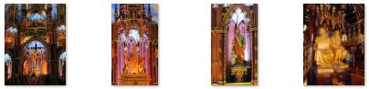
While I was taking my photographs for the large image, Fred was getting a very nice closeup view of the center of the altar and you should definitely have a look at it. Built in the Gothic Revival style, the church is highly decorated. The vaults are coloured deep blue and decorated with golden stars, and the rest of the sanctuary is decorated in blues, azures, reds, purples, silver, and gold. I have four more views of the altar that I want to include here- it was so beautiful:
 |
 |
|
|
Finally, here is that movie I mentioned earlier, where I am very close to the altar and am able to pan back and forth and up and down to get the whole thing in:
|
|
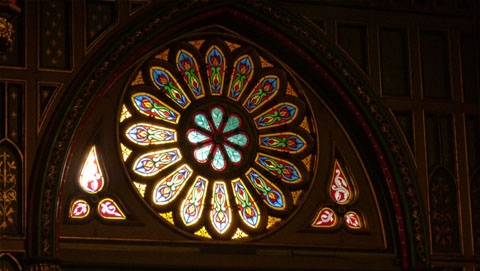
Rose Windows
|
|
Church Decorative Elements
|
 |
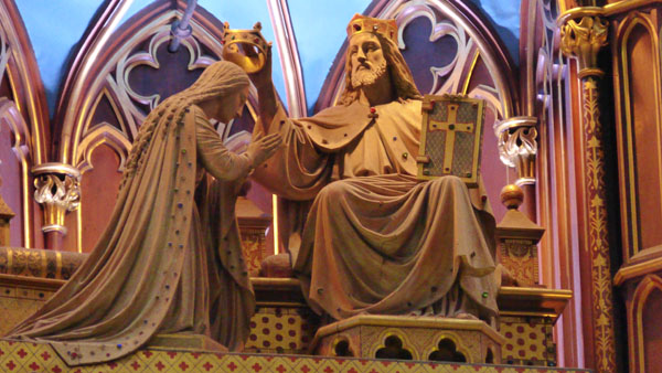
There were other religious statues, many of them in the small side chapels, but the ones we could actually get close to were larger and more impressive.
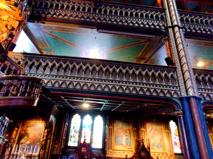
Finishing the interior took much longer than the actual construction of the building; Victor Bourgeau, who also worked on Montreal's Mary, Queen of the World Cathedral, worked on it from 1872 to 1879. Because of the splendour and grand scale of the church, a more intimate chapel, Chapelle du Sacré-Cśur (Chapel of the Sacred Heart), was built behind it, along with some offices and a sacristy. It was completed in 1888. We found the decoration of the columns and the ceiling to be intricate and quite beautiful. Here are two more views of the carvings and decoration of the walls, balustrades, columns, and ceiling:
 |
 |
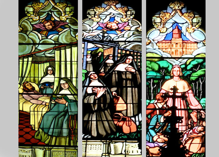
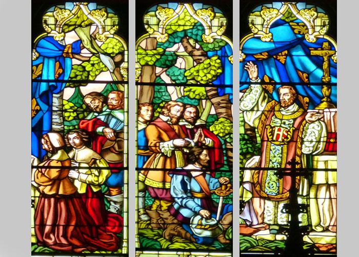
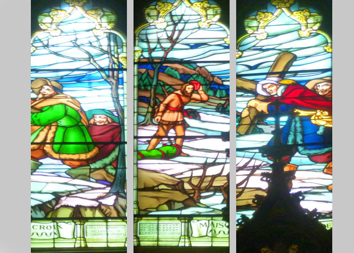
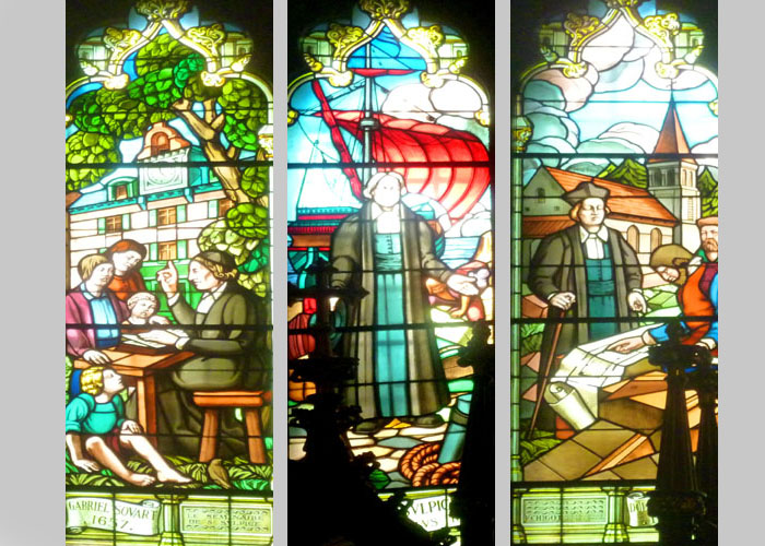
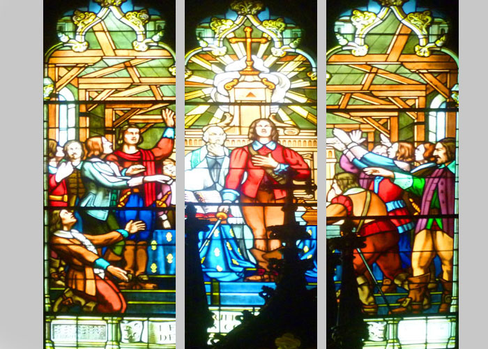
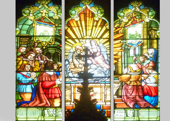
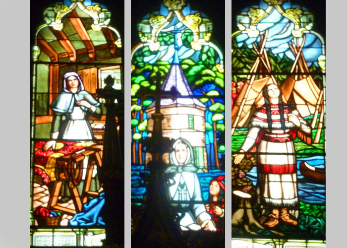
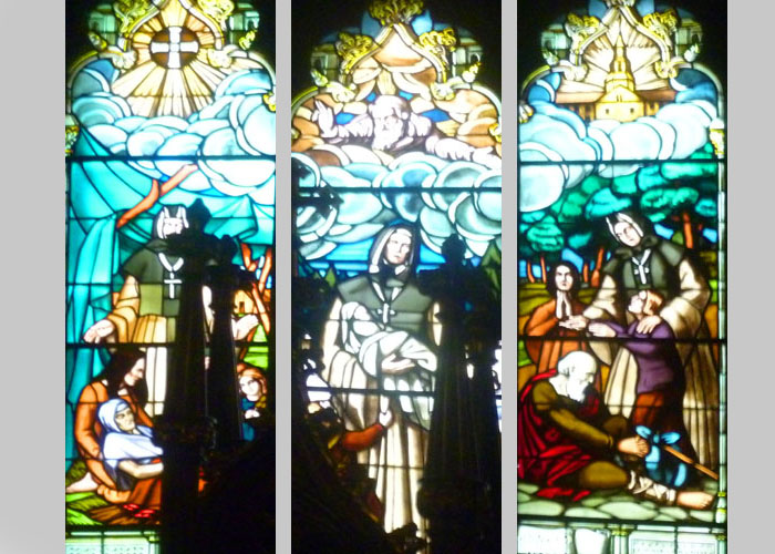
Stained Glass
|
|
We thought that this lent a certain familiarity to these windows; one could imagine oneself in some of them (albeit in the past). In any event, we were also able to get fairly close to most of the individual window panels (although some were obscured by the constructions in the side chapels where most of them were located.
At left is a 9-slide show. Each side shows three panels; most of the time, these three panels formed a single window and thus were part of the same larger scene. As with all slide shows in this album, you can move from one slide to another using the little forward and backward arrows in the lower corners of the slide, and you can track your progress with the index numbers in the upper left.
We hope you enjoy looking at these beautiful stained glass windows!
When we were finished in the Basilica, Guy, Fred, and I went outside to the street alongside the church where we waited for the rest of the tour group.
NOTE:
As it happened, many of us returned the next morning, Sunday, to the Basilica for an actual service. Guy wanted to see what it was like, and so he, Fred, myself, Prudence, and Nancy came for a 9AM service. It was interesting, and I took the opportunity to make three movies, and you can use the players below to watch them:
|
|
|
|
|
I also took another good picture of the sacristy here in the Basilica, and I want to include it here:
Our Guided Tour of Montreal
Our visits to Place d'Armes and the Notre Dame Basilica were actually the first two stops on our guided tour of Montreal that Karl arranged for all of us. From the Basilica, we got back aboard the small bus and headed off for the rest of our tour- which took us most of the day. Below right is a map of the area of Montreal that we covered during the bus-tour part of the day. It requires a bit of explanation before we get to the pictures taken along the way and at the various stops we made.
|
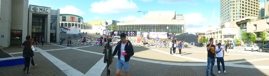
There, our tour guide had us disembark and we walked around the center of town for a little while. I think the main purpose of the stop was to let everyone take a "facilities" break inside one of the underground shopping areas, but we also got to look at some of Montreal's many outside art installations as well as the underground Metro.
Back on the bus again, we headed north to the Farmer's Market area where our guide let us off to tour the market and have lunch (which we all did). After that it was off on the last leg of our bus tour where we headed back south and then around the west side of Mont Royal (Montreal's central hill). We drove through some interesting neighborhoods, went past the L’Oratoire Saint-Joseph du Mont-Royal and then up onto the hill itself where we got out to take in some of the neat views out over Montreal.
The bus then took us back down the hill and through some more interesting neighborhoods and onto Sherbrooke Street- one of Montreal's prettiest and busiest streets. As the bus came in front of the Musée des beaux-arts de Montréal (The Montreal Museum of Fine Arts) on its way back to the William Gray, Fred, Guy, and myself decided to hop off the bus and walk back to the hotel. It was a beautiful afternoon, and we were all three a bit tired of riding around on the bus.
With that overview in mind, come on along on the tour with us.
Riding Out Onto St. Helen's Island
|
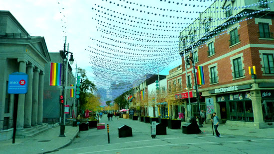
As we made our way to the entrance ramp to get up onto the bridge, we drove through an area actually called Gay Village which is, as its name implies, the center of gay and lesbian culture in Montreal. Unlike most U.S. cities, Montreal has long recognized the contribution of its gay and lesbian citizens. This area has long been a residential area for gays and lesbians, and far from trying to hide it or legislate it out of existence, the city has embraced it, helped develop and gentrify it, and actually publicizes it as a tourist attraction to the millions of gay and lesbian travelers from around the world.
St. Catherine Street, which crosses the entire Montreal downtown from the southwest to the northeast and Gay Village, is here a pedestrian mall lined with shops, restaurants, and bars. As soon as the street crosses into Gay Village, it becomes festooned with strings of colored balls.
|
As we came up the circular entrance ramp onto the bridge approach, Fred noticed that someone (presumably the city) had created a topiary right at the roadside, although we went by it so quickly that we didn't get very good views. Soon we were up onto the bridge and heading across to the island.
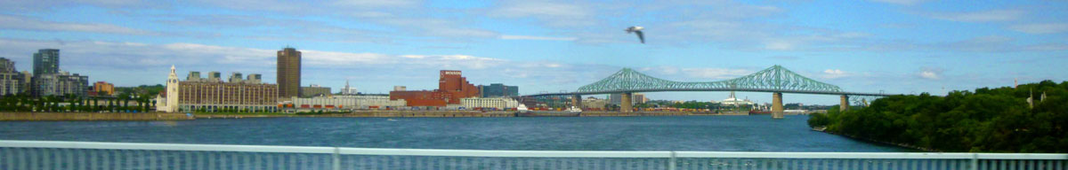
As we crossed the bridge, I made a movie of downtown Montreal (although the bridge railings obscured quite a bit). If you use the player at right to watch the movie, you'll also hear a bit of our tour guide's commentary.
When we got onto the island, our driver was going to take us around to the La Ronde entertainment district and the Stewart Museum (a military museum), but there was something going on and the traffic was terrible. So we just headed south across the island.
|
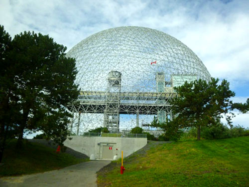
The building originally formed an enclosed structure of steel and acrylic cells, 250 feet in diameter and 200 feet high, forming a "Class 1, Frequency 16 Icosahedron". A complex system of shades was used to control its internal temperature. The sun-shading system was an attempt by the architect to reflect the same biological processes that the human body relies on to maintain its internal temperature. The system never worked properly and was eventually removed.
In the original building, visitors had access to four themed platforms divided into seven levels. The building included a 120-foot-long escalator, the longest ever built at the time. The "Minirail" monorail ran through the pavilion. On 20 May 1976, during structural renovations, a fire burned away the building's transparent acrylic bubble, but the hard steel truss structure remained.
The site remained closed until 1990 when Environment Canada purchased the site to turn it into an interactive museum showcasing and exploring the water ecosystems of the Great Lakes-Saint Lawrence River regions. The museum was inaugurated in 1995 as a water museum, and is a set of enclosed buildings designed by Éric Gauthier, inside the original steel skeleton. The Biosphčre adopted its name in 2007, and offers interactive activities and presents exhibitions about the major environmental issues related to water, climate change, air, ecotechnologies and sustainable development.
From St. Helen's Island, we crossed a small bridge onto a larger, artificial island that is separated from the main part of Montreal by only a small canal. As we crossed, we got nice views looking back towards the Jacques Cartier Bridge:
 |
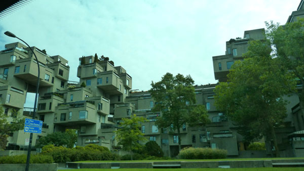
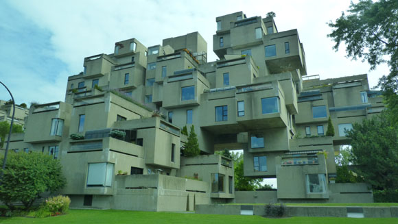
The area we crossed to is called Cité du Havre. It was here that the road ran alongside Habitat 67.
|
Safdie's design for Habitat 67 began as a thesis project for his architecture program at McGill University. It was "highly recognized" at the institution, though Safdie cites its failure to win the Pilkington Prize, an award for the best thesis at Canadian schools of architecture, as early evidence of its controversial nature. After leaving to work with Louis Kahn in Philadelphia, Safdie was approached by Sandy van Ginkel, his former thesis advisor, to develop the master plan for Expo 67, the world's fair that was set to take place in Montreal during 1967. Safdie decided to propose his thesis as one of the pavilions and began developing his plan.
After the plans were approved in Ottawa by the federal cabinet minister responsible for the exhibition, Safdie was given the blessing of the Expo 67 organization to leave the planning committee in order to work on the building project as an independent architect. Safdie was awarded the project in spite of his relative youth and inexperience, an opportunity he later described as "a fairy tale, an amazing fairy tale".
|
Habitat 67 comprises 354 identical, prefabricated concrete forms arranged in various combinations, reaching up to 12 stories in height. Together these units created 158 residences of varying sizes and configurations, each formed from one to eight linked concrete units. Some units have been combined, and there are now only 146 separate residences. Each unit is connected to at least one private terrace; the terraces range from 225 to 1,000 sq ft in size.
The development was designed to integrate the benefits of suburban homes— gardens, fresh air, privacy, and multilevelled environments— with the economics and density of a modern urban apartment building. It was a model for the increasingly crowded cities around the world. Safdie's goal for the project to be affordable housing largely failed, as demand for the building's units has made them more expensive than originally envisioned. In addition, the existing structure was originally meant to only be the first phase of a much larger complex, but the plan was never fully implemented. During Expo 67, Habitat 67 became a thematic pavilion visited by thousands of visitors who came from around the world, and during the expo it also served as the temporary residence of the many dignitaries visiting Montreal.
As one of the major symbols of Expo 67, Habitat 67 gained worldwide acclaim as a "fantastic experiment" and "architectural wonder". This experiment was and is regarded as both a success and failure— while it "redefined urban living" and has since become "a very successful co-op", it ultimately failed to revolutionize affordable housing or launch a wave of prefabricated, modular development as Safdie had envisioned. Despite its problems, however, Habitat's fame and success helped launch Safdie's career; he has now designed over 75 buildings and master plans around the world.
We continued down Cité du Havre to another bridge that would take us back to downtown Montreal. as we drove, we had nice views of the city on our right- including this one with a cruise ship docked at the downtown port:
 |
A Short Walk Downtown
 McGill College Avenue |
 Outside Eaton Centre |
I had not been to Montreal for many years before Fred and I visited in 2007, and have not been here since then. Even in the last ten years, I could see that Montreal's downtown has changed greatly, with a great deal of new architecture all over city. You'll see more examples on this album page and those that follow.
|
|
It was a triangular spiral, with gradually-rising interconnected floors; shoppers could either take escalators or simply walk the spiral from top to bottom. Floors were color-coded and the mall was adorned with trees, plants and ivy. It housed 140 stores, each facing towards the centre of the triangle. It was demolished after only one decade of use and, following extensive construction, reopened as the Montreal Eaton Centre in 1990. Eaton's department store, for which it was named, closed in 1999.
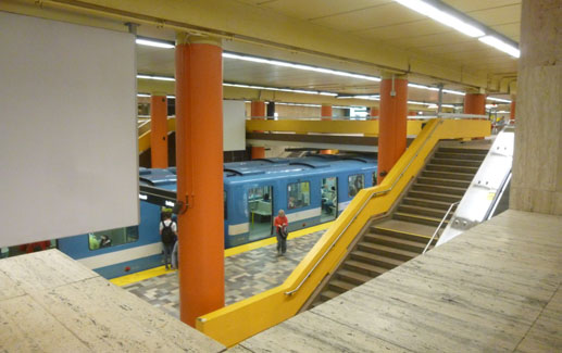
The Montreal Metro is a rubber-tired, underground rapid transit system and the main form of public transport here. It dates to 1966, having expanded since then to a 68-station, 4-line, 45-mile-long system serving the north, east and center of the Island of Montreal. It is Canada's busiest rapid transit system, and North America's third busiest by daily ridership behind those of New York City and Mexico City. The Montreal Metro was inspired by the Paris Métro, which is clearly seen in the Metro's station design and rolling stock. Our guide spent some time showing us how tickets are purchased, which stood us in good stead later in our stay.
|
|
Unfortunately, the design, though acclaimed for its architecture, suffered from important engineering flaws. The soft ground could not support the heavy central stone tower and steeple, which began to subside and lean. Alterations were designed, and reconstruction was carried out in 1939-1940. (The 2000-ton stone steeple had been removed in 1927, a new foundation poured, and a much lighter 125-foot steeple put back.)
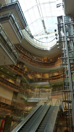
In the 1980s, a vast real estate project was undertaken beside and below the cathedral. The project consisted of a 34-floor skyscraper, KPMG Tower, built north of the Cathedral, underground parking, and two levels of retail stores situated beneath the cathedral. For a period in 1987, the Cathedral was supported on stilts while footings for the underground mall, Promenades Cathédrale, were excavated. This project allowed for the linkage of the eastern and western branches of Montreal's underground city, including the connection to Eaton Center that we came out of.
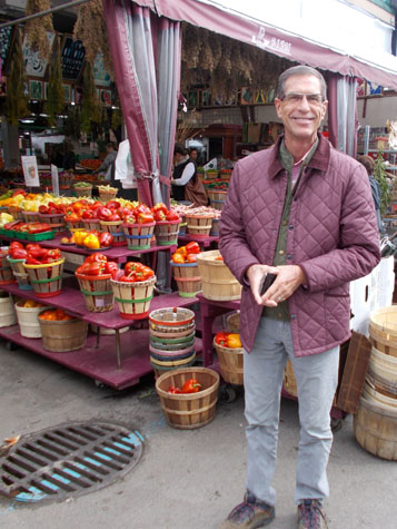
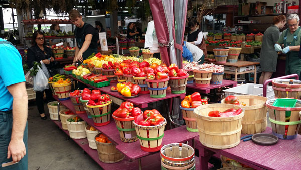
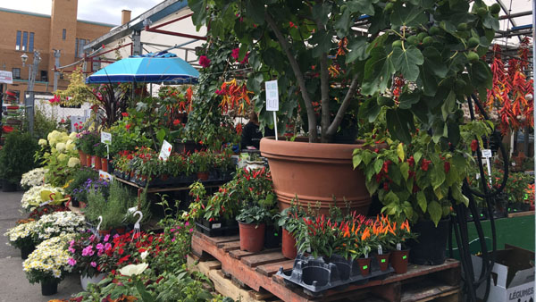
The Jean-Talon Market and Lunch
|
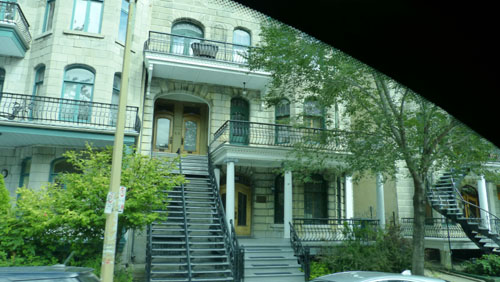
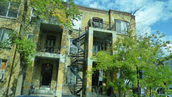
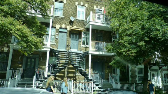
Building Space Setbacks: When new housing units began popping up in the early 20th century, the City of Montreal enforced some regulations that limited the amount of distance between the foundation of a building and the sidewalk. This was done to ensure streets weren't crowded, but it also limited the amount of space available to an apartment unit. So, in order to free up some room, builders did away with indoor staircases and instead put them on the outside, thus providing more room without breaking any building regulations.
The Frugal Landlord: One very real reason for Montreal's many staircases may be attributed to the very human desire of saving money. Landlords, you see, are responsible for heating all "common areas" of a building, and that extends to staircases. So, in order to save some cash, some theorize that landlords (or the original builders) built external staircases to circumvent that cost.
Because The Church...: Throwing away all of the economic and cultural factors that may have led to Montreal's abundance of exterior stairways, there is the very real possibility that religion was the driving factor behind the building practice. You see, a private, enclosed staircase would have been regarded as a space where any number of sins could go down, like a torrid love affair between a mail man and a married woman. So, in order to suppress potential sinful acts, outdoor staircases that everyone could see (and judge you upon) were encouraged by the Catholic church.
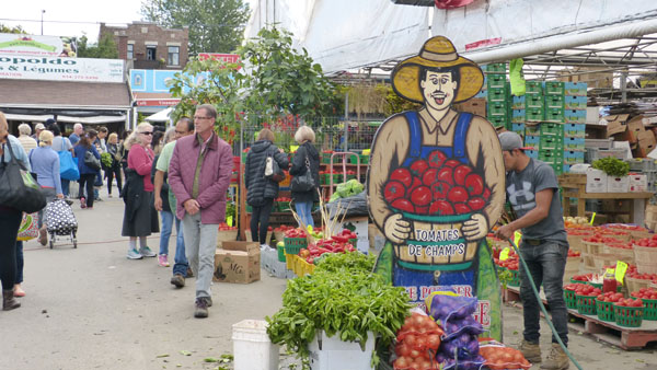
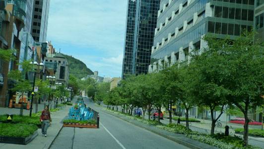
Regardless, on our trip to the market we passed hundreds of these staircases done in all different styles. We also passed numerous examples of graffiti wall art- certainly not unique to Montreal. The bus let us out on the Boulevard St. Laurent, right near one of the entrances to the Jean-Talon Farmer's Market.
|
 |
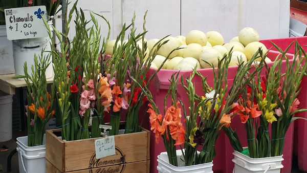
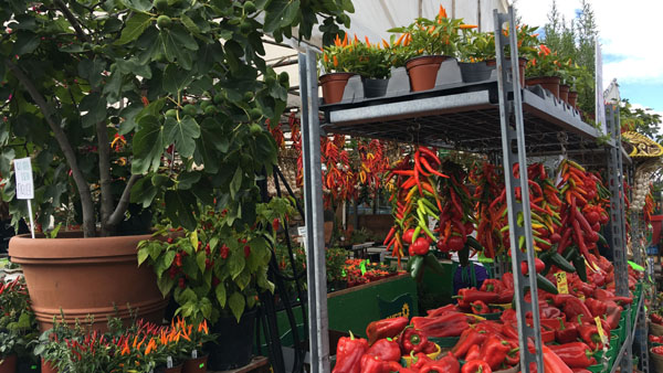
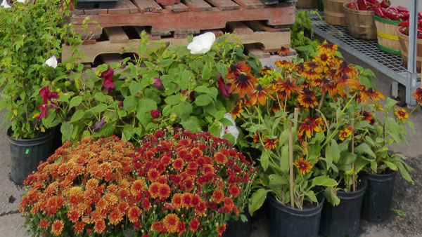
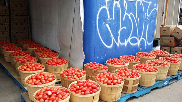
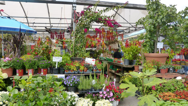
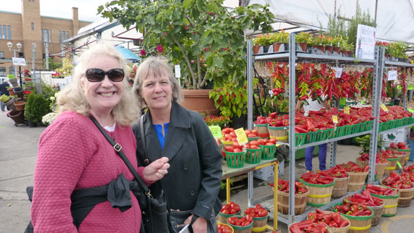
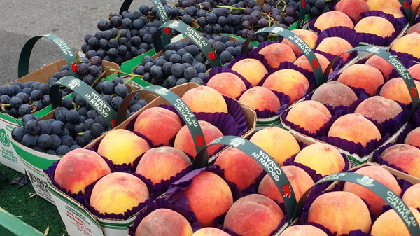
The Jean-Talon Market was not exceptionally large, nor did it have the variety of other outdoor markets that we have seen (a couple in Barcelona and in Lima, Peru, come to mind), but it was outdoors, the weather was nice, and walking through it was pleasant enough (as we looked for a place to have lunch).
|
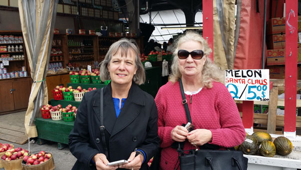
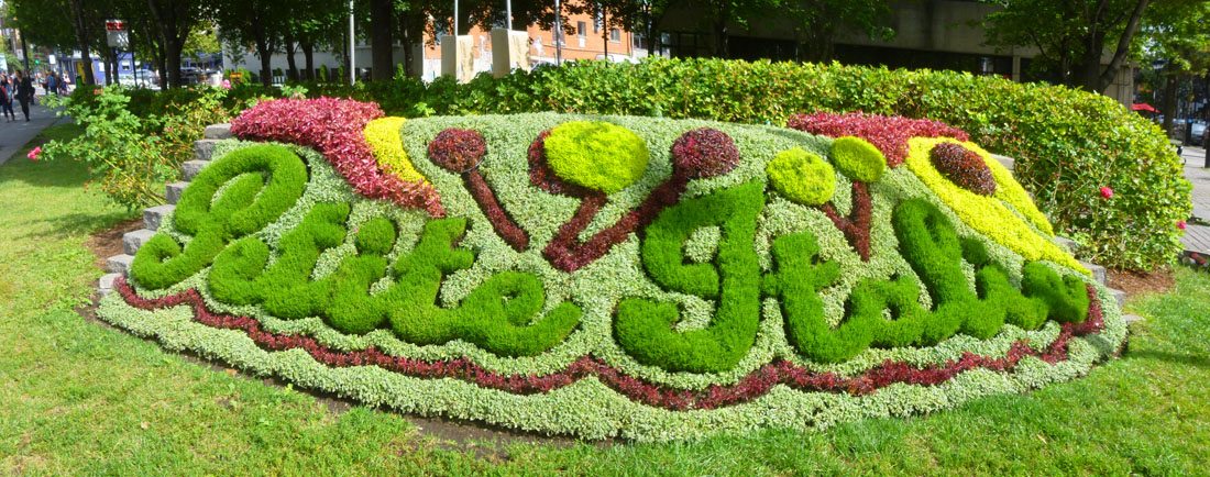
We did end up having lunch at Montreal's version of a Mexican restaurant. It was actually pretty good. Then we walked a couple of block away to the rendezvous point to get back on the bus. The streets around the market were pretty typical for this area, and we found our corner with no problem. That's when it became clear that we were in Little Italy, and I stopped at the corner to get a nice picture of Fred, Prudence, and Nancy standing by the floral display that made that clear. Of course, you have to translate from the French:
 |
The Drive to Mont Royal
 |
 |
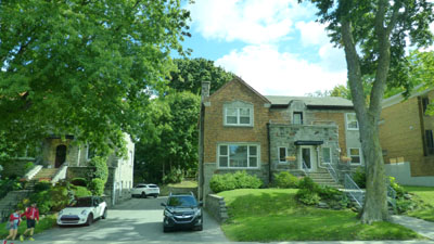
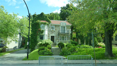
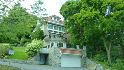
The van made its way south towards Mont Royal, and then went around the back side (west side) of the high hill. When we got to the slopes of the hill, the neighborhood became very, very upscale. We passed a number of interesting and pleasant-looking residences; here are a few of them:
 |
 |
 |
The houses were very traditional, as were most of the buildings associated with the University of Montreal. One building that we passed, HEC Montréal, is the French-language business school of the Université de Montréal (which is French-language as well). Since its founding in 1907, the School has trained more than 78,000 students in all fields of management.
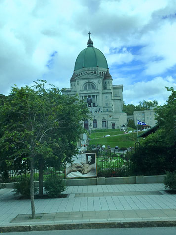
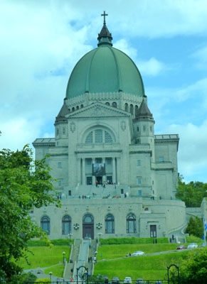
We continued around the back side of Mont Royal, and as we turned to head towards the top of the mountain, we came by the Oratory of St. Joseph.
|
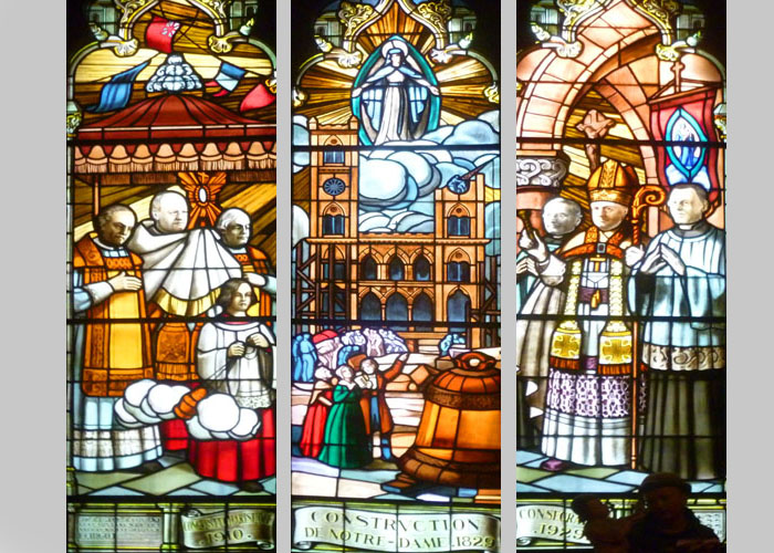
The basilica enshrines a statue of Saint Joseph, which was authorized first by Pope Pius X in 1910 and again by Pope Pius XII in 1955. The shrine is also famous due to its association with Brother Andre Bessette who was believed to possess healing powers through his Josephian devotion and an oil ointment given freely to its believers.
|
The basilica is dedicated to Saint Joseph, to whom Brother André credited all his reported miracles. These were mostly related to some kind of healing power, and many pilgrims (handicapped, blind, ill, etc.) poured into his Basilica, including numerous non-Catholics. On display in the basilica is a wall covered with thousands of crutches from those who came to the basilica and were purportedly healed. Pope John Paul II deemed the miracles to be authentic and beatified Brother André in 1982. In October 2010 Pope Benedict XVI canonized the saint.
A reliquary in the church museum contains Brother André's heart, which he requested as a protection for the basilica. More than 2 million visitors and pilgrims visit the Oratory every year. Composer Émilien Allard notably served as the church's carillonneur from 1955 to 1975. On October 19, 2004, the Oratory held its centennial. All the bells of all the churches on the island of Montreal were supposed to ring at 9:00 a.m., though not all churches participated. At 9:05 a.m., the basilica rang its bell in response and celebration. That same year, the Oratory was designated a National Historic Site of Canada on the occasion of its 100th anniversary. That same year, the Oratory was memorialized on a Canada Post stamp.
The van continued on to the road that crosses the crest of Mont Royal. It bypassed the road to the parking area for the overlook Fred and I had visited years ago; possibly because our guide didn't think there would be time to stop and allow everyone to walk from the parking area to the overlook- about a quarter mile.
|
In June 2017, during the 375th anniversary of Montreal, the city formally renamed the Outremont peak with a Mohawk name meaning "the place of the big fire," reflecting how the hill had been used for a fire beacon by First Nations people.
Mount Royal is the deep extension of a vastly eroded ancient volcanic complex, which was probably active about 125 million years ago. As a result, some tourist guidebooks, such as the Michelin Guide to Montreal, state that it is an extinct volcano. The mountain, along with the other mountains of the Monteregian Hills, was formed when the North American Plate moved westward over the New England hotspot by a process known as intrusion: magma intruded into the sedimentary rocks underneath the area. During and after the main stage of intrusion, the gabbros and surrounding rocks were intruded by a series of volcanic dikes and sills. Subsequently, the surrounding softer sedimentary rock was eroded, leaving behind the resistant igneous rock that forms the mountain. At least one new mineral was discovered here, and it took its name from the mountain.
 |
 |
In 1643, Paul de Chomedey, Sieur de Maisonneuve made a pilgrimage to the top of the mountain, in order to fulfill a vow made in the winter season on occasion of a great flood which swept up to the town palisades.
In 1876, residential development began on the western slope of Mount Murray, in what is now the Cote-des-Neiges district. In 1906, a large housing development- Northmount Heights- was begun, and recent times large tracts were expropriated by the Université de Montréal. In 1918, the Mount Royal Tunnel was dug under the mountain by the Canadian Northern Railway, and in the mid-1960s the area was briefly considered as a site for Expo 67, before the exposition grounds were ultimately built on adjoining islands in the Saint Lawrence River.
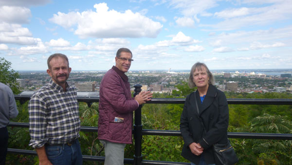
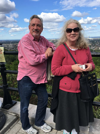
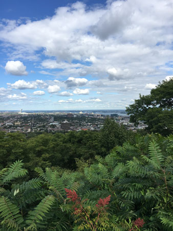
The mountain is the site of Mount Royal Park, one of Montreal's largest greenspaces. The park was originally designed by Frederick Law Olmsted (who also co-designed New York's Central Park) and was inaugurated in 1876. The park contains two belvederes, the more prominent of which is the Kondiaronk Belvedere, a semicircular plaza with a Mount Royal Chalet overlooking Downtown Montreal. Built in 1906, it is named for the Petun chief Kondiaronk, whose influence led to the Great Peace of Montreal in 1701. This was the plaza that Fred and I visited years ago; we hiked up to it from the streets of McGill University at the bottom of the mountain to the east.
We took many good pictures from the overlook where we did stop, and here are some of them:
 (Click on Thumbnails to View) |
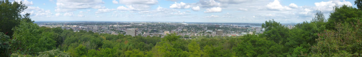
For my part, I tried my hand at a panoramic view. After trying to let my camera do it a few times, I decided to take my own series of pictures and stitch them together in post-production. Here is the result, in a broad view looking north:
 |
From Mont Royal, our van headed back down the hill to the south, came around the south end of the mountain, traversed some in-town neighborhoods and finally turned onto Sherbrooke Street heading northeast back to the William Gray. As I mentioned earlier, Fred, Guy, and myself decided to hop off and walk back to the hotel, both to get some exercise and just to see what we could see on the way.
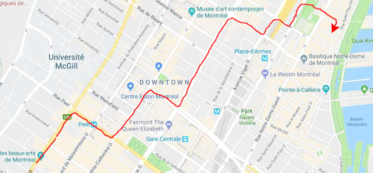
We Walk Back to the William Gray
Once we got off the van across the street from the Montreal Museum of Fine Arts, we began heading diagonally across downtown Montreal back towards the William Gray Hotel. It isn't really necessary that I record the exact route, but here it is anyway:
|
The only problem we encountered was how best to cross over the Autoroute (Expressway) Ville-Marie, a below-ground expressway that goes through a tunnel under most of downtown but is open for about six blocks near the hotel. We crossed it on one of the two street bridges, just taking a guess, and came out right by the hotel.
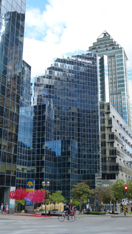
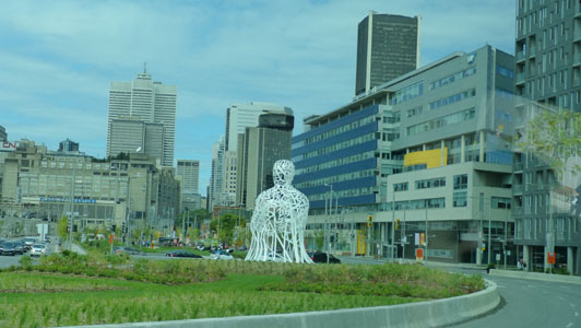
Much of what we saw on the way back to the hotel involved the innumerable examples of "public art" that exists throughout downtown Montreal- the many sculptures and statues and murals that make the downtown such an interesting place. As it turned out, on the subsequent days of our visit, when we did more walking around downtown, we, in various combination of people, revisited many of these art installations; I saw one of them three different times with three different groups of our party. To avoid a lot of duplication on these album pages, I am going to postpone looking at a lot of these art installations until I can gather together all the pictures of each one of them, weed out the duplications, and record them in a more efficient manner. For this section of the album, I will concentrate on those things we saw that we didn't visit more than once during our various walks.
|
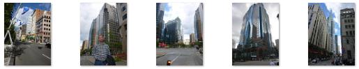 |
I happen to like modern architecture; I think that these glass towers (sterile though they might appear to many) are quite stunning in their own right. But here in Montreal, we discovered, all new buildings have to leave at least some space for art or sculpture at the street level. Even some of the older buildings have added artistic installations; this combination of plants and sculpture in front of the Queen Elizabeth Hotel is just one example. Many of the "public art" installations that you'll see later on are situated in front of these new skyscrapers.
|
|
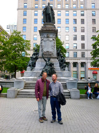
The square was first laid out in 1842, in what was at the time a wealthy residential area. In 1878, Alfred Joyce, “the high class caterer and confectioner”, was the first merchant to open a store here. In 1891, Morgan's department store (later absorbed into The Hudson's Bay Company) established itself on the north side of the square. Of particular interest to American visitors, there was a plaque on the west wall of the store (now called simply "The Bay") dedicated to the memory of Jefferson Davis, president of the Confederate States, who came in 1867 to stay in John Lovell’s house which then stood on the site. (Perhaps in a reflection of the controversy now raging in the United States regarding statues of Civil War southern "heroes", the plaque was removed in 2017.)
Montreal’s first art gallery was opened here by Princess Louise and the Marquess of Lorne in 1879; its collection is now in the Montreal Museum of Fine Arts. The site of Joyce's pastry shop is now the Canada Cement Building, built in 1921. That 10-storey structure was the first office tower to be built completely of reinforced concrete. (It was also the first skyscraper in Montreal to have an underground parking garage, at a time when there weren’t too many automobiles on the road.)
The square features a bronze monument of King Edward VII, who ruled from 1901 to 1910. He visited Montreal in 1860, when he was still the Prince of Wales, to open the Victoria Bridge. The statue was designed by Louis-Philippe Hébert and was erected in 1914. The four allegorical figures at the base of the monument represent Peace, the Four Founding Nations, Abundance, and Liberty.
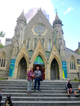
|
When it was built in June 1889, it was the largest Methodist church in Canada, with 2,000 seats; it was nicknamed the "Cathedral Church of Methodism." It now belongs to the United Church of Canada, into which the Canadian Methodists merged in 1925. Its congregation founded the first YMCA in North America in 1851 (before the present church building was built) and led an active campaign for women's suffrage early in the 20th century.
A World War I memorial window added in 1924 by Charles William Kelsey depicts a trench scene, and is dedicated to 32 church members who were killed overseas and 267 others who served in the Great War. (That window is in the lower portion of the right-hand tower.) The side lights represent the cardinal virtues, Justice, Prudence, Temperance and Fortitude.
In 1927, to cover upkeep costs, the church permitted a commercial building to be built in front of its Sainte Catherine Street façade. The building, adjoining the church's structure, concealed the church for over 78 years, the church itself being announced by a large neon sign. In 2005, as part of an $8-million restoration effort sponsored by the city of Montreal and the Quebec government, a portion of the commercial building was demolished, once again revealing the facade of the church as well as a new public square designed by Quebec architect Claude Cormier. This is why we could see its facade today.
We continued along St. Catherine Street, and were approaching Complex des Jardins when we came to the new Place des Arts and the esplanade outside it. This is a major performing arts center and the largest cultural and artistic complex in Montreal.
|
The esplanade features numerous public artworks which, acording to the signage, change frequently. One interesting aspect was the set of low steps on the south side where we entered the area. Painted on the risers were instructions for some sort of game involving movement from step to step. These instructions were in both French and English and, as near as I could figure, the game was something akin to Twister, with the added difficulty of moving from one step to another.
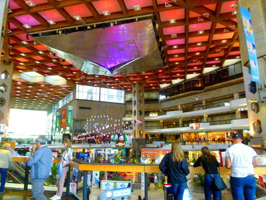
Just across the street was a place I'd last visited about 40 years ago- Place desJardins. A huge indoor, multi-level shopping mall, it is connected to two office towers, and I did a class in one of them for the Canadian National Railway all those years ago. Today, the three of us walked aboveground from the area by the Queen Elizabeth Hotel, but back then I was able to traverse the entire distance underground via a very complicated route to arrive here.
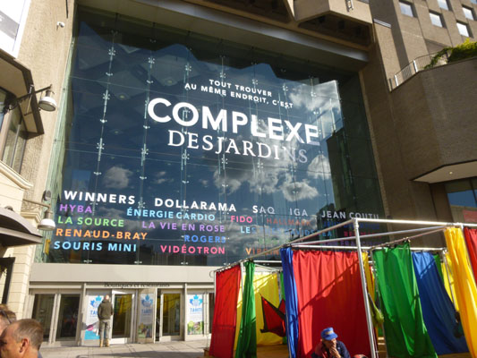 |
 |
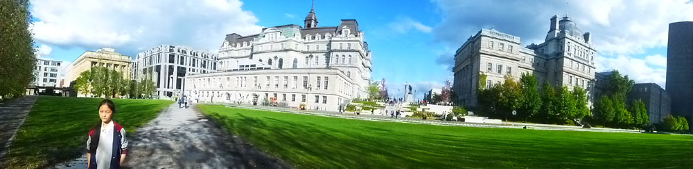
The rest of our walk home to the hotel only took about 30 minutes. We continued north on St. Catherine, and then jogged over two street to find a bridge across the expressway, where we were treated to an impressive view of the Montreal skyline. Then a path led us up a hill and across the Champ de Mars- a public park in the "Old Montreal" quarter; we have left the new downtown core and are now in an area of much older, restored structures.
|
A short walk through Place Vauquelin (just to the right of City Hall in the view above) and crossing Rue Notre Dame and we were in Place Jacques-Cartier, the square just outside the doors of the Hotel William Gray. We will look at both Place Vauquelin and Place Jacques-Cartier on another album page.
Evening and Dinner
When we returned to the Hotel William Gray, Prudence, Ron, Nancy, and Karl were already back, of course, and had left us a message to meet them on the rooftop bar at 6:30. This gave us some time to relax before heading upstairs.
|
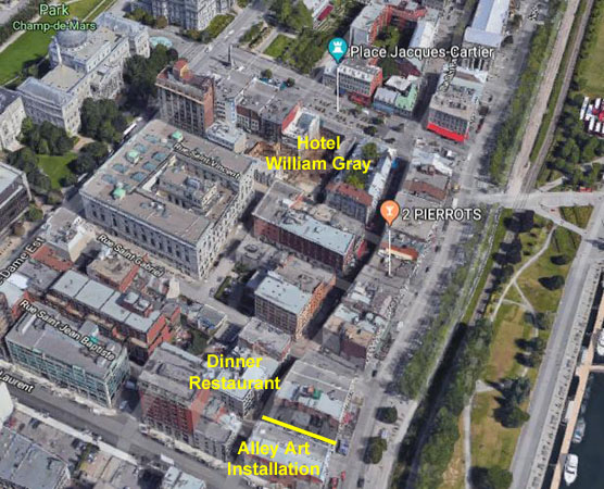
After we had drinks at the rooftop bar, we headed off on foot down to the very scenic, very old Rue St. Paul just a half block from the hotel. This pedestrian street was a place where we came to walk nightly. I have marked the restaurant we went to this evening- a very nice steak place just a block away.
After dinner, we did some more walking around, and ran across a unique art installation that I'll talk more about in a moment.
In any event, Fred and I headed upstairs and arrived just shortly after everyone else. The bar was a glass-roofed affair that was open at the outsides (although there were fittings where it could be closed in for heating at wintertime). There were actually some very nice views from here. In one direction, you could see the entertainment area at the old port as well as La Ronde in the distance (look at that view here) and in another you could see the Bonsecours Market and the Jacques-Cartier Bridge behind it (look at that view here). We will be visiting the market a few days from now, so I will have more to say about it then.
Prudence took the previous two pictures; I took one of the Montreal City Hall. Prudence took two more pictures up here this evening- one of Nancy and Ron and another of Ron and Karl. For my part, I took a couple of pictures to show you what the bar looked like; here they are:
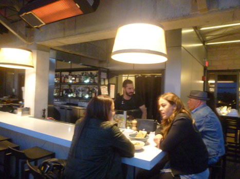 |
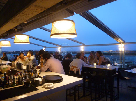 |
A little while after we had our drinks, we headed downstairs and down to Rue St. Paul to The Keg- an upscale steakhouse where we had dinner.
|
|
"Montreal was founded in 1642, which means that in 2017, the city is celebrating its 375th birthday. That’s a long stretch of history, and people can’t be expected to remember everything that’s happened. To help jog our memories, Montreal has created a multimedia exhibition called Cité Memoire (Memory City), transforming the old town into a living tribute to the past. Eighteen spots around Old Montreal have been selected for Cité Mémoire. At each one, there’s a projection, or “tableaux,” which brings a significant moment from Montreal’s history to life. In order to understand each clip, you have to download a free app that allows you to listen to the audio. And the projections don’t just play on a loop. Using the app, you’re the one who starts them. If it were just short movies projected against the sides of buildings, Cité Mémoire would be cool, but not all that memorable. However, each of the eighteen tableaux has been produced with the utmost artistry. They’re the work of some of Quebec’s most renowned multidisciplinary artists. The projections are poetic, haunting and beautiful, and each one makes perfect use of its individual location. “The Creation of the World,” located in a narrow alley off the Rue Saint Paul, is a tale told in the Algonquin language about the tribe's myth about the beginning of it all. It is a long projection, and we did not stay to see it all. But I did make a movie of about a minute's worth of the projection, and you can use the movie player at left to watch it. The coolest facet of this project is the level of interaction required by the viewer. You could just show up and watch the pictures, but to get much out of Cité Mémoire, you must become a participant by downloading the app and wearing headphones. And when you’re the one to press “play” and set one of these tremendous projections into motion, you feel somehow more invested in it. Cité Mémoire runs every evening after dusk, and for the next few years will be a permanent fixture in the Old Town. It’s rare that such a cool idea meets with such perfect execution." |
Our evening walk brought our first full day in Montreal to and end. It's been enjoyable so far, but there is lots more to do and see!
You can use the links below to continue to another photo album page.
|
September 10, 2017: Art and Nature in Montreal |
|
September 8, 2017: Our First Evening in Montreal |
|
Return to the Index for Our Trip to Montreal |