|
September 18-23, 1977: A Trip to Quebec City, Quebec, Canada |
|
Return to Index for 1977 |
Between my trip to Mexico last year, and a this business trip to Seattle, I really didn't go anywhere that was interesting enough for me to take my camera. All the places I've been to so far this year are either places I've been to before, or places where picture-taking opportunities were slim (who wants to see pictures of Galesburg, Illnois?). But this month, I had another opportunity to go to Seattle, to do some more training for Nordstrom- a four-day stint that began the day after Labor Day, and I planned to take a trip up to Mt. Rainier on Labor Day itself.
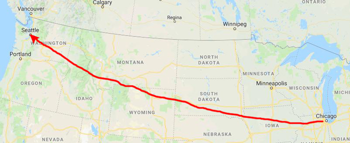
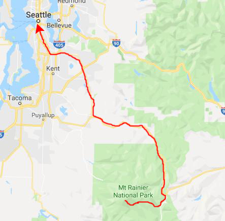
Traveling from Chicago to Seattle
|
Nordstrom, my client this week, had made a reservation for me in downtown Seattle near their offices, but I decided not to extend that reservation to this evening but rather to just check in to a reasonably-priced hotel just off the airport.
I rented a car and then after checking in at the hotel, I went to get some supper and then returned to the hotel to check to see if there were any Baskin-Robbins stores nearby that I hadn't been to and to plan my trip tomorrow over to Mt. Rainier.
When my plan for tomorrow was complete, I did go find a new Baskin-Robbins store I hadn't yet visited before returning to the hotel.
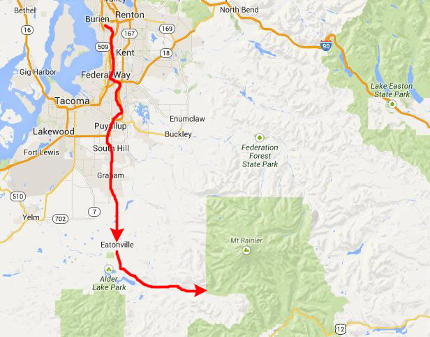
My Day Trip to Mt. Rainier
|
 |
South of Eatonville, the road turns east and continues to the Nisqually Entrance to Mt. Rainier National Park at its extreme southwest corner. The vast majority of the Park's visitors enter here.
|
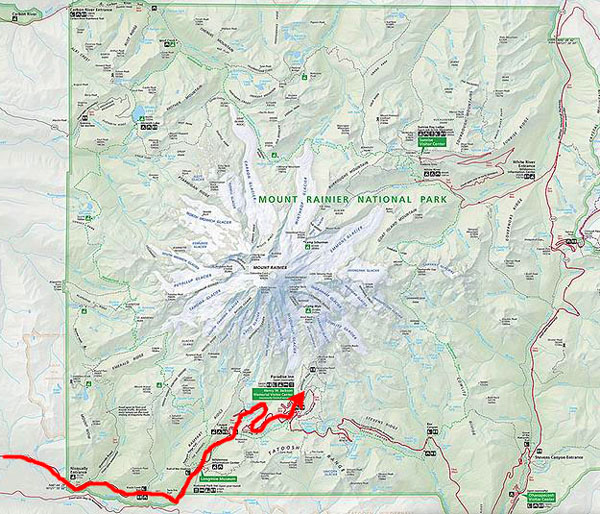
As you can see, the part of the park I traversed was only a small fraction of the area the park actually covers, but then 95% of the park is only backcountry accessible. The vast majority of the visitors to the park either follow my route in and back out or they continue to follow the one major road that continues east through the park to come out in central Washington State.
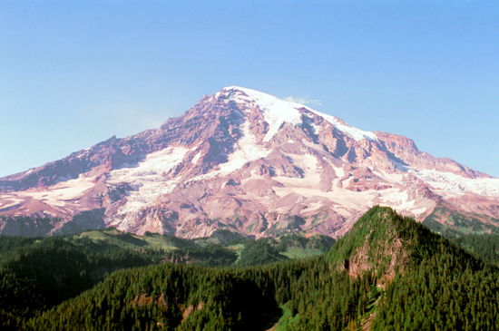
Mount Rainier National Park was established on March 2, 1899 as the fifth national park in the United States. The 370-square-mile park encompasses all of Mount Rainier, a 14,410-foot stratovolcano. The mountain rises abruptly from the surrounding land with elevations in the park ranging from 1,600 to over 14,000 feet- the highest point in the Cascade Range. Around it are valleys, waterfalls, subalpine wildflower meadows, old growth forest and more than 25 glaciers. The volcano is often shrouded in clouds that dump enormous amounts of rain and snow on the peak every year and often hide it from the crowds that head to the park on weekends. I lucked out today, and the weather was about as good as it gets in the park at this time of year.
It took me a bit over 90 minutes to get from the hotel to reach the park headquarters, which is actually outside the park itself about ten miles from the actual entrance, and a few minutes after that to reach the Nisqually Entrance.
|
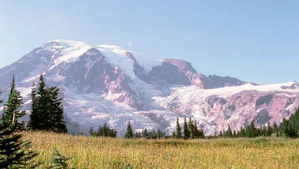
I, like most of the visitors to the park, will be heading to Paradise, an area at approximately 5,400 feet on the south slope of Mount Rainier in the national park. Paradise is the most popular destination for visitors to Mount Rainier National Park; 75% of the over 1 million people who visit the park each year head here.
Paradise, near the subalpine valley of the Paradise River, is the location of the historic Paradise Inn (built 1916), Paradise Guide House (built 1920) and Henry M. Jackson Visitor Center (built 1966). Along the road to Paradise is much of the park's best, easily accessible scenery. I am sure that the scenery out in the backcountry is as scenic or even more so, but then it's very difficult for the inexperienced to get to.
Nostalgically-speaking, my trip today will duplicat a trip that I took seven years ago when I stopped at McChord AFB on my way to Korea- the pictures from which are among the very first in this collection (NOTE: Not available as I write this in 2019, as I have not worked my way back that far. But you can compare the pictures I took today with those that Fred and I took in 2001 when we visited the park and again followed this same route.
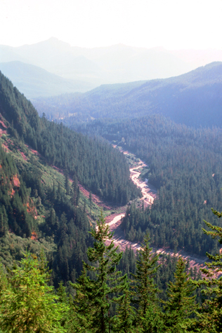
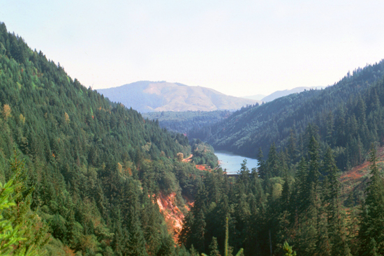 On the way to the park entrance, I passed this reservoir. It's just outside the park itself, but fed by snowmelt from Mt. Rainier. |
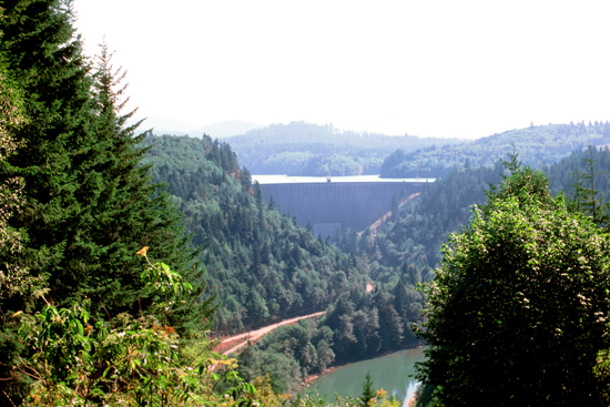 Most of the power in the Pacific Northwest is generated hydroelectrically, and this is just one of the generating stations. |
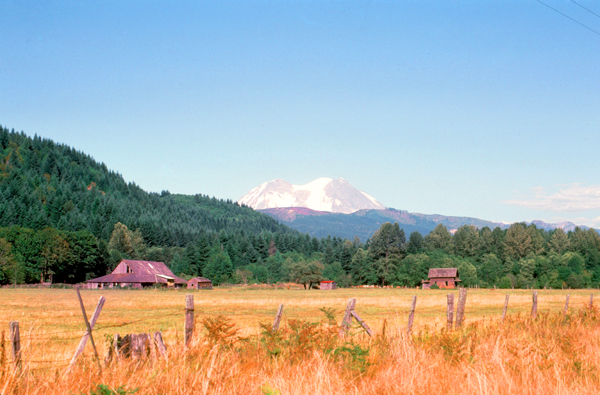
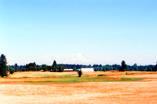
It was a very pleasant drive towards the park entrance, and the day was just about perfect.
|
Mount Rainier National Park was created in 1899 from the Pacific Forest Reserve that had been set aside in 1893. The naturalist John Muir had visited Mount Rainier in 1888, when he and nine others climbed to the summit in what became the fifth recorded ascent. This trip to Mount Rainier reinvigorated Muir, who had long advocated for the set aside of wild, natural spaces, and convinced him to rededicate his life to the preservation of nature as national parks.
At the time national forests were being created throughout the American West, under the utilitarian "conservation-through-use" view of Gifford Pinchot. Muir came to be known as a "preservationist". He wanted nature preserved under the more protected status of national parks. But during the 1890s there was more public support for creating national forests than national parks. When the Pacific Forest Reserve was created in 1893, Muir quickly persuaded the newly formed Sierra Club to support a movement to protect Rainier as a national park.
Other groups soon joined, such as the National Geographic Society and scientific associations wanting Mount Rainier preserved as a place to study volcanism and glaciology. Commercial leaders in Tacoma and Seattle were also in support, as was the Northern Pacific Railway. The effort lasted over five years and involved six different attempts to push a bill through Congress. Congress eventually agreed, but only after acquiring assurances that none of the new park was suitable for farming or mining and that no federal appropriations would be necessary for its management.
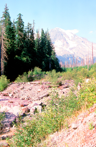
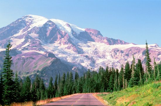
After entering the park, I was treated to one beautiful view after another, each one seemingly more beautiful than the last.
 |
 |
 |
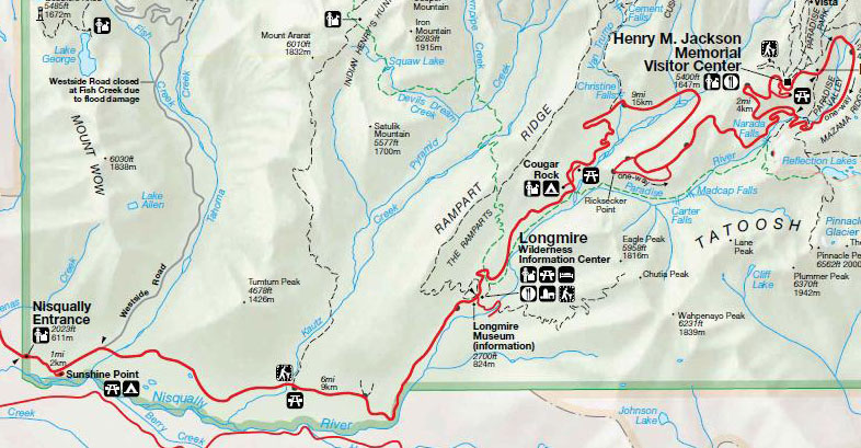
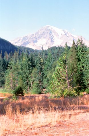
After ten miles or so to reach Longmire- the Wilderness Information Center. With the establishment of Mount Rainier National Park in 1899, Longmire became park headquarters. The site had previously served as James Longmire's homestead, lodging, and mineral springs resort. Although park headquarters are no longer at Longmire, the original headquarters building houses a museum that tells the story of the early days of the park. All of Longmire is now designated a national historic district. The museum was not open, so I continued on. Soon, I was getting so close to the mountain itself that it was no longer a backdrop but the only thing in the picture.
 |
 |
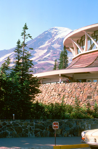
A ways beyond Longmire, the road became very twisty and steep, and eventually I saw the sign for the turnoff to the Visitor Center. We reached the Visitor Center a few minutes later.
|
The structure's round shape and distinctive roof were intended to fit its surrounding mountain landscape, and a flyer produced for the opening ceremony spoke of "the swooping, bough-like shape of the beams, the branching 'tree' columns, the 'switchback trail' ramps, and the sloped 'cliffs' of the stone base." But the center's modernist style (common to many of the program's projects and a distinct departure from "National Park Service Rustic") has always been controversial.
I've read about frequent comparisons to a flying saucer, or that the Visitor Center reminded others of a sunken Seattle Space Needle. It has been accused of not fulfilling its goal of appropriateness for its setting, instead being "incompatible with the rustic character of Paradise". Others have disagreed, but the chorus of opposition has grown.
Inside, the Center is kind of sparse and cavernous, although mostly in the off-season; in the summer and on weekends, the inside of the center can be quite crowded. I have to admit that I like the building, the latticework windows that you can see in my picture at left offer expansive views 360° around.
|
NOTE: Fred and I would visit here again in 2001, and the Visitor Center you see here would still be here as well. But a few years after that visit, the combination of more than 40 years of snide comments, as well as other more significant architectural problems led the National Park Service to replace the Paradise Visitor Center with the Henry Jackson Visitor Center (named to honor Henry "Scoop" Jackson, the longtime U.S. Senator from Washington, 1953-1983) with a more traditional design. The roof of the original structure was not designed to handle the copious amounts of snowfall in the Paradise area each winter; melting it to avoid a roof collapse used up hundreds of gallons of diesel fuel each day. Additionally, the building no longer met building and accessibility codes, despite ramps and other features that required a disproportionate amount of space. The National Park Service began construction of a smaller, more energy-efficient visitor center in 2006. The new Henry M. Jackson visitor center opened in the Fall of 2008. Demolition of the building you see here was accomplished in 2009. |
|
 |
Coming down from the park was one of the longest continual downgrades that I remember, requiring no use of the gas pedal for at least fifteen miles. The scenery was consistently beautiful; it is getting late in the season, but the trees and grass are still green.
A number of times on the way back I got out of the car just to sit and breathe in the mountain air; I would be back in the city soon enough. And of course I stopped to take pictures.
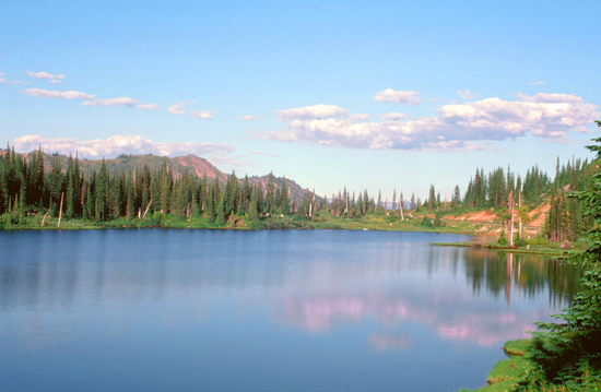 Ghost Lake, just north of the junction between Highways 123 and 410 on the east side of the park. |
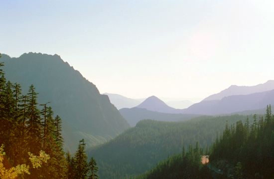 The late afternoon sun has put many of the valleys into deep shadow. |
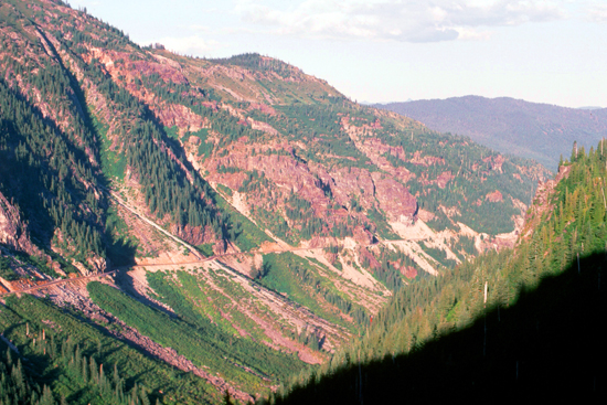 This is a view of the grade of the road, winding around the side of the range of hills, continually downward. |
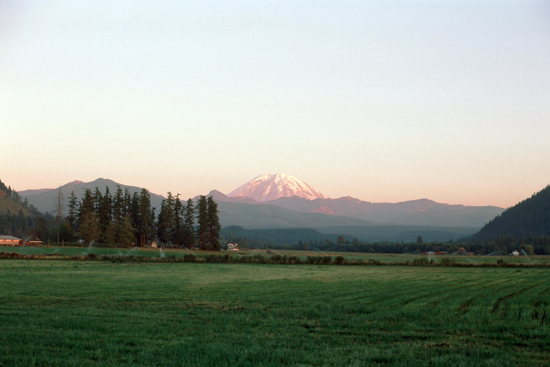 This was my last view of Mt. Rainier, taken from the north at sunset. Such a beautiful sight. |
The class went well, and I enjoyed the people. On Thursday afternoon, after class, I got a bee in my bonnet and decided that I would go and see what the coastline of Washington State looked like. (OK, I admit it; there was a Baskin-Robbins in Aberdeen and I had never been to.) I took my ice cream over to the coast, which wasn't far from the store, to eat it and look at the sunset. I didn't get a good picture of the sunset, but I did get one of the surprisingly flat and sandy Washington coast.
I probably should have stayed into Saturday, but after the class on Friday I went back to Sea-Tac to catch a red-eye flight back to Chicago, where I arrived about 6AM.
You can use the links below to continue to another photo album page.
|
September 18-23, 1977: A Trip to Quebec City, Quebec, Canada |
|
Return to Index for 1977 |